Report
ON THE FIRST ASCENT TO THE SUMMIT OPTIMIST VIA THE SOUTHWEST RIDGE, CATEGORY 2A DIFFICULTY, BY THE "GORY BAIKALA" TEAM ON OCTOBER 20, 2018
I. Ascent Passport
| № | 1. General Information | |
|---|---|---|
| 1.1 | Full name, sports rank of the team leader | Mironenko Konstantin Gennadievich, 3rd sports rank |
| 1.2 | Full name, sports rank of the participants | Pyankovskaya Svetlana, 3rd sports rank. Korotkov Pyotr, 3rd sports rank |
| 1.3 | Full name of the coach | Glazunov Evgeny Vladimirovich, Master of Sports |
| 1.4 | Organization | Gory Baikala (project "Impossible is not forever") |
| 2. Characteristics of the Ascent Object | ||
| 2.1 | Region | Eastern Sayan, Tunkin Golets Ridge |
| 2.2 | Valley | Chertolen-Gorkhon |
| 2.3 | Number according to the 2013 classification table | 6.1.2 |
| 2.4 | Name and height of the summit | Optimist, 2660 m |
| 2.5 | Geographical coordinates of the summit (latitude/longitude), GPS coordinates | 51°50′25.78″ N, 101°36′35.72″ E |
| 3. Characteristics of the Route | ||
| 3.1 | Name of the route | Via the southwest ridge |
| 3.2 | Proposed category of difficulty | 2A |
| 3.3 | Degree of route exploration | First ascent |
| 3.4 | Character of the route relief | Rocky |
| 3.5 | Height difference of the route (data from altimeter or GPS) | 380 m |
| 3.6 | Length of the route (in meters) | 435 m |
| 3.7 | Technical elements of the route (total length of sections of various difficulty categories with indication of relief character) | Category I rocky - 185 m. Category I ice-snow - 20 m. Category II rocky - 210 m. Category III rocky - 10 m. Category IV rocky - 10 m. Movement on closed glacier - 0 m |
| Rappelling (on descent) - 1 rope, 20 m | ||
| 3.8 | Descent from the summit | Via the ascent route |
| 3.9 | Additional characteristics of the route | Lack of water |
| 4. Characteristics of the Team's Actions | ||
| 4.1 | Time of movement (team's walking hours, in hours and days) | 4 hours |
| 4.2 | Overnights | |
| 4.3 | Departure on the route | 07:00, October 20, 2018 |
| 4.4 | Arrival at the summit | 11:20, October 20, 2018 |
| 4.5 | Return to the base camp | 16:00, October 20, 2018 |
| 5. Responsible for the Report | ||
| 5.1 | Full name, e-mail | Pyankovskaya Svetlana Petrovna, spy.asbtv@gmail.com |
II. Description of the Ascent
1. Characteristics of the Ascent Object
1.1. General photo of the summit.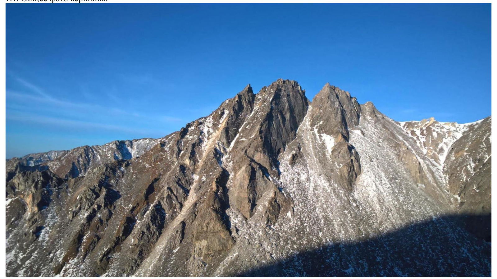
Photo 1. Taken from the slope of peak Russko-Mongolskoy druzhby (Internatsionalnaya) on October 14, 2018.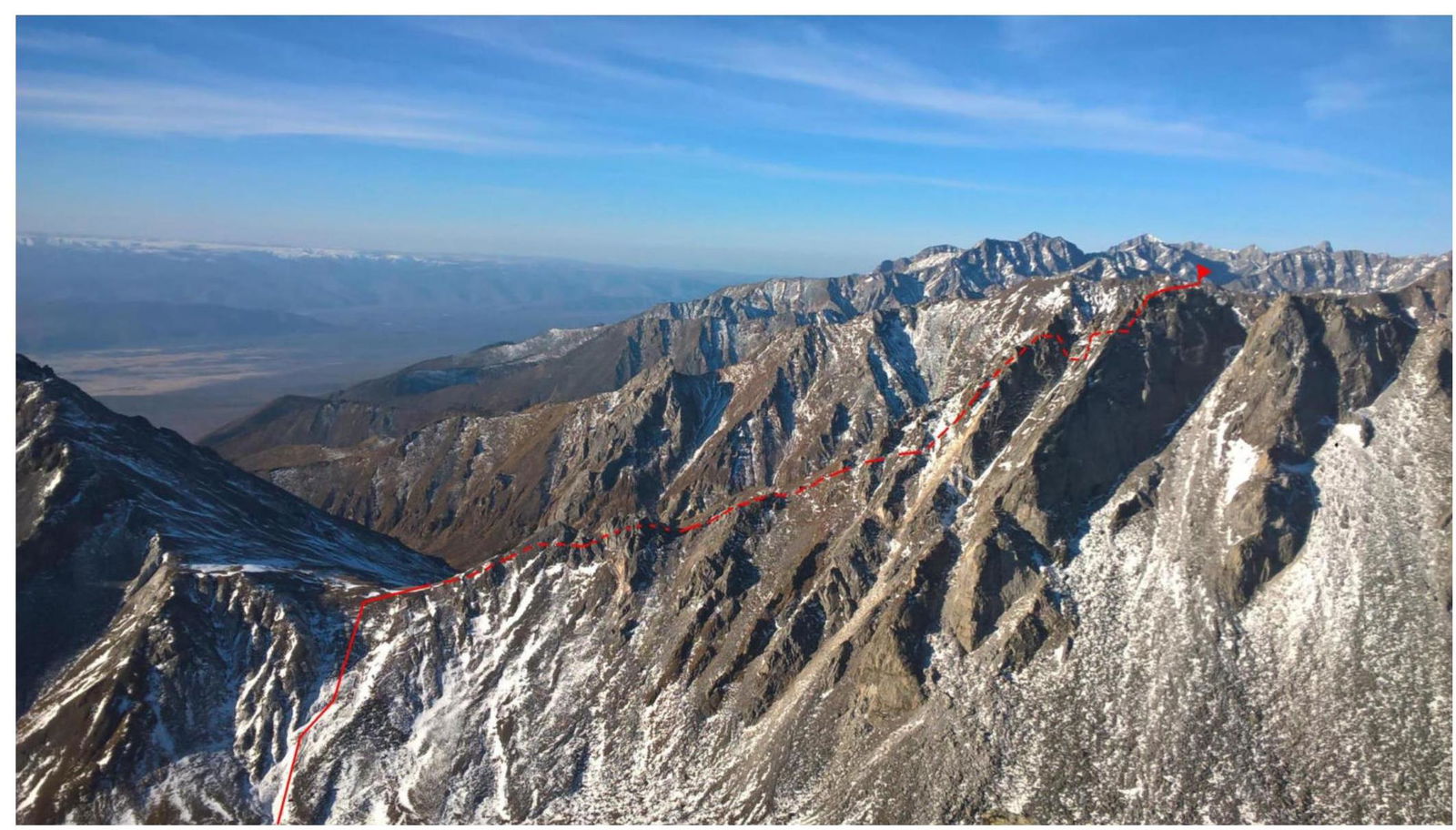
Photo 2. Taken from the southeast relative to the summit from the pre-summit gendarme of peak Russko-Mongolskoy druzhby (Internatsionalnaya) on October 14, 2018. 1.3. Photopanorama of the area.
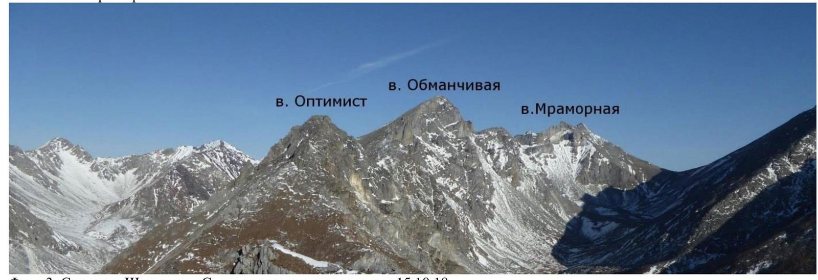
Photo 3. Taken from v. Shkolnaya. South relative to the summit. October 15, 2018.
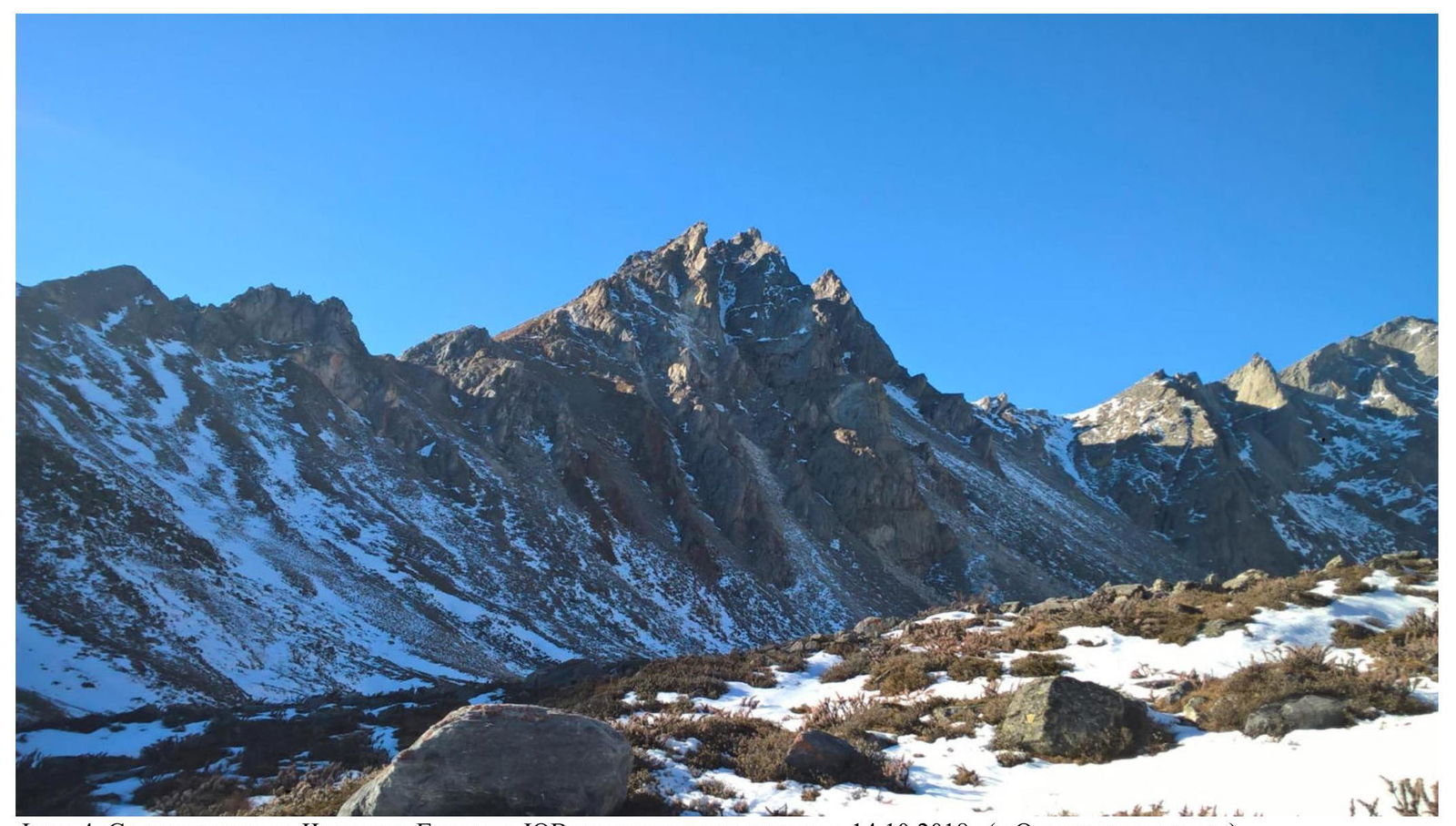
Photo 4. Taken from the Chertolen-Gokhon valley, southeast relative to the summit on October 14, 2018 (v. Optimist in the center)
1.4. Map of the area.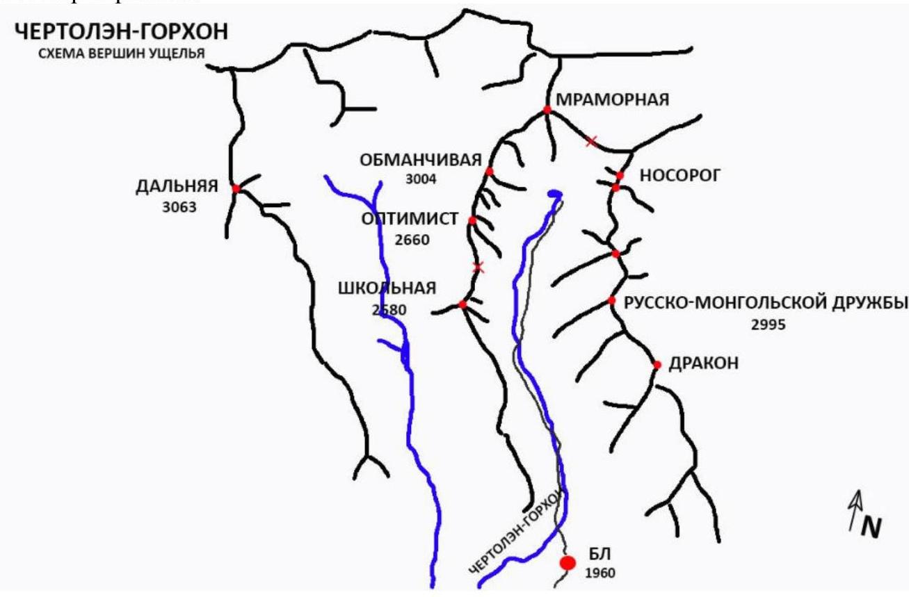
The summit Optimist is located in the upper reaches of the Chertolen-Gorkhon valley of the Tunkin Ridge in the Eastern Sayan, west of the Khubuty river valley, along which the trail leads to the Shumak mineral springs - a popular tourist route in our region.
The nearest settlement is the village of Nilova Pustyn and the village of Khoito-Gol in the Tunkinsky district of the Republic of Buryatia (district center - the village of Kyren). Approach:
- Drive along the old highway to the Sukhoy Ruchey tourist base
- Further - transport to the upper reaches of the highway by a high-passability vehicle or on foot to the r. Cherttlym-Gorkhon
- From there, a good trail leads into the valley
Features of the valley:
- It is a dead-end valley
- Regularly visited by local herb and wild food gatherers
- Has a very simple approach
- Horseback transportation to the base camp is possible along the trail
In terms of mountaineering, the potential of the valley allows for mountaineering events with ascents from category 1B to 5A.
2. Characteristics of the Route
2.1. Technical photograph of the route.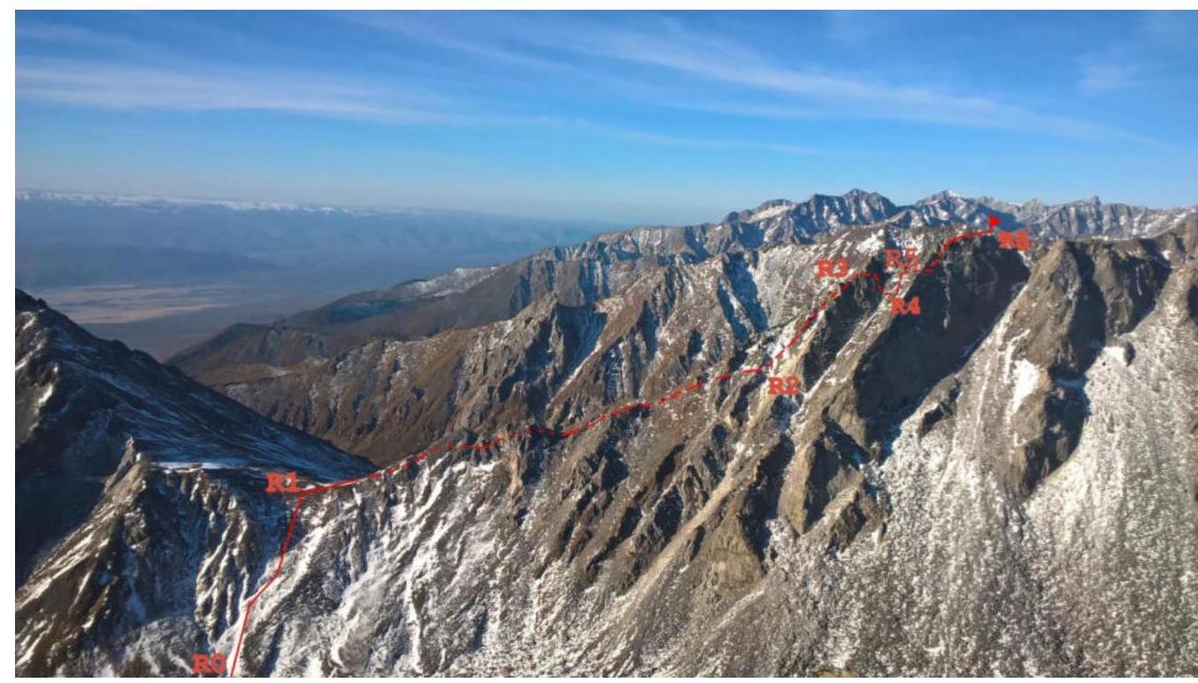
Photo 5. Taken on October 14, 2018.
The numbers of the sections on the technical photograph correspond to the numbers of the sections in paragraph 2.3.
2.3. Technical characteristics of the route sections
| № | Character of relief | Category of difficulty | Length, m | Type and quantity of protection |
|---|---|---|---|---|
| R5–R6 |  | 120 160 | 1 medium friend | |
| R4–R5 | III–IV | 10 10 | Anchor hooks 2 pcs., friends (small, medium) 2 pcs., chocks 2 pcs. | |
| R3–R4 | 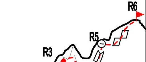 | 40 125 | ——— | |
| R2–R3 | 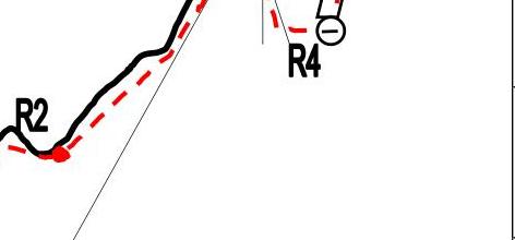 | 150 80 50 | ——— | |
| R1–R2 |  | 650 | ——— | |
| R0–R1 |  | 500 | ——— |
3. Characteristics of the Team's Actions
3.1. Brief description of the route passage.
The approach to the start of the route from the base camp takes 1 hour along a good snow-free trail. Along the trail up along the river, the trail leads alternately along the left and right banks.
Ascent to the pass between v. Shkolnaya and v. Optimist - 500 m (easy).
Further movement along the western slope along the ridge:
- Ascent to the 1st gendarme, without going out onto the ridge, along a rocky-grassy slope - 150 m (easy).
- Not reaching the top of the gendarme, traverse along a wide ledge of the gendarme to the left - 100 m (easy) in the direction of movement.
- Descent to the saddle between the 1st and 2nd gendarmes - 60 m (easy).
- Ascent to the 2nd gendarme - along a grassy slope - 160 m (easy).
- Not reaching the top of the gendarme, traverse along a wide ledge of the gendarme to the left - 80 m (easy) in the direction of movement.
- Gentle descent to the saddle between the 2nd and 3rd gendarmes - 100 m (easy).
- Gentle ascent to the 3rd gendarme (adjacent to the summit) - along a grassy slope - 150 m (easy), staying to the left.
Further, the angle increases, the relief becomes large-blocky, movement with simultaneous belay for the relief:
- Along a system of narrow ledges, partially overgrown with grass - 80 m (Category I), 50 m (Category II) to a wide ledge.
- Along the ledge, we bypass the gendarme on the left in the direction of movement - 40 m (easy).
- Descent along a narrow couloir - 15 m (snow, Category I).
- Traverse of the couloir between the gendarme and the western counterfort - 100 m (Category I).
- Ascent along a narrow passage between a large stone and the counterfort wall - 10 m (snow/firn, Category I).
We come out onto a wide, convenient platform. Further, the key section of the route:
- Ascent - 10 m, 60-65°, Category III.
- Further along the internal corner - 10 m, 70-75°, Category IV (prusik loop 2 m, anchor hooks 2 pcs., medium friends 2 pcs., chocks 2 pcs.).
Station on the edge of a wide ledge - a loop on a rock outcrop.
Further:
- Traverse along the ledge to the left in the direction of movement - 20 m (easy).
- We climb over the western counterfort along an inclined slab (3 m, holds only for hands).
- With alternate belay, we continue the traverse with a slight descent - 40 m (Category II).
We come out to the logical path of ascent to the summit - a system of grassy, partially communicating, narrow ledges, on smoothed rocks - 120 m (60°, Category II).
Further flattening and exit to the ridge. Movement along large, slightly inclined slabs slightly to the left of the ridge to the very summit - 100 m (easy).
| № section | Description | Photo number |
|---|---|---|
| R0–R1 | Ascent to the pass between v. Shkolnaya and v. Optimist. | |
| R1–R2 | Movement along the western slope along the ridge. Ascent (traverse), descent to the 1st and 2nd gendarmes. Approach to the start of the ascent to the 3rd gendarme. | |
| R2–R3 | Ascent to the 3rd gendarme to a wide ledge. | |
| R3–R4 | Movement along the ledge. Descent along a narrow snow-covered couloir. Alternate belay. Traverse of the couloir, ascent along a narrow snow-covered passage to a ledge at the start of the key section. | Photo 2, 3, 4 |
| R4–R5 | Internal corner. Station. | Photo 5 |
| R5–R6 | Bypass of the western counterfort along smoothed rocks. Alternate movement. Belay for the relief. Exit to the ridge. Movement along the ridge to the north. Summit. | Photo 6, 7, 8 |
Photo 2 - ascent to a wide ledge from a snow-covered couloir (photo taken on descent from the summit)
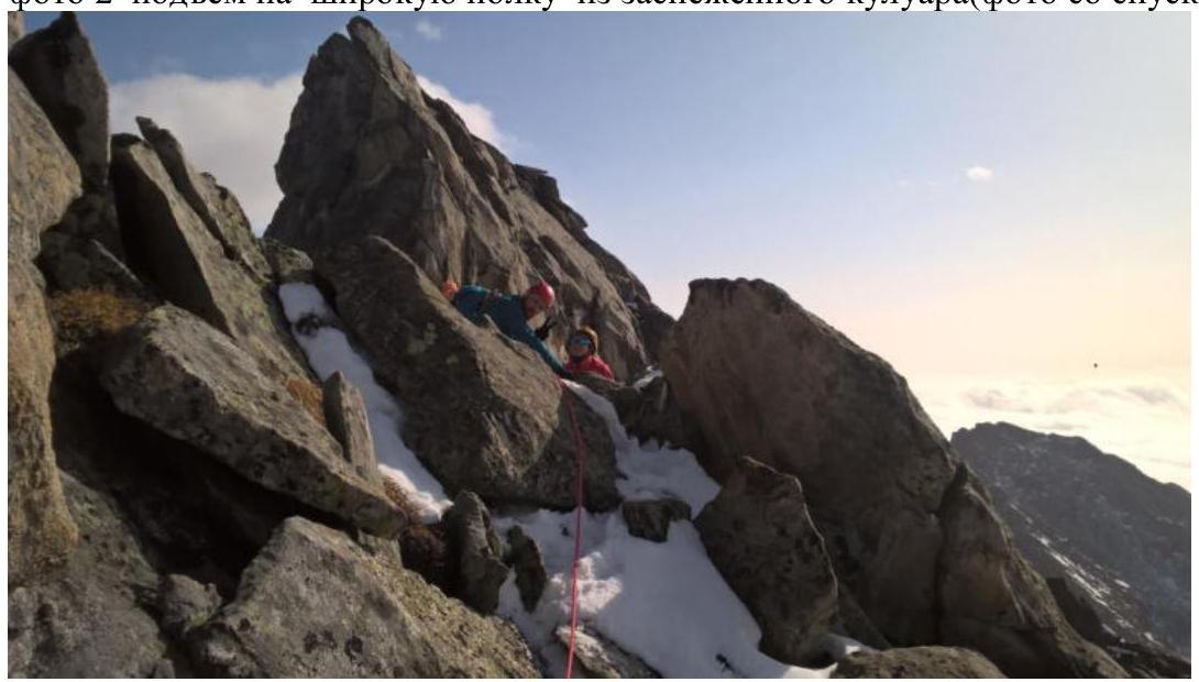
Photo 3 (couloir of descent and ascent strictly in the center)
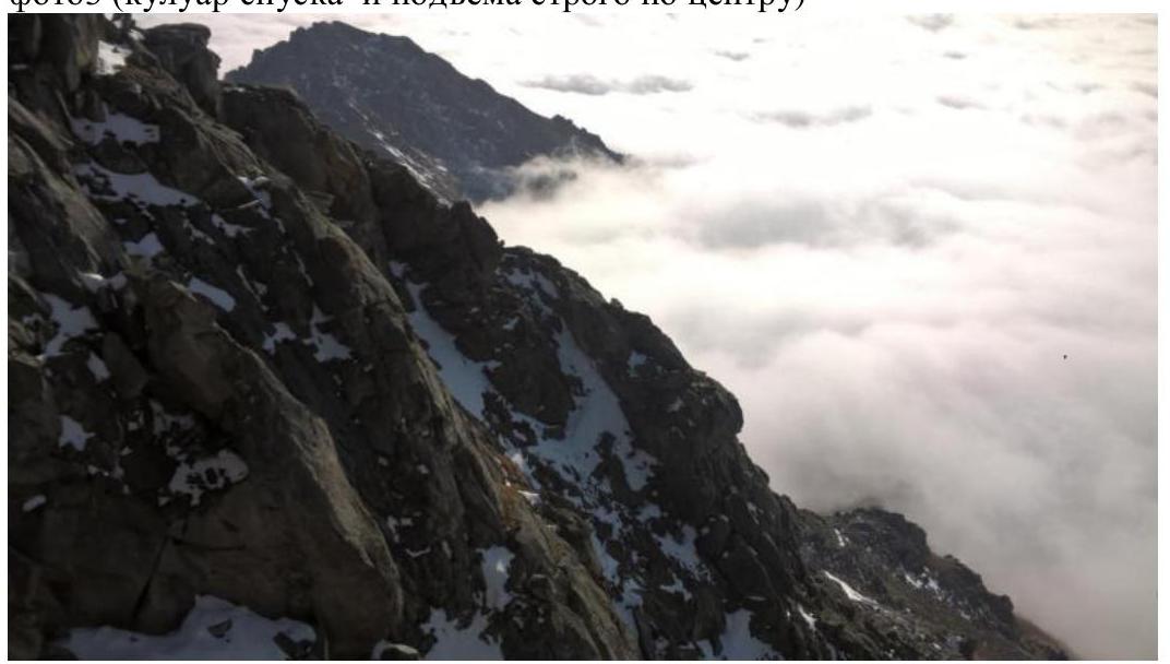
Photo 4 - ascent along a passage between a stone (stone to the right of the participant in the direction of movement upwards) and a wall in a couloir between the 3rd gendarme and the summit

Photo 5 - key section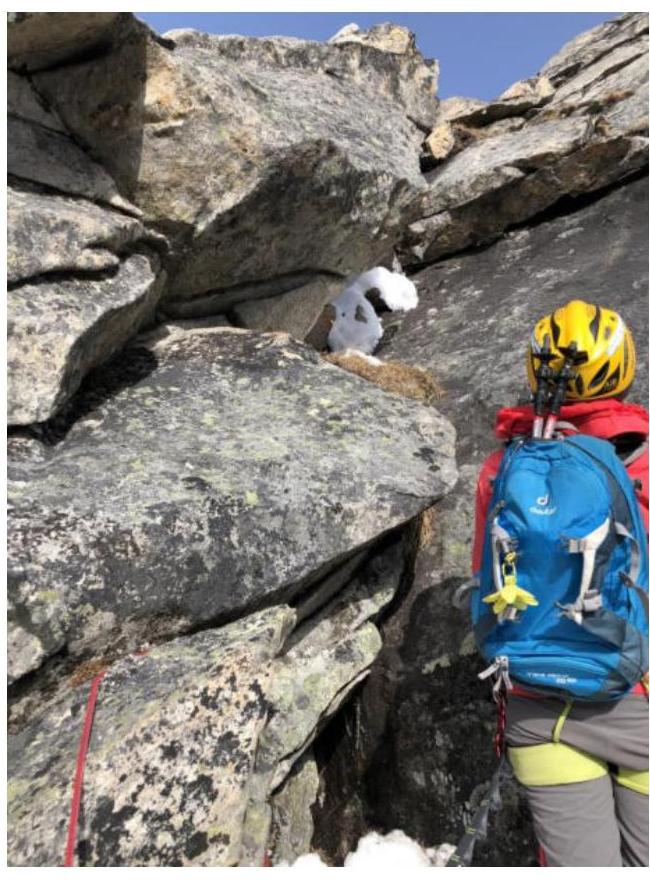
Photo 6 - western counterfort (view from the south)
Photo 7 - western counterfort - start of movement along an inclined slab (photo taken on descent, view from the north)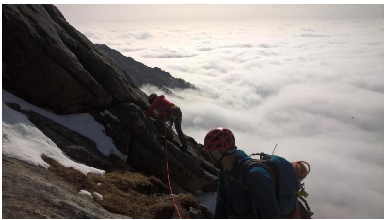
Photo 8 - section before flattening and exit to the pre-summit ridge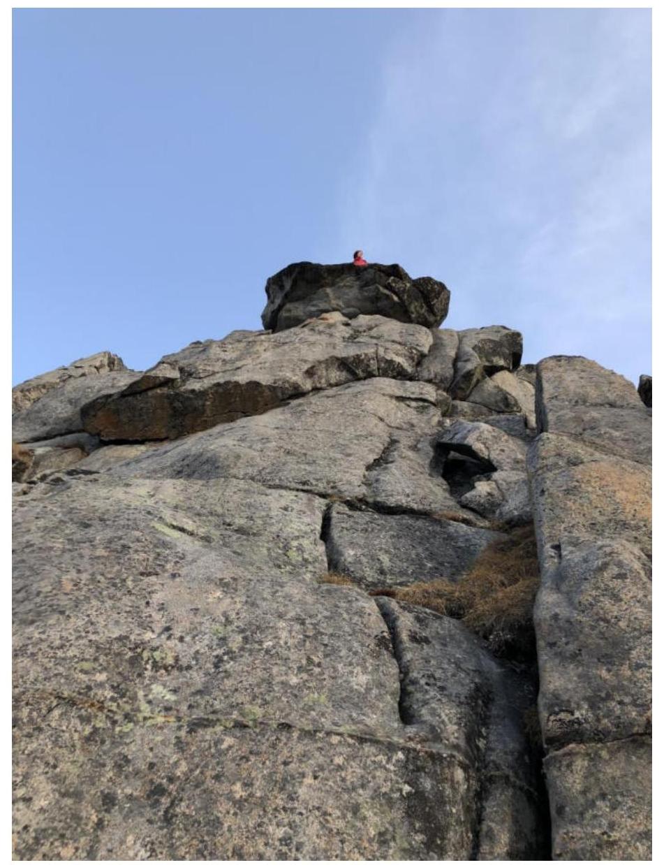
3.2. Photo of the note left by the team on the summit from the control tour.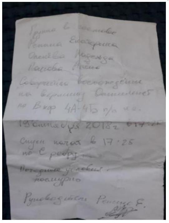
Photo of peak Rossisko-Mongolskoy druzhby (Internatsionalny) taken from the control tour on the summit Optimist.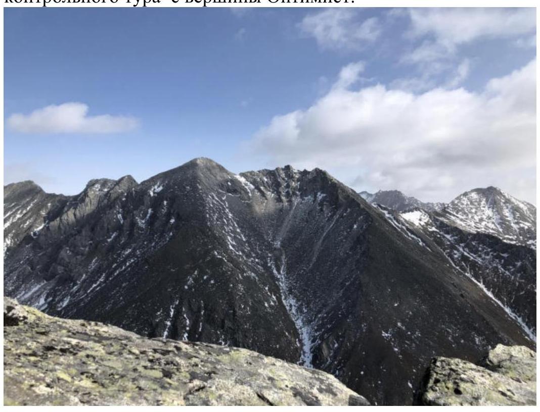
3.3. The rocky part of the route passes mainly along large-blocky rocks. The route corresponds to other Category 2A routes in the Eastern Sayan. The team descended along the ascent route, with rappelling (20 m) at the key section of the route.