Irkutsk Regional Public Organization Active Recreation and Alpinism Club "Gory Baikala"
Report on the First Ascent
On v. Obmanchivaya 3004 m, via the "Troya" route on the center of the North-Eastern wall. Approximately 5A cat. dif. Irkutsk 2017
Ascent Passport
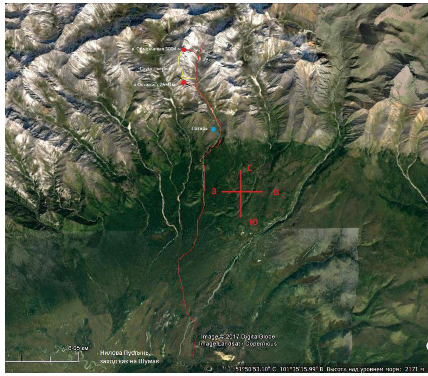
- Eastern Sayan, Tunkinskie Goltsy ridge, Cherlytym-Gorkhon gorge.
- Obmanchivaya 3004 m (height by GPS, peak coordinates: 51°51′14.11″N, 101°36′29.97″E), "Troya" route on the center of the North-Eastern wall.
- Cat. dif.: proposed 5A cat. dif. First ascent.
- Route character — rock climbing.
- Route elevation gain: 400 m.
Route length: 550 m.
Section length:
- V cat. dif. – 120 m
- VI cat. dif. – 230 m Average steepness:
- wall part of the route — 80°
- entire route — 60°
- Pitons left on the route: 0. Used on the route: anchor: 21/7, stoppers: 49/20, bolted pitons: 0/0.
- Team's climbing hours: 8 h 45 min, Overnights: none.
- Leader: Glazunov Evgeniy Vladimirovich (MS). Participant: Egorov Dmitriy Anatolyevich (1st sports category). Boiko Aleksey Andreich (2nd sports category).
- Coach: Glazunov Evgeniy Vladimirovich (MS).
- Departure from BL to the route: 04:00, July 11, 2017. On the summit — 16:45, July 11, 2017. Return to BL — 18:45, July 11, 2017.
- Alpinism Club "Gory Baikala".
Overview of the Ascent Area, Sports Characteristics, and Tactical Actions of the Team
The Obmanchivaya peak is located in the upper reaches of the Cherlytym-Gorkhon gorge, Tunkinsky ridge of the Eastern Sayan, to the west of the Khubuty river gorge, which is used by the trail to Shumak mineral springs, a popular tourist route in our region. The nearest settlement: Nilova Pustyn and Khoito-Gol village, Tunkinsky district, Republic of Buryatia (district center — Kyren village). From there, travel by old road to the "Sukhoy Ruchey" tourist base, then by high-clearance vehicle up the road, or on foot to the Cherlytym-Gorkhon river, from where a good trail leads into the gorge.
The gorge is a dead end, regularly visited by local herb collectors and foragers, with a very simple approach. Horseback transportation to the base camp is possible along the trail.
In terms of alpinism, the gorge is undeveloped and not visited by tourists. We are aware of only one first ascent to the "Optimist" peak via a 2A–2B cat. dif. route (led by Nikonov V. P.). The remaining peaks have not been visited, and routes have not been classified. Our reconnaissance allows us to assess the potential of the gorge for alpinism events with ascents ranging from 1B to 5A cat. dif. All ascents will be first ascents.
The chosen peak is a characteristic rock bastion peak with no signs of human presence at the summit, giving us the right to claim a first ascent.
The chosen route is the most logical and immediately noticeable, with good anchoring to the terrain; some sections have scree and chimneys with wedged rocks, requiring special attention during ascent. The route is relatively monolithic, consisting mainly of vertical cracks and chimneys, as well as smooth slabs with limited holds.
According to the team's assessment, the route corresponds to similar 5A cat. dif. routes in the Eastern Sayan.
To complete the route, we recommend having, in addition to a standard set, a medium-sized friend and two large camalots #3 and 4.
Map-scheme of the Cherlytym-Gorkhon gorge and the approach path to the routes.
General view of the Obmanchivaya peak and the ascended route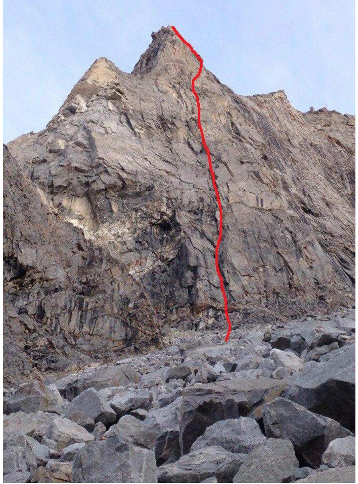
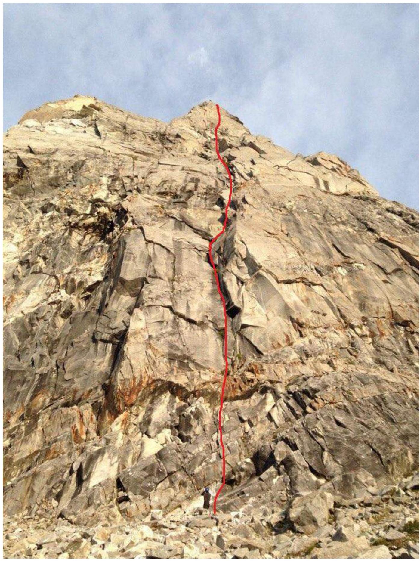 Photos of the route by sections
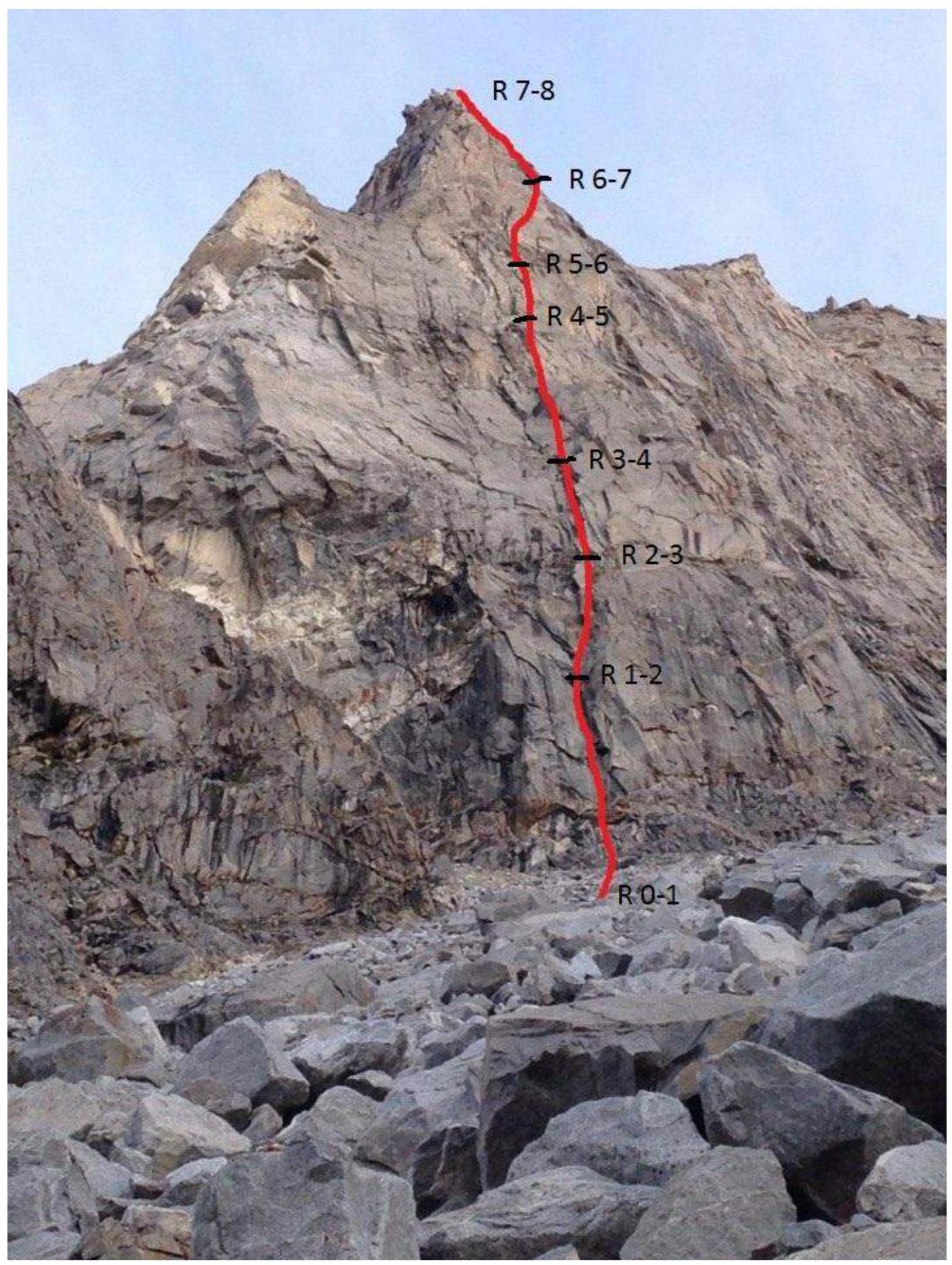
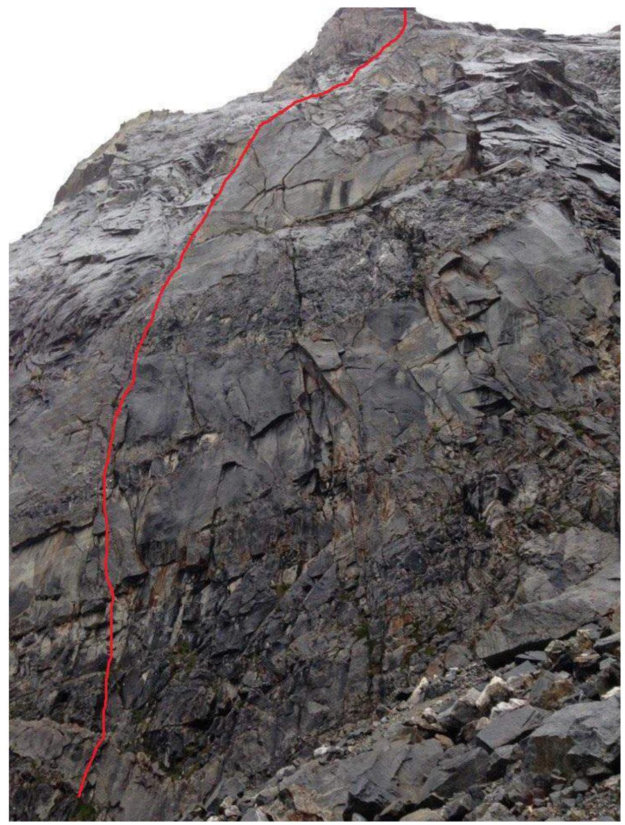
Photo of the route profile on the right
UIAA Scheme
| Section | Protect. elem. | Rock piton | UIAA Route Diagram | Length (m) | Avg. steep. (°) | Cat. dif. |
|---|---|---|---|---|---|---|
| R6–R7 | 0 | 0 | 200 m | 35° | III | |
| R5–R6 | 6 | 2 | 60 m | 65° | V | |
| R4–R5 | 9 | 5 | 60 m | 85° | VI A2 | |
| R3–R4 | 6 | 5 | 60 m | 65° | V | |
| R2–R3 | 11 | 3 | 60 m | 75° | VI | |
| R1–R2 | 9 | 2 | 50 m | 75° | VI A1 | |
| R0–R1 | 8 | 4 | 60 m | 90° | VI A2 |
Route Description by Sections
R0–R1 The beginning of the route passes through sloping rocks under an internal corner. The corner slightly overhangs. Diverse relief for organizing protection points, pitons and friends go well. Difficult free climbing, then transition to aid climbing. Further exit onto a sloping ledge. Stand carefully on the ledge due to loose rocks, station on the relief. (60 m, 90° VI A2)
R1–R2 From the station, move upwards following the pronounced relief, many holds. Then approach under a small internal corner. Move carefully through the corner due to wedged rocks. At the end of the corner, an awkward entry onto a small grassy ledge. Through a small cornice, exit right onto a large inclined block. Station on the relief. (50 m, 75° VI A1)
R2–R3 Traverse 2 m to the right from the station, then move upwards through free climbing following the pronounced path. Exit onto a small ledge, move slightly left under a large destroyed internal corner. Move with maximum caution through the corner due to many wedged blocks—rocks. Large camalots in the amount of 2–3 pieces are recommended. Exit the corner through a small overhang onto a sloping ledge. Station on the relief. (60 m, 75° VI)
R3–R4 From the station, move left, through smooth slabs approach under a small internal corner. Then through free climbing exit onto a large balcony consisting of relatively stable rocks. Station behind a rock. (60 m, 65° V)
R4–R5 Bypass the sheer wall to the right along a small ledge, approach under a one-sided corner with a pronounced crack. The corner was climbed using aid climbing due to wet relief. Then move right through free climbing onto sloping slabs. Station behind a rock. (60 m, 85° VI A2)
R5–R6 Further up and to the right along the slabs. Pass at the base of a large, diagonally lying boulder onto a small crevice. Exit onto the ridge. Then along the ridge exit onto a large balcony. Station behind a rock. (60 m, 65° V)
R6–R7 From the large balcony, continue moving right with simultaneous protection, exit onto a scree slope. Along the slope, bypass small walls and again exit onto the ridge. Along the coarse relief, ascend to the summit. On the summit, a control cairn. (200 m, 35° III)
Descent from the summit via a 1B cat. dif. route along the scree towards the col to a large limestone arch, then down the couloir into the gorge.
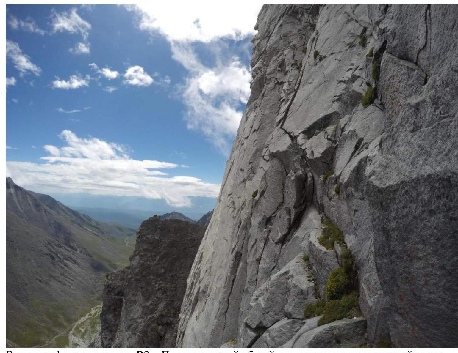
View in profile from station R3 — showing the overall angle of the route in the middle section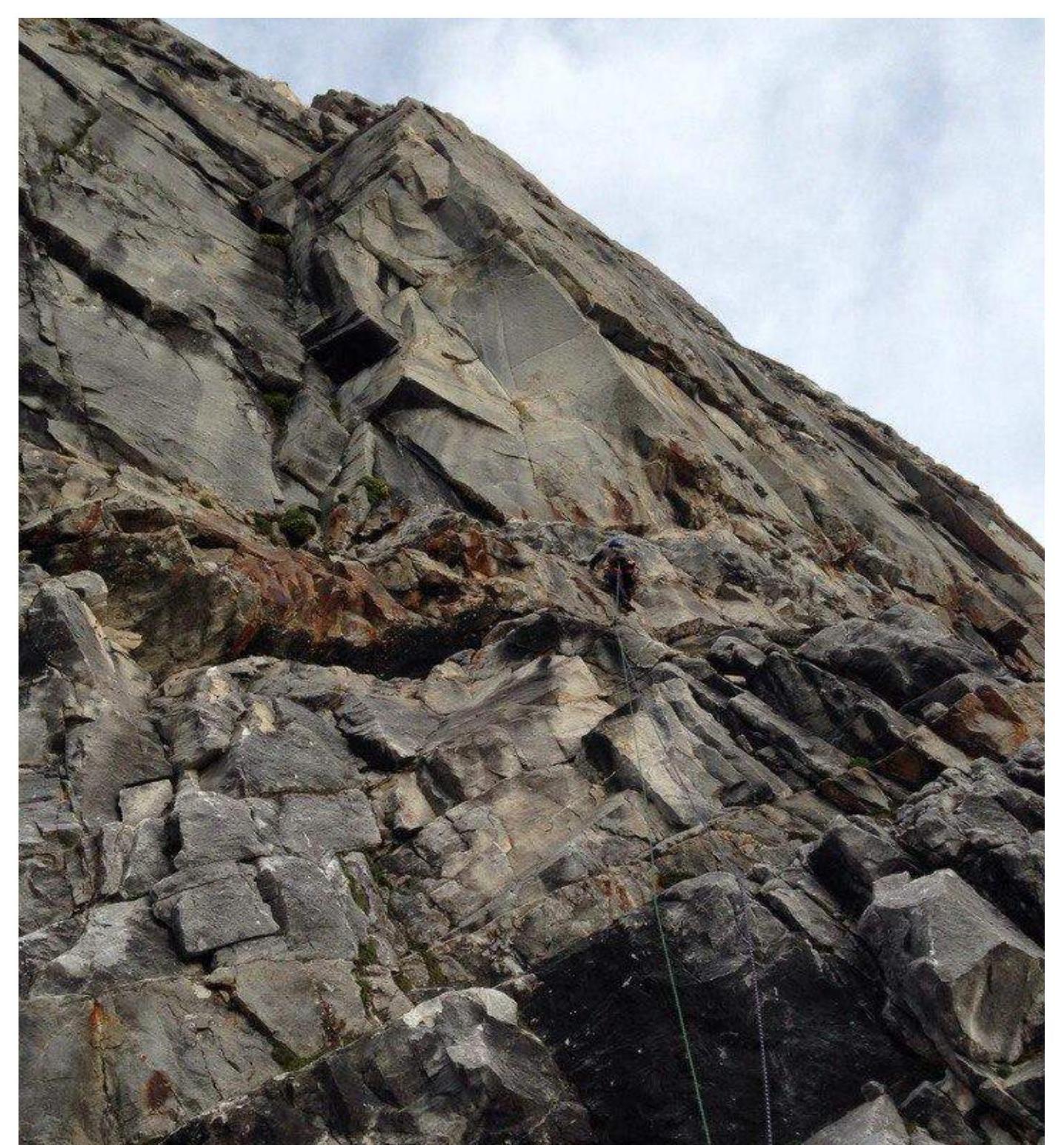
Start of the route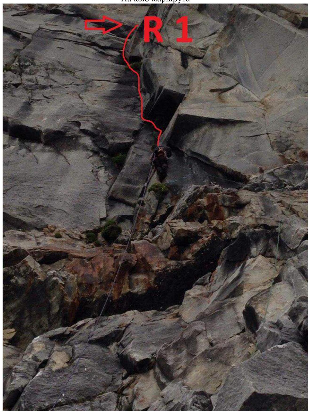
Middle of section R0–R1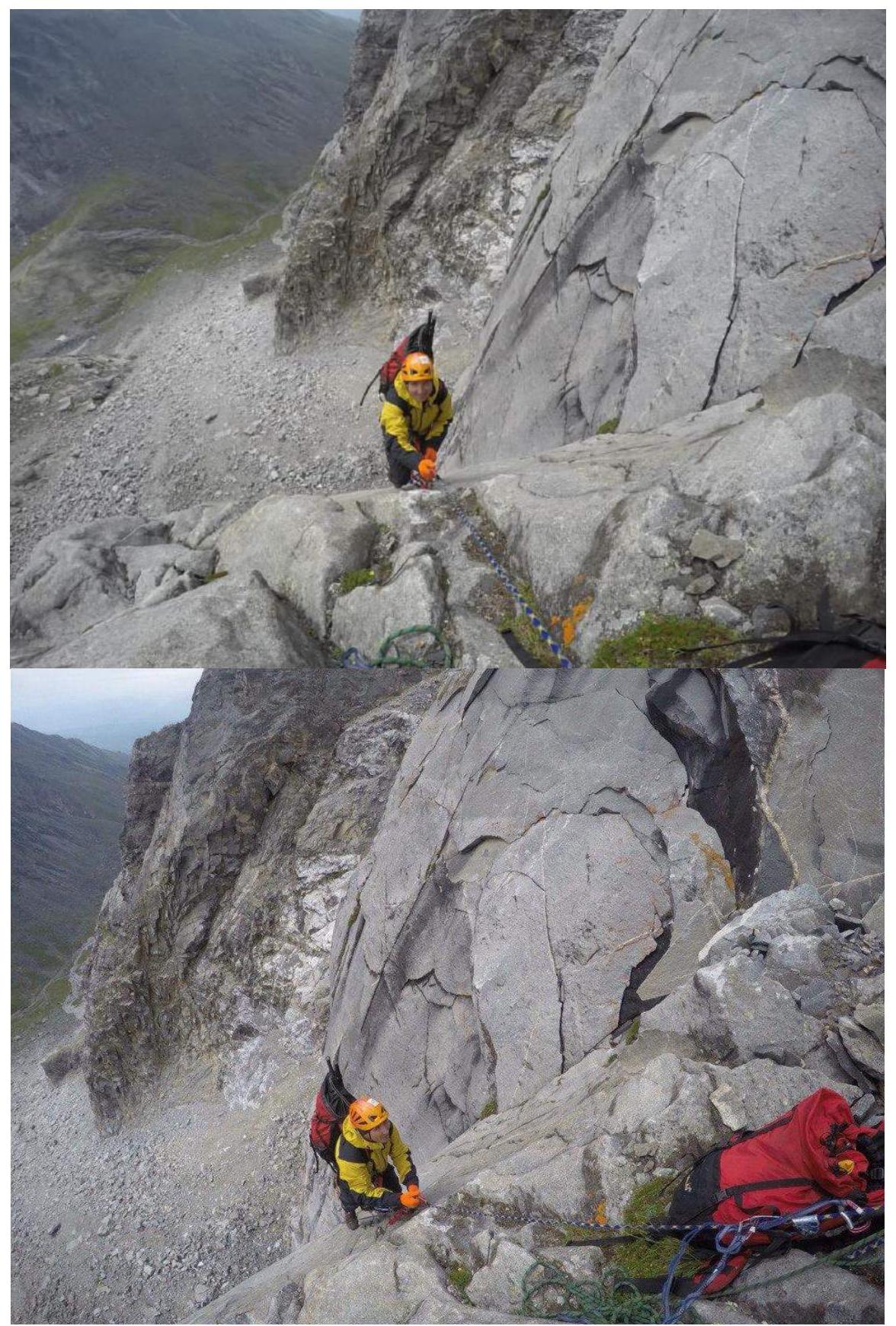
End of section R0–R1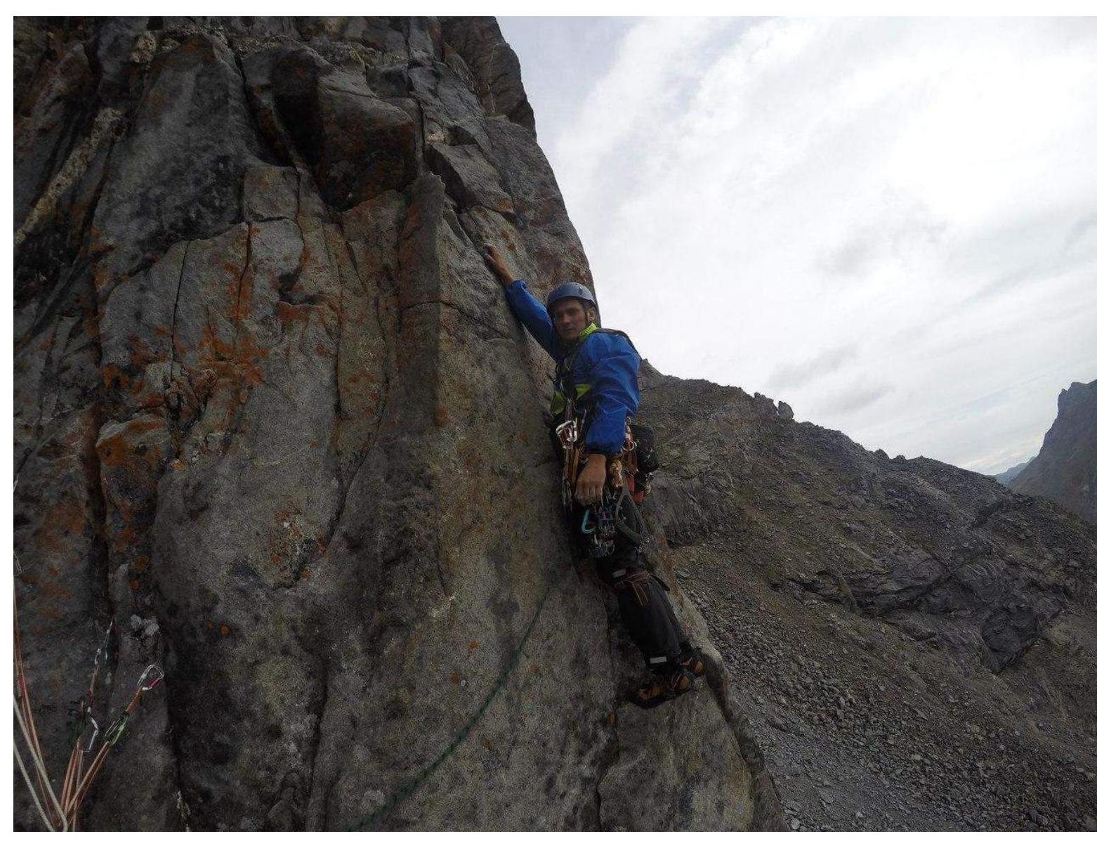
Section R1–R2 start
Section R1–R2 middle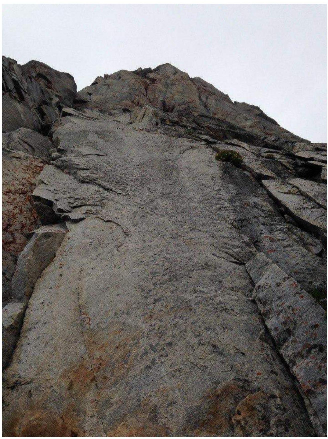
Section R2–R3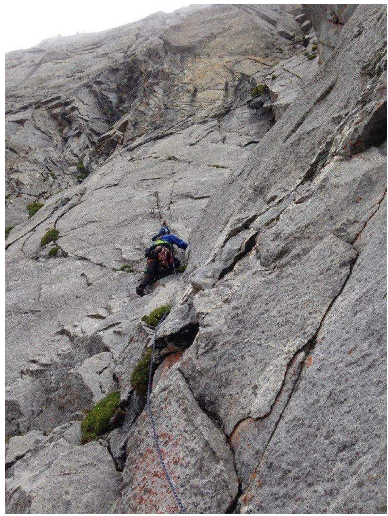
Section R3–R4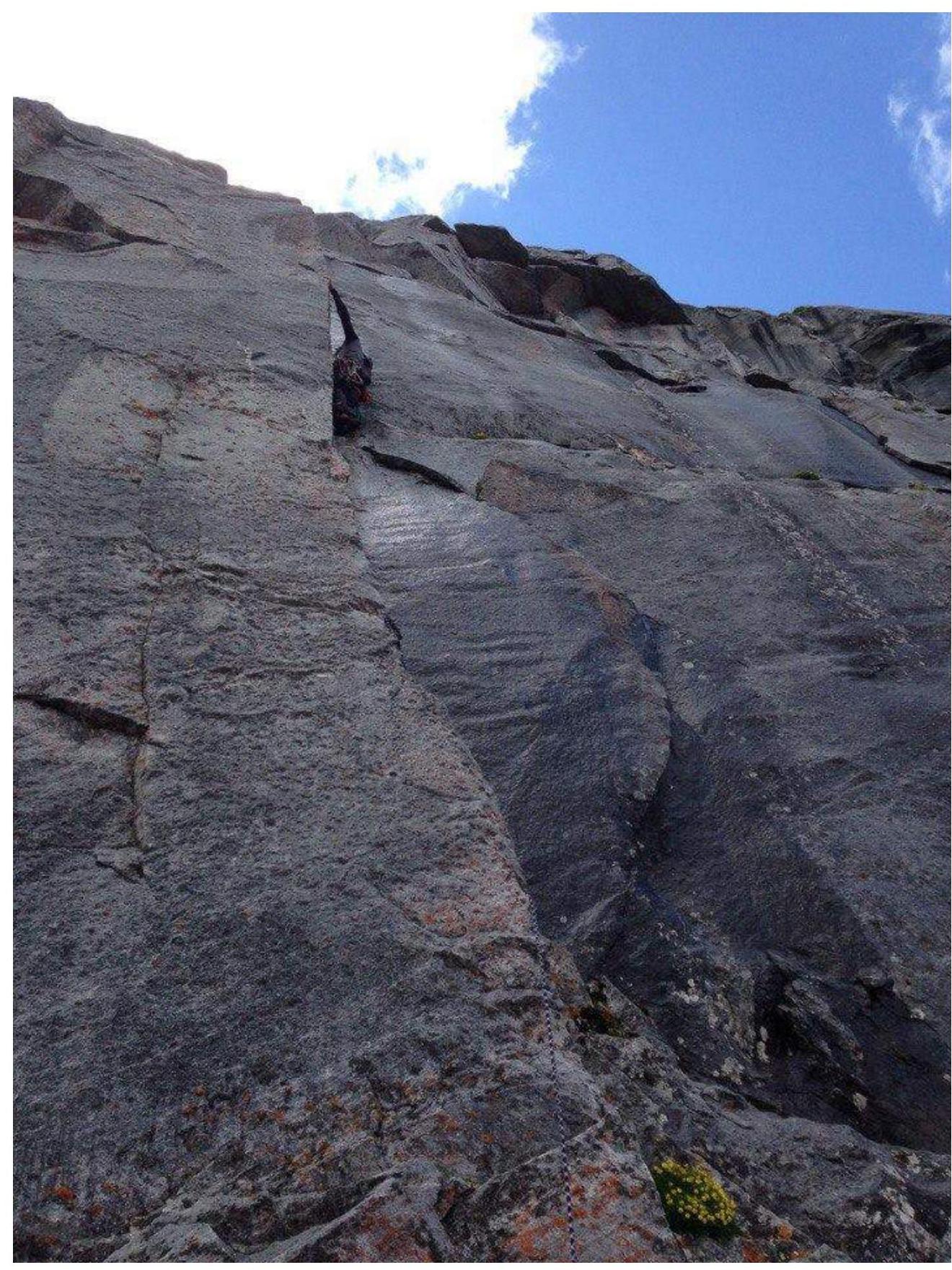
Start of section R4–R5
Section R5–R6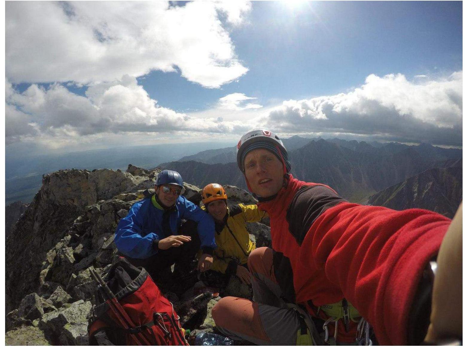
Summit
Footnotes
-
51°50′53.10″N, 101°35′15.99″E. Height above sea level: 2171 m. ↩