Report
on the first ascent to the summit Obmanchivaya 3004 m via the route through Zub Obmanchivoy, approximately 5A category of difficulty, for the period from October 17, 2018 to October 17, 2018.
I. Climbing Report
| 1. General Information | ||
|---|---|---|
| 1.1 | Full Name, Sports Rank of the Leader | Boyko Alexey Andreevich, 1st sports rank |
| 1.2 | Full Name, Sports Rank of Participants | Glazunov Evgeny Vladimirovich, MS, Panova Alena Mikhailovna, 1st sports rank |
| 1.3 | Full Name of Coach | Glazunov Evgeny Vladimirovich (MS) |
| 1.4 | Organization | Irkutsk Regional Public Organization "Club of Active Recreation and Alpinism 'Gory Baikala'", project "Nevozmozhno — eto ne navsegda" |
| 2. Characteristics of the Climbing Object | ||
| 2.1 | Region | Vostochnye Sayany, Tunkinskie Goltsy mountain range |
| 2.2 | Valley | Cherlytym-Gorkhon |
| 2.3 | Section Number according to the 2013 Classification Table | 6.1.2 |
| 2.4 | Name and Height of the Summit | Obmanchivaya 3004 m |
| 2.5 | Geographical Coordinates of the Summit (latitude, longitude), GPS Coordinates | — |
| 3. Characteristics of the Route | ||
| 3.1 | Route Name | Through the Eastern wall of the Southern ridge |
| 3.2 | Proposed Category of Difficulty | 5A |
| 3.3 | Degree of Route Exploration | First ascent |
| 3.4 | Relief Characteristics of the Route | Rocky |
| 3.5 | Height Difference of the Route (data from altimeter or GPS) | 290 m |
| 3.6 | Route Length (in meters) | 765 m |
| 3.7 | Technical Elements of the Route (total length of sections with different categories of difficulty, indicating the type of relief (ice-snow, rocky)) | Rock I cat. diff. – 400 m. Rock II cat. diff. – 0 m. Rock III cat. diff. – 140 m. Rock IV-V cat. diff. – 0 m. Rock V cat. diff. – 75 m. Rock VI cat. diff. – 150 m. Rock VI, A1 – 0 m. Rock VI, A2 – 150 m. |
| 3.8 | Descent from the Summit | Along the ridge in a southern direction to the saddle between v. Optimist, to a characteristic large limestone arch, turn left into a couloir before reaching it. |
| 3.9 | Additional Route Characteristics | Lack of water |
| 4. Characteristics of the Team's Actions | ||
| 4.1 | Time of Movement (team's traveling hours) | 9 h 30 min |
| 4.2 | Overnights | No |
| 4.3 | Time at Control Points | Departure from overnight stay under the summit Zub – 5:00. Start on R0 – 7:30. Summit – 17:00. Descent to the valley – 18:30. Return to BL – 20:00 |
| 5. Characteristics of Weather Conditions | ||
| 5 | Clear, no precipitation, temperature approximately +10 °C. | |
| 6. Person Responsible for the Report | ||
| 6.1 | Full Name, e-mail | Boyko Alexey Andreevich, alexeiboiko1@gmail.com |
II. Climbing Description
1. Characteristics of the Climbing Object
1.1. General photo of the summit Obmanchivaya from the Gorkhon river valley.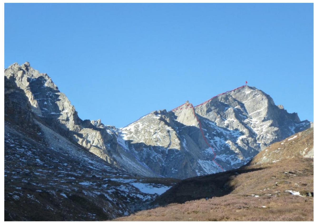
1.2. General photo of the western wall of the summit Zub (taken from the Gorkhon river valley).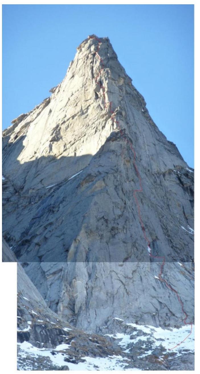
1.3. Photo of the route profile.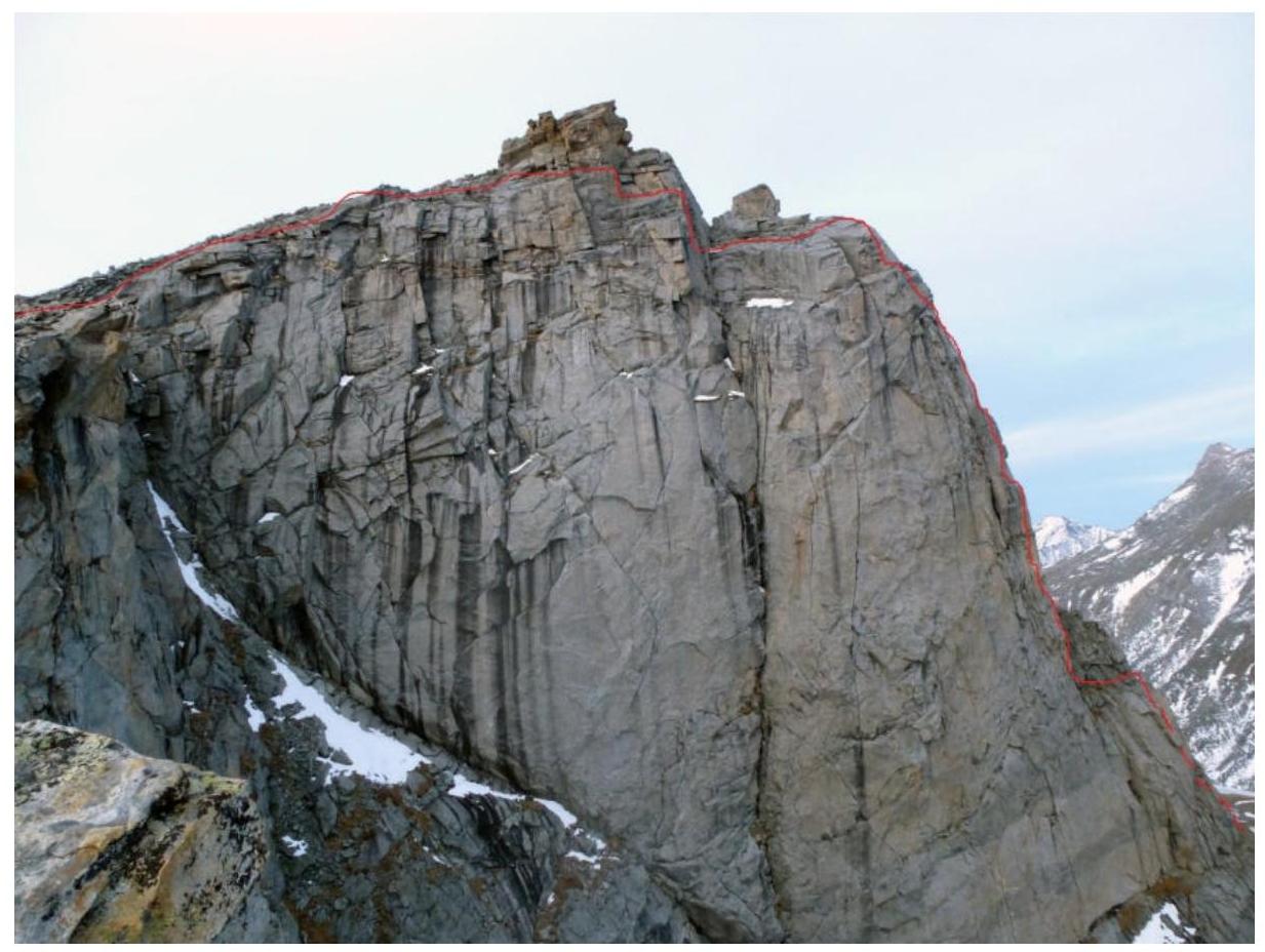
1.4. Photopanorama of the upper part of the Cherlytym-Gorkhon valley from the summit Shkolnaya.
1.5. Map of the area.
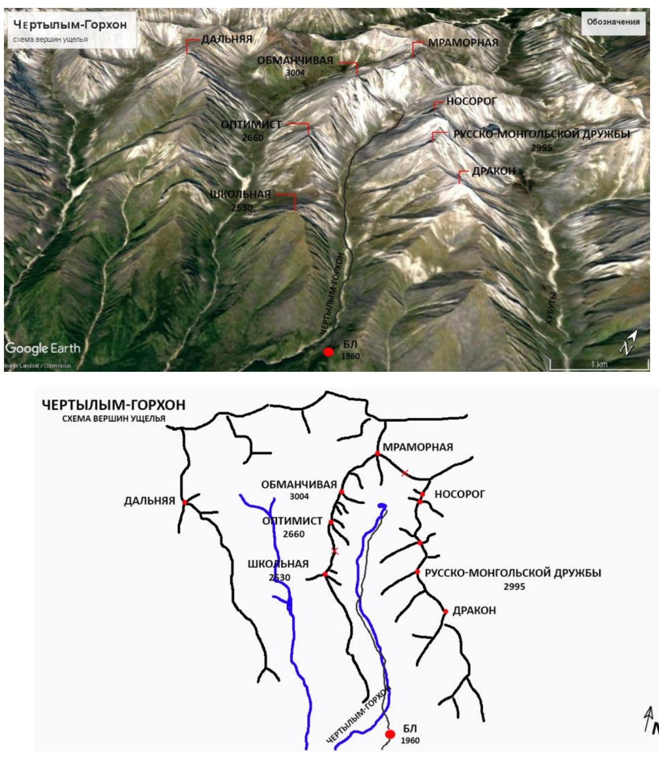
The summit Obmanchivaya is located in the upper reaches of the Cherlytym-Gorkhon valley, Tunkinsky mountain range, Vostochnye Sayany, to the west of the Khubuta river valley, along which the trail leads to the Shumak mineral springs — a popular tourist route in our region. The nearest settlements:
- Nilova Pustyn settlement;
- Khoito-Gol village.
Tunkinsky district of the Republic of Buryatia (district center — Kyren settlement). From them, you need to move along the old highway to the Sukhoy Ruchey tourist center 5 km, then:
- transportation by a high-passability vehicle up the highway 3 km;
- or on foot to the Cherlytym-Gorkhon river.
From there, a good trail leads into the valley to the base camp 6 km.
The valley is a dead end, regularly visited by local herb and wild food gatherers, and has a very simple approach. It is possible to transport cargo to the base camp on horses along the trail.
The chosen line passes through a beautiful, standalone bastion of two towers, standing in a cascade, very similar to a tooth — which is why it got its name. The route thread is quite straight. The route features:
- a great variety of relief;
- a considerable number of monolithic blind cracks.
The approach to the route from the base camp takes 2 hours 30 minutes.
According to the team's assessment, the route corresponds to similar routes in Vostochnye Sayany of 5A category of difficulty.
2. Characteristics of the Route
2.1. Technical photo of the route.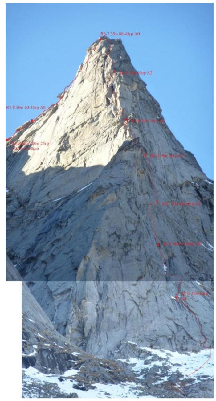 2.2. Section numbers on the technical photo correspond to the section numbers on the UIAA symbol route diagram.
2.3. UIAA symbol route diagram.
2.2. Section numbers on the technical photo correspond to the section numbers on the UIAA symbol route diagram.
2.3. UIAA symbol route diagram.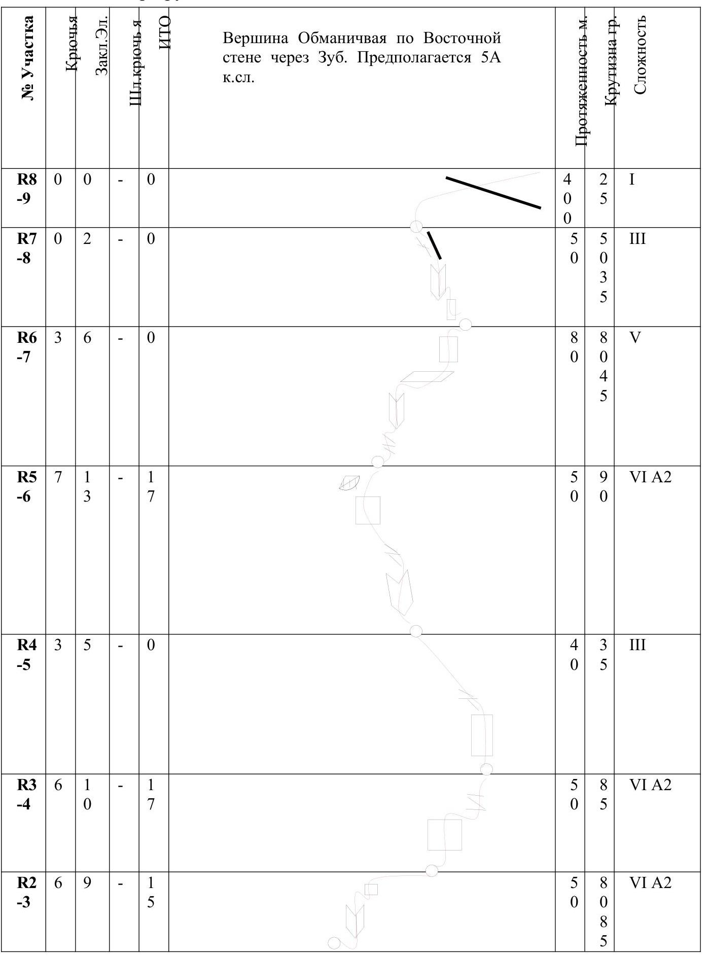
| Section # | Pitons | Stopper elements | AID | Length, m | Steepness, ° | Cat. diff. |
|---|---|---|---|---|---|---|
| R0–R1 | 5 | 5 | 0 | 50 | 60 | III |
| R1–R2 | 6 | 3 | 0 | 40 | 65 | V |
| R2–R3 | 6 | 9 | 15 | 50 | 80 | VI A2 |
| R3–R4 | 6 | 10 | 17 | 50 | 80 | VI A2 |
| R4–R5 | 3 | 5 | 0 | 40 | 35 | III |
| R5–R6 | 7 | 13 | 17 | 50 | 90 | VI A2 |
| R6–R7 | 3 | 6 | 0 | 80 | 80 | V |
| R7–R8 | 0 | 2 | 0 | 50 | 50 | III |
| R8–R9 | 0 | 0 | 0 | 40 | 25 | I |
3. Characteristics of the Team's Actions
3.1. The approach to the summit Obmanchivaya from the base camp takes 2 hours 30 minutes. Follow the trail upstream along the river, the trail goes alternately along the left and right banks, then ascend via a distinct steep couloir towards Zub (WARNING! MAY BE AVALANCHE-PRONE WITH HEAVY SNOWFALL), the beginning of the route passes to the right of the central rib, directly under a pronounced cascade of rusty cornices from above, along a unilateral internal corner.
| Section # | Description | Photo # |
|---|---|---|
| R0–R1 | Along the unilateral internal corner, move up the smoothed slabs towards the corner, belay — friends, station on pitons. | — |
| R1–R2 | From the station, traverse left approximately 7–8 m to the base of the internal corner, then move up through two large blocks, transition to the wall, belay — on pitons, station under a small overhanging cornice on a sloping ledge on anchors and friends. | Photo 1 |
| R2–R3 | From the station, move up using AID or challenging free climbing through a series of cracks, pitons, skyhooks, small friends. Approach the first small rusty cornice, another landmark is the rough relief. From it, traverse 3 m. Station on a ledge with grass behind the bend on pitons. | Photo 2 |
| R3–R4 | From the station, move up using AID or challenging free climbing through a series of cracks and walls in the direction of a not very distinct internal corner, then traverse right 8 m along large-block relief. Be cautious of loose blocks. Station in a niche on a sloping grassy ledge, pitons, or on a large block to the left. | Photo 3 |
| R4–R5 | From the station, move up: 2 m up the smooth rocks on friction from the block, then traverse 1 m left into a small internal corner with a characteristic even crack. Continue moving, bypassing the large-block relief along sloping slabs, in the direction of the second bastion, then slightly left and up. Station on a ledge with grass on pitons. | Photo 4 |
| R5–R6 | From the station, move slightly left and then up along the characteristic resonant crack approximately 7 m (free climbing). At the end of the crack, traverse left onto the southern wall approximately 3 m and then up along a partly blind crack using AID to a large lying block on a ledge, representing a small cornice. Having passed it, take a little left, exit climbing into a niche under a large cornice, bypass the cornice on the left. Station to the right on a small ledge on friends in a monolithic crack. | Photo 5, 6, 7 |
| R6–R7 | Along the monolithic crack from the station, move up (the crack veers left, belay — on friends). Then move up along the large-block relief, exit onto a huge sloping ledge. From the ledge, move up along slabs, then exit onto the ridge of Zub. You will be faced with a large rusty gendarme. Station on anchors. | Photo 8 |
| R7–R8 | From the station, simultaneous movement in a rope team along slabs via the simplest route through a small internal corner from blocks and then, bypassing the gendarme on the left, exit onto the main ridge. | Photo 9, 10, 11 |
| R8–R9 | Along the ridge, walk to the summit. | Photo 12 |
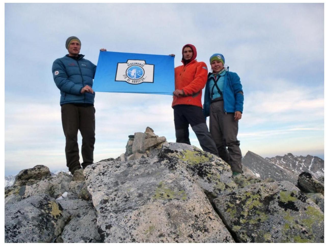
3.2. Photo of the team at the summit near the control tour.
3.3. Descent from the summit along the ridge in a southern direction to the saddle between v. Optimist, to a characteristic large limestone arch, turn left into a couloir before reaching it.
3.4. Photo report by sections
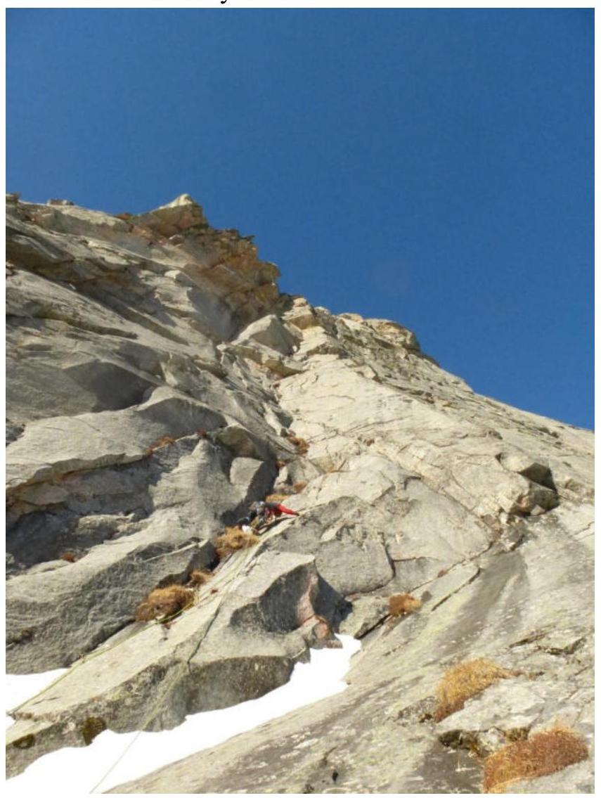
Photo 1. Section R1–R2 from point R1

Photo 2. Section R2–R3
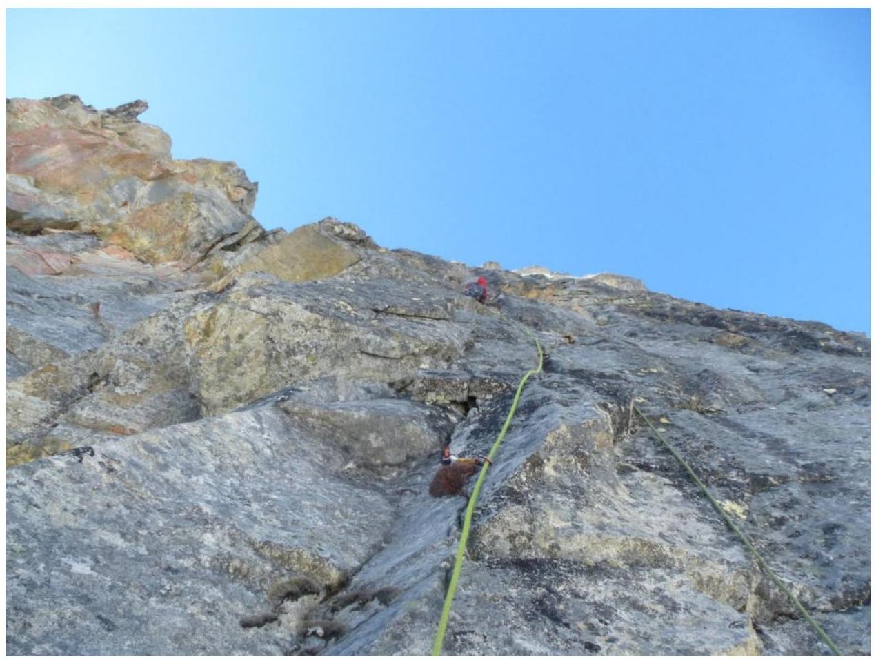
Photo 3. Section R3–R4

Photo 4. Beginning of section R4–R5
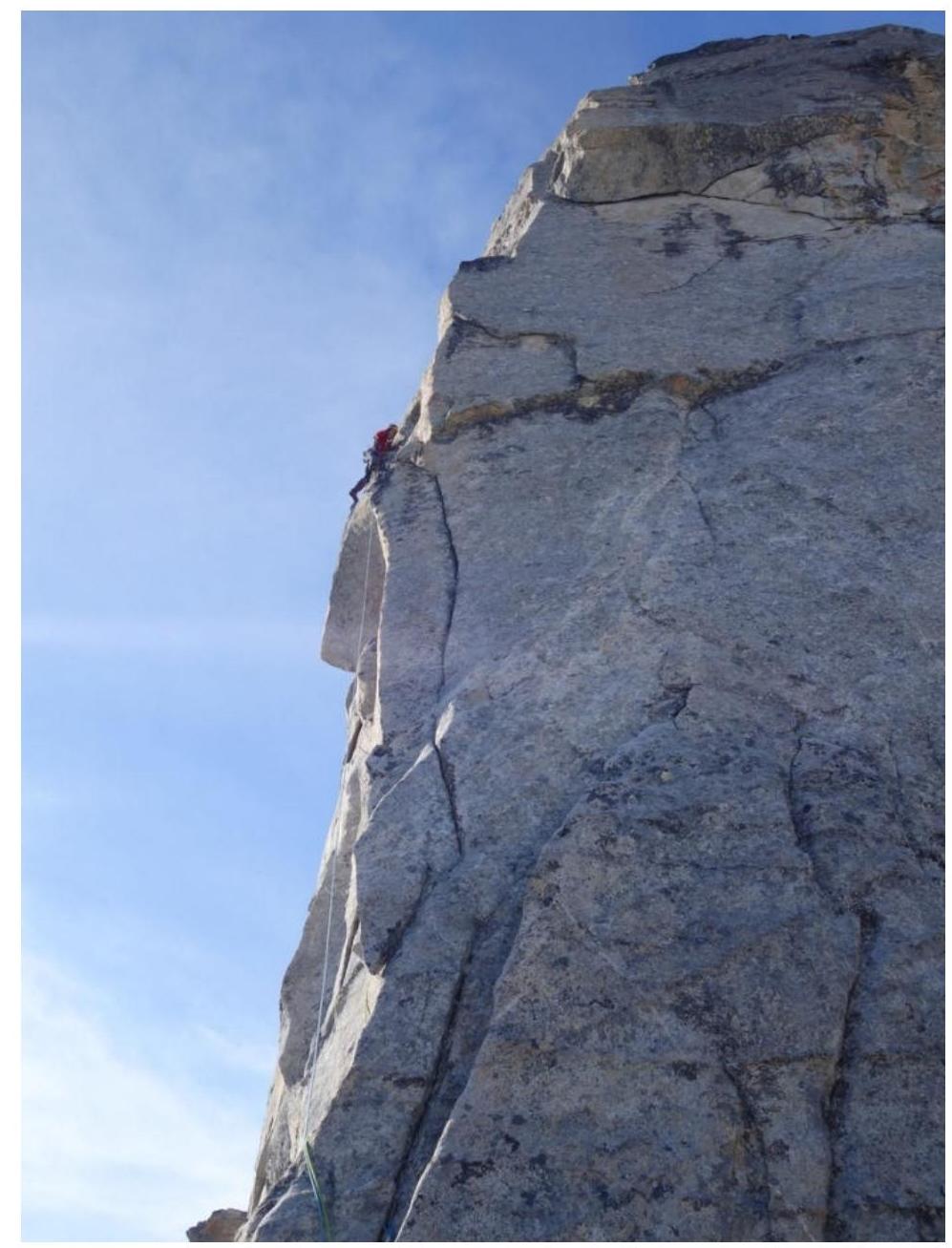
Photo 5. Section R5–R6
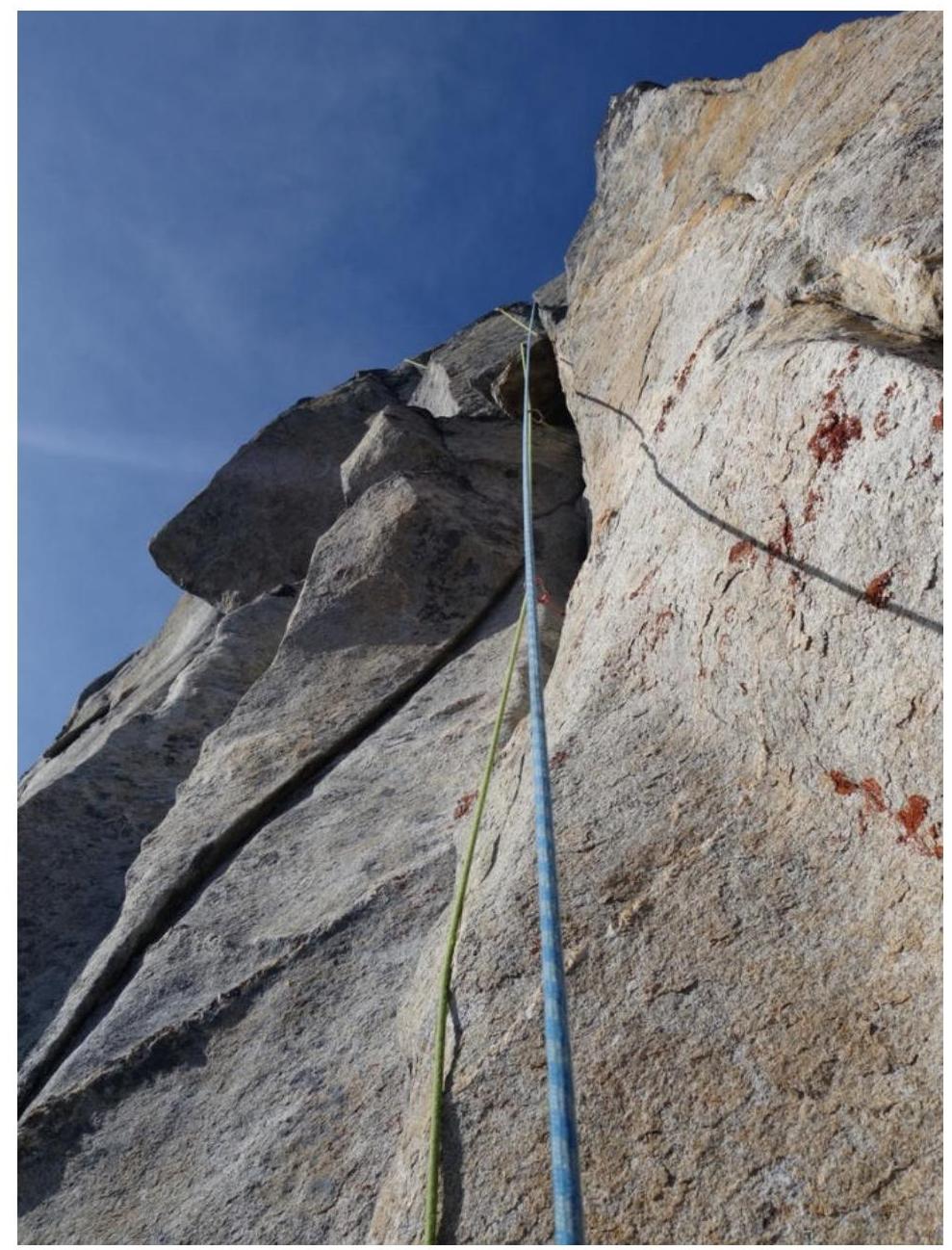
Photo 6. Section R5–R6 from the second climber's perspective
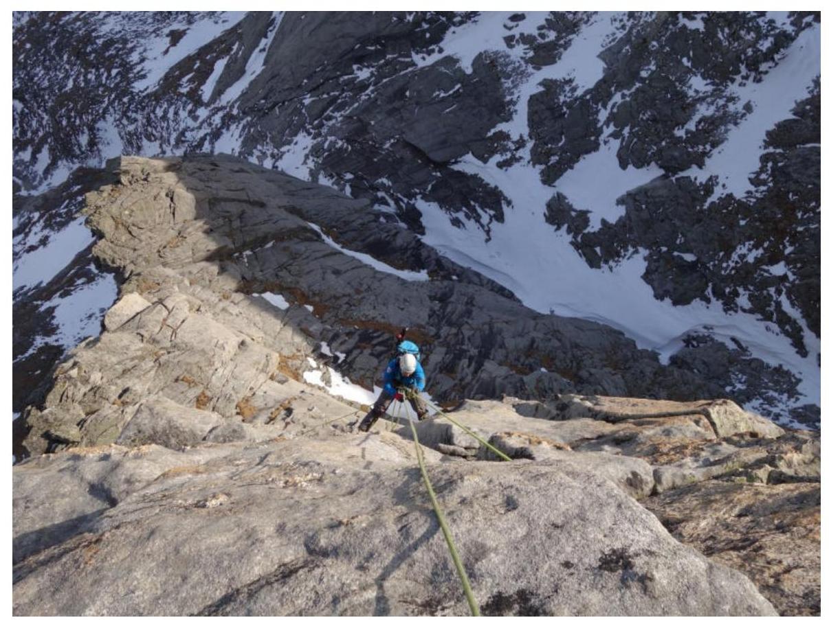
Photo 7. View from the station onto section R5–R6
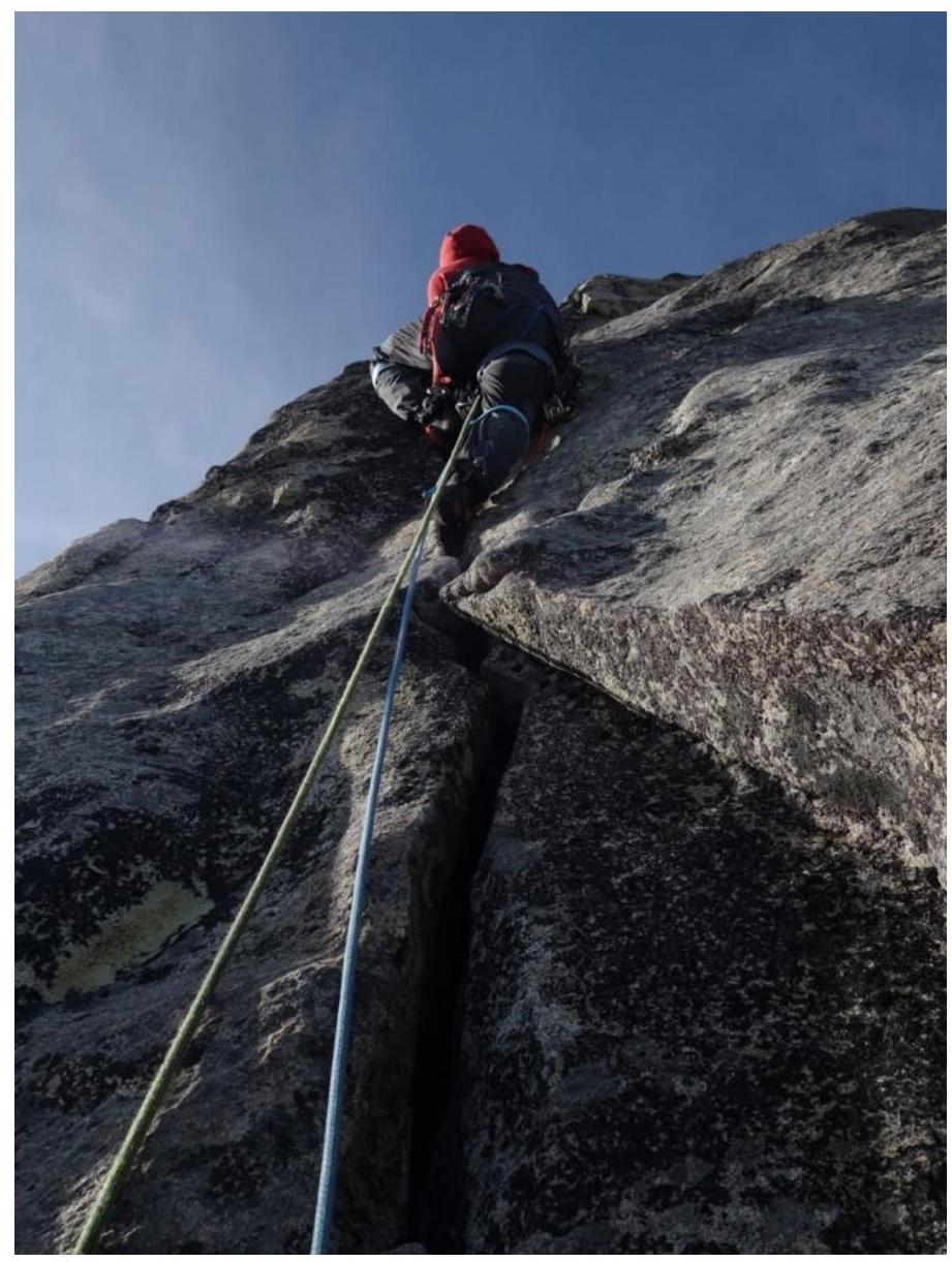
Photo 8. Beginning of section R6–R7, monolithic crack.
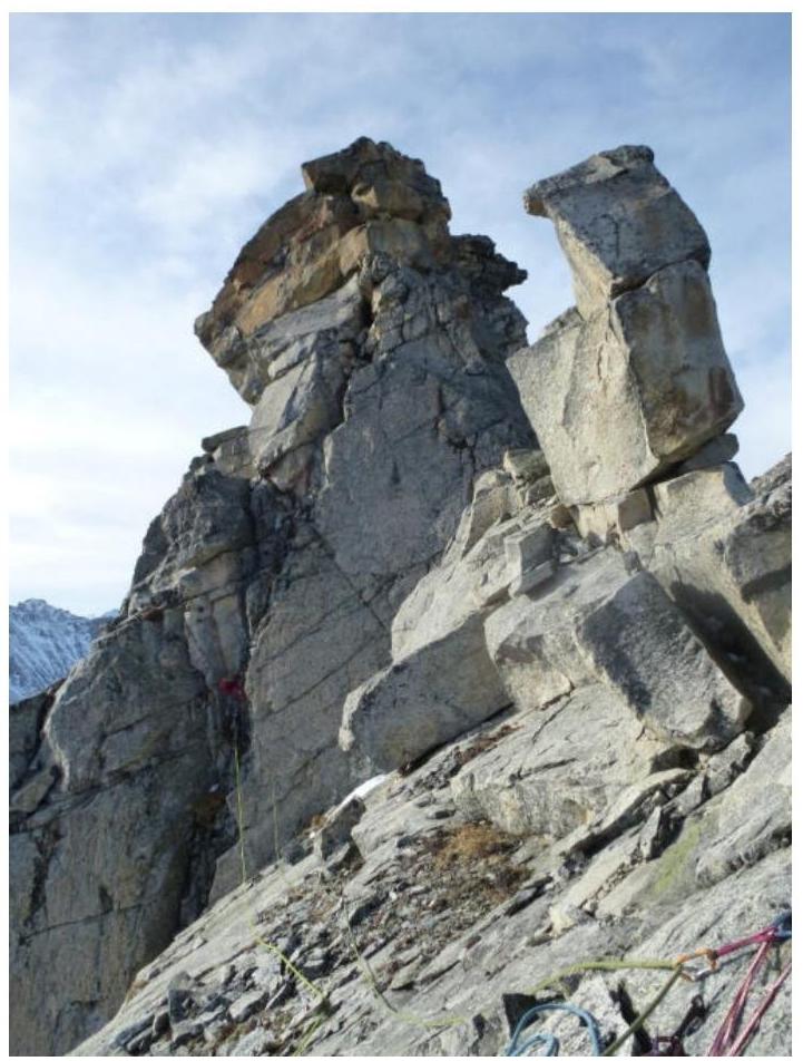
Photo 9. Section R7–R8
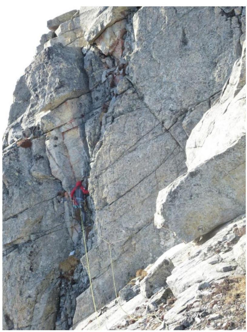
Photo 10. Section R7–R8

Photo 11. Section R7–R8
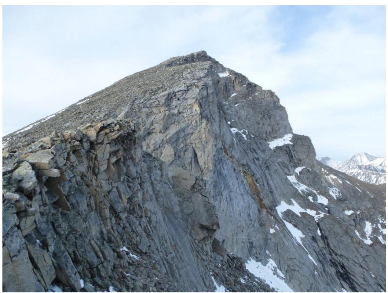
Photo 12. Section R8–R9, the summit and ridge are visible.