Report
On the first ascent to the summit Obmanchivaya via the route along the North-Eastern counterfort of the Northern ridge, category 2A, by the team "Gory Baikala" within the project "Невозможно — это не навсегда" for the period from October 19, 2018 to October 19, 2018.
I. Ascent Passport
| № p.p. | 1. General Information | |
|---|---|---|
| 1.1 | Full name, sports rank of the leader | Boyko Aleksey Andreevich, 1st sports rank |
| 1.2 | Full name, sports rank of the participants | Tkachenko Pavel Valentinovich, 1st sports rank |
| 1.3 | Full name of the coach | Glazunov Evgeniy Vladimirovich, Master of Sports |
| 1.4 | Organization | Irkutsk Regional Public Organization "Club of Active Recreation and Alpinism Gory Baikala" |
| 2. Characteristics of the Ascent Object | ||
| 2.1 | Region | Vostochnye Sayany, Khrebet Bolshoy Sayan |
| 2.2 | Gorge | Chertrlym-Gorkhon |
| 2.3 | Section number according to the 2013 classification table | 6.1.2 |
| 2.4 | Name and height of the summit | Obmanchivaya, 3004 m |
| 2.5 | Geographical coordinates of the summit (latitude/longitude), GPS coordinates | - |
| 3. Characteristics of the Route | ||
| 3.1 | Route name | Along the North-Eastern counterfort |
| 3.2 | Proposed category of difficulty | 2A |
| 3.3 | Degree of route development | First ascent |
| 3.4 | Nature of the route terrain | Rocky |
| 3.5 | Height difference of the route (altimeter or GPS data) | |
| 3.6 | Route length (in meters) | 225 m |
| 3.7 | Technical elements of the route (total length of sections of varying difficulty with indication of terrain type: ice-snow, rocky) | I cat. diff. ice/rock/combination – 0 m II cat. diff. ice/rock/combination – 120 m III cat. diff. ice/rock/combination – 105 m IV cat. diff. ice/rock/combination – 0 m Movement on closed glacier – 0 m |
| 3.8 | Descent from the summit | Along n/k cat. diff. to Chertrlym-Gorkhon gorge |
| 3.9 | Additional route characteristics | Lack of water |
| 4. Characteristics of the Team's Actions | ||
| 4.1 | Time of movement (team's walking hours, in hours and days) | Time of movement 1 h 20 min |
| 4.2 | Overnights | No overnight stays |
| 4.3 | Exit to the route | 5:30 October 19, 2018 |
| 4.4 | Reach the summit | 10:20 October 19, 2018 |
| 4.5 | Return to the base camp | 13:00 October 19, 2018 |
| 5. Responsible for the Report | ||
| 5.1 | Full name, e-mail | Boyko Aleksey Andreevich, alexeiboiko1@gmail.com |
II. Description of the Ascent
1. Characteristics of the Ascent Object
1.1. General photo of the summit
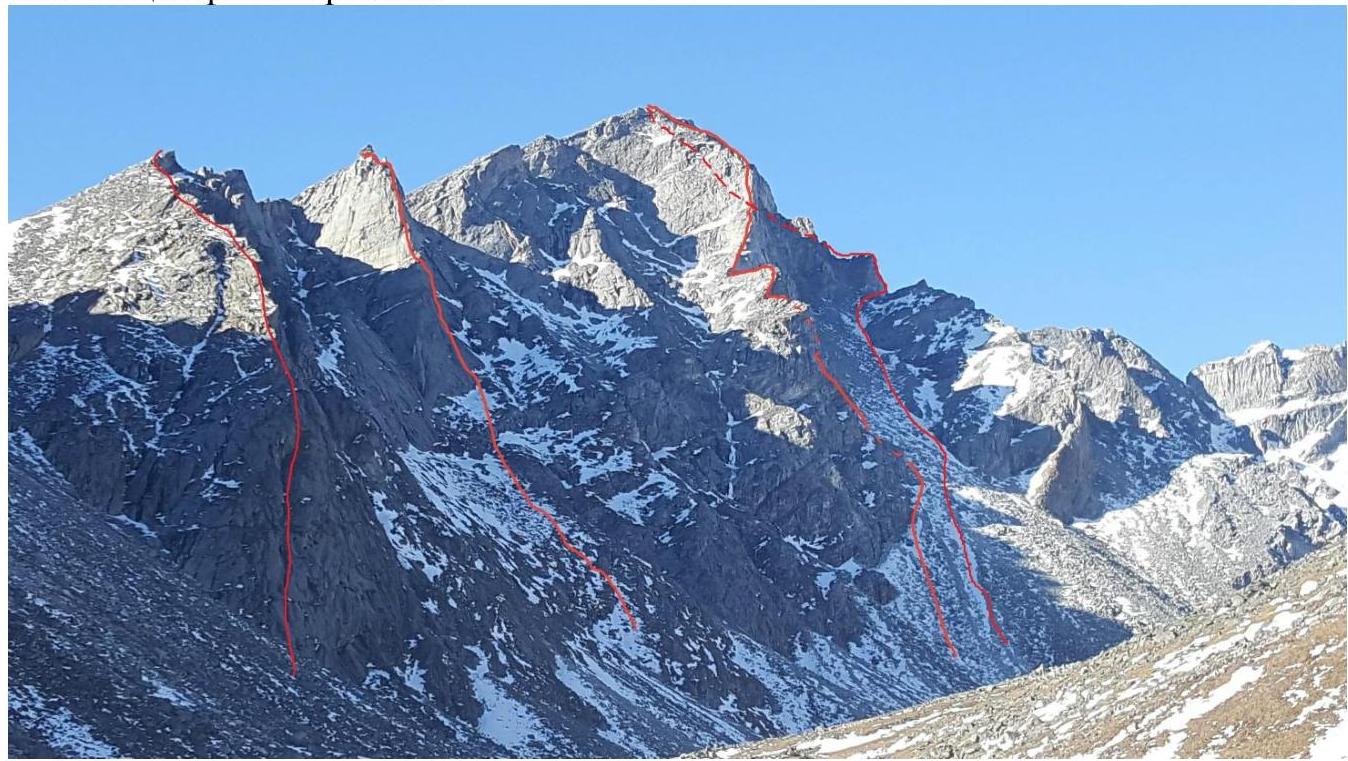
Photo 1. Taken on October 14, 2018 from Chertrlym-Gorkhon gorge. Routes from left to right:
- SE cf. SGR 4A
- Zub Obmanchivoy 5A
- E cf. SGR 4B.
1.2. Photo of the route profile.
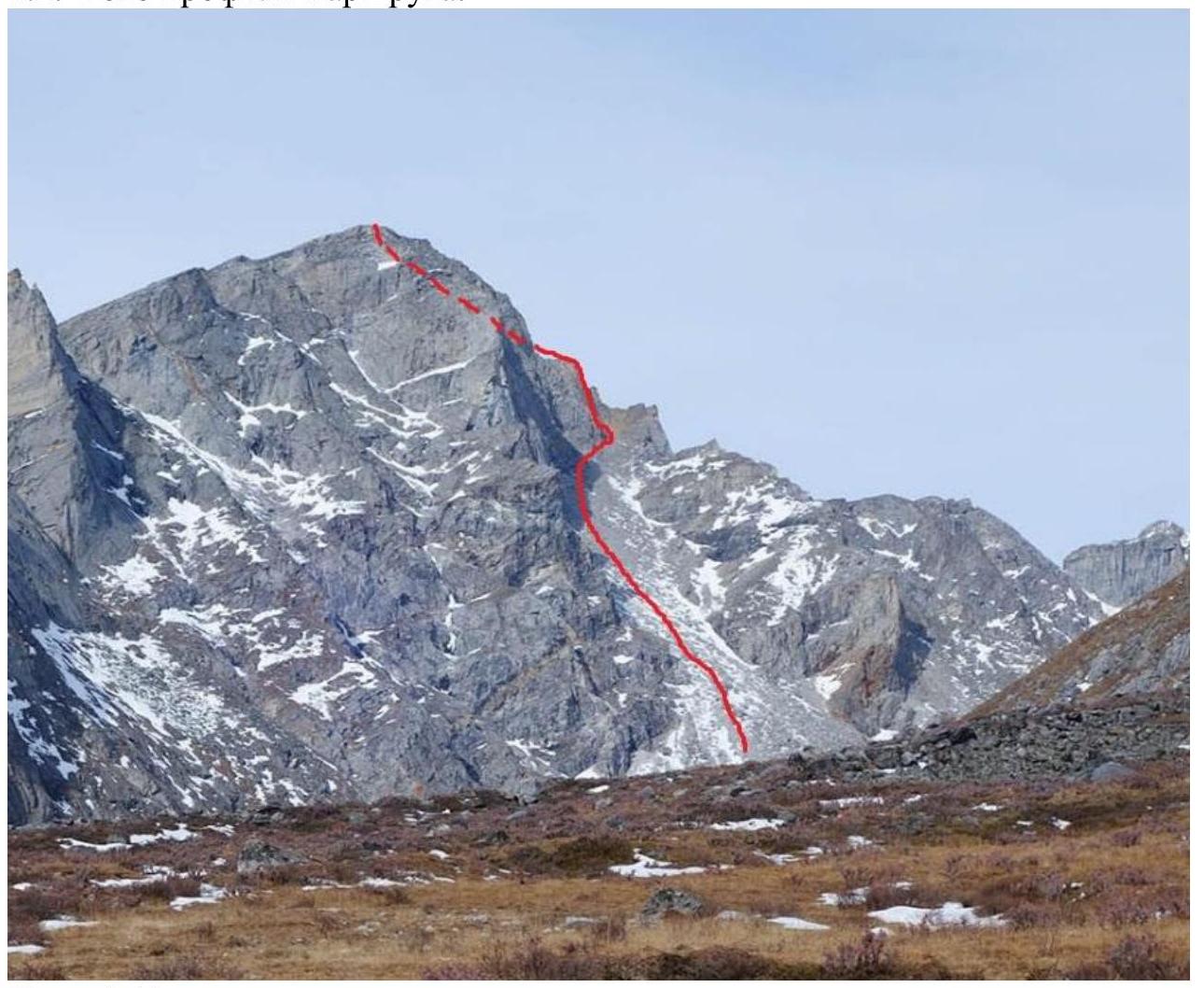
Photo 2. Route line.
1.3. Map of the area.
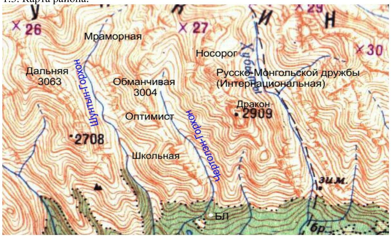
Photo 3. The summit Obmanchivaya is located in the upper reaches of Chertrlym-Gorkhon gorge, Tunkinsky Ridge of the Eastern Sayan, west of the Khubuty river gorge, along which the trail leads to Shumak mineral springs, a popular tourist route in our region. The nearest settlement: Nilova Pustyn and Khoyto Gol village, Tunkinsky district, Buryatia Republic (district center Kyren). From there, move along the old road to "Sukhoy Ruchey" tourist center 5 km, then transport by high-passability vehicle up the road 3 km, or on foot to Chertrlym-Gorkhon river, from where a good trail leads to the base camp 6 km, then to the start of the route 2.5 km, and then 225 m to the summit.
The gorge is a dead end, regularly visited by local herb and wild food collectors, and has a very simple approach. Horseback transportation to the base camp is possible along the trail.
2. Characteristics of the Route
2.1. Technical photograph of the route
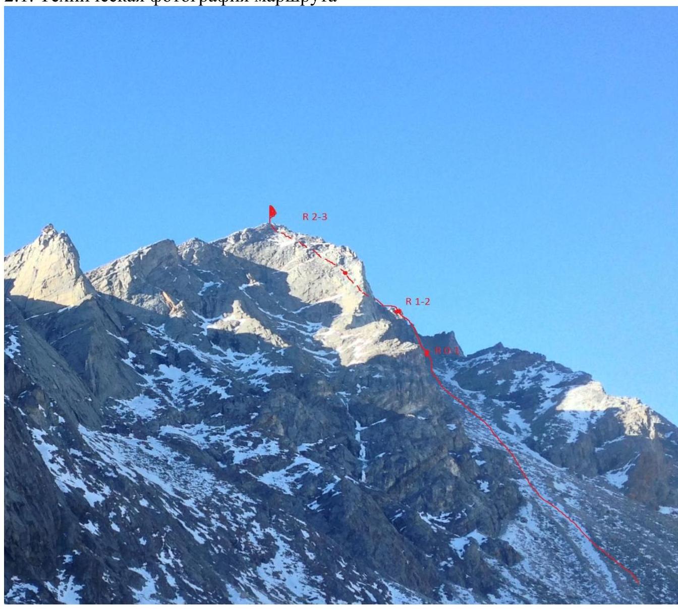
Photo 4. Technical photograph of the route with indication of belay stations.
2.2. Technical characteristics of route sections
| Section № | Terrain characteristics | Category of difficulty | Length, m | Type and number of hooks |
|---|---|---|---|---|
| R0–R1 | Large-block, semi-destroyed terrain, large cracks, suitable for friends. | 3 | 55 m | - |
| R1–R2 | Large-block, semi-destroyed terrain, large cracks, suitable for friends. | 3 | 50 m | - |
| R2–R3 | Not steep slope, consists of stone scree. | 2 | 120 m | - |
3. Characteristics of the Team's Actions
3.1. Brief description of the route passage.
| Section № | Description | Photo № |
|---|---|---|
| R0–R1 | The route begins with a characteristic inner corner to the right of the counterfort. Move up, veering to the right, bypass the gray cornice made of a huge block to the right, along semi-destroyed rocks and separate lying stones, exit to the ridge of the counterfort, go along destroyed rocks, choosing the most logical path, then large-block terrain and sloping slabs about 30 m, station on a small ledge made of sloping slabs on a boulder. | Photo 5, 6 |
| R1–R2 | From the station, move to the right, gaining height along characteristic "steps" made of blocks, move forward along large-block terrain towards a large gendarme, bypass the gendarme to the right along a series of small ledges, then exit to a not steep, crumbly slope, station on a boulder. | Photo 7 |
| R2–R3 | From the station, simultaneous movement along the crumbly slope to the summit. | - |
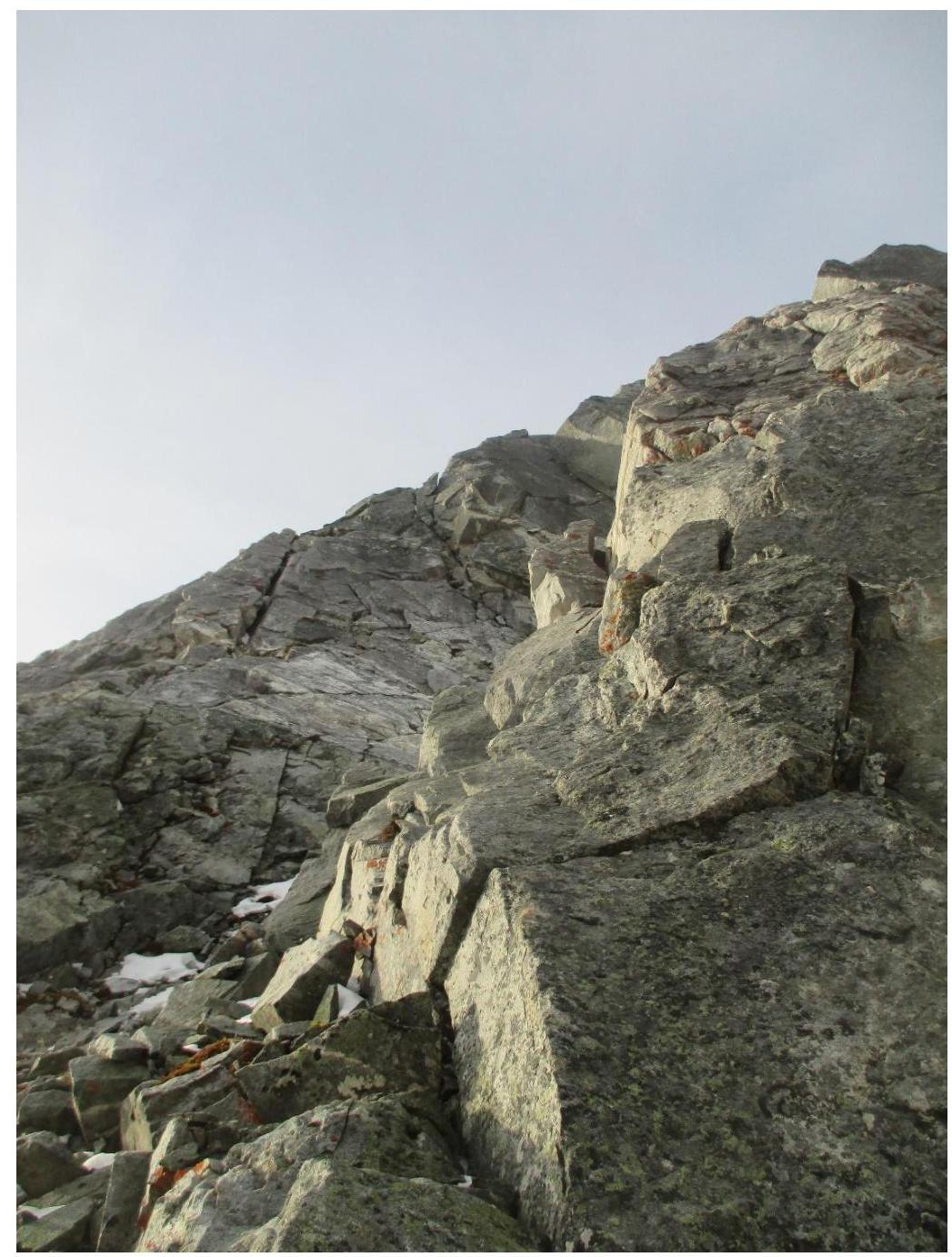
Photo 5. Start of the route, section R0–R1, inner corner, to the right in the upper part of the photograph, a gray cornice made of a block is visible. Multiple cracks are clearly visible. It is very convenient to organize protection with protection devices.
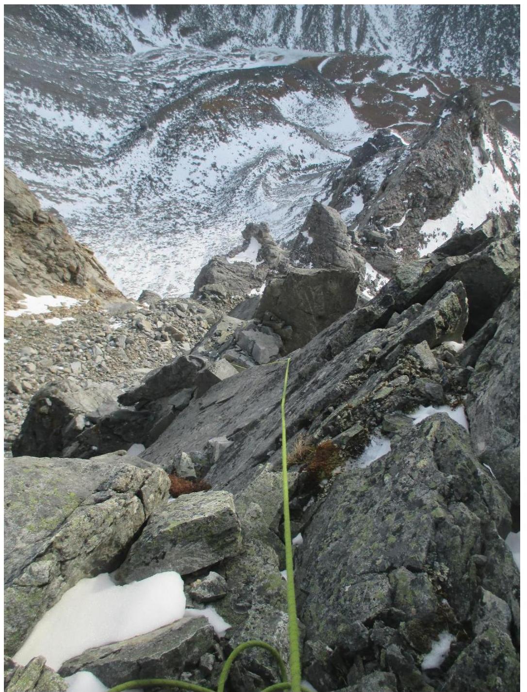
Photo 6, view of section R0–R1 from the station.
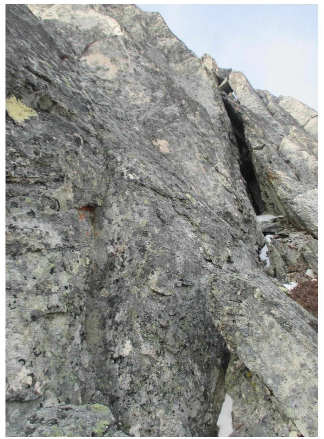
Photo 7, start of section R1–R2, photo from the station. Gain height and move to the left.
3.2. Photo of the team on the summit with the control tour.
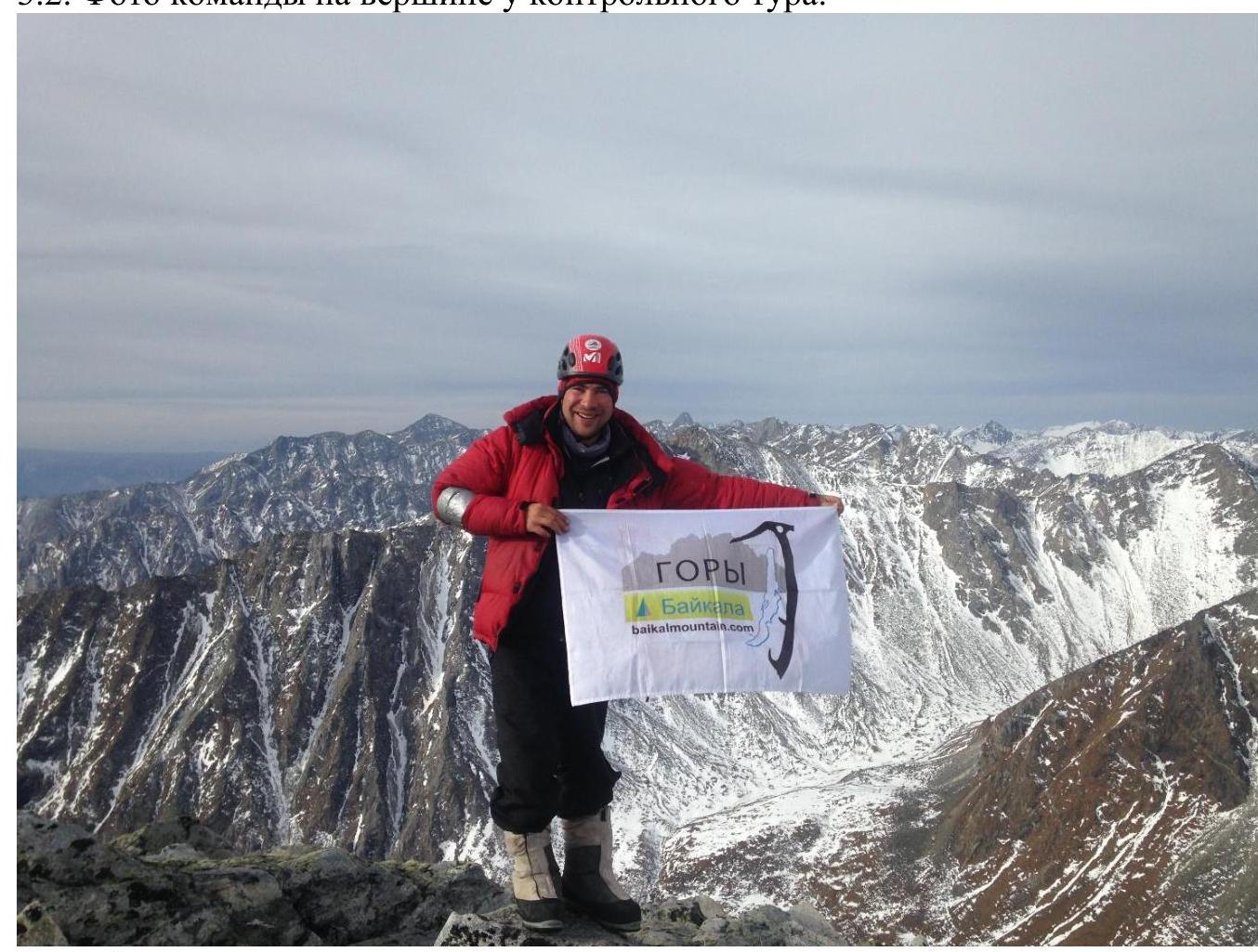
Photo 8.
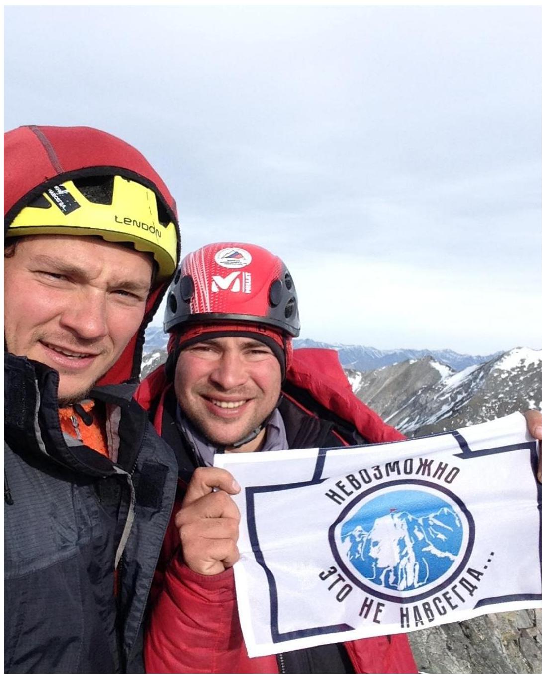
Photo 9.
3.3. Overall assessment of the route and recommendations
The route is relatively safe; cautious movement is required only at the beginning to avoid dropping stones on the belayer. Communication on the route with the base camp is functioning; BAOFENG UV-5R radios were used. Descent from the summit goes along the southern ridge towards a large limestone arch on the saddle; before reaching the arch, turn left into the couloir (AVALANCHE WARNING, in winter, assess the situation; otherwise, pass with protection behind the rocks). In conclusion, the team decided that the route has a 2A category of difficulty, although it is very short.