Ascent passport to v. Nedobraya 2676 m, via the southern ridge, cat. 2B, diff. cat.
- East Sayan, Tunkinskie Goltsy ridge, Barun Khandagai valley, section 6.1. 2. Peak Nedobraya (2676 m) via the Southern ridge. 3. Proposed category 2B, first ascent. 4. Character of the route is rocky. 5. Height difference 250 m, length 520 m, average slope 30°. 6. Driven pitons: rock and закладных 7 pcs. 7. Team's walking hours — 6 hours. 8. No overnight stays on the route. no. 9. Group:
Afanasiev A. E. MS Volodov A. N. 3rd sp. разряд Geidarov K. G. 3rd sp. разряд Emelyanov S. M. 3rd sp. разряд Rozhin A. Yu. 3rd sp. разряд Tashlykov V. A. 3rd sp. разряд
- Coach Afanasiev A. E., MS
- Ascent to the summit and return on August 15, 2008.
Description of the ascent route to peak Nedobraya 2676 m via the southern ridge, op. 2B cat. diff. Geographical coordinates: b-51°55'27" N, l-102°09'31" E.
Approach via the Vityaz cirque (right orographically to the Barun Khandagai valley) to the Tunkinsky pass — a passage into the Tunka (Ulutere) valley. The start of the route is at the pass. Areas for belaying are to the right and above on the ridge.
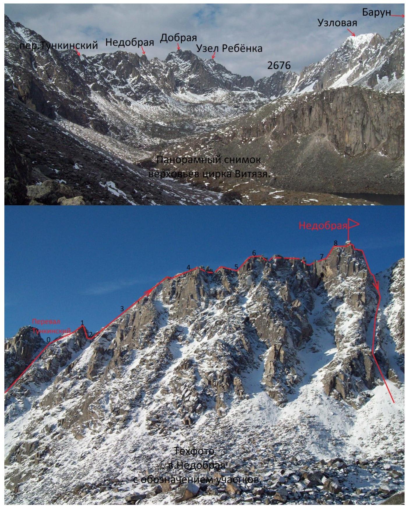
The pass and peak Nedobraya are located on the ridge of the southern spur of the Tunkinskie Goltsy ridge, extending from peak Uzel Rebyonka to peak Kupol. Peak Nedobraya is situated to the right of the Tunkinsky pass, i.e., to the north on the ridge of the spur.
| Sect. 0–1 30 m 55° II+ | Along the ridge, exit to a gendarme. |
|---|---|
| Sect. 1–2 15 m 80° III+ | Rappelling to the right of the ridge. (photo 7) |
| Sect. 2–3 80 m II– | Traverse of the slope 40° to the right of the ridge. |
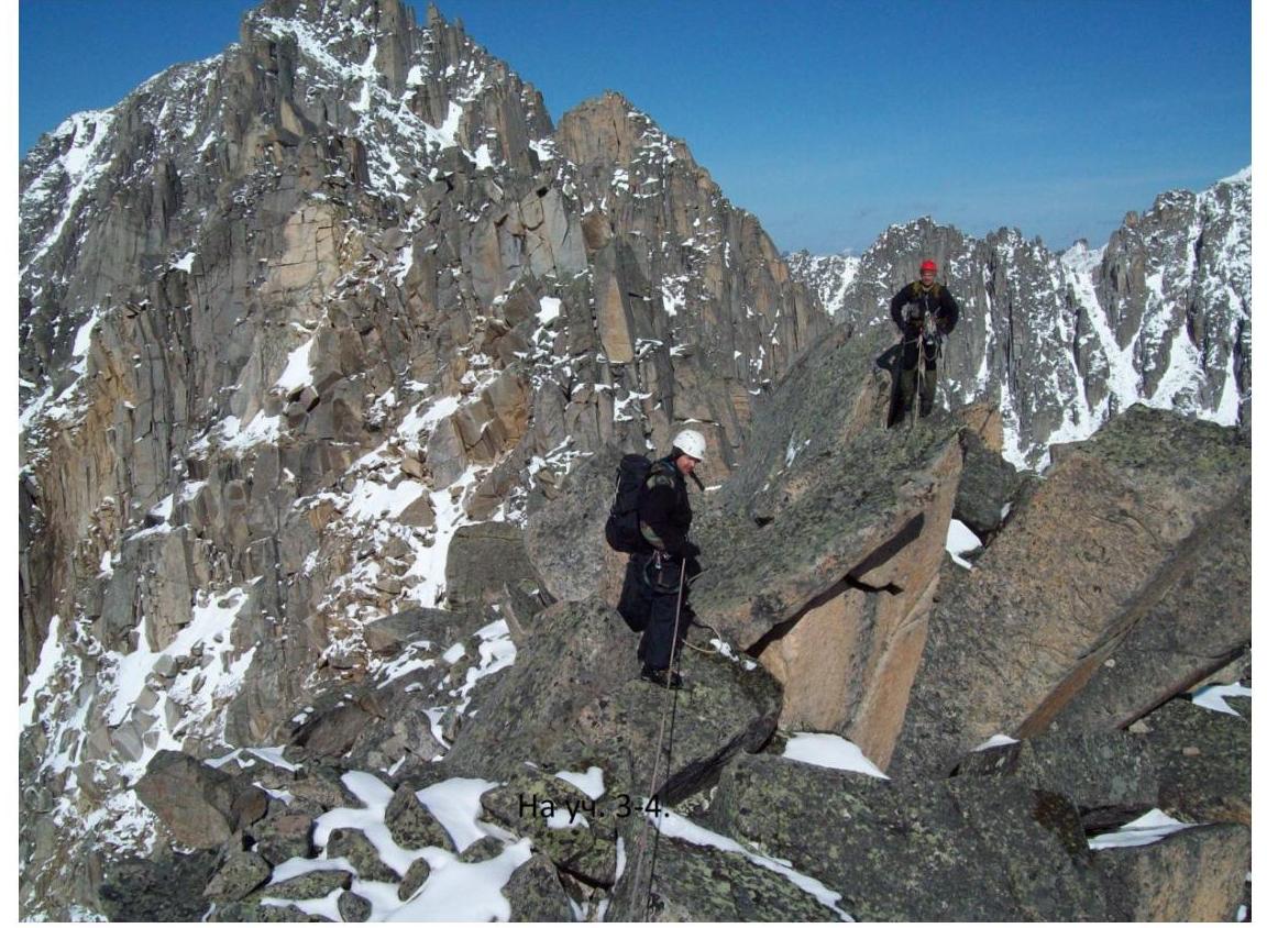
| Sect. 3–4 200 m 5° I+ | Along large rocky blocks on the ridge. |
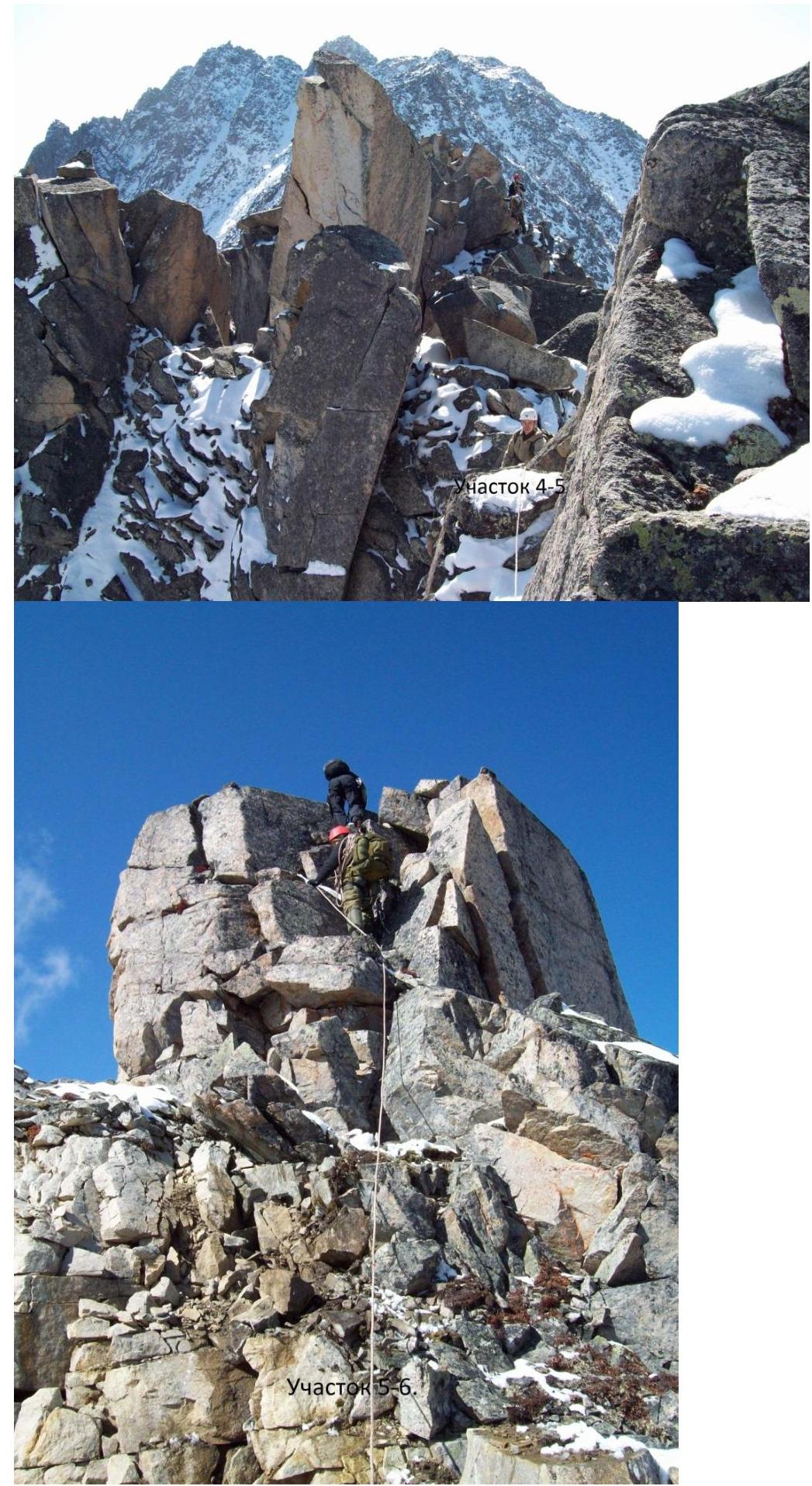
| Sect. 4–5 50 m II+ of the gendarme. | To the left of the ridge along the slope 45° in обод. |
| Sect. 5–6 30 m 55° II+ (photo 11) | The next gendarme is passed head-on. |
| Sect. 6–7 80 m I+ | Along the ridge down — up through large stone blocks under the summit tower. |
| Sect. 7–8, 20 m, 85°, III– | Exit to the summit tower along large-block weathered rocks (photo 13) |
| Sect. 8–9, 15 m | On the summit tower stands an enormous |
| sharp, flat-sided, yellow stone, 10 m high. On the нависающей side of the red stone, the date of the first ascent is carved. Control cairn on the shoulder of the stone, three meters from the ledge. On the balcony of the summit cairn, one person can fit. (photo 16, 17) |
Descent is initially by rappelling along the ridge towards peak Dobraya to a saddle. Then via a couloir: 1 sports descent from the saddle and 1 sports descent in the middle of the couloir, the rest on foot with belaying.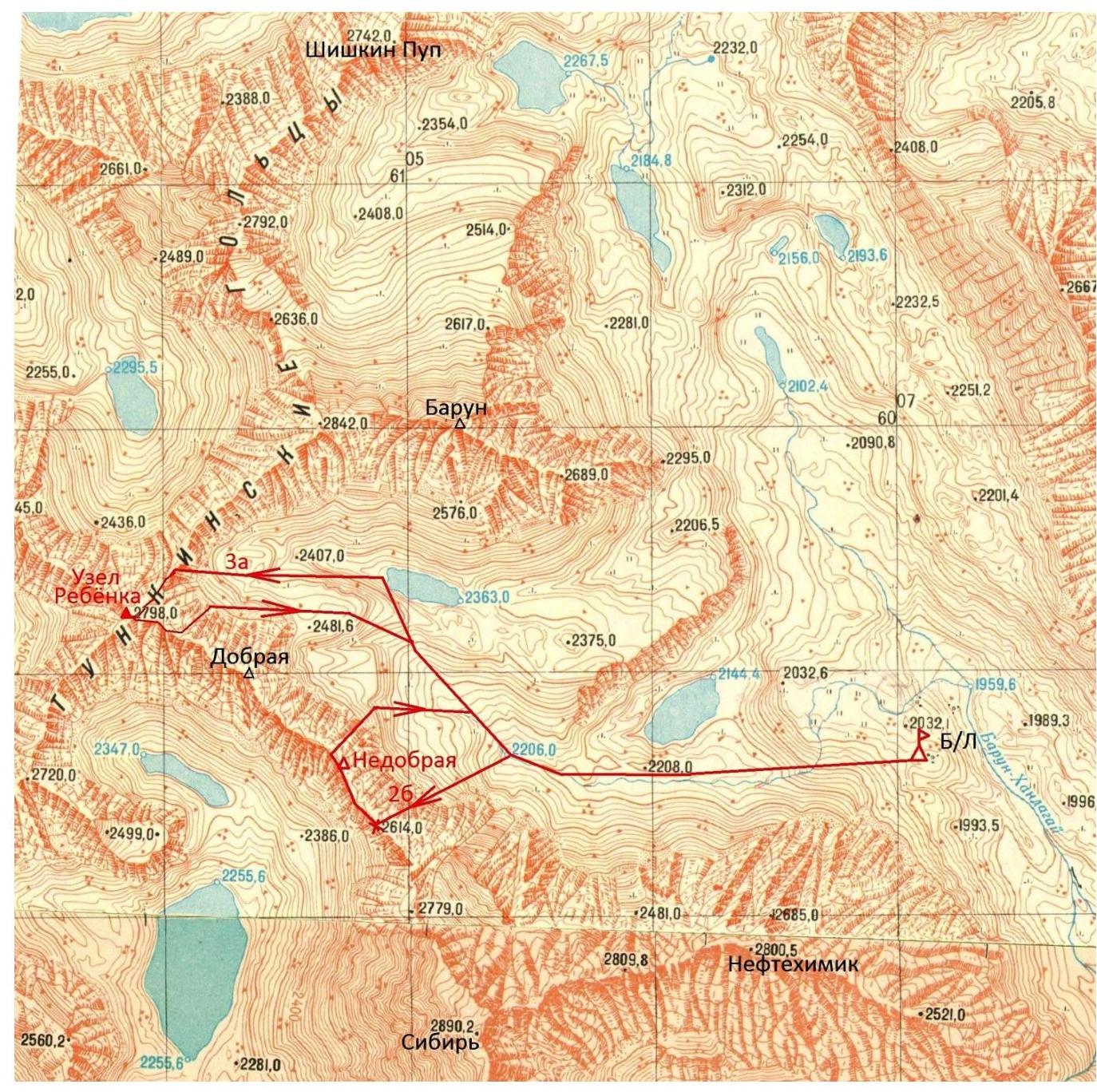
| 2560.2 | 2560.6 | 2561.0 | 2561.6 | 2562.6 | 2562.6 |
|---|---|---|---|---|---|
| 2560.2 | 2560.6 | 2561.0 | 2561.6 | 2562.6 | 2562.6 |
The text lacks обозначения, dates
and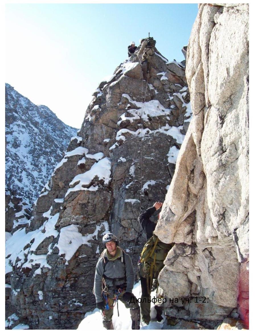
Section
4