Irkutsk Region Alpinism Federation.
Report on the first ascent of v. Monakh 2850 m via the South Face, approx. 4B cat. diff.
Irkutsk, 2011
Ascent Passport
-
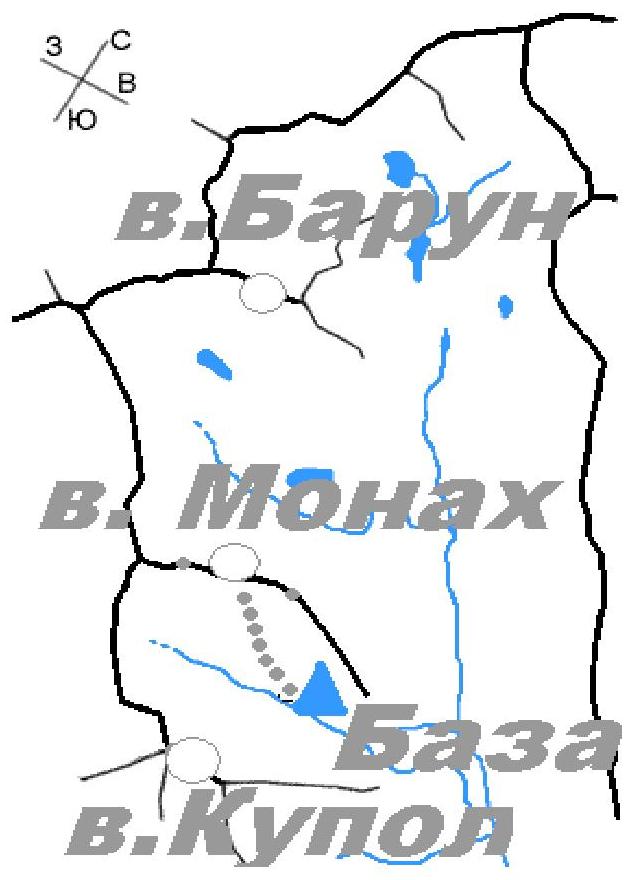
Eastern Sayan, Tunkinskie Goltsy ridge, Baruun-Khandagai river gorge. Section number according to the classification table — 6.1.
-
Monakh peak 2850 m (peak coordinates: 51°55′24.54″ N 102°10′90″ E), via the South Face.
-
Category of difficulty: proposed 4B cat. diff. first ascent
-
Route type — rock.
-
Route elevation gain: 400 m
Route length: 550 m. Length of sections: V cat. diff. — 60 m, VI cat. diff. — 85 m. Average steepness: wall section of the route — 80°, entire route — 60°
- Number of "hooks" left on the route: total 0
Used on the route: anchor: 34/11, chock stones: 30/8, bolt hangers: 0/0, + about 20 points on fifi hooks.
- Team's total climbing hours: 6 h 00 min, No overnight stays
- Leader: Glazunov Evgeny Vladimirovich (Candidate for Master of Sports). Team members: Bolydyreva Ekaterina Georgievna (1st sports category), Davydenko Mikhail Alexandrovich (Candidate for Master of Sports)
- Coach: Glazunov Evgeny Vladimirovich (Candidate for Master of Sports)
- Departure to the route from Base Camp: 9:00, June 13, 2011. Reached the summit — 17:00, June 13, 2011. Return to Base Camp — 20:30, June 13, 2011.
- Irkutsk Region Alpinism Federation
Overview of the ascent area, sports characteristics, and tactical actions of the team
Monakh peak is located in the upper reaches of the Baruun-Khandagai gorge, Tunkinsky ridge of the Eastern Sayan, between the peaks Charskie Zori (to the west) and Neftekhimikov (to the east).
Two classified routes of 2B cat. diff. have been established on it:
- from the south
- from the north and then along the western ridge
There are also several unclassified routes from the northern side.
The route we chose for the first ascent runs along the southern wall from the hanging cirque of Kupol peak; no routes had been laid along this wall before. The wall is attractive due to its monolithic nature and vertical cracks, which are pleasant to climb and convenient to belay.
We chose the most logical line with a minimum of ITO; the route is monolithic, with very few loose rocks, and no bolt hangers were used. Anchor hooks are essential. The route remained completely clean after the ascent.
According to the team's assessment — a strong 4B with sections of very difficult climbing, but too short for 5A.
Map-scheme of the Baruun-Khandagai gorge and the approach path to the route
General view of Monakh peak from the South (taken from the wall of Kupol
peak)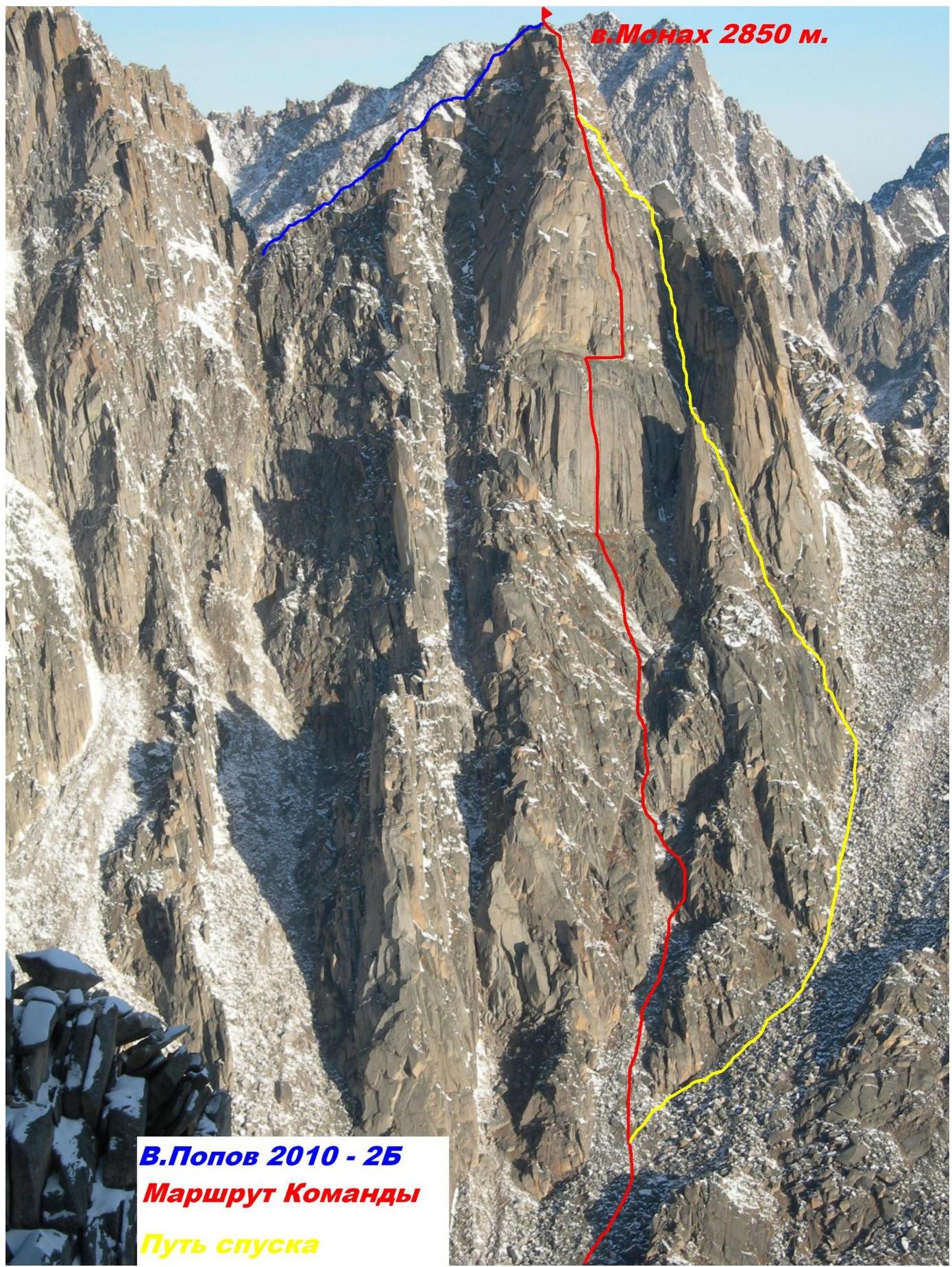
V. Popov 2010 — 2B Team's Route Descent path
6
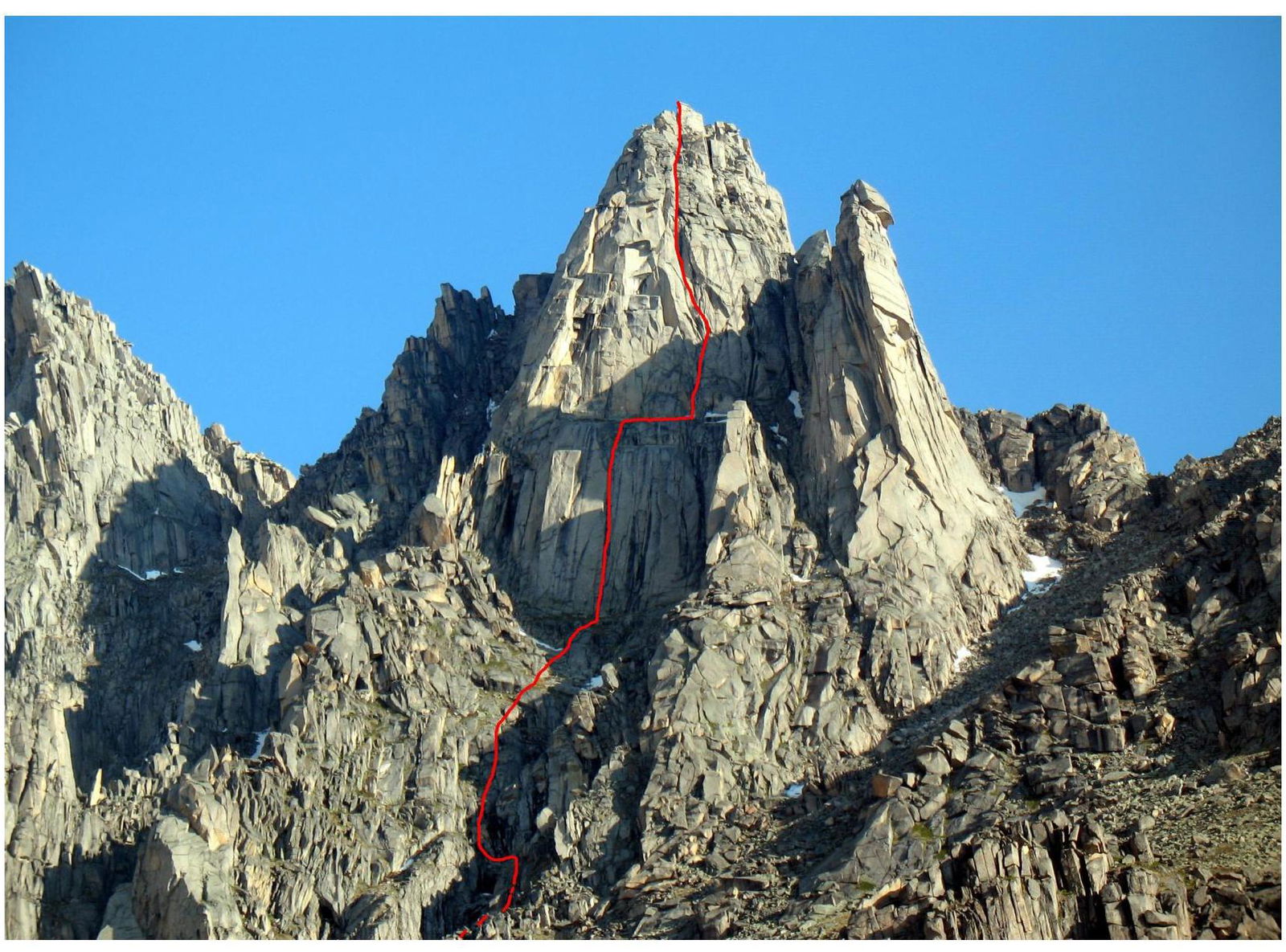
7 Technical photo of the
route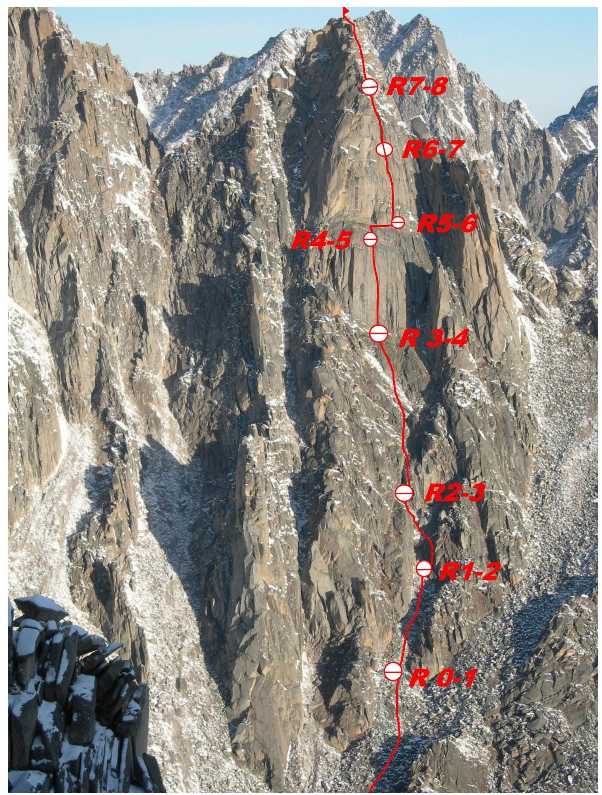
UIAA Scheme
 □
□
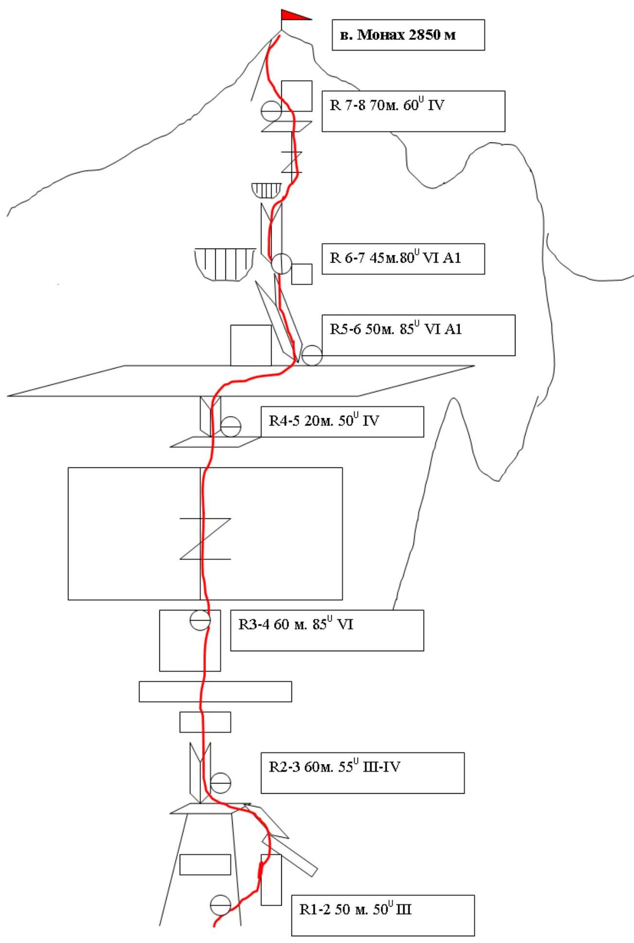
Description of the route by sections
R0–R1 Beginning of the route from a narrow couloir under the start of the South Face. Approach through the couloir to the rock wall. 100 m. 45° I
1–2 pitch. Slightly to the right via a series of small walls and ledges, exit onto a large ledge at the base of an inner corner with black streaks. Climbing is straightforward.
50 m. 50° IV
2–3 pitch. Via slabs, a series of small walls with ledges and boulders, exit under the base of the Bastion with monolithic vertical cracks onto a good ledge. 60 m. 55° IV
3–4 pitch. Then via a vertical monolithic crack, which runs through the center of the wall, move upwards with free climbing. Belay on camalots. In the upper part, the crack narrows under anchors. Exit onto a small ledge, section length 60 meters. 60 m. 85° VI
4-5
From the ledge upwards 7–8 m to a wide terrace, then traverse 20 m to the right to the base of a vertical corner.
- 20 m
- 50°
- IV
5-6
Climb the corner with free climbing to exit onto a slab with cracks, then via deep cracks with ITO and placements move in the direction of a vertical gray inner corner. First key rope.
In the upper part, transition to the left into the corner. Hanging belay station at the base of the corner on anchor hooks.
- 50 m
- 85°
- VI A1
6–7. From the station, climb the corner upwards; the corner is deep and ends with a small overhang. Second key section. In the upper part of the corner, cracks appear for chock stones. From under the overhang at the end of the corner, transition to the right around the bend with free climbing. Then move via a vertical crack to a small ledge. Exit onto the ridge. 45 m. 80° VI А1
7–8. Along the ridge through a series of small walls and ledges, exit to a small dip,
then either climb over or jump across it, and climb onto a large boulder with coils,
through which exit onto the summit. 70 m. 60°
IV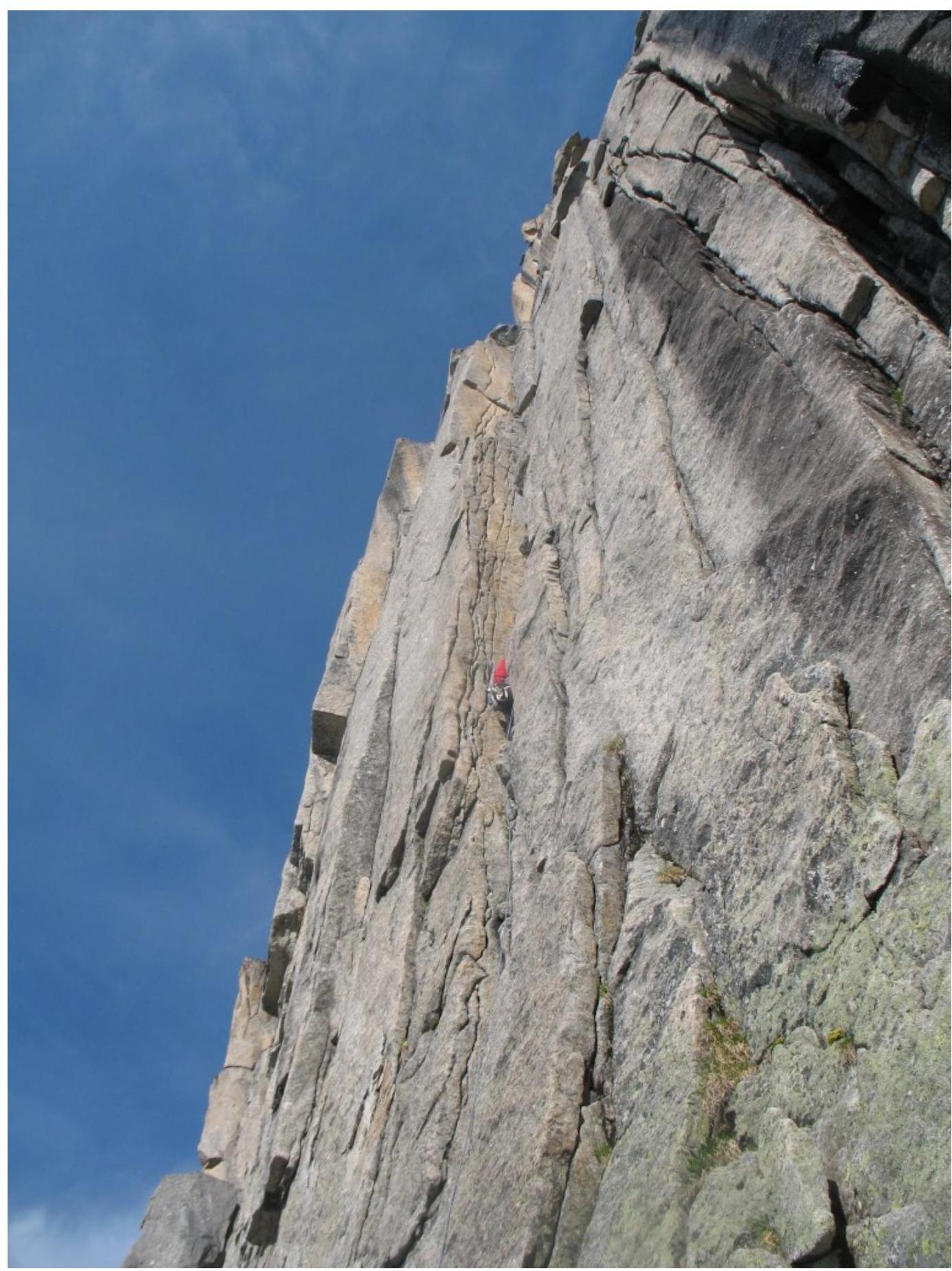
Photo 1 (section 3–4 in
profile)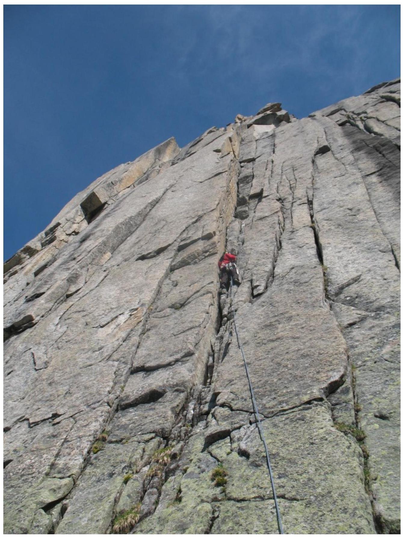
Photo 2 (section
3–4)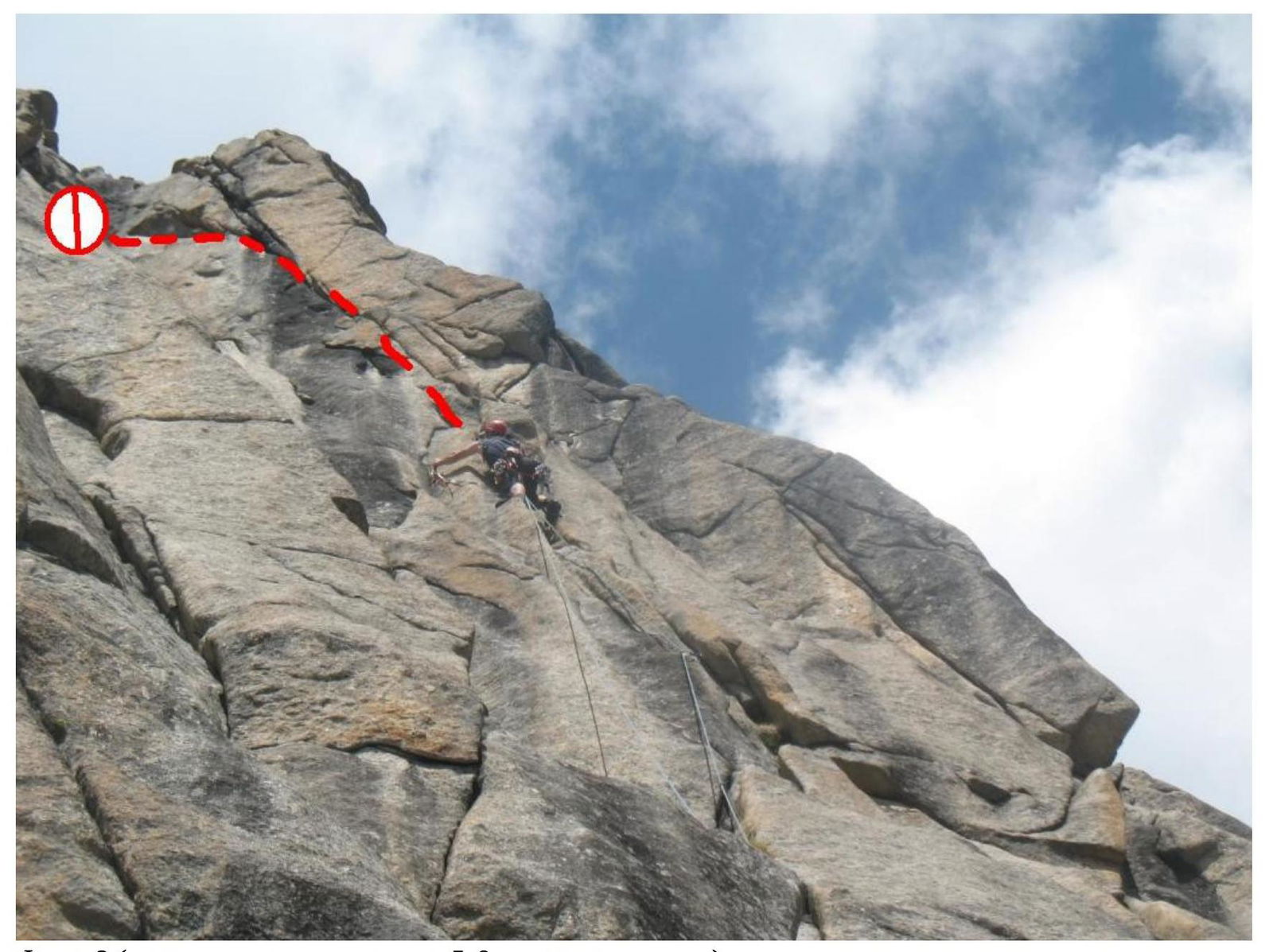
Photo 3 (upper part of section 5–6, transition into the
corner)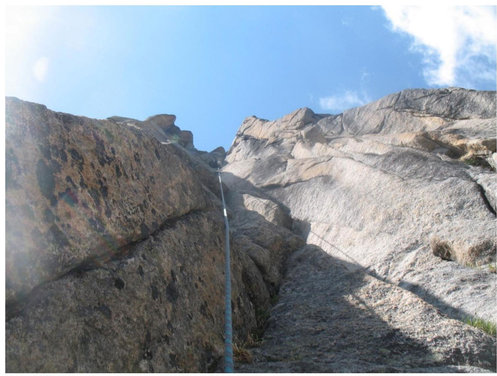
Photo 4 (view of the belay station at the end of section 5–6 and straightened
belays)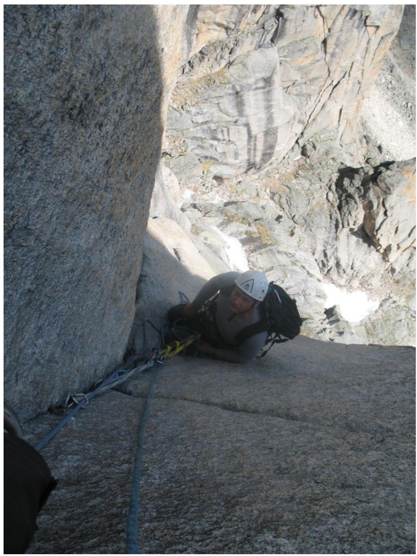
Photo 5 (start of section 6–7, hanging belay station at the end of section
5–6)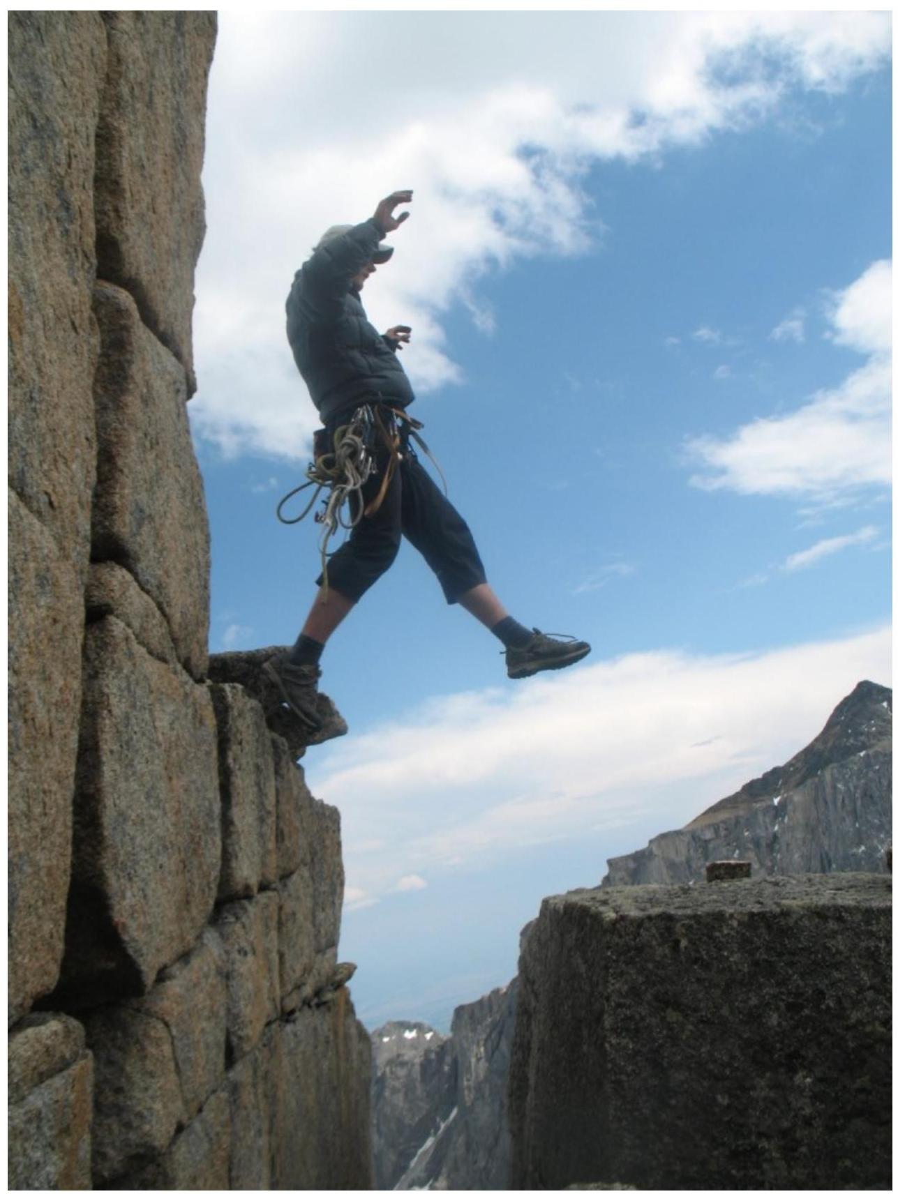
Photo 6 (overcoming the dip on section
7–8)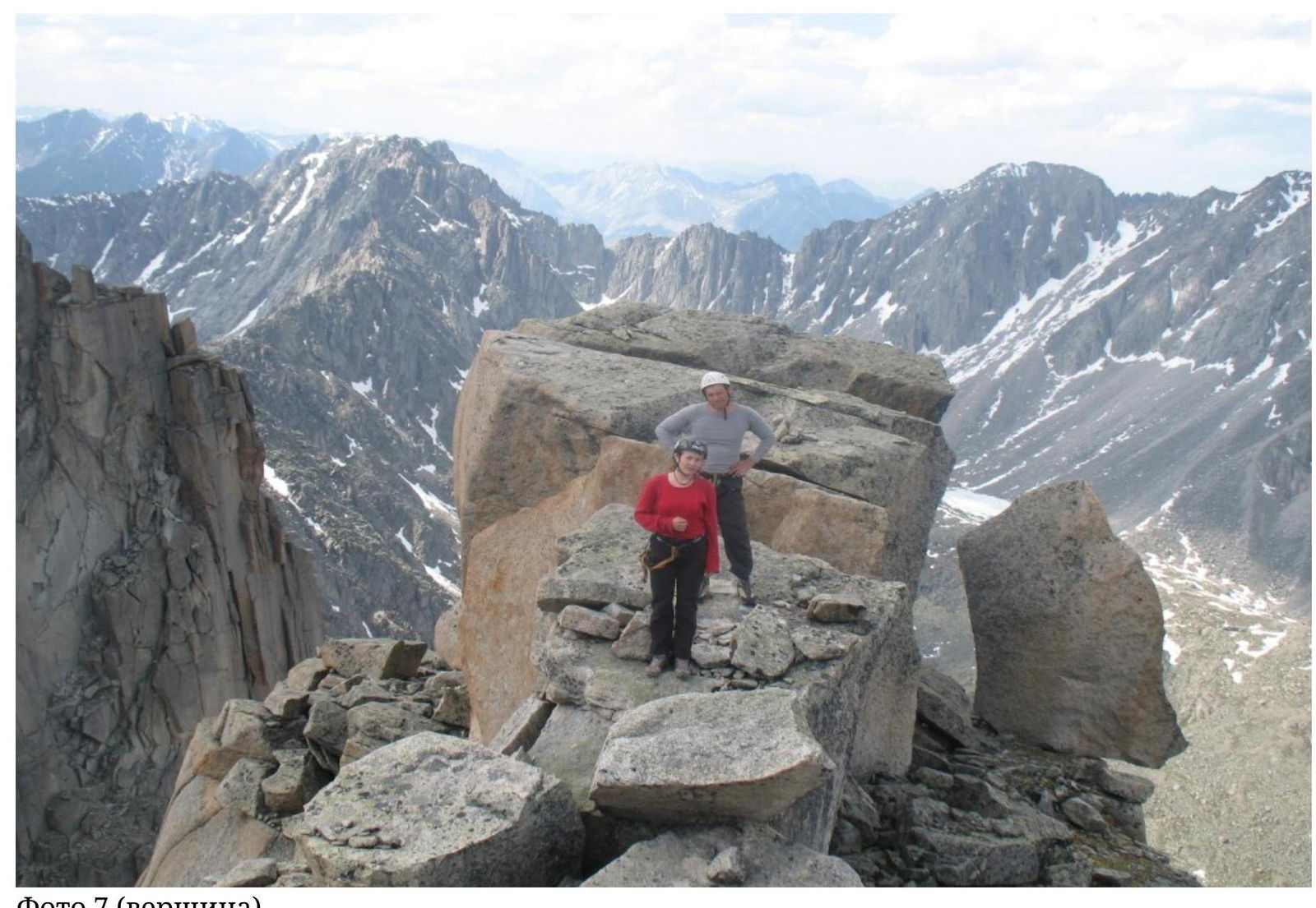
Photo 7 (summit)