Ascent Report
Peak Kupol (2954 m) via the North-Eastern plates of the Eastern shoulder. Route category 5A (proposed), first ascent. Route name: "Through friction to the stars". Eastern Sayan, Tunkinskie Goltsy ridge, Barun-Khandagai valley, 6.1.
Team leader: Klepikov A.A. Participants: Ilyinsky V.A., Shcherban A.N.
2016
Ascent Passport
- Eastern Sayan, Tunkinskie Goltsy ridge, Barun-Khandagai valley, 6.1.
- Peak Kupol (2954 m), via NE plates of E shoulder.
- Proposed - 5A - first ascent.
- Route type: rock climbing.
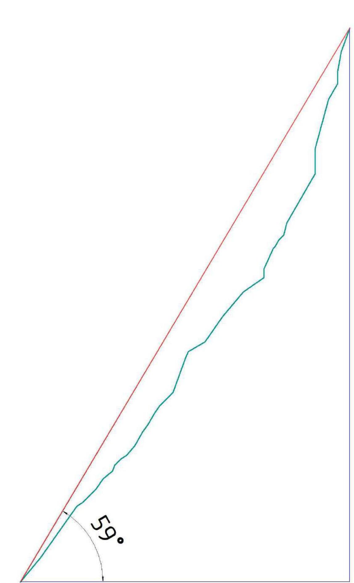
- Route height difference: 693 m. Route length: 1177 m. Main part height difference: 530 m. Main part length: 627 m. Section lengths: 6th category - 43 m 5th category - 229 m 4th category - 83 m Average steepness of the main part: 59°.
- Pitons left on the route:
total: 0; including bolting - 0.
Used on the route:
- bolting - 0
- rock pitons (including anchors) - 36
- chocks - 5
- friends - 40
- skyhooks (including skyhooks on thin features) - 13 Total number of protection points: 25.
- Team's climbing hours (to the summit) - 11; days - 1. Number of bivouacs on the route - 0.
- Team leader: Klepikov Alexander Alexandrovich (MS).
- Participants: Ilyinsky Vasily Andreevich (1st sports category). Shcherban Alexey Nikolaevich (2nd sports category).
- Team coach: Afanasyev Andrey Evgenievich (MS), 1st category instructor.
- Route start: 07:00, August 2, 2012. Summit reached: 18:00, August 2, 2012. Return to base camp: 22:00, August 2, 2012.
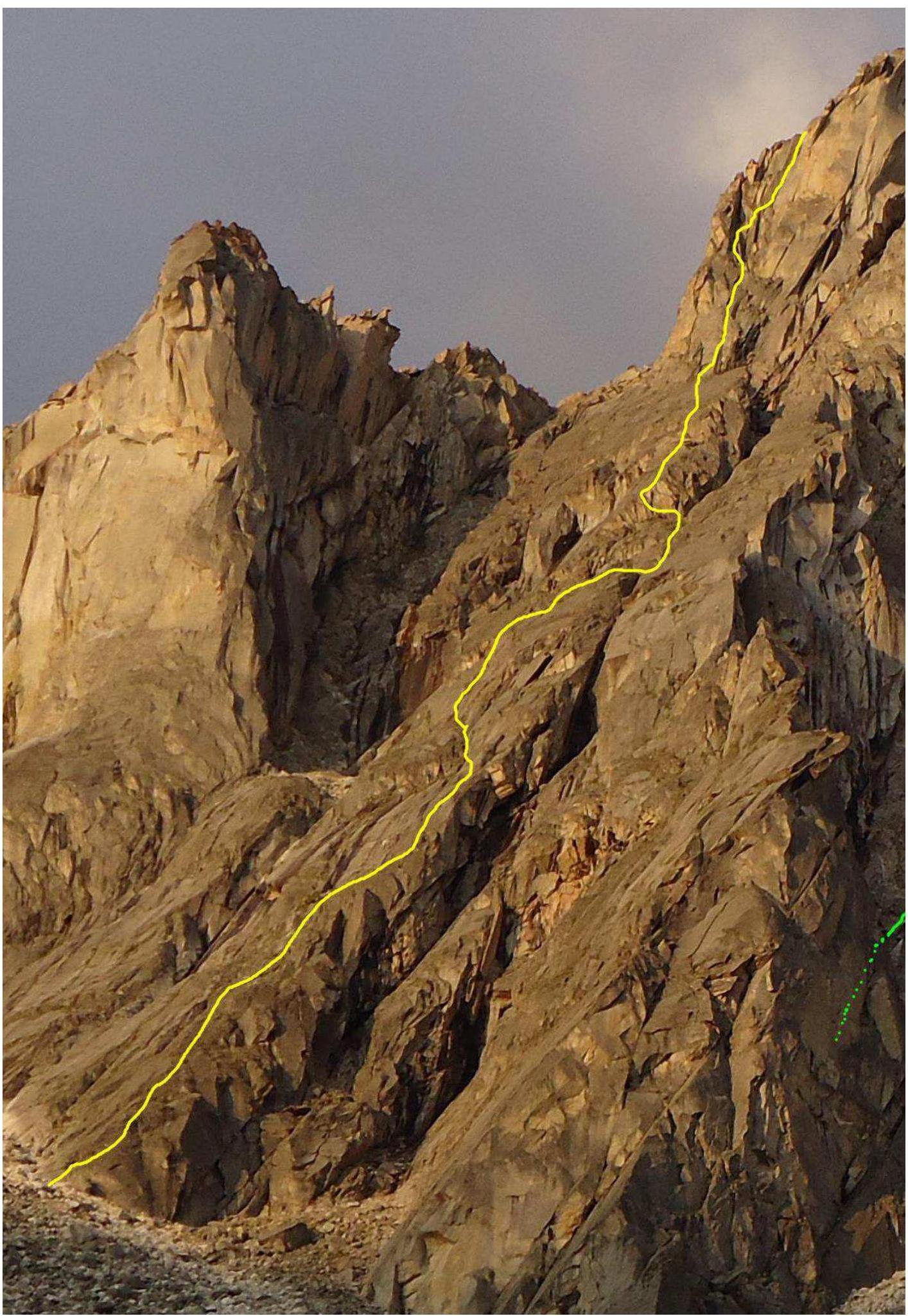
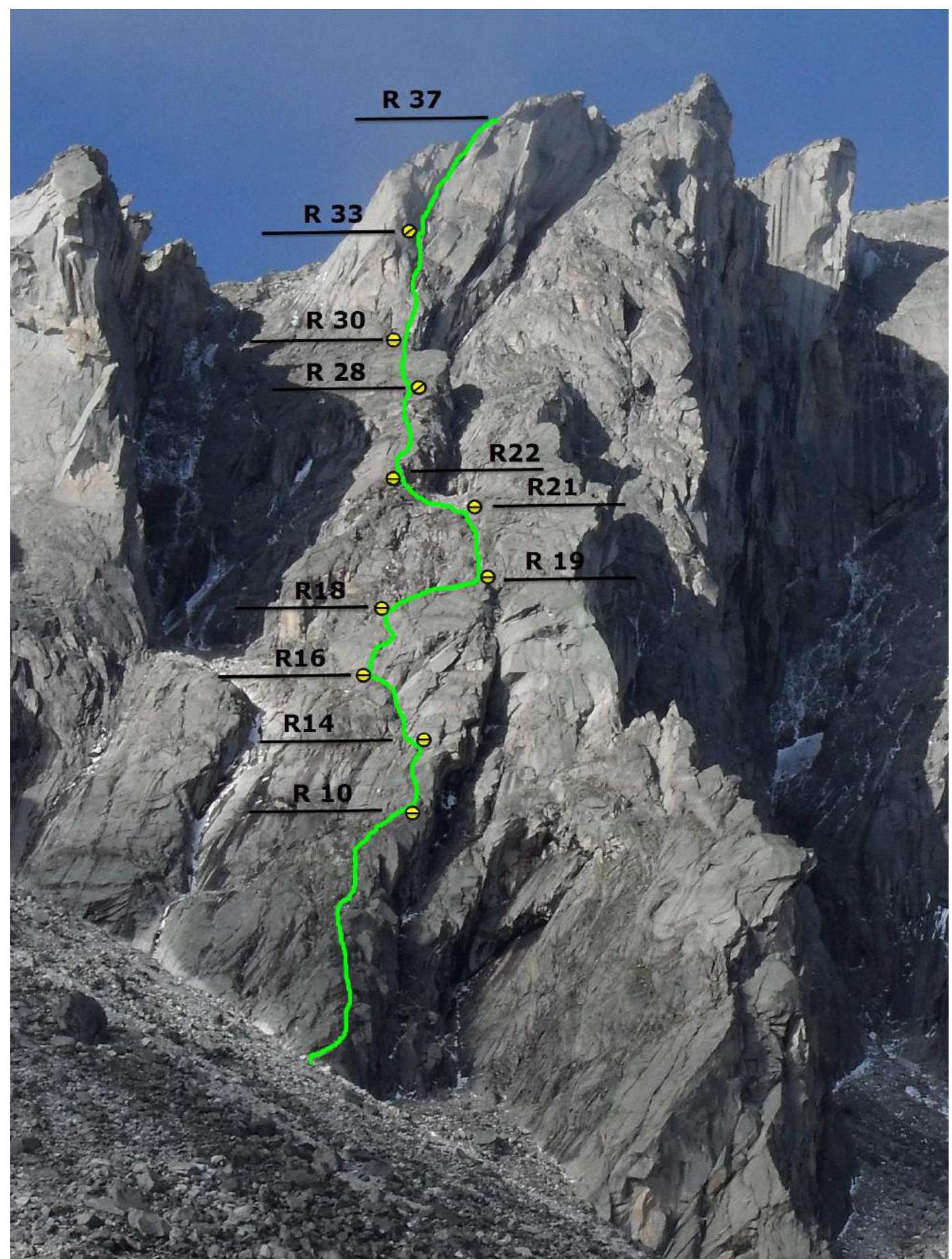
General View of the North Face of Peak Kupol
The photo was taken on July 22, 2012, from a winter hut located in the Alaska cirque (base camp). The photo height is 2100 m.

YELLOW - team route GREEN - Afanasyeva's 2013 route, 5A category. BLUE - Kuzmenko's 2010 route, 6A category. RED - Afanasyev's 2002 route, 6A category.
Route Profile Photo
Hand-Drawn Route Profile
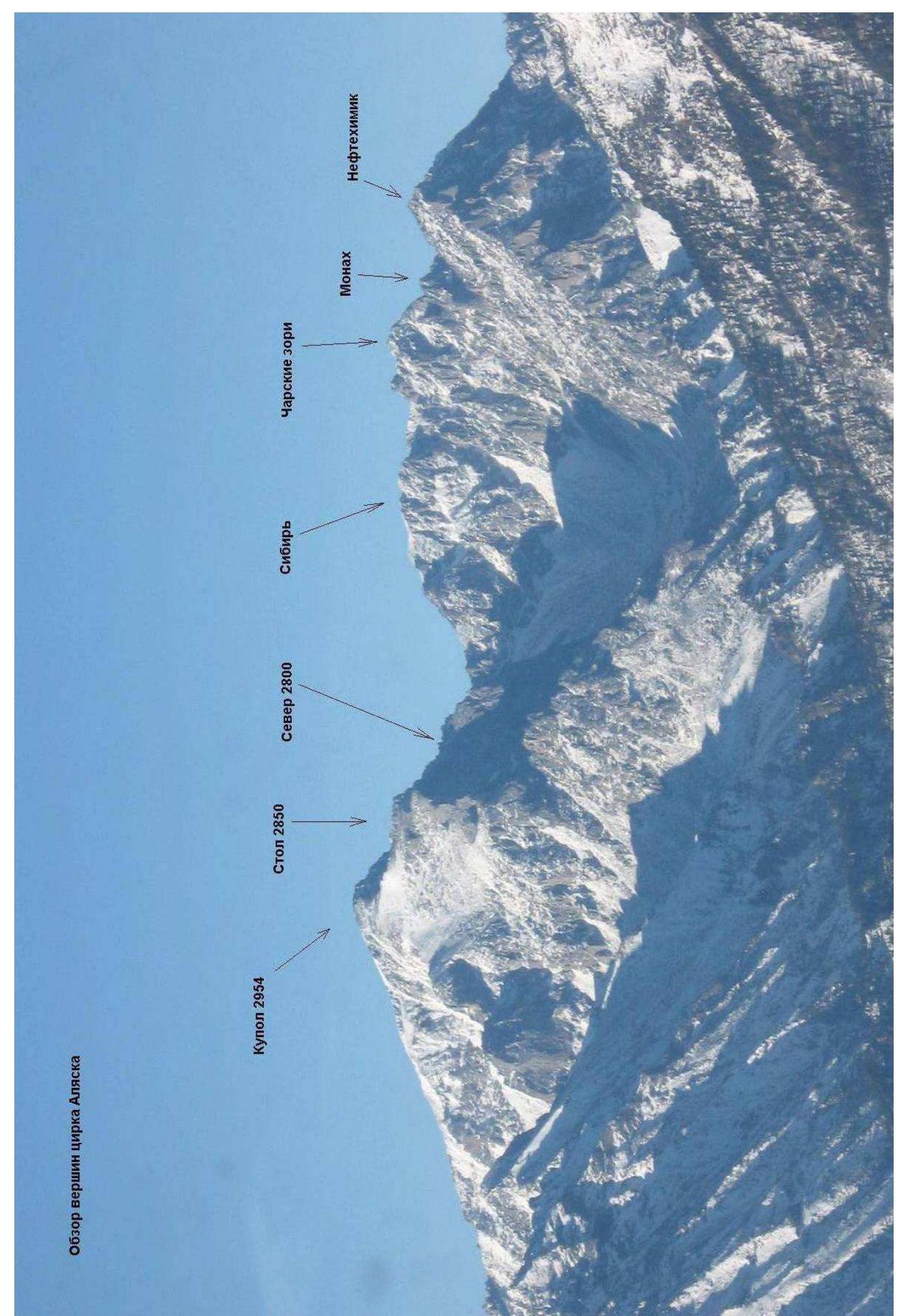
Panorama of the Peaks in the Alaska Cirque
Map-Scheme of the Barun-Khandagai Valley
The Barun-Khandagai valley is one of the most promising areas in the Eastern Sayan for sports climbing. Peak Kupol (2954 m) is the dominant peak in the area. It is located in the Tunkinsky district of the Republic of Buryatia. The nearest large settlement is the village of Arshan. From Arshan, you can reach the entrance to the valley by a high-passability vehicle - a journey of about 15 kilometers. Then, follow the valley; there is a trail; the area is popular with tourists in the summer. The Alaska cirque is located to the left when entering the valley; the height difference is 1400 m, and the length is approximately 15 km. In the summer, it takes 6-8 hours to approach the wall, while in winter, it may take 5-6 days due to the large amount of snow. Several complex routes pass through the north face of Peak Kupol: Afanasyev's route 5B on the N face in 1982, Afanasyev's route 6A "Klinok" on the N face of the E shoulder in 2002 (1st place at the Russian Championship 2002), Afanasyev's route 6A on the vertical sections of the N face of the E shoulder in 2007 (4th place at the Russian Championship 2007), Kuzmenko's route 6A on the central N face of the E shoulder in 2010.
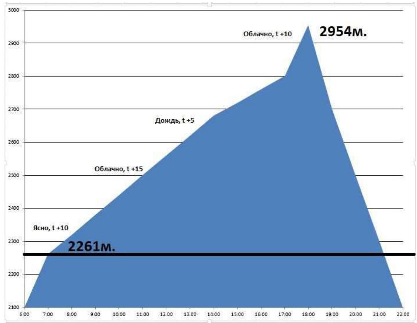
Ascent Schedule
Team's movement schedule on the route: August 2, 2012 - from 07:00 to 17:00, sections R0-R37 were completed. August 2, 2012 - from 17:00 to 18:00, section R37-R38, the so-called "Beach" (exit to the summit 2954 m). August 2, 2012 - from 18:30 to 22:00, descent to base camp via route 1B (E rock).
Main Part of the Route in UIAA Symbols, Scale 1:2000, Sheet 1
| Section | Chocks | Friends | Rock Pitons | Skyhooks | Bolts | Route in UIAA Symbols M 1:2000 Sheet 1 | Length (m) | Steepness (°) | Climbing Grade | AID |
|---|---|---|---|---|---|---|---|---|---|---|
| R28-R29 | 1 | 3 | 3 | - | - | 40 | 60 | 5- | - | |
| R27-R28 | - | - | 1 | - | - | 10 | 75 | 5+ | - | |
| R25-R26 | - | 1 | - | - | - | 7 | 60 | 4+ | ||
| R23-R24 | 1 | 2 | 1 | - | - | 18 | 65 | 5- | - | |
| R22-R23 | - | 1 | - | - | - | 7 | 90 | 5+ | - | |
| R21-R22 | - | - | 1 | - | - | 40 | 35 | 2+ | - | |
| R20-R21 | - | 3 | 1 | - | - | 25 | 50 | 3- | - | |
| R19-R20 | 1 | 2 | 1 | - | - | 25 | 55 | 4 - | - | |
| R18-R19 | - | - | - | - | - | 30 | 30 | 2- | - | |
| R16-R17 | - | 4 | 2 | - | - | 30 | 70 | 5- | - | |
| R14-R16 | - | 3 | - | - | - | 35 | 45 | 3+ | - | |
| R12-R14 | - | 1 | 2 | 17 | 60 | 5- | - | |||
| R11-R12 | - | - | 1 | - | - | 7 | 55 | 5+ | ||
| R10-R11 | - | - | 2 | 4 | - | 13 | 60 | 6- | A1 | |
| R9-R10 | - | 1 | - | - | - | 10 | 50 | 3+ | - | |
| R7-R9 | - | 2 | 1 | - | - | 27 | 30 | 2– (2+) | - | |
| R6-R7 | - | 1 | 1 | - | - | 5 | 70 | 5- | - | |
| R4-R5 | - | - | 2 | - | - | 10 | 55 | 3+ | - | |
| R3-R4 | - | - | 1 | - | - | 15 | 45 | 2+ | - | |
| R1-R2 | - | 2 | 2 | - | - | 50 | 55 | 4+ | - | |
| R0-R1 | - | 1 | 2 | - | - | 25 | 50 | 3+ | - |
Main Part of the Route in UIAA Symbols, Scale 1:2000, Sheet 2
| Section | Chocks | Friends | Rock Pitons | Skyhooks | Bolts | Route in UIAA Symbols M 1:2000 Sheet 2 | Length (m) | Steepness (°) | Climbing Grade | AID |
|---|---|---|---|---|---|---|---|---|---|---|
| R35-R37 | 1 | 4 | 2 | - | - | 35 | 70/80 | 5+ | - | |
| R34-R35 | - | 1 | 1 | - | - | 10 | 90 | 6- | - | |
| R33-R34 | - | 2 | - | - | - | 15 | 60 | 5- | - | |
| R32-R33 | 1 | 3 | 2 | 3 | - | 30 | 75 | 5+ | A1 | |
| R31-R32 | - | 1 | 3 | - | - | 10 | 75 | 5- | - | |
| R30-R31 | - | 2 | 4 | 6 | - | 20 | 90 | 6- | A2 |
Relief Description
R0-R1 25 m, 50°, 3+, Along the ridge R1-R2 50 m, 55°, 4+, Along the ridge R2-R3 5 m, 30°, 1+, Shelf R3-R4 15 m, 45°, 2+, Ridge R4-R5 10 m, 55°, 3+, Slightly to the left R5-R6 10 m, 40°, 2+, R6-R7 5 m, 70°, 5-, Wall R7-R8 7 m, 45°, 2+ R8-R9 20 m, 30°, 2- R9-R10 10 m, 50°, 3+ R10-R11 13 m, 60°, 6-, A1 R11-R12 7 m, 55°, 5+ R12-R13 10 m, 60°, 5- R13-R14 7 m, 55°, 5- R14-R15 5 m, 20°, 2-, Shelf to the left R15-R16 30 m, 45°, 3+ to the left R16-R17 30 m, 70°, 5- wall upwards R17-R18 5 m, 65°, 3+ R18-R19 30 m, 30°, 2- Shelf traverse to the right R19-R20 25 m, 55°, 4-, Chimney R20-R21 25 m, 50°, 3-, Chimney VU R21-R22 40 m, 35°, 2+, Scree in the couloir to the left under the ridge lowering R22-R23 7 m, 90°, 5+, Exit to the ridge R23-R24 18 m, 65°, 5-, Slab upwards R24-R25 1 m, 30°, 1+, Shelf R25-R26 7 m, 60°, 4+, Wall R26-R27 5 m, 45°, 3-, Diagonal shelf R27-R28 10 m, 75°, 5+, Left to the shelf R28-R29 45 m, 60°, 5-, Slabs R29-R30 30 m, 30°, 1+, Shelf R30-R31 20 m, 90°, 6-, A2 Rightwards, AID on thin features along the cracks beyond the bend R31-R32 10 m, 75°, 5- Smooth VU R32-R33 30 m, 75°, 5+, A1 Along the VU system R33-R34 15 m, 60°, 5- Large boulders R34-R35 10 m, 90°, 6- Wall under the chimney R35-R36 15 m, 80°, 5+ Chimney with a cork R36-R37 20 m, 70°, 5+ Chimney, Exit to the beach R37-R38 550 m, 30°, 2-/1- To the summit
Technical Photo of the Route
Route Characteristics and Team Actions on the Wall
The route taken by our team passes along the North-Eastern plates of the Eastern shoulder of Peak Kupol. The route largely follows the external forms, except for the key, very steep section, which goes along the wall with internal forms. The route is characterized by the presence of smoothed "ram's foreheads" and a large amount of friction climbing. In winter, due to the great length and the complication of climbing, the route will be felt as a full-fledged category 5B; there are good, safe shelves for setting up a bivouac on every third of the route. The route is almost entirely monolithic; live rocks are present only in the upper half of the route and do not pose an objective danger - neither for the leader nor for those moving behind. Anchor pitons are a practically necessary element of equipment due to the route going along slabs and "ram's foreheads"; often, anchors are the only way to organize reliable protection. Having extensive experience in climbing in the area, as well as good fitness, form, and team cohesion, we planned to complete the route in one climbing day. We started moving on the route at 07:00, with Ilyinsky V.A. leading; part of the time we moved simultaneously, using alternate protection on difficult sections. We changed the leader only after 11 ropes, before the key section, when Klepikov A.A. took the lead. At that time, the weather worsened, and it started raining. The key section is about 100 meters of almost vertical rock, part of which is climbed using AID, and part is free climbing. The maximum difficulty of the section climbed free is 6C (French grading), and the maximum difficulty of AID is A2-A3 (more than 10 consecutive points). In terms of difficulty, the route is similar to 5th category routes: 5B Erydag West face, 3rd stage (Nekrasov 1986); 5A Dinosaur left part, NW face (Morozov 2001); 5A Argada grey "slabs" right part, E face (Sherstnev 2004). In 2016, the route was repeated by a group led by Igor Saveliev, based on my recommendation; according to his words, it confirms the stated category of difficulty.
Photo 1. Beginning of the route, the entire line is visible.
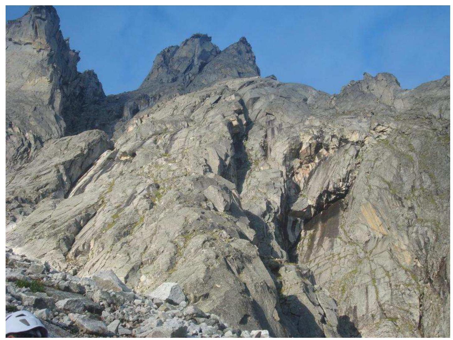
Photo 2. Section R6-R7
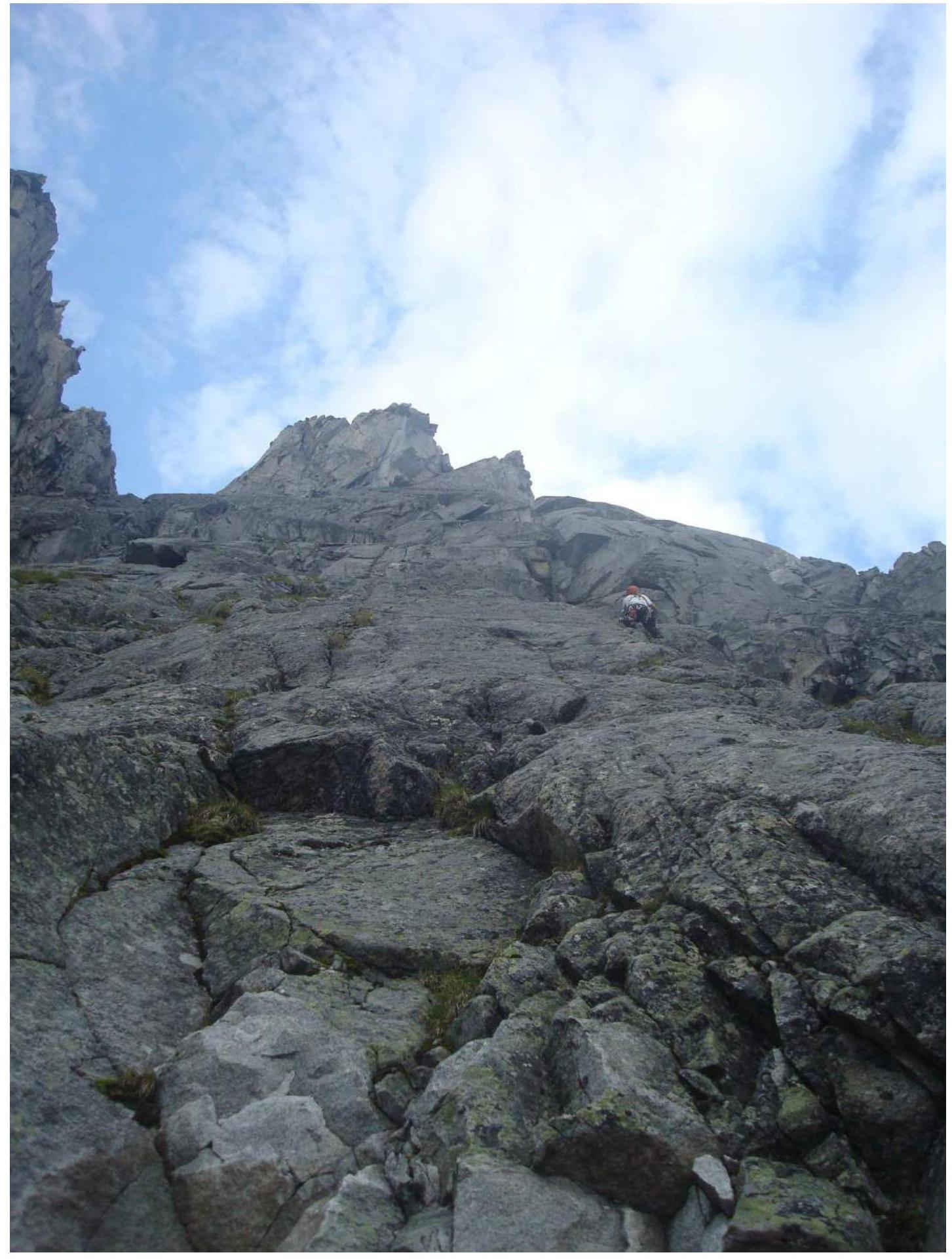
Photo 3. Section R10-R11
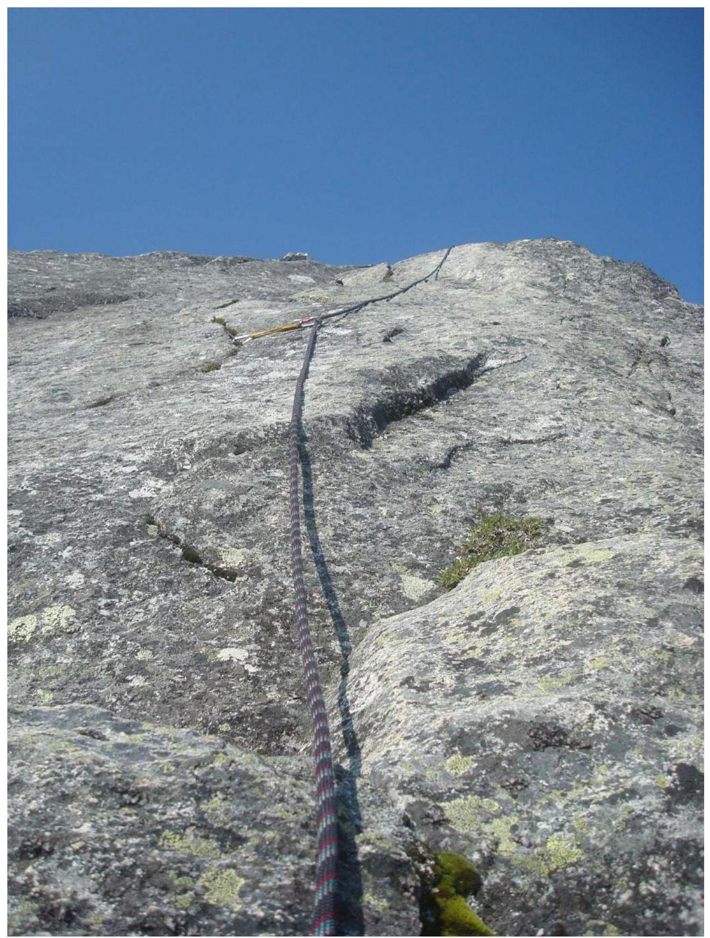
Photo 4. Sections R12-R14
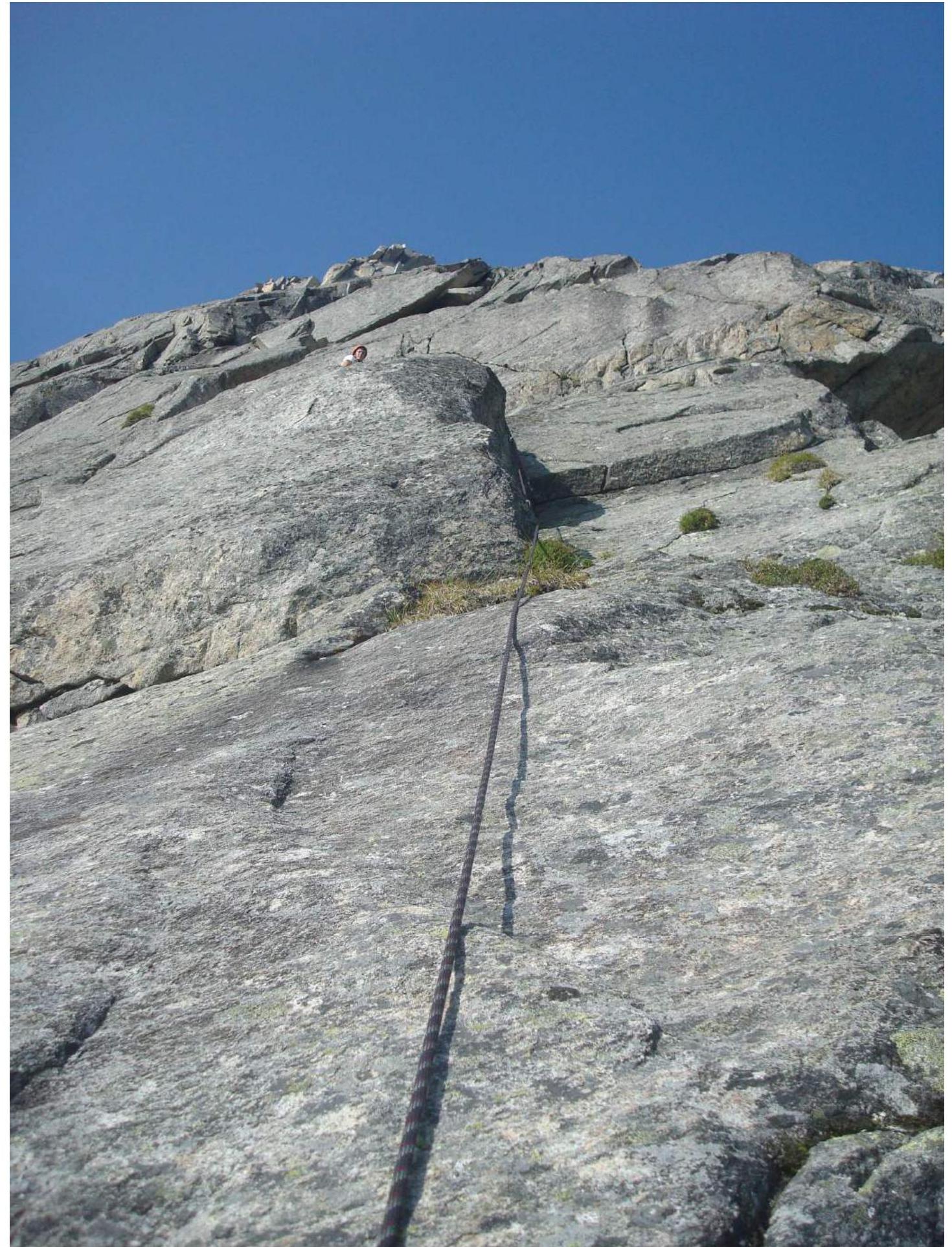
Photo 5. Section R19-R21
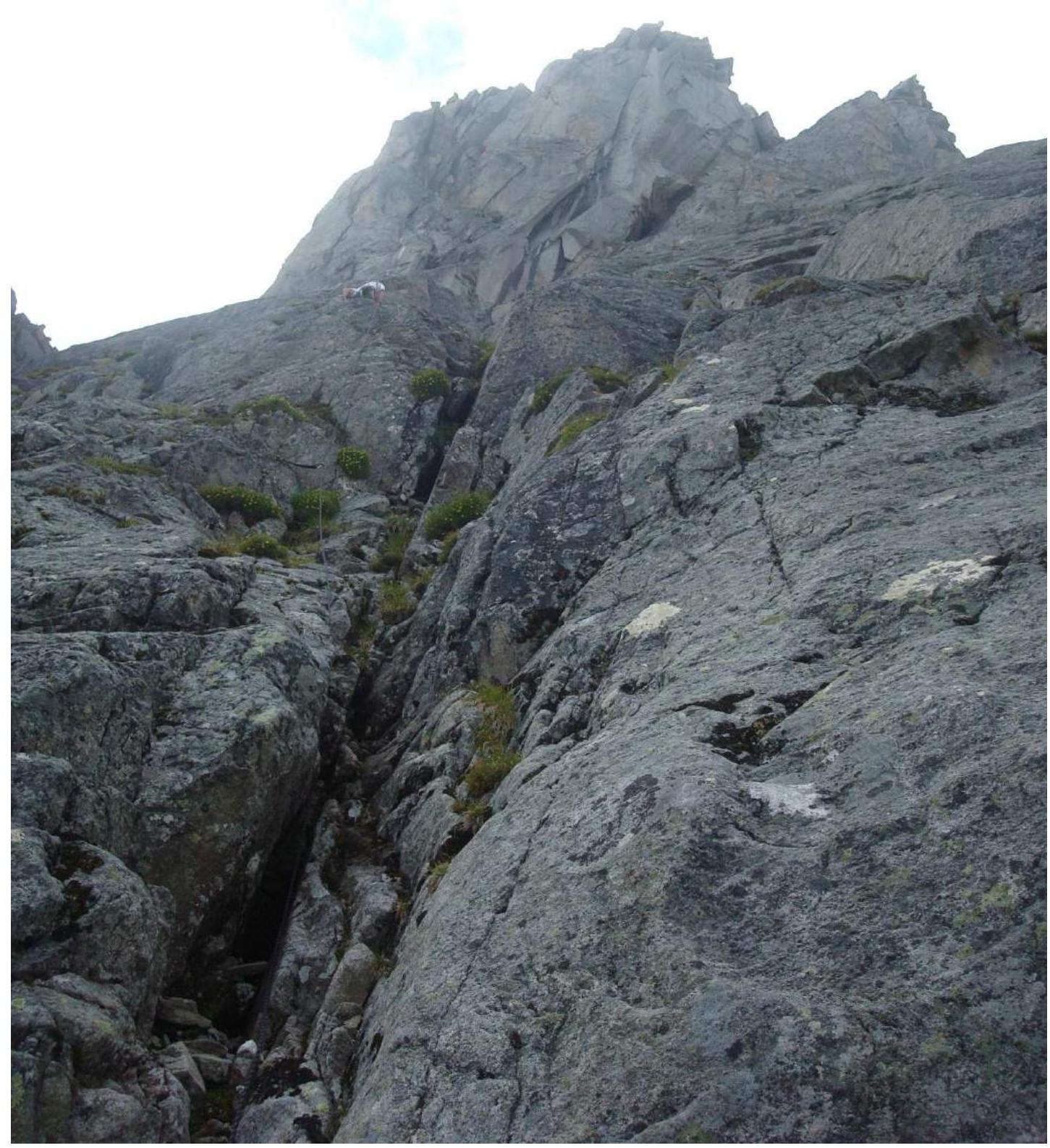
Photo 6. Sections R23-R28
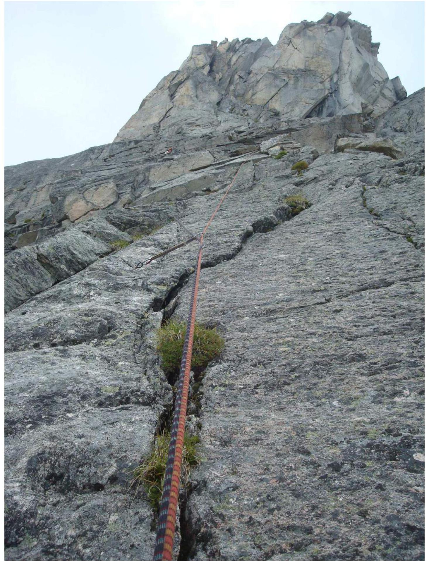
Photo 7. Section R30-R31
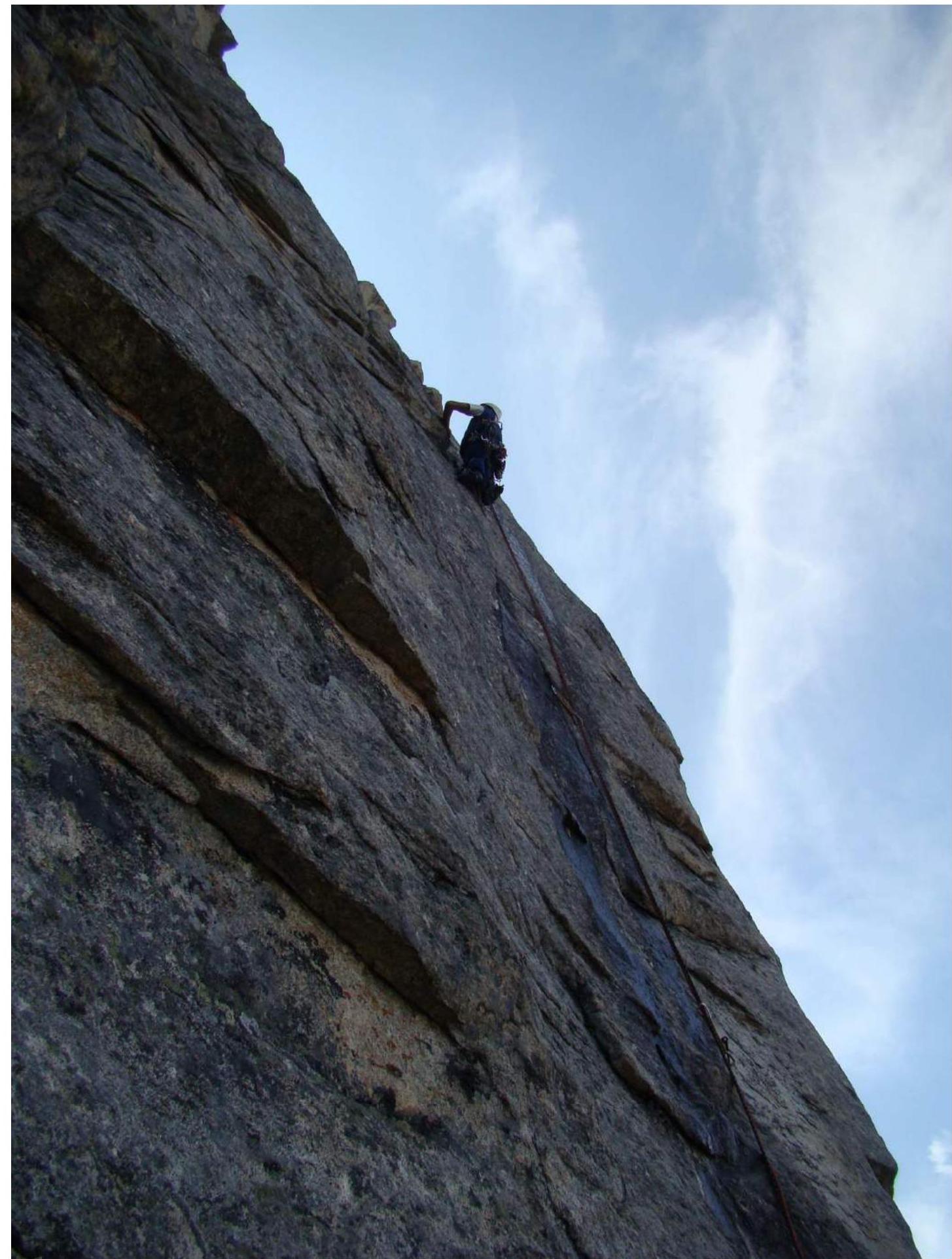
Photo 8. Section R31-R32
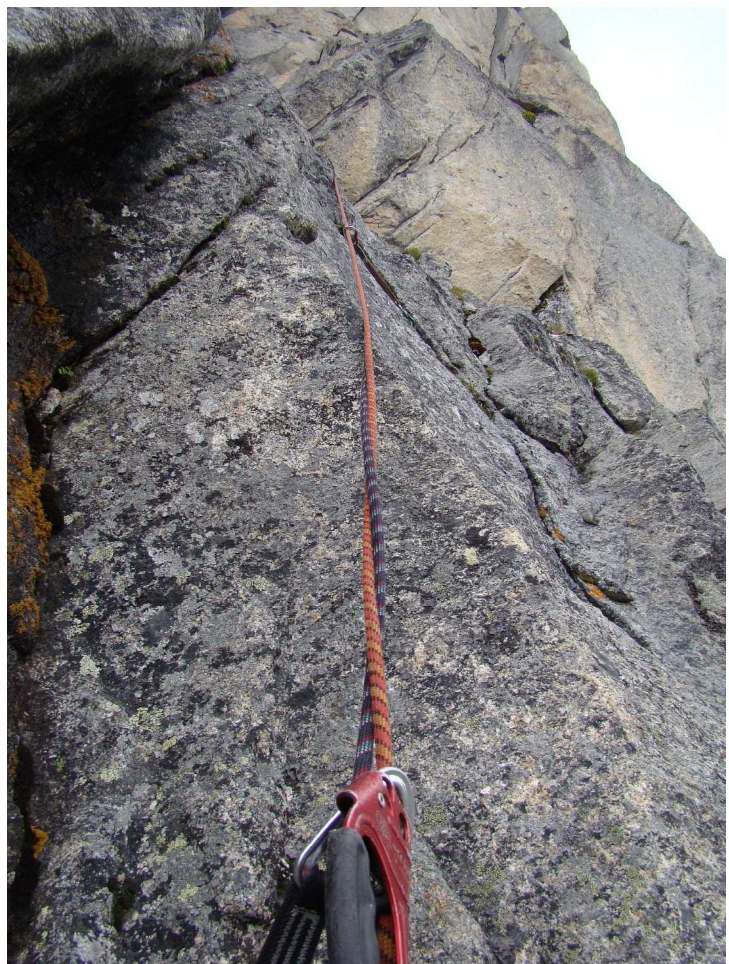
Photo 9. Section R33-R34
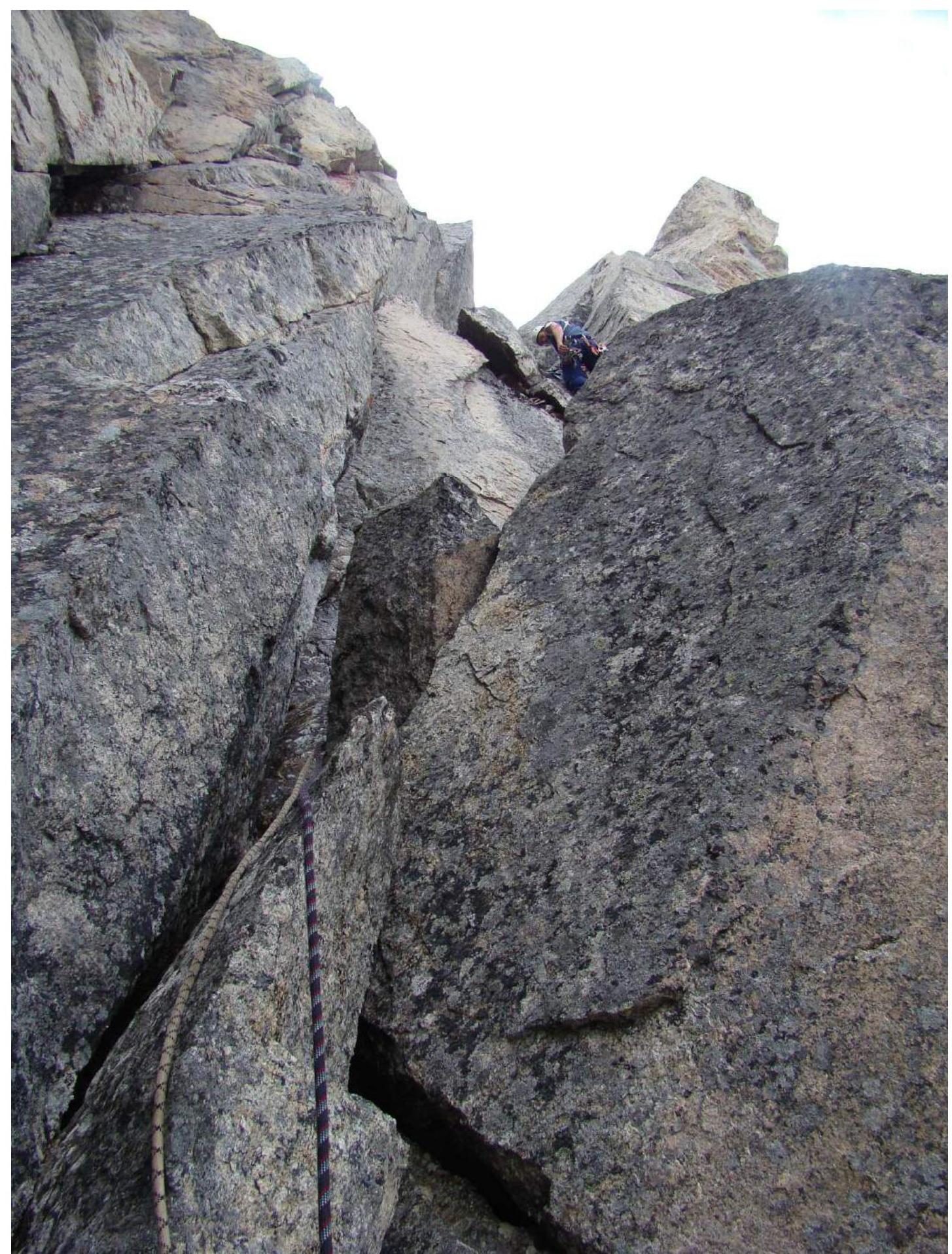
Photo 10. Section R36-R37

Photo 11. Section R36-R37
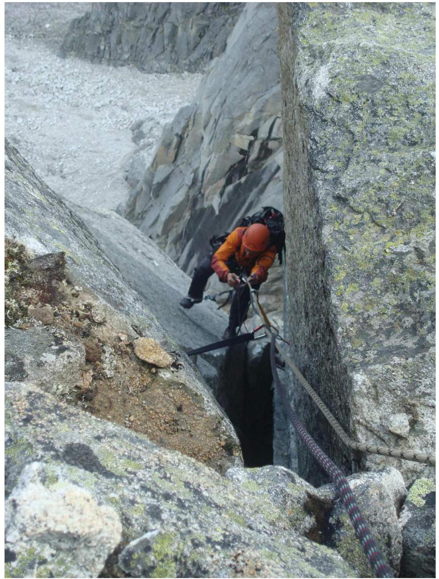
Photo 12. Summit. Ilyinsky Vasily.

Photo 13. Summit. Klepikov Alexander and Shcherban Alexey.
