Report on the First Ascent
Peak Kupol (2954 m) Right Central Counterfort of the North Face Route 5A cat. diff. (proposed), first ascent Route name: "Fast & Light" Eastern Sayan, Tunkinskiye Goltsy ridge, Barun-Khandagai Valley, 6.1 2013
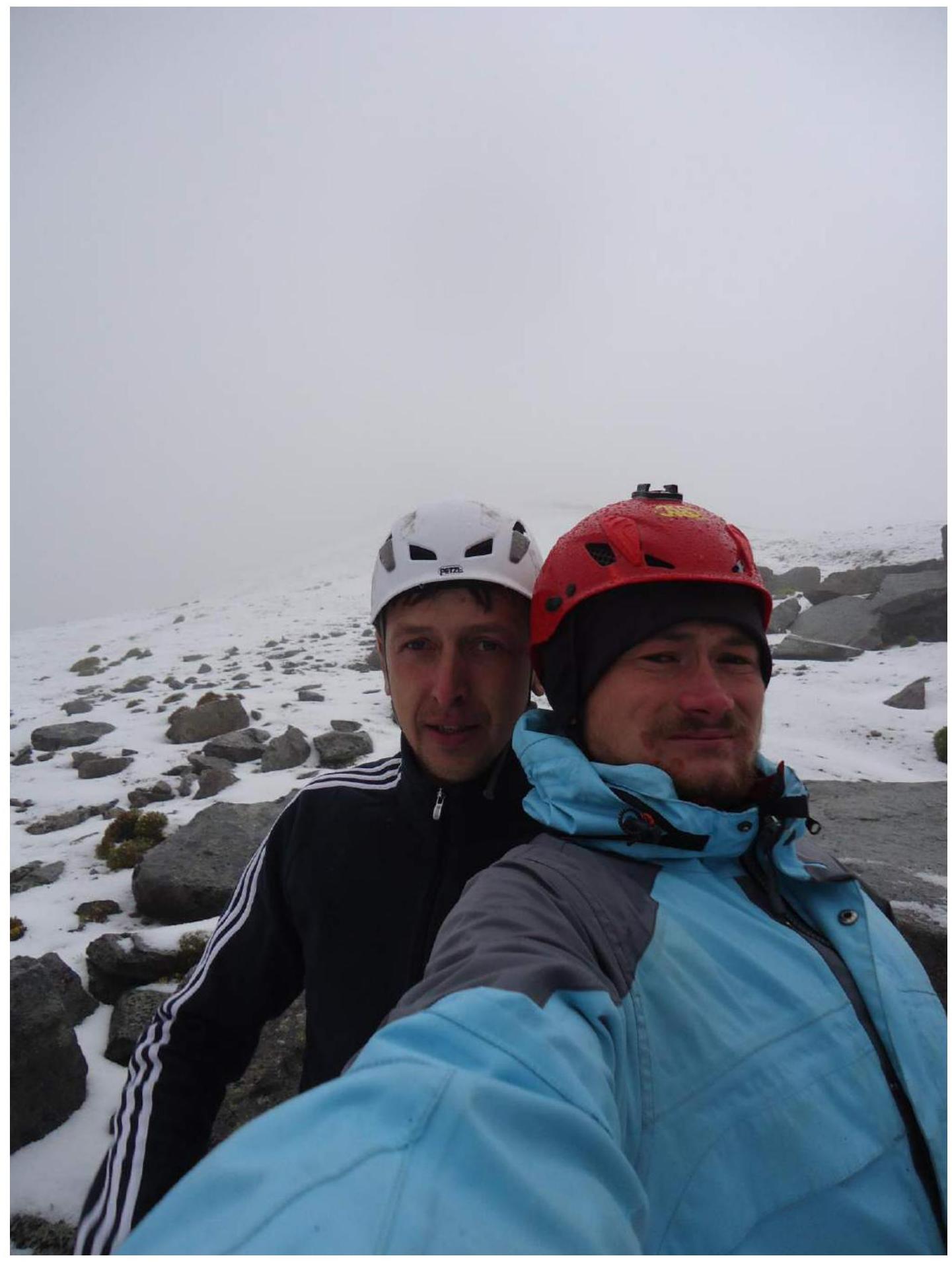
Team Leader: Klepiov A.A. Participants: Shcherban A.N.
- Eastern Sayan, Tunkinskiye Goltsy ridge, Barun-Khandagai Valley, 6.1.
- Peak Kupol (2954 m), via the Right Central Counterfort of the North Face.
- Proposed 5A category — first passage.
- Route type: rock climbing.
- Route elevation gain: 674 m.
Route length: 1030 m.
Main part elevation gain: 554 m.
Main part length: 660 m.
Section lengths:
- 6 cat. diff. — 80 m
- 5 cat. diff. — 305 m
- 4 cat. diff. — 50 m Average steepness of the main part: 63°
- Pitons left on the route: total: 0; including bolted: 0.
Total equipment used on the route:
- bolted pitons — 0
- rock pitons (including anchors) — 37
- chocks — 0
- friends — 59
- sky-hooks (including pitch progression) — 10 Total number of intermediate belay anchors (ITOs): 23.
- Team's total climbing hours (to the summit): 11; days: 1. Number of nights spent on the route: 0.
Team Leader: Klepiov Alexander Alexandrovich (MS) Participants: Shcherban Alexey Nikolaevich (2nd sports category) Team Coach: Afanasiev Andrey Evgenievich (MS), 1st category instructor.
- Departure: 7:00, August 4, 2012. Summit arrival: 18:00, August 4, 2012. Return to Base Camp: 21:00, August 4, 2012.
General view photo of the North Face of Peak Kupol.
Photo taken on July 22, 2012, from the Alaska circus (base camp). Shooting height 2100 m.
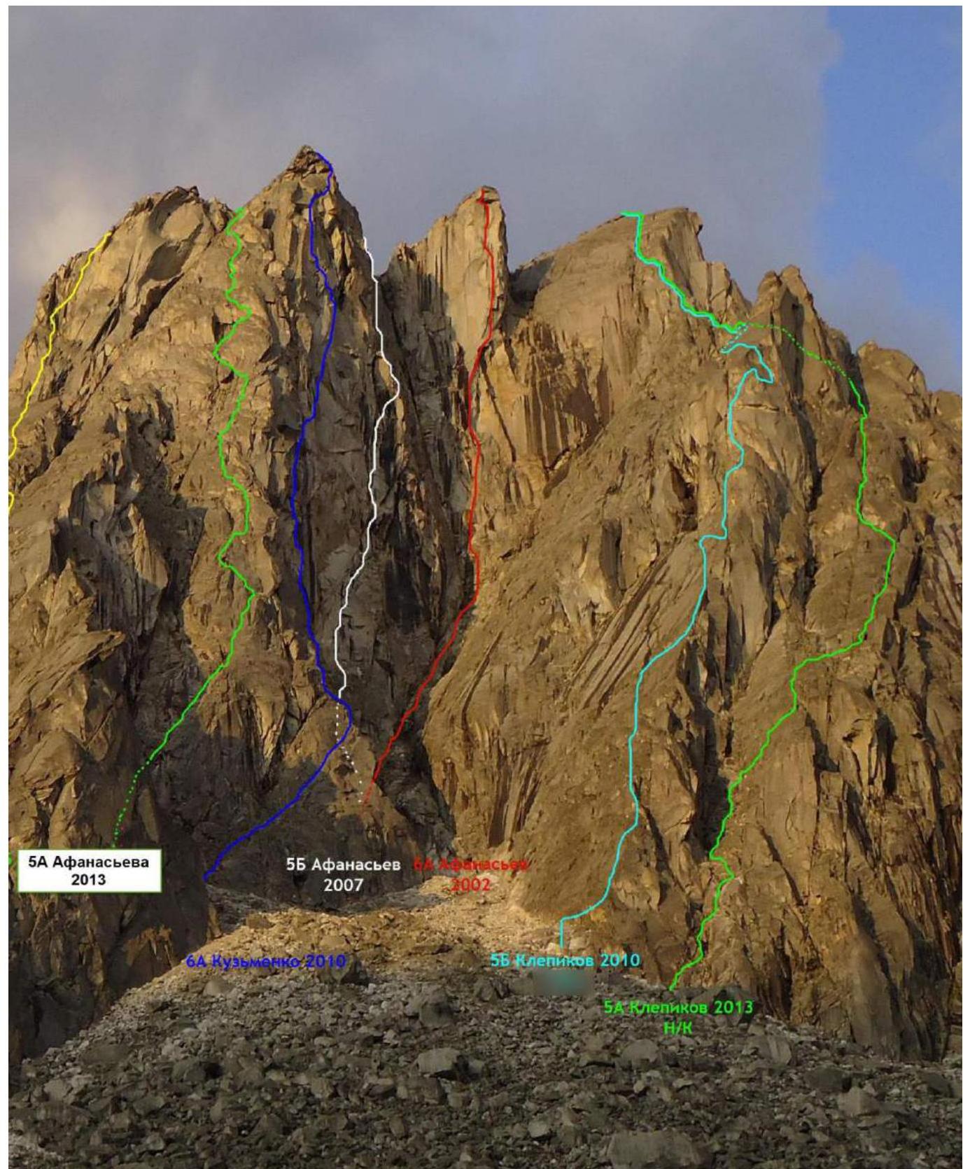
Green left — Afanasieva's route 2013, 5A cat. diff. Blue — Kuzmenko's route 2010, 6A cat. diff. Red — Afanasiev's route 2002, 6A cat. diff. Turquoise — Klepiov's route 2010, 5B cat. diff. Green right — team's route 5A — 2013.
Route profile photo.
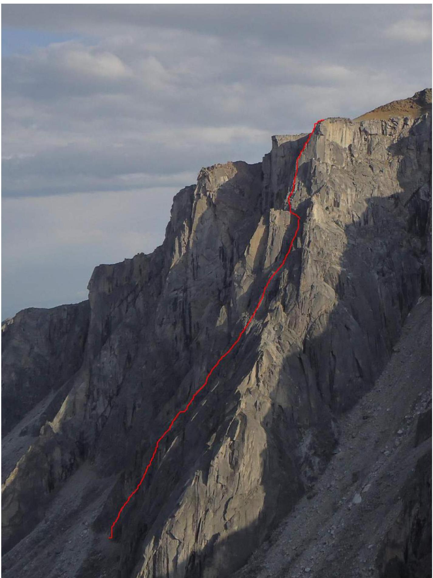
Hand-drawn route profile.

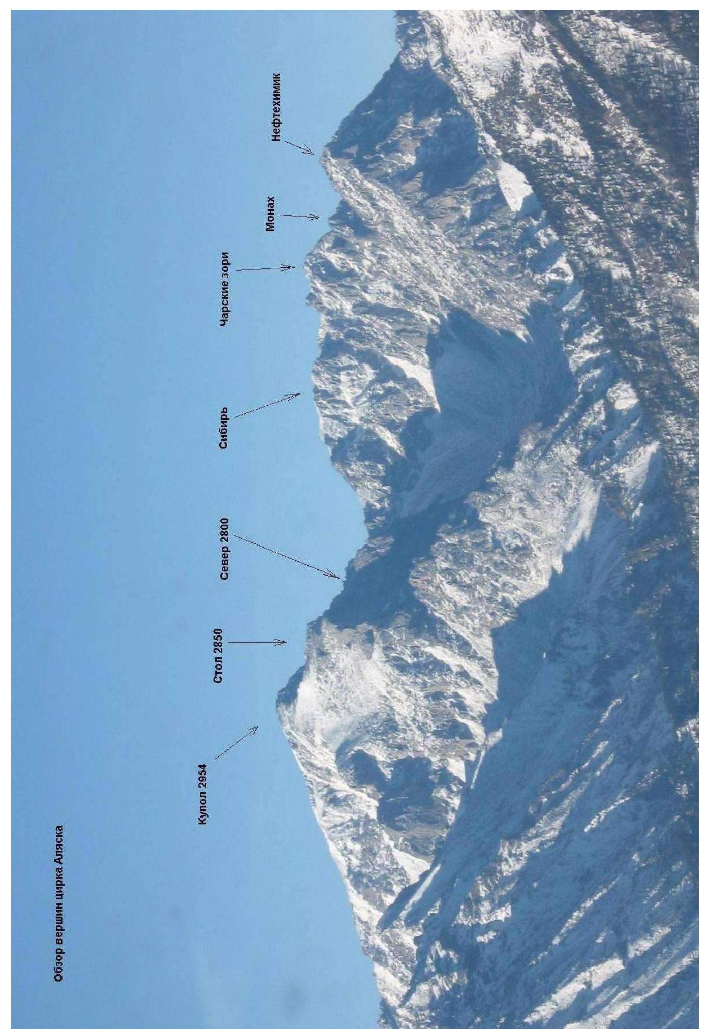
Panorama of the Alaska circus peaks.
Overview of the Alaska circus peaks
Map of the Barun-Khandagai Valley
The Barun-Khandagai Valley is one of the most promising areas in the Eastern Sayan for sport climbing.
Peak Kupol (2954 m) is the dominant peak in the area. Located in the Tunkinsky District of the Republic of Buryatia. The nearest large settlement is the village of Arshan.
From Arshan, you can reach the entrance to the valley by a high-clearance vehicle — a journey of about 15 kilometers. Further, there is a path along the valley, the area is popular with tourists during the summer.
The Alaska circus is located to the left along the valley, with an elevation gain of 1400 m and a length of approximately 15 km. In the summer, it takes 6–8 hours to reach the wall, while in winter, it may take 5–6 days due to the large amount of snow.
Several challenging routes pass through the North Face of Peak Kupol:
- Afanasiev's 5B route on the North Face, 1982.
- Afanasiev's 6A route ("Klinok") on the North Face of the Eastern shoulder, 2002, 1st place at the Russian Climbing Championship 2002.
- Afanasiev's 6A route on the plumbs of the North Face of the Eastern shoulder, 2007, 4th place at the Russian Climbing Championship 2007.
- Kuzmenko's 6A route on the Central North Face of the Eastern shoulder, 2010.
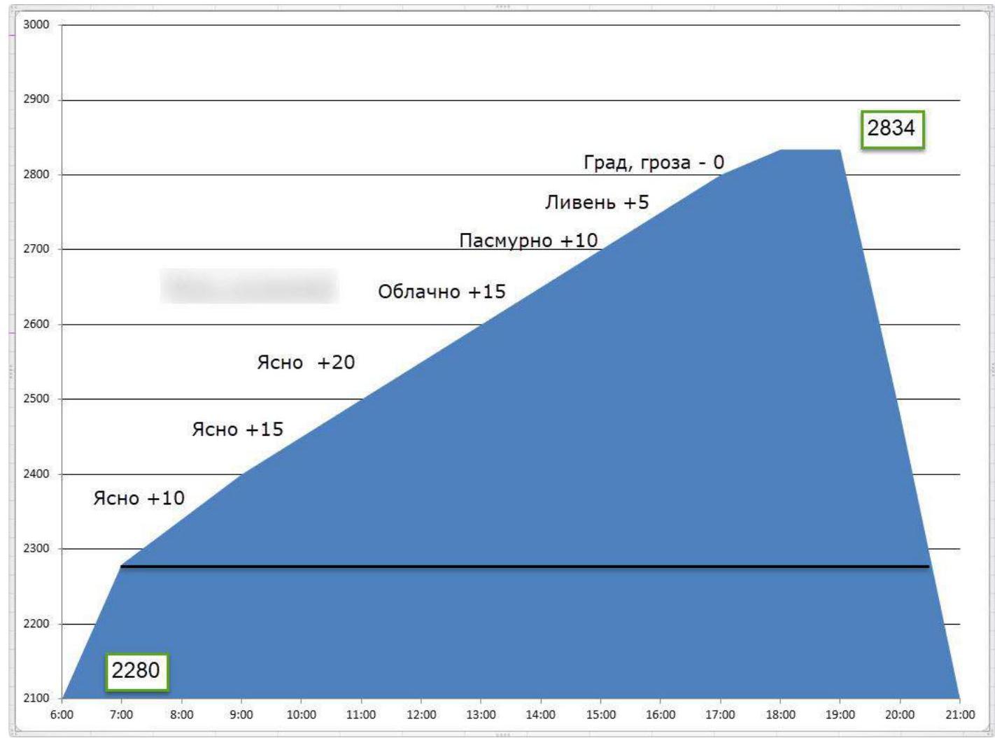
Ascent schedule
Team's movement schedule on scheduling the route:
- August 4, 2013 — from 7:00 to 18:00, sections R0–R41 were completed.
- August 4, 2013 — from 18:00 to 19:00, weathered a storm, decided to descend without reaching the summit due to the objective danger of a lightning strike.
- August 4, 2013 — from 19:00 to 21:00, descent to Base Camp via a 1B category route.
Schematic representation of the main part of the route in UIAA symbols, scale 1:2000, sheet 1
| Section | Chock | Friend | Rock Piton | Sky-Hook | Bolt | UIAA Route Diagram M 1:2000 Sheet 1 | Length (m) | Steepness (deg) | Free Climbing | ITO |
|---|---|---|---|---|---|---|---|---|---|---|
| R28–R29 | - | 2 | 1 | - | - | 25 | 65 | 5- | - | |
| R27–R28 | - | 2 | - | - | 1 | 50 | 40 | 3+ | - | |
| R26–R27 | - | 2 | 4 | - | - | 20 | 70 | 6- | - | |
| R25–R26 | - | 1 | 1 | - | - | 10 | 55 | 4+ | - | |
| R24–R25 | - | - | - | - | - | 20 | 30 | 2- | - | |
| R22–R24 | - | 3 | 2 | - | - | 45 | 70/80 | 5–/5+ | - | |
| R21–R22 | - | 1 | 1 | - | - | 10 | 75 | 5- | - | |
| R17–R20 | - | 3 | 1 | - | - | 25 | 70/80 | 5+/6– | - | |
| R16–R17 | - | 1 | 2 | - | - | 10 | 70 | 5- | - | |
| R15–R16 | - | - | 1 | - | - | 5 | 75 | 5+ | - | |
| R14–R15 | - | 3 | 1 | - | - | 30 | 75 | 5+ | - | |
| R12–R13 | - | 2 | - | - | 10 | 70 | 5+ | - | ||
| R11–R12 | - | 1 | - | - | - | 25 | 30 | 2- | - | |
| R10–R11 | - | 2 | - | - | - | 15 | 60 | 5- | - | |
| R9–R10 | - | 4 | - | - | - | 50 | 40 | 3+ | - | |
| R8–R9 | - | 2 | - | - | - | 10 | 60 | 3+ | - | |
| R7–R8 | - | 2 | 3 | - | 1 | 30 | 75 | 5- | - | |
| R6–R7 | - | 2 | 3 | - | - | 28 | 50 | 3+ | - | |
| R5–R6 | - | 1 | 1 | 1 | - | 10 | 60 | 4- | - | |
| R4–R5 | - | 1 | - | - | - | 5 | 50 | 4- | - | |
| R3–R4 | - | 2 | 3 | - | - | 15 | 70 | 5- | - | |
| R1–R2 | - | 2 | 2 | - | 20 | 75 | 6- | - | ||
| R0–R1 | - | 2 | 2 | - | 1 | 20 | 65 | 5- | - |
Schematic representation of the main part of the route in UIAA symbols, scale 1:2000, sheet 2
| Section | Chock | Friend | Rock Piton | Sky-Hook | Bolt | UIAA Route Diagram M 1:2000 Sheet 2 | Length (m) | Steepness (deg) | Free Climbing | ITO |
|---|---|---|---|---|---|---|---|---|---|---|
| R41–R42 | - | - | - | - | - | 5 | 50 | 3+ | - | |
| R40–R41 | - | 1 | - | - | - | 10 | 60 | 4- | - | |
| R39–R40 | - | 1 | - | - | - | 15 | 65 | 4+ | - | |
| R38–R39 | - | 3 | - | - | - | 25 | 70 | 5- | - | |
| R37–R38 | - | 2 | - | - | - | 10 | 90 | 6- | - | |
| R36–R37 | - | 1 | 1 | - | - | 10 | 80 | 5- | - | |
| R35–R36 | - | - | 1 | 5 | 85 | 5+ | - | |||
| R34–R35 | - | 1 | 2 | - | - | 5 | 10 | 1+ | - | |
| R33–R34 | - | 3 | 2 | 8 | - | 15 | 90 | 6+ | A3 | |
| R32–R33 | - | 1 | 1 | 2 | - | 10 | 85 | 6+ | A1 | |
| R31–R32 | - | 2 | - | - | - | 15 | 80 | 5+ | - | |
| R30–R31 | - | 1 | 1 | - | - | 15 | 80 | 5+ | - | |
| R29–R30 | - | - | - | - | - | 5 | 40 | 2+ | - | |
| R28–R29 | - | 2 | 1 | - | - | 25 | 65 | 5- | - |
Terrain description
- R0–R1 20 m, 65°, 5-
- R1–R2 20 m, 75°, 6-, The plug is climbed on the left.
- R2–R3 5 m, 45°, 3+, Shelf.
- R3–R4 15 m, 70°, 5-, Move slightly right under the wall. Protection.
- R4–R5 5 m, 50°, 4-, Move left along the ledge.
- R5–R6 10 m, 60°, 4-, Slightly left into the chimney.
- R6–R7 28 m, 50°, 3+, Right part of the chimney.
- R7–R8 30 m, 75°, 5-, From the chimney to the ridge.
- R8–R9 10 m, 60°, 3+, Along the ridge, station behind a boulder.
- R9–R10 50 m, 40°, 3+, Along the edge.
- R10–R11 15 m, 60°, 5-, Wall.
- R11–R12 25 m, 30°, 2-, Along the ledge to the right.
- R12–R13 10 m, 70°, 5+, Wide crack.
- R13–R14 15 m, 30°, 3+, Transition to a wide crack.
- R14–R15 30 m, 75°, 5+, Wide crack.
- R15–R16 5 m, 75°, 5+, Transition to a ledge on the left.
- R16–R17 10 m, 70°, 5-, From the ledge to the right onto the edge.
- R17–R18 5 m, 65°, 6-, Coil.
- R18–R19 10 m, 80°, 5+, Cracks.
- R19–R20 10 m, 70°, 5-
- R20–R21 5 m, 40°, 2+, Ledge.
- R21–R22 10 m, 75°, 5-, Wall.
- R22–R23 40 m, 70°, 5-, Chimney.
- R23–R24 5 m, 80°, 5+, Right-hand detour.
- R24–R25 20 m, 30°, 2-, Ledge under the VU.
- R25–R26 10 m, 55°, 4+, VU.
- R26–R27 20 m, 70°, 6-, Left VU, wet.
- R27–R28 50 m, 40°, 3+, Couloir with loose rocks to the left-hand col.
- R28–R29 25 m, 65°, 5-, Wall.
- R29–R30 5 m, 40°, 2+, Ledge.
- R30–R31 15 m, 80°, 5+, VU, transition to the left side of the edge. Station on a ledge.
- R31–R32 15 m, 80°, 5+, VU from the ledge towards the vertical VU above.
- R32–R33 10 m, 85°, 6+, A1 — Wall with a small crack under the VU.
- R33–R34 15 m, 90°, 6+, A3 — VU with a block in the middle, narrow crack in the VU.
- R34–R35 5 m, 10°, 1- — Ledge, station.
- R35–R36 5 m, 85°, 5+ — Wall from the ledge on the left part.
- R36–R37 10 m, 80°, 5- — Exit into a wide chimney.
- R37–R38 10 m, 90°, 6- — Wide chimney with a plug.
- R38–R39 25 m, 70°, 5- — Along the wide chimney.
- R39–R40 15 m, 65°, 4+ — Along the chimney.
- R40–R41 10 m, 60°, 4- — Along the chimney. VU, transition to the "beach."
- R41–R42 5 m, 50°, 3+ — Exit to the summit.
- R42–R43 370 m, 25°, 1-
Technical photo of the route.

Route characteristics and team's actions on the wall.
The route our team laid out follows one of the counterforts of the North Face of Peak Kupol. The route is entirely tied to the terrain; there are no illogical transitions, and if you start the route correctly, there is no easier path — the route forces you upwards, making it practically impossible to deviate.
The route is characterized by smoothed sections of "ram's foreheads" at the beginning and a large amount of crack climbing in the middle. There is a series of wet internal corners that remain in the shade, which can be a revelation for some participants. In winter, due to the route's length and increased difficulty, it will feel like a heavy 5B category route. The route is largely monolithic, with loose rocks present only in the upper half, potentially posing a danger to participants on the station if not climbed carefully. However, the station locations generally allow for protection under overhangs.
The route features a significant amount of crack climbing; for protection, it is recommended to have two sets of friends (12–15 pieces) in sizes up to the 3rd number of the camalot, including one of the 4th number. Anchor pitons are also necessary, especially in the first third of the route.
With extensive experience in the area and good training, we planned to complete the route in one day as a duo, aiming to utilize simultaneous climbing as much as possible. We began at 7:00, with Klepiov A.A. leading and working on the lower key and a couple of simple ropes simultaneously. We then switched, climbing moderately difficult rocks with good protection. After a few ropes, we switched again due to the onset of rain, which made the rocks slippery. We continued alternating, setting up stations.
A few ropes later, while passing the upper key, a downpour began just two ropes from exiting the wall, with streams flowing down the wall. Half a rope from exiting, the downpour turned into large hail (up to 1–1.5 cm). Soon after, a thunderstorm began, with lightning initially striking with a 3–4 second delay, then 1 second, and finally, two lightning strikes hit the base of the wall beneath us. The options for descending or taking shelter on the wall were practically non-existent, as the lightning was striking the wall below us. During the second climber's ascent, a lightning strike occurred 30 meters away, deafening us.
Removing all metal equipment, we took shelter in the depths of the rock formation at the top of the wall. There was no possibility of descending due to the high risk of being struck by lightning on the open terrain.
After waiting for half an hour, once the lightning had stopped striking nearby and the storm cloud had moved away, we gathered our equipment and headed towards the summit. At that moment, lightning struck the summit (300 m away). We decided not to tempt fate and descended without visiting the summit.
The wall was climbed, and the remaining section presented no significant difficulties, typically taking no more than 20 minutes to ascend. Upon debriefing, the release officer decided to validate our ascent.
The total complexity and technical elements suggest classifying this line as a weak 5B category. However, to avoid a trend of understating route difficulties in the area, we decided to submit this route for classification as a 5A category.
Comparing this route to the neighboring 5B category route we climbed three years earlier, we note the following:
- The old 5B category route has a pronounced key section about 150–200 m long with significant steepness, requiring good ITO and free climbing skills.
- Our new route lacks a pronounced key section; the climbing is uniformly challenging, interspersed with gentle sections of easy climbing.
The maximum difficulty of a section climbed free is 7A (Fr.), and the maximum difficulty of ITO is A2–A3 (more than 10 points in a row).
In terms of complexity, the route is comparable to 5th category routes:
- Erydag Central Left part of the 3rd wall (Nekrasov 1986) 5B;
- Dinosaur Left part of the Northwest wall (Morozov 2001) 5A;
- Dragon's Tooth Central South wall of the Central tower (Kosoturov 2001) 5B;
- Ak-Kaya Southwest wall chimneys (Bershov 1979) 5B.
Photo 1. Start of the route.

Photo 2. Section R0–R1.
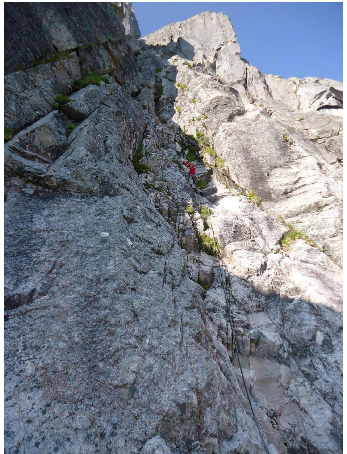
Photo 3. First rope. Leader on section R2–R3.
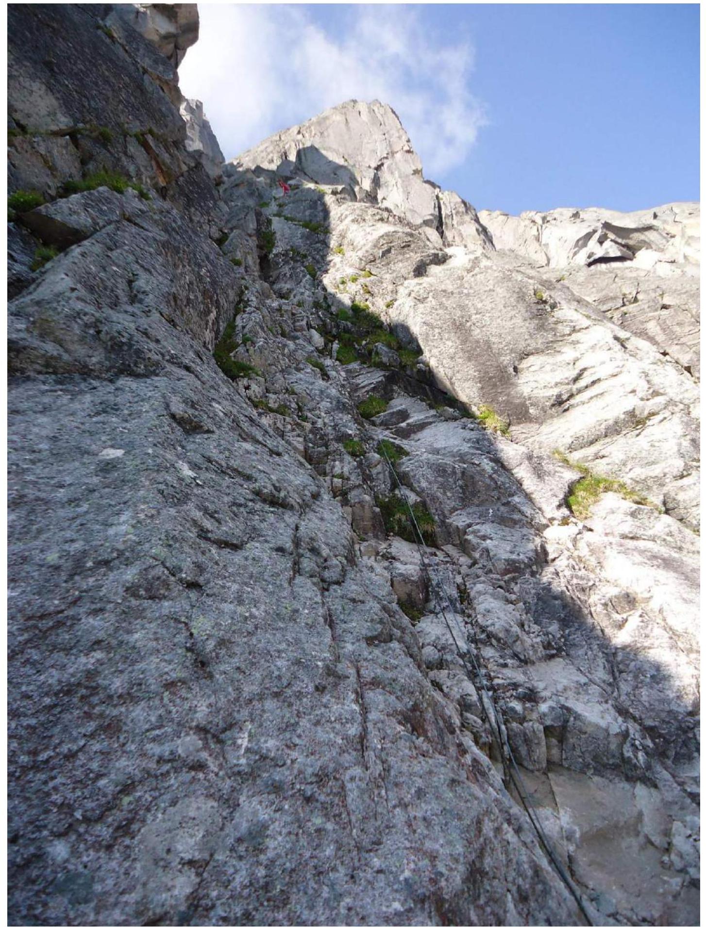
Photo 4. Third rope. Section R7–R8.
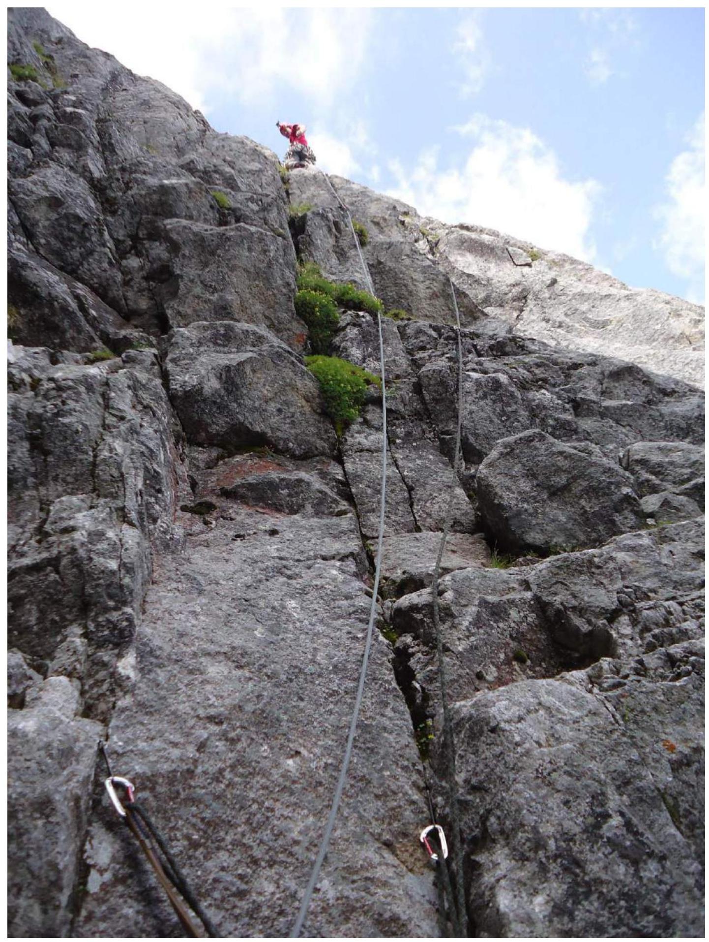
Photo 5. Section R14–R15.
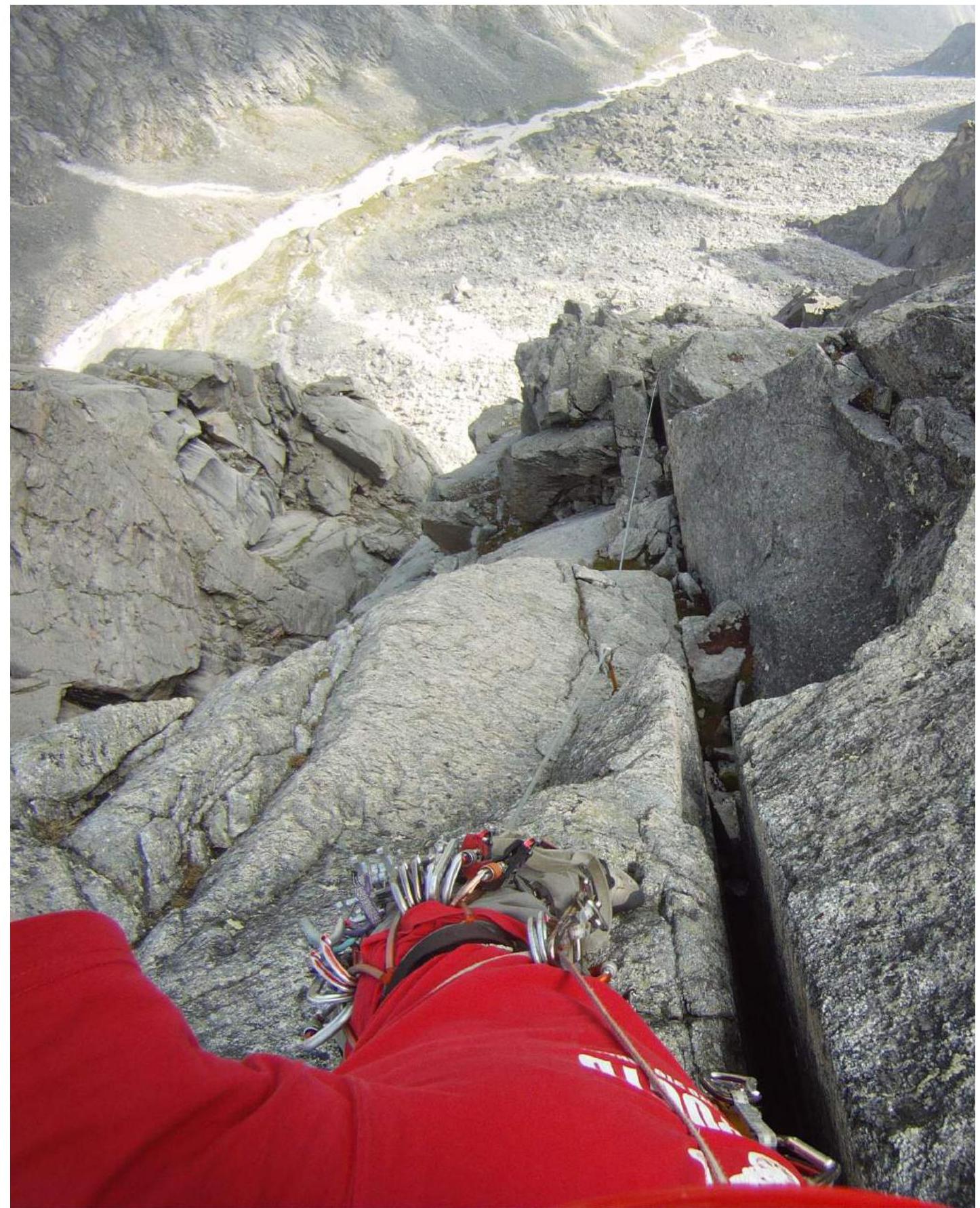
Photo 6. Photo taken from point R14.
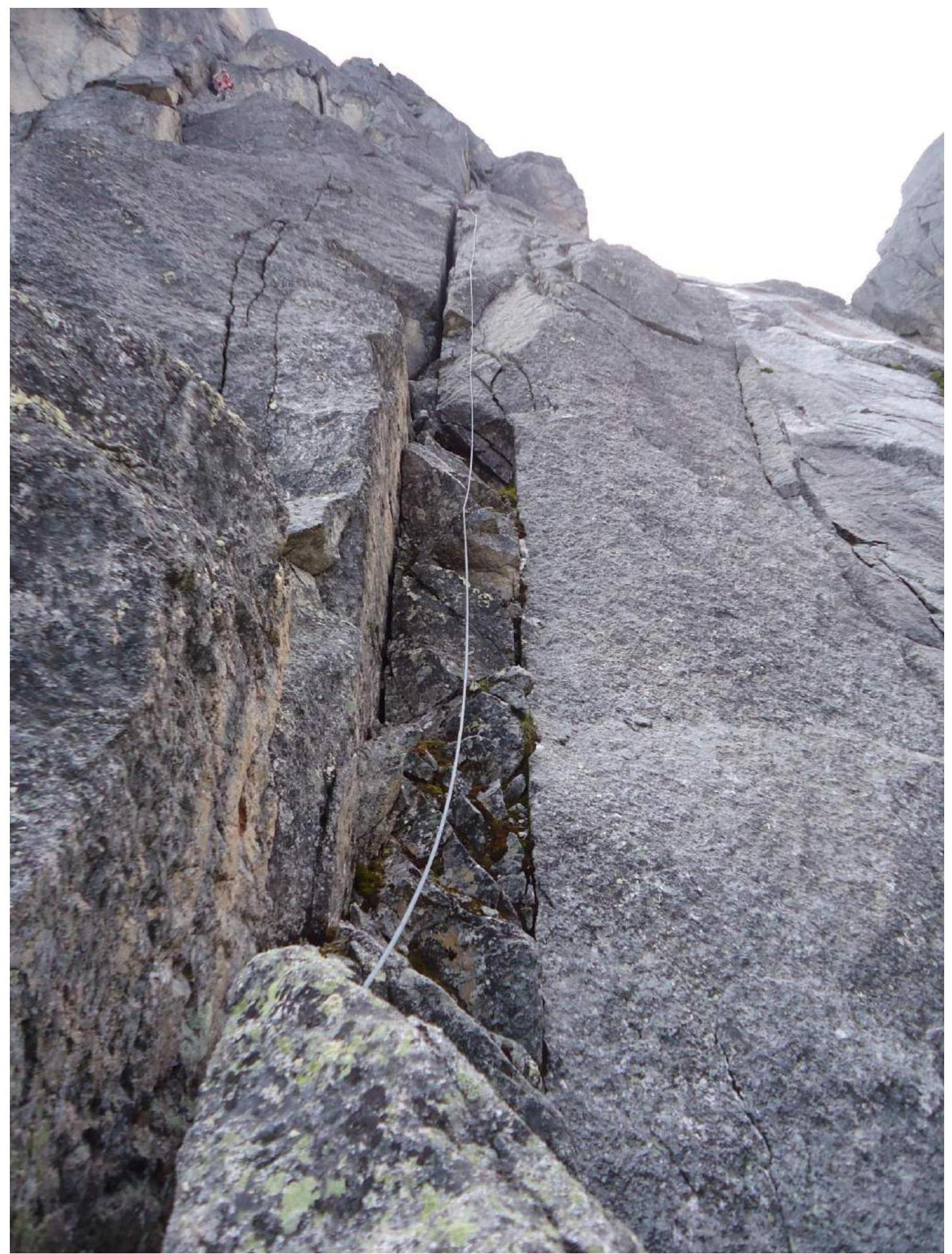
Photo 7. Taken from point R24 downwards.
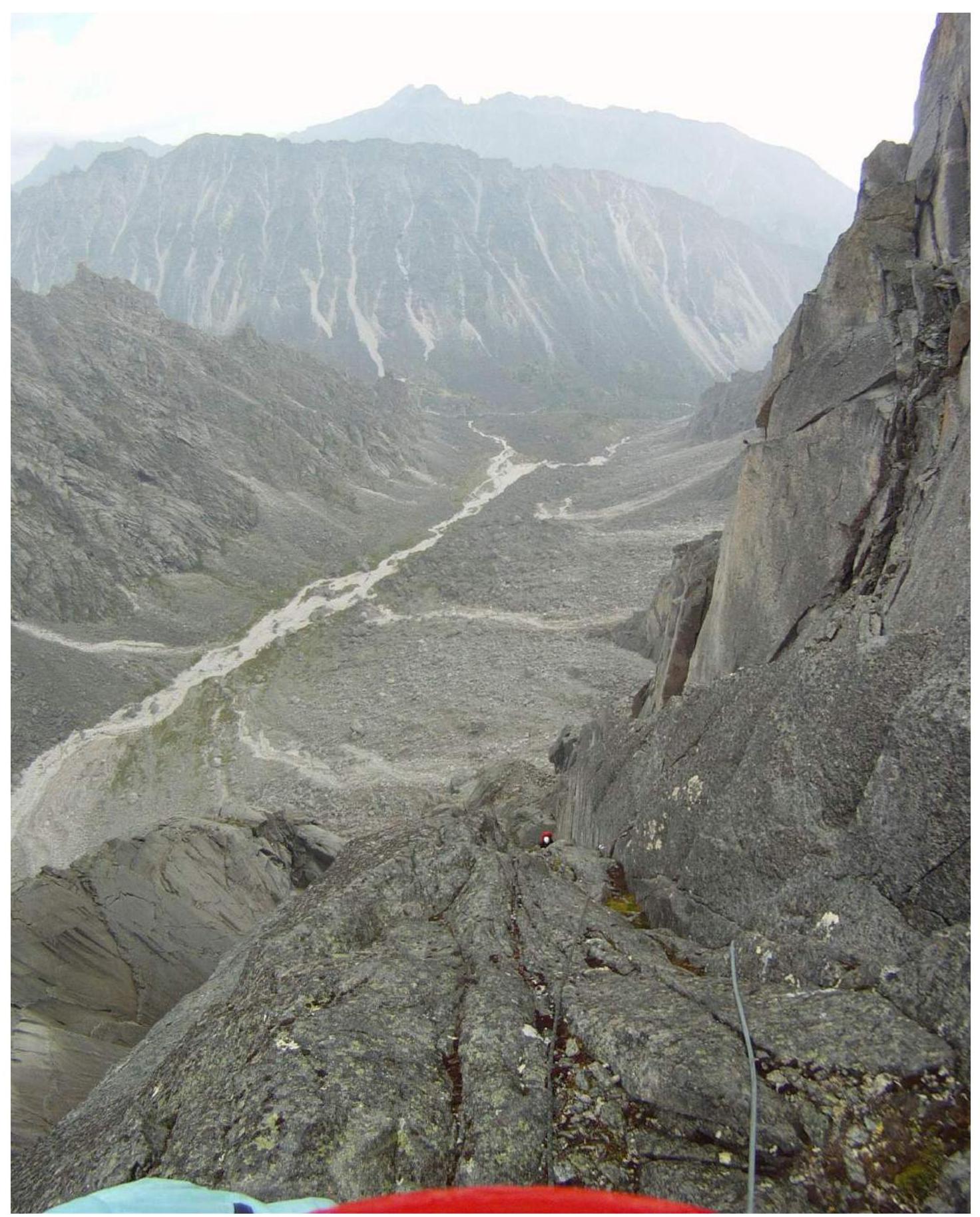
Photo 8. Section R26–R27.
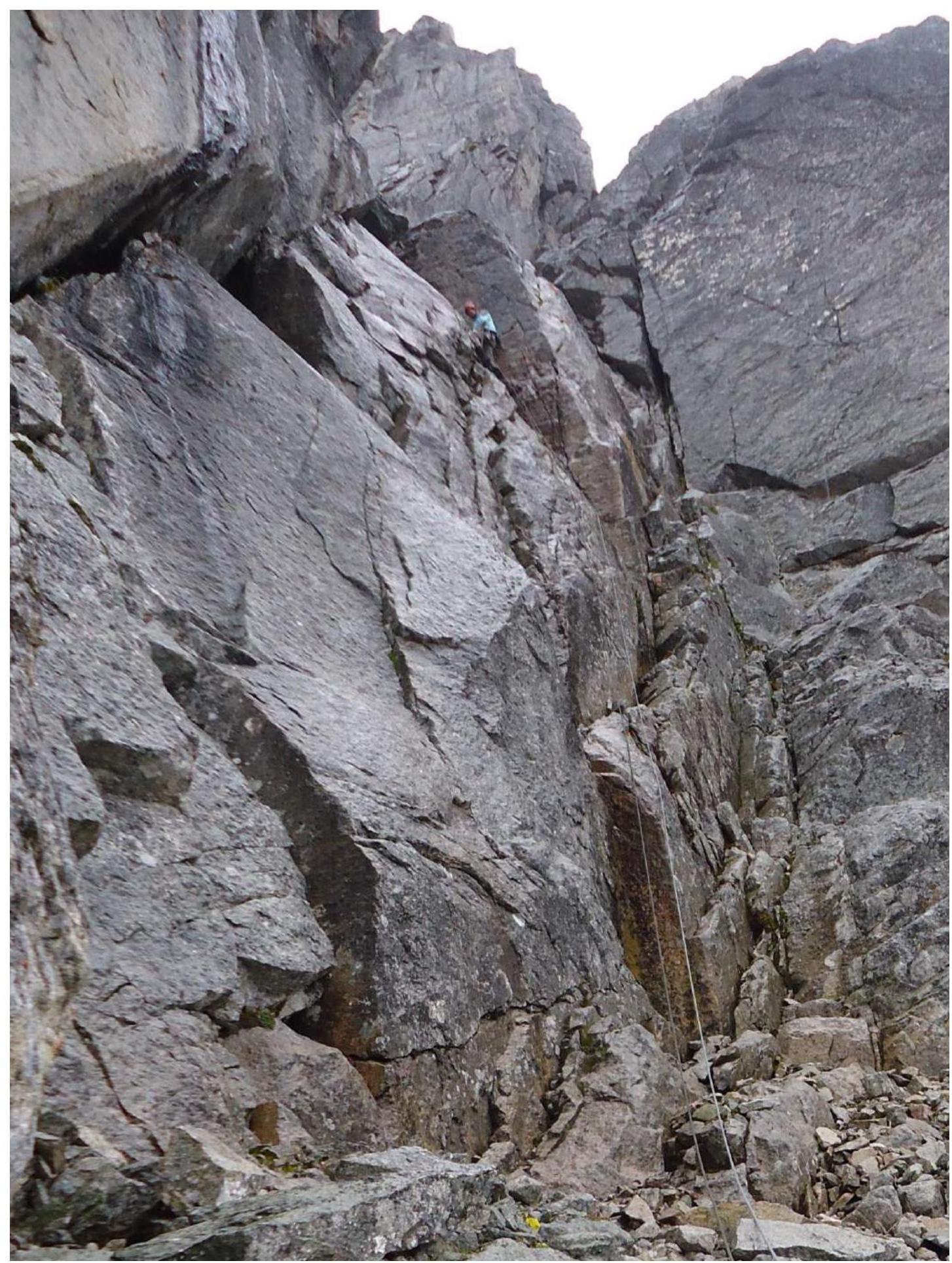
Photo 9. Leader on section R33–R34.
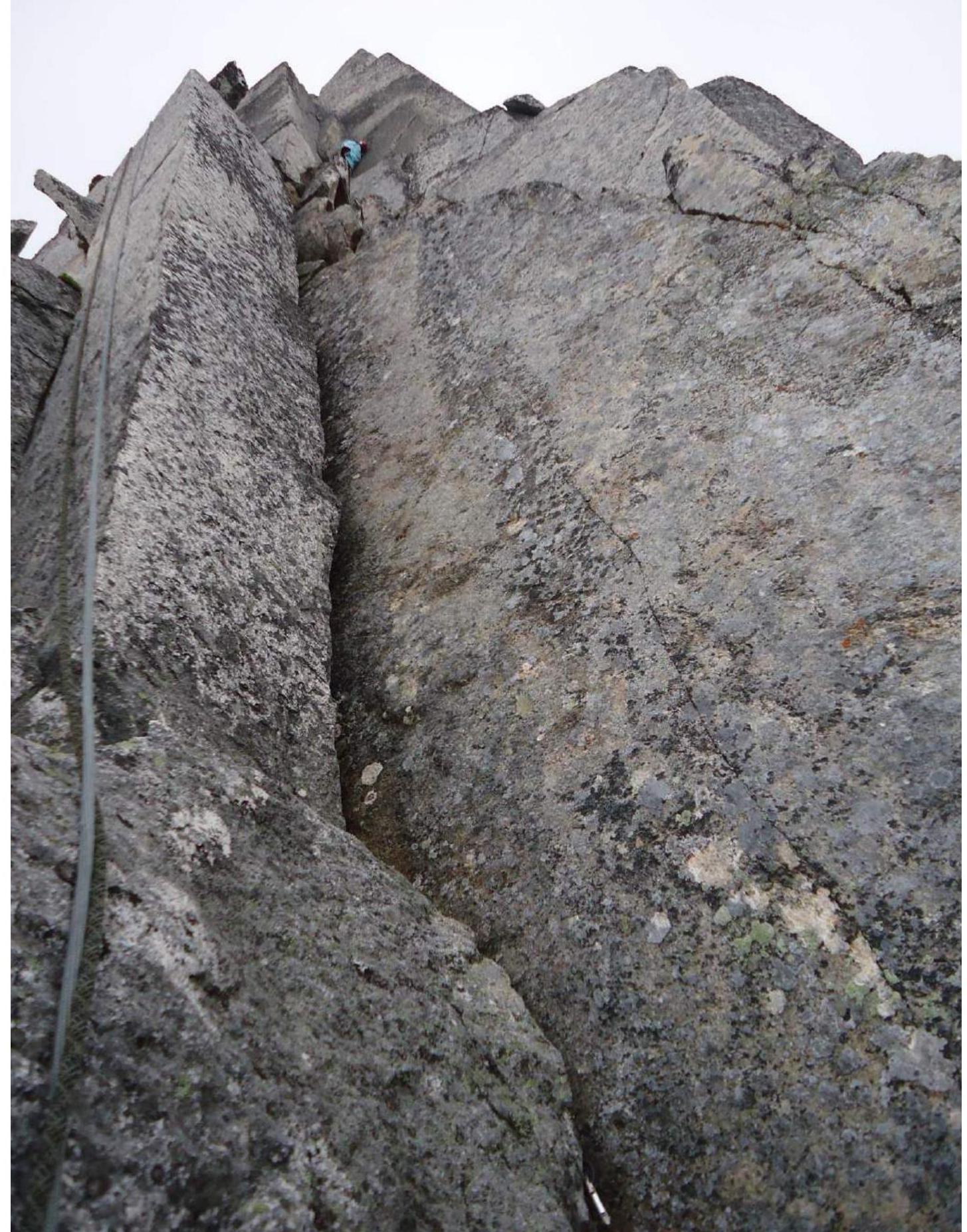
Photo 10. After exiting the wall, we did not proceed to the summit due to the danger of being struck by lightning!