Zun via Ts.ktf 10-3 from 2834 m. Kirillov S.A. Vostochny Sayany 6.1. first ascent
PASSPORT
- Rock class
- Vostochny Sayany, Zun-Khandagai gorge.
- To Zun via Ts.ktf. 10-3 peak. (2834 m)
- Proposed 4A category of complexity, first ascent.
- Height difference — 400 m, length — 500 m.
Length of sections with 5th category of complexity — 60 m. Average steepness of the main part of the route — 53°.
- Pitons left on the route — 0
- Team's walking hours: 11 hours and days — 1.
- Leader: Kirillov Sergey Anfilofievich Master of Sports of the USSR
Members: Nikonov Viktor Petrovich — Candidate Master of Sports, Prosandeeva Nina Vasilievna — 2nd sports category, Ponomarenko Oleg Vladimirovich — 2nd sports category, Sulimova Marina Alexandrovna — 2nd sports category
- Coach: Yurinsky Yuri Ivanovich
- Approach to the route: May 8, 1990
- Summit: May 8, 1990
- Return: May 8, 1990
- Year-round event of the Irkutsk Regional Sports Committee

BRIEF DESCRIPTION OF THE ROUTE
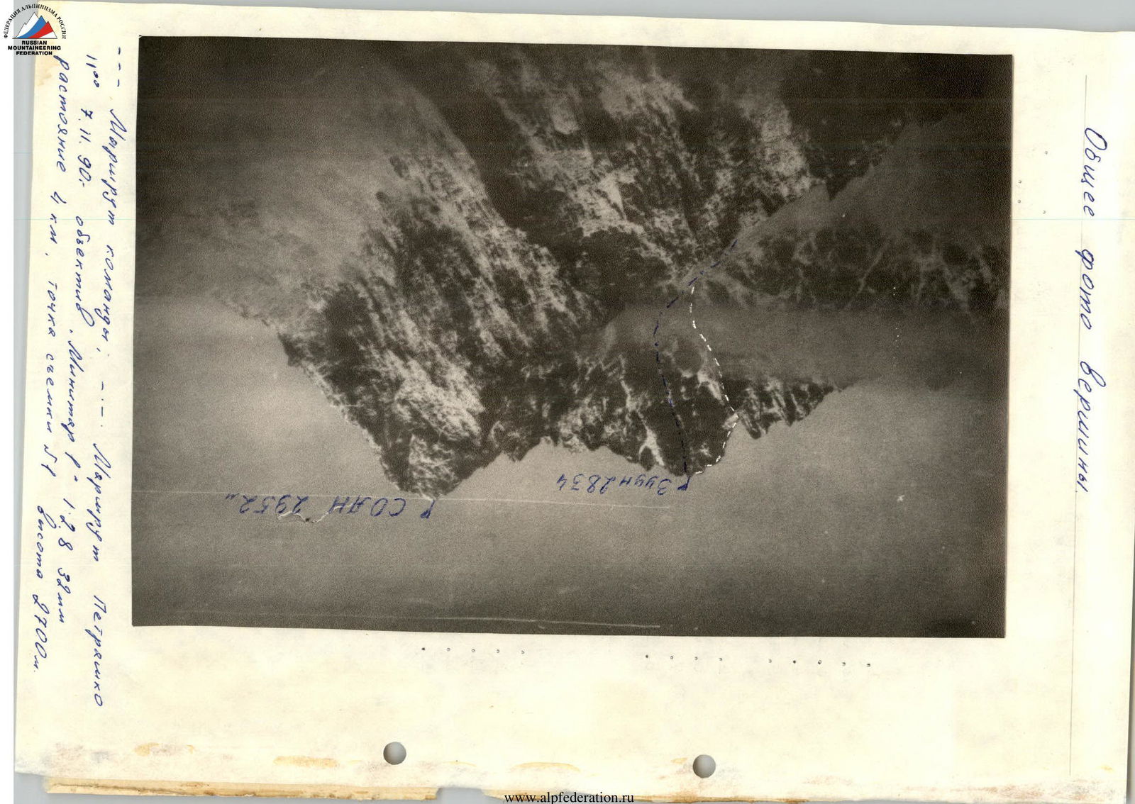
From the base camp on the Zun-Khandagai river to the cirque under the Southwest wall of Zun peak. Then up to the beginning of the counterforce, clearly visible in the center of the entire summit complex in the form of a large triangular gendarme. We go around it on the left and exit onto the counterforce. Further up to the saddle on the ridge.
Exit to the saddle along the scree slope and further up under the summit bastion.
Continuation of the ascent:
- To the right along the route through a steep wall in the direction of the rock plug.
- Not reaching it, traverse to the left to bypass the beak, a ledge.
- Chimney leading to the plug — a convenient place for belay.
Ascent along the plug:
- From the plug along the inner corner (the beginning slightly overhangs), climbing is very difficult, possibly using ladders.
- From a small ledge — departure to the right.
- Further through steep short walls to a ledge (loop for descent).
Final section:
- From the ledge to the left onto the ridge.
- Along the ridge — exit to the summit.
Descent:
- Along the ascent route to the saddle.
- Further to the left along the route into the couloir.
- At the bottom of the couloir — rappel (sporting descent).
The group completed the route from camp to camp in 11 hours. The route is logical and safe, as most of it goes along the ridge.
Subsequent groups are recommended to take with them on the route, in addition to the standard equipment:
- ladders or "hook-legs" for passing the key section;
- crampons.
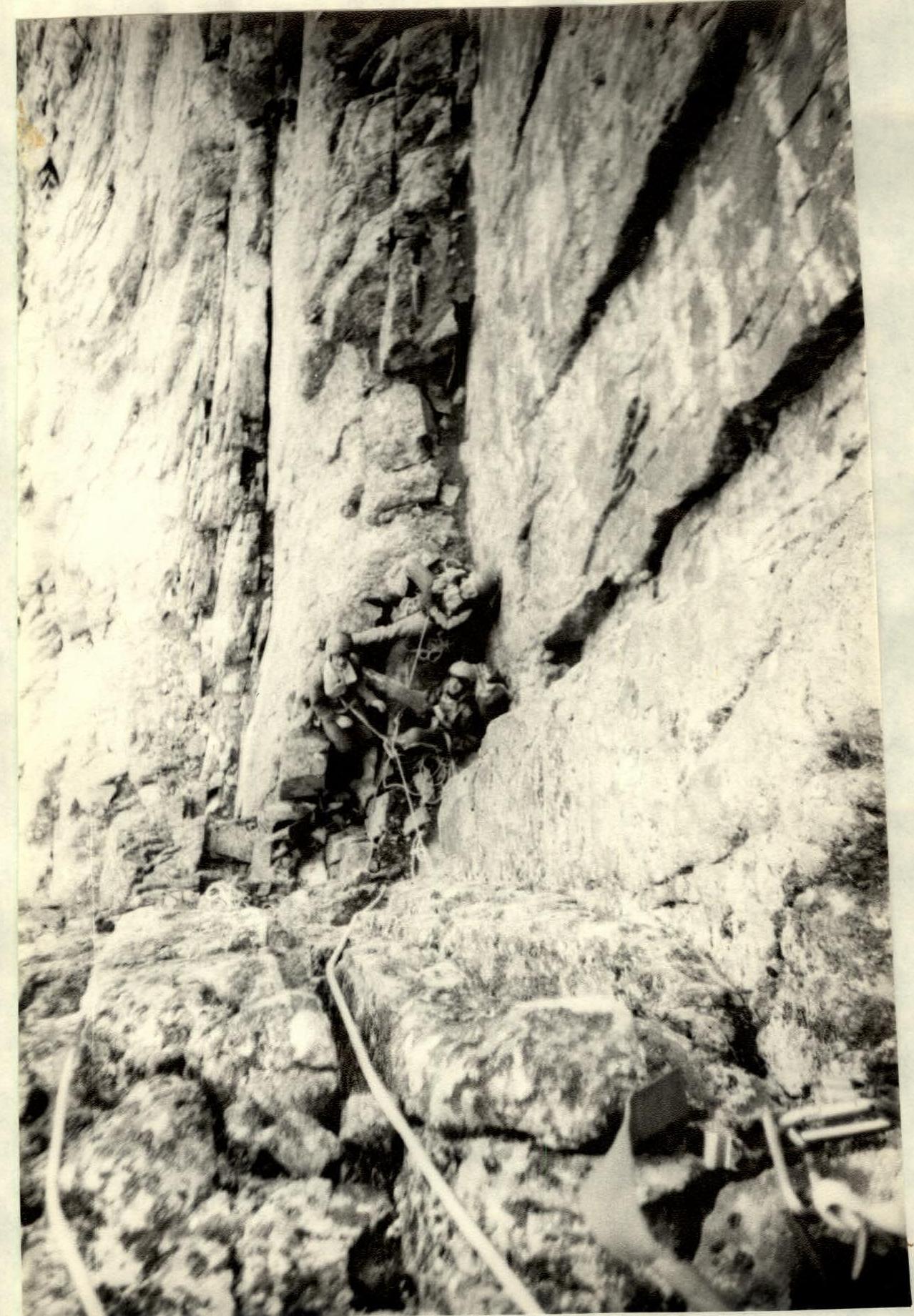
Photo L3 View from sect. 8 to sect. 7 and 6. 12° May 8, 1980 lens "Miniter-1" 1:2.8. TH3