Ascent Log
- Region: Eastern Sayan, Tunkinskiye Goltsy, section 6.1.2
- Peak Druzhba 2500 m via the Southern Ridge
- Proposed category: 1B
- Route type: rock.
Route elevation gain: 1600 m; average slope of the entire route: 22°; total route length: 4380 m;
-
Total number of pitons used on the route: 4 of which left: 0; chocks: 4 (section R5–R6);
-
Time taken to reach the summit: 9.7 hours
Route started: 5:50, November 20, 2016 Reached the summit: 15:30, November 20, 2016 Returned to base camp: 21:00, November 20, 2016
- Leader and coach: Voylichenko S.K., Candidate for Master of Sports, instructor III category. Participants: Kleshnin I. (3rd category); Rudman A. (novice)
- Responsible for the report: Voylichenko S.K. kim@inbox.ru
- Organization: Irkutsk Alpine Section.
Irkutsk — 2016
Fig. 1: Panorama of peaks near Arshan village. The route taken is shown in red. Photograph taken in summer 2016.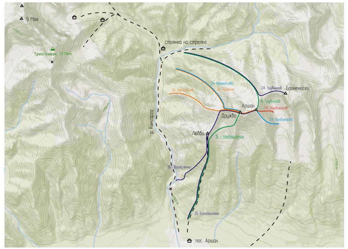
Fig. 2: Map of the ascent area. Relative positions of routes and peaks in the area of Pik Arshan. Route categories are shown in color. The route taken is marked in green and labeled as "1B — proposed".
Brief Overview of the Ascent Area
There are four known routes to Pik Druzhba (2500 m according to the classifier), two to the summit: 2A Prokopyeva (1988) and 3A Afanasyev (2010), and two traverses to Pik Arshan: 3A Luzyanin (1970) and 2B Bonadysenko (1995). The proposed route to Druzhba is the simplest path to the summit and descent. For example, Prokopyeva's report (1988) mentions the Southern Ridge as an alternative descent route from the summit. The issue is that most routes traditionally start from the base camps, from the confluence of the Left and Right Kyngarga rivers to the cirques of the Three-headed and Bratchanka peaks. Descending from Druzhba via the Southern Ridge leads in the opposite direction, towards the foot of the mountains where Arshan village is located. Thus, ascending Druzhba via the Southern Ridge is convenient directly from the village. The cornerstone that prompted the ascent via the proposed route is the 800 m sharp ridge between Pik Lyubvi and Druzhba, requiring confident simultaneous movement over rocks and not recommended for novice training groups. The route features diverse terrain:
- frozen grassy slope
- talus and scree
- snow-covered rocks requiring moderate rope work
The route is recommended for beginner training groups as a first mountaineering experience and to practice skills on mixed terrain. An undeniable advantage of this route is its low avalanche risk and relative accessibility, unlike other routes of similar category.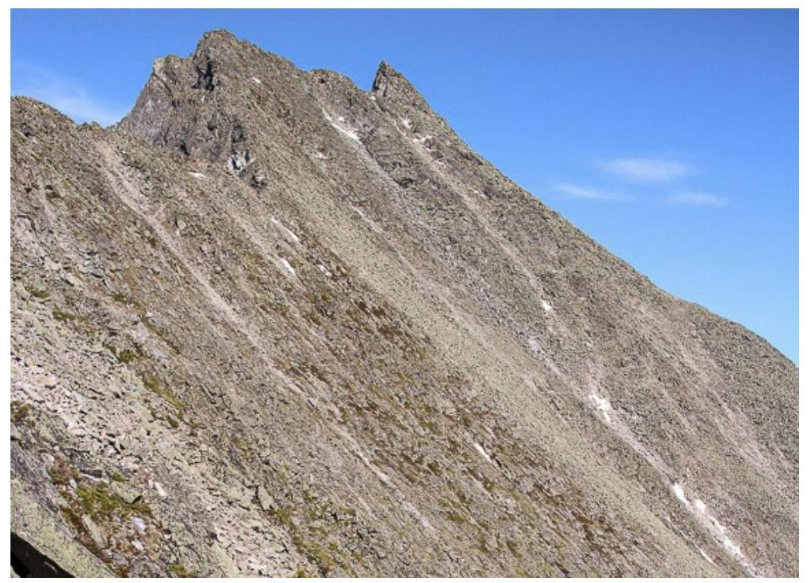
Fig. 3: Pik Druzhba. Photograph taken by section participants on June 12, 2015, during the ascent via route 3A Afanasyev (2010). The photo was taken from the ridge between Pik Lyubvi and Druzhba, after passing the control tour on Pik Molodezh, showing the profile of the Southern Ridge and the tip of the summit.
General Description of the Ascent Route
Coordinates of the starting point: 51°55′15″ E102°25′54″, coordinates of the summit: 51°57′03″ E102°27′24″.
Approach. The ascent begins from the village along the trail to Pik Lyubvi. It takes 15 minutes to reach the start of the ascent trail from the bus station.
General description of the route. Ascend along the trail towards Pik Lyubvi until the forest boundary. Above the forest boundary, before the final ascent to Pik Lyubvi, deviate from the trail to the right and traverse down into the cirque between Pik Lyubvi and Druzhba. Ascend the slope to the southern ridge of Pik Druzhba. Move along the ridge to the pre-summit ascent, then reach the crest and the pre-summit, overcome the dip, and reach the summit of Druzhba 2500 m. Descend via the ascent route.
General remarks and recommendations. In winter, the well-trodden trail to Pik Lyubvi turns into a low-snow, icy grassy-earth slope, requiring crampons for safe passage. It may take 3 to 5 hours to reach the forest boundary.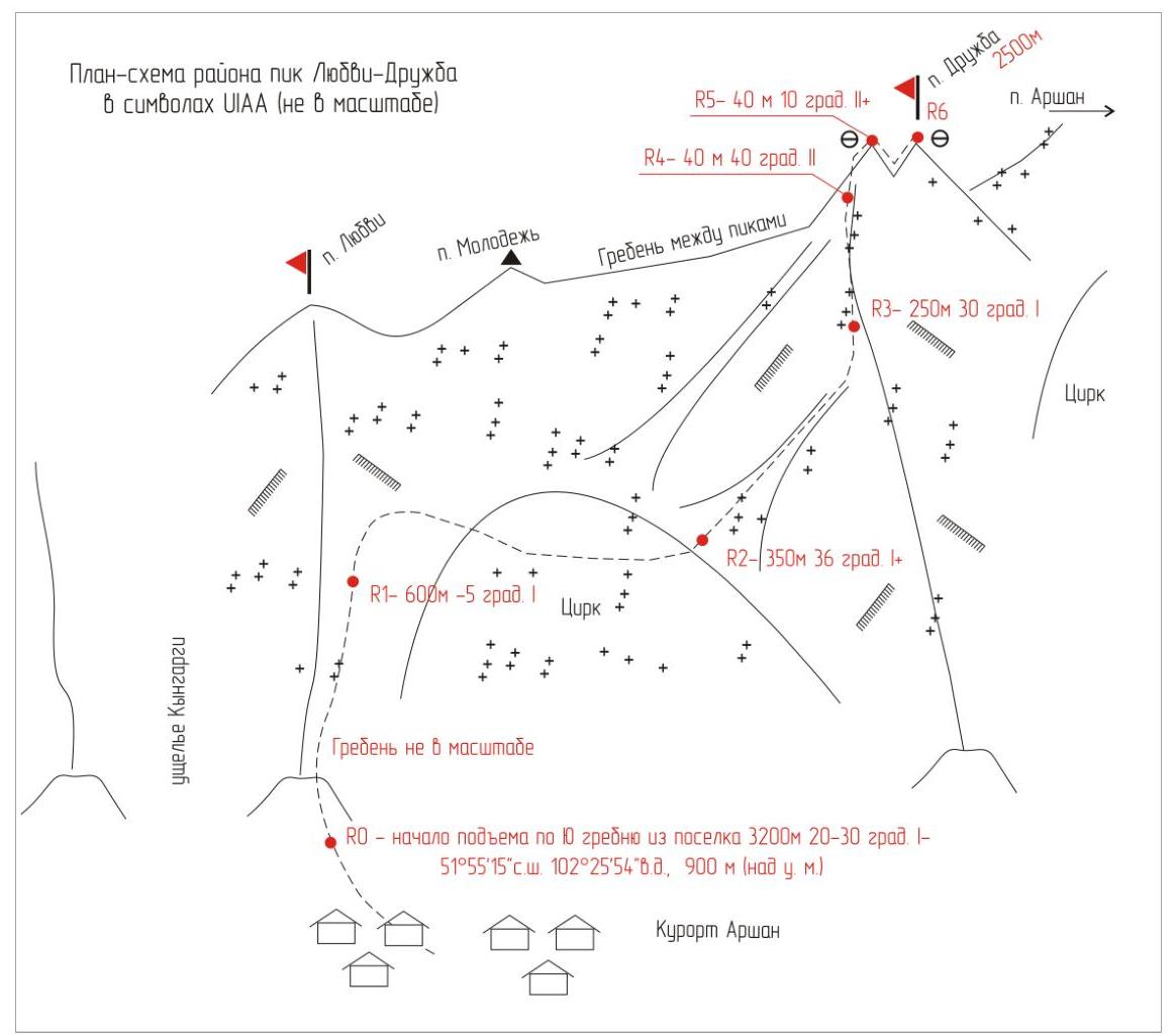
Fig. 4: Route diagram in UIAA symbols. The diagram is not to scale, for a clear representation of all key sections of this extensive route.
Detailed Description of the Ascent Route by Sections
R0–R1 3200 m, 20–30° I–. Ascend along the trail until the forest boundary, 4 hours.
R1–R2 600 m, up to –5° I. Traverse the eastern slope of Pik Lyubvi. Enter the Druzhba cirque. Medium and large boulder scree.
R2–R3 350 m, 36° I+. Couloir with SW exposure.
R3–R4 250 m, 30° I. Move along the ridge to the pre-summit ascent.
R4–R5 40 m, 40° II. Large boulder crest. Pre-summit ascent is done in rope teams. Self-arrest on the terrain.
R5–R6 40 m, 10° II+. Along the crest to the summit. Overcome the dip between the pre-summit and the summit. Protection via chocks, alternating movement.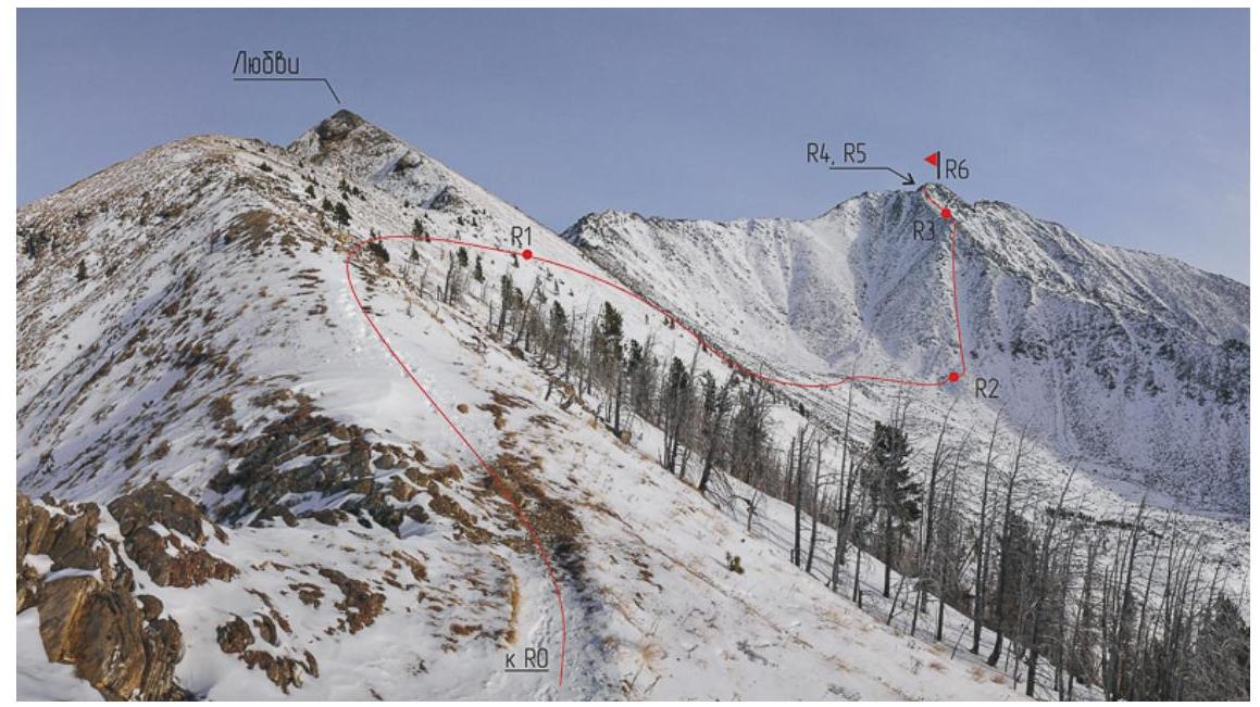
Fig. 5: Technical photograph of the route from the forest boundary.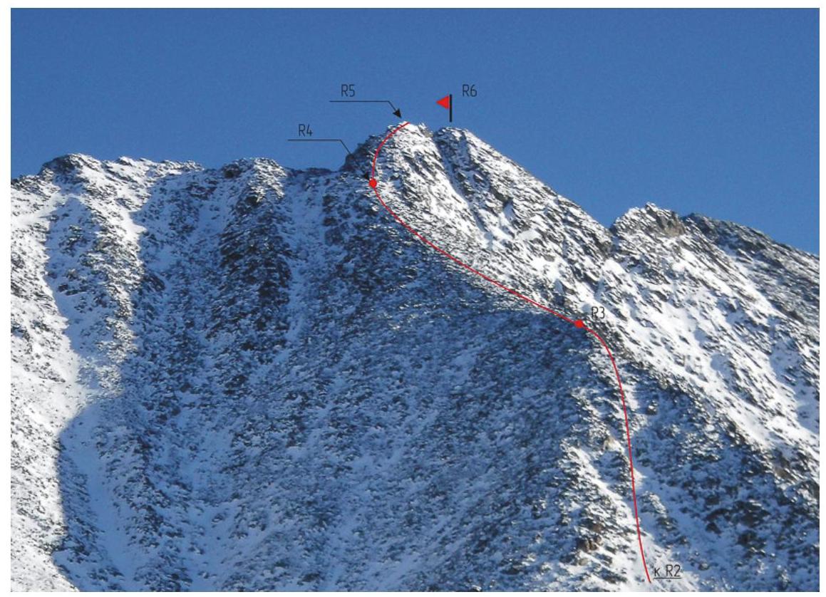
Fig. 6: Technical photograph of sections R3–R6 in close-up.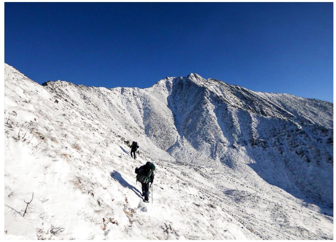
Fig. 7: On section R1–R2. Traverse of the grassy eastern slope of Pik Lyubvi. Descent into the cirque.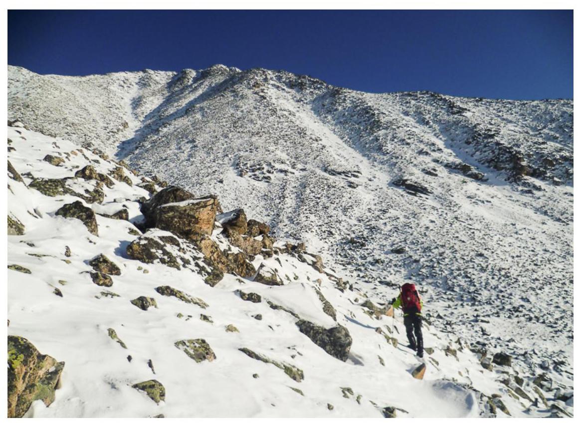
Fig. 8: On section R1–R2. Crossing the cirque. Medium-sized scree.
Fig. 9: On section R3–R4. Movement along the Southern Ridge.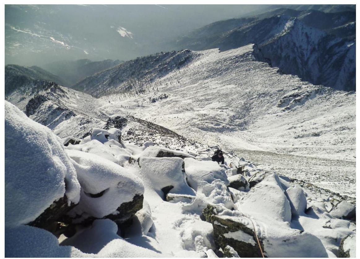
Fig. 10: On section R4–R5. Pre-summit ascent.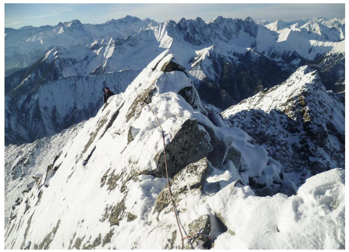
Fig. 11: On section R5–R6. Crucial section. Second participant reaching the pre-summit.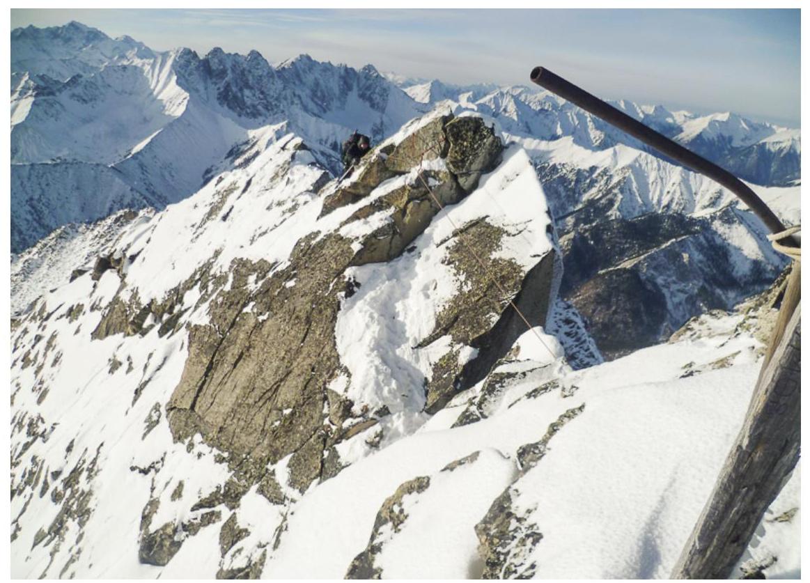
Fig. 12: On section R5–R6. Crucial section. Overcoming the dip between the pre-summit and the summit.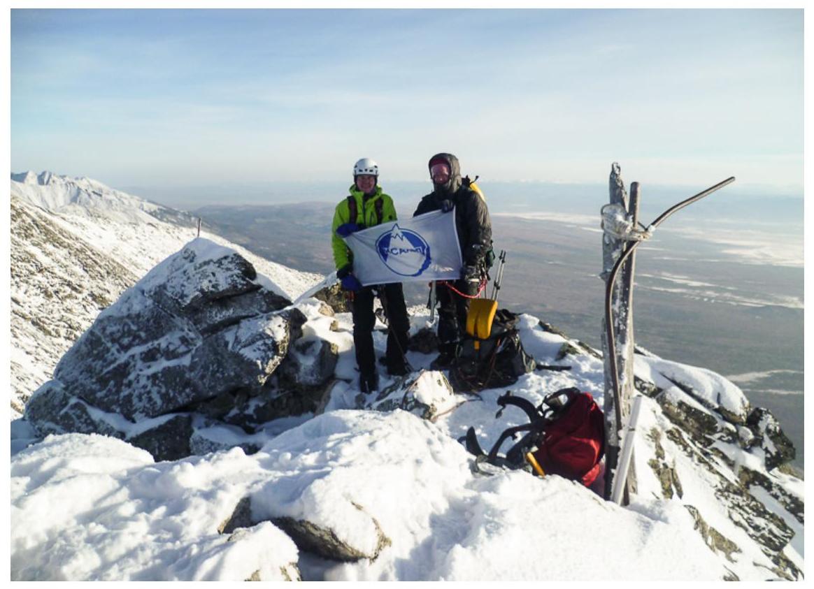
Fig. 13: Photograph from the summit. Kleshnin I. (left), Rudman A. (right), photo taken by Voylichenko S. on November 20, 2016, at 15:40 before the descent.


