Ascent Certificate for Goretz Zapadny 2461 m – Goretz Vostochny 2457 m, via the Western Couloir, traverse, category III complexity.
- Eastern Sayan, Tunka Goltsy ridge, Serebryanoe valley (Vetryany region), section 6.1.2.
- Traverse of peaks Goretz Zapadny 2461 m – Goretz Vostochny 2457 m, via the Western Couloir.
- Proposed category III complexity, first ascent.
- Route type — rocky terrain.
- Height difference — 500 m, distance — 900 m, average slope — 20°.
- Pitons hammered: rock and wired — 15 pcs.
- Team's walking hours — 7 hours.
- No overnight stays on the route.
- Team members:
- Afanasiev A.E. — Master of Sports
- Karelov P.S. — 3rd sports category
- Mordovin A.A. — 3rd sports category
- Rasskazov D.V. — 3rd sports category
- Rozhin A.Yu. — 2nd sports category
- Coach — Afanasiev A.E. — Master of Sports
- Summit ascent and descent on October 24, 2013.
Route Description for the Ascent on Goretz Zapadny 2461 m – Goretz Vostochny 2457 m, via the Western Couloir, traverse, category III complexity.
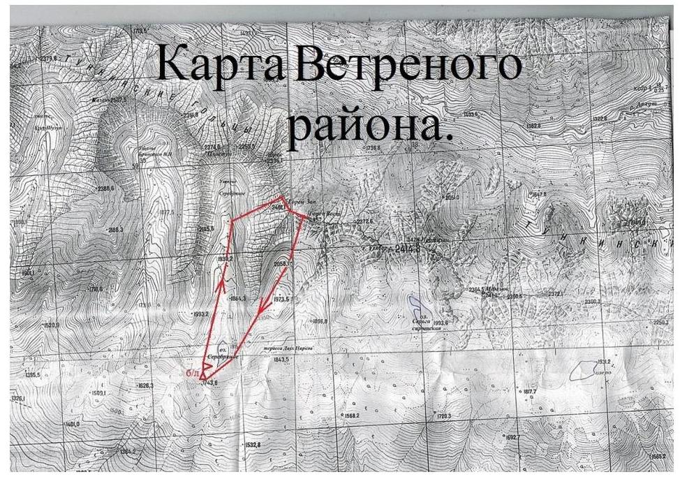
From the base camp at Serebryanoe lake or at the Terrace of two glacial cirques, it takes 1-1.5 hours to approach the route. The route starts from the Serebryany valley cirque, at the entrance of the western couloir of Goretz Zapadny peak, at an approximate height of 2050 m.
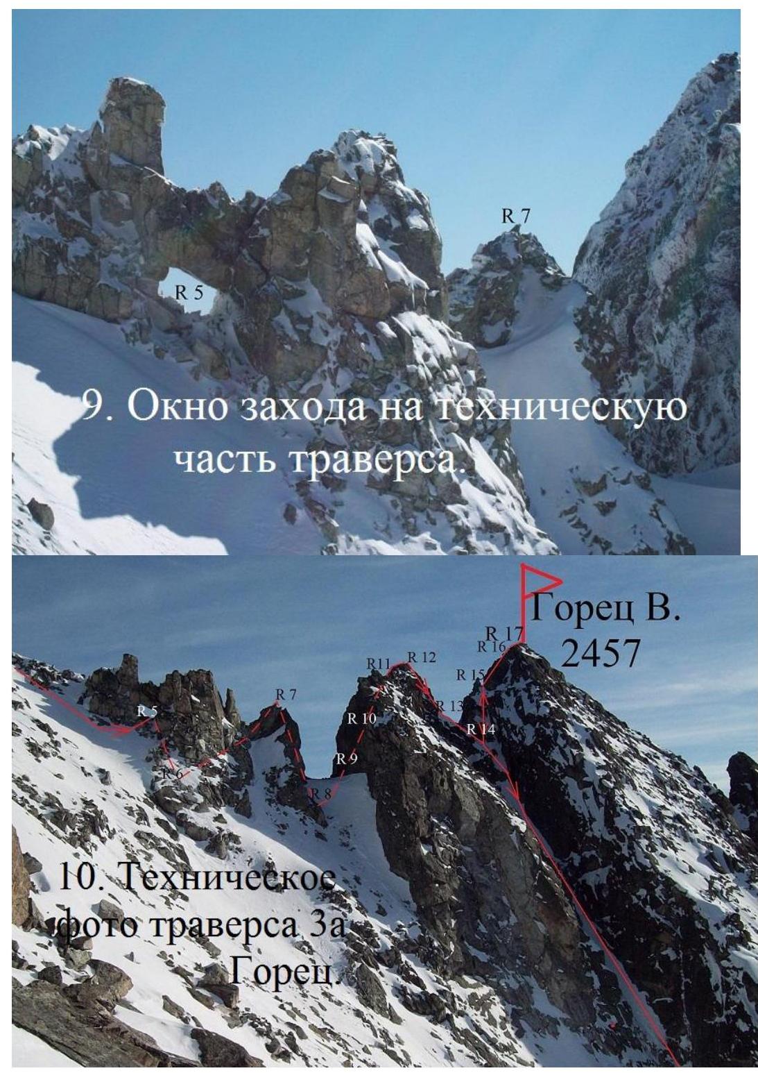
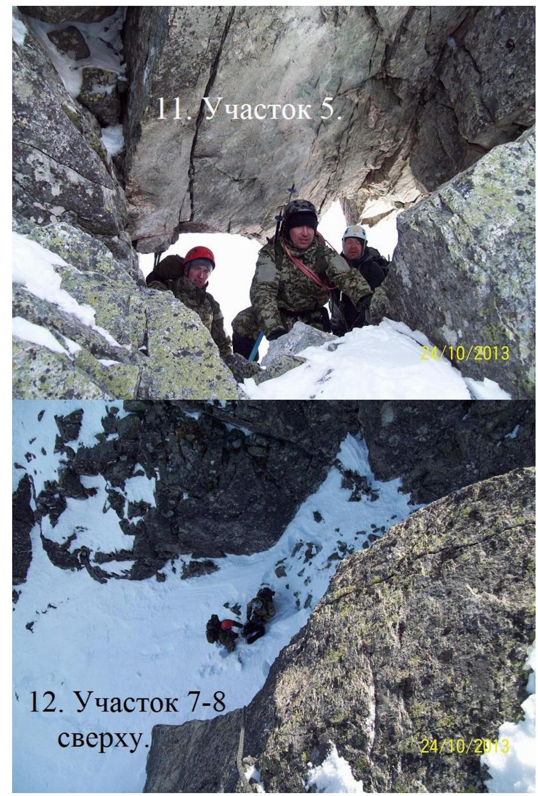
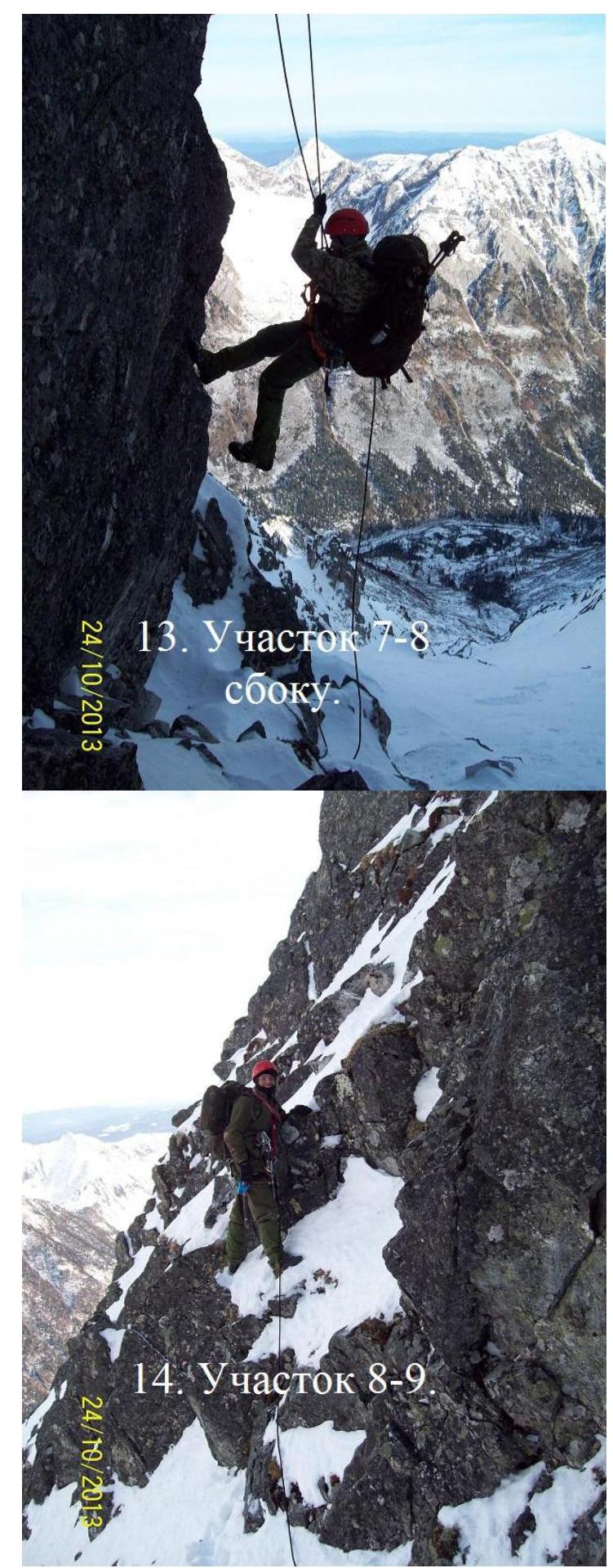
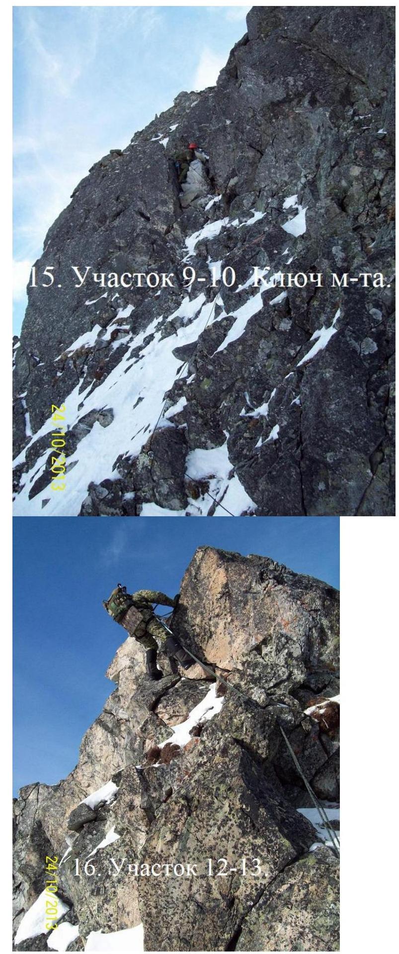
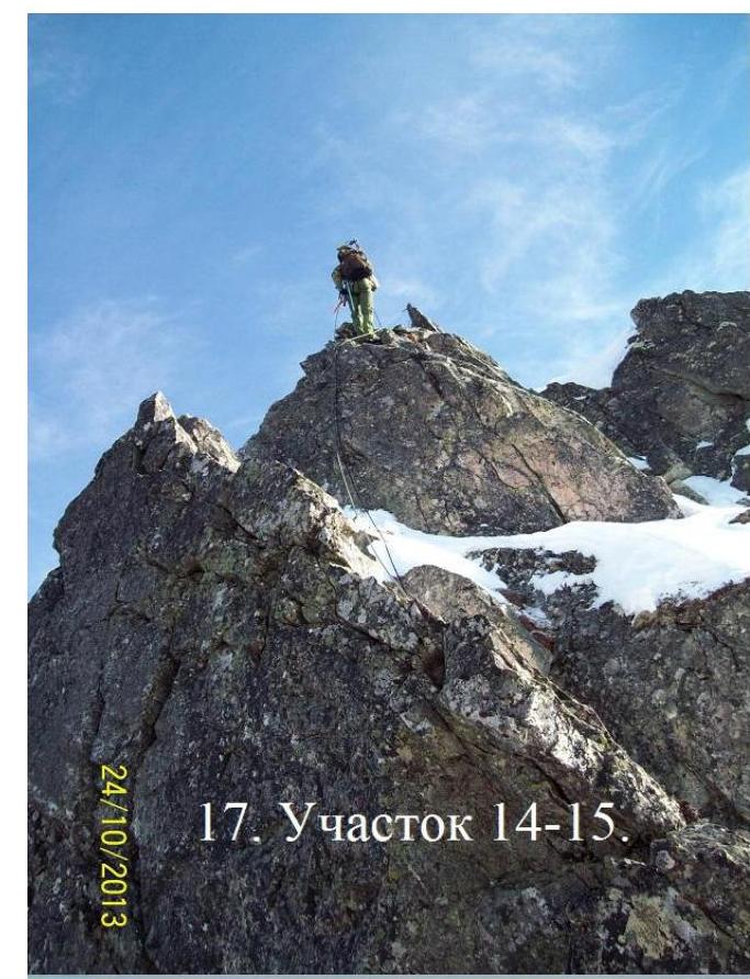
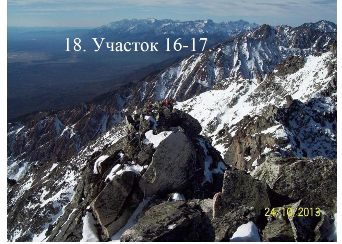
Section R0–R1 350 m height gain, 35°, grade 1. Snowy couloir within rocky outcrops. Leads to the northern ridge of Goretz 3 peak, onto a connecting ridge between the Gayduk gendarme and the summit tower. The connecting ridge is on the main ridge of Tunka Goltsy between Serebryanoe and Arkhut valleys. Section R1–R2 60 m, 50°, grade 2. Rocky slope of the flat northern ridge. Leads to a more gentle, large-block ridge section. Section R2–R3 50 m, 40°, grade 1. Wide ridge with large outcrops. Leads to Goretz Zapadny summit 2461 m. Section R3–R4 80 m, grade 1. Gentle, jagged ridge to the eastern sub-summit of Goretz Zapadny. Section R4–R5 50 m, 30°, grade 1. Slope to the right of the ridge, to a "window", a large through-hole in the rocky ridge. Section R5–R6 6 m down, 40°, grade 1. Snowy couloir down to the left of the ridge. Section R6–R7 20 m, 45°, grade 2. To the left of the ridge, up onto a gendarme. Section R7–R8 20 m, 90°, grade 5. Rappelling from the gendarme onto a connecting ridge. Section R8–R9 15 m, 60°, grade 4. Rocky outcrop with distinct holds, 5 meters to the left of the connecting ridge. Section R9–R10 10 m, 90°, grade 5. Destroyed chimney. The key section of the route. Section R10–R11 15 m, 60°, grade 3. Rocky outcrops leading to the second gendarme. Section R11–R12 12 m, 0°, grade 3. Along the sharp ridge of the gendarme, to the edge overlooking the connecting ridge. Section R12–R13 15 m, 80°, grade 4. Rappelling down to the connecting ridge in front of the summit tower. Section R13–R14 4 m, 0°, grade 2. Traverse to the right of the ridge, across yellow rocks. Section R14–R15 17 m, 80°, grade 4. Inner corner, loose rocks present. Leads to the ridge. Section R15–R16 18 m, 60°, grade 3. Ridge wall. Leads to the sub-summit. Section R16–R17 45 m, 3°, grade 2. Sharp sub-summit ridge. Roped, sliding carabiner belay. Leads to Goretz Vostochny summit 2457 m.
Descent to the west, via the ascent route, down to the connecting ridge — 1 rappel. Then, left along the route, into the snow-covered couloir with southern exposure: 1 rappel, 1 sport descent. Preliminary rockfall clearing necessary! Potential avalanche danger!
Map of Vetryany region.
-
Panorama of Vetryany, from Tunka valley to the right.

-
Overview photo of Goretz peak
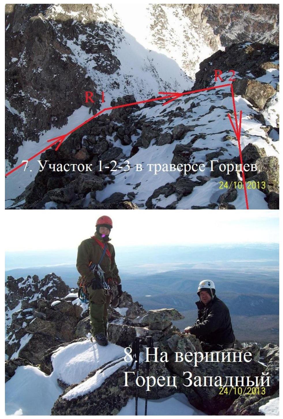
3. At the summit of Goretz Zapadny
-
Beginning of the Goretz Z.–V. traverse.
-
Section R7–R8 from above.
-
Approach to R8–R9.
-
Section R9–R10. Key section of the route.
-
Section R14–R15.
-
Section R16–R17.
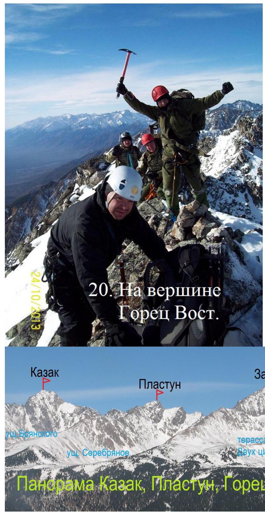
Goretz, Kazak, Plastun, Zapadny, Vostochny.