Ascent Certificate for v. Gorets Zapadny, 2461 m, via the Southern Ridge, cat. 2A
- East Sayan, Tunkinskie Goltsy ridge, Terrace of two cirques (Vetryany region), section 6.1.2.
- Peak Gorets Zapadny, 2461 m, via the Southern Ridge.
- Proposed category 2A, first ascent.
- Route type — rock.
- Height difference — 450 m, length — 860 m, average steepness — 30°.
- Pitons hammered: rock and chocks — 6 pcs.
- Team's travel time — 5 hours.
- No overnight stays on the route.
- Group: Vasiliev M.Yu. 2nd sports category Afanasiev A.E. MS Vorobyov P.Yu. 3rd sports category Golovin V.V. 2nd sports category Geidarov K.G. 2nd sports category Marchukov K.F. 2nd sports category Rasskazov D.V. 3rd sports category Senatorov A.V. 3rd sports category Tashlykov V.A. 3rd sports category
- Coach Afanasiev A.E. MS
- Ascent to the summit and return on April 26, 2011.
Description of the ascent route to v. Gorets Zapadny, 2461 m, via the Southern Ridge, cat. 2A
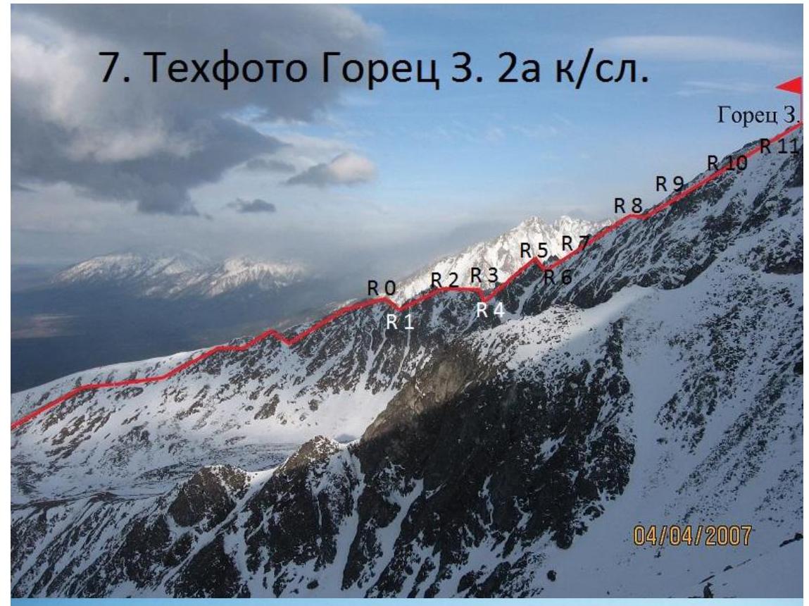
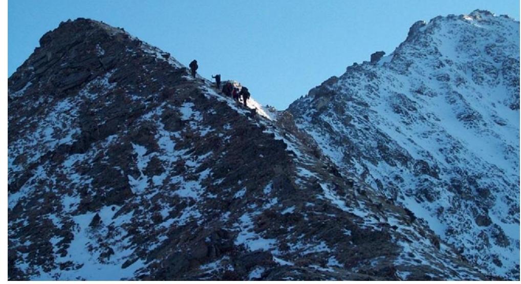
From the base camp on Serebryanoe Lake to the rappel is 1.5 hours walk along the southern ridge, which is the watershed between Serebryanoe gorge and the Terrace of two cirques. Here is a limited area for tying in and putting on crampons. Start of the route.
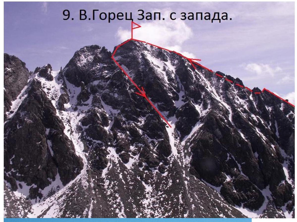
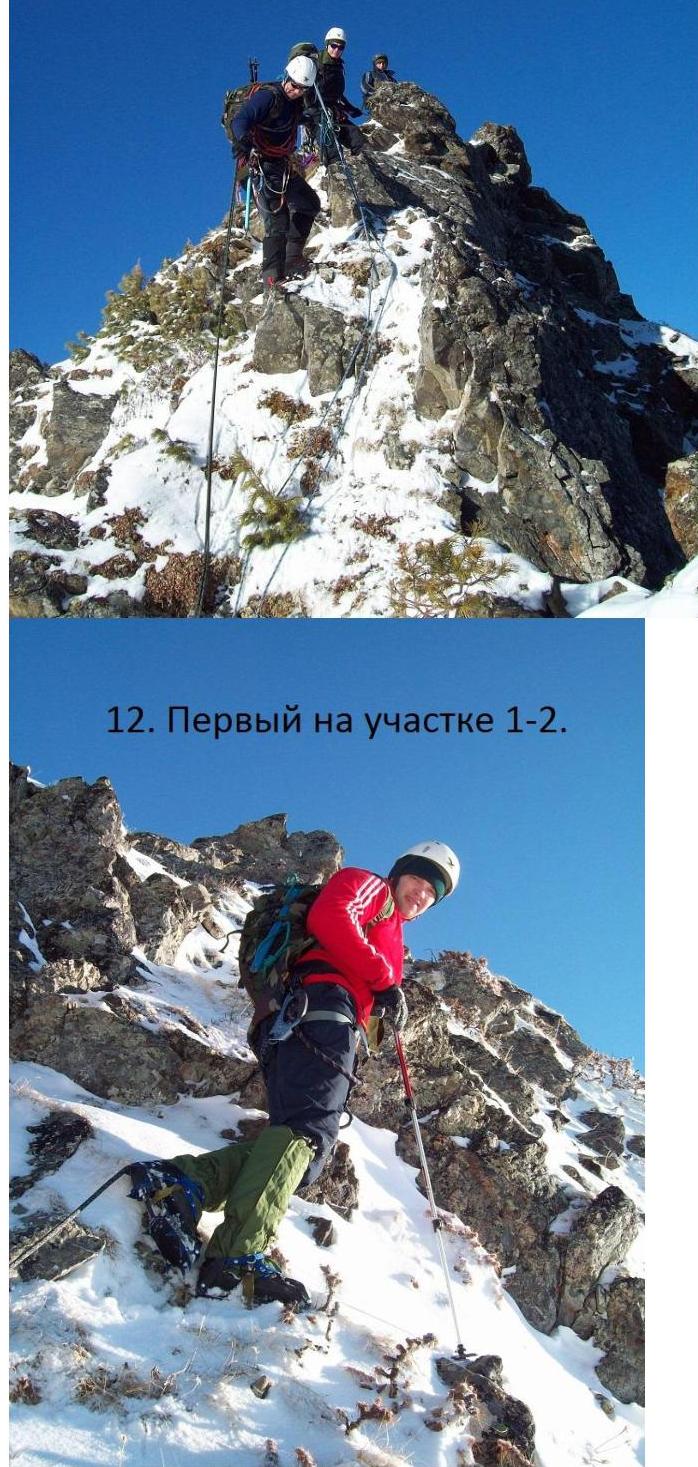
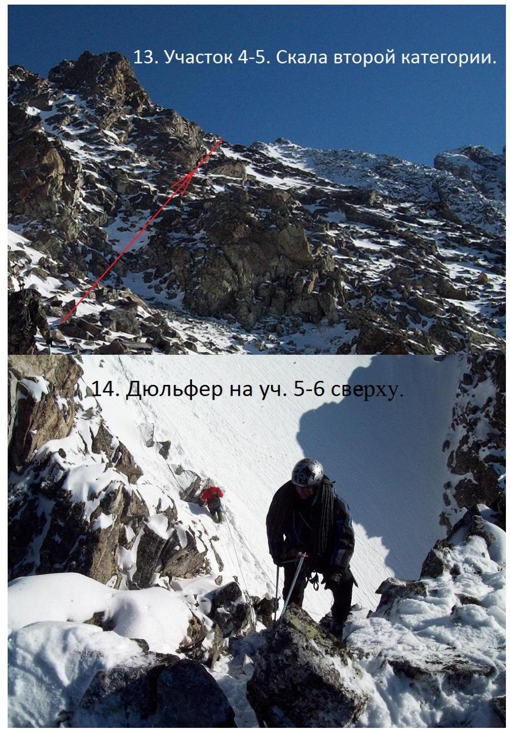
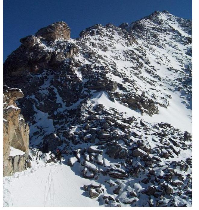
Sect. R0–R1 15 m, 60°, 3rd cat. Sport descent to a saddle on the ridge. Sect. R1–R2 20 m, 50°, 2nd cat. Grassy rocks. Roped along protrusions. Sect. R2–R3 40 m, 45°, 1st cat. Ridge is grassy. Sect. R3–R4 100 m, 1st cat. Traverse of a horizontal ridge to a saddle. Sect. R4–R5 150 m, 50°, 2nd cat. Gendarme is passed on the right side. Piton belay. Sect. R5–R6 20 m, 70°, 3rd cat. Rappel from the gendarme. Sect. R6–R7 20 m, 40°, 1st cat. Traverse of a snow slope. Sect. R7–R8 30 m, 30°, 1st cat. Destroyed ridge. Sect. R8–R9 120 m, 40°, 1st cat. To the right of the ridge. Sect. R9–R10 50 m, 35°, 1st cat. Ridge. Sect. R10–R11 180 m, 30°, 1st cat. To the right of the ridge. Sect. R11–R12 80 m, 25°, 1st cat. Pre-summit gendarme is bypassed on the right. Sect. R12–R13 40 m, 5°, 1st cat. Along the ridge to the Western summit of Gorets, 2461 m.
Descent to the north along the ridge to a saddle and then left into a snow-filled couloir with western exposure, i.e., left in the direction of descent. The couloir may be avalanche-prone. It is necessary to test it with rocks beforehand.
| v. Gorets Zap. 2A | Length, m | Steepness, ° | Complexity | Number of pitons | chocks | |
|---|---|---|---|---|---|---|
| 13 | ||||||
| 12 | 40 | 5 | 1 | |||
| 11 | 80 | 25 | 1 | |||
| 10 | 180 | 30 | 1 | |||
| 9 | 50 | 35 | 1 | |||
| 8 | 120 | 40 | 1 | |||
| 7 | 30 | 30 | 1 | |||
| 6 | 20 | 40 | 1 | |||
| 5 | 15 | 65 | 3 | |||
| 4 | 150 | 50 | 2 | 2 | 2 | |
| 3 | 100 | 0 | 1 | |||
| 2 | 40 | 45 | 1 | |||
| 1 | 20 | 50 | 2 | 1 | ||
| 0 | 15 | 60 | 3 | 1 |
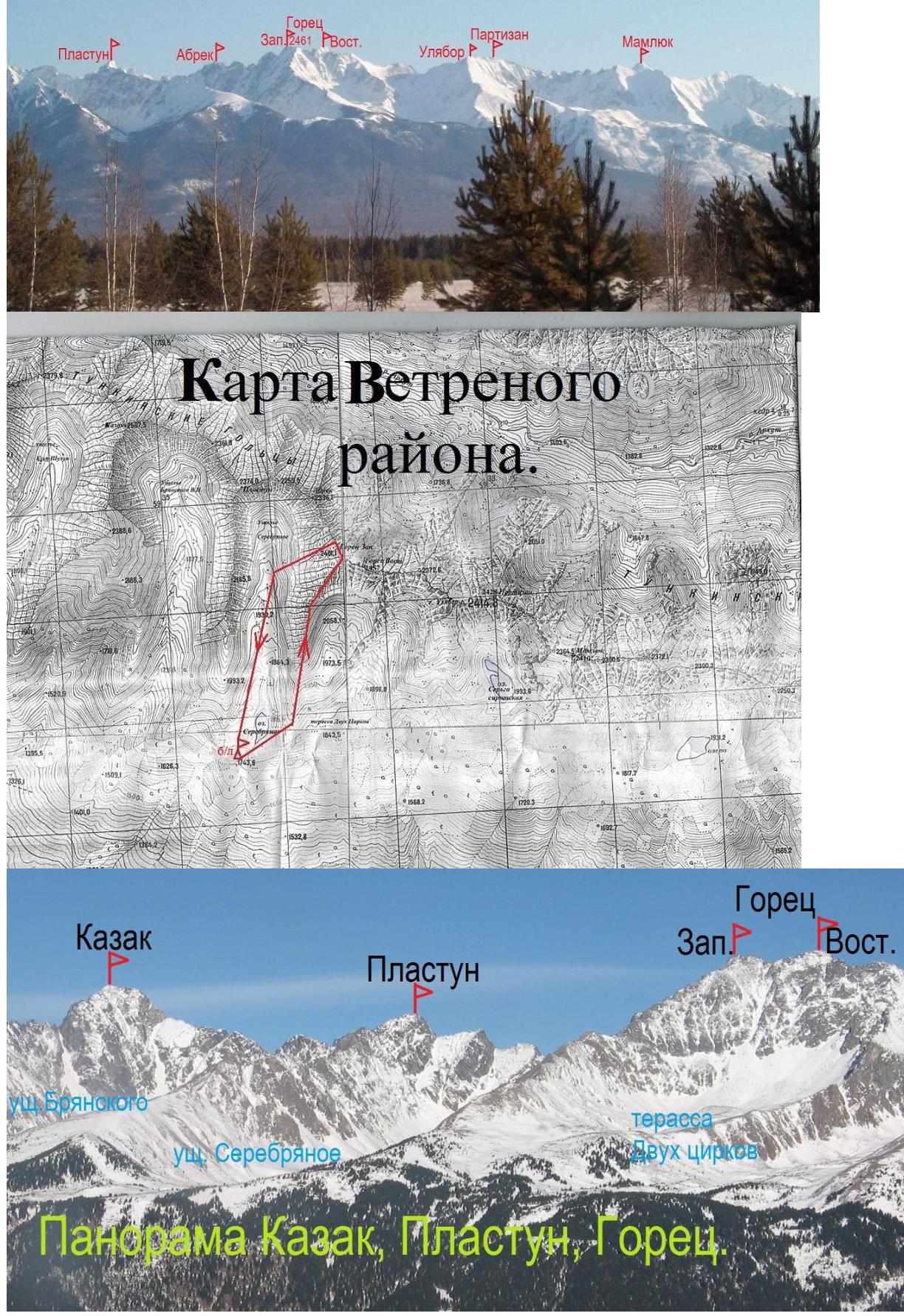
- Panorama of Vetryany from the Tunkinskaya valley to the right.
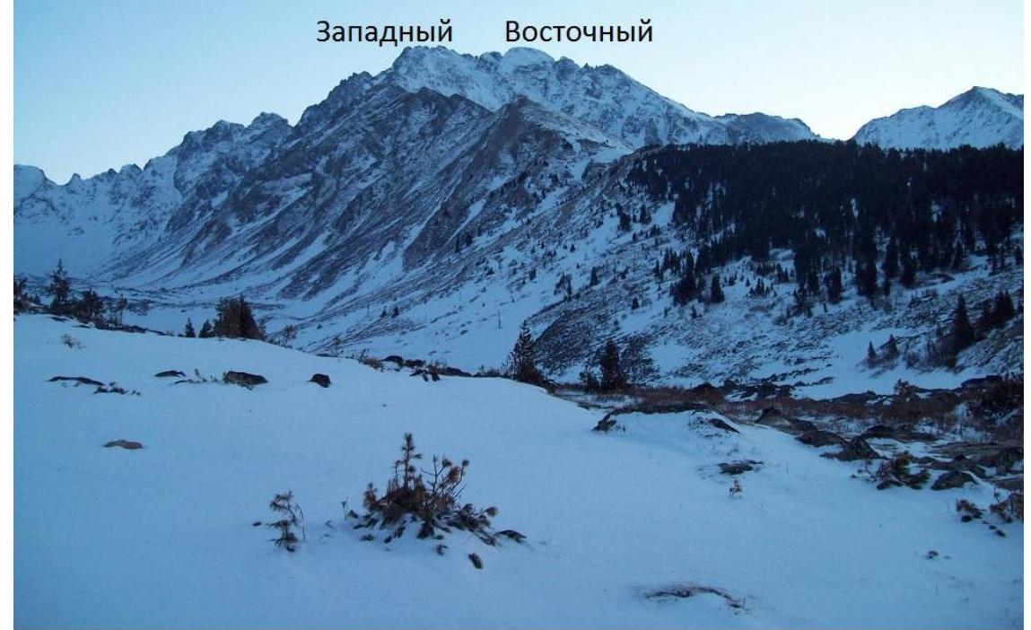
- General view of v. Gorets from Serebryanoe gorge.
- Approach to section R0.
- Rappel on section R0–R1.
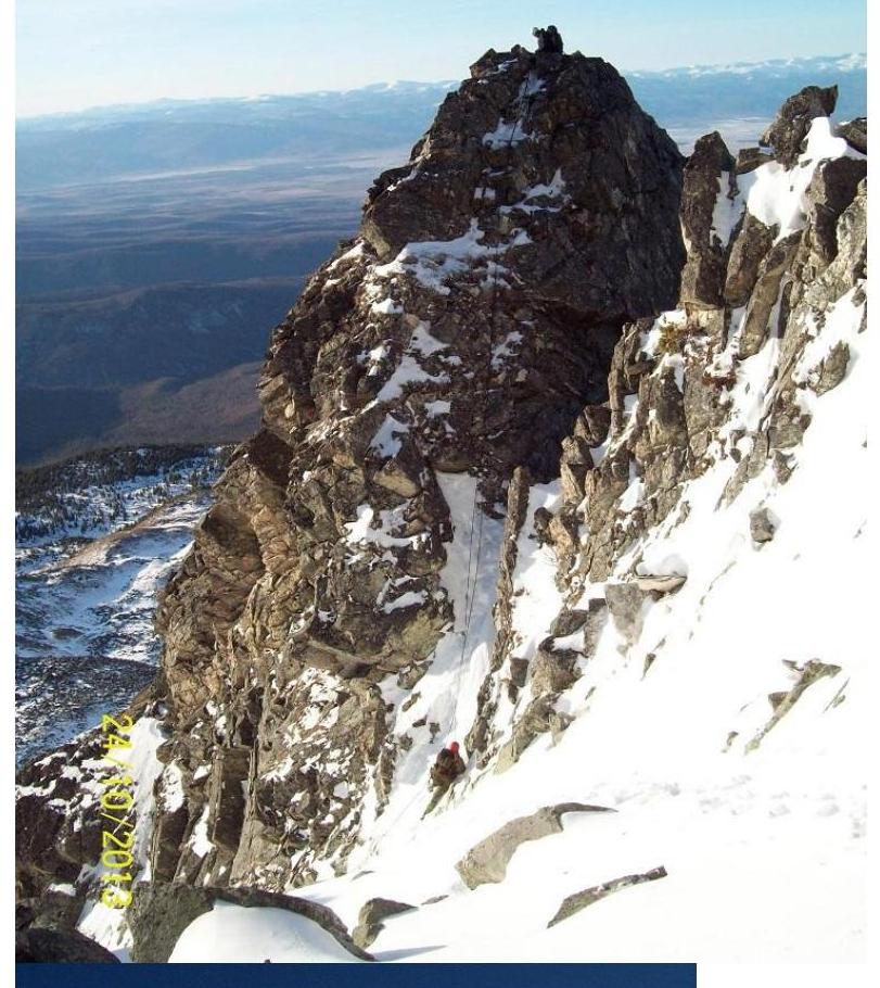
- Rappel on sect. R5–R6 from above.
15. Rappel on section R5–R6.
- Ridge above section R7.
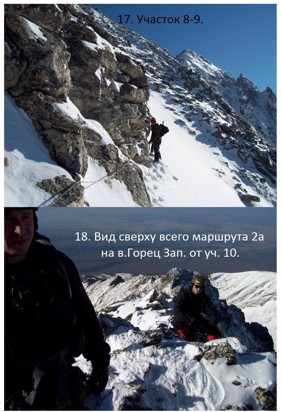
- Top view of the entire 2A route on v. Gorets Zap. from sect. R10.

- On the summit of Gorets Zap.

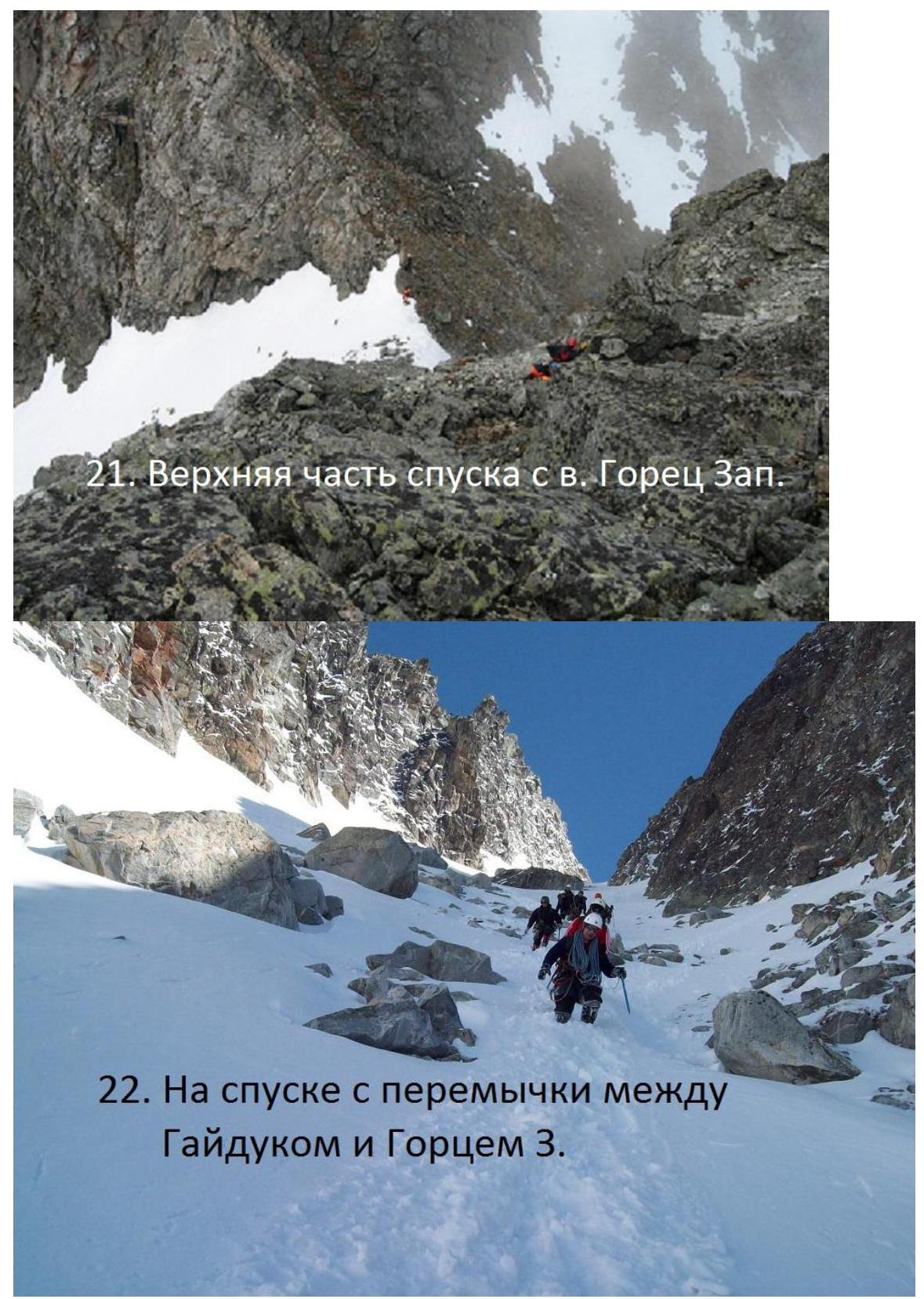
- On descent from the saddle between Gaiduk and Gorets 3.