Report
On the first ascent to the summit of General Koryakov via the SE couloir of the SW ridge, category 2B, by the team "Невозможно это не навсегда" (It's impossible not to be forever) from March 27 to March 27, 2019.
2019
I. Ascent Passport
| № | 1. General Information | |
|---|---|---|
| 1.1 | Full name, sports rank of the leader | Pyotrko Pavel Vladimirovich, 1st sports rank |
| 1.2 | Full name, sports rank of participants | Pyotrko Pavel Vladimirovich, 1st sports rank Panova Alena Mikhailovna, CMS Abramov Grigory Alexandrovich, Badge Kiselnikov Pavel Alexandrovich, Badge Kozyreva Alena Timofeevna, Badge Desyatova Darya Nikolaevna, Badge Mashtakova Natalia Gennadievna, Badge |
| 1.3 | Full name of coach | Glazunov Evgeny Vladimirovich |
| 1.4 | Organization | Gory Baikala (Baikal Mountains) |
| 2. Characteristics of the ascent object | ||
| 2.1 | Region | Eastern Sayan, Tunkinskie Goltsy ridge |
| 2.2 | Valley | Ulan-gol |
| 2.3 | Section number according to the 2013 classification table | |
| 2.4 | Name and height of the summit | General Koryakov summit (3032 m) |
| 2.5 | Geographical coordinates of the summit (latitude, longitude), GPS coordinates | 51.49° 101.26° |
| 3. Route characteristics | ||
| 3.1 | Route name | SE couloir of the SW ridge |
| 3.2 | Proposed category of complexity | 2B |
| 3.3 | Route освоенности (degree of освоенность?) | First ascent |
| 3.4 | Relief characteristics of the route | Combined |
| 3.5 | Height difference of the route (according to altimeter or GPS data) | 600 m |
| 3.6 | Route length (in meters) | 1180 m |
| 3.7 | Technical elements of the route (total length of sections of various complexity categories with indication of relief character (ice-snow, rocky)) | 1st category, rocks — 200 m 2nd category, combination — 900 m 3rd category, rocks — 80 m rappel descent (on descent) — 1 rope 50 m |
| 3.8 | Descent from the summit | Via 2B category route, same as ascent |
| 3.9 | Additional route characteristics | Lack of water |
| 4. Team actions characteristics | ||
| 4.1 | Time of movement (team's walking hours, in hours and days) | 8 hours |
| 4.2 | Overnights | No |
| 4.3 | Start of ascent | 05:00, March 27, 2019 |
| 4.4 | Reaching the summit | 12:00, March 27, 2019 |
| 4.5 | Return to base camp | 16:00, March 27, 2019 |
| 5. Responsible for the report | ||
| 5.1 | Full name, e-mail | Kiselnikov Pavel Alexandrovich doc1339@yandex.ru |
II. Ascent Description
1. Characteristics of the ascent object
2. Route characteristics
Technical characteristics of route sections
| Section № | Relief character | Category of complexity | Length, m | Type and number of hooks |
|---|---|---|---|---|
| R0–R1 | rocky | 1st cat. | 200 m | - |
| R1–R2 | combined | 2nd cat. | 900 m | - |
| R2–R3 | rocky | 3rd cat. | 80 m | 4 placement elements |
| Section № | Description | | Approach | The approach from the base camp to the start of the ascent took 3 hours. We walked along the frozen river, bypassing the waterfalls. We reached the fork where two rivers merge, then went along the left tributary towards the couloir between the two ridges on the southeast side. It's easy to walk. | №2 | | R0–R1 | The ascent started at 8:00. The terrain before the couloir is mainly composed of stable large and medium-sized stones. It's easy to walk. | №4 | | R1–R2 | The couloir is 20-30 m wide; we ascended through the middle, with snow depth ranging from 0.5 m to 1 m in some places. The movement is challenging. | №5 | | R2–R3 | At the top of the couloir, there's a ridge. To the left, there's a 30 m vertical wall leading to the Pogon summit. To the right, a ridge leads to the General Koryakov summit, with a width of 1-1.5 m in some places. The conditions are difficult due to loose rock that crumbles at the slightest touch. We placed 4 placement elements for safe passage. We reached the summit at 12:00. | №6, №7 |
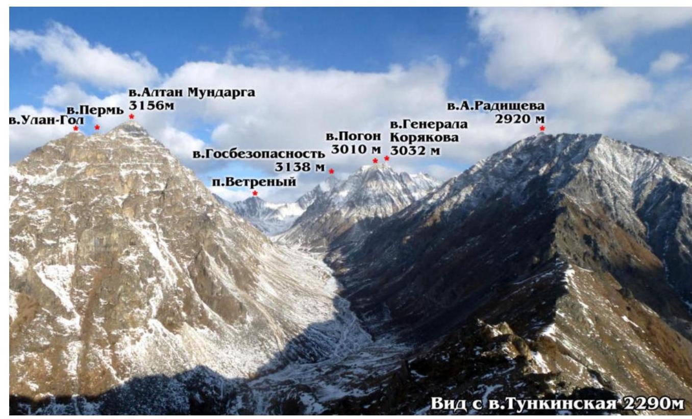 Figure 1 (General view of the valley)
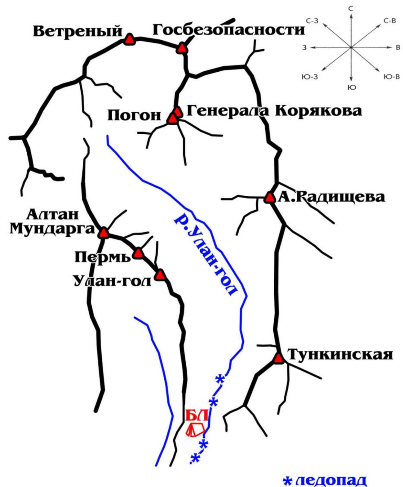 Figure 2 (Valley scheme)
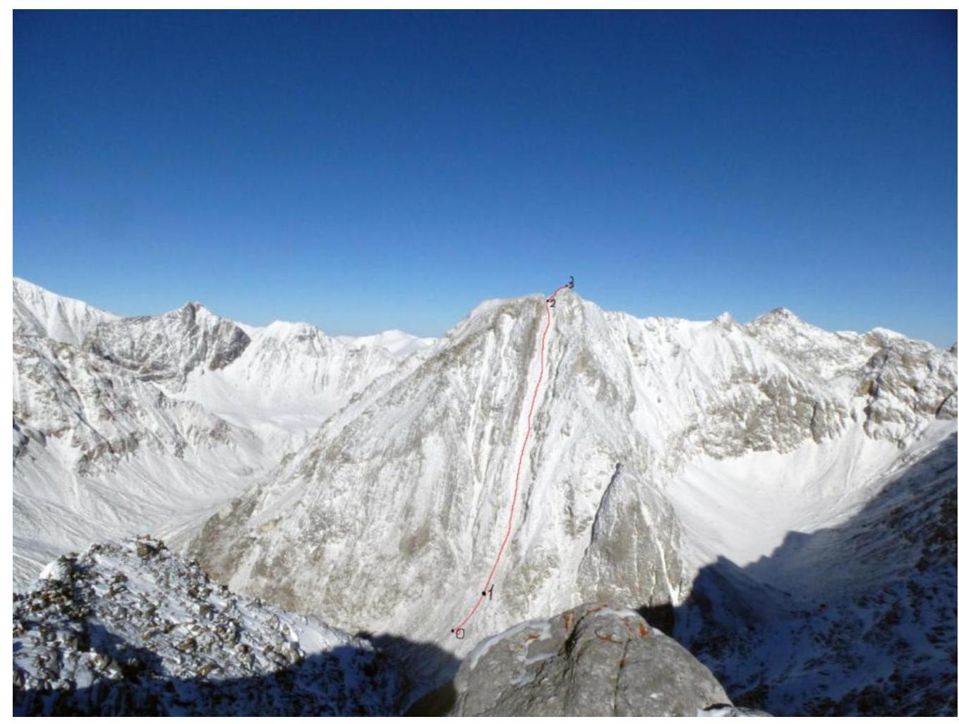 Figure 3 (Route scheme)
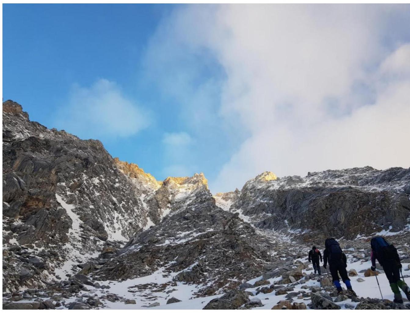 Figure 4 (Ascent on the first section)
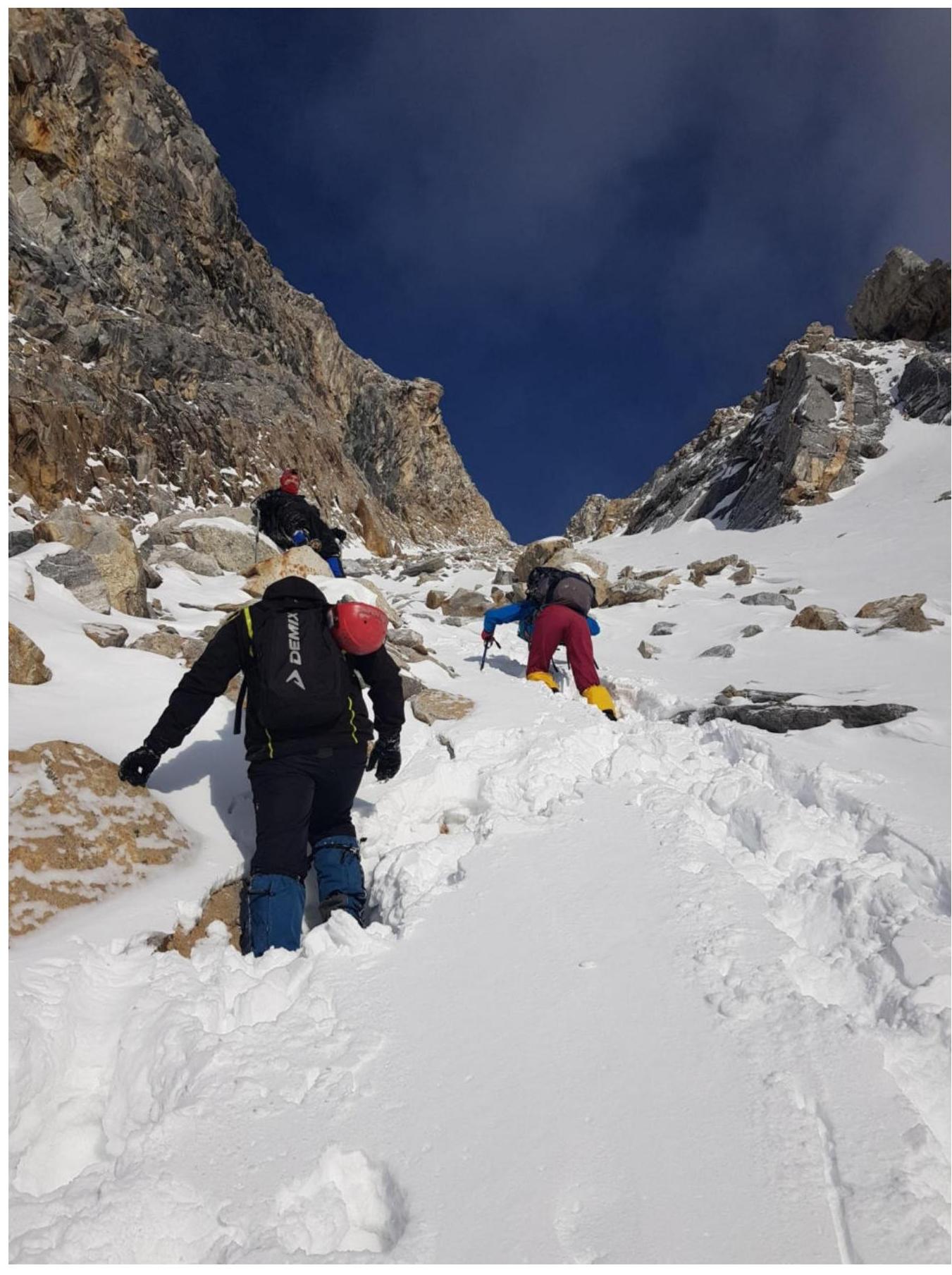 Figure 5 (Ascent on the second section)
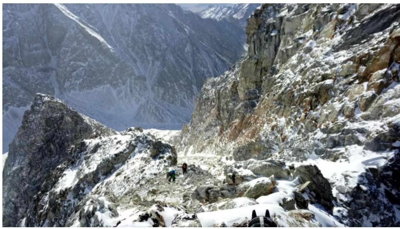 Figure 6 (Ascent on the third section)
 Figure 7 (At the summit)