Brief geographical description of the area
The peak "Burevestnik" (2929 m) is located in one of the lateral ridges of the Tunka Goltsy ridge in the Eastern Sayan Mountains. The Tunka Goltsy is the highest ridge in the Eastern Sayan Mountains, stretching in a latitudinal direction for 200 km. The highest point of the ridge reaches 3266 m above sea level in the upper reaches of the Ganga-Khairym gorge.
In general, the ridge has sharp alpine forms with deep gorges and wide glacial cirques. For over 100 km - from the Arshan resort in the east to the Shu-Mak pass in the west - there are many peaks in the ridge that are of great interest to climbers. The forest boundary on the southern slopes is 1800 m, on the northern slopes 1600-1700 m. The snow cover almost completely disappears by the end of summer. Glaciation is found only in the western part of the ridge.
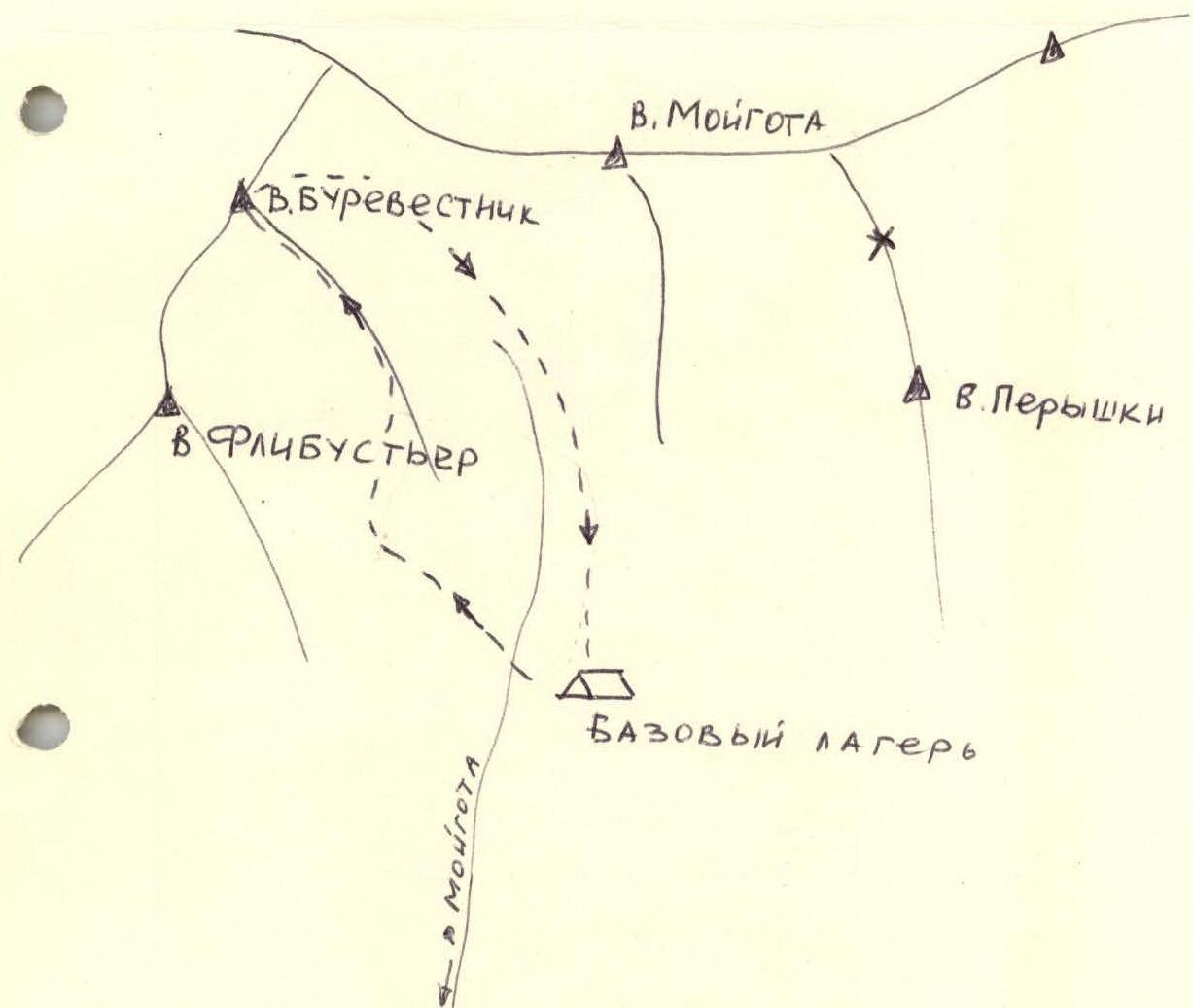
The peak "Burevestnik" has an elevation of 2929 m above sea level - the highest point in the area (Peak Per'ya 2996 m). The nearest settlements are Arshan and Tagarhay, 25-30 km away. There is a dirt road to the Moigota gorge. It takes 8 hours to reach the base camp on the forest boundary from the gorge.
From the base camp, ascend the gorge to the Moraine Ridge. 300-400 m later, turn left to the edge of the "Hanging Valley". Ascend via medium and large scree and rock sections.
Section R0–R1
From the edge of the "Hanging Valley", move right to the ridge. Connect on the ridge. Move simultaneously along the left slope. The ridge is 400 m long. Average steepness is 20°. (Photos 1, 2, 3, 4, 5).
Section R1–R2
Then, without reaching the ridge, ascend to the edge approaching from the left (0.5 rope length), and then up and right along a wide ledge - one rope length.
Descend to a small saddle - 5 m. (Photos 6, 7).
Section R2–R3
From the saddle, ascend with alternate belay (2 ropes). Belay through ledges and pitons. Rappel. Then move simultaneously. One rope length. (Photos 8, 9, 10, 11, 12, 13).
Section R3–R4
A gap in the ridge before the sub-summit. Descend via slabs, 2 ropes of 40 m, sport climbing style. The last one descends on a double rope. Belay through ledges and pitons. (No photos on this section, camera was lost).
Section R4–R5
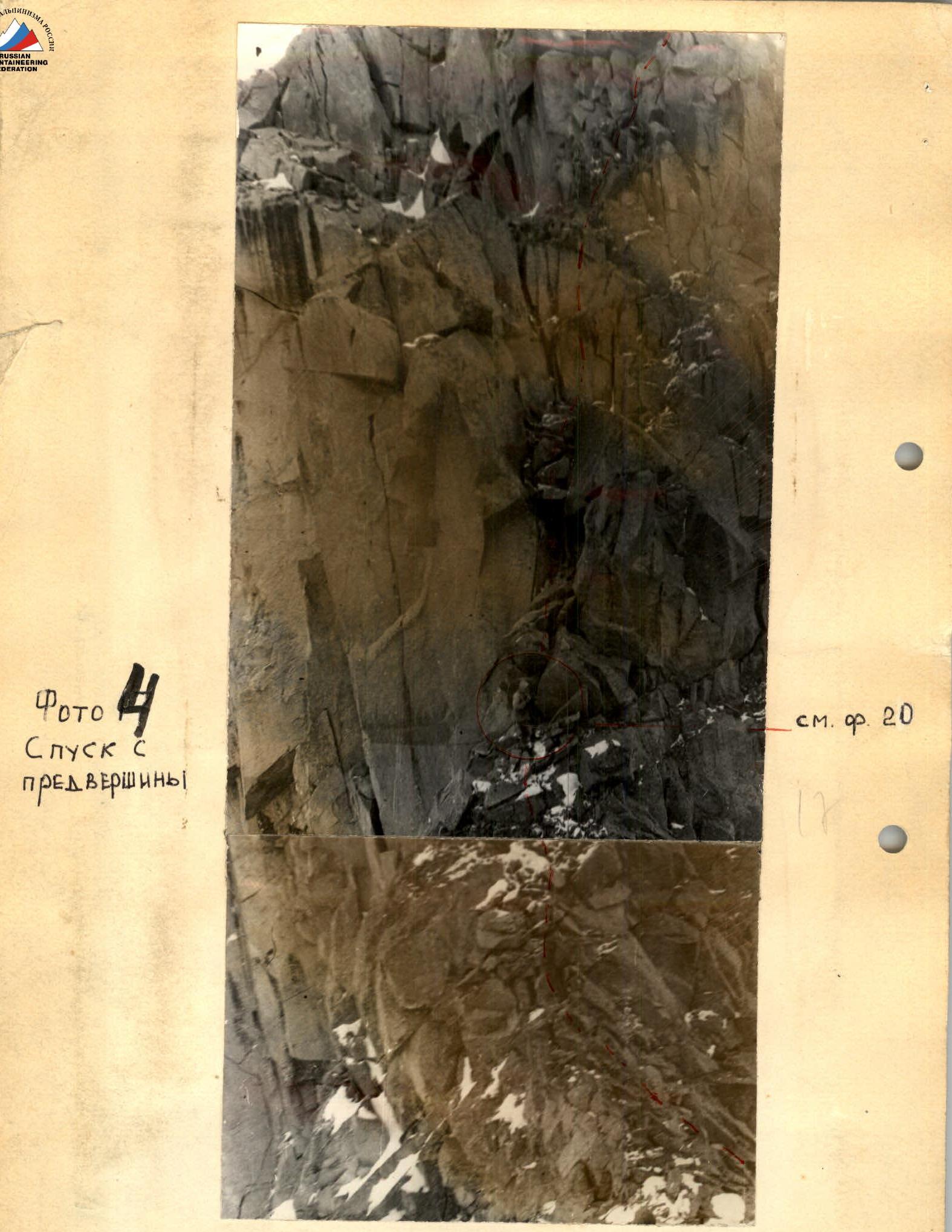
Ascend to the sub-summit mainly simultaneously. At times, use alternate belay on short sections. (Photos 14–23).
Section R5–R6
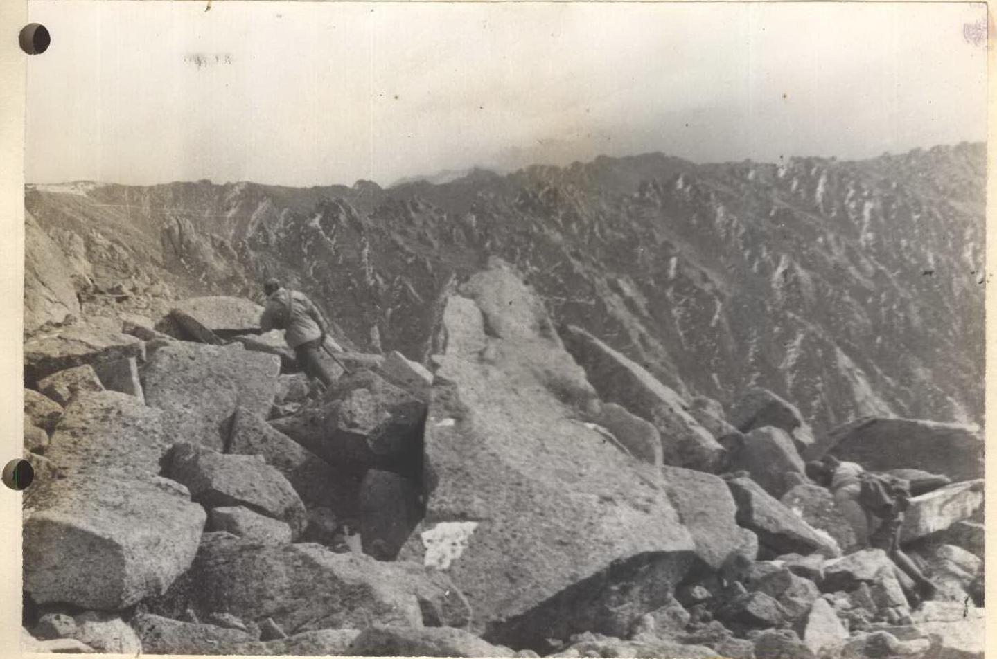
Descend from the sub-summit to the right along a short section of the ridge. Belay is alternate through ledges and pitons. Two 40 m ropes, sport climbing style. The last one descends on a double rope. Then a narrow, destroyed ridge leads to a connecting ridge. 1 rope length. Belay is alternate through ledges. (Photos 24–28).
Section R6–R7
From the connecting ridge, ascend to the summit via large scree with short rock sections, moving simultaneously. (Photos 29, 30, 31). Descend from the summit initially via the ascent route to the connecting ridge, then left via large scree into the main valley (Photo 32).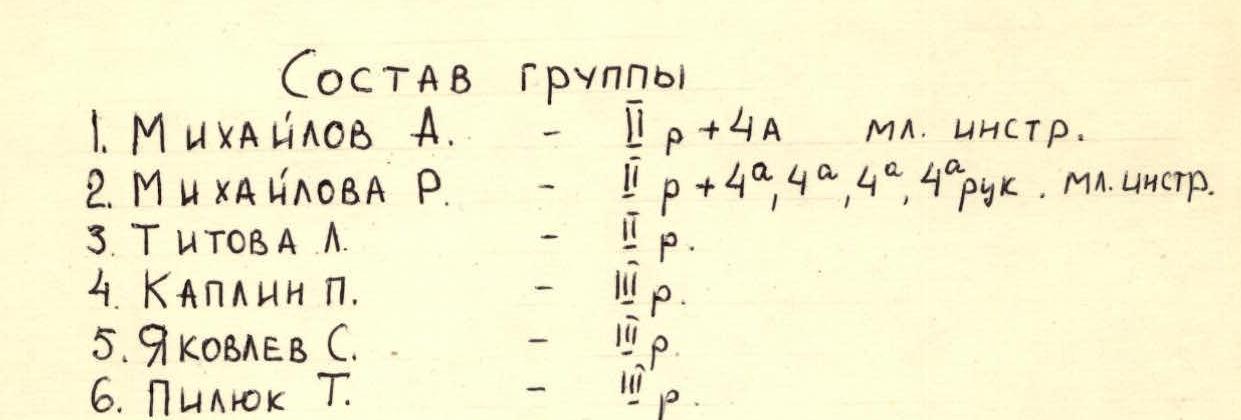
The group believes that in these conditions, the route corresponds to category 2.0 difficulty. The route takes 8 hours + 4 hours for approach and return.
Leader: Mikhailov.
Table of main route characteristics. Ascent route to peak "Burevestnik" 2929 m.
- Elevation gain – 750–800 m.
- Including the most difficult sections. Steepness of the route.
| Sections | Average steepness | Length, m | Terrain type | Technical difficulty | Method of overcoming and belay | Weather conditions | Time: Stopped at bivouac | Time: Climbing hours | Pitons: Rock | Pitons: Ice | Pitons: Bolts |
|---|---|---|---|---|---|---|---|---|---|---|---|
| R0–R1 | 20° | 400 | Rocks, Snow | 1 | Free climbing, simultaneous | Overcast, calm | 0 | 0 | 0 | ||
| R1–R2 | 170 | Rocks, snow, ledge | 2 | Free climbing, simultaneous, alternate, pitons, ledges | 1 | 0 | 0 | 0 | |||
| R2–R3 | 50° | 100 | Rocks | 3 | Free climbing, alternate, pitons | 2 | 0 | 0 | |||
| R3–R4 | 50° | 80 | Slabs, short walls | 3 | Sport climbing descent, on double rope | Overcast, weak wind, cold | 3 | 0 | 0 | ||
| R4–R5 | 45° | 120 | Rocks, Snow | 1 | Free climbing, simultaneous, alternate, pitons | 0 | 0 | 0 | |||
| R5–R6 | 60°–65° | 90 | Rocks | 3 | Sport climbing descent, on double rope | 4 | 0 | 0 | 0 | ||
| R6–R7 | 35° | 250 | Snow, Rocks | 1 | Free climbing, simultaneous, alternate, pitons | 0 | 0 | 0 | |||
| R7–R8 | 35° | 250 | Snow, rocks | 1 | Free climbing, simultaneous, alternate, pitons | 0 | 0 | 0 |
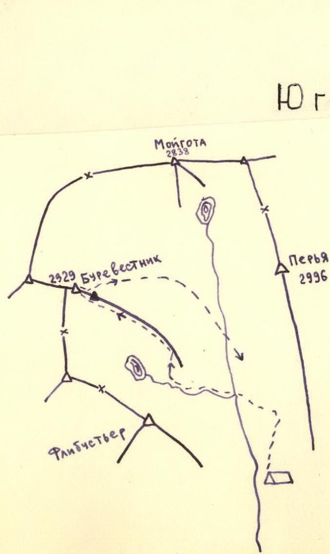
Map of the area
Sub-summit
 Photo 3. Descent from the sub-summit to the connecting ridge.
Peak Burevestnik
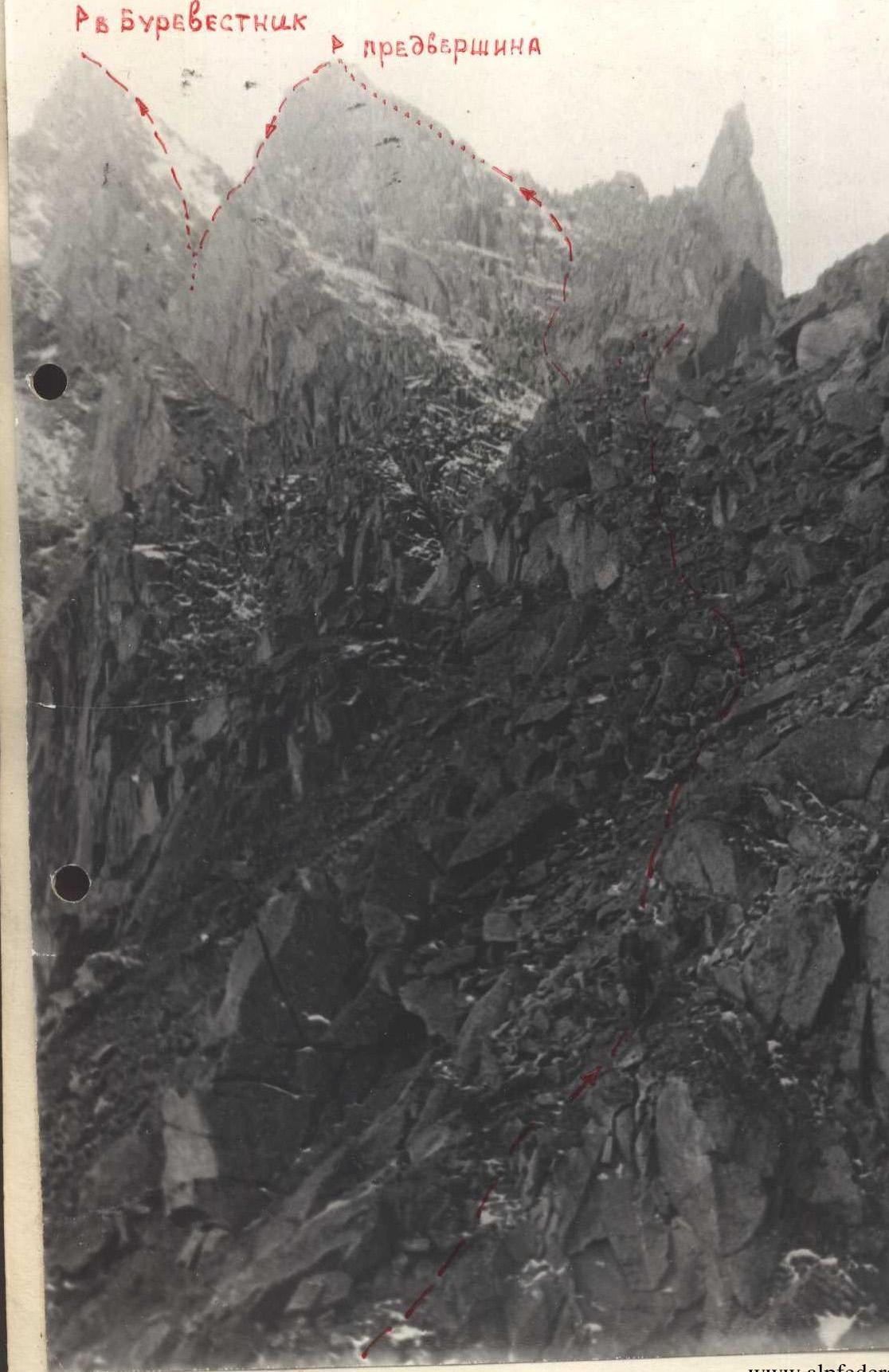 Photo 1. Peak Burevestnik.
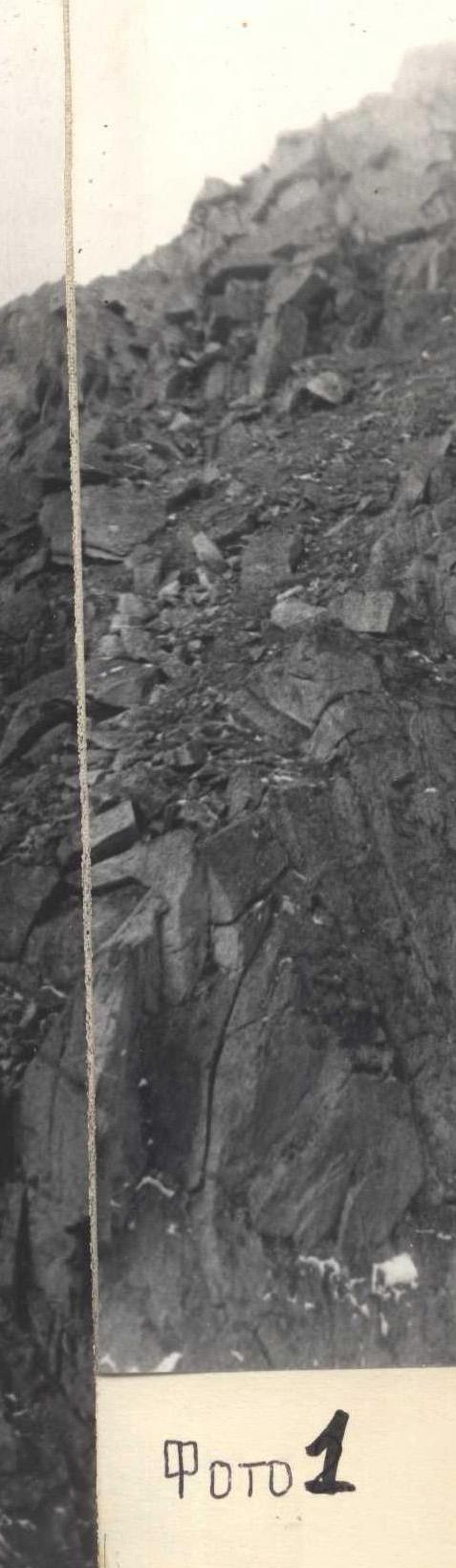
Photo 4. Descent from the sub-summit.
Photo 2.
 Peak Burevestnik.
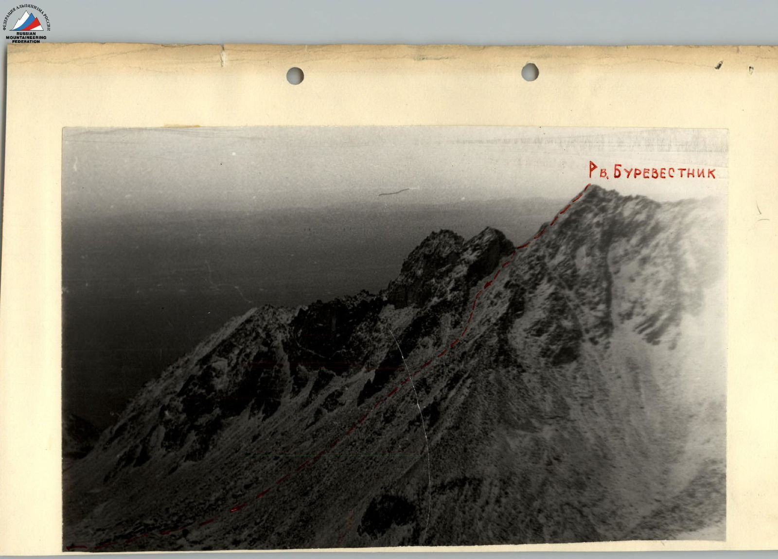 South-eastern ridge of peak Burevestnik (2929 m). Moigota gorge.