Report on the First Ascent
To the peak Brig 2499 m. Via the Central Counterfort of the Eastern Wall. Approximately 4A category of difficulty.
Passport of the Ascent
Region — Eastern Sayan, Tunka Goltsy, Kyngarga gorge. Peak — Brig 2499 m. Coordinates of the peak: 51°58′55.27″ N 102°21′28.08″ E. Route — via the Central Counterfort of the Eastern Wall, proposed category 4A. First ascent.
Route nature — combined.
Route characteristics:
-
Height difference: 260 m.
-
Route length: approximately 340 m.
-
Length of sections:
- cat. diff. 5 — 80 m
- cat. diff. 6 — 20 m
-
Average steepness of the route: 60°.
Left on the route — pitons 0.
Pitons used on the route: 31, including:
- "cam" — 14
- bolt pitons — 0
- ITO — 2.
Number of climbing hours — 5, days 1, no overnight stays. Leader — Sergey Vladimirovich Glazunov — 1st sports category. Participant — Evgeny Vladimirovich Glazunov — Master of Sports. Date of departure: to the route from Base Camp 26 October 2013 at 07:00. To the peak 26 October 2013 at 15:00. Return to Base Camp — 26 October 2013 at 17:00.
Approach to the route from the wide couloir between the peaks Bratchan and Brig, start of the route — from the upper part of the aforementioned couloir, at the base of the central, pronounced rocky counterfort with cornices, of the peak Brig.
General view of the peak Brig and the climbed route (taken from the peak Bratchan)
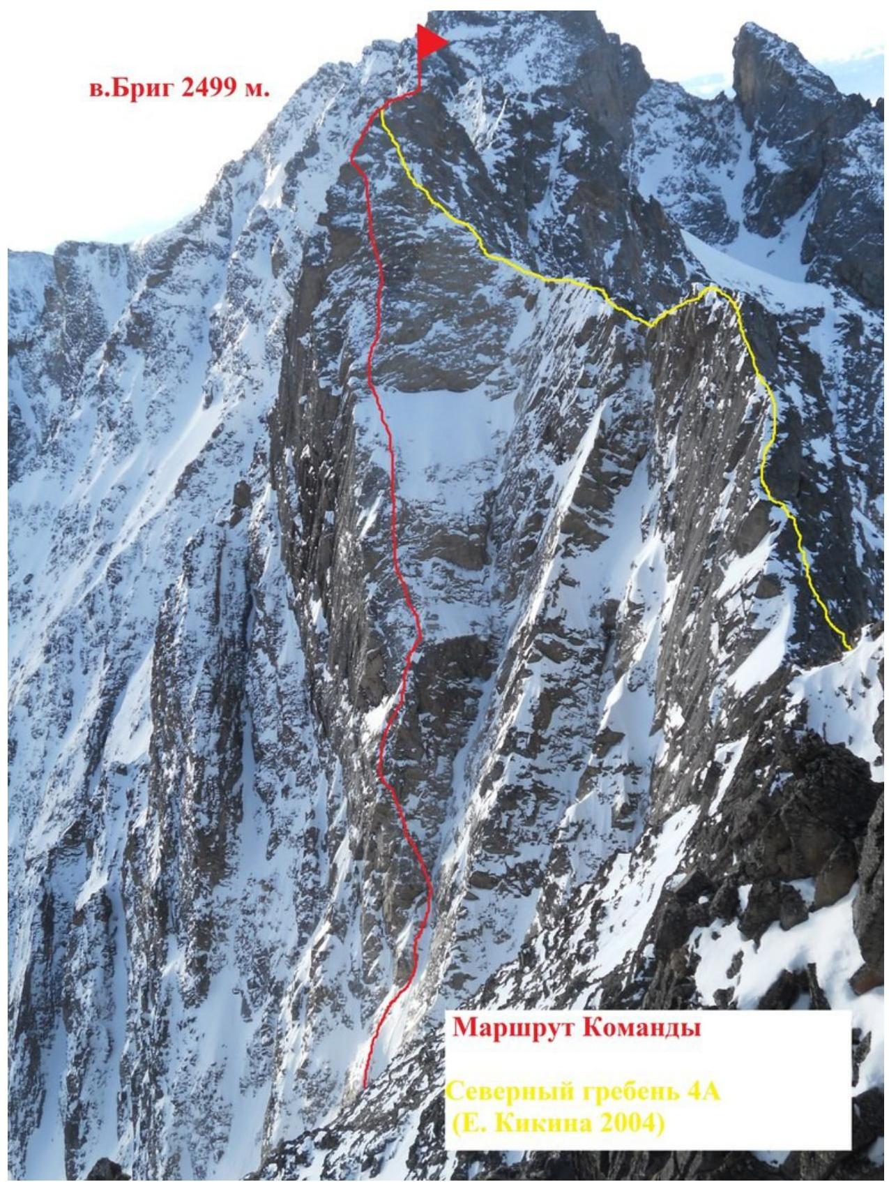
North ridge 4A (E. Kikina, 2004) — Route scheme
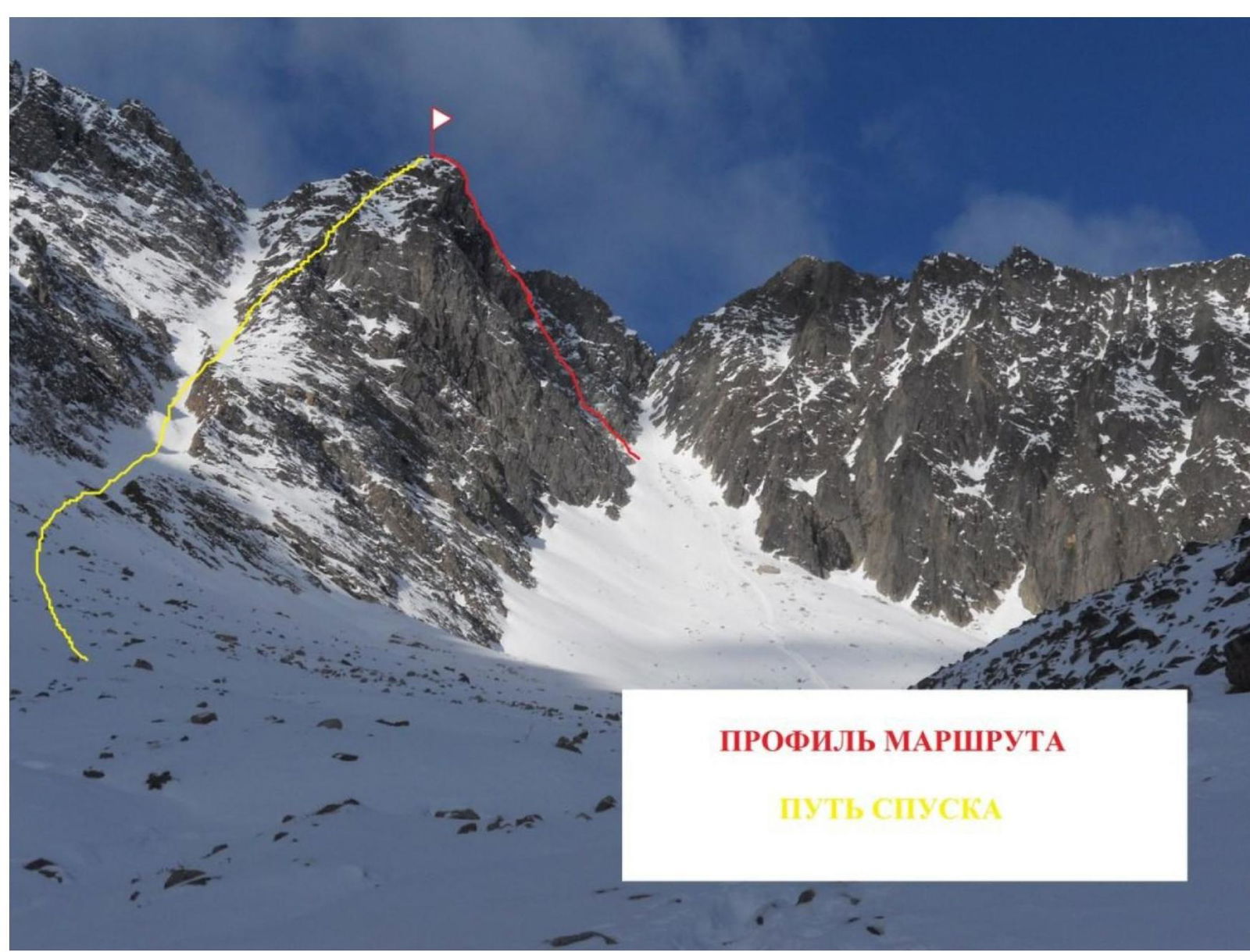
PROFILE OF THE ROUTE — DESCENT PATH
UIAA Scheme
peak Brig 2499
m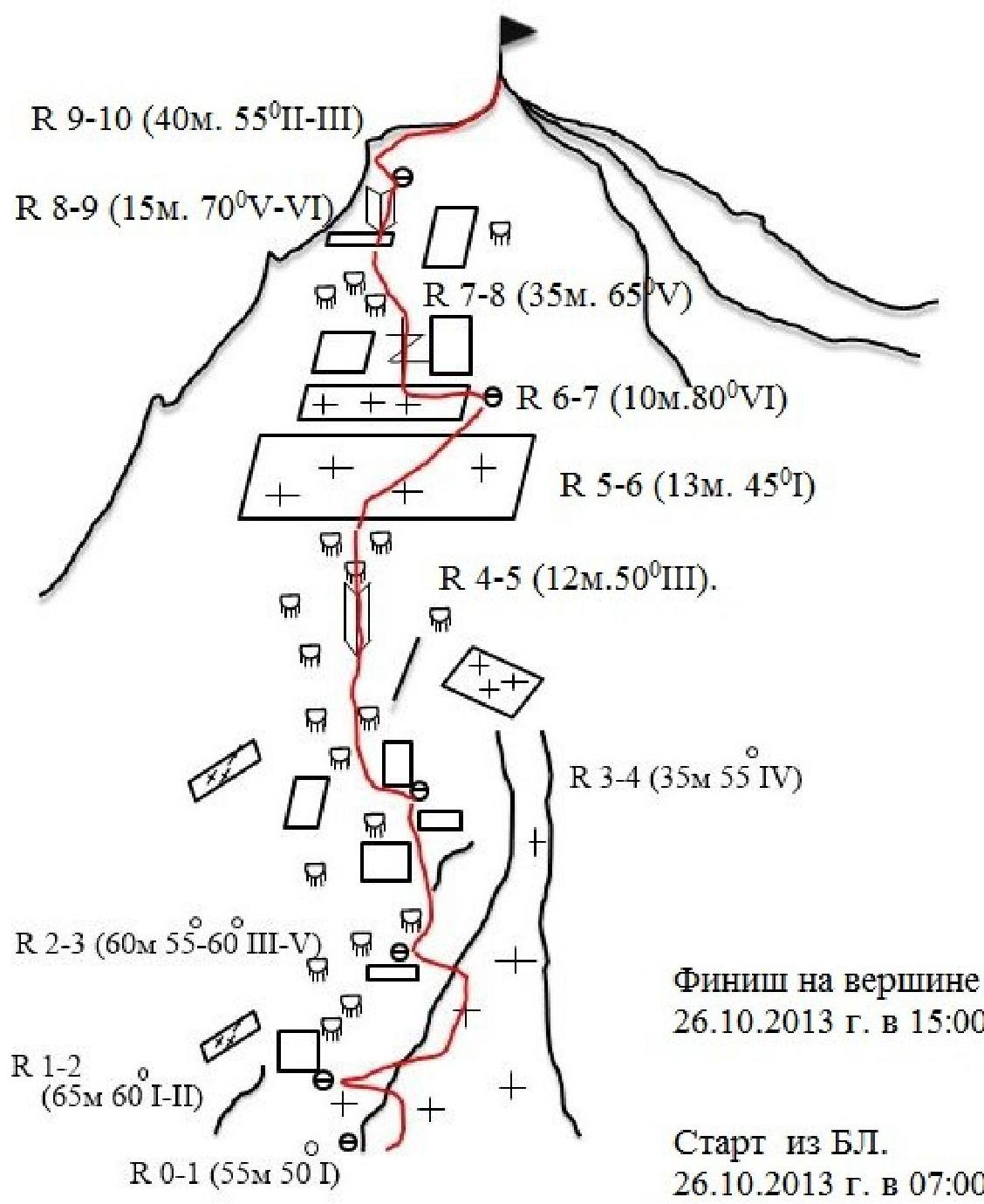
Description of the route by sections
0–1 Start of the route on a steep snowy slope from the upper part of the wide couloir between the peaks Brig and Bratchan. Movement towards the base of the central, pronounced rocky counterfort with cornices of the peak Brig. Under the rocky wall, left of the narrow couloir with snow and ice. Attention: the snowy slope may be avalanche-prone!!! (55 m. 50° I) (Photo 1)
0–2 To the right of the rocks into a narrow couloir with snow and sections of ice and mixed terrain. (65 m. 60° I–II), then exit to the rocks left of the couloir, snow-covered ledge, station on anchor pitons and cams.
0–3 Left and up from the ledge along an inclined internal angle under the wall, then to the right along a ridge leading to rocks left of an inclined snow-covered internal angle. Small ledge for a station on terrain and anchor pitons (60 m, 55°–60° III–V) (Photo 2)
0–4 Left and up, bypassing characteristic "ram's foreheads" on smoothed rocks with scarce relief, you come out onto a small wall with an internal angle (35 m, 55° IV) (Photo 3)
0–5 Then another 12 m of easy rocks (12 m, 50° III)
0–6 After which you reach a snowy field (13 m, 45° I), ending with a snowy ledge under a rocky wall, convenient for organizing insurance on terrain and anchor pitons.
0–7 Rocky wall, partially destroyed. Passage requires care and occurs almost in the center, near a characteristic "tooth" with a crack and rich relief of holds (10 m, 80° VI) (Photo 4 and 5).
0–8 Further movement along smoothed rocks, with limited relief for placing protection and blind cracks (35 m, 65° V).
0–9 Internal angle. A sloping slab, under which one bypasses to the right along worn-out rocks with poor relief, the movement of the first on this section requires attention, organization of insurance is complicated by a large number of blind cracks and lack of cracks. (15 m. 70° V–VI) (Photo 6).
0–10 Then along the internal angle to the left over the bend — exit to the peak. (40 m. 55° II–V) (Photo 8 and 9)
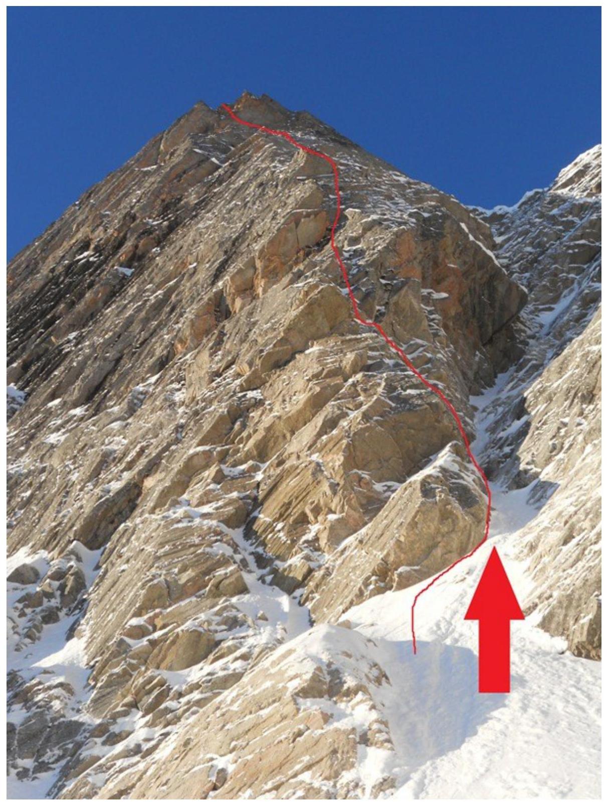
Photo 1 Section
R0–R1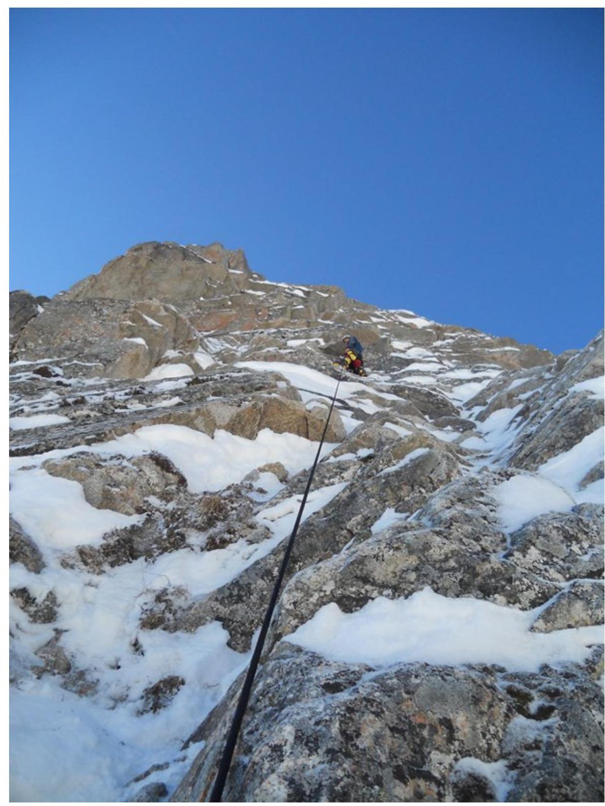
Photo 2 Section
R2–R3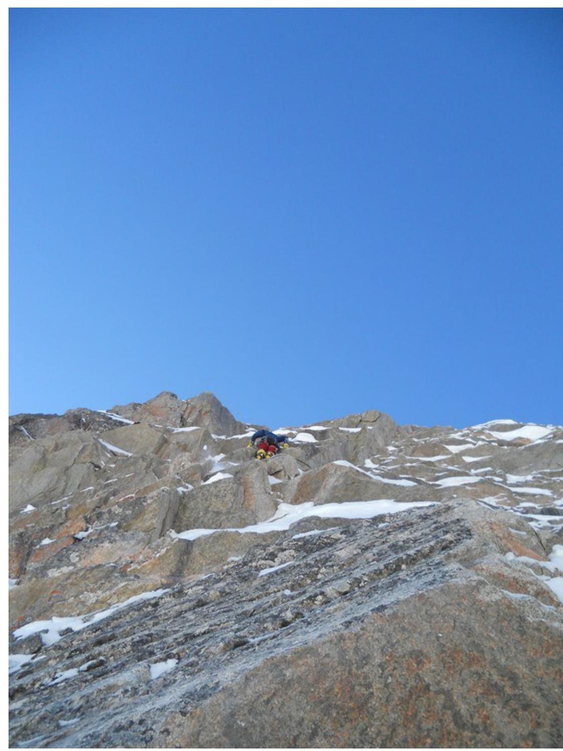
Photo 3 Section
R3–R4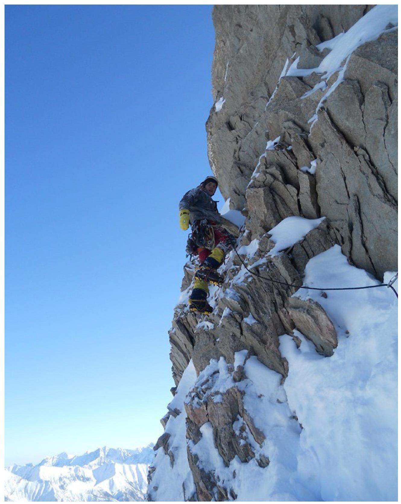
Photo 4 Section
R6–R7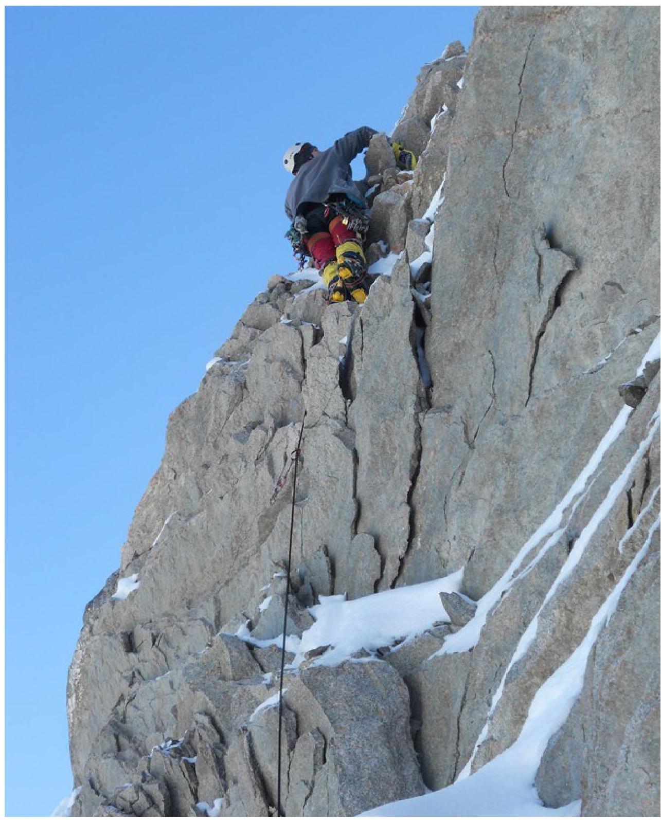
Photo 5 Section
R6–R7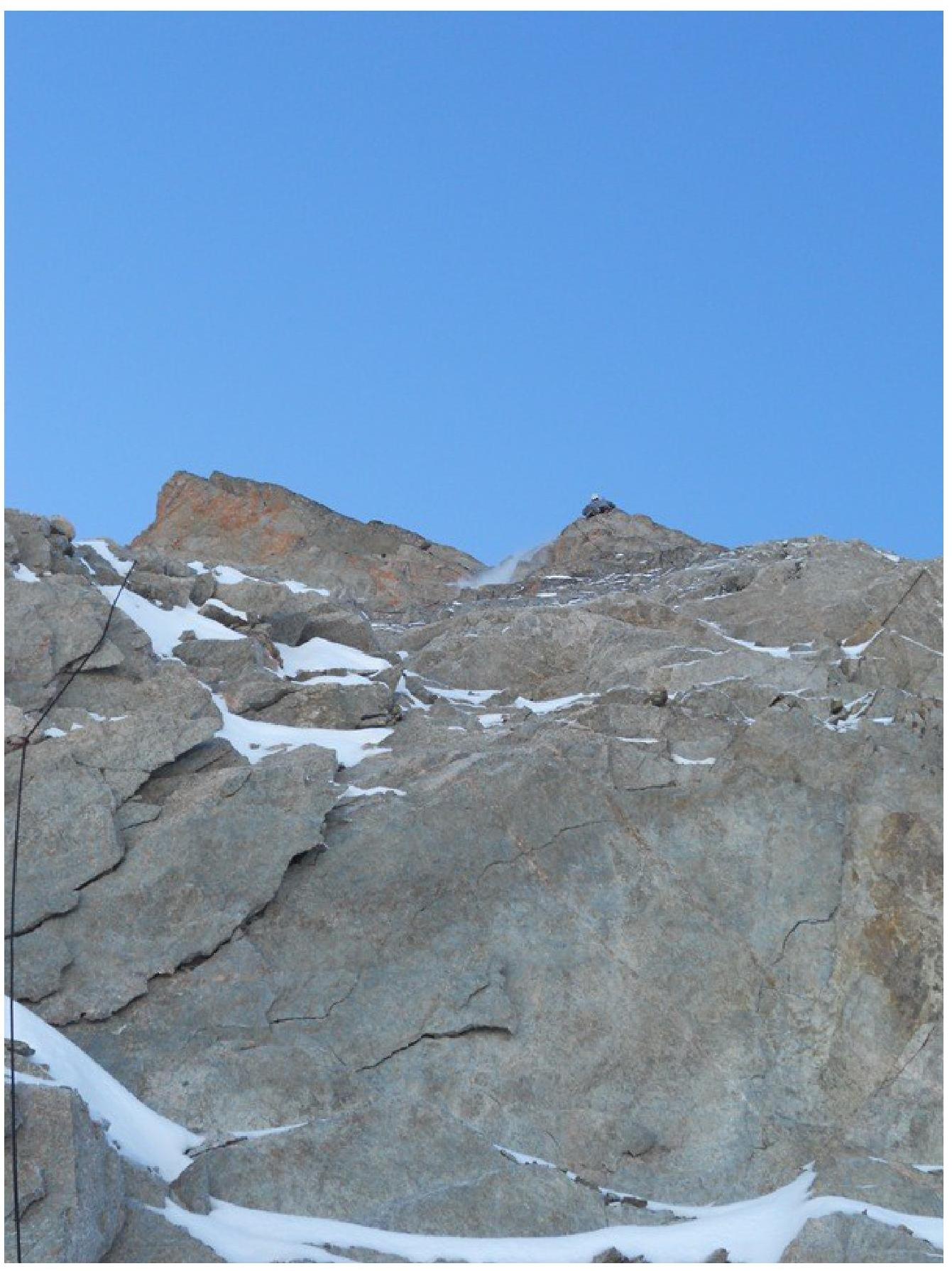
Photo 6 Section
R8–R9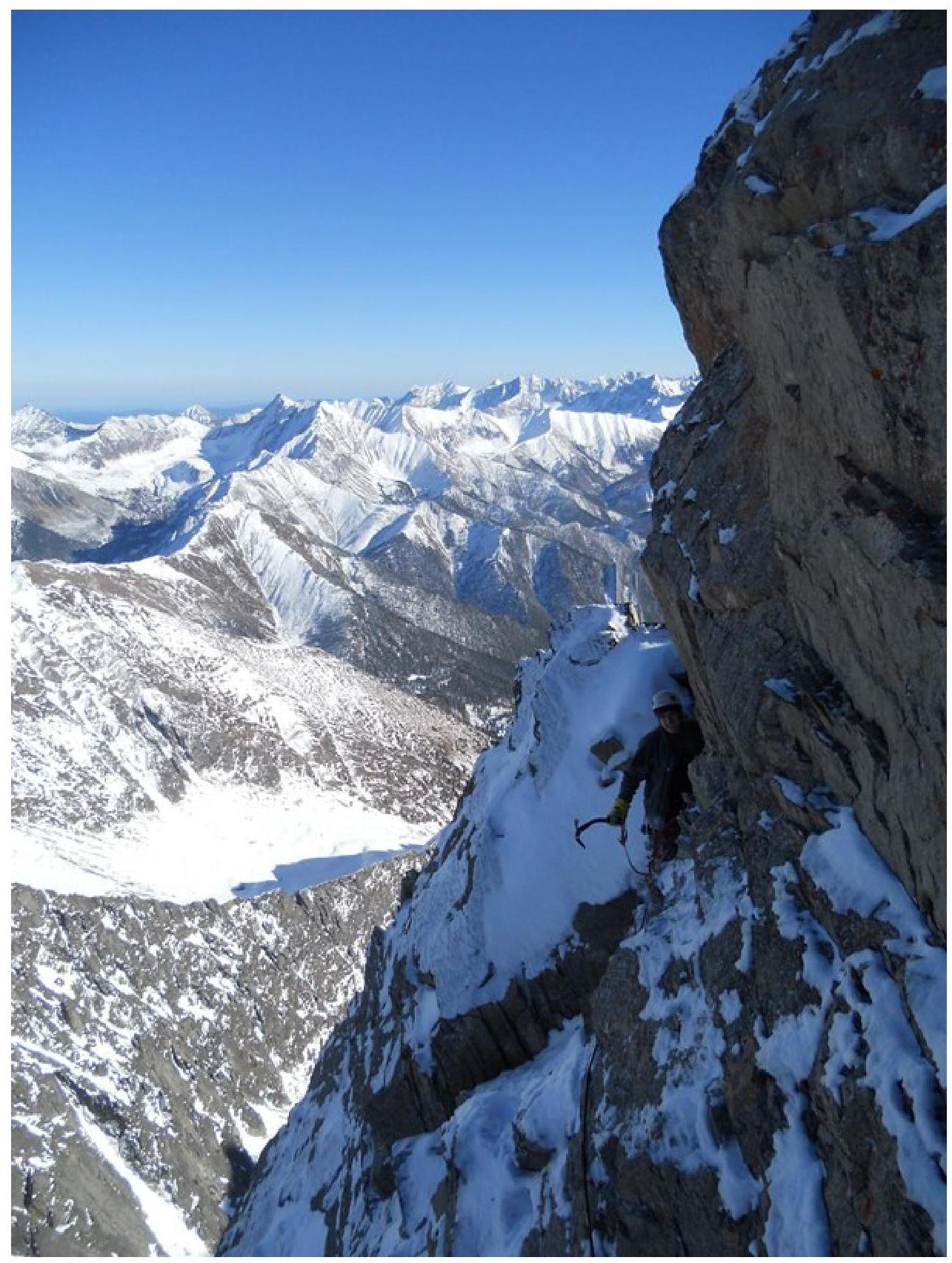
Photo 7 Section
R9–R10
Photo 8 Section
R9–R10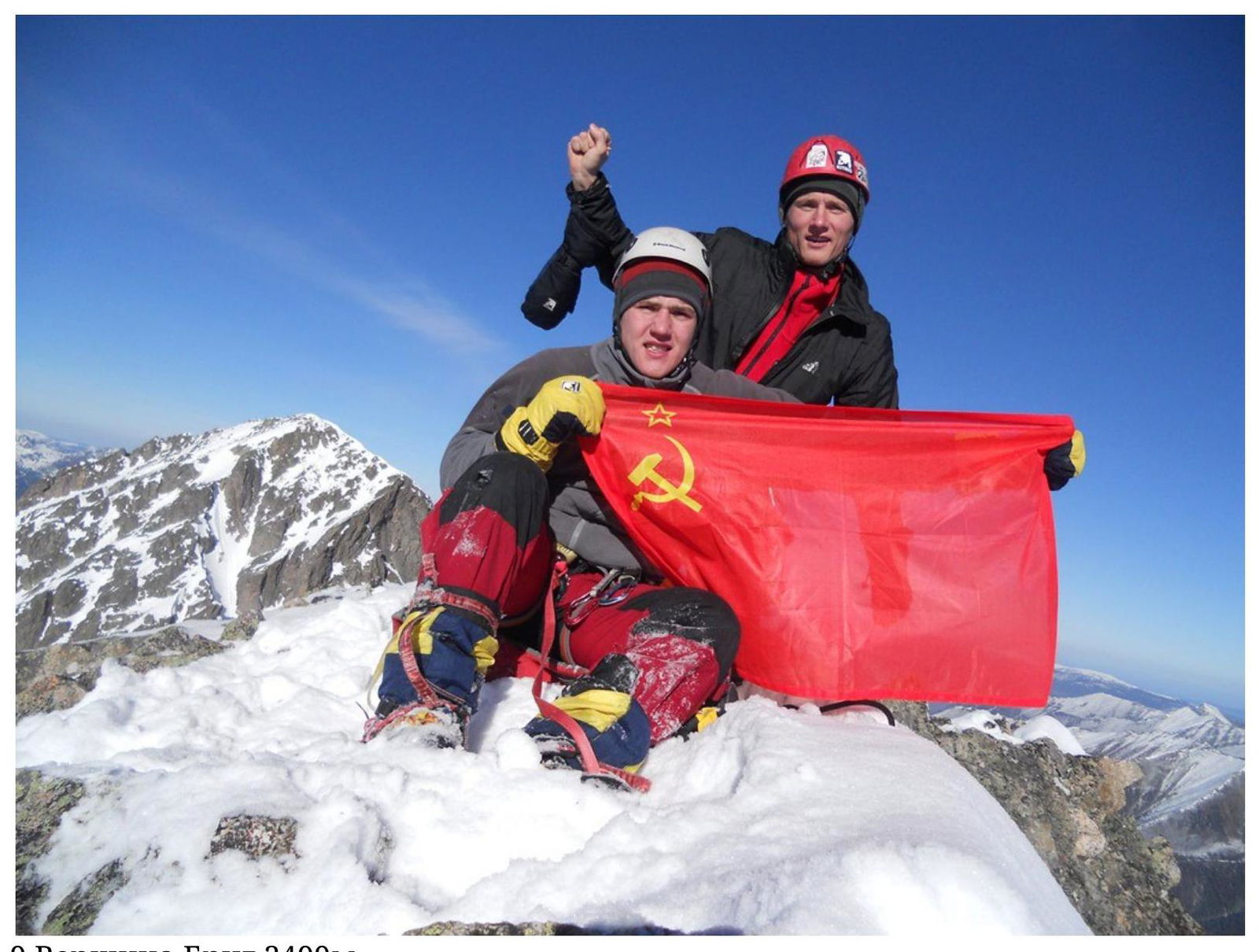
Photo 9 Peak Brig 2499 m.