Report on the First Ascent
Peak Arshan (2546 m) via the East Counterfort, route 4A cat. diff. (proposed), first ascent. Eastern Sayan, Tunkinskie Goltsy ridge, Dождевое (Rainy) Gorge, 6.1.2.
Leader: Klepikov A.A. Participants:
- Shcherban A.N.
- Resnyansky I.O.
- Generalchenko D.S.
Climbing Passport
- Eastern Sayan, Tunkinskie Goltsy ridge, Dождевое (Rainy) Gorge, 6.1.2.
- Peak Arshan (2546 m), East counterfort.
- Proposed 4A cat. diff. — first passage.
- Route type: rock climbing.
- Route height difference: 406 m.
Route length: 573 m.
Main part height difference: 213 m.
Main part length: 243 m.
Average steepness of the main part: 66°.
Overall route steepness: 48°.
Section lengths:
- IV cat. diff. — 90 m
- V cat. diff. — 128 m Pitons left on the route:
- total: 0
- including bolted: 0 Total used on the route:
- bolted pitons — 0
- rock pitons (including anchors) — 21
- chocks — 5
- friends — 16
- sky-hooks (including hooking) — 4 Total ITO (Artificial Technical Aid) points: 10
- Team's climbing hours (to the summit) — 8; days — 1. Number of nights on the route — 0.
- Leader: Klepikov Alexander Alexandrovich (Master of Sports) trainee
Participants:
- Shcherban Alexey Nikolaevich (2nd sports category)
- Resnyansky Ilya Olegovich (2nd sports category)
- Generalchenko Dmitry Sergeevich (2nd sports category)
- Team coach: Afanasyev Andrey Evgenievich (Master of Sports), (Coach), 1st category instructor.
- Route start: 10:00, January 24, 2016. Summit: 18:00, January 24, 2016. Return to Base Camp: 23:00, January 24, 2016.
Photo of the general view of the East slope of Mount Arshan.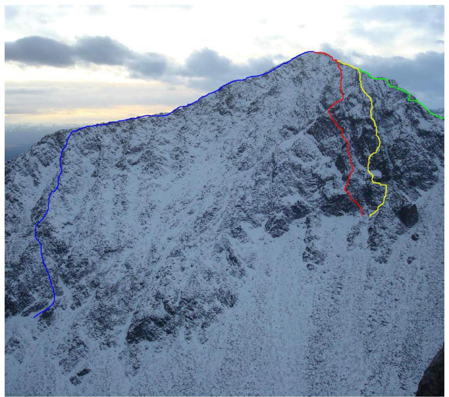
BLUE — Khandzhapov's 2005 route, 2A cat. diff. RED — team's route, 4A cat. diff. YELLOW — Khandzhapov's 2005 route, East counterfort, 3B cat. diff. GREEN — Trubnikov's 1971 route, South slope, 1B cat. diff.
Photo of the route profile from the side (semi-profile).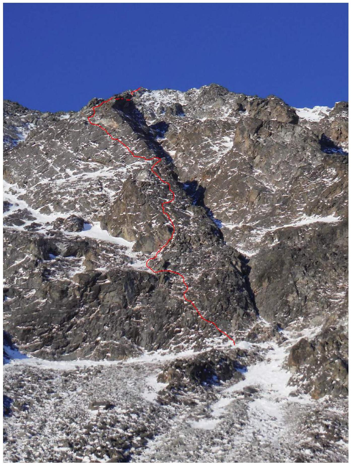
Drawn route profile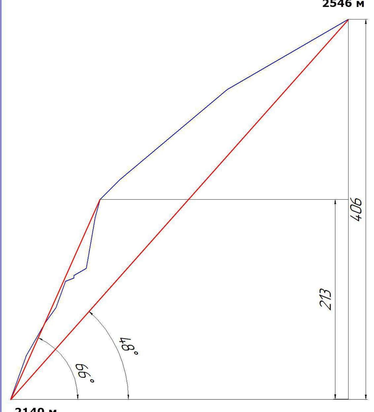
Panorama of the Tunkinskie Goltsy ridge peaks near Mount Arshan. (Photo taken from the Tunkinskaya valley, from a distance of 15 km)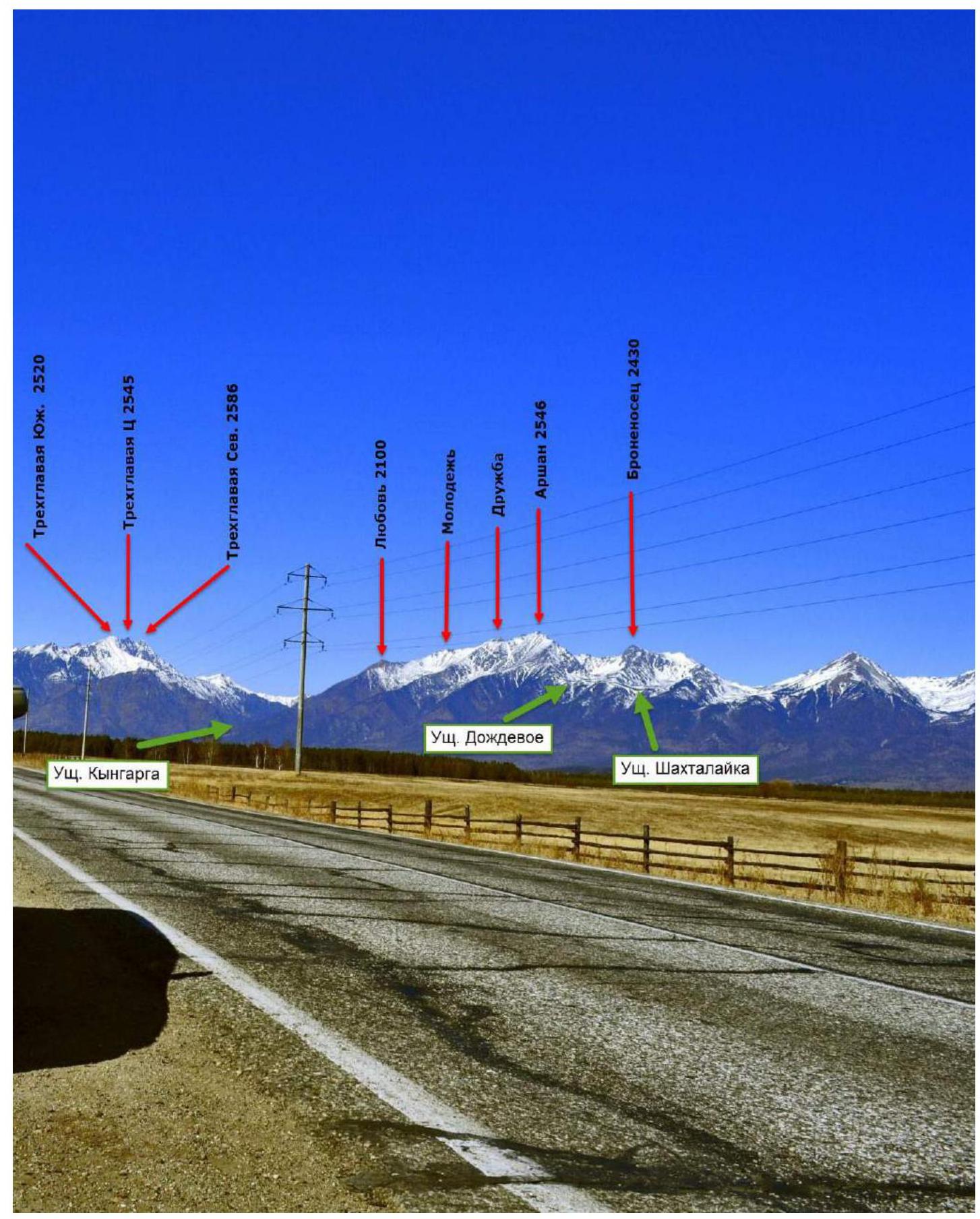
Dождевое (Rainy) Gorge is located in the Tunkinskie Goltsy ridge near the Arshan settlement and faces the Tunkinskaya valley. Morphologically, the gorge is essentially a long cirque or hanging valley, lying between the mountains Bronenosets and Arshan and breaking off with a steep, weakly incised stream towards the Tunkinskaya valley. The surface of the gorge above the forest zone is weakly inclined, and when intersected, it appears as a trough. The bottom of the gorge and part of its slopes are composed of moraine deposits (bottom, surface, and lateral). The material is coarse-grained, with an average fraction size of 0.5 to 5 m in diameter, of intrusive rocks, mainly granite, and less frequently sedimentary metamorphic rocks. The bottom of the gorge has been weakly altered by post-glacial erosion.
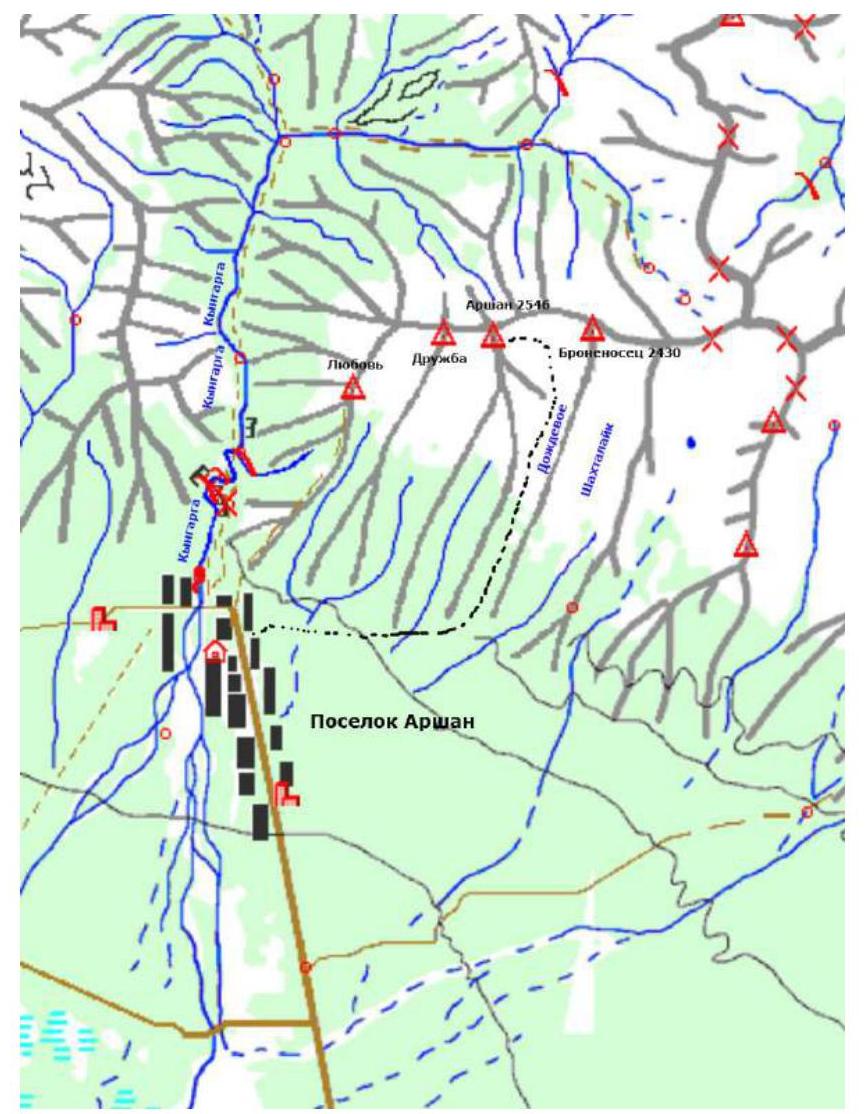
It is the most accessible gorge for mountaineering ascents in the Eastern Sayan. The time taken to reach the base camp in the gorge from the Arshan settlement is between 3 to 5 hours. Even in winter, the approach is not complicated, as the height of the snow cover is very low due to the slope exposure, and it becomes significant only half an hour to an hour before reaching the base camp. The gorge is bounded by only two mountains and their ridges: to the west is Mount Arshan, and to the east is Mount Bronenosets. The gorge currently has routes, including first ascents:
- 1B — 1 route
- 2A — 2 routes
- 2B — 1 route
- 3A — 1 route
- 3B — 2 routes
- 4A — 2 routes
- 4B — 2 routes
- 5A — 1 route
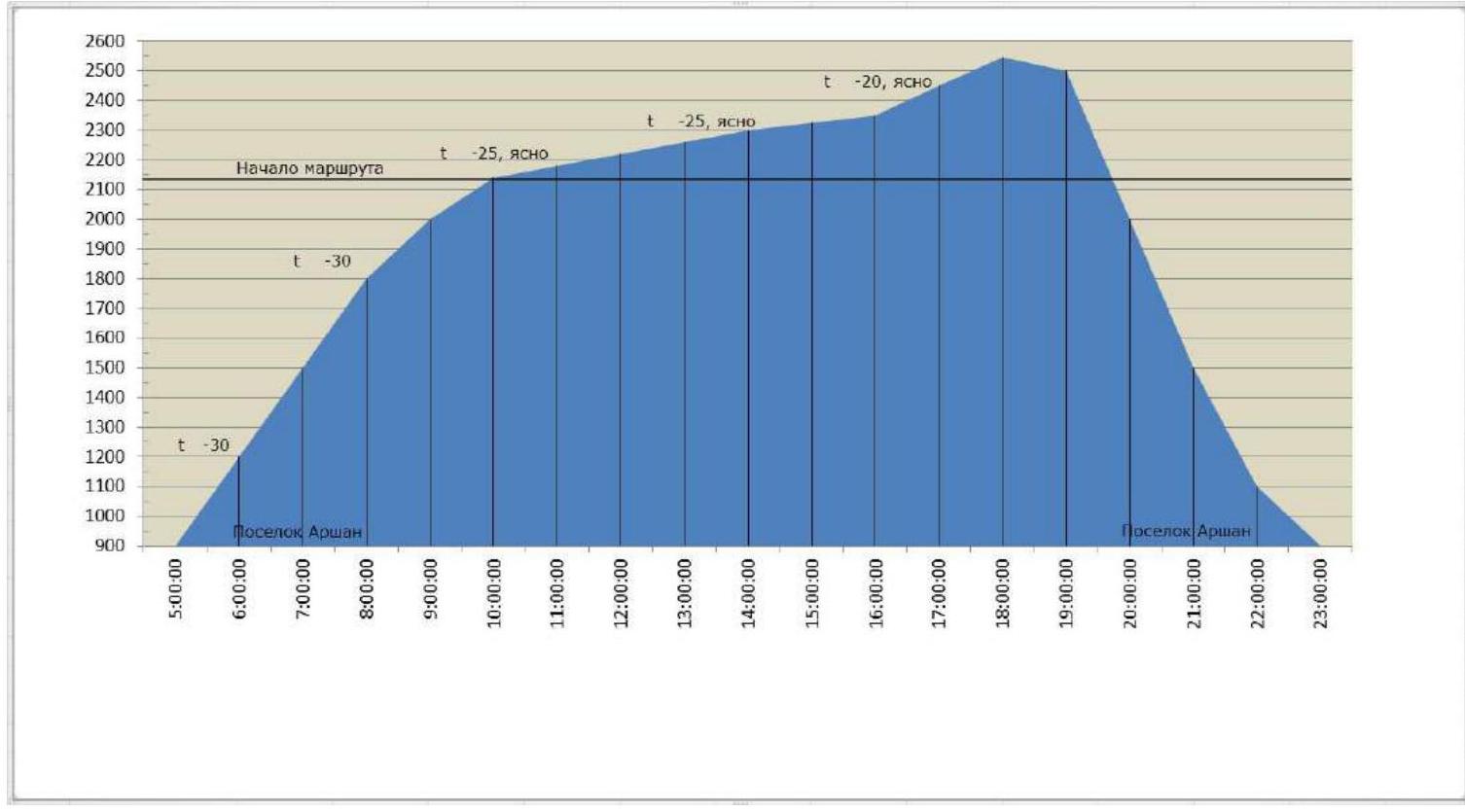
Team's movement schedule on the route:
- January 24, 2016, at 05:00, the team left the base camp located in the Arshan settlement.
- January 24, 2016, at 10:00 — start of work on the route.
- January 24, 2016, at 16:00 — key section R9 passed.
- January 24, 2016, at 18:00 — summit.
- January 24, 2016, at 23:00 — return to camp.
Scheme of the main part of the route, made in UIAA symbols, scale 1:2000, sheet 1
| Section | Chocks | Friends | Rock Pitons | Sky-Hooks | Bolts | Length (m) | Steepness (°) | Grade | ITO |
|---|---|---|---|---|---|---|---|---|---|
| R11–R12 | - | - | - | - | - | 150 | 30 | 2- | - |
| R10–R11 | - | 3 | - | - | - | 150 | 40 | 3- | - |
| R9–R10 | - | 2 | 1 | - | - | 30 | 45 | 2- | - |
| R8–R9 | - | 1 | 2 | - | - | 20 | 75 | 5+ | - |
| R7–R8 | 2 | 3 | 5 | 4 | - | 55 | 80 | 5+ | A1 |
| R6–R7 | - | - | 3 | - | - | 15 | 30 | 3- | - |
| R5–R6 | - | - | 1 | - | - | 3 | 90 | 5+ | - |
| R3–R4 | 1 | 2 | 3 | - | - | 30 | 70 | 4+ | - |
| R2–R3 | - | 1 | 2 | - | - | 20 | 55 | 4- | - |
| R1–R2 | - | 2 | 2 | - | - | 40 | 60 | 4+ | - |
| R0–R1 | 2 | 2 | 3 | - | - | 50 | 70 | 5- | - |
Relief Description
The beginning of the route, a steep counterfort left of the Khandzhapov's 3B route.
- R0–R1 50 m, 70°, 5-, Move left and up through a more gentle part, to a ledge under an overhang, bypassing the overhang on the left, through an internal corner, exit right to the outer form.
- R2–R3 20 m, 55°, 4-, Up a gentle inner corner, under a rising wall.
- R3–R4 30 m, 70°, 4+, A monolithic wall straight up, with a destroyed overhang at the top, exit to the top of a gendarme.
- R4–R5 10 m, 20°, 3-, Ridge.
- R5–R6 3 m, 90°, 5+, through a gap, 3 m of extremely difficult climbing, (can make a "slonik" or rappel left 15 m and up a couloir under the wall (avalanche danger)).
- R6–R7 15 m, 30°, 3- along the ridge under the wall.
- R7–R8 55 m, 80°, 5+, A1. Steep wall, general direction of movement is left and up towards white geology, extremely difficult climbing, live rocks present but they move away from the anchor.
- R8–R9 20 m, 75°, 5+ — exit to the left shoulder of the ridge.
- R9–R10 30 m, 45°, 2- — up the shoulder to the ridge, easy climbing, anchor on a "balda".
- R10–R11 150 m, 40°, 2+/3– — along the ridge to the main ridge connecting the peaks Arshan and Bronenosets.
- R11–R12 150 m, 30°, 2- — along the ridge to the summit.
Technical Photo of the Route
Photo taken from the West wall of Mount Bronenosets 2430 m.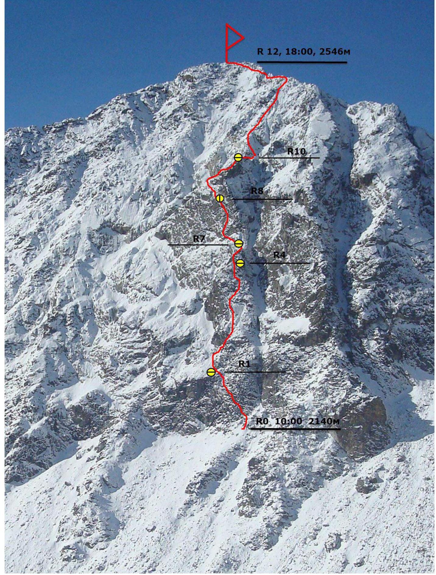
Route Characteristics and Team Actions on the Wall
On the East slope of Mount Arshan 2546 m, before us, only two routes had been climbed: 2A and 3B. Both routes follow the outer forms of the relief and are well tied to it.
When choosing the thread of the new route, we were guided first and foremost by:
- logic
- safety of the line
Of all possible variants of complex threads, the most beautiful and logical seemed to be the one that goes along the adjacent counterfort with the existing 3B, and we settled on it. The rocks are quite heavily destroyed, with live rocks present, but the route line goes in such a way that the rocks fall away from the climber and to the side of the anchor.
The route has two pronounced key sections, requiring significant skills in free climbing or good mastery of ITO techniques, and setting anchors in difficult conditions. The first key is on the very first rope of the route, 50 m. The second key is over 75 m long, with a hanging anchor, and complicated by the setting of anchors.
The descent from the summit is done in the direction of the Tunkinskaya valley along the ridge:
- Initially, 30 m of rappelling — can be very slippery under certain conditions, need to rappel;
- Then along the ridge almost to the forest boundary;
- Then left into Dождевое (Rainy) Gorge.
Under the route.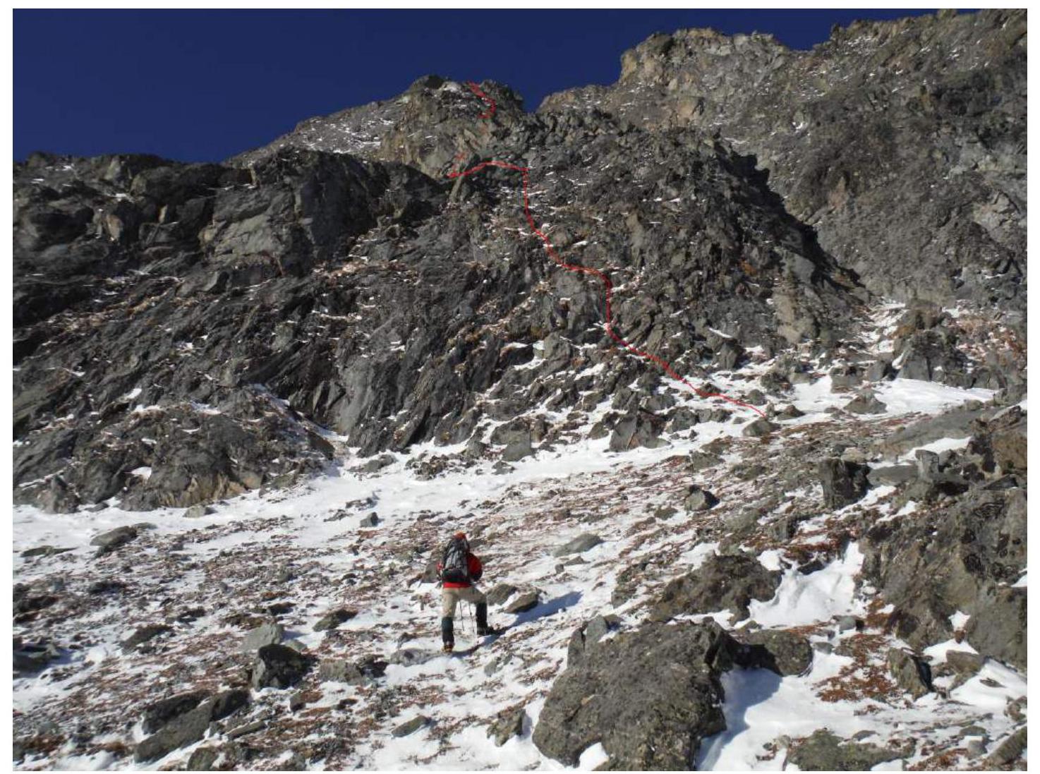
First rope. Section R0–R1.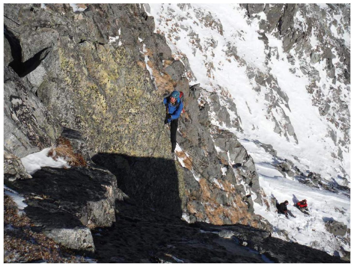
Section R2–R3. Outer form with a gentle inner corner.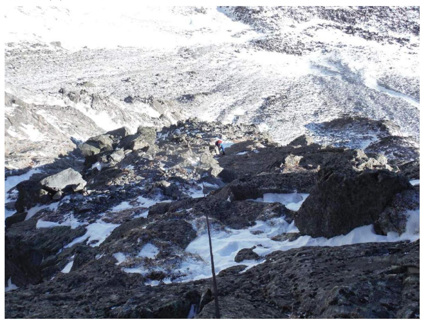
Section R3–R4. Monolithic wall.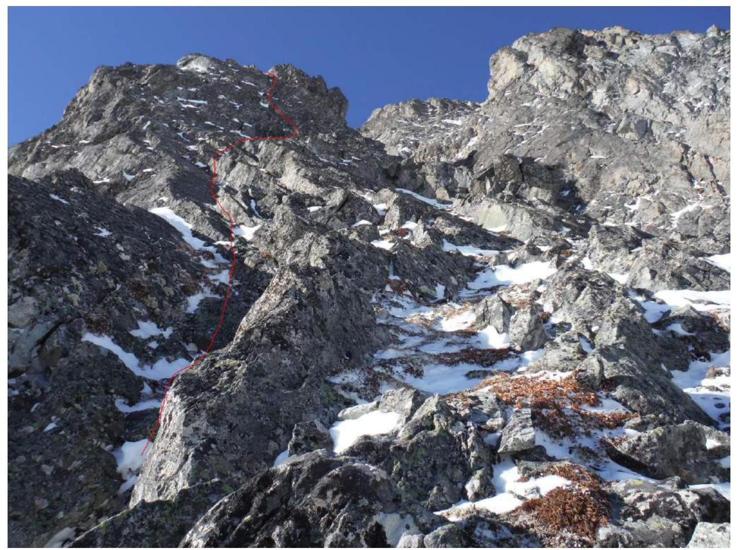
2nd key section of the route, R7–R8
View upwards! From point R7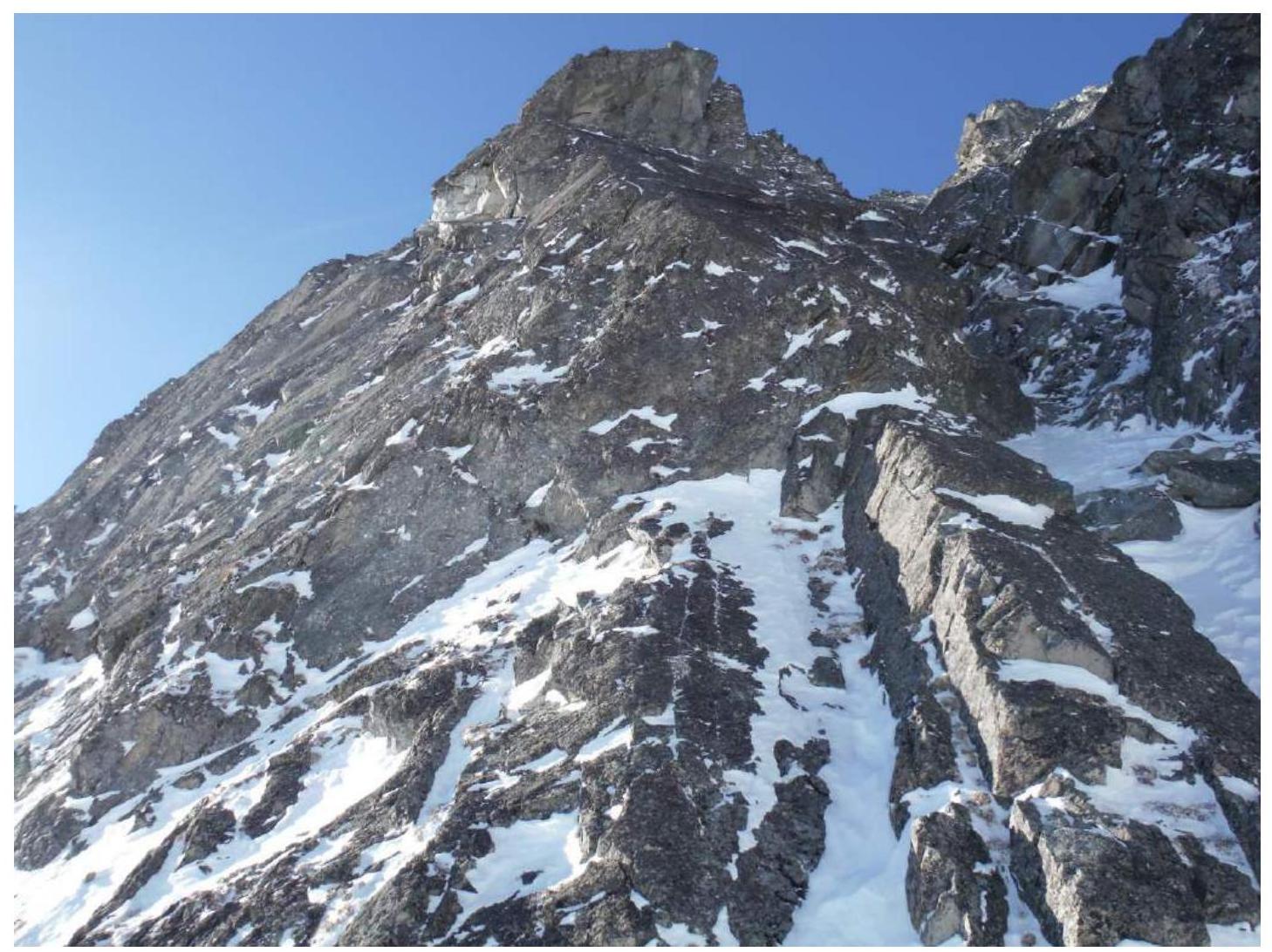
2nd key section of the route, R7–R8
View downwards! From point R8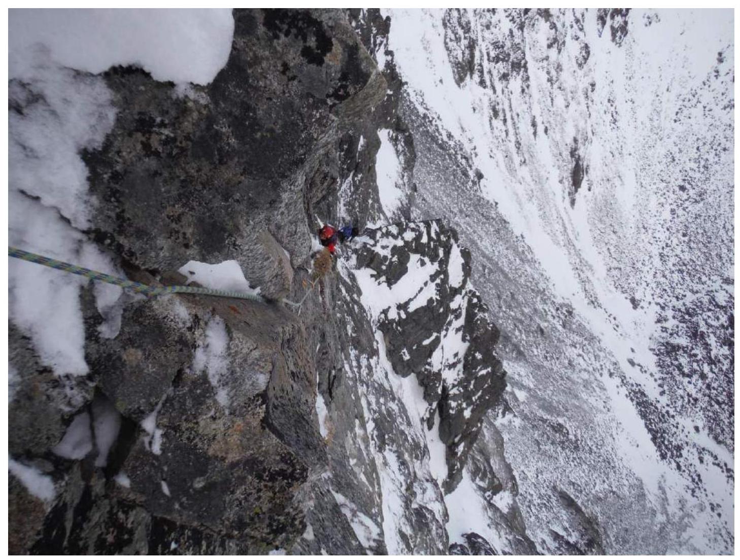
P.S. It was very cold, so every time we removed our mittens, took out the camera, and photographed — it was a heroic effort and an ordeal for our hands. Therefore, there are not many photos from the route.
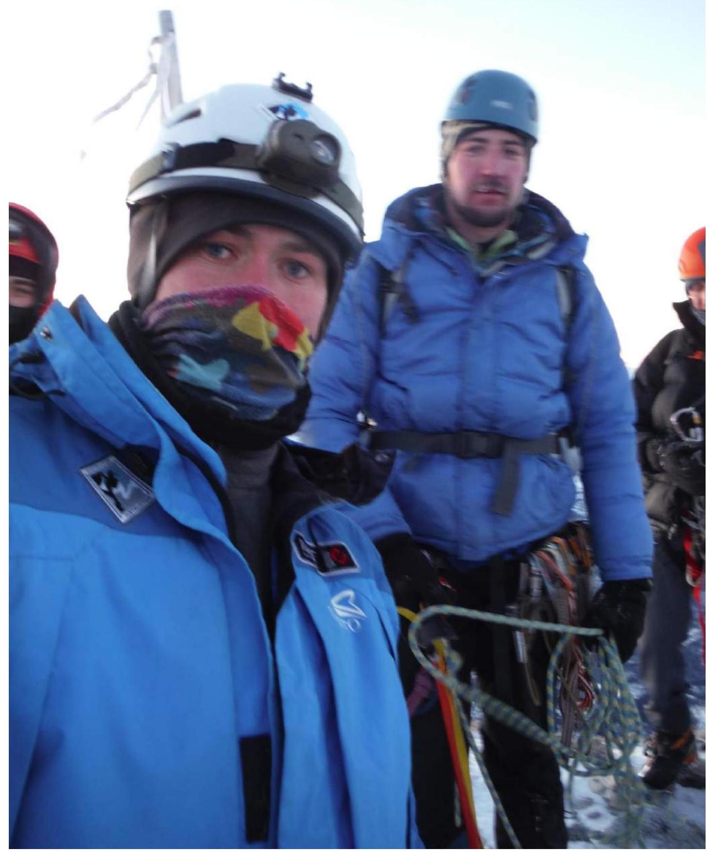
Participants on the summit:
- Resnyansky I.O.
- Generalchenko D.S.
- Shcherban A.N.
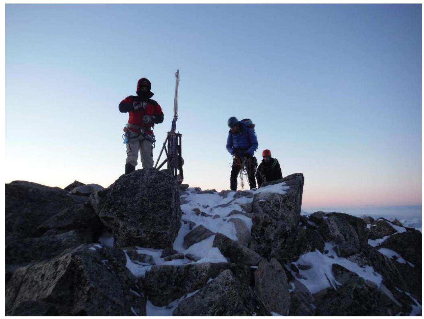
Summit, all together