ALPINISM FEDERATION OF THE REPUBLIC OF BURYATIA
Report
ON THE FIRST ASCENT TO THE SUMMIT ARSHAN VIA THE RIGHT BUTTRESS OF THE SOUTHERN RIDGE APPROXIMATELY CATEGORY 3A DIFFICULTY June 9, 2018
I. Climbing Passport
| 1. General Information | ||
|---|---|---|
| 1.1 | Full Name, Sports Rank of the Leader | Baguzha Alexander Mikhailovich, Candidate for Master of Sports |
| 1.2 | Full Name, Sports Rank of Participants | Lykova V.V., 2nd sports rank, Kolesnikova O.S., 3rd sports rank, Nikiforov B.I., 3rd sports rank, Chernyavsky M.S., 3rd sports rank, Gulyaev M.N., 3rd sports rank, Sustavova N.S., Alpine badge |
| 1.3 | Full Name of Coach | Ayusheev D.V., Master of Sports |
| 1.4 | Organization | Alpinism Federation of the Republic of Buryatia |
| 2. Characteristics of the Climbing Object | ||
| 2.1 | Region | Eastern Sayan Mountains, Tunkin Mountains |
| 2.2 | Valley | Dozhdevoe |
| 2.3 | Classification Table Section Number for 2013 | 6.1.2. |
| 2.4 | Name and Height of the Summit | Arshan 2546 m |
| 3. Route Characteristics | ||
| 3.1 | Route Name | Along the right buttress of the southern ridge |
| 3.2 | Proposed Category of Difficulty | 3A |
| 3.3 | Degree of Route Exploration | First ascent |
| 3.4 | Route Terrain Character | Rock |
| 3.5 | Route Elevation Gain | 248 m |
| 3.6 | Route Length (in meters) | 465 m |
| 3.7 | Technical Elements of the Route | 1st cat. rock — 105 m. 2nd cat. rock — 271 m. 3rd cat. rock — 72.5 m. 4th cat. rock — 14.5 m. 5th cat. rock — 5 m. |
| 3.8 | Average Steepness of the Route, (°) | 45° |
| 3.10 | Descent from the Summit | Along the n/k southern ridge to the saddle with a grassy slope, then down to the Dozhdevoe valley |
| 3.11 | Additional Route Characteristics | Total protection points used: 17 (5 anchors; 5 friends; 5 stoppers; 2 natural protection points). Water availability: a stream runs to the right of the route start in the first half of summer. No water on the route. |
| 4. Team Actions Characteristics | ||
| 4.1 | Time of Movement | Climbing hours: 5 hours 20 minutes, 1 day |
| 4.2 | Start of the Route | 5:00 June 9, 2018 |
| 4.3 | Summit Arrival | 10:50 June 9, 2018 |
| 4.4 | Return to Base Camp | 13:00 June 9, 2018 |
| 6. Responsible for the Report | ||
| 5.1 | Full Name, e-mail | Baguzha A.M., dovokin777@gmail.com |
II. Climbing Description
1. Climbing Object Characteristics
1.1. General Photo of the Summit
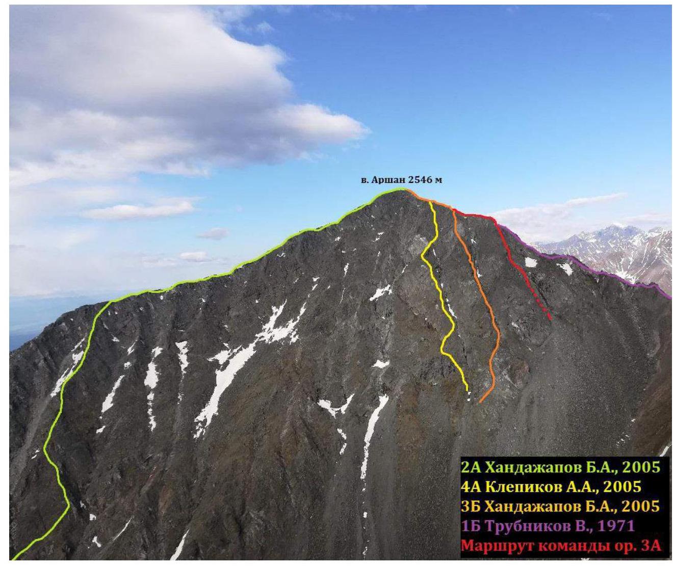
Photo taken on June 8, 2018, from v. Bronenosets
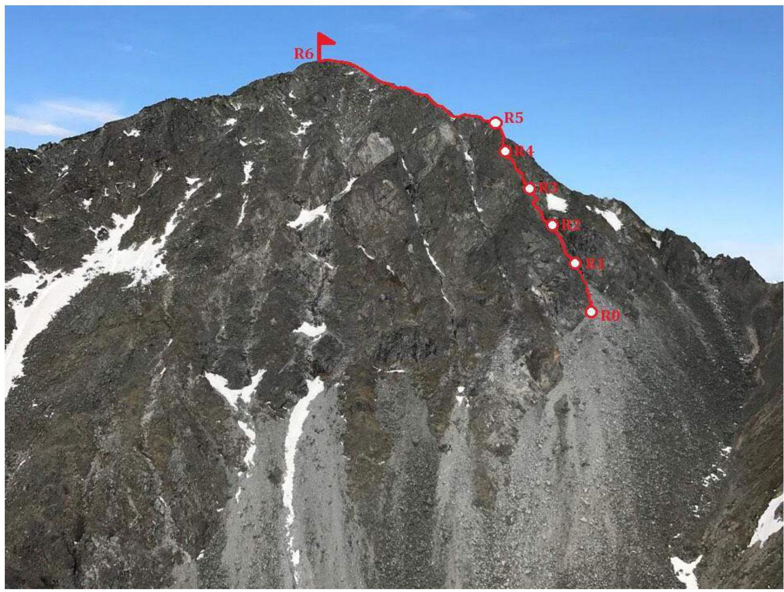
1.2. Route Profile Photo
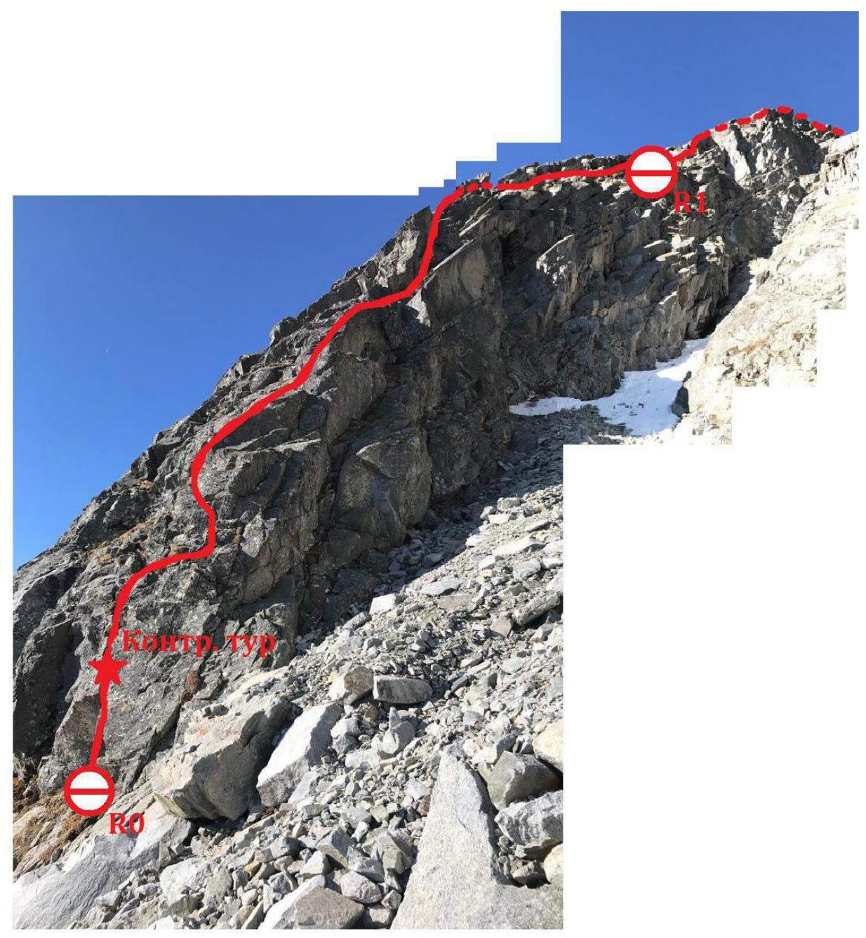
Profile of the route start (key section), made by combining two photographs
1.3. Panoramic Photo of the Area
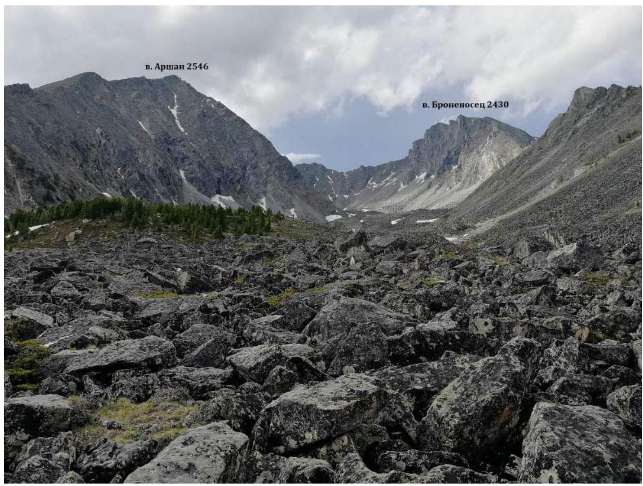
Panoramic photo of the summits in the Dozhdevoe valley (Arshan and Bronenosets cirque)
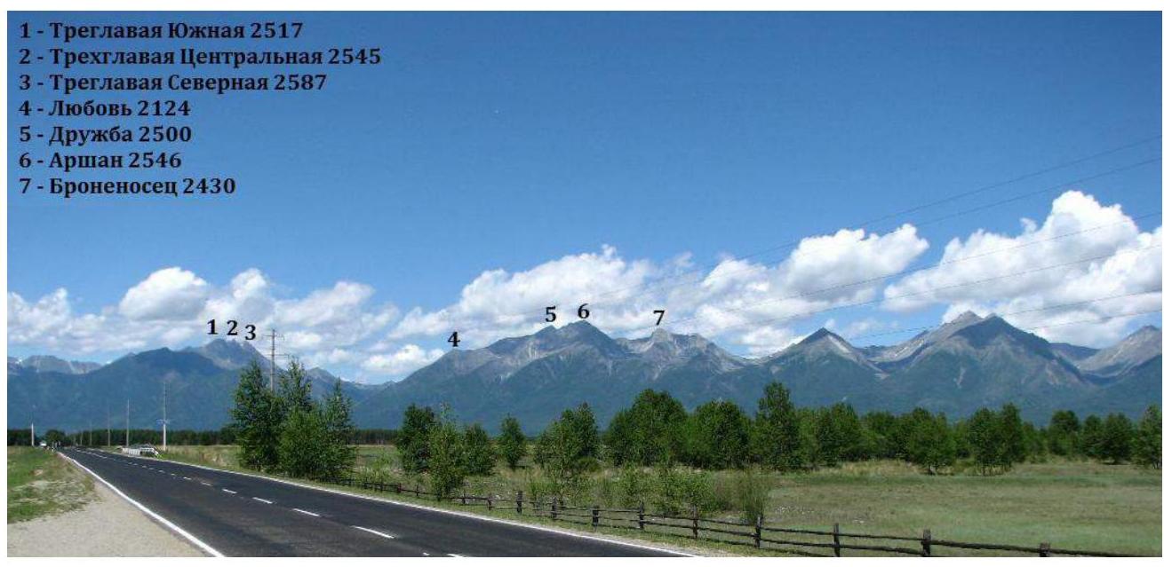
Panoramic photo from the highway in Arshan settlement
1.4. Area Description and Approach to the Route.
Brief description and overview of the area. The Dozhdevoe valley is located in the Eastern Sayan Mountains (Tunkin Mountains range). The nearest settlement is the resort village of Arshan. Arshan can be easily reached by shuttle bus from Ulan-Ude, Irkutsk, and Slyudyanka. The Dozhdevoe valley is a popular area among climbers. The area is well-accessible and developed. There are classified routes from 2A to 5A category in the area (1–2A, 2–2B, 1–3A, 1–3B, 2–4A, 1–4B, 1–5A). The average time for the approach from Arshan to the lake in the Dozhdevoe valley is about 4 hours.
Approach to the area. Our team recorded a track using the Galileo-App during the approach to the base camp; the track can be viewed and downloaded at: http://shared.galileo-app.com/5b2760be6a01e2266bb123e0.html↗. Below is a map showing the path to the base camp.
The approach to the Dozhdevoe valley starts from the northeastern outskirts of Arshan: from the northern end of Konstantina Gabanova Street, or from Trakhtovaya Street, turning onto Vostochnaya Street and reaching the outskirts.
First, follow the path eastward for 2.5 km, sometimes losing the trail and crossing areas with mudflows. The elevation gain on this section is approximately 100 m.
Next:
- Reach the parking area with a table and benches;
- Start moving up northeast along the forested slopes alongside the "white river";
- Walk 2 km up the trail (elevation gain from the tables on this section is approximately 300 m);
- Turn away from the "white river" to the north;
- At the end of the path, enter the osyp slopes and proceed to the Dozhdevoe valley (Bronenosets–Arshan cirque) and continue to the lake.
The total distance from Arshan to the lake is approximately 8 km, with a total elevation gain of approximately 1000 m.
Our base camp was set up by the lake. In winter, it is more suitable to camp at the edge of the forest zone at the beginning of the cirque, as there will be access to firewood.
Approach to the route. The route starts from the lower part of the right buttress of the eastern slope, to the right of the steep inner angle with cornices. The buttress is located to the right of the central buttress, where the classified 3B Handajapov route is located. The approach to the route from the lake takes about 1 hour.
In summer, it's better to walk through the center of the valley, where the osyp alternates with "grassy fields" and there are fewer large blocks to navigate. If you walk under the eastern Andes of Arshan, the path will be mainly through coarse and medium osyp with areas of "living stones" and "fresh" osyp.
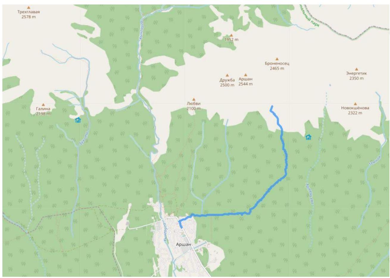
Map-scheme of the area showing the path from Arshan to the base camp in the Dozhdevoe valley by the lake
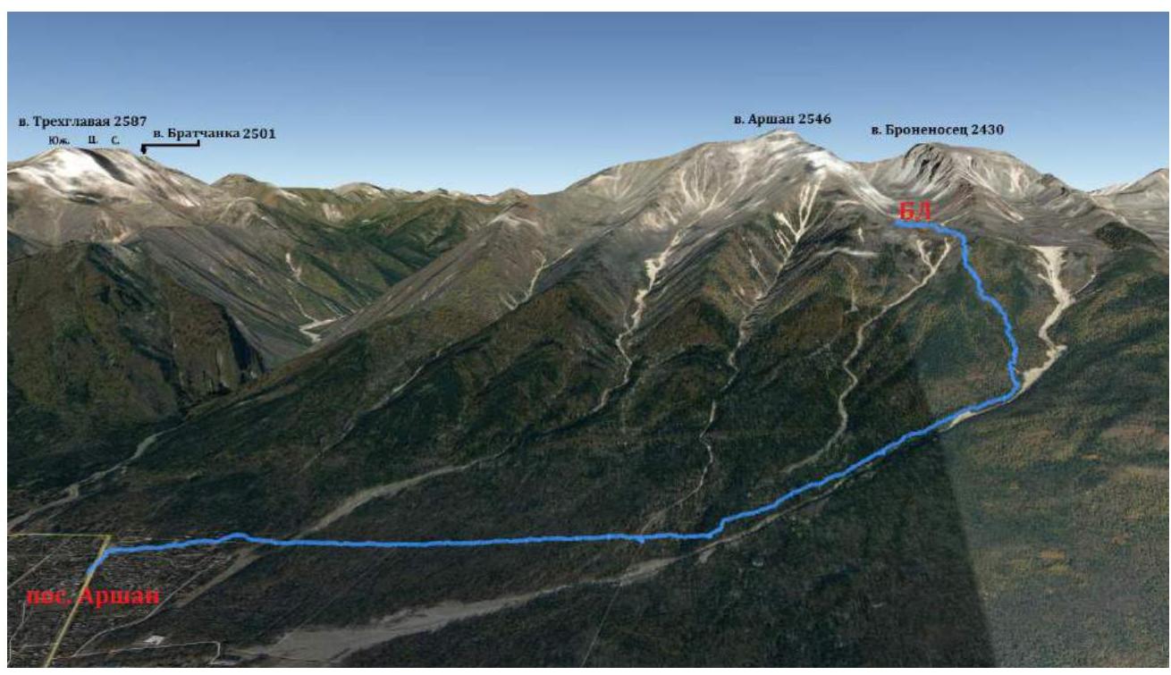
Google Planet screenshot showing the summits and the approach path
2. Route Characteristics
2.1. Technical Photograph of the Route
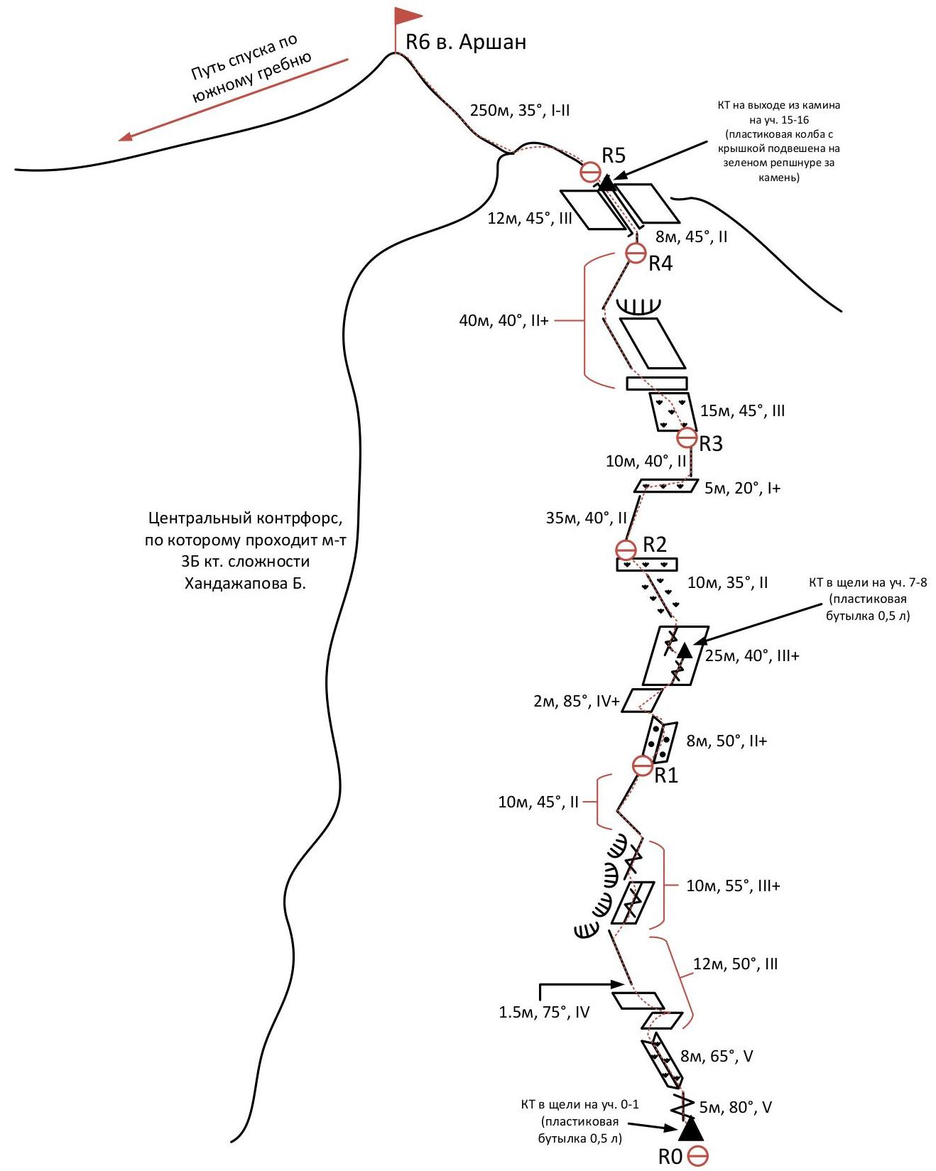
2.2. Technical Characteristics of Route Sections
Table 2.2.1
| № участка | Характер рельефа | Категория сложности | Протяжённость, м | Вид и количество крючьев | |
|---|---|---|---|---|---|
| R0–R1 | 0–1 | Скалы | 5, 80° | 5 | 1 френд |
| 1–2 | Скалы, трава | 4, 65° | 8 | 2 якоря | |
| 2–3 | Скалы | 3, 50° 4, 75° | 10,5–3 1,5–4 | 2 якоря, 1 френд | |
| 3–4 | Скалы | 3+, 55° | 10 | 1 якорь | |
| 4–5 | Скалы | 2, 45° | 10 | – | |
| R1–R2 | 5–6 | Скалы | 2+, 50° | 10 | 1 якорь |
| 6–7 | Скалы | 4+, 85° | 2 | 1 френд | |
| 7–8 | Скалы | 3+, 40° | 25 | 2 стоппера | |
| 8–9 | Скалы, трава | 2, 35° | 10 | – | |
| R2–R3 | 9–10 | Скалы | 2, 40° | 35 | 1 френд |
| 10–11 | Скалы, трава | 1+, 20° | 5 | – | |
| 11–12 | Скалы | 2, 40° | 10 | – | |
| R3–R4 | 12–13 | Скалы | 3, 45° | 15 | 1 френд, 1 стоппер |
| 13–14 | Скалы | 2+, 40° | 40 | 1 стоппер | |
| R4–R5 | 14–15 | Скалы | 2, 45° | 8 | – |
| 15–16 | Скалы | 3, 45° | 12 | 1 стоппер | |
| R5–R6 | 16–17 | Скальный гребень | I–II, 35° | 100–1; 200–2 | 2 петли за рельеф |
2.3. Route Diagram in UIAA Symbols
3. Team Actions Characteristics
3.1. Brief Description of Route Passage.
The route along the right buttress of the southern ridge to the summit Arshan passes to the right of the 3B Handajapov route, and the line of the route is logical, making orientation on the route straightforward.
The route has 3 control points, the locations of which are described below in the section descriptions.
The most difficult sections of the route are in the lower part of the buttress. The first rope is the key and most challenging. Starting from the 3rd rope (section R9–R10), the edge of the buttress becomes more gentle, and movement with simultaneous protection becomes possible in some areas.
All stations on the route were organized using large rocks and outcrops. For a group of 6, the team took the following group equipment on the ascent:
- 3 ropes of 50 m (2 static and 1 dynamic);
- 8 quickdraws;
- 6 anchor slings;
- 5 anchor hooks;
- 10 stoppers;
- 5 friends;
- 3 rock hammers.
Photographs
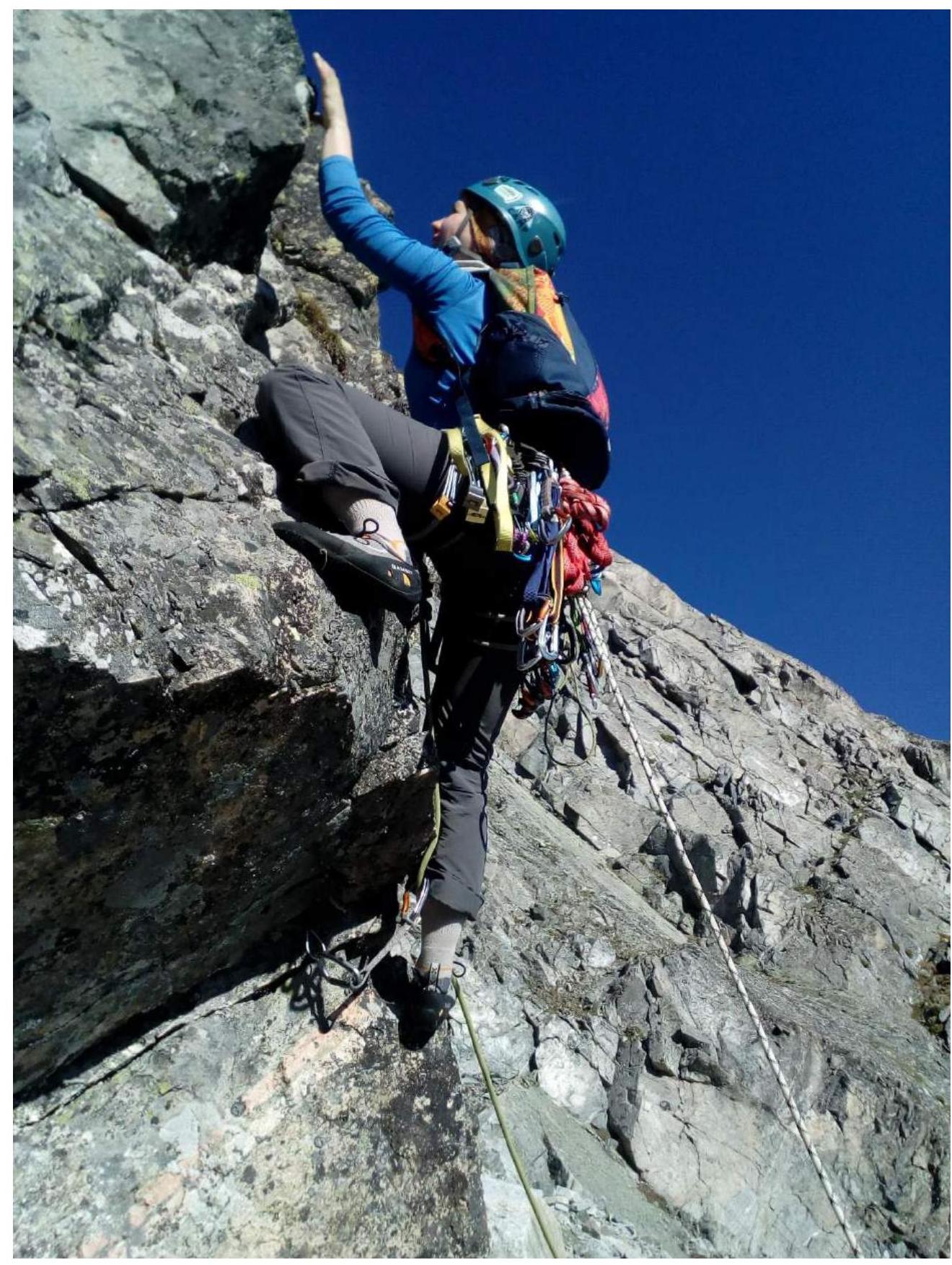
Photo #1. Route start, section R0–R1. Lykova V.V. leading
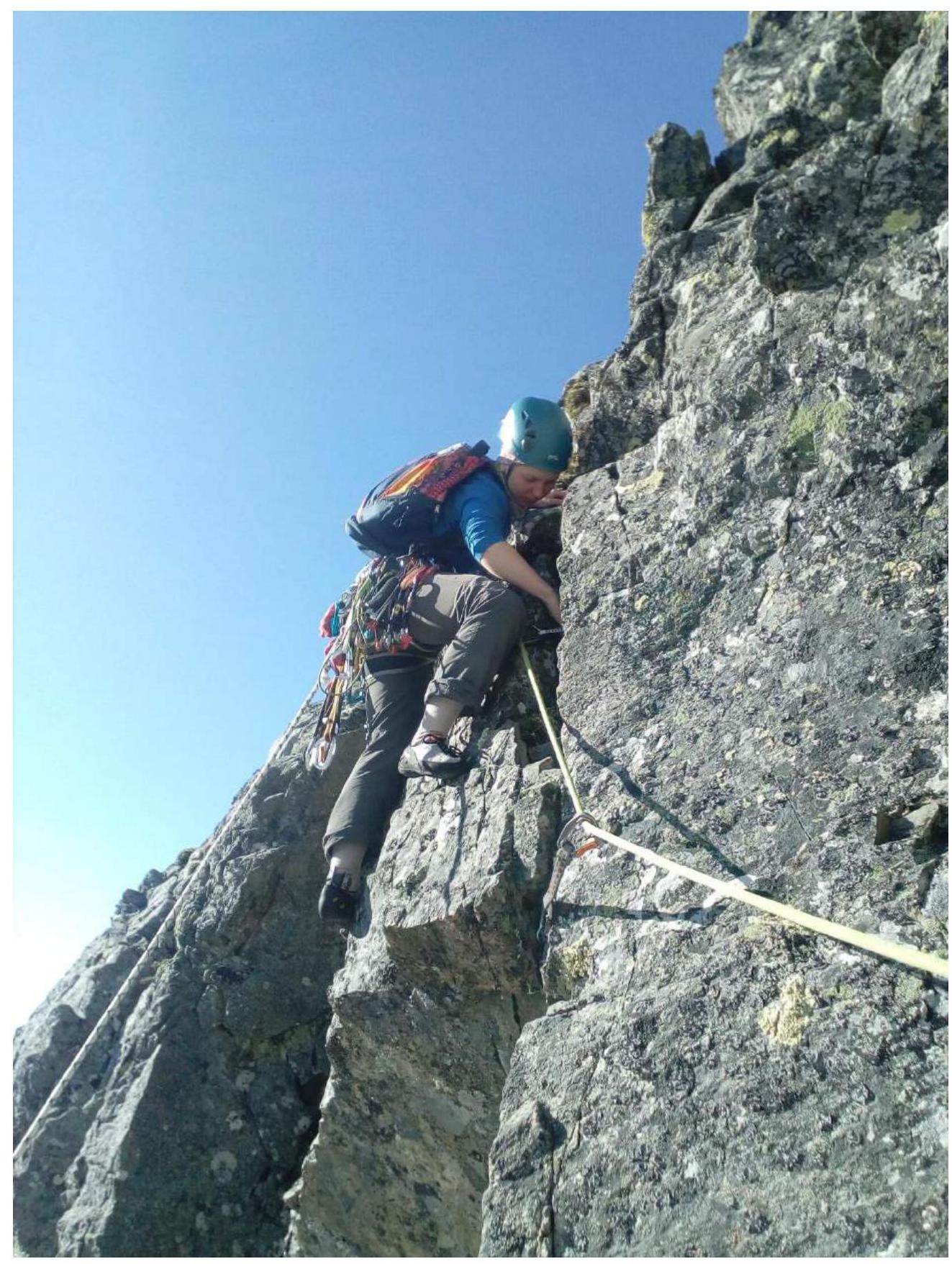
Photo #2. Route start, section R0–R1. Lykova V.V. leading
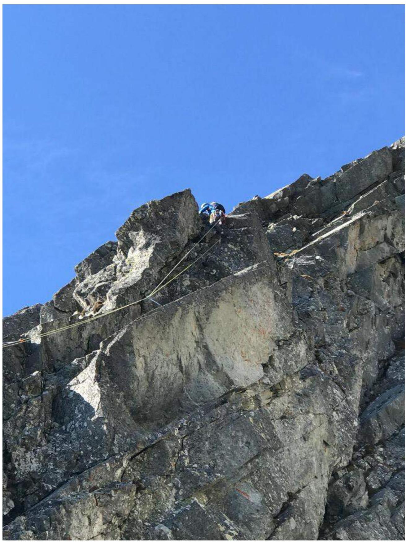
Photo #3. Transition from section R3–R4 to section R4–R5. Lykova V.V. first
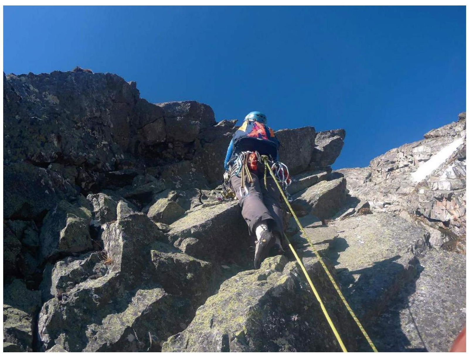
Photo #4. Section R5–R6, then moving up and under the overhang — transition to the left. Lykova V.V.
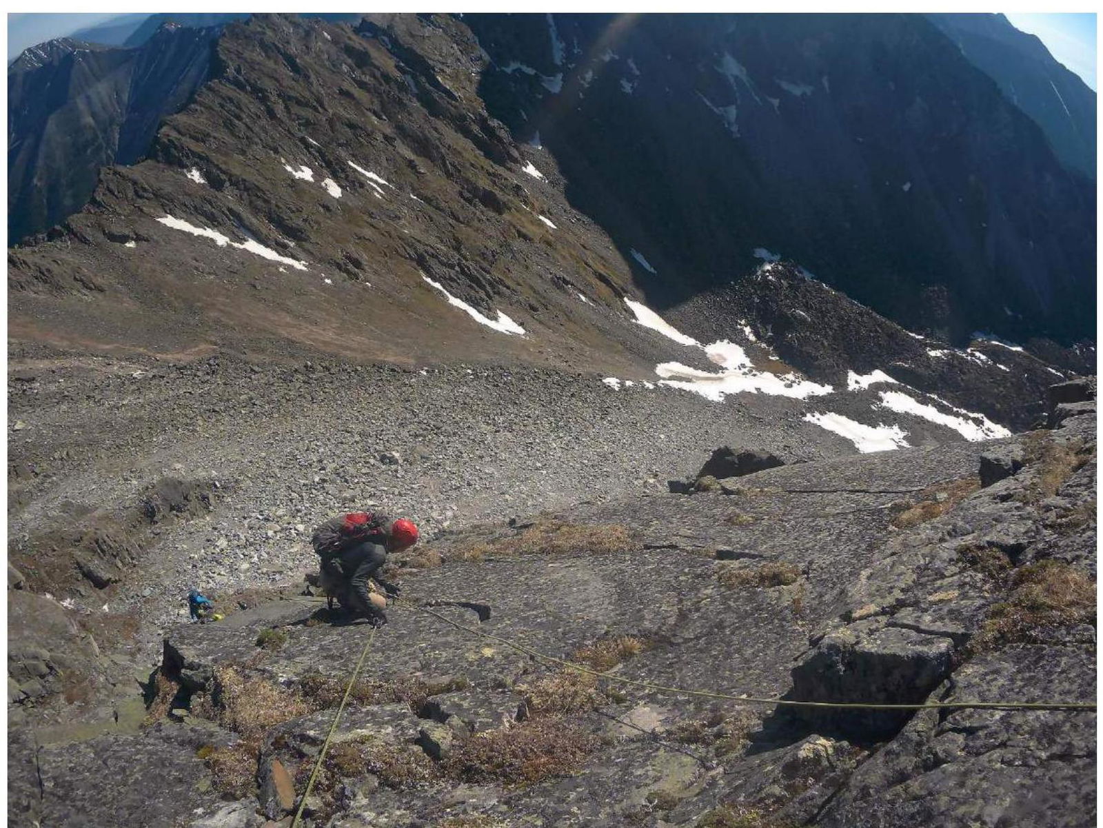
Photo #5. Nikiforov B.I. on section R7–R8, below in blue Chernyavsky M.S.
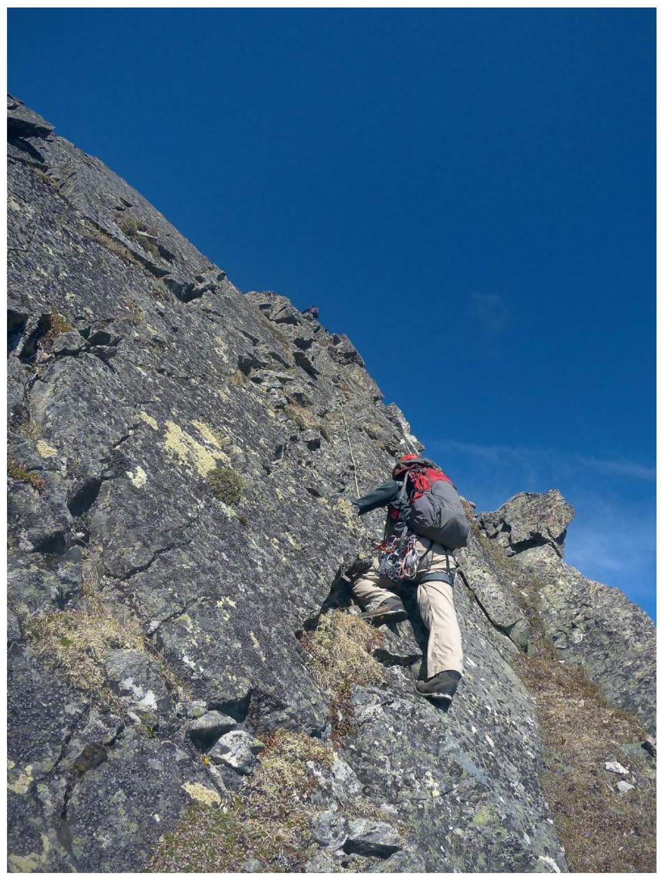
Photo #6. Section R12–R13. Nikiforov B.I., above Gulyaev M.N.
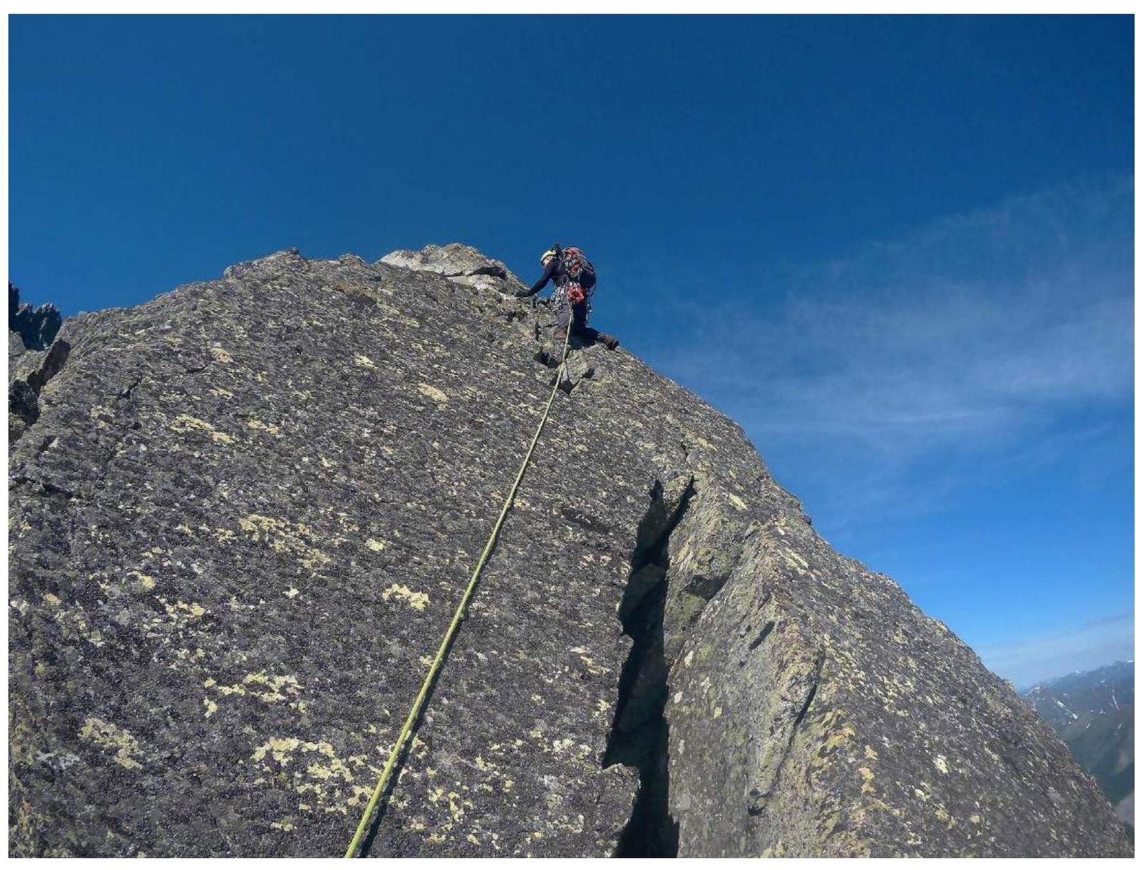
Photo #7. Section R15–R16, then exit to the ridge. First in the rope is Gulyaev M.N.
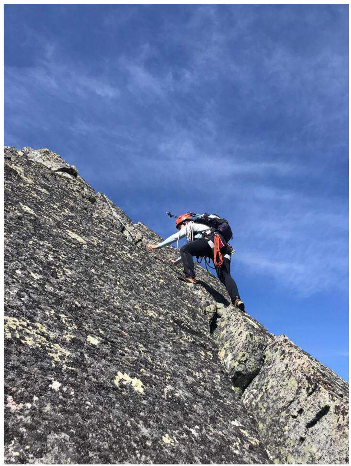
Photo #8. Kolesnikova O.S. on section R15–R16
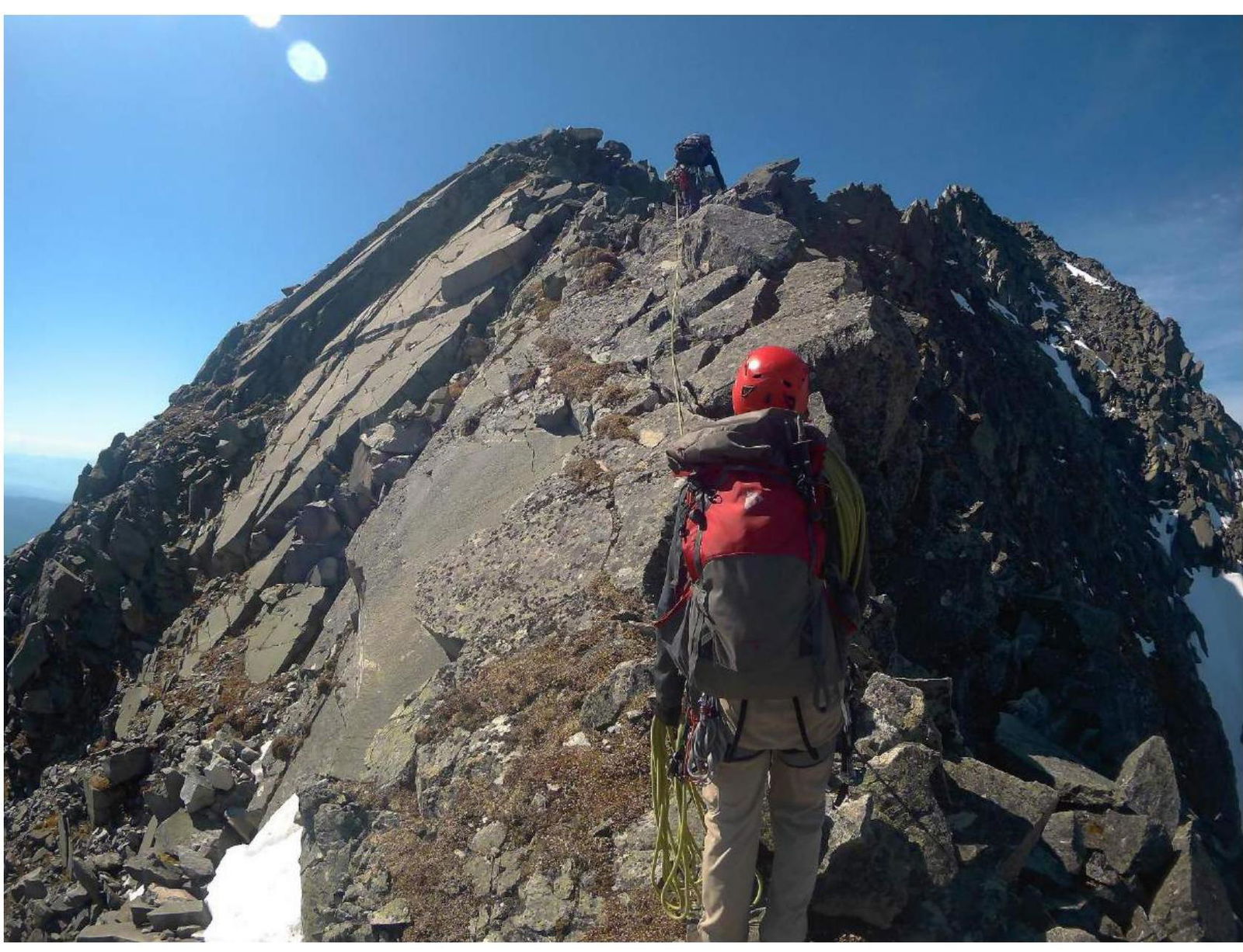
Photo #9. Section R16–R17 — ridge to the summit. Nikiforov B.I., higher on the ridge Gulyaev M.N.
Section-by-Section Description
| № участка | Описание | Номер фото |
|---|---|---|
| R0–R1 | Crack, under which there is a small cornice, passed in a layback. At the start of the crack — a control point in the form of a 0.5-liter plastic bottle with a note inside. 5, 80°. 5 m | №1; №2 |
| R1–R2 | Inner angle with grass. 4, 65°. 8 m | |
| R2–R3 | Movement to the right along a small ledge, then up and left along an inclined slab to an inner angle, transition into the angle (complexity of transition: 4, 75°, 1.5 m), then movement up to the right to a slab. 3, 50°. 12 m. | |
| R3–R4 | Up to the right along a slab with cracks and crevices. 3+, 55°. 10 m. | №3 |
| R4–R5 | Left — exit to the edge of the buttress, up along the edge. 2, 45°. 10 m. Station behind a large rock. | |
| R5–R6 | Up along an inner angle with many loose rocks. 2+, 50°. 10 m. | №4 |
| R6–R7 | Exit left from under a small overhang onto a slab, need to make a dynamic move onto a foot. Caution — possible fall of loose rocks. 4+, 85°. 2 m. | |
| R7–R8 | Up along a series of cracks on a slab, transitioning from one crack to another. A control point in the form of a 0.5-liter plastic bottle with a note inside is installed in the crack. 3+, 40°. 25 m. | №5 |
| R8–R9 | Grasy slope and rocks. 2, 35°. 10 m. Station behind a large rock. | |
| R9–R10 | Up along the edge of the buttress, here and further — movement in ropes with alternating (partly simultaneous) protection and installation of intermediate points. 2, 40°. 35 m. | |
| R10–R11 | Traverse along a grassy ledge to the right. 1+, 20°. 5 m. | |
| R11–R12 | Up along simple rocks. 2, 40°. 10 m. | |
| R12–R13 | Up along slabs with grass, exit to a ledge. 3, 45°. 15 m. | №6 |
| R13–R14 | From the ledge up along simple rocks to the left of a slab with small cornices. 2+, 40°. 40 m. | |
| R14–R15 | Simple rocks to a slab. 2, 45°. 8 m. | |
| R15–R16 | Up along a slab with a chimney, not entering the chimney but using its edges as footholds. Exit to the ridge. Control point in a plastic vial with a lid is hung on a green cord behind a rock. 3, 45°. 12 m. | №7; №8 |
| R16–R17 | Along the ridge to the summit. I–II, 35°. 250 m. | №9 |
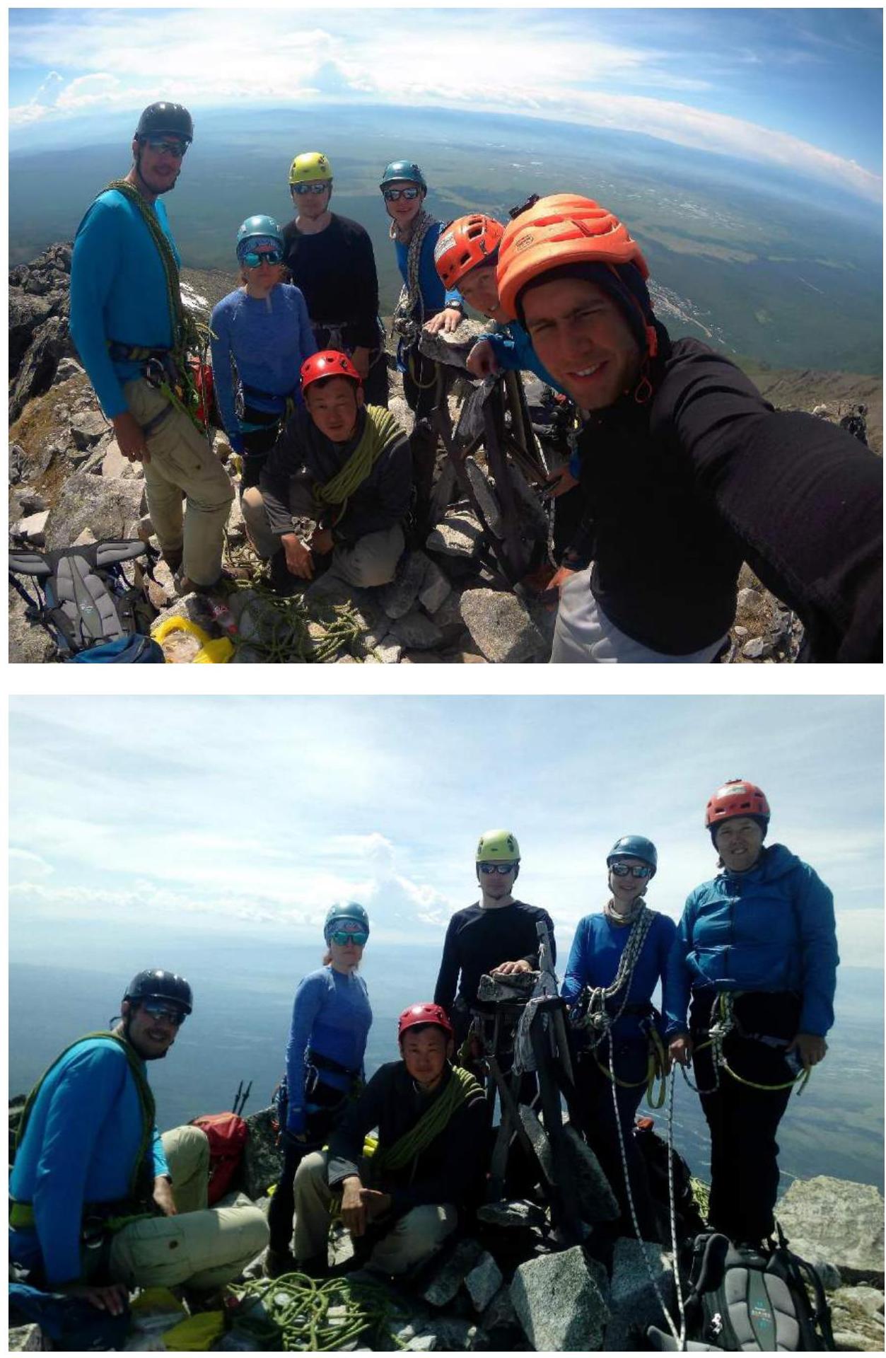
3.2. Team Photo on the Summit at the Control Point
3.3. Route Safety Assessment. Communication Options on the Route. Recommendations for Subsequent Climbers. Information on Descent from the Summit. Conclusion on the Preliminary Route Assessment.
Safety. The route has loose rocks, with the most significant number on the first two ropes.
When passing the first rope, participants should avoid being under the leader to prevent being hit by falling rocks.
The most significant rockfall hazard is on sections R5–R6 and R6–R7.
Communication. The team used radio communication with the base camp via Baofeng portable radios on the route. Mobile communication and internet also work well on the route, summit, and in the Dozhdevoe valley.
Recommendations for subsequent climbers. It is recommended to have anchor hooks on the route to simplify protection organization. In winter, the key sections of the route will be more challenging, and the leader should be confident in climbing rocks in crampons. It is assumed that using an ice axe/ice hammer in winter will simplify the passage. This route is recommended for a group improving in rock climbing and starting to climb 3rd category routes.
Descent. The descent is along the southern ridge. At the beginning of the ridge, there are I–II category slabs — movement in ropes, then osyp. During rain or in winter, the slabs will be slippery.
Movement along this ridge is done until a saddle with a grassy slope at the edge of the forest zone. On the saddle, there is a landmark — broken trekking poles stuck in the ground. From this saddle, descend left down to the base camp in the Dozhdevoe valley along a grassy slope, which turns into a small-medium osyp. If you continue along this ridge, you can descend to Arshan settlement.
Route Difficulty Assessment. Compared to the classified 3A category route along the west wall couloir to v. Bronenosets in this valley, the route passed by the team is more challenging and requires better climbing skills.
Comparing this route to other 3A category routes that the participants have climbed, and similar routes in the Eastern Sayan Mountains, we believe that this route corresponds to the 3A category.
2018 year