
Ascent Passport
-
Region – Eastern Sayan.
-
Peak – Tykhen-Ardyn 3175 m, south spur
-
Claimed – 2B category of difficulty, first ascent.
-
Route type – combined.
-
Route characteristics:
Total elevation gain – 1100 m. average steepness of the main part – 45°.
-
Used on the route: fixed protection – 12 pieces.
-
Total travel hours – 11 hours.
-
Overnight stays – none.
-
Team members:
Leader: Muravyov Vladimir Yuryevich, CMS Verbitsky Alexander Vladimirovich, 2nd sports category Korovin Denis Vladimirovich, 3rd sports category Trunova Evgeniya Gennadyevna, badge holder Rudko Pavel Vasilyevich, badge holder
-
Team coach:
Suvorkina Lyudmila Davydovna, CMS
-
Departure dates:
On the route – April 3, 2005. On the summit – April 3, 2005. Return – April 3, 2005.
-
Ascent organized by – Krasnoyarsk Youth Center for Travelers.
2005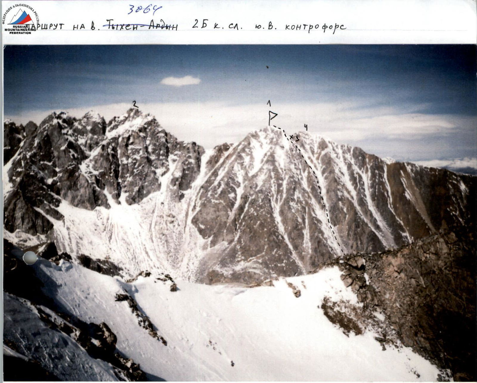
3064
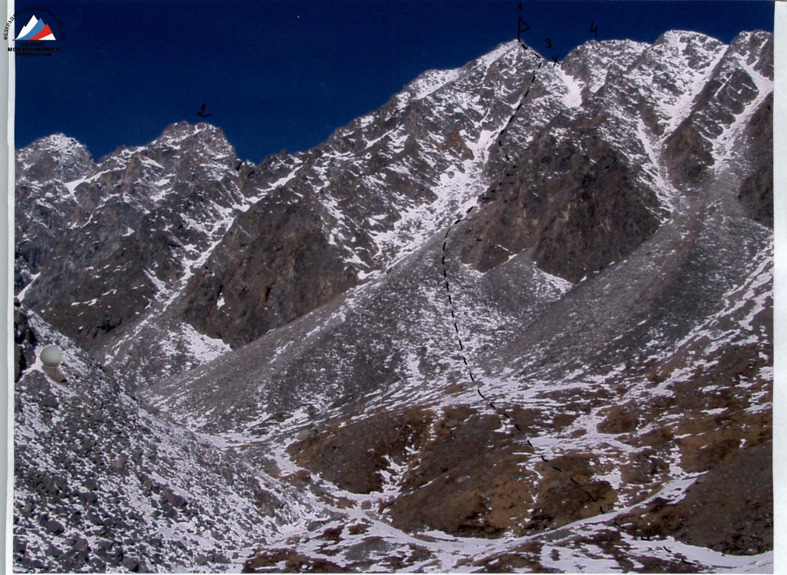
- Mt. Tykhen-Ardyn 3175 m
- Mt. Opasnaya
- pass Gorny
- Mt. Katka-Dura
3064
- Mt. Tykhen-Ardyn 3175 m
- Mt. Opasnaya
- pass Gorny
- Mt. Katka-Dura View of the route from the right
UIAA Scheme of the 2B category route to the summit of Tykhen-Ardyn.
R5 h=3175 m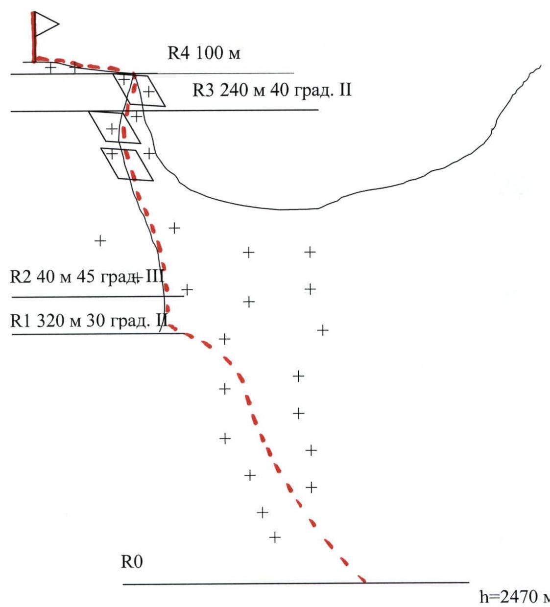
R4 100 m R3 240 m 40° (2) R2 40 m 45° (3) R1 320 m 30° (2) R0 h=2470 m
Route description to the summit of Tykhen-Ardyn, 2B category of difficulty, by sections.
Section R0–R1: Ascent towards the Tykhen-Ardyn pass to the beginning of the rocky ridge, steepness 30°, distance 320 m. Section R1–R2: Ascent onto the rocky ridge via snowy rocks, steepness 45°, distance 40 m. Section R2–R3: Ascent along the snowy rocky ridge, steepness 40–45°, distance 240 m. Section R3–R4: Ascent along the pre-summit snowy rocky ridge to the summit, distance 100 m.
Descent via the 2A route to the Tykhen-Ardyn pass into the Munguvek river valley, or to the north side from the Tykhen-Ardyn pass into the Beliy Irkut river valley.
Comments
Sign in to leave a comment