
Ascent Passport
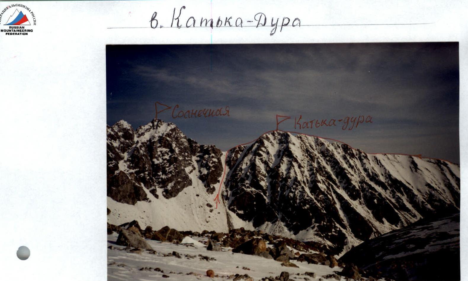
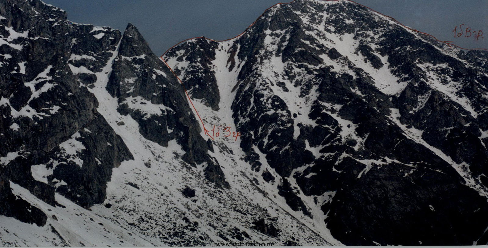
- East Sayan, Bolshoy Sayan ridge, Mguvek gorge, section 6.1.
- Katka-Dura peak, 3064 m, via East ridge.
- Proposed category 1B, first ascent.
- Route type — rocky.
- Height difference 300 m, length 1000 m, average slope 20°.
- Pitons driven: rock and wired 2 pcs.
- Team's travel time — 4 hours.
- No overnight stays.
- Group: Lukina E.A. II sports category Davydenko M.A. II sports category Gutarev Yu.V. III sports category Kikina E.I. III sports category Tsarkov A.M. III sports category
- Coach — Afanasyev A.E., Master of Sports
- Approach to the route and return on May 9, 2003.
Description of the ascent route to Katka-Dura peak via East ridge, category 1B.
Approach from the base camp at the forest boundary in Mguvek gorge:
- first through forest-tundra 1 km,
- then up a 30-degree slope at the start of the ridge 2 km. Takes 2 hours 30 minutes.
The route begins where the slopes turn into a distinct ridge.
R0–R1, 500 m, 10°, 1 — Snowy, gentle, wide ridge. R1–R2, 220 m, 15°, 1 — Snow-covered несложные rocks bypassing two gendarmes. R2–R3, 50 m, 20°, 1 — Ascent to the third gendarme. R3–R4, 20 m, 30°, 1 — Descent to the saddle. R4–R5, 40 m, 45°, 1 — Fourth gendarme via the destroyed rocky ridge. R5–R6, 30 m, 45°, 2 — Sport descent to the saddle. R6–R7, 70 m, 30°, 1 — Hard crust on the snowy slope. Exit to the ridge. R7–R8, 30 m, 10°, 1 — Traverse right along the slope. R8–R9, 20 m, 30°, 2 — Exit to the sub-summit ridge via snow-covered rocks. R9–R10, 30 m, 5°, 1 — Hard crust. R10–R11, 7 m, 80°, 5 — Summit rock. Passed by means of rope tossing. Control cairn on top.
Descent via the simple West ridge to the saddle with Solnechnaya (Tykhen) peak and left down the South couloir.
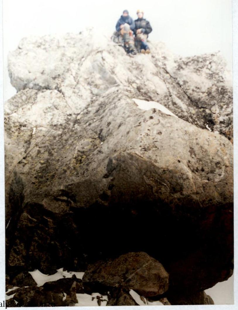
At the summit
6 cambells aura
Comments
Sign in to leave a comment