Ascent Report for the summit of Krylya Sovetov, approximately 2B category of difficulty, via the North Counterfort of the Western Ridge. Bolshoy Sayan Range.
 Ulan-Ude
2018
Ascent Passport
- Ascent area: Eastern Sayan, Bolshoy Sayan Range, Mugivek gorge, section 6.1.1.
- Summit: Krylya Sovetov peak (3341 m), via the North Counterfort of the Western Ridge.
- Estimated category of difficulty: 2B.
- Route type: rock.
- Height difference (according to Google Planet): 390 m Route length: 577 m. Average steepness of the route: 35°
- Total protection points used on the route: pitons and chocks: 10
- Team's total climbing hours: 11 h 45 min
- Team leader: Baguza A.M. — Candidate Master of Sports; Participants:
- Pisarev A.S. — 3rd sports category;
- Ishmatov K.Yu. — 3rd sports category;
- Ivankovich M.O. — 3rd sports category;
- Guz V.V. — 3rd sports category
- Coach: Afanasiev A.E. — Master of Sports.
- Departure from Base Camp to the route: 5:00 May 14, 2018 Summit ascent: 13:25 May 14, 2018 Return to Base Camp: 16:45 May 14, 2018
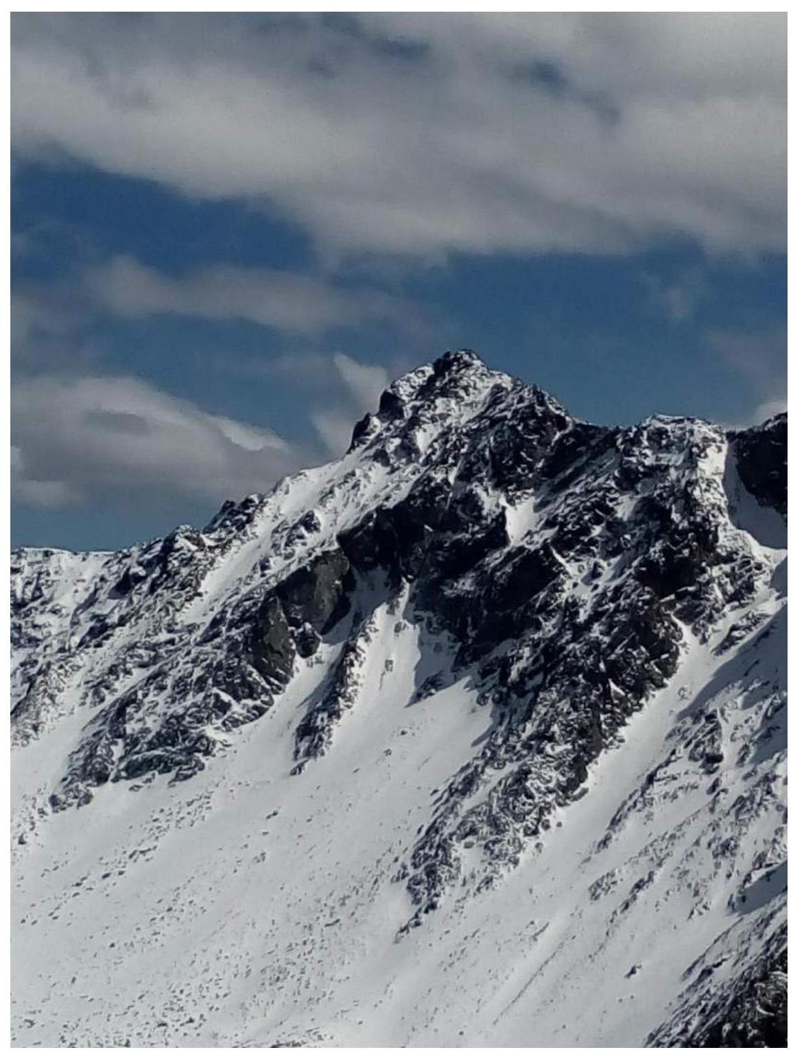
General photo of the summit with the route line

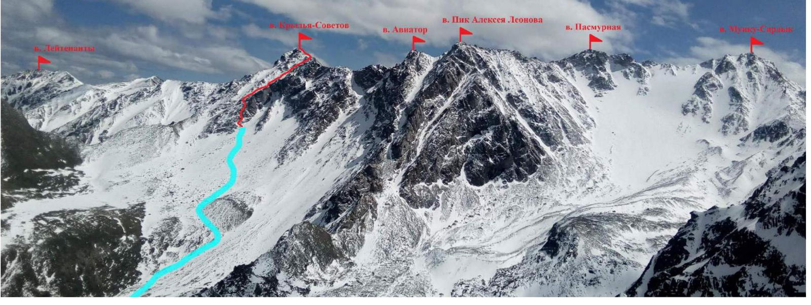
Panorama of the area taken from Mugivek peak

Panorama of the area taken from Lastochka peak, indicating the approach to the route and the route thread
UIAA Scheme and route description by sections
Descent path through the couloir
between route 2A on the
North ridge and route
2B climbed by the team
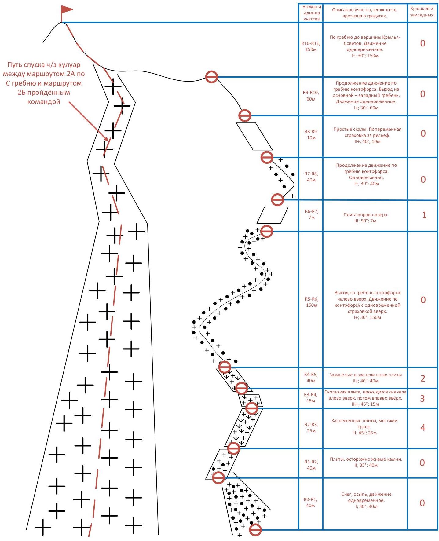
| Section number and length | Section description, difficulty, steepness in degrees | Pitons and chocks |
|---|---|---|
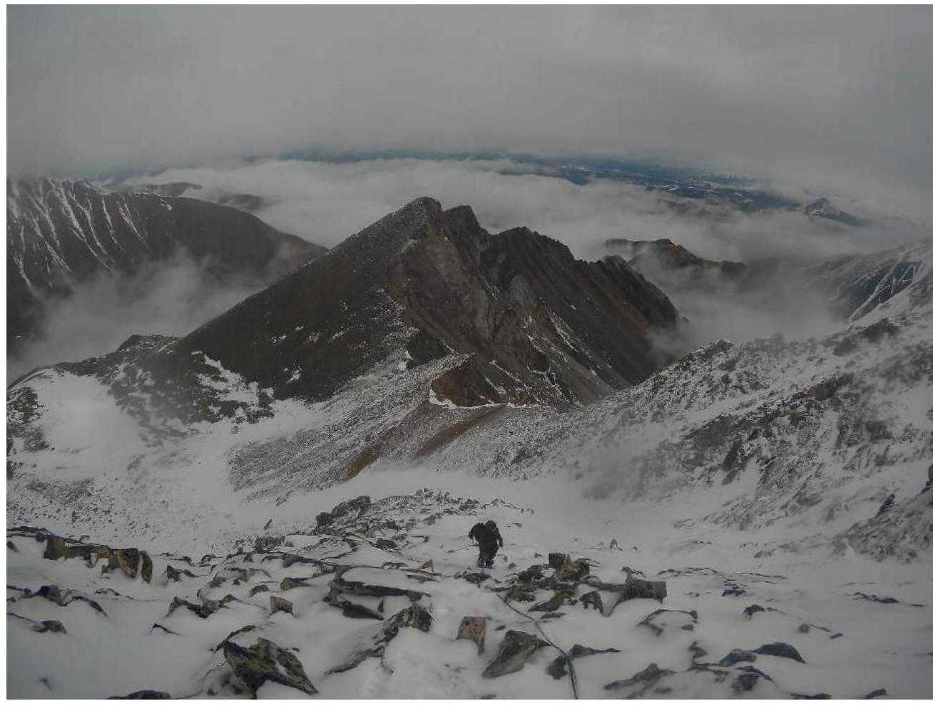
| R10–R11, 150 m | Along the ridge to the summit of Krylya Sovetov. Simultaneous movement. 1; 30°; 150 m | 0 |
| R9–R10, 60 m | Continuing along the counterfort ridge. Exit to the main - western ridge. Simultaneous movement. 1; 30°; 60 m | 0 |
| R8–R9, 10 m | Simple rocks. Alternate belay on terrain. 2; 40°; 10 m | 0 |
| R7–R8, 40 m | Continuing along the counterfort ridge. Simultaneous. 1; 30°; 40 m | 0 |
| R6–R7, 7 m | Slab to the right-up 3; 50°; 7 m | 1 |
| R5–R6, 150 m | Exit to the counterfort ridge to the left-up. Movement along the counterfort with simultaneous belay up. 1; 30°; 150 m | 0 |
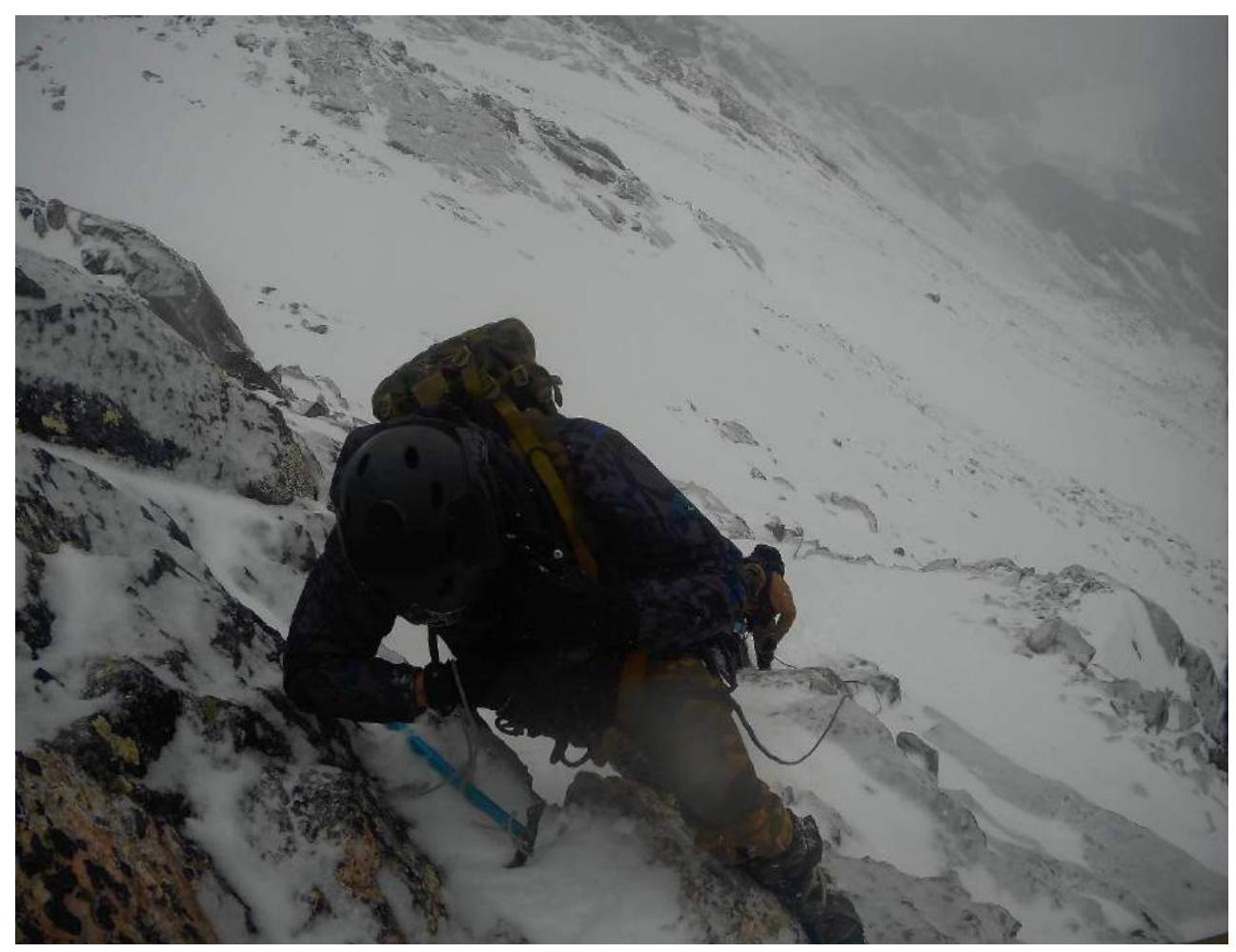
| R4–R5, 40 m | Mossy and snow-covered slabs 2; 40°; 40 m | 2 |
| R3–R4, 15 m | Slippery slab, first goes left-up, then right-up. 3; 45°; 15 m | 3 |
| R2–R3, 25 m | Snow-covered slabs, with grass in places. 3; 45°; 25 m | 4 |
| R1–R2, 40 m | Slabs, careful of loose rocks. 2; 35°; 40 m | 0 |
| R0–R1, 40 m | Snow, scree, simultaneous movement. 1; 30°; 40 m | 0 |
Photographs
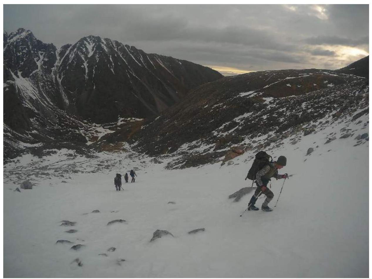
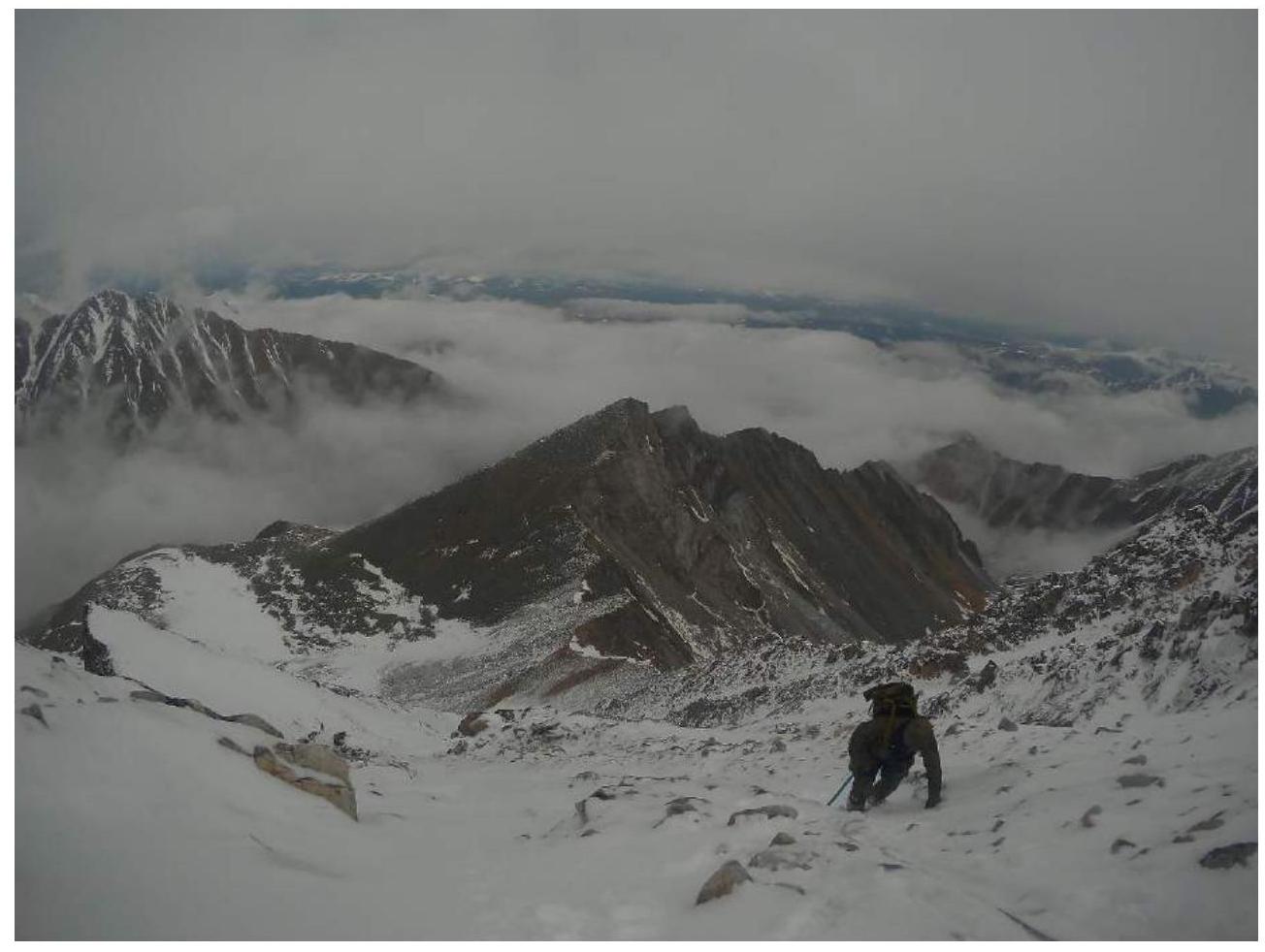
On the approach to the route
At the start of section R1–R2
R2–R3
R4–R5
Ropes made on section R3–R5 (photo taken from R5)
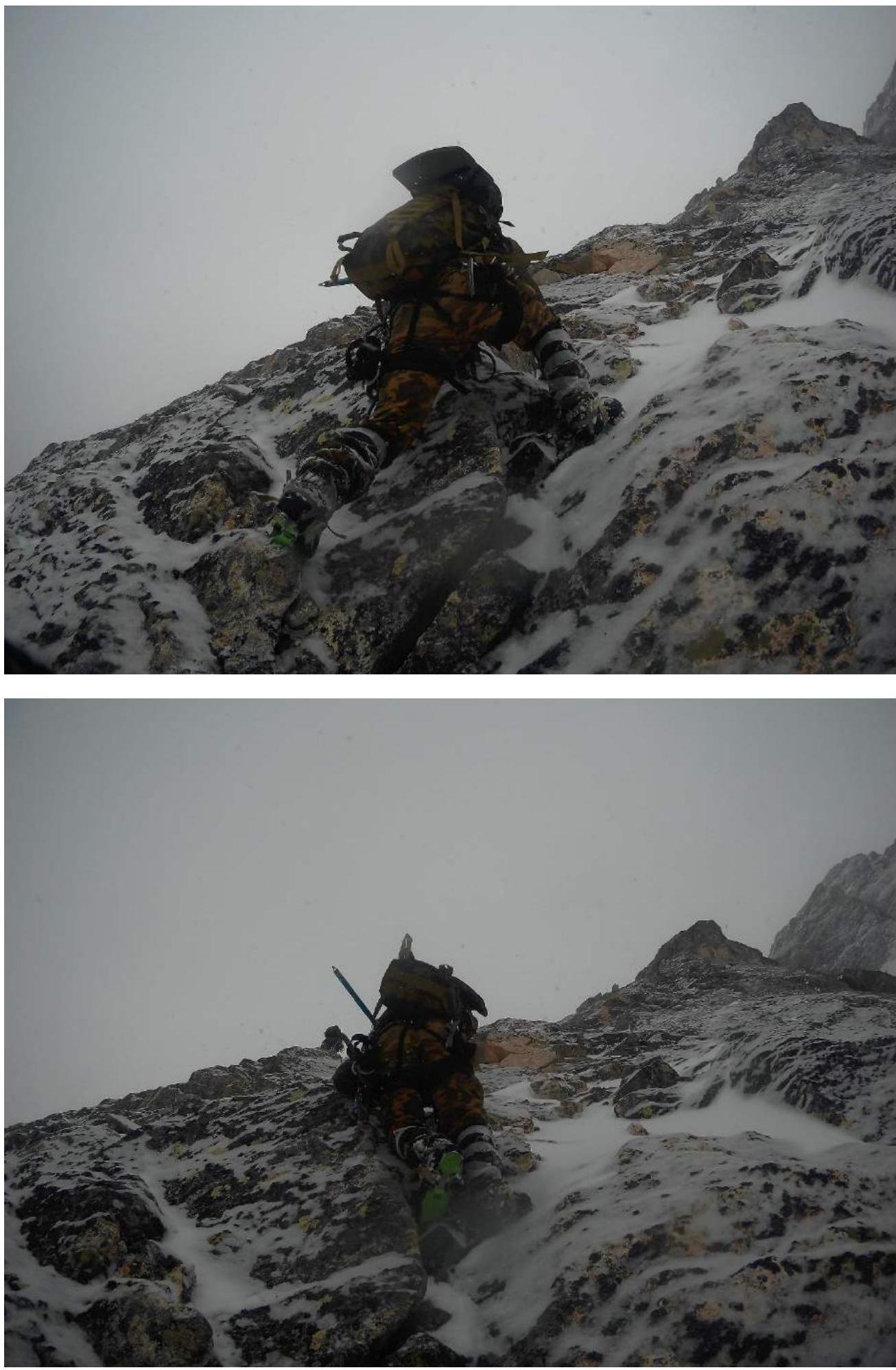
R5–R6
R7–R8
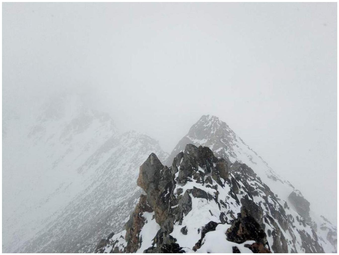
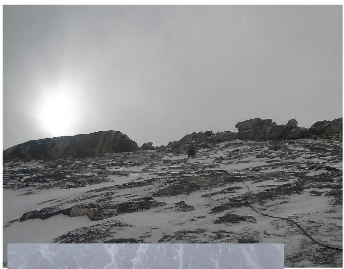
Exit to the ridge R10
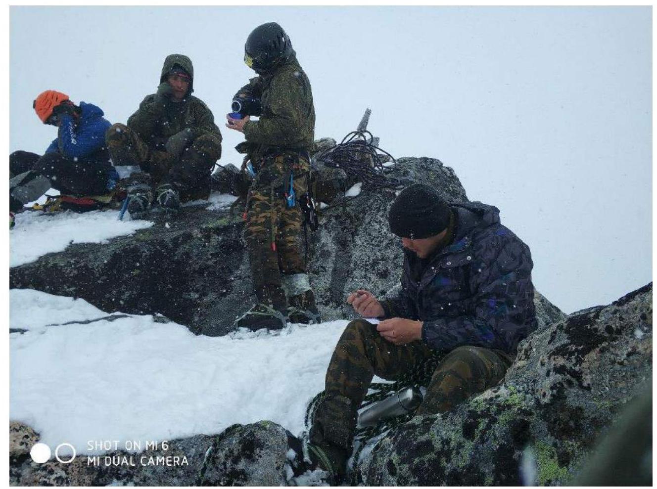
Photo at the summit


