Ascent Passport
- Region — Eastern Sayan.
- Peak — Krylya Sovetov 3341 m ridge from Muguvek pass
- Assumed — 2B cat. diff., first ascent.
- Route character — combined.
5. Route characteristics:
Total elevation gain — 1200 m, including ascent to Muguvek pass. Average steepness of the main part — 40°.
- Equipment used on the route: ice screws — 2, chocks — 12 pieces.
- Total travel hours — 12.
- Overnights — none.
- Team members:
Leader:
- Muravyov Vladimir Yuryevich CMS
- Verbitsky Alexander Vladimirovich 2nd sports category
- Korovin Denis Vladimirovich 3rd sports category
- Omelchenko Mikhail Alexandrovich badge
- Rudko Pavel Vasilyevich badge
10. Team coach:
Suvorkina Lyudmila Davydovna CMS
11. Departure date:
On route — April 5, 2005. On summit — April 5, 2005. Return — April 5, 2005.
-
Ascent organized by — Krasnoyarsk Youth Center for Travelers.
-
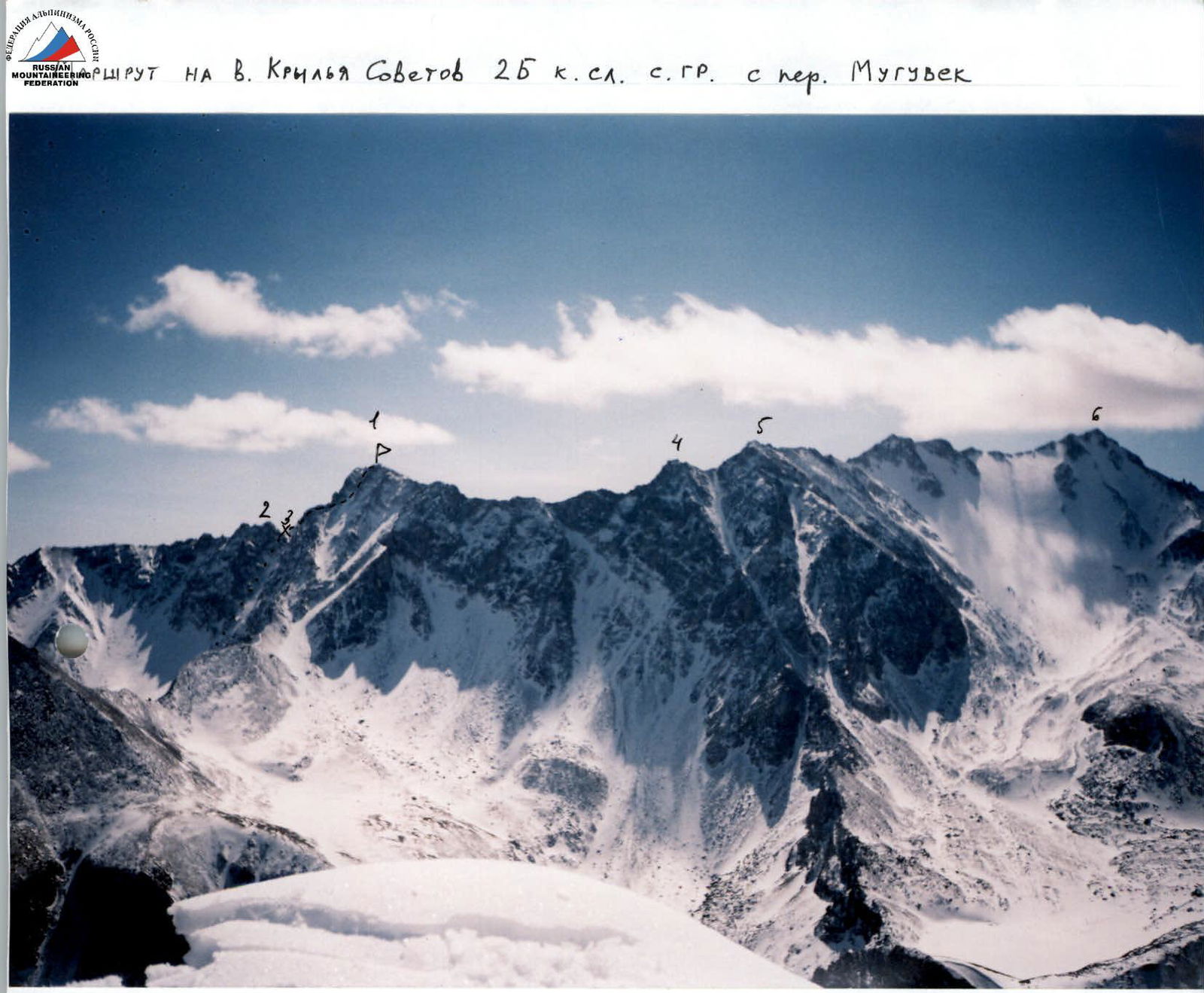
P. Krylya Sovetov 3341 m
-
P. 2974
-
Muguvek pass
-
P. Aviator
-
P. Leonova
-
P. Munku-Sardyk
Route description to peak Krylya Sovetov 2B cat. diff. by sections.
Section R0–R1
- Ascent to Muguvek pass via snow-rock slope with 30° steepness
- Distance 800 m.
Section R1–R2
- Snow-covered rocky ridge, steepness 35–45°.
- Distance 400 m.
- All obstacles are bypassed on the right.
Section R2–R3: Snow couloir, steepness 40°, distance 50 m. Section R3–R4: Snow-covered pre-summit rocky ridge, steepness 30°, distance 50 m.
Descent via the ascent route to the eastern side of Muguvek pass. Alternative descent: via snow couloir to the north into Muguvek river valley.
UIAA scheme of 2B cat. diff. route to peak Krylya Sovetov
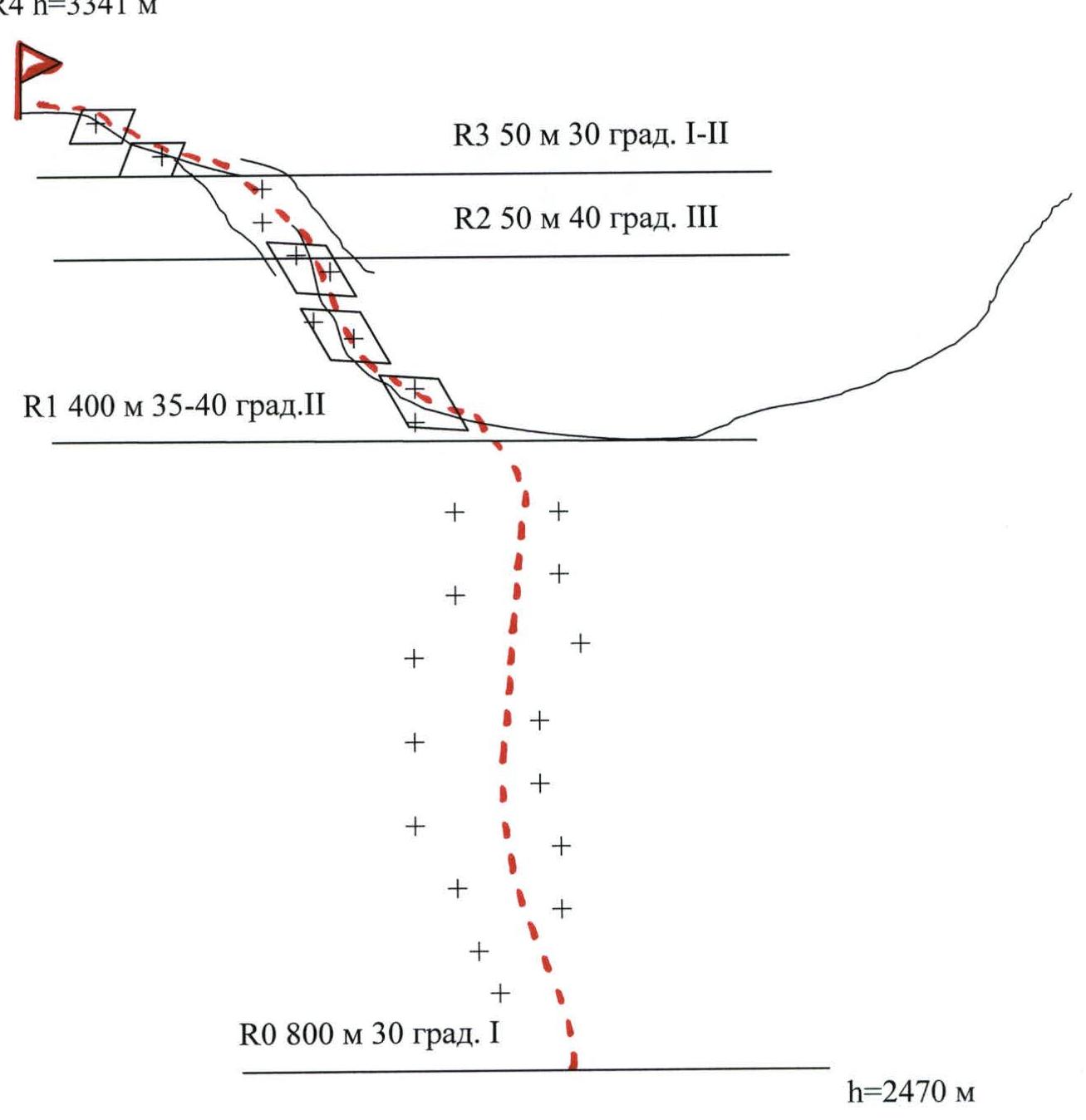
R4 h=3341 m R3 50 m 30° 1–2 R2 50 m 40° 3 R1 400 m 35–40° 2 R0 800 m 30° 1 h=2470 m

