REPORT
ON THE FIRST ASCENT TO THE SUMMIT 4971 VIA THE SOUTHWEST RIDGE (SOUTHWEST PAMIR, NORTH SHUGNAN RANGE) BY THE VARZOB ALPINIST CLUB TEAM CONSISTING OF:
- TRONOV Yu.N. — TEAM LEADER
- BELINSKY S.F. — MEMBER
- MISHCHENKO E.A. — MEMBER
- STEFANOVICH A.V. — MEMBER
Pamir-1978. TABLE OF MAIN CHARACTERISTICS OF THE ASCENT ROUTE TO PEAK 4971 VIA THE SW RIDGE
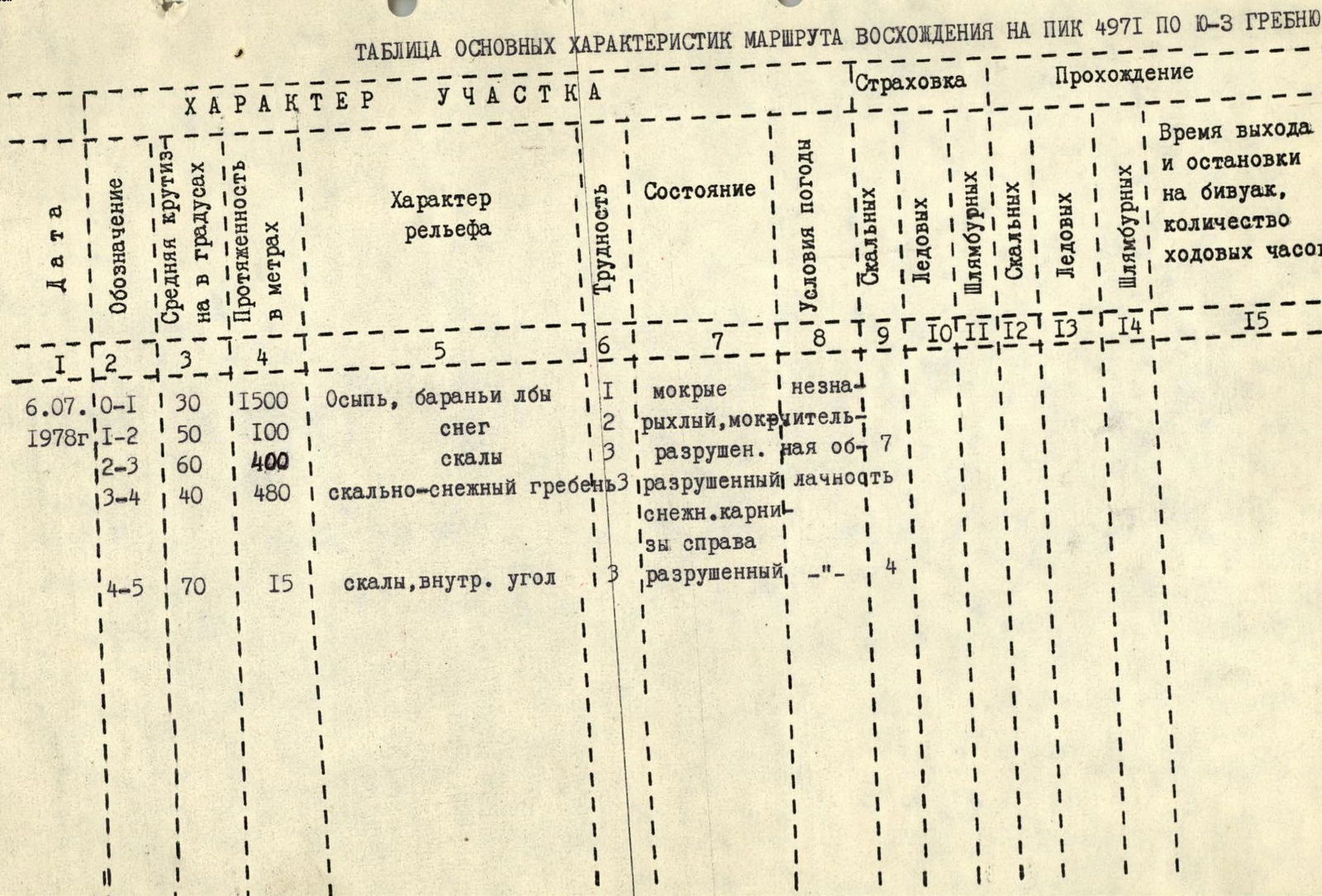
EXPLANATION TO THE TABLE № (Description of the ascent route to peak 4971) From the bivouac near the rocks, the snow-ice cirque between the Southwest ridge and the Northwest edge is clearly visible.
0—1 The path to it goes first across the scree, then across snow and rock. Before reaching the rocks, the steepness of the snow slope increases sharply. To the left of the ice slope, 4 buttresses lead to the ridge. The route passes via the second buttress from the right.
1—2 Ascent to the buttress via a steep (up to 50°) snow slope, 100 m. Insurance with an ice axe. 1.5–2 hours from the bivouac.
2—3 The path along the buttress goes through heavily destroyed rocks of medium difficulty. It is recommended to go along the edge of the buttress as there are fewer "live" rocks. Insurance via ledges and pitons. In the upper part of the buttress, it is possible to go along its right side. After 400 m, exit to the Southwest ridge. Cairn.
3—4 Along the ridge to the first gendarme, which is bypassed on the left or climbed straight on. Then there is a sharp snow slope with small cornices on the right, 40 m. Further, again along the rocks of medium difficulty on the ridge to the second gendarme. Climbing or bypassing on the right (when bypassing, piton insurance is necessary). Along the heavily destroyed ridge to the South shoulder of the summit. From the shoulder, left to the summit tower.
4—5 First across simple, then across rocks of medium difficulty, exit to the summit via an inner corner, 15 m. 7 hours from the bivouac.
Descent is recommended via the Northwest edge to the third couloir and further down the couloir (left in the direction of travel). Descent from the summit to the bivouac near the rocks takes 2–3 hours.
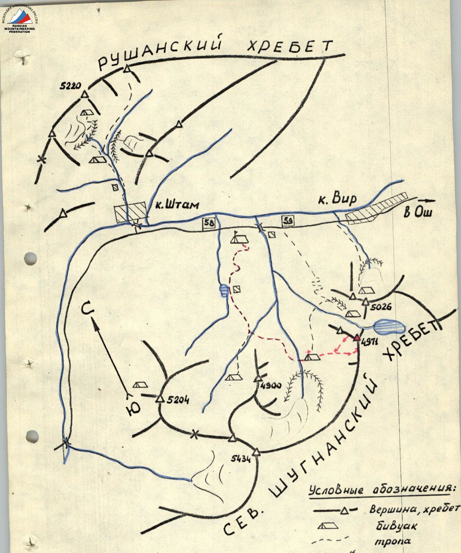
MAP OF THE AREA

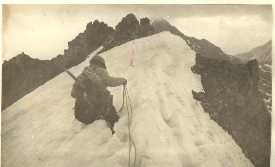
BEGINNING OF THE BUTTRESS. Section 1—2 and 2—3
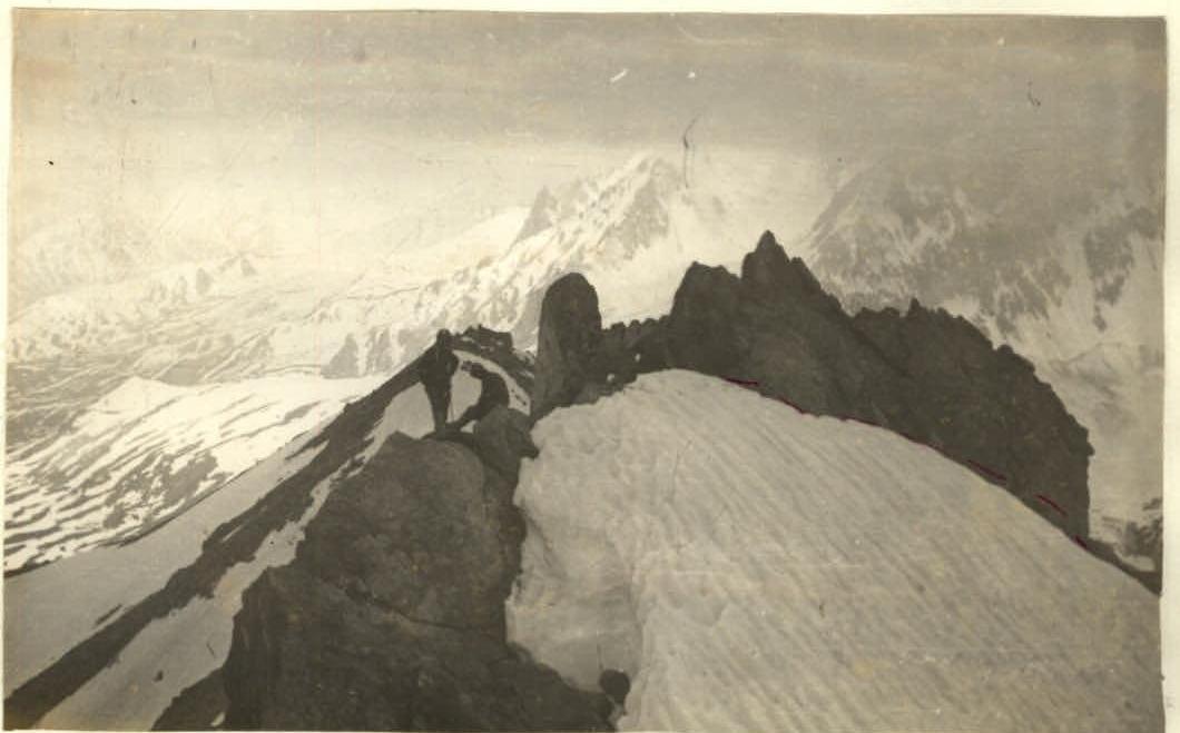
South ridge. Part of section 3—4