
- Ascent class: technical.
- Ascent area, ridge: South-West Pamir, North Shugnan ridge.
- Summit, its height, ascent route:
- 40 let Chelyabinskogo politekhnicheskogo instituta;
- 5070 m;
- along the W ridge.
- Proposed difficulty category: 3B, comb.
- Route characteristics:
- height difference — 670 m;
- average steepness — 35°;
- Pitons driven: for belay for RPE
| rock | ice | bolted | |
|---|---|---|---|
| for belay | 14 | 2 | - |
| for RPE | - | - | - |
- Number of travel hours (on ascent): 8 hours.
- Number of overnight stays and their characteristics: there were no overnight stays. There are convenient overnight stay locations at sections 5 and 9.
- Surnames, names, patronymics of the leader, participants, and their qualification: Leader — Danileyko Alexander Fedorovich, 2nd sports category. Participant — Stepanov Sergey Igorevich, 2nd sports category.
- Team coach: Ryabukhin Alexander Grigorievich, Honored Coach of the RSFSR in alpinism.
- Dates of departure on the route and return: August 15, 1983, August 15, 1983.
- the described route
- S. Pelyudov's route along the N wall
- M. Karpenkov's route along the N wall

Route diagram (view from the south)
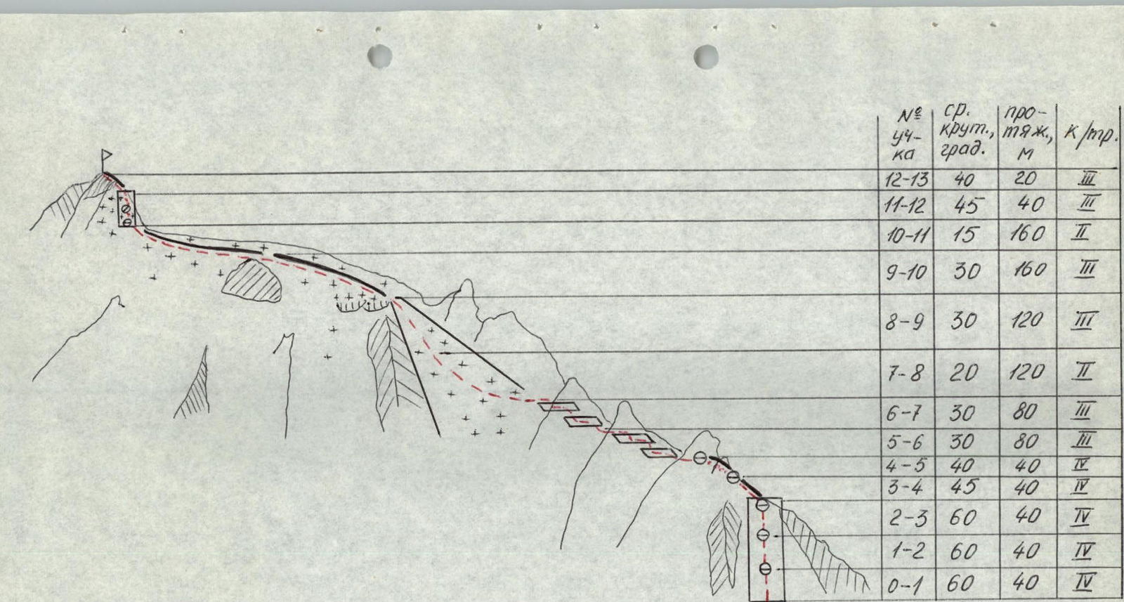
TABLE OF MAIN CHARACTERISTICS OF THE ASCENT ROUTE
| Date, time | Designation | Average steepness, ° | Length, m | Terrain characteristics | Difficulty | Condition | Weather conditions | Rock pitons | Ice pitons | Bolted pitons |
|---|---|---|---|---|---|---|---|---|---|---|
| 10:00 | R0–R1 | 60 | 40 | Rock wall | 4 | Sand-covered rocks | Clear | 4 | - | - |
| 10:45 | R1–R2 | 60 | 40 | idem | 4 | idem | idem | 4 | - | - |
| 11:15 | R2–R3 | 60 | 40 | idem | 4 | idem | idem | 2 | - | - |
| 12:00 | R3–R4 | 45 | 40 | Rock rib | 4 | Monolith | idem | 2 | - | - |
| 12:50 | R4–R5 | 40 | 40 | idem | 4 | idem | idem | 2 | - | - |
| 13:20 | R5–R6 | 30 | 80 | Inclined rock shelves (bypass of gendarmes) | 3 | Broken rocks | idem | - | - | - |
| 14:00 | R6–R7 | 30 | 80 | idem | 3 | idem | idem | - | - | - |
| 14:45 | R7–R8 | 20 | 120 | Snow-ice couloir | 2 | Loose snow | idem | - | - | - |
| 15:15 | R8–R9 | 30 | 120 | idem | 3 | idem | idem | - | - | - |
| 16:00 | R9–R10 | 30 | 160 | Snow ridge | 3 | idem | idem | - | - | - |
| 16:30 | R10–R11 | 15 | 160 | idem | 2 | idem | idem | - | - | - |
| 17:00 | R11–R12 | 45 | 40 | Snow-ice wall | 3 | Ice | idem | - | - | 2 |
| 18:00 | R12–R13 | 40 | 20 | Rock tower | 3 | Monolith | idem | - | - | - |
Descent from the summit along the North ridge to the snow saddle between Peak 40 let ChPI and Peak Vodzh. The ridge is rocky, with an estimated difficulty of 3A category. During the descent, one 40 m rappel was organized, and 2 rock pitons were driven.
Brief description of the approach. The assault camp is located on the right side of the Vodzh North glacier under the saddle between Peak 4971 and Peak Vodzh (camp 4300). The approach from the base camp, located near the 59th kilometer of the Horog-Osh highway, to camp 4300 takes 4 hours. From camp 4300, along the right-hand (orographic) moraine of the glacier and on snow, ascend to the saddle between Peak 4971 and Peak Vodzh, and then exit onto the saddle. From the saddle, without gaining height, move along the southern slope of Peak Vodzh in a southwest direction. A slight descent and exit onto the glacier flowing out of the cirque of Peak 40 let ChPI and Peak Vodzh. Crossing the glacier tongue from the left (orographic) bank to the right leads to the foot of the 120-meter 60° rock wall, where the route begins.
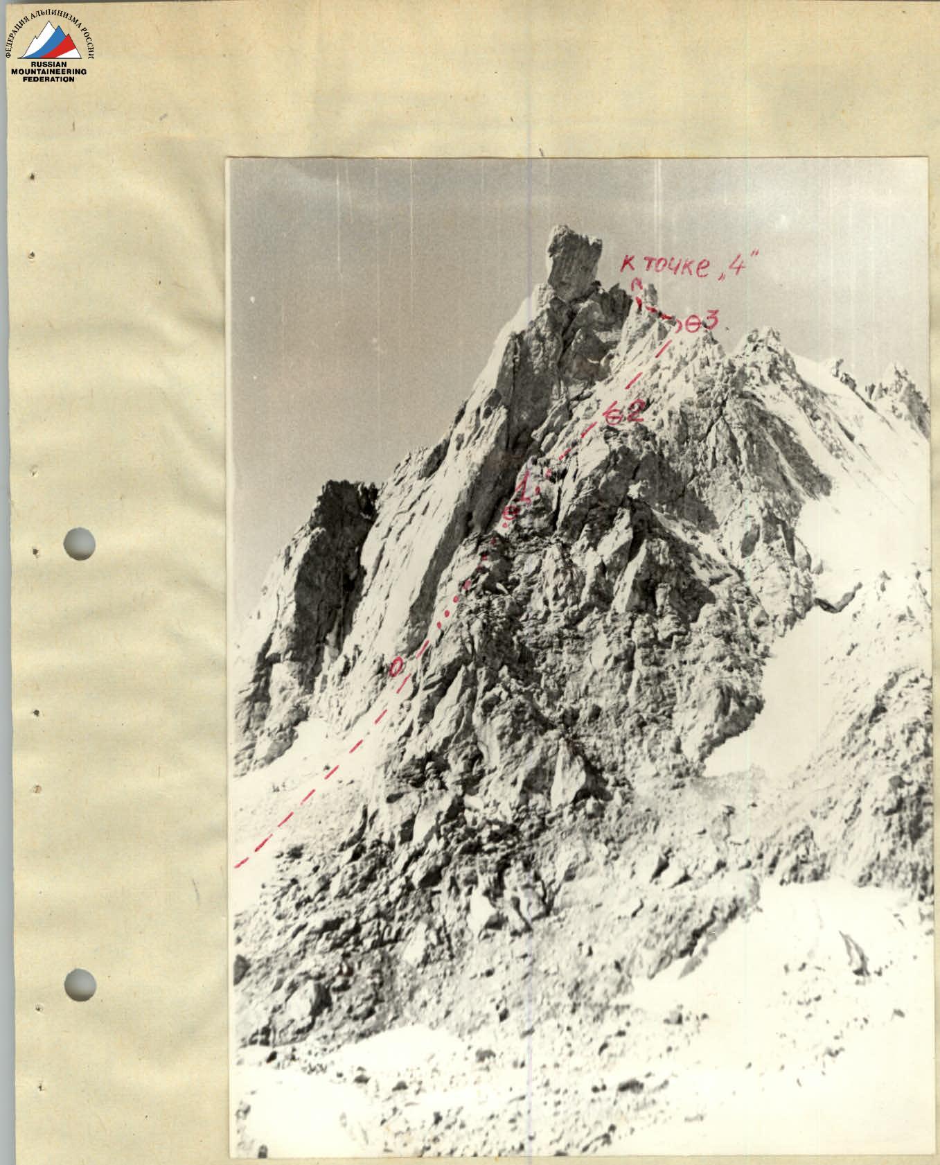
Photo 2. Start of the route (wall).
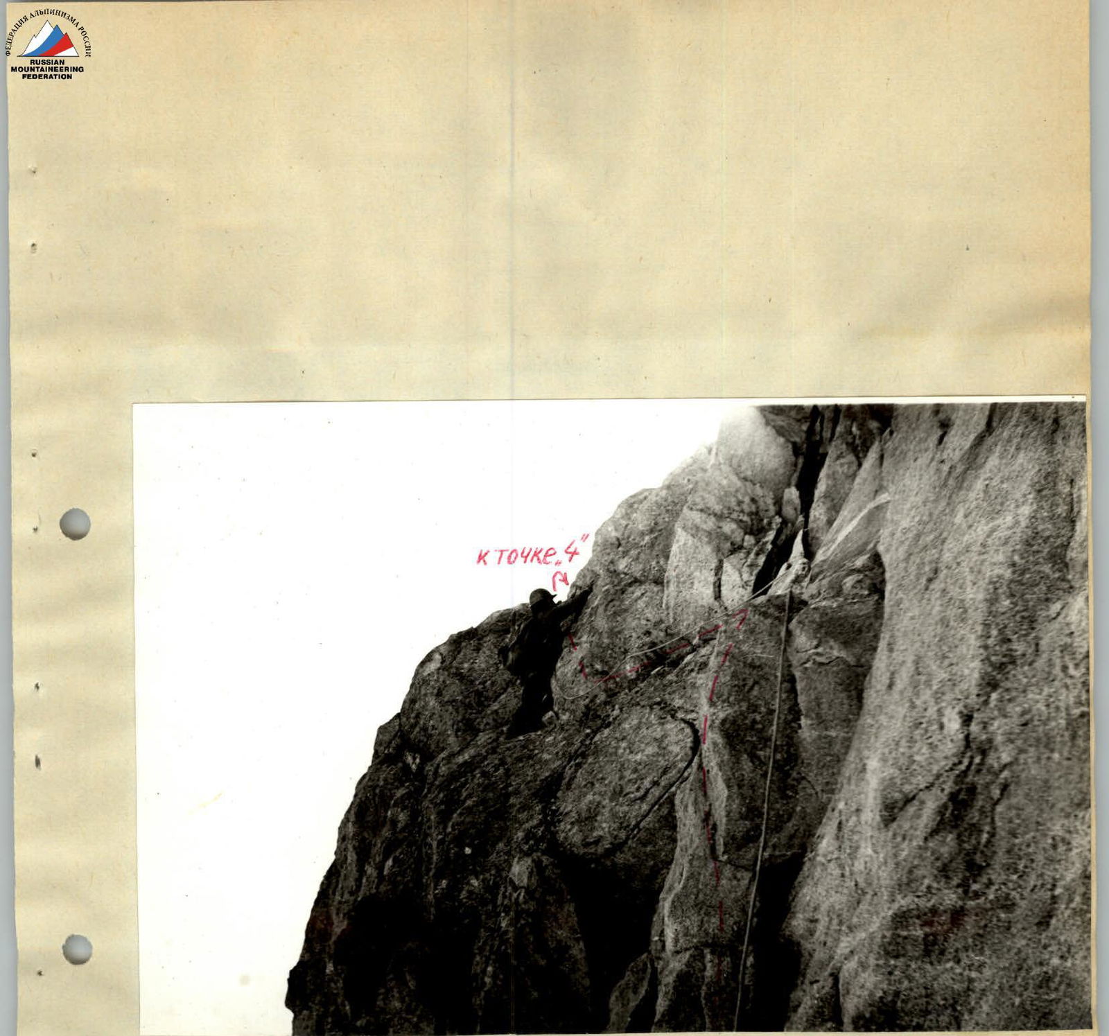
Photo 4. Passing the rock rib on section R3–R4.
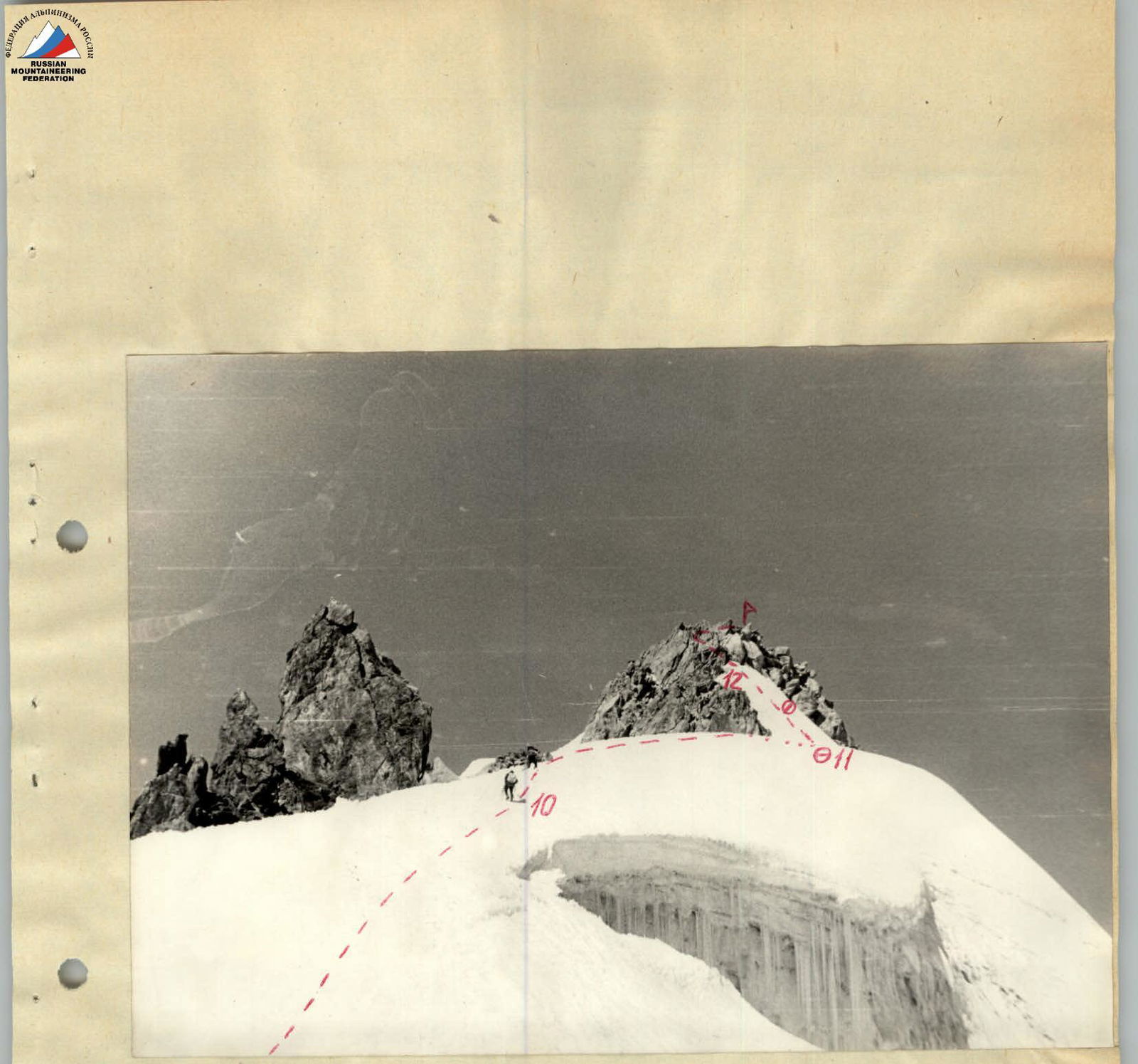
Photo 5. Snow ridge (taken from point 9).