
Southwestern Pamir
North Shugnanskiy ridge
p. Vodzh (5434)
First ascent route 3A cat. diff. by E. slope, combined
600 m, 40°, 360/m, 100/Tv, 7 pitches, 3 belays, 6 hours
Tarkhanov V.G. Samokotin Yu.T. Svyazin G.F. Rublev V.P. Elgin V.M. Petrov E.A.

August 13, 1983
Brief description of the approach to the route
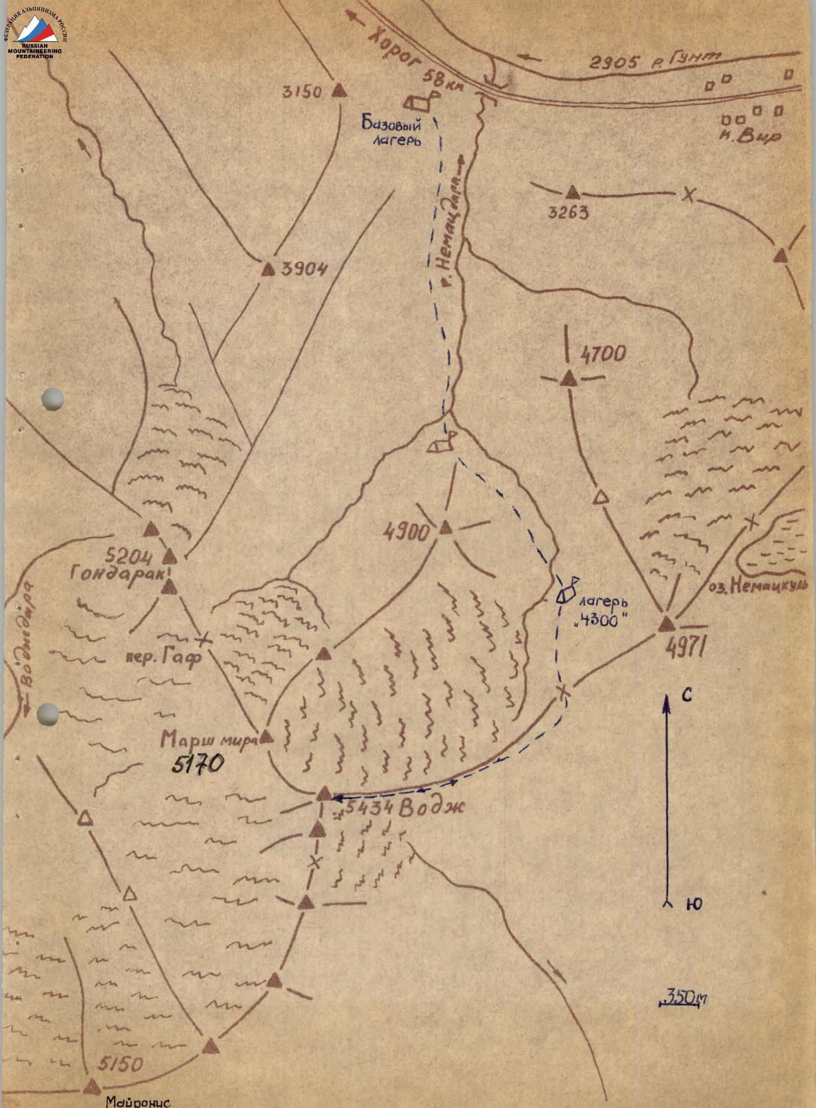
By car from the city of Osh along the Pamir Highway, pass the village of Vir and at the 58th km (counting from Khorog) on the left side in the direction of travel, in a willow grove is the base camp.
The assault camp "4300" is located on the right (orographically) side of the Vodzh Severny glacier under the saddle between peak 4971 and p. Vodzh.
The approach from the base camp to camp "4300" takes 4 hours.
From here, the approach to the route takes 1.5 hours. From camp "4300" along the right-hand (orographically) moraine of the glacier and on snow - ascent to the saddle between p. 4971 and p. Vodzh, and then - exit to the saddle. From the saddle, with a gain in height, move along the southern slope of p. Vodzh along the rocky ridge. A pronounced counterfort is visible. The route begins here.
p. Vodzh (5434)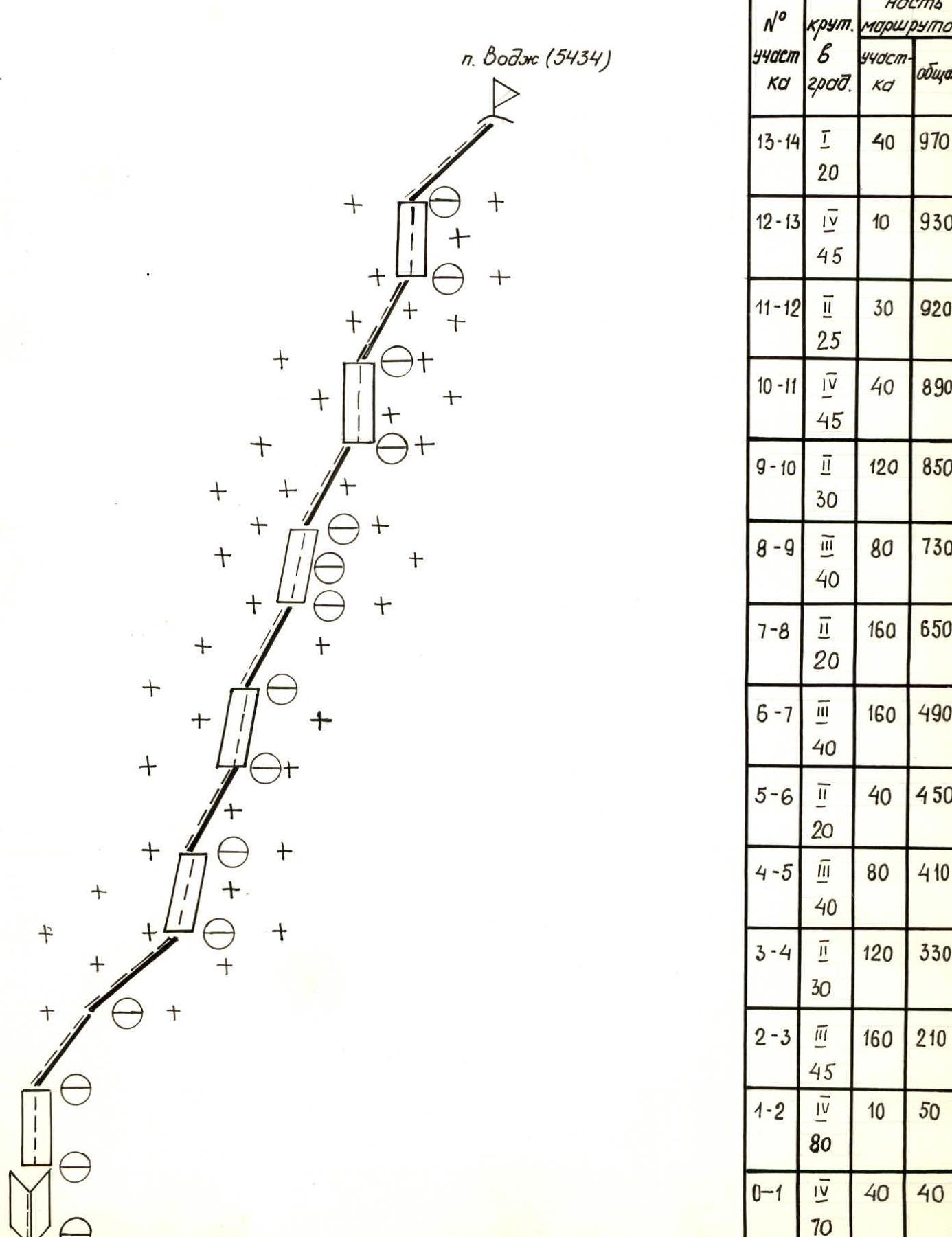
Route sections table
| Section # | Steepness (in degrees) | Section difficulty category | Section length (m) | Total length (m) |
|---|---|---|---|---|
| R13–R14 | 20 | 1 | 40 | 970 |
| R12–R13 | 45 | 4 | 10 | 930 |
| R11–R12 | 25 | 2 | 30 | 920 |
| R10–R11 | 45 | 4 | 40 | 890 |
| R9–R10 | 30 | 2 | 120 | 850 |
| R8–R9 | 40 | 3 | 80 | 730 |
| R7–R8 | 20 | 3 | 160 | 650 |
| R6–R7 | 40 | 3 | 160 | 490 |
| R5–R6 | 20 | 2 | 40 | 450 |
| R4–R5 | 40 | 3 | 80 | 410 |
| R3–R4 | 30 | 2 | 120 | 330 |
| R2–R3 | 45 | 3 | 160 | 210 |
| R1–R2 | 80 | 4 | 10 | 50 |
| R0–R1 | 70 | 4 | 40 | 40 |
Comments
Sign in to leave a comment