Ascent Passport
- Ascent category — technical
- Pamir, Yazgulyam Range
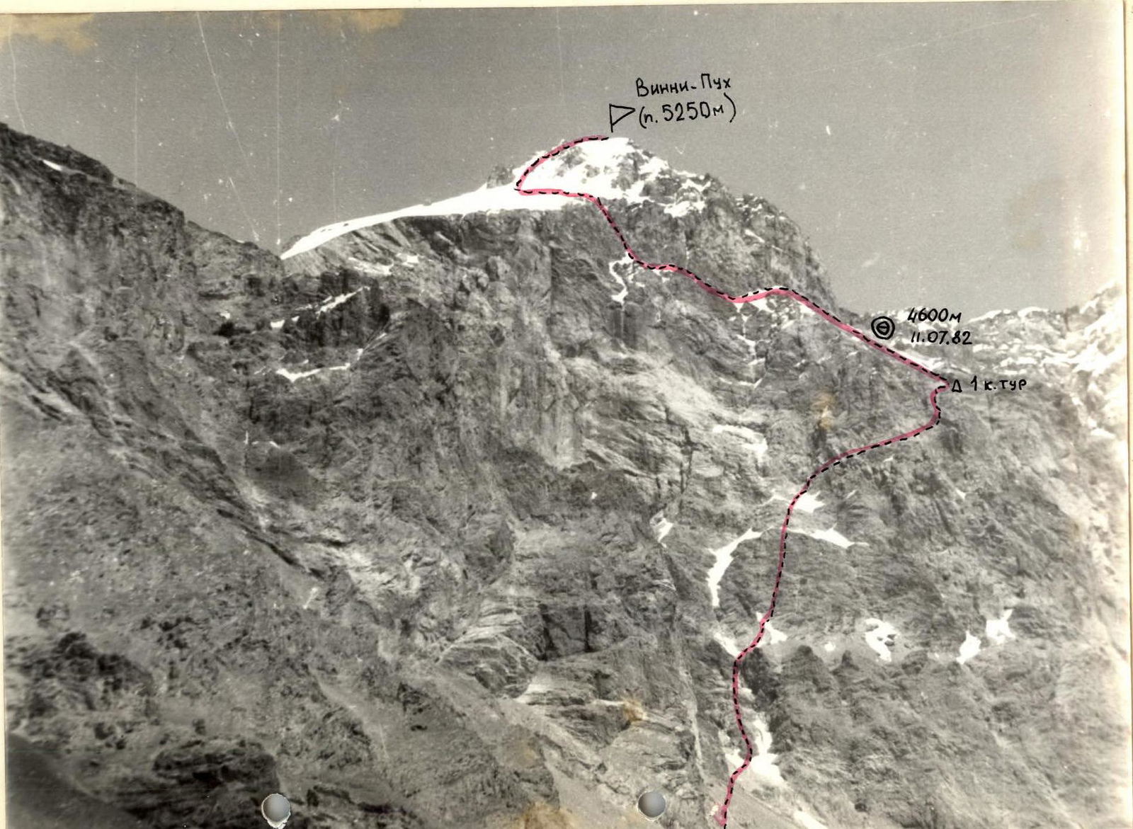
- v. Winnie-the-Pooh (peak 5250 m) via the center of the western wall
- Estimated category of difficulty — 5A, first ascent
- Route characteristics: height difference — 1250 m length of sections with 5th category of difficulty — 130 m average steepness — 50°
- Pitons hammered: for belaying: rock (including chocks) — 62 ice — 1 bolt — none for creating artificial anchors — 1
- Total hours on the route — 19
- Nights on the route — one, lying on a comfortable site
- Group composition:
- Krasavin Viktor Ivanovich, Candidate Master of Sports, leader
- Bogomolov Sergei Georgievich, Master of Sports of the USSR
- Osipov Dmitry Georgievich, Candidate Master of Sports
- Ponomarchuk Viktor Semenovich, Candidate Master of Sports
- Coaches: Manshin Yu.P., Master of Sports of the USSR, 1st category instructor-methodologist Mikhailov A.A., Master of Sports of the USSR, 1st category instructor-methodologist
- Departure to the route — July 11, 1982
Return — July 12, 1982
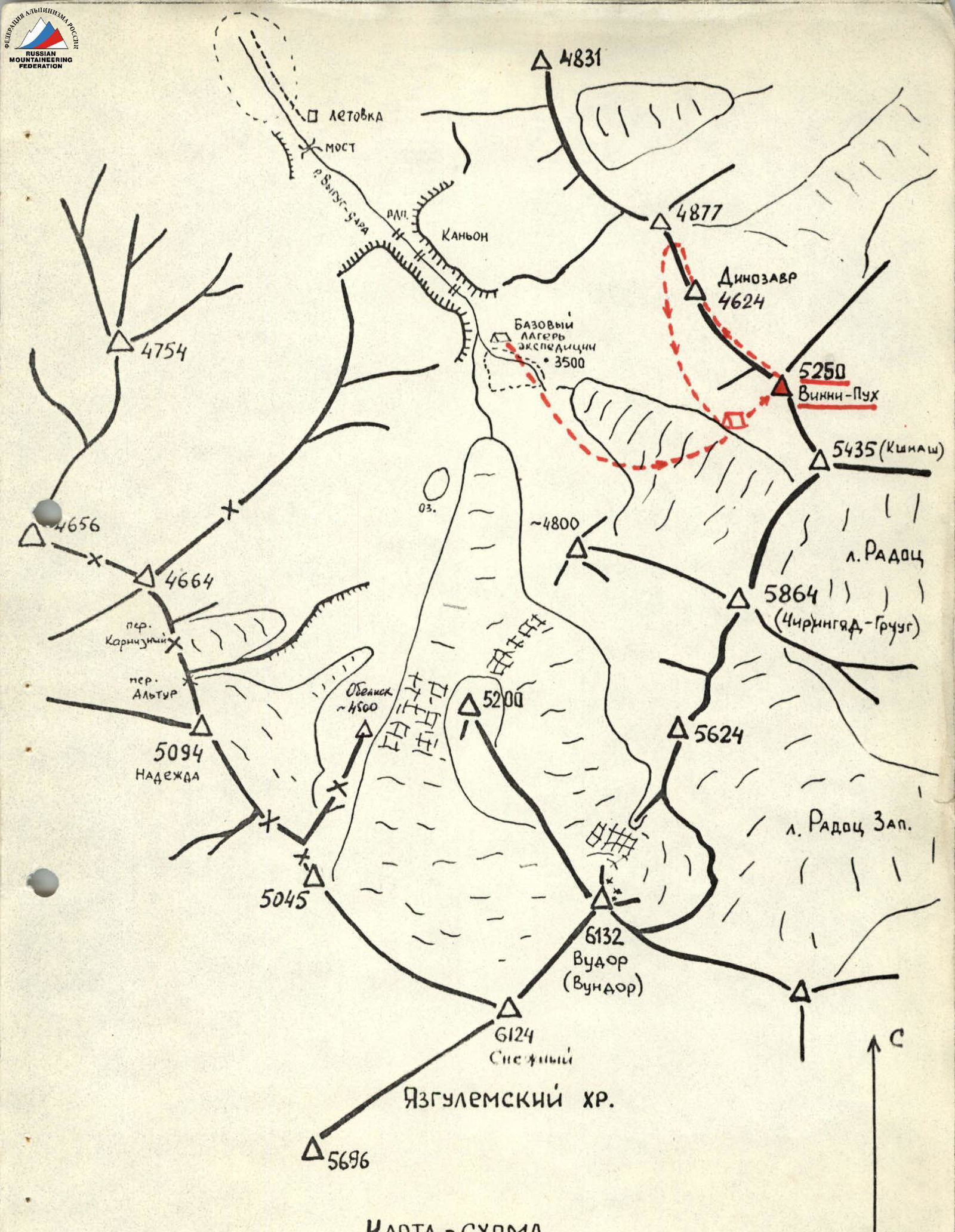
MAP — SCHEME OF THE WESTERN PART OF THE YAZGULYAM RANGE
(Vundor, Chiringyad-Gruug, etc. – Local mountain names in Yazgulyam language. 93.) Scale 1:50000
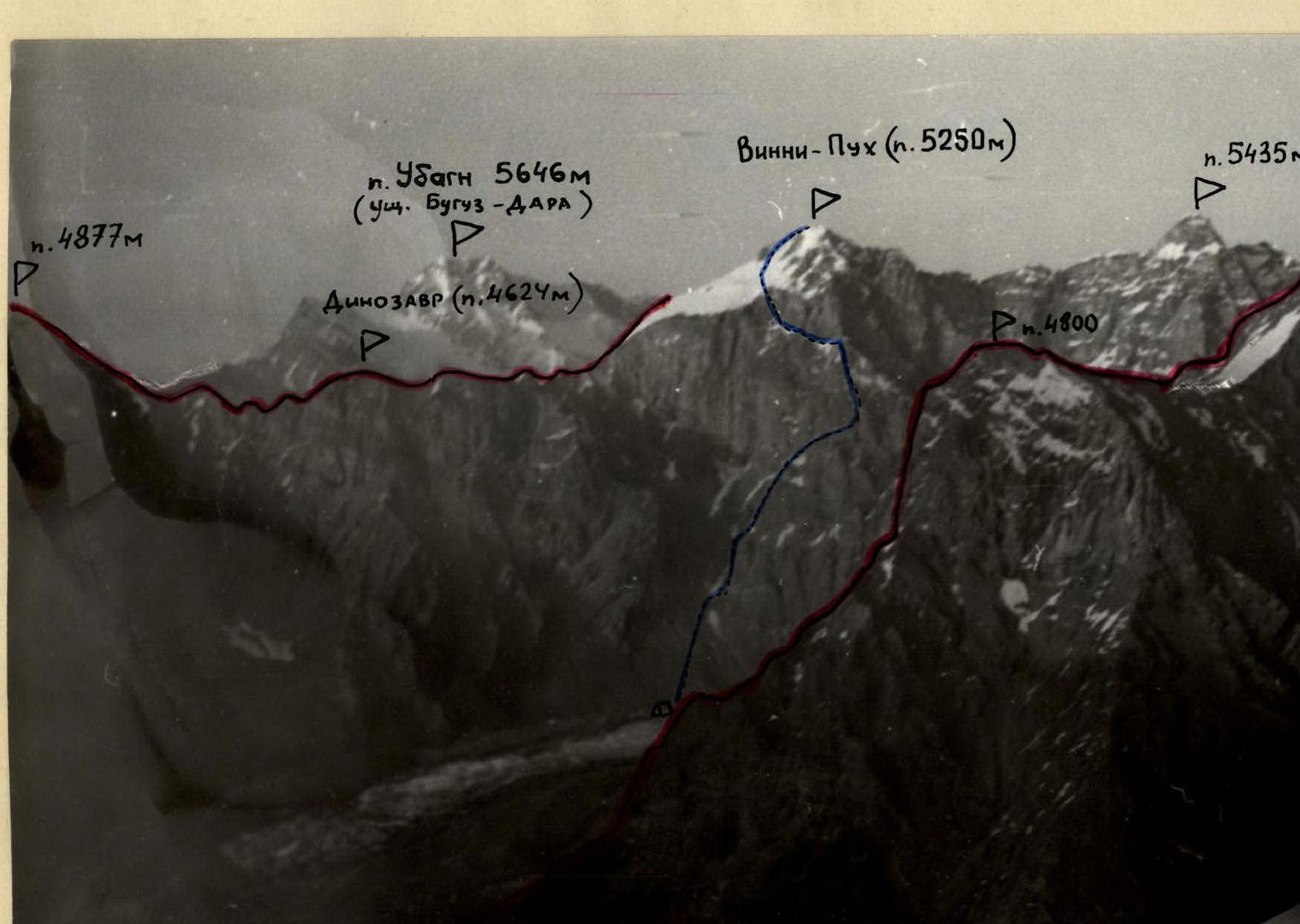
Photo #2. Panorama of the northwestern spur of the Yazgulyam Range. The photo was taken from the slope of p. 4664 m.
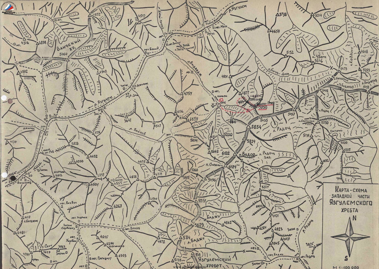
MAP — SCHEME OF THE WESTERN PART OF THE YAZGULYAM RANGE

Table of main characteristics of the ascent route to v. Winnie-the-Pooh (p. 5250 m) via the center of the western wall, Pamir, Yazgulyam Range.
| Date | Section | Average steepness, ° | Length, m | Terrain characteristics | Category of difficulty | Condition | Weather conditions | Rock pitons | Ice pitons | Bolt pitons |
|---|---|---|---|---|---|---|---|---|---|---|
| July 11, 1982 | R0 | 40 | 350 | scree | 1 | unstable | Clear | – | – | – |
| R1 | 45 | 100 | snow | 2 | dense | Clear | – | – | – | |
| R2 | 55 | 130 | ridge | 3 | destroyed | Clear | 2 outcrops | – | – | |
| R3 | 70 | 45 | walls | 3, 5 | destroyed | Clear | 5 | – | – | |
| R4 | 45 | 60 | snow | 3 | loose | Clear | 3 | – | – | |
| R5 | 60 | 195 | walls | 4 | monolithic | Clear | 11 | – | – | |
| R6 | 40, traverse | 140 | oblique shelves, walls | 3–4 | destroyed | Clear | 7 outcrops | – | – | |
| R7 | 50 | 90 | wall, inclined shelves | 4–5 | destroyed | Clear | 8 | – | – | |
| R8 | 90 | 60 | chimney with a plug | 5 | destroyed | Clear | 9, 1 | – | – | |
| R9 | 40 | 170 | ridge | traverse-4 3 | destroyed | Clear | 4 outcrops | – | – |
Departure to the route — 7:00, stop for bivouac — 20:00. Total hours on the route — 13. Overnight stay is comfortable on a site.
| Date | Section | Average steepness, ° | Length, m | Terrain characteristics | Category of difficulty | Condition | Weather conditions | Rock pitons | Ice pitons | Bolt pitons |
|---|---|---|---|---|---|---|---|---|---|---|
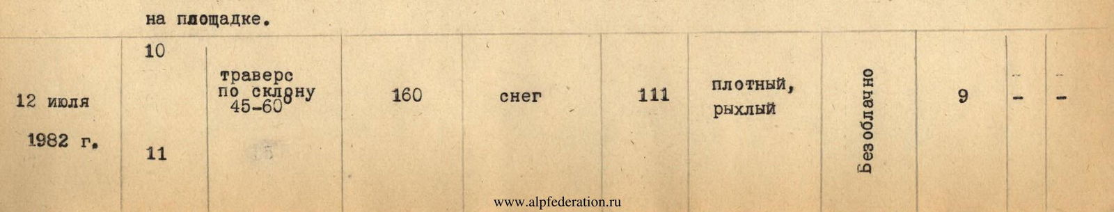
| July 12, 1982 | R11 | 65 | 40 | chimney | 4 | destroyed ice formation | Clear | 4 | 1 | – |
| R12 | 30–40 | 400 | snow | 2 | loose | Clear | simultaneous movement | 1 | – |
Departure to the route — 8:00, SUMMIT — 14:00. Total hours on the route — 5. Return to the original bivouac via v. Dinosaur at 19:30.
TOTAL HOURS ON THE ROUTE — 19. PITONS: rock 62, ice 1.
– 5 → – 4 → – 3 → – 2 → – 1 →
3 2 1

For section R0–R1 Scale 1:4000 Route scheme to v. Winnie-the-Pooh via the center of the western wall in UIAA symbols. Scale 1:2000
- Scale 1:2000
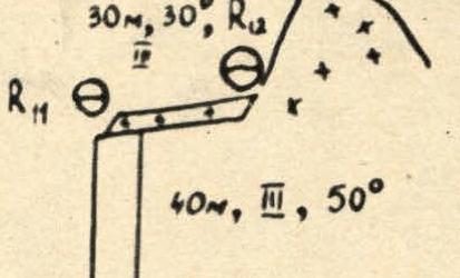
- R6: 35 m, 65°, 4
- R5: 40 m, 45°, 3
- R4: snow – 20 m, 45°, 3
- R3: 20 m, 75°, 5
- R2: 25 m, 60°, 3
- R1: 130 m, 45°–60°, 3, "Live" stones
- R0: 100 m, traverse along the slope 45° (steepness of ascent 30°), 2
- R23: 150 m, 35°–45°, 3
- R22: 60 m, 45°, 3
- R21
- R20: Large, standalone stone
- R20: 15 m, 80°, 5
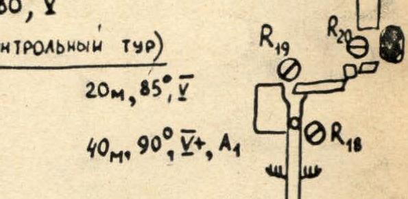
- R20: Δ (Control tour)
- R19–R20: 20 m, traverse, 0°, 4
- R19: 20 m, 85°, 5
- R18
- R17
- R16: Oblique, inclined shelves, 40 m, 90%+, A1
- R15: 60 m, 40°, 4+
- R14: 30 m, 80°, 5
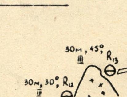
- R13: 40 m, 40°, 3, traverse
- R12: 40 m, 45°, 4, traverse
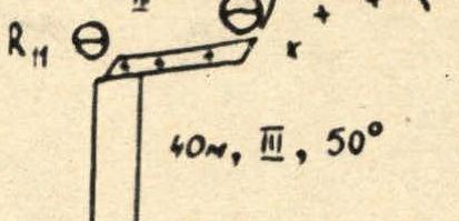
- R11: 30 m, 30°, 3
- R10: 40 m, 50°, 3
- R9: 40 m, 60°, 4
- R8: 40 m, 60°, 4
- R7: 40 m, 50°–60°, 3


Scale 1:4000
- Scale 1:4000
- Winnie-the-Pooh (p. 5250 m)
- West wall of the Summit Tower
- SSW wall
- 350–400 m, 30°–40°, 3
- R28
- R27
- R26
- R25
- R24
- R23
- 40 m, 65°, 4
- R23–R24–R25–R26: 10°–20°, 160 m, 3
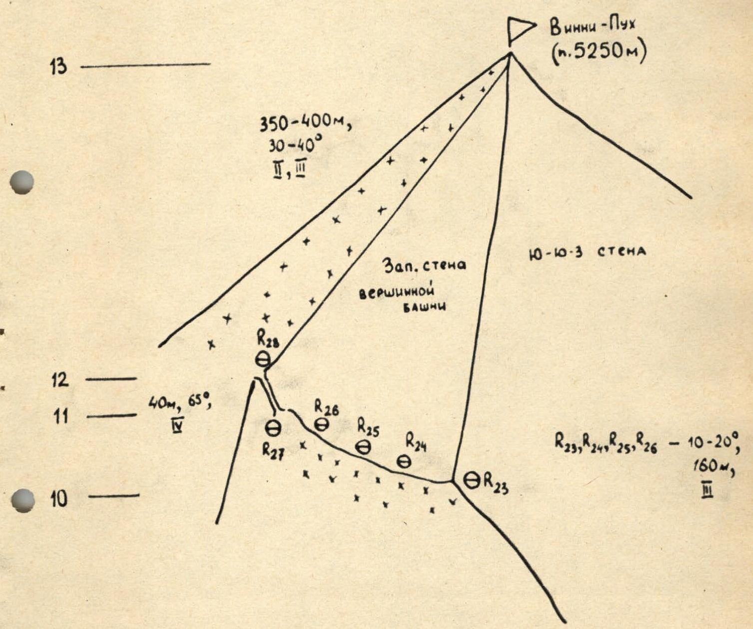
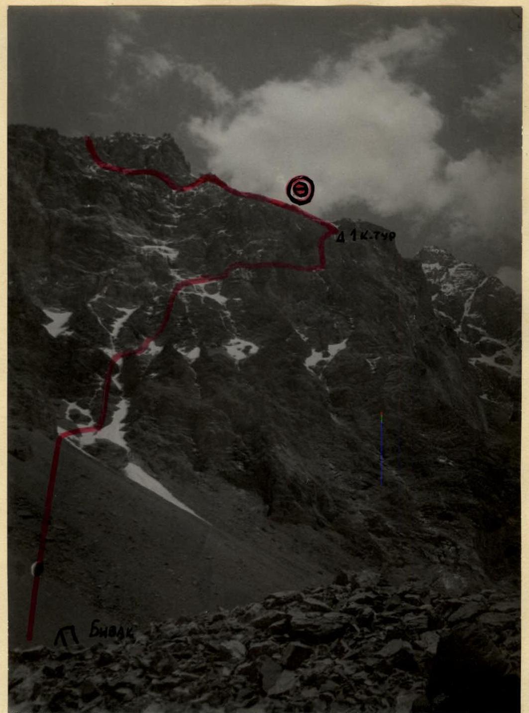
Photo #9. Western wall of v. Winnie-the-Pooh (p. 5250 m).