Sports Club of the Army of the Leningrad Military District
Peak "Armeitsev" (5398 m) via the Southwest Ridge (first ascent)
The route was completed by the team of the Armed Forces of the Leningrad Military District on August 7-8, 1977.
1978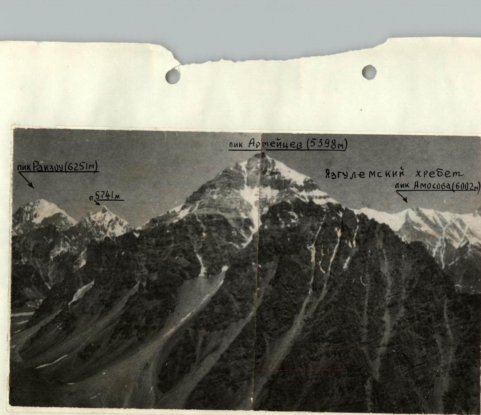
I. General view of the peak 5398 m, Armeitsev
 Map of the Yazgulem-dara area
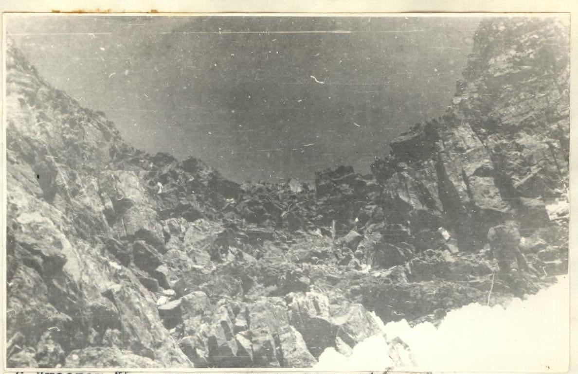
Approach to the summit
The peak Armeitsev (5398 m) is located in a lateral spur of the Yazgulem Ridge, which has a northeast-southwest orientation over a short distance. The spur, where the peak is situated, has an eastern and southeastern orientation. This spur starts from the peak 5700 m, borders the upper arm of the Yazgulem-dara glacier from the south. At the slopes of this spur, the Yazgulem-dara glacier makes a sharp turn to the south and flows along the eastern slopes of peak Armeitsev.
On the other side of peak Armeitsev lies a large cirque, bordered from the west by the crest of the Yazgulem Ridge, and from the east by a spur of the Yazgulem Ridge, branching off near the Lower Khurdzhin pass. Considering that the base camp is located opposite the gorge leading to the Lower Khurdzhin pass, the next gorge to the north leads to peak Armeitsev. Peak Armeitsev dominates the base camp area. It is a bright red, peaked summit rising to the northwest from the green clearing of the Yazgulem-dara gorge. The path from the base camp goes north along a trail, crossing the covered moraines, and leads to a river, which drops steeply along the moraine ridge from the gorge leading to peak Armeitsev. The ascent to the gorge is made on the right bank of the river. The travel time from the base camp to the valley above the moraine ridge is 1 hour. Further, the path goes up the glacier, gradually approaching its left bank, along which a very convenient moraine is located. The travel time along the glacier to the couloir leading to the start of the route is about 2 hours. A landmark for finding this couloir is a pronounced red rock in the southwest ridge, resembling a medieval castle with a round tower in the upper part. The couloir goes so that this "tower" remains on the left during the ascent. The ascent through the couloir (scree, with snow and rock outcrops in the upper part) takes about 30 minutes and leads to a narrowing, ending with a wall and a couloir going left from this wall. A stream flows from above in this couloir, ending with a small waterfall.
To the left of the waterfall is the start of the route. The total time of the approach to the route from the base camp is 4-4.5 hours. The return time is about 3 hours.
Explanations for the table
August 7. At 6:45, departure from the base camp on the green clearing, along the trail uphill, and ascent through the moraine ridge on the left side of the stream. After another 2 hours of movement along the moraine to the base of the couloir leading to the start of the route. Ascent through the couloir along the scree to the start of the rocks takes another 45 minutes. At the start of the route - at 11:00, rest. Start of movement along the route - at 12:00. Movement in teams with alternate and piton belays. By 18:00, 8 rope lengths have been passed through the couloir and 4 rope lengths along the ridge. Overnight stay on a rocky ledge on the ridge at the edge of the ice cap descending from the summit. The height of the bivouac is about 5000-5050 m.
August 8. Departure from the bivouac at 6:20. Movement to the summit in teams, on crampons with alternate, and in some places, piton belays. The slope is snow-ice with crevasses. A large number of ice calderas. The summit tower is rocky. Ascent to it by free climbing. At the summit - at 7:30. The summit is a small area, steeply dropping to the east. To the north and northeast, a long, sharp ridge departs, on which another snowy peak is visible about two kilometers away. From the summit, the entire area is clearly visible, including some peaks in the Rakzou gorge area. No signs of human presence were found on the summit. By right of first ascent, the peak was named peak Armeitsev. Descent from the summit to the overnight stay site - 30 minutes. After 2 hours - on the moraine of the glacier. Return to the base camp - another 2 hours.
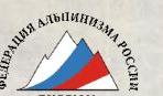
Table of main route characteristics
| Date | Designation | Average steepness (grade) | Length (m) | Terrain characteristics | Category of difficulty | State of the route | Weather | Rock belay | Ice belay | Piton belay | Technique | Time breakdown (passage) |
|---|---|---|---|---|---|---|---|---|---|---|---|---|
| August 7 | R0–R1 | 60 | 20 | rocky wall | 3 | wet rocks, ice forming | clear | 2 | – | – | free climbing | Entry time 12:00 |
| R1–R2 | 30 | 60 | couloir with snow cone | 1–2 | scree: brittle rocks, live rocks | clear | 1 | Travel time 4-5 hours | ||||
| R2–R3 | 35 | 120 | rocky couloir | 2 | live rocks | – | 2 | 2 | 3 | – | Overnight stay on a ridge flattening on scree, height 5050 m, T=−7°C | |
| R3–R4 | 60 | 20 | rocky wall | 3 | – | |||||||
| R4–R5 | 45 | 100 | short rocky walls (5–10 m) with flattening | 2–3 | brittle rocks, many live rocks | – | ||||||
| R5–R6 | 20–30 | 160 | scree ridge with ice outcrops | 2 | live rocks | – | simultaneous, belay through outcrops | |||||
| August 8, 1977 | R6–R7 | 20 | 600 | snow-ice slope | 2–3 | dense firn with crevasses, many crevasses, pure ice outcrops | clear | simultaneous, belay through ice axe | Departure 6:20. Summit arrival at 7:30 | |||
| R7–R8 | 70 | 10 | rocky wall | 3 | rock crevices filled with ice | clear | outcrops | Travel time 1 hour 10 minutes. On descent, 8 rappels of 25-30 m. Descent time 2-3 hours. |
-
Section #3.

-
Fragment of section #4.
-
Section #5 before reaching the ridge.
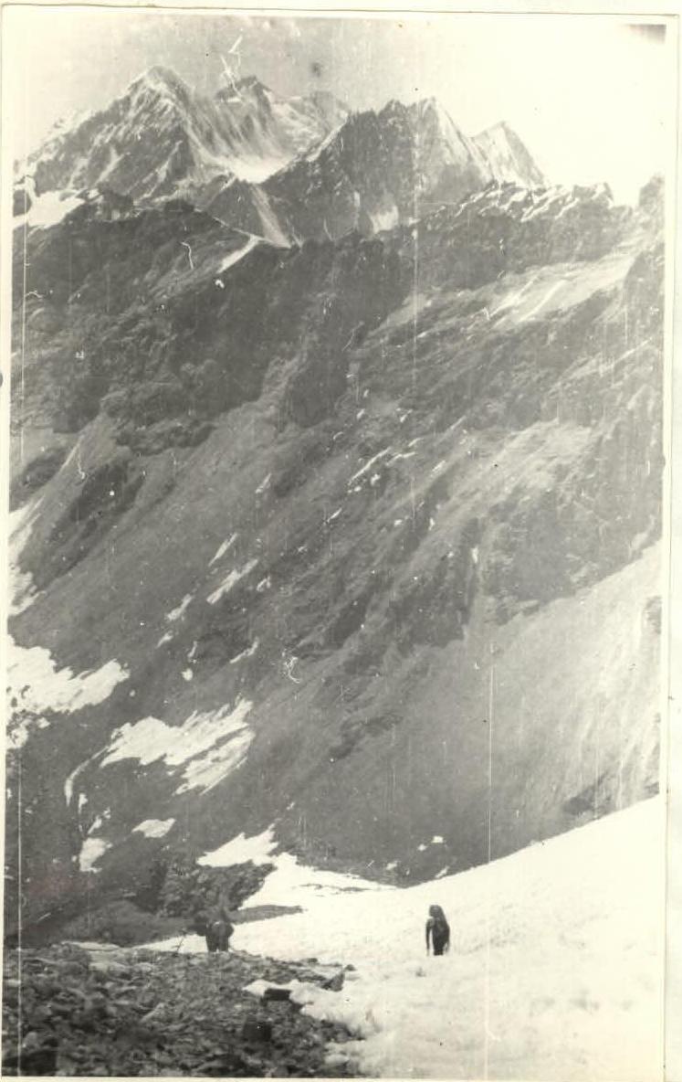
-
Snow-scree ridge on section #6.