
16.04.85
Passport
- Class: High-altitude technical
- Climbing area: South-West Pamir, Shahdara Range (Vakhan Range), 5449 m (Audra)
- Ascent route: via the southern ridge
- Climb characteristics:
- First ascent, proposed category 1B
- Route length — 800 m
- Elevation gain — 600 m
- Average slope of ascent — 45°
- No pitons were used
- Number of climbing days — one
- Number of climbing hours — 10 h
- Team name — "Granitas"
- Team composition: four people
- BRONIUS VARSACKIS, 1958, II sports category, team leader
- JULITA BUROKAITE, 1960, III sports category
- AUDRIUS BLOSKIS, 1959, III sports category
- ZIGMAS STAPONAS, 1958, III sports category
- Coach — Algis GUDYALIS
- Time:
- departure from base camp — 7:00 August 22, 1984
- ascent — 13:50 August 22, 1984
- return to base camp — 17:00 August 22, 1984
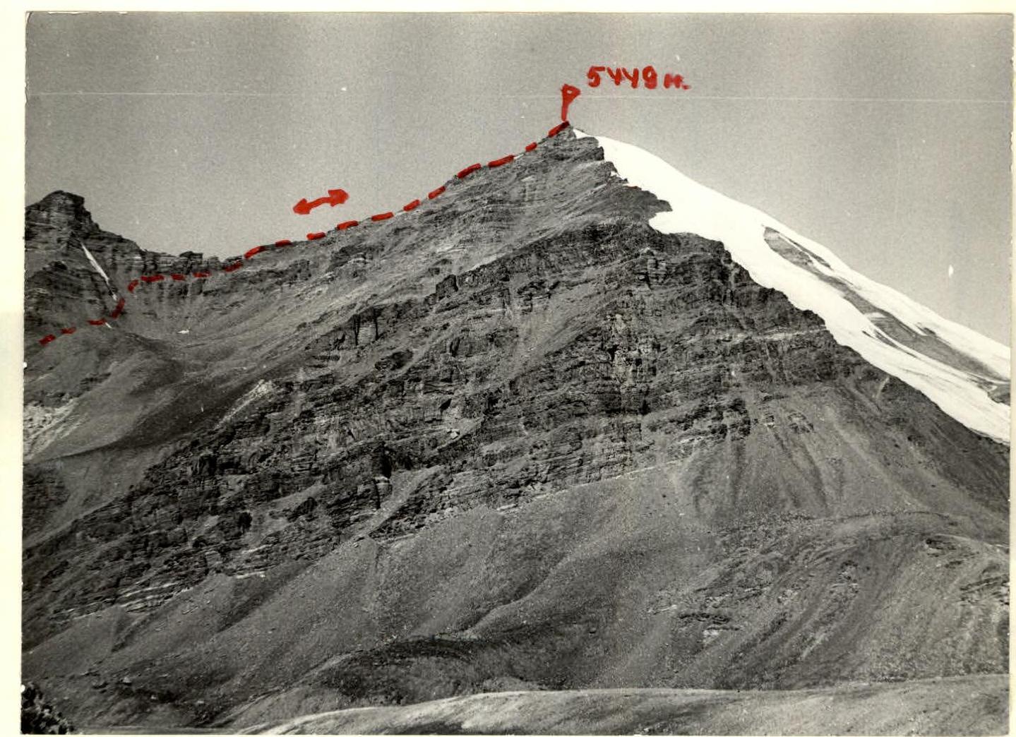
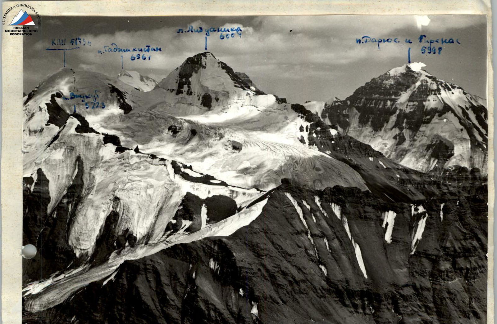
View of peak 5449 (Audra) from Godji Rab glacier. Distance to the summit is about 2000 m. From an altitude of 4300 m. Camera "Zenit E" lens "Industar-50" 3.5/50.

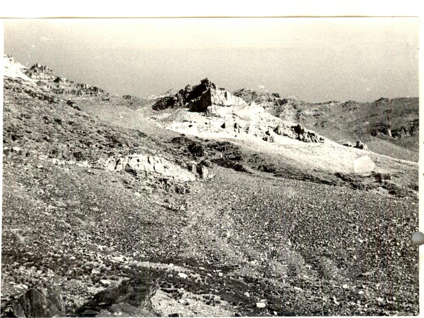
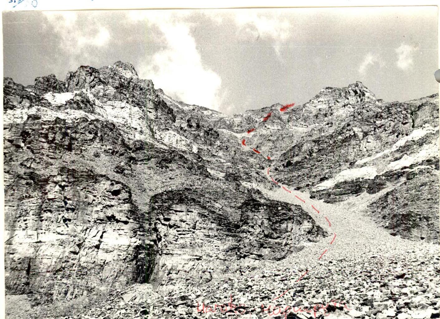
Route views. Camera "Zenit E" lens "Industar-50" 3.5/50.
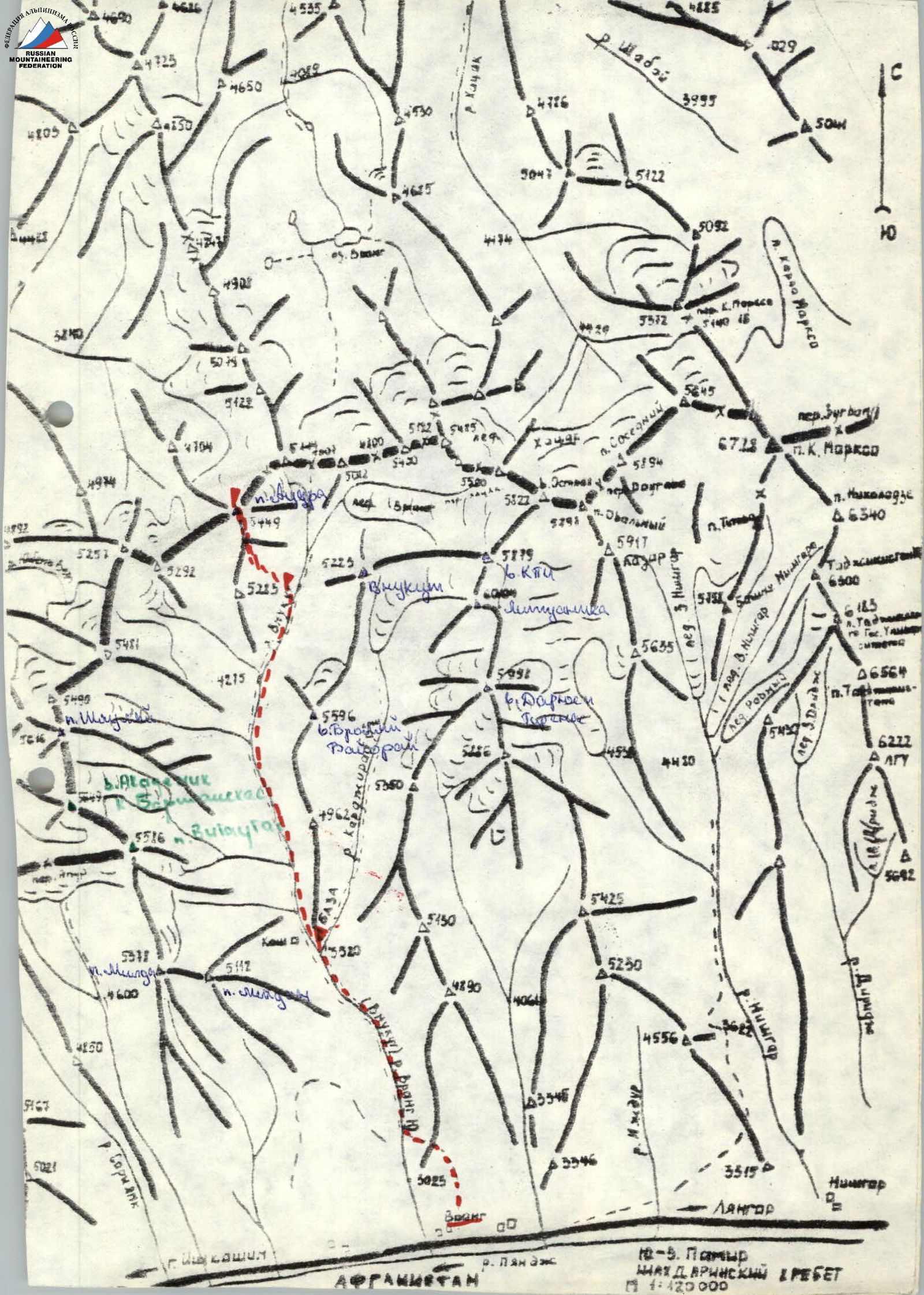
10-B. Pamir, Shahdara Range. 1:120000. Afghanistan.
Brief historical and geographical overview of the area
Peaks 5350 m (Vrang), 5998 m (Darius and Girenas), 6004 m (Lituanica), 5879 m (KIN), 5649 m (Academician Barshauskas) are located in the South-West Pamir, in the eastern part of the latitudinal section of the Shahdara Range, specifically in the Vakhan Range.
The nearest areas explored by climbers are the areas of peak K. Marx (6726 m) and Engels (6510 m) to the east, and the areas of peaks Armed Forces (6138 m) and Baikonur (6038 m) to the west.
B. A. Fedchenko's journey to the Pamir in 1904 explored and described the Shahdara Range area, located between the Shakhdara and Panj rivers.
Climbing exploration of the Shahdara Range began in 1946: peak Karl Marx was conquered that year. In subsequent years, several expeditions were organized mainly in the area of peaks Marx and Engels. The central part of the Shahdara Range began to be explored in 1974, when the walls, later named peak Lukinitskiy, were accidentally noticed by V. P. Nekrasov.
In 1975, an expedition of the Armed Forces led by V. P. Nekrasov, based at the Zardiv lake base camp, conquered peak 5800 m via a category 5B route on the NW edge. This peak was named peak Lukinitskiy.
In subsequent years, army climbers and other climbing expeditions completed several interesting category 5B and 6B routes in this area, which became prize-winners in the USSR Climbing Championship.
However, the part of the Shahdara Range between peaks Dientiv and Marx remained unknown to climbers until 1983 and was visited only by rare tourist groups. The reason for such late exploration of the area should apparently be considered the fact that the peaks of these mountains are not visible from populated areas and roads, and climbers' attention was more focused on the area of peaks Engels, Marx, Lukinitskiy, and Mayakovskiy.
Preliminary reconnaissance of the Vakhan Range area (Yangut, Sarylig, Yetsukut, Chon-Tsiiray valleys) was carried out in 1983 by a reconnaissance group from the Sports Committee of the Lithuanian SSR (A. Gudyalis and R. Silutis). Photos of the Vakhan Range peaks were taken and routes were visually studied.
The most attractive peaks for climbers are those that have not been climbed yet, especially if these peaks reach or exceed 6000 m.
In the summer of 1984, an expedition from the Sports Committee of the Lithuanian SSR led by A. Gudyalis arrived in the Yetsukut valley to study the area from a climbing perspective and climb previously unconquered peaks, giving them corresponding names.
The expedition established its base camp at the confluence of the Vnukut and Chon-Tsiiray rivers at an altitude of 3529 m, approximately 3 hours' walk from the village of Vrang.
From a climbing perspective, the area is very interesting for climbers from 2nd sports category to Candidate Master of Sports inclusive. There are many routes to the peaks ranging from category 3A to 5B, including rock, combined, and snow-ice routes. Approaches to the routes take 3–8 hours from the base camp.
Many first ascents are possible.
Rivers are turbulent. In the second half of the day, they are difficult to cross. The weather is fairly stable, although in August 1984, a sharp cold snap, thunderstorms, and rains were observed for a week, resulting in many ascents not being completed.
The flora and fauna of the valley are not rich. Ephedra and Rhodiola rosea are rarely found. In the upper reaches of the Knukut and Chon-Tsiiray rivers, there are summer pastures for shepherds.
Location of peak 5449 m (Audra)
The peak is located in the central spur of the Shahdara (Vakhan) Range, between peaks 5228 m and 5112 m (currently nameless). The peak is not difficult from the southern side. But a more complex glacier is visible from the northern side. There are no routes yet, but the peak is very convenient for viewing the entire area. Not only the peaks in our expedition's area were visible, but also peaks K. Marx and F. Engels, peak Tajikistan, peak Armed Forces, and other interesting peaks in the area.
Audra (5449 m) via the southern ridge, category 1B.
From the base camp at the confluence of the Vnukut and Chondzhirat rivers, the path to the peak goes along the left and, after some time, along the right bank of the Vnukut river. After 2 hours, we pass a shepherd's hut on the left bank. Another hour later, we reach a large, beautiful meadow under the Vnukut glacier. At the beginning of the meadow, the route starts immediately to the left up a large scree couloir. Up this couloir to the light-red walls. They are destroyed and easily passable. Along them, we reach the ridge via a destroyed ridge to a 7 m high wall. On this wall, there are rocks, and along it, we reach the pre-summit ridge, along which 40 m to the summit. The entire route is completed in 3.5 hours. Descent is via the ascent route.
View from peak Audra to the southwest. Camera "Zenit E" lens "Industar-50" 3.5/50.
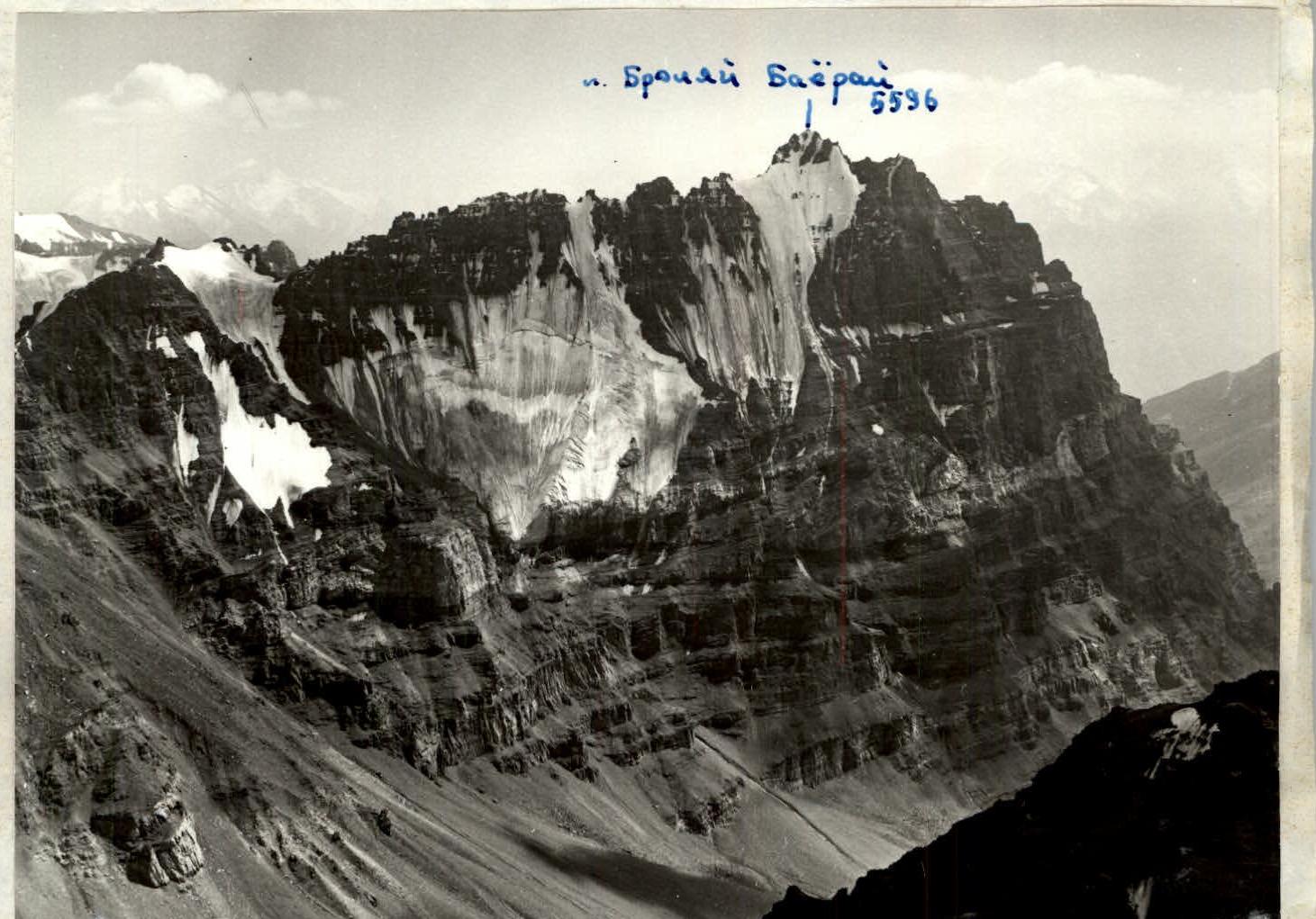
Peak Bronyai Bayorai 5596.
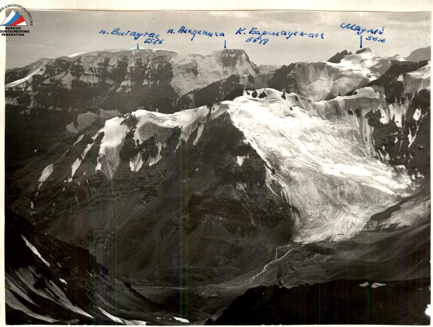
View to the southwest from peak Audra. Camera "Zenit" lens "Industar-50" 3.5/50.