
 “Pik Ukraina”, elevation 5030 m. “Kurayshapak” ridge, North-Eastern spurs of the Peter I ridge, PAMIR. Republic of Tajikistan.
Ascent Passport
- Country, mountain system name: Republic of Tajikistan, Pamir.
- Ascent class: High-altitude.
- Ascent area, ridge: North-Eastern spurs of the Peter I ridge.
- Summit, its elevation, ascent route: “Pik Ukraina” 5030 m, Central counterfort of the Eastern wall.
- Proposed difficulty category: 3B, combined.
- Route characteristics: elevation difference: 1430 m, length of sections 2–3 cat. diff.: 600 m, 4 cat. diff.: 100 m, average steepness: 30°.
- Number of pitons driven or anchor placements used:
for belaying:
- rock pitons — 7
- ice screws — 23
- bolted anchors — 3 for artificial support points.
- Total time on the route: ascent to the initial bivouac at the foot of the summit — 12 hours, establishment of the initial bivouac at an elevation of 3600 m. Ascent from the initial bivouac to the summit — 8 hours. Total: 20 hours.
Descent:
- to the 3600 m overnight stop — 5 hours
- to the base camp — 9 hours Total: 14 hours.
- Number of overnight stops and their characteristics: 2 overnight stops, good.
- Surname, first name, patronymic of the team leader, participants, and their qualification: Kaifadzhyan Sergey Amatunovich, 1st sports category, Ukraine. Sharipov Anatoly Raimdzhanovich, Candidate for Master of Sports, Republic of Tajikistan. Kovalev Sergey Viktorovich, Master of Sports of International Class, instructor of the 3rd category, Ukraine.
- Team coach:
- Date of departure and return: August 15, 2004 – August 17, 2004.
Chairman of the FRS of Donetsk region
 Kovalev S.V.
June 6, 2005
Kovalev S.V.
June 6, 2005
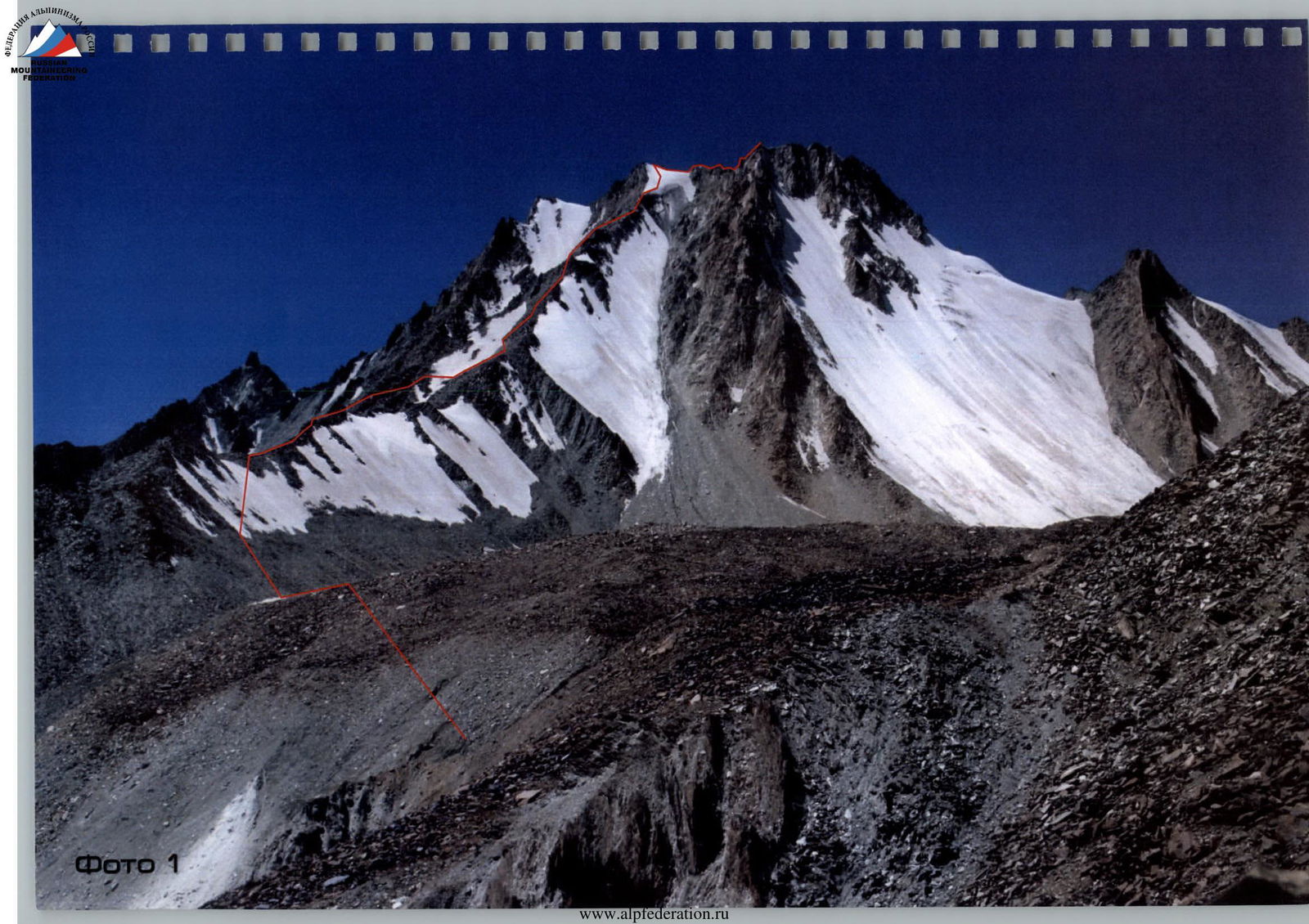
Photo 1
Table №2
Ascent date: August 16, 2004.
| № p/p. | Characteristics of sections. | Number of pitons used. For belaying. For artificial support points. | Time in motion. Time stopped at bivouac. Bivouac conditions. |
|---|---|---|---|
| R0–R1 | Along large rocks and rocky scree 800 m. | – | Good overnight stop. Departure at 4:30. Time taken: 1 h 00 min. |
| R1–R2 | Up a snowy slope 150 m, to reach the Central counterfort 35°. | – | Time taken: 0 h 20 min. |
| R2–R3 | Rocky ridge 400 m. | – | Time taken: 0 h 50 min. |
| R3–R4 | Rocky ascent 10 m. Rockfall. 3 cat. diff. | – | Time taken: 0 h 10 min. |
| R4–R5 | Rocky slab 15 m, angle of ascent 50°. 3 cat. diff. Rockfall. | 2 rock pitons | Time taken: 0 h 25 min. |
| R5–R6 | Rocky ridge 400 m. | – | Time taken: 1 h 55 min. |
| R6–R7 | Ledge 10 m. | – | Time taken: 0 h 05 min. |
| R7–R8 | Rocky wall 20 m, angle of ascent 50°. 4 cat. diff. | 1 anchor, 2 rock pitons | Time taken: 0 h 35 min. |
| R8–R9 | Rocky ascent 50 m, beware of rockfall. | – | Time taken: 0 h 20 min. |
| R9–R10 | Ledge 10 m. | – | Time taken: 0 h 05 min. |
| R10–R11 | Rocky wall 15 m, angle of ascent 60°, 4 cat. diff. | 2 anchors, 3 rock pitons | Time taken: 0 h 35 min. |
| R11–R12 | Rocky ridge of the Central counterfort, angle of ascent 45°, 150 m. | – | Time taken: 0 h 30 min. |
| R12–R13 | Rocky ridge at an angle of 40°, 100 m, move right onto the glacier. | – | Time taken: 0 h 25 min. |
| R13–R14 | Ice wall 100 m, angle of ascent 70°. | 15 ice screws | Time taken: 0 h 50 min. |
| R14–R15 | Snow-ice slope, 70 m, steepness 50°, snow-ice drops. | 8 ice screws | Time taken: 0 h 45 min. |
| Total | 3 anchors, 7 rock pitons, 23 ice screws | 8 h 00 min |
Route diagram in UIAA symbols
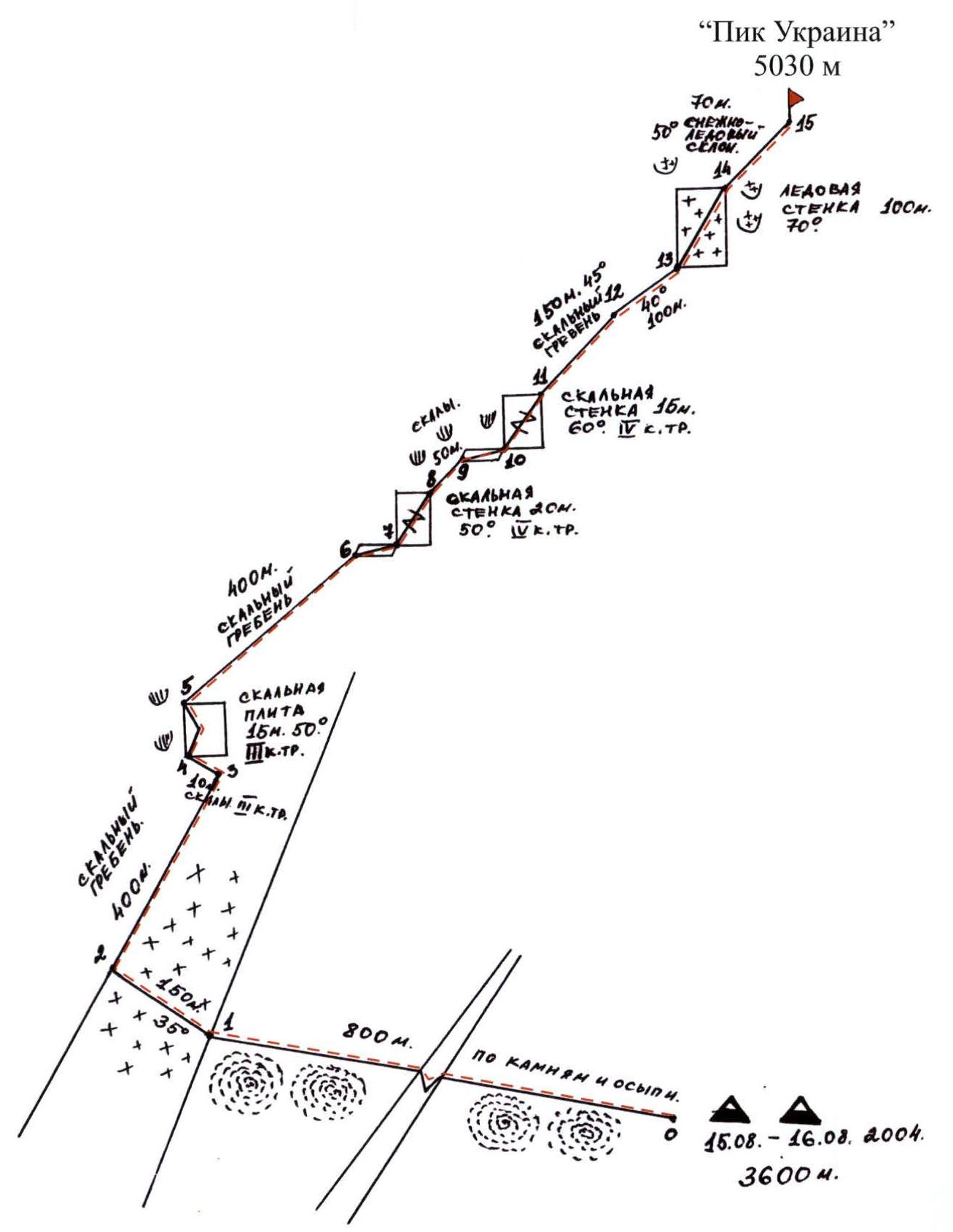 August 15–16, 2004.
3600 m.
August 15–16, 2004.
3600 m.
Description of the first ascent routes to the summit Pik Ukraina. Republic of Tajikistan. Pamir. North-Eastern spurs of the Peter I ridge.
From the settlement of Belkondo, 4–5 people cross the “Belkondo” pass into the “Sugran” gorge. Then from the “Sugran” meadow, through the “Irget” pass (3800 m), descend to the slopes of “Irget” towards the cliffs of the Muksu River. Then cross the “Khadyrsha” pass, descend and cross the Khadyrsha River via the moraine along the “Khadyrsha” glacier, pass to the “Khadyrsha” meadow in front of the “Kurayshapak” pass, which is located at an elevation of 3000 m near the “Khadyrsha” glacier opposite the “Kurayshapak” pass and the “Shafak” glacier.
“Pik Ukraina” (5030 m) in the form of a trapezoidal trident is located on the “Kurayshapak” ridge.
Location of summits and passes:
- To the west of “Pik Ukraina” (5030 m) lies the “Sasun” pass (4667 m), behind which rises “Pik Armenia” (5495 m).
- “Pik Armenia” is situated between the “Sasun” pass (4667 m) and the “Khadyrcha” pass (5259 m), behind which lies the “Shapak” summit (5667 m).
- To the east of “Pik Ukraina” towards the “Kurayshapak” pass lies “Pik Oleg Mkrtchyan” (4980 m).
Ascent route to “Pik Ukraina” (5030 m):
- Via the Central counterfort of the Eastern wall.
- The route is combined, category 3B.
- First ascent: August 16, 2004.
- Performed by: Kaifadzhyan S.A. (Ukraine), Sharipov A.R. (Tajikistan).
North-West Pamir
1:200 000, 2 kilometers per 1 centimeter
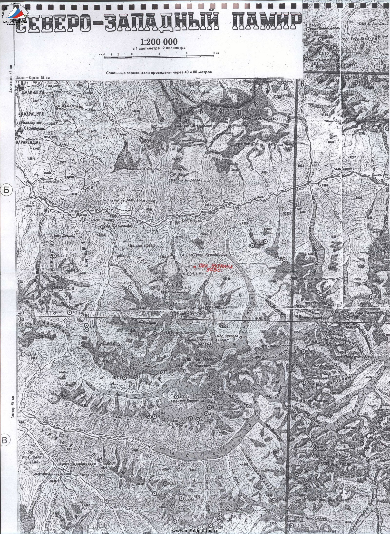 Solid horizontals are drawn every 40 and 80 meters.
Center “Priroda”
STATE RESEARCH AND PRODUCTION CENTER “PRIRODA”
Climbing Department
ALL-UNION COUNCIL OF THE ALL-UNION VOLUNTARY SPORTS SOCIETY OF TRADE UNIONS
Pik Ukraina 5030 m
Via the Central counterfort of the Eastern wall, route category 3B, combined. Kaifadzhyan S.A. (Ukraine).
Establish the initial bivouac at an elevation of 3600 m near the “Shafak” glacier. Depart at 4:30 AM, traverse the moraine for 800 m, ascend 150 m up a snowy slope with an angle of 35–40° to reach the Central counterfort of the Eastern wall.
Continue moving along the Central counterfort of the Eastern wall:
- traverse a rocky ridge for 400 m.
Approaching the ice slope between the Central and Right counterforts:
- deviate slightly to the left for 10 m to reach a rocky wall;
- then ascend 15 m upwards at an angle of 50° (beware of rockfall, loose rocks).
Then:
- move up through live rocks and sharp ridges, along the rocks on the left side of the couloir for about 400 m to reach the Eastern ridge.
From here:
- move 10 m to the right;
- then ascend 20 m up rocky terrain, angle of ascent 50°;
- continue up rocky ridges for 50 m (beware of rockfall);
- move 10 m to the right again;
- ascend a rocky wall for 15 m, angle of ascent 60°, to reach a rocky ridge.
Then:
- continue up the rocky ridge of the Central counterfort for 150 m, angle of ascent 45°.
After that, continue moving:
- diagonally upwards for 100 m, transitioning along a rocky ridge at an angle of 40°;
- exit to the right onto the glacier between the Central and Right counterforts;
- ascend a steep ice wall (70°), from the left part of the wall, continue the route diagonally to the right for 100 m towards the summit;
- then move straight up for 70 m to the very summit, angle of ascent 50°.
To the right, there are ice drops and avalanche-prone snow cornices.
The summit at an elevation of 5030 m is reached via the left slope. The summit is a snow-ice pad, approximately 20 square meters in area. To the right, there is a rocky trident. On the summit, a metal disc was installed:
- with the inscription “Pik Ukraina” and the national coat of arms, dates of ascent, and names of the first ascenders;
- a cairn was built below, with a capsule containing a note about assigning the summit the name “Pik Ukraina”.
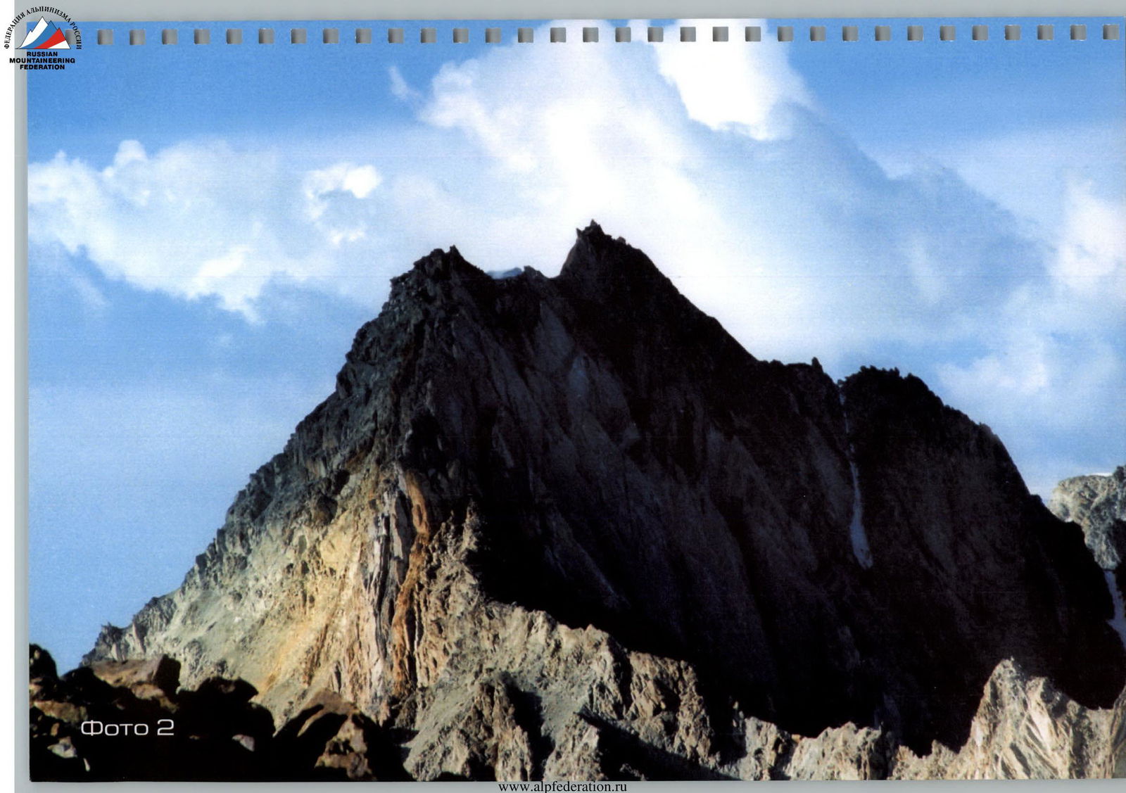
Photo 2
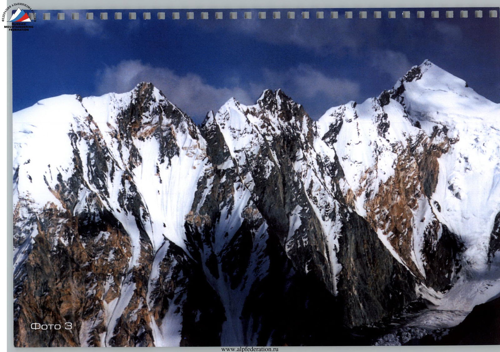
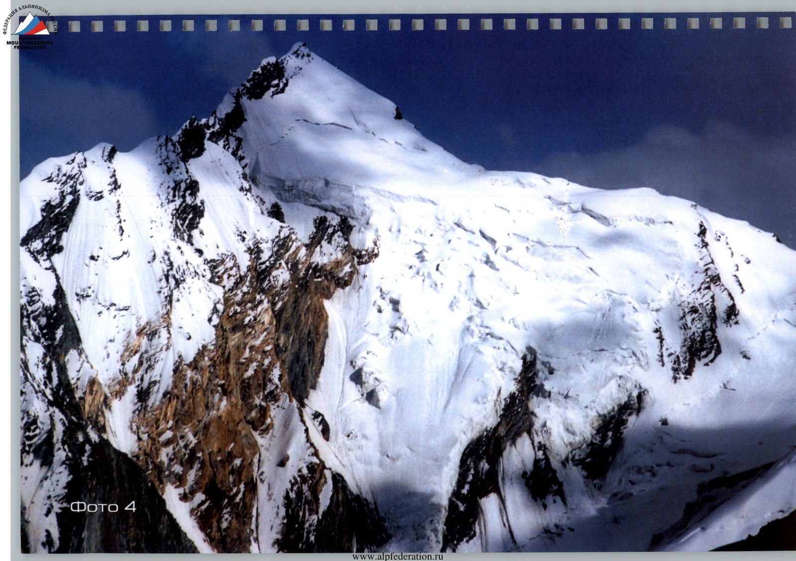
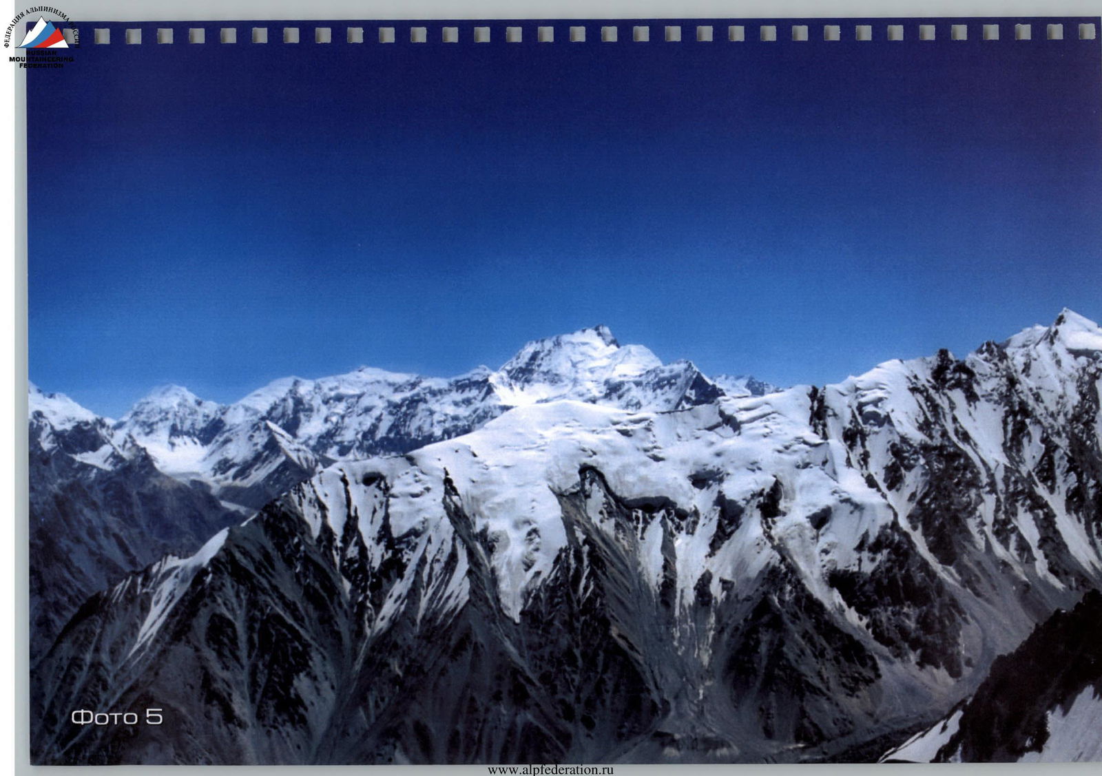
Photo 5
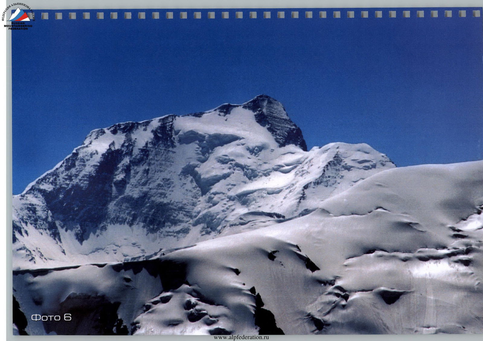
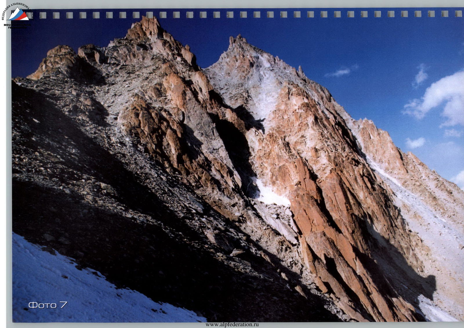
Photo 7
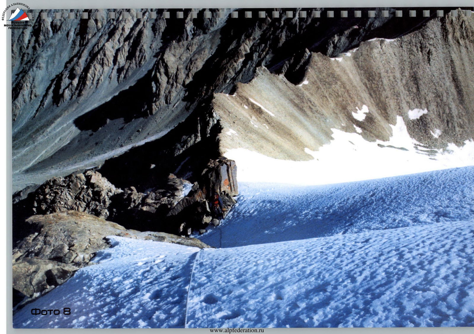
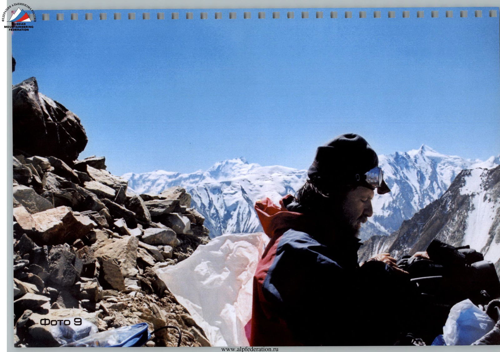
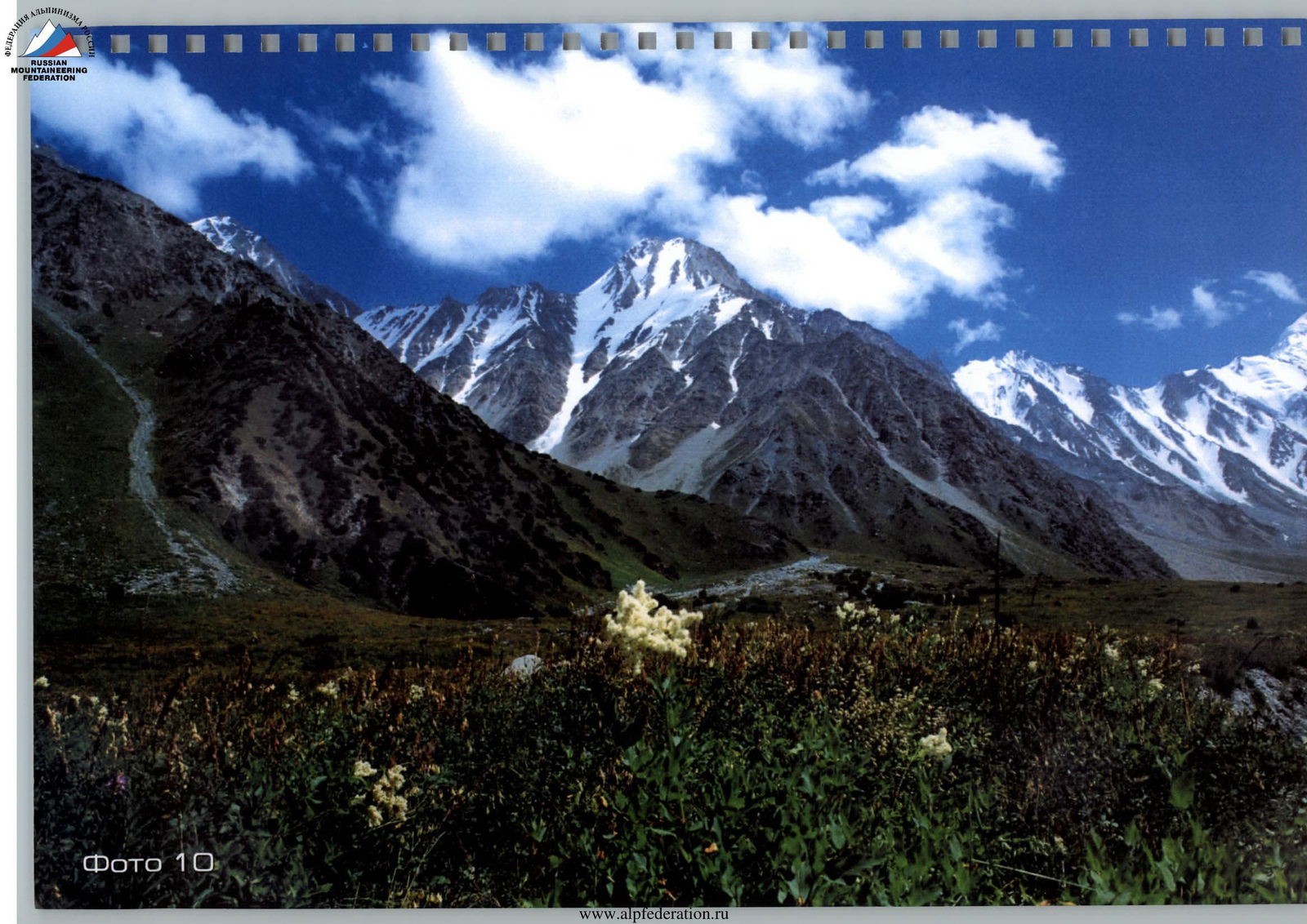
Photo 10
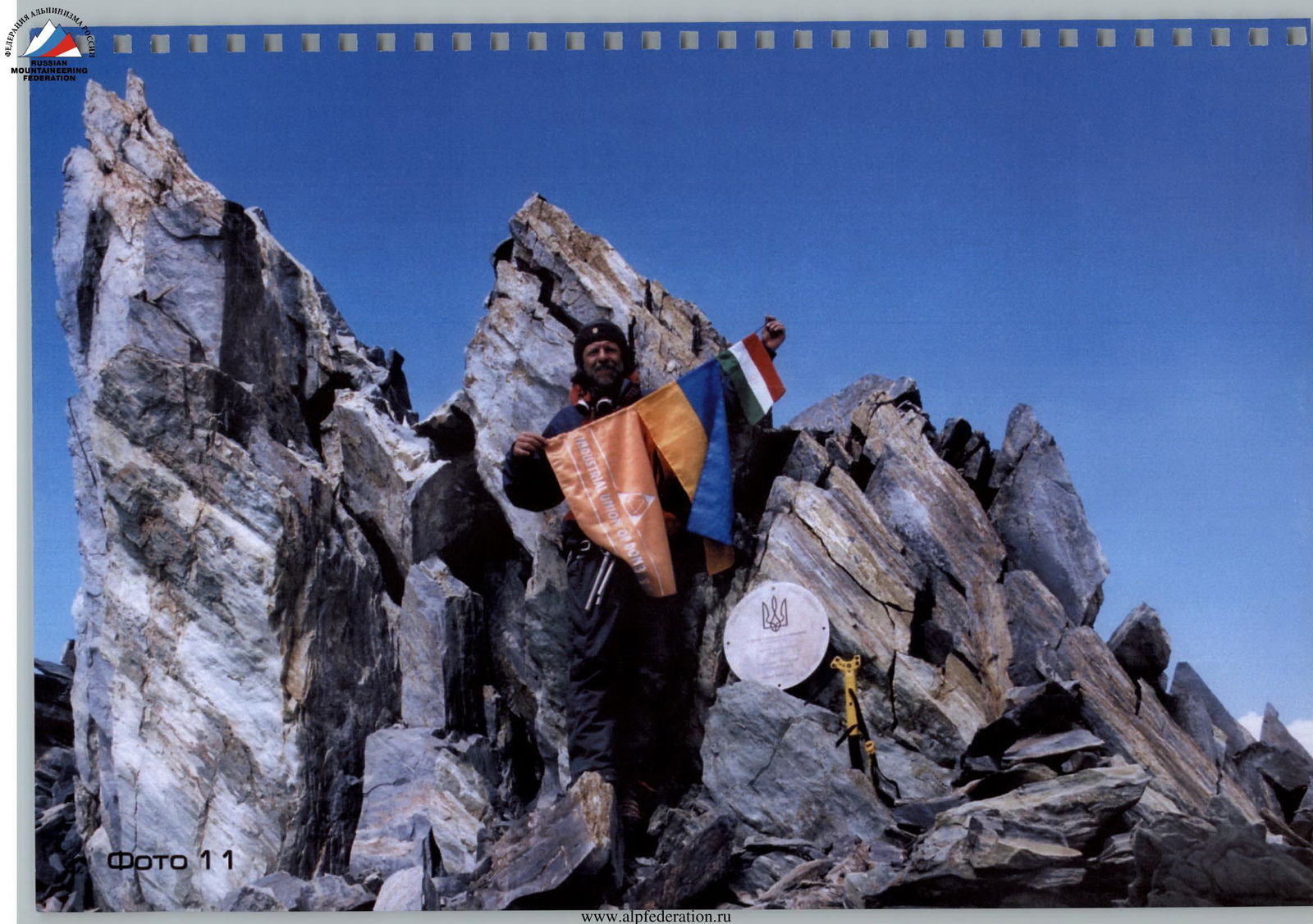
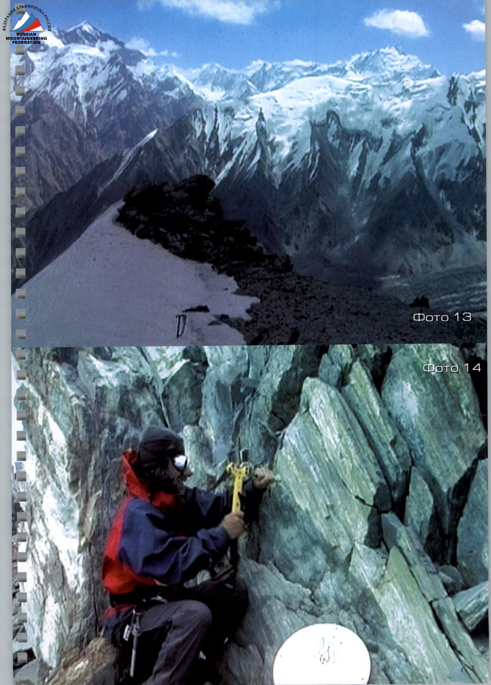
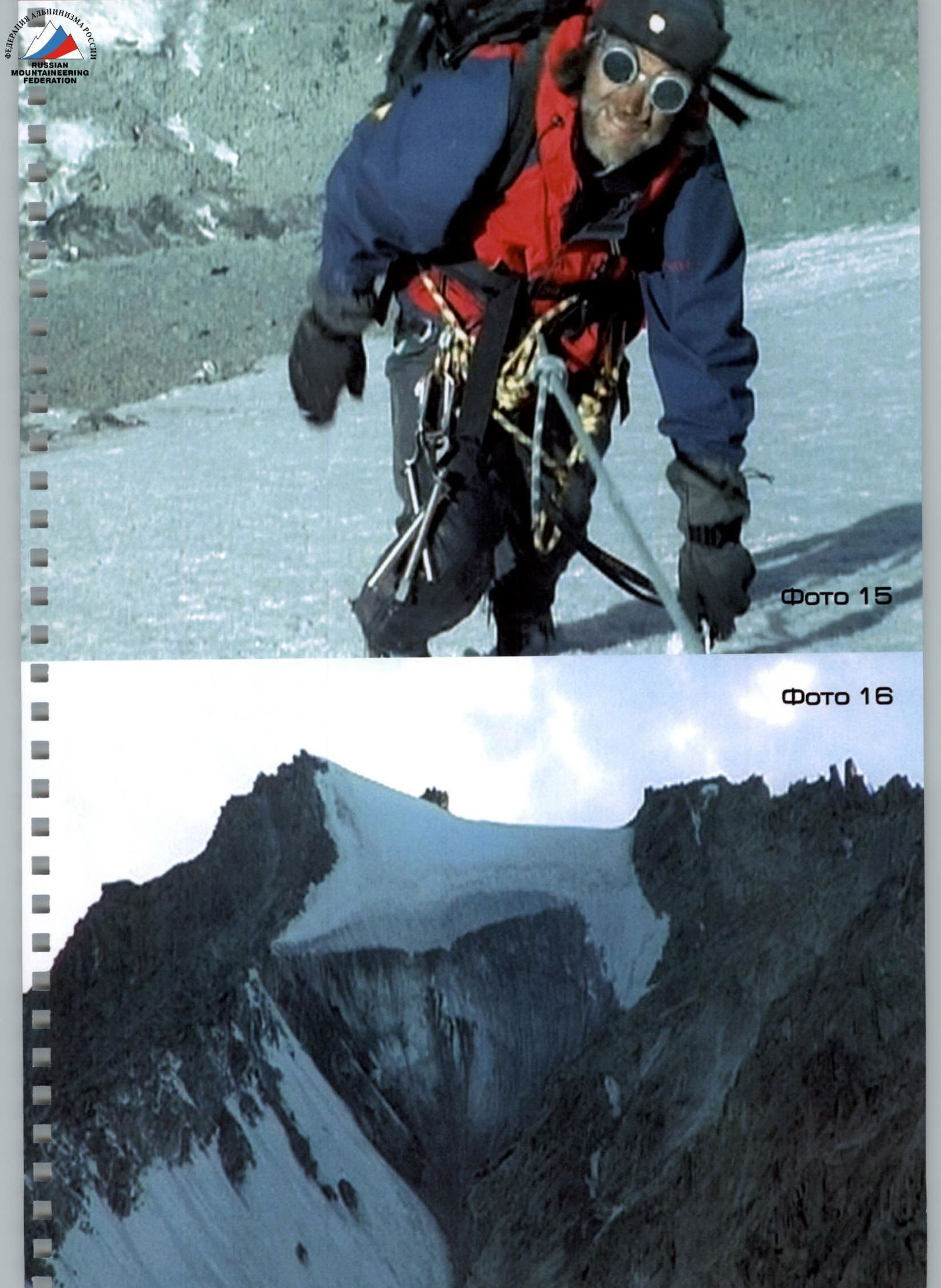
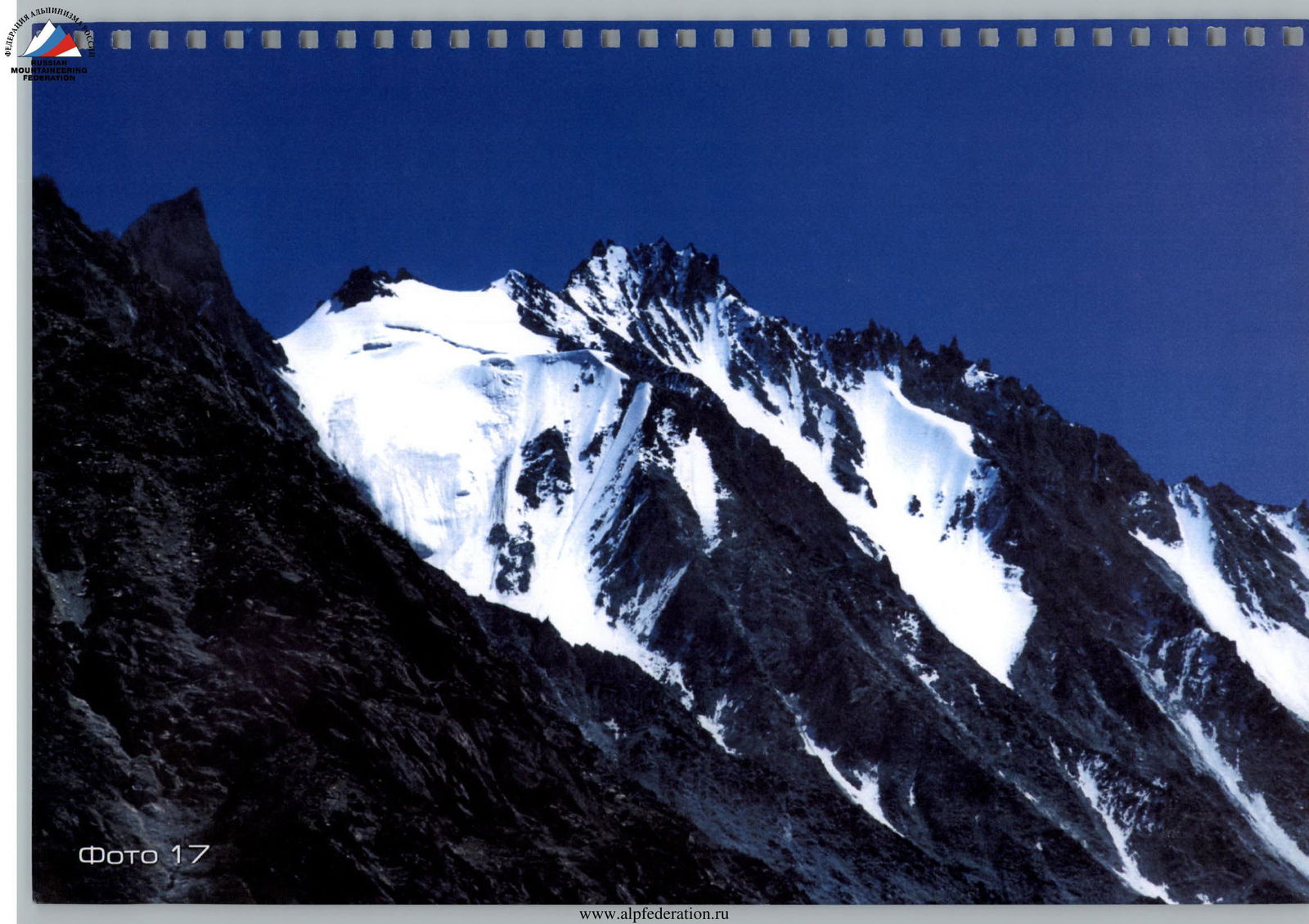
Photo 17
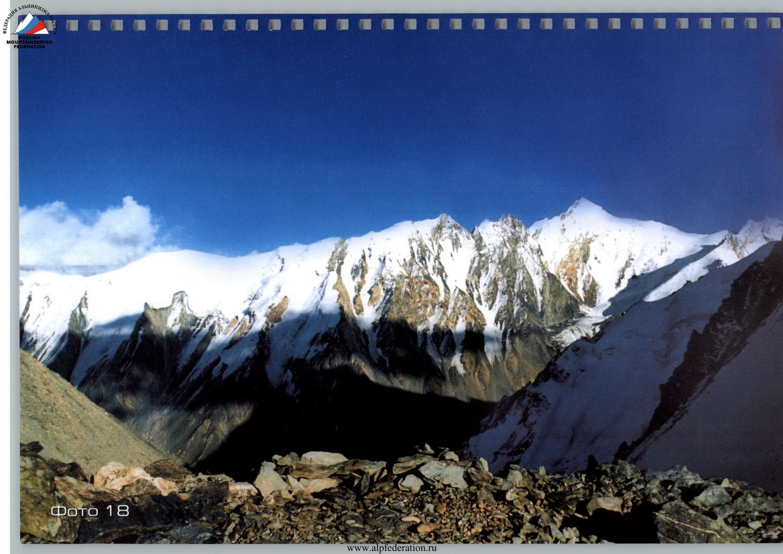
Photo 18
List of photographs
| Photo 1 | “Pik Ukraina” (photograph taken from an elevation of 3600 m); |
|---|---|
| Photo 2 | South-Western side of Pik Oleg Mkrtchyan (photograph taken from Pik Ukraina at an elevation of 4800 m); |
| Photo 3 | Suloeva summit in the upper right corner, the Shafak glacier visible below; |
| Photo 4 | Pik Suloeva, view from the summit of Pik Ukraina; |
| Photo 5 | Pik Kommunizma, view from the summit of Pik Ukraina; |
| Photo 6 | Summit of Pik Kommunizma, photo taken from the summit of Pik Ukraina; |
| Photo 7 | On the route to the Central counterfort of Pik Ukraina; |
| Photo 8 | Sergey Kaifadzhyan on the route along the Central counterfort to Pik Ukraina; |
| Photo 9 | Preparing for video filming en route to the summit “Pik Ukraina”, with Pik Kommunizma on the left and Pik Suloeva on the right in the background (Sergey Kaifadzhyan in the photo); |
| Photo 10 | View from the Khadyrsha meadow. Pik Oleg Mkrtchyan in the foreground, Pik Ukraina on the right; |
| Photo 11 | Sergey Kaifadzhyan on the summit of “Pik Ukraina” (elevation 5030 m) with flags of the Republic of Tajikistan, Ukraine, and the “Industrial Union of Donbass” corporation, with a metal disc installed bearing the coat of arms of Ukraine and the name of the peak on August 16, 2004; |
| Photo 12 | Metal disc with the coat of arms of Ukraine, the name “Pik Ukraina”, and the names of the first ascenders installed on the summit by the first ascenders (diameter 35 cm); |
| Photo 13 | View from the summit of “Pik Ukraina” towards Pik Korzhenevskoi on the left and Pik Kommunizma on the right; |
| Photo 14 | Installation of a metal disc with the coat of arms and the name Pik Ukraina on the summit; |
| Photo 15 | Sergey Kaifadzhyan en route to the summit of “Pik Ukraina” via the Central counterfort; |
| Photo 16 | Ice wall before the summit of “Pik Ukraina”; |
| Photo 17 | Pik Ukraina, view from the North side; |
| Photo 18 | View from the summit of “Pik Ukraina” towards Pik Suloeva. |
| Front cover: | Photo “Pik Ukraina”. |
| Back cover: | Sergey Kaifadzhyan after the ascent on Pik Ukraina. |
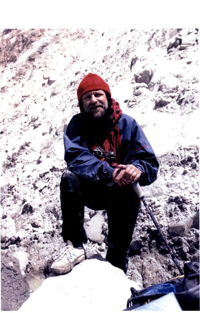
Author and first ascender — Sergey Kaifadzhyan, 2005, Ukraine.