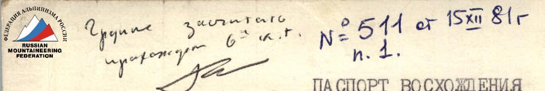
Ascent Passport
-
Ascent class: high-altitude technical
-
Ascent area: Peter I Range, Pamir
-
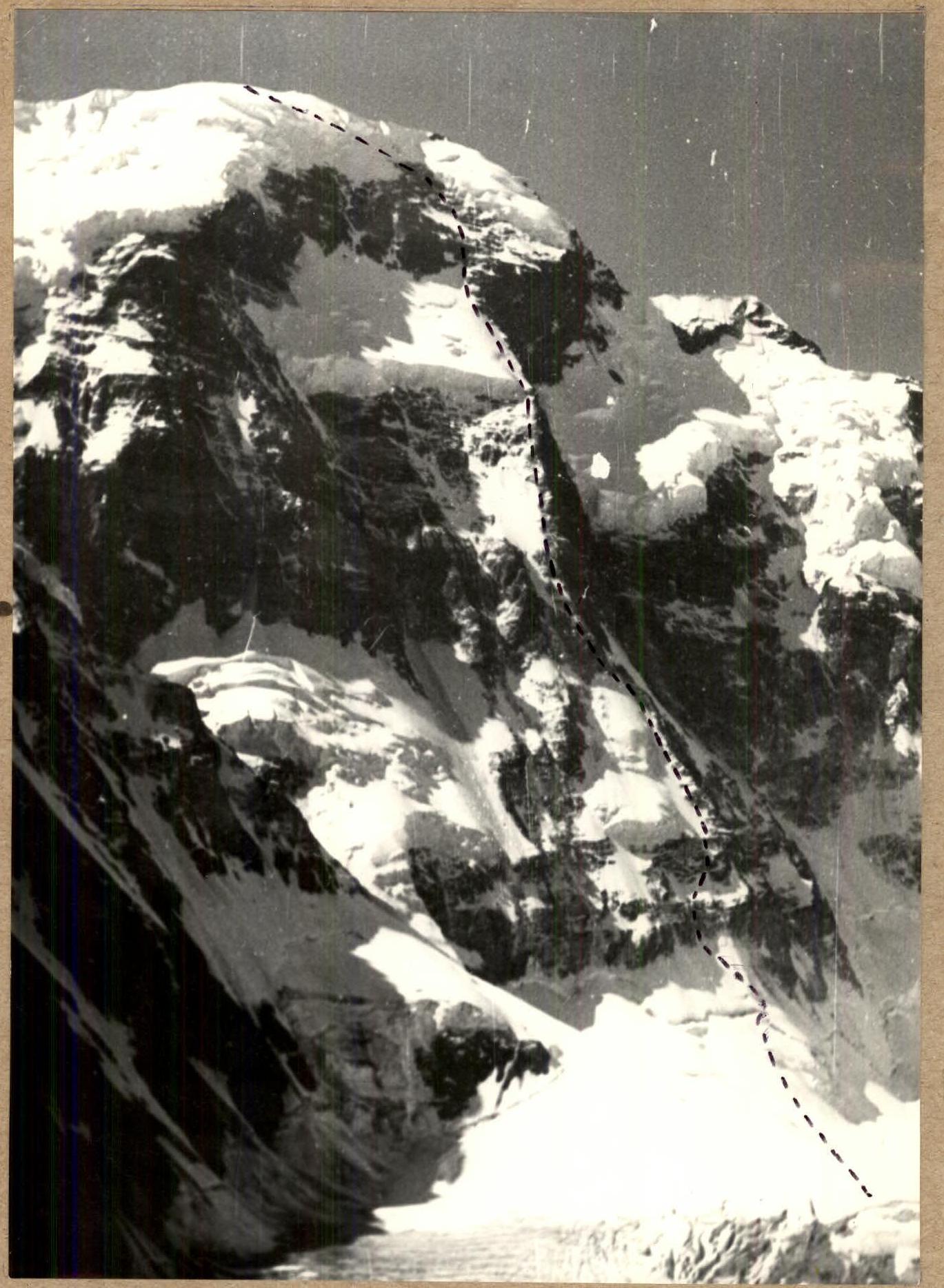
Peak, its height, and ascent route: Peak E.A. Abalakova 6460 m via the right ridge of the North face
-
Expected difficulty category: 6B
-
Route characteristics:
total height difference 2260 m, average route slope 59°, including technical sections 63°, route length 2820 m and sections by category of difficulty (m)
| 1 | 250 |
|---|---|
| 2 | 310 |
| 3 | 140 |
| 4 | 1280 |
| 5 | 670 |
| 6 | 170 |
-
Pitons driven:
- for belaying:
- rock and chock stones — 109
- ice screws — 0
- bolt pitons — 0
- for anchors, etc.:
- bolt pitons — 54
Total travel time: 29 h 40 min
- for belaying:
-
Number of bivouacs and their characteristics: 2 lying down safe
-
Surname, name, patronymic of the leader and participants and their sports qualification:
- Salikov Alexander Mikhailovich — leader, Candidate Master of Sports
- Garshin Vladimir Stepanovich — participant, Candidate Master of Sports
- Valyaev Evgeny Nikolaevich — participant, Candidate Master of Sports
- Kompaneets Igor Vasilyevich — participant, Candidate Master of Sports
- Samsonov Vladimir Anatolyevich — participant, Candidate Master of Sports
- Filatov Sergey Alekseevich — participant, Candidate Master of Sports
-
Date of departure on the route: August 11, 1981 and return from the route: August 15, 1981
-
Team coach: Master of Sports of the USSR Shevchenko Nikolai Alekseevich, 630003, Novosibirsk-93, SKA-18.
Ascent Route
Route Characteristics Table
| Date and section number | Slope in degrees | Length in m | Terrain characteristics | Difficulty | Route condition | Type of belay | Weather conditions | Rock and chock stones | Ice screws | Bolt pitons |
|---|---|---|---|---|---|---|---|---|---|---|
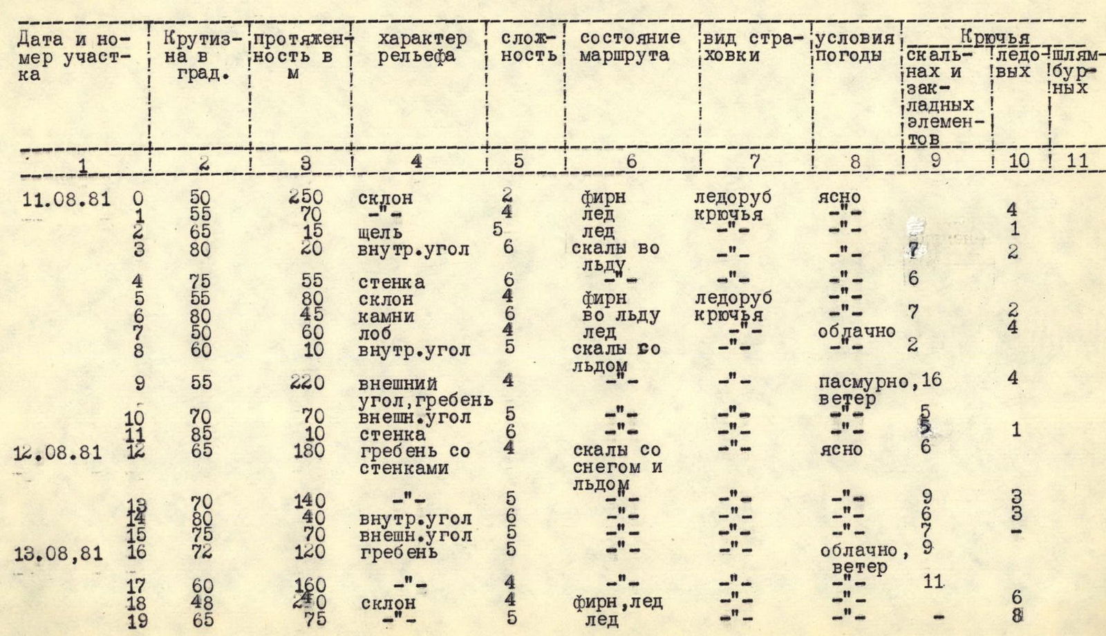
| 11.08.81 | ||||||||||
| 0 | 50 | 250 | slope | 2 | firm snow | ice axe | clear | — | — | — |
| 1 | 55 | 70 | — | 4 | ice | pitons | « | 4 | — | — |
| 2 | 65 | 15 | crevice | 5 | ice | « | « | 1 | — | — |
| 3 | 80 | 20 | inner corner | 6 | rocks in ice | « | « | 7 | — | 2 |
| 4 | 75 | 55 | wall | 6 | « | « | « | 6 | — | — |
| 5 | 55 | 80 | slope | 4 | firm snow | ice axe | « | 7 | — | — |
| 6 | 80 | 45 | rocks | 6 | in ice | pitons | « | 2 | — | 4 |
| 7 | 50 | 60 | forehead | 4 | ice | « | cloudy | — | — | — |
| 8 | 60 | 10 | inner corner | 5 | rocks with ice | « | « | 2 | — | — |
| 9 | 55 | 220 | outer corner, ridge | 4 | — | — | overcast, wind | 4 | — | — |
| 10 | 70 | 70 | outer corner | 5 | « | « | « | 5 | — | — |
| 11 | 85 | 10 | wall | 6 | « | « | « | 5 | — | 1 |
| 12.08.81 | ||||||||||
| 12 | 65 | 180 | ridge with walls | 4 | rocks with snow and ice | — | clear | 6 | — | — |
| 13 | 70 | 140 | —"— | 5 | « | « | cloudy, wind | 9 | — | — |
| 14 | 80 | 40 | inner corner | 6 | « | « | « | 6 | — | 3 |
| 15 | 75 | 70 | outer corner | 5 | « | « | « | 7 | — | 3 |
| 13.08.81 | ||||||||||
| 16 | 72 | 120 | ridge | 5 | « | « | « | 9 | — | — |
| 17 | 60 | 160 | —"— | 4 | firm snow, ice | « | « | 11 | — | — |
| 18 | 48 | 240 | slope | 4 | ice | « | « | 6 | — | 8 |
| 19 | 65 | 75 | ice | 5 | « | « | « | — | — | — |
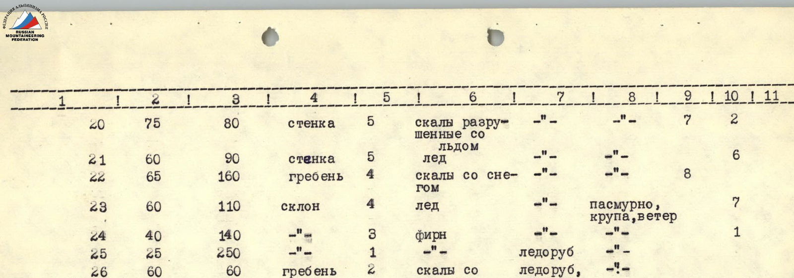
| 20 | 75 | 80 | wall | 5 | broken rocks with ice | « | « | 7 | — | 2 |
| 21 | 60 | 90 | wall | 5 | ice | « | « | — | — | — |
| 22 | 65 | 160 | ridge | 4 | rocks with snow | « | « | 8 | — | — |
| 23 | 60 | 110 | slope | 4 | ice | « | overcast, graupel, wind | 7 | — | — |
| 24 | 40 | 140 | —"— | 3 | firm snow | « | « | 6 | — | 1 |
| 25 | 25 | 250 | —"— | 1 | « | ice axe | « | — | — | — |
| 26 | 60 | 60 | ridge | 2 | rocks with snow | ice axe, outcrops | « | — | — | — |
Note: Section 16–17 was processed on August 12, 1981.