1. Ascent Passport
-
Region: Saukdara ridge (western spur of Zulumart ridge, North Pamir). Valley: Northern Zulumart. Section number according to the 1999 classification table — 4.5
-
Peak name: peak Beleuli. Route name: via the northern wall of the eastern ridge.
-
Proposed — 4B category of difficulty, first ascent.
-
Route type: snow-ice.
-
Route height difference: 905 m (by altimeter)
Route length: 1680 m. Length of sections:
- V category of difficulty — 0 m.
- VI category of difficulty — 0 m.
Average steepness:
- main section of the route — 33.6°
- entire route — 33.6°
-
Pitons left on the route:
total — 0; including, bolted — 0. Pitons used on the route: 12–25 Stationary bolted — 0, including, ITO — 0. Removable bolted — 0, including, ITO — 0. Total ITO used — 0
-
Team's working hours: 8 h 20 min, 2 days
-
Leader: Lebedev Andrey Alexandrovich, Master of Sports of International Class in tourism Participants:
- Lvov Vyacheslav Yurievich, 1st sports category in tourism
- Nistratov Igor Igorevich, 1st sports category in tourism
- Rykalov Petr Vladimirovich, Candidate Master of Sports in tourism
-
Coach: Lebedev Andrey Alexandrovich
-
Route start: 16:20 August 2, 2001
Summit ascent: 18:15 August 3, 2001
Descent to the start of the route: 14:00 August 4, 2001
2. General Photo of the Summit
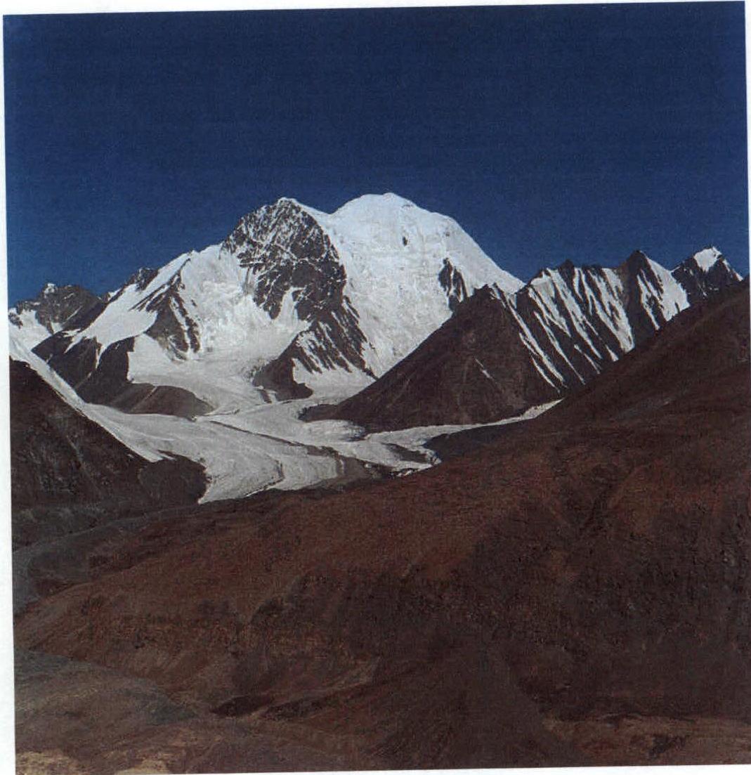 Fig.1.
The photograph was taken on August 5, 2001. The location of the photo shoot — moraine of the right side of the Northern Zulumart valley
3. Overview of the Region
Peak Beleuli (6065) is located in the Saukdara ridge (western spur of Zulumart ridge) to the west of the tongue of the Northern Zulumart glacier. This is the highest point of a vast mountain area from the Fedchenko glacier in the west to Lake Karakul in the east and from the Sauksay valley in the north to the Tanymas valley in the south. The lack of attempts to ascend this peak is explained by its significant remoteness from roads. The simplest approach to its foot leads from the Baygashki river valley through the Nikitina pass (5287, 2A) into the Northern Zulumart valley. It is possible to drive into the Baygashki valley from Osh in a high-clearance vehicle, turning west from the Eastern Pamir Highway before the Markansu valley. Our expedition entered the area from the west along the Sauksay valley. The base camp of the expedition was set up in the Northern Zulumart valley below the tongue of the eponymous glacier at an altitude of 4320 m. Here, in a wide gravel floodplain on the right bank of the river, there is a powerful spring with clean water. The water is filtered from under the moraine of the glacier descending from the Nikitina pass.
4. Map of the Region
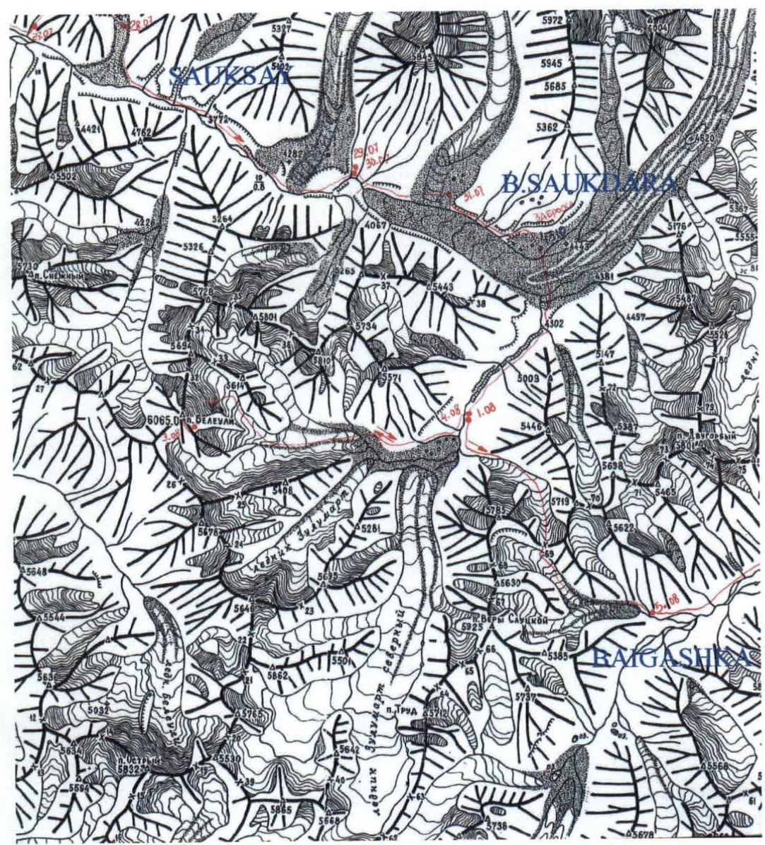
On the map, the Nikitina pass (5287 m, 2A) is marked with the number 69
5. Approach to the Summit from Base Camp
From the base camp (4320 m), cross the Northern Zulumart river and traverse the gravel floodplain of the river to the southwest to the mouth of the stream in front of the moraine rampart of the valley. Along the stream, ascend to the left moraine of the unnamed glacier on the left bank of the Northern Zulumart valley (1 hour from BC). Then ascend the moraine to the exit to the gentle part of the unnamed glacier above its steeply falling tongue (40 minutes). On the glacier, ascend for 1 hour 30 minutes to the foot of the northern slope of peak Beleuli. Height 5160 m. After lunch, it is recommended to:
- start the route
- spend the night under a serac at the beginning of the icefall at an altitude of 5440 m.
6. Technical Photograph of the Route
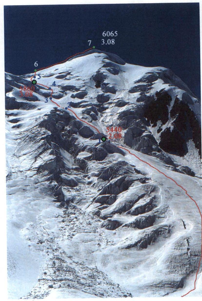 Fig.2.
7. Table of Route Sections
| № | Section Name | Start Height | End Height | photo | Difficulty | Length (m) | Steepness (degrees) |
|---|---|---|---|---|---|---|---|
| R7 | Snow-ice ridge | 5960 | 6065 | 2,8 | 2 | 300 | 15°, locally 30° |
| R6 | Ice wall | 5900 | 5960 | 2,8 | 3 | 80 | 45°, upper part 55° |
| R5 | Snow slope | 5770 | 5900 | 2,8 | 2 | 300 | 20–30° |
| R4 | Ice wall | 5670 | 5770 | 2,4,5,8 | 4 | 120 | 50°, lower part 65° |
| R3 | Snow slope | 5620 | 5670 | 2 | 1 | 100 | 20–30° |
| R2 | Snow-ice slope | 5440 | 5640 | 2,3 | 3 | 250 | 45°, locally 50° |
| R1 | Snow-ice slope | 5160 | 5440 | 2 | 2 | 530 | From 30° to 35° |
8. Route Profile

Scale 1:10000 (1 cm — 100 m)
9. Description of the Route Ascent
On August 2, after lunch, we crossed the glacier, roped up, and approached the foot of the ice slope. The height of the base of the peak — 5160 m. In 1 hour 20 minutes, in a roped team, we ascended (section R1) to the first serac before entering the icefall. Under the shelter of this serac, we set up for the night. Height — 5440 m.
August 3. The next morning, we entered the icefall. Almost immediately, we started using belays. After 250 m (ice, locally snow crust up to 10 cm, steepness from 45° to 50°, section R2), we reached a snow field (section R3), above which an ice wall blocked the exit to the plateau (section R4). The wall started with a steep forehead (60–65°, 40 m), followed by a slope dissected by a bergschrund (50°, 80 m). Above, the slope became gentler and turned into a snow slope. On the right-hand side, the bergschrund was not high (1.5 m). That's where we crossed it.
The snow slope (section R5) turned out to be quite steep, so to set up a camp, we had to ascend to its middle part and find a crevasse. Height 5860 m. After a short rest in tents, we went to the summit lightly packed. The exit to the eastern ridge of the peak in its lowest part was complicated by crevasses. We had to bypass the crevasses on the right (in the direction of travel), hanging 80 m of belays (ice, 45–50°, at the end of the section snow, section R6). We traversed the easy ridge (section R7) simultaneously. We reached the summit at 18:15. We set up a cairn at the exit of rocks, which is located 50 m southwest of the highest point. We did not find an old cairn. We spent about an hour on the summit, then descended to the camp at 5860 m.
August 4. In the morning, we started descending, using a variety of means to secure rope loops:
- On ice, we drilled holes,
- On loose snow, we used nylon "parachutes" as anchors,
- In one place, where it was neither ice nor snow, but something in between, we chopped out a column with a groove for a cordelette.
From the plateau to the first night's stop (5440 m), we dropped 8 ropes. After lunch, from the foot of the peak, we descended to the Northern Zulumart river in 2 hours. Here, we faced the most challenging ford of the trip. And after the ford — hot tea, and then a celebratory dinner in the base camp. Height 4320 m.
10. Photo Illustrations
 Fig.3. At the start of R2
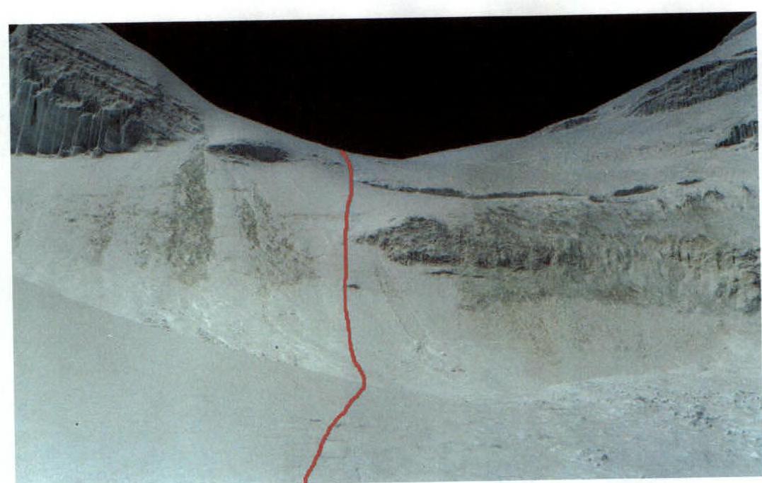 Fig.4. Section R4
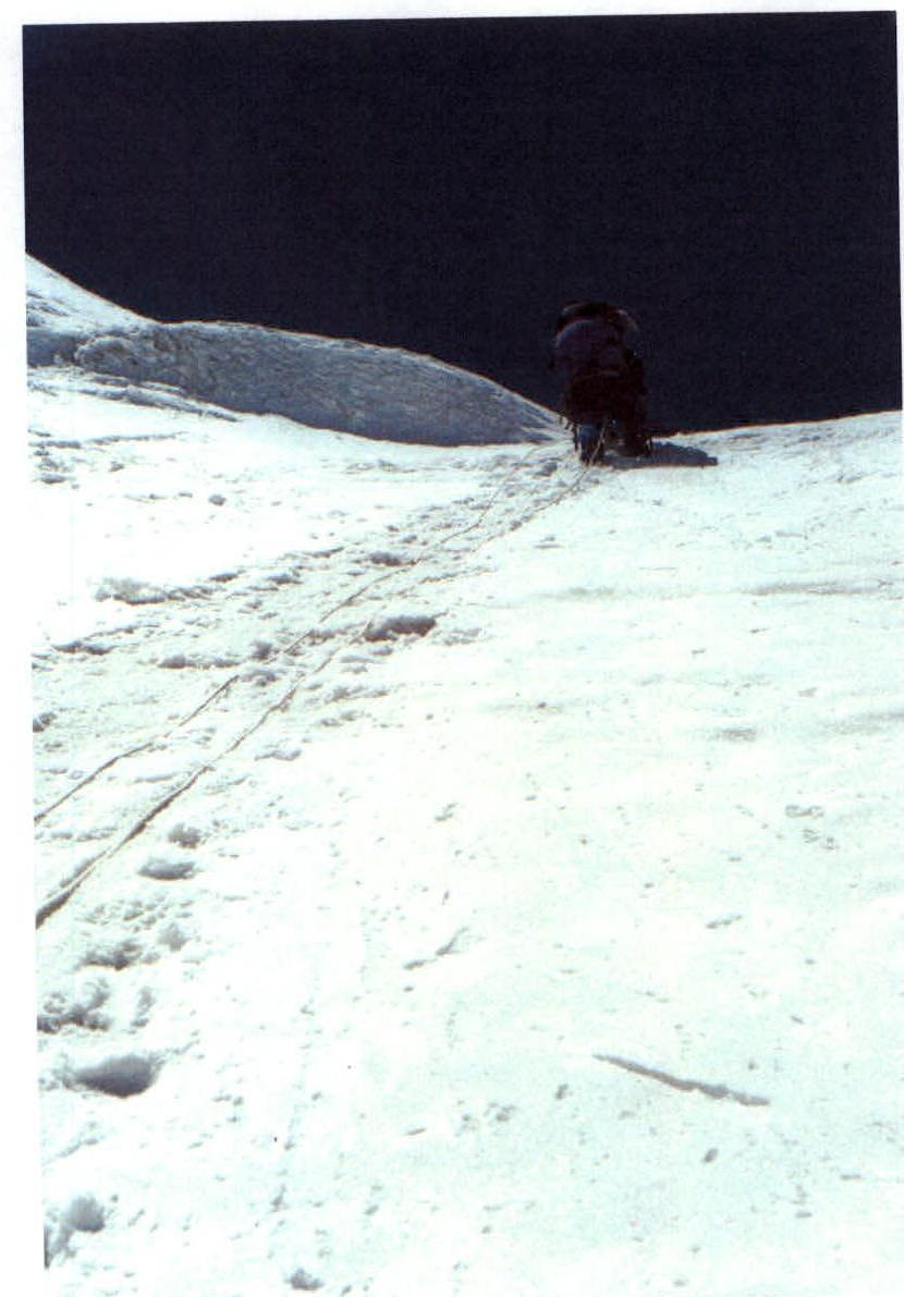 Fig.5. On section R4
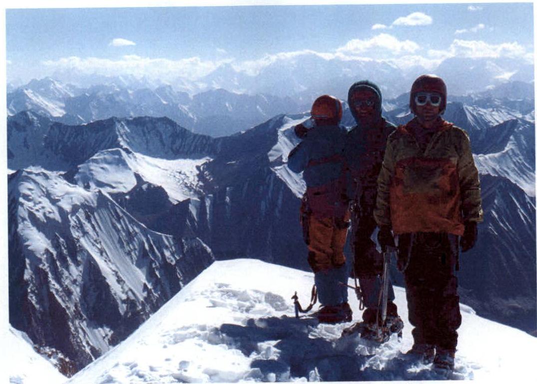 Fig.6. On the summit of peak Beleuli (in the distance, peak Kommunizma)
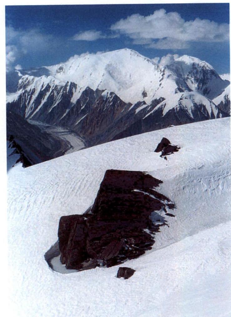 Fig.7. Rock outcrop slightly north of the summit, on a ledge where the group left a control cairn (in the background, peak Lenin)
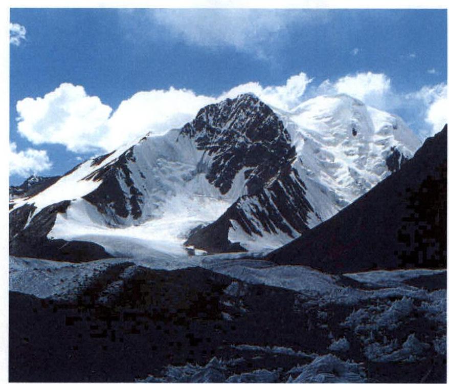 Fig.8. Peak Beleuli, farewell photo on August 4, 2001