Report
On the first ascent of the peak Nevidimka (4686 m) via the SW ridge through the 4607 m pass, category 1B-2A, by the Asia Outdoor guide team on July 29, 2023.
2023 I. Climbing Report Form
| № | 1. General Information | |
|---|---|---|
| 1.1 | Full name, sports rank of the leader | Eduard Borisovich Inozemtsev, 1st sports rank |
| 1.2 | Full name, sports rank of participants | Vadim Yuryevich Ivanov, 3rd sports rank |
| 1.3 | Full name of coach | Vladimir Ivanovich Suviga |
| 1.4 | Organization | Asia Outdoor Club |
| 2. Characteristics of the ascent object | ||
| 2.1 | Region | Pamir, Trans-Alay Range |
| 2.2 | Valley | Achik-Tash |
| 2.3 | Section number according to the 2013 classification table | 4.4 |
| 2.4 | Name and height of the peak | Peak Nevidimka, 4686 m |
| Geographic coordinates of the peak | 39°26′03″N, 72°52′09″E | |
| 3.1 | Route name | SW ridge via the 4607 m pass |
| 3.2 | Proposed category of difficulty | 1B-2A |
| 3.3 | Degree of route exploration | First ascent |
| 3.4 | Relief characteristics of the route | Combined |
| 3.5 | Height difference of the route | 299 m |
| 3.6 | Route length | 1375 m |
| 3.7 | Technical elements of the route | Category I combination — 510 m, category I snow — 720 m, category II rocks — 145 m |
| 3.8 | Descent from the peak | New route, category 1A-1B |
| 3.9 | Additional route characteristics | Streams on horizontal glacier sections and snow on the pass and cornices on the ridge |
| 4. Characteristics of the team's actions | ||
| 4.1 | Travel time | 2 hours 20 minutes |
| 4.2 | Overnight stays | No overnight stay |
| 4.3 | Start of the route | 5:00, July 29, 2023 |
| 4.4 | Reaching the peak | 7:20, July 29, 2023 |
| 4.5 | Return to base camp | 10:35, July 29, 2023 |
| 5. Responsible for the report | ||
| 5.1 | Full name, e-mail | Eduard Borisovich Inozemtsev, inozemtsev.edik2012@yandex.ru |
II. Climbing Report
1. Characteristics of the Ascent Object
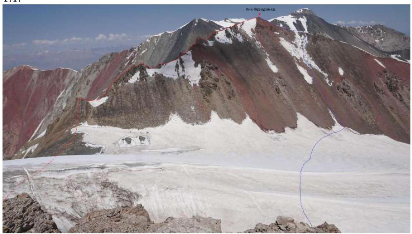
1.1.
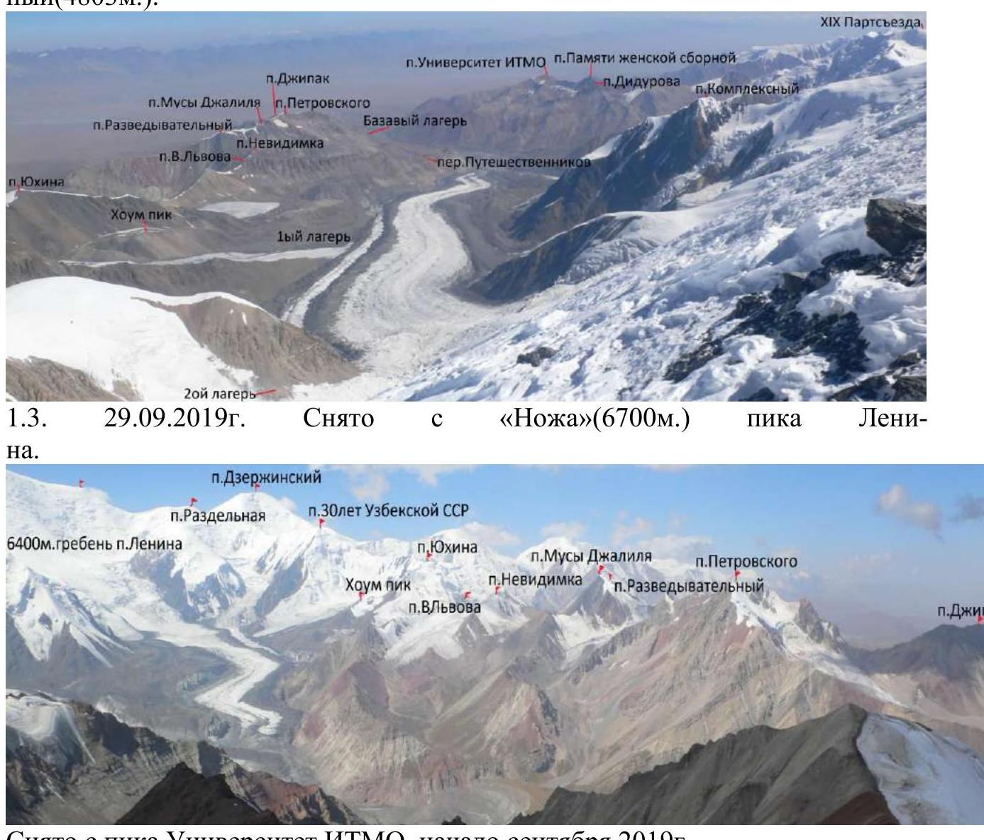
 August 11, 2021. Taken from the ridge of Peak Vyacheslav Lvov (4696 m)
 June 30, 2021. Taken from the "Skovorodka" (5200 m) of Peak Lenin.
 June 24, 2023. Taken from Peak Yukhin (5130 m)
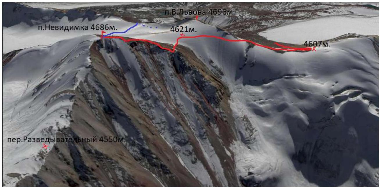 Google Earth Pro screenshot, view from the side of Peak Razvedchik (4803 m).
 Taken from Peak University ITMO, early September 2019.
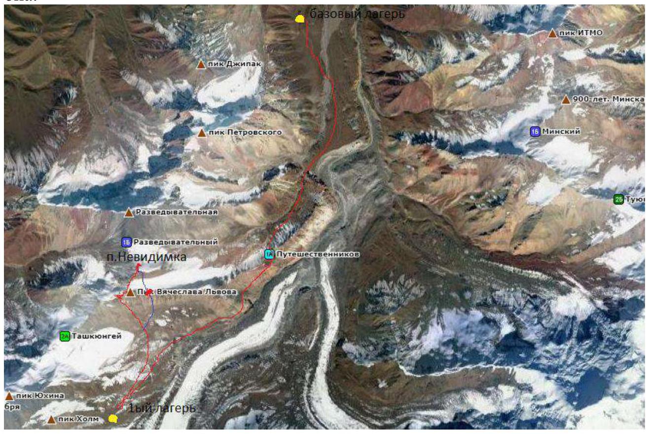
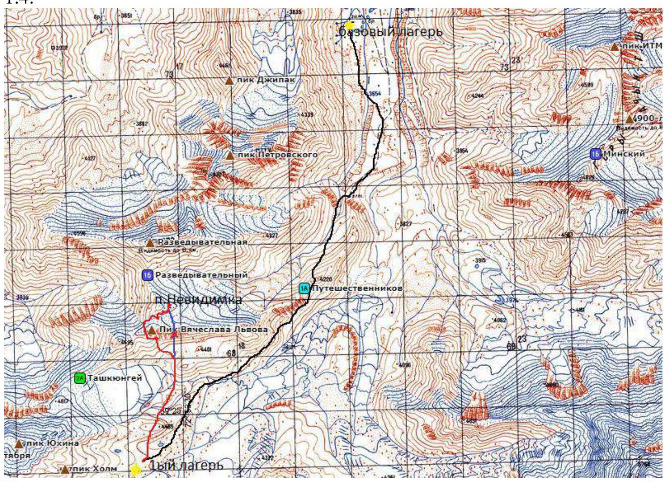 Map of the area.
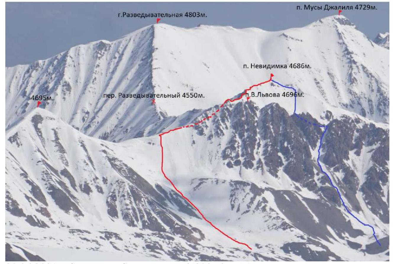
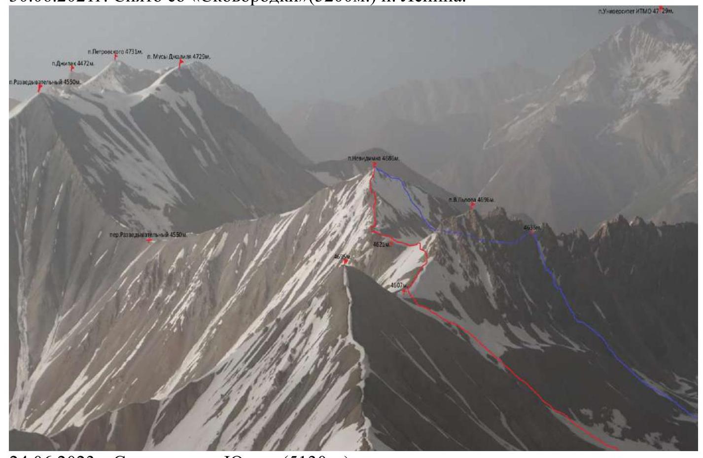
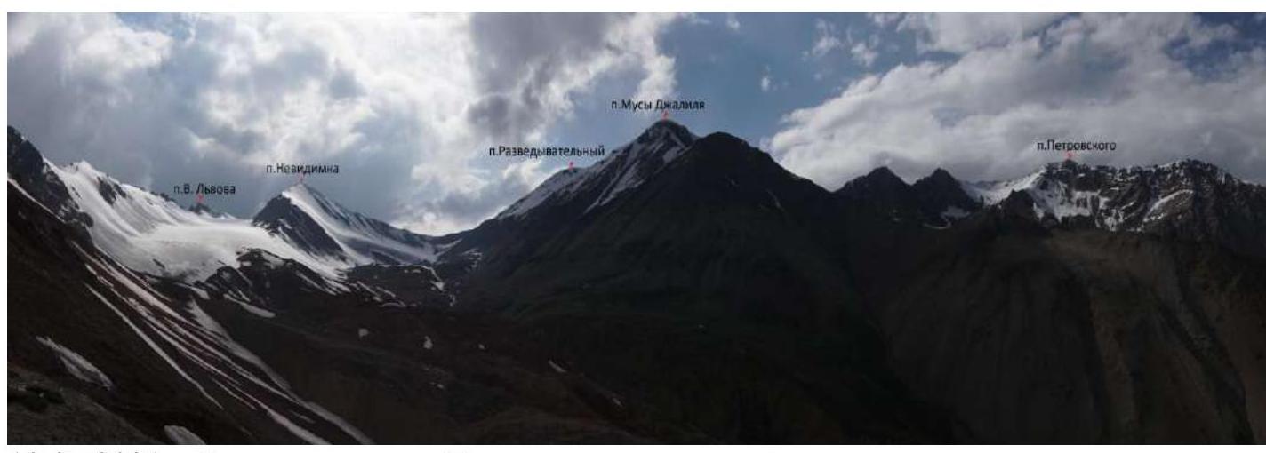
 1.4. Peak Nevidimka is located near the border between Kyrgyzstan and Tajikistan, in the Osh region, in the Achik-Tash valley, between Peaks Musa Jaliľ and Yukhin, closer to Peaks Razvedchik and Vyacheslav Lvov, but the latter are not in the classifier, the last one was named by tourists after a deceased friend.
By the way, in the classifier, Peak Musa Jaliľ is marked with a height of 4729 m, and Peak Razvedchik on tourist maps is 4803 m, although according to Google Maps, the height indicator shows Musa at 4808 m and Razvedchik at 4785 m, and visually from Nevidimka, Musa is higher. Peak Nevidimka is located in the Trans-Alay Range, in the central part of which is its highest point — Peak Lenin (7134.3 m), forming the northern border of the Pamir. This range stretches in a latitudinal direction for 150 km and borders the easternmost western spurs of Kokshala-Tau (Tian Shan) to the east, and to the west near the confluence of the Muksu and Kyzylsu rivers. The northern slope of the range faces the Alay Valley, and the southern slope — the Pamir. For a significant extent, the average heights of the Trans-Alay Range exceed 6000 m. The nearest city to the Alay Valley is Osh, which can be reached by plane or by car from Bishkek. Further, it's only by car to numerous tour firm bases. We were based at the MAL at Asia Outdoor. In a straight line from Osh to MAL is 120 km, by road — 280 km, the journey takes 5-10 hours, depending on the driver's experience and the passability of the vehicle, but I've seen even a "Volga" there.
To the last settlement — Sary-Mogol — there is a good asphalt road, then we turn left, cross the bridge, and continue on a dirt road. At the beginning of June, there may be snow, and the rivers still present difficulties, especially in the evening or after rain. From there to the base is 37 km, then we cross the 1A Pass Puteshestvennikov (4150 m) and move along the southern side of the ridge. In principle, you can reach our mountain by traversing. From the Pass Puteshestvennikov and the approaches to it, Peak Nevidimka is visible, but only its ridge and NE slope. From the base to the 1st camp is approximately 12 km, 4-6 hours of walking.
 July 19, 2021. Photo from the Pass Puteshestvennikov.
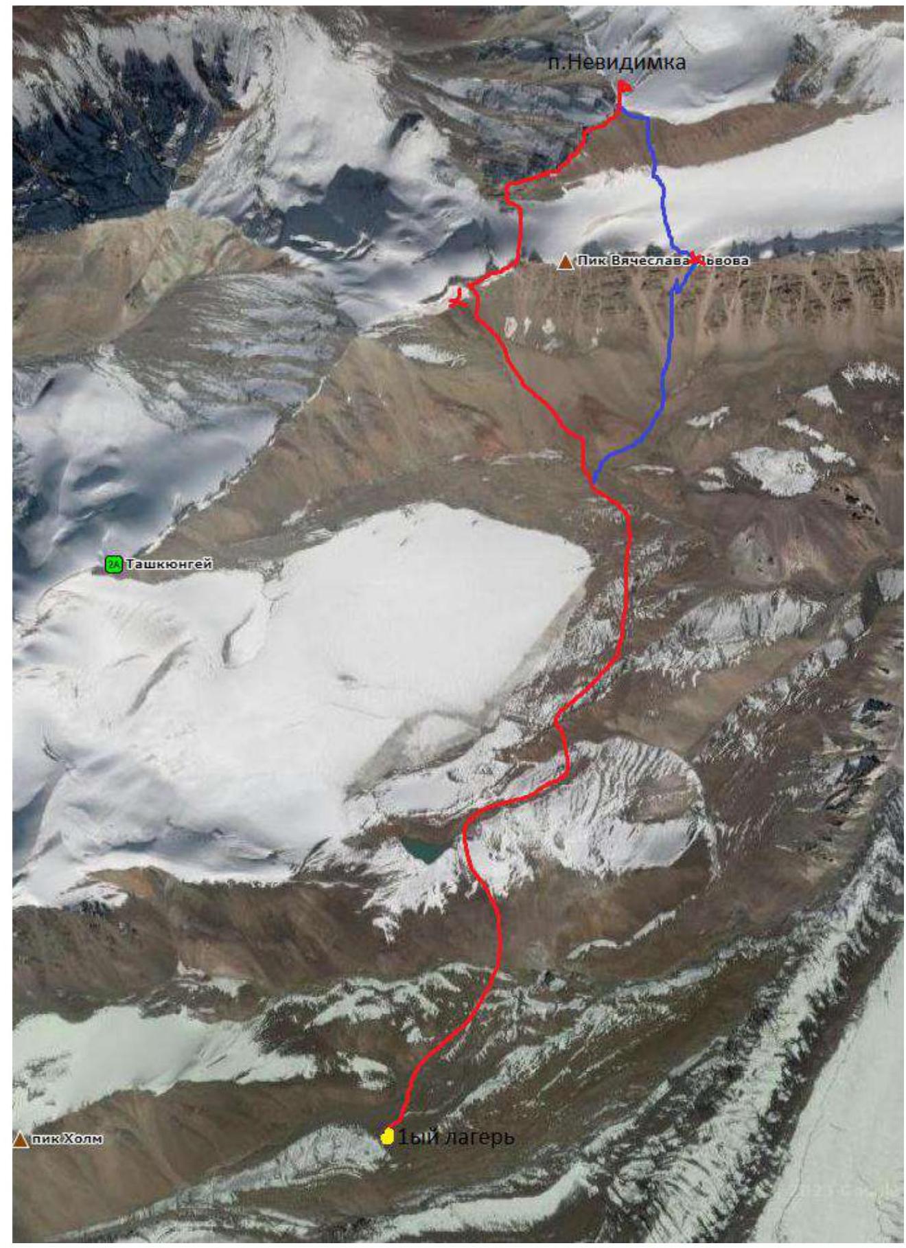
On June 29, 2023, my friend from Chita, Vadim Yuryevich Ivanov, and I decided to climb an unclimbed peak. I named it Nevidimka because it is not visible from the 1st camp; only when you climb to the "Skovorodka" does its summit appear, but it merges with Peak V. Lvov. I didn't find similar heights in the classifier in this area, so I assumed we would make the first ascent.
We left the Asia Outdoor camp at exactly 4:00. I'll note right away that I had climbed this peak before in 2021 via the same route, but solo, i.e., unofficially, and therefore didn't submit a report for classification. Now I've found a great partner, and I've decided to, so to speak, formalize everything.
We walked:
- to the left of Yuri Ermachek's camp;
- then to the right of the lake;
- we circled the tongue of the glacier, which flows from the northern, northeastern slopes of Peak Yukhin.
Our path lay across moraine ridges — up and down. There was no trail. At night, a light snowfall dusted the ground, no more than 1 cm.
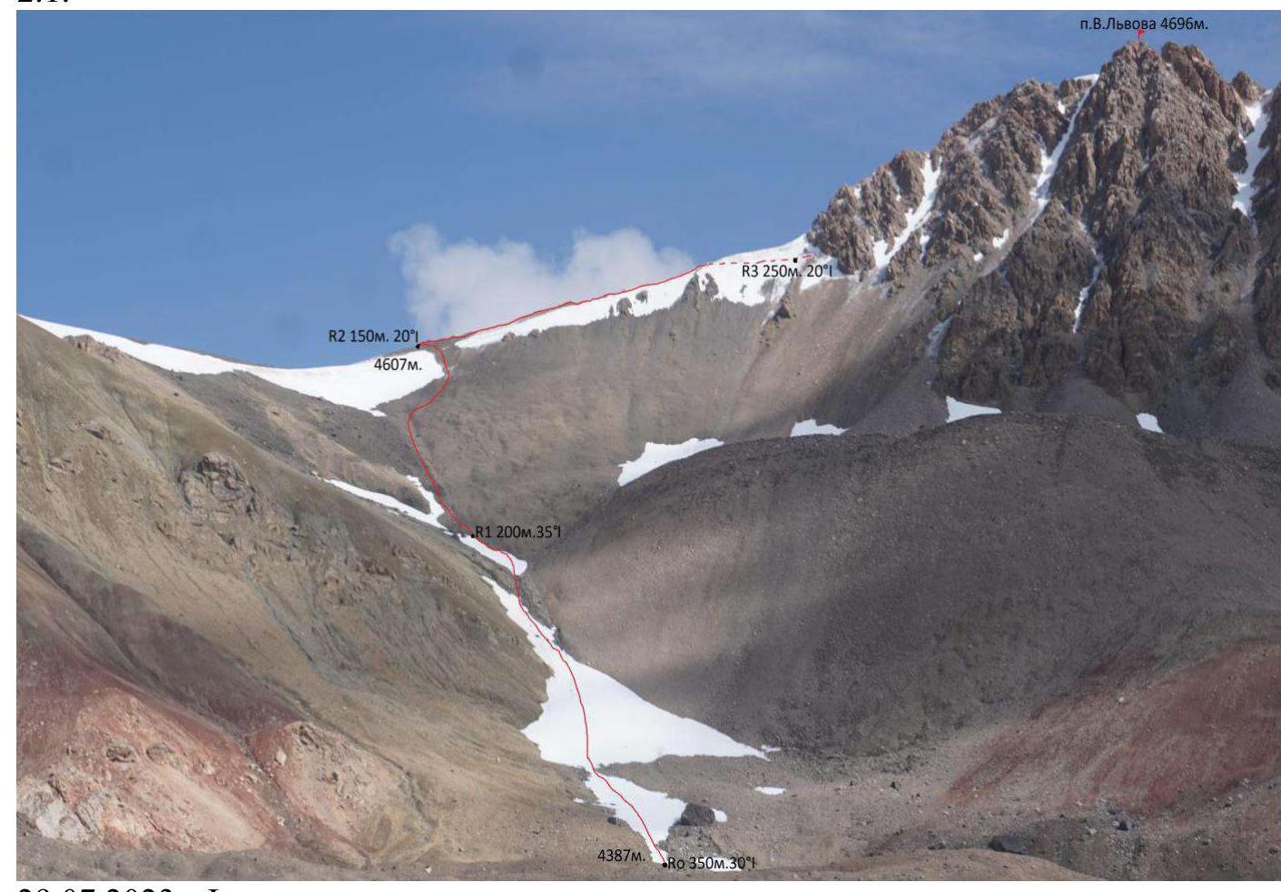
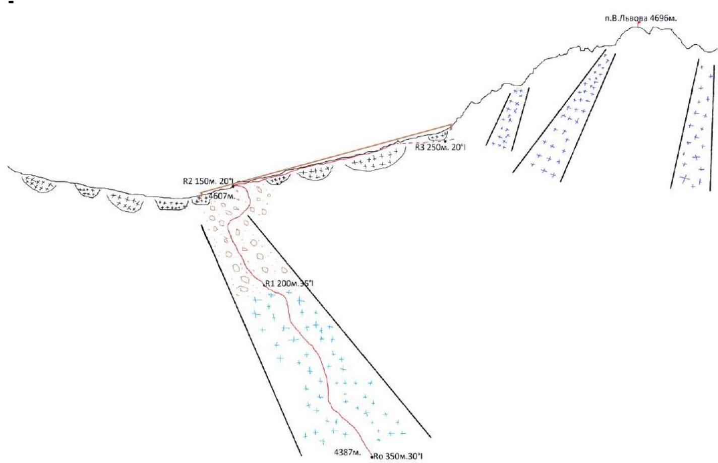
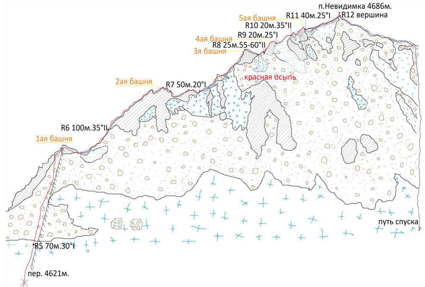
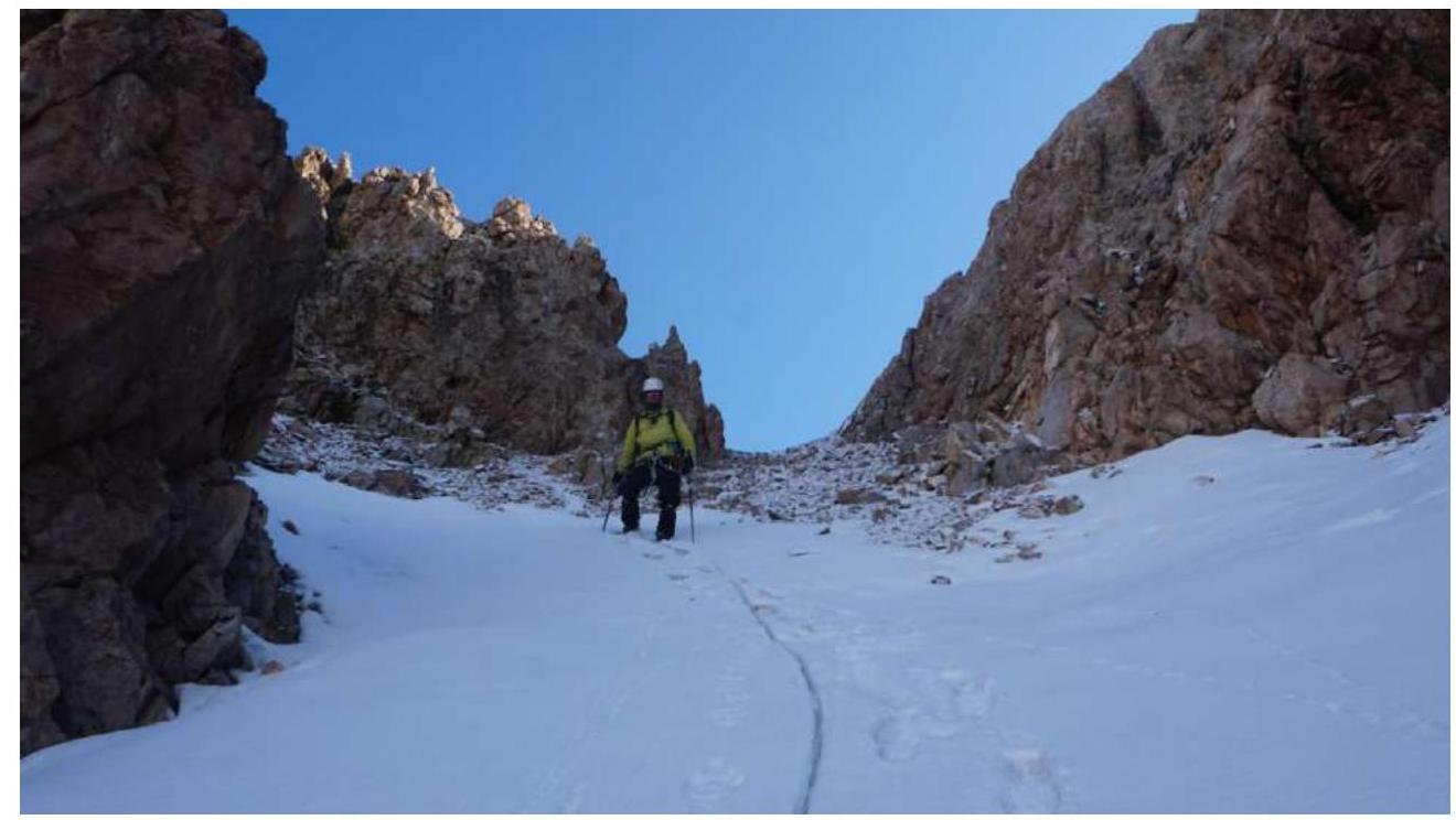
In 1 hour, we approached the first section — under the pass (height 4387 m).
- we ascended the couloir (snow-firn, approximately 30-35°, 550 m long);
- in the upper part — loose scree.
We spent 50 minutes overcoming the pass. At the beginning of the season, it's entirely covered in snow, and avalanches are possible. Now — snow, dried loose scree, a stream runs under the snow, and rocks protrude. From above, along the entire length, snow-ice cornices overhang, but there are no avalanche cones from collapsed cornices. There's a passage about 10 m wide between the cornices.
On the pass:
- we put on harnesses;
- attached crampons;
- tied in with a rope;
- took ice axes in hand.
At 6:00, we moved further:
- first along the ridge on loose scree under Peak V. Lvov (the ridge is wide, we don't step on snow cornices);
- we circumvent the rocky ridge of Peak V. Lvov from the left;
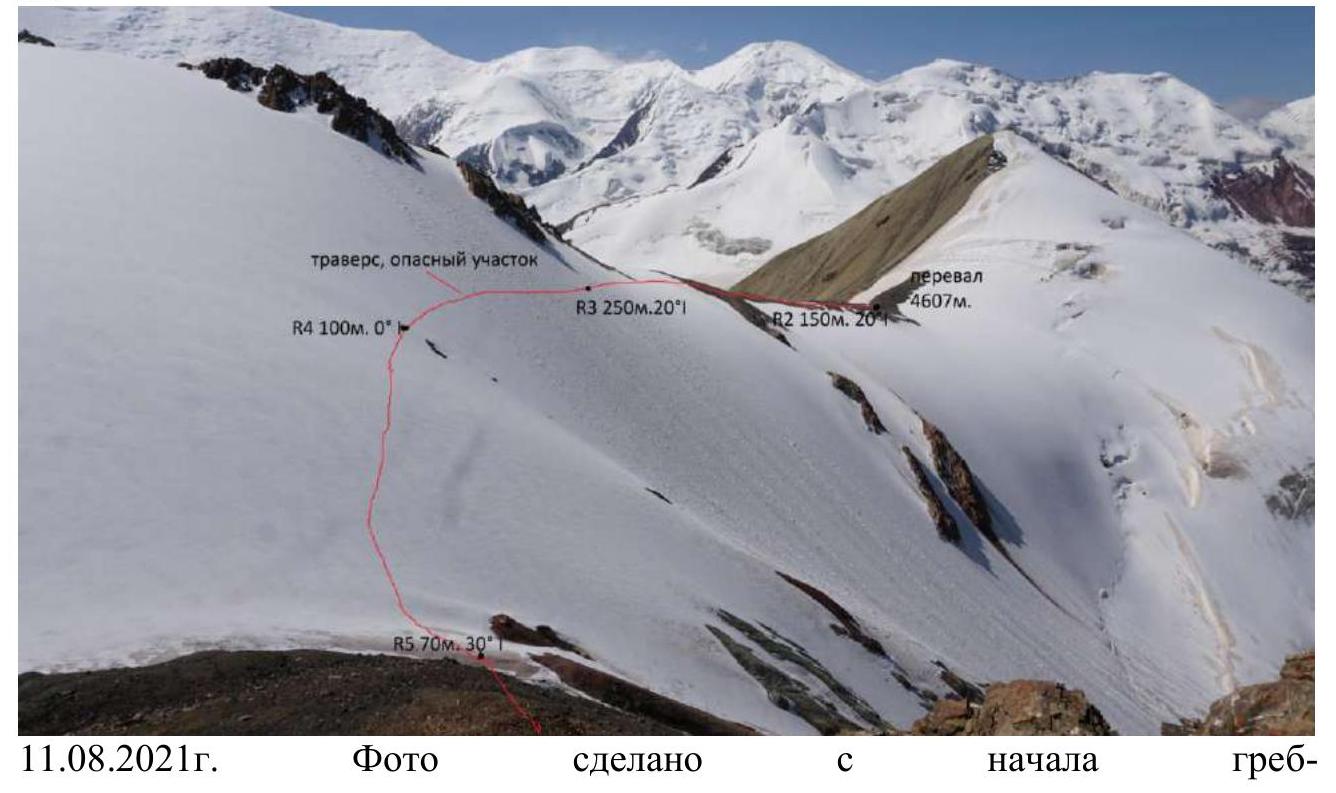
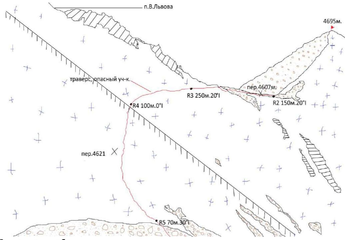
- then traverse a snow-ice slope (it's steep, 40°, 420 m long) with a slight descent down (4621 m).
In the middle of this section, you can fly down a long way, about 500 m into the neighboring valley, so a rope is essential here.
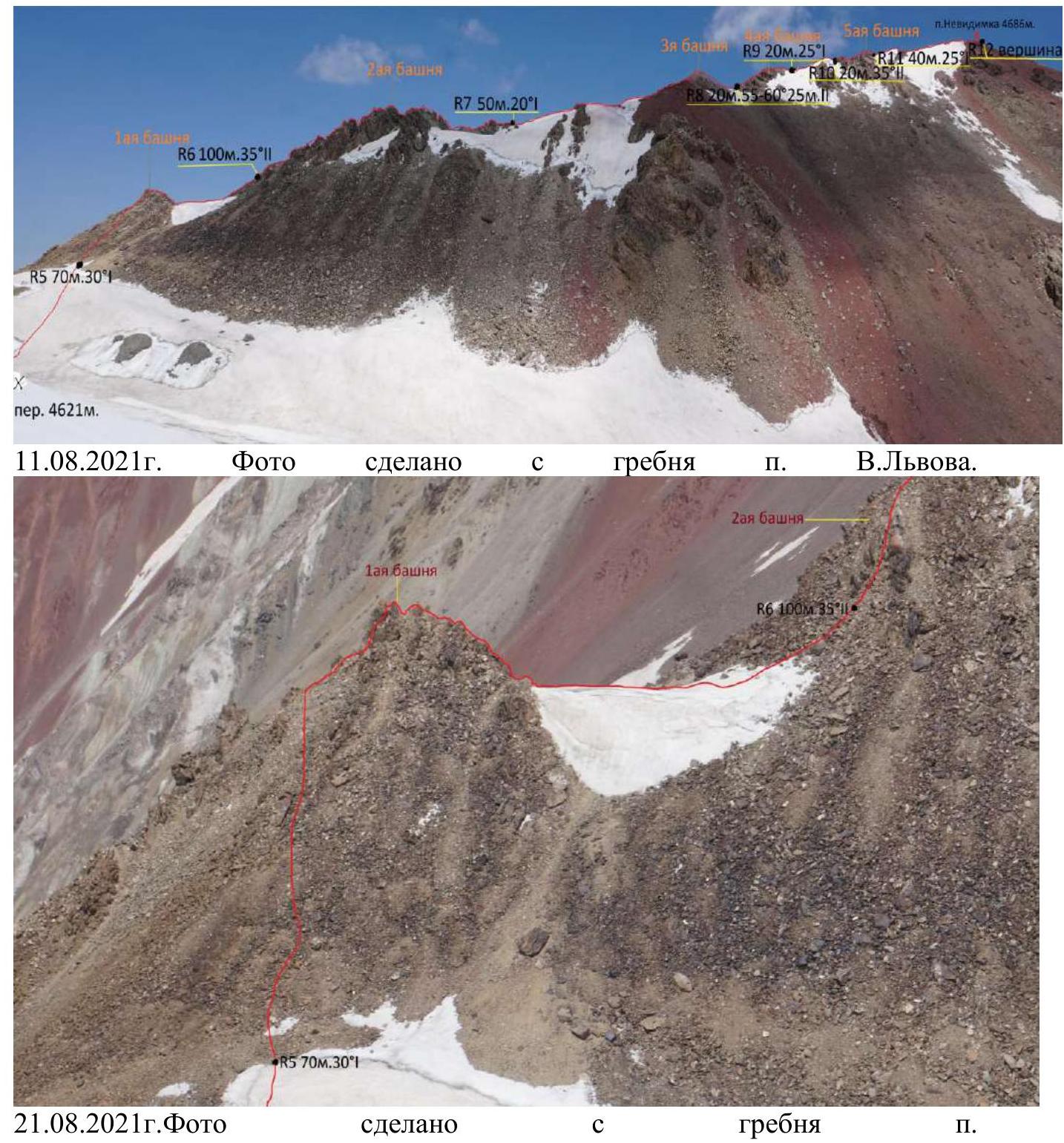
We exit the beginning of the ridge, remove crampons and all equipment, and continue without it. Time 6:23, height 4630 m. The ridge to the summit has an average incline of 30-35°, alternating between:
- loose scree;
- rocky destroyed towers;
- in places, we pass over snow with non-threatening cornices facing south.
We ascend to the 1st tower on loose scree of medium size, then descend to a snow patch with a cornice. The 2nd tower is the largest (100 m):
- initially — loose scree with large stones that we need to avoid dropping on our partner;
- further on, we need to climb, holding onto the rock.
Next:
- we descend on loose scree, the snow patch remains below on the right;
- a small rocky tower that we climb over the top;
- again loose scree (now red);
- we pass a small "gendarme" on the right;
- exit onto snow.
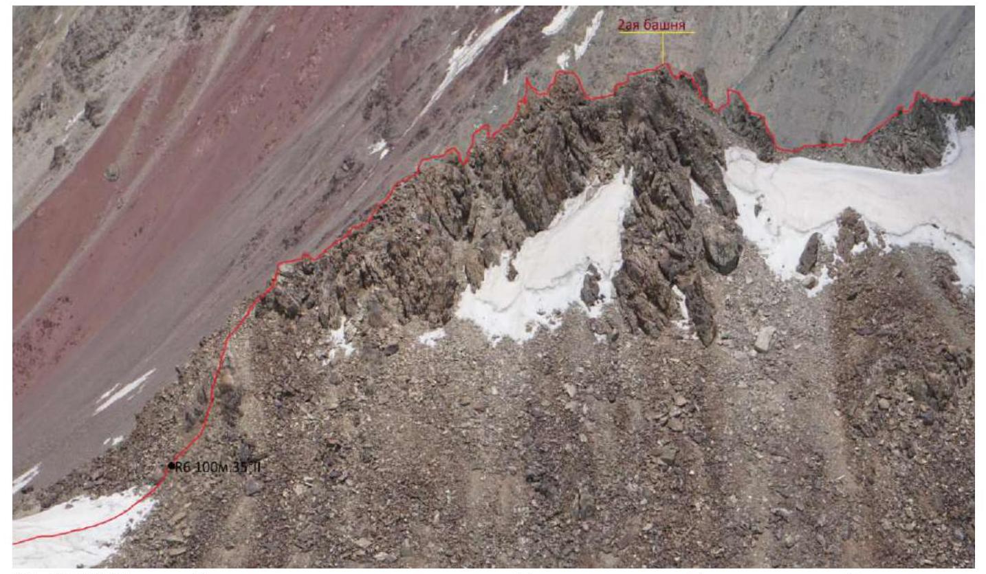
Further, the ridge makes a slight turn to the left. Up the rocks protruding from the ridge, we reach the 3rd tower (it's now gray):
- we hold on with our hands;
- try not to drop stones down on our partner;
- climb over the top;
- then — down into the next dip.
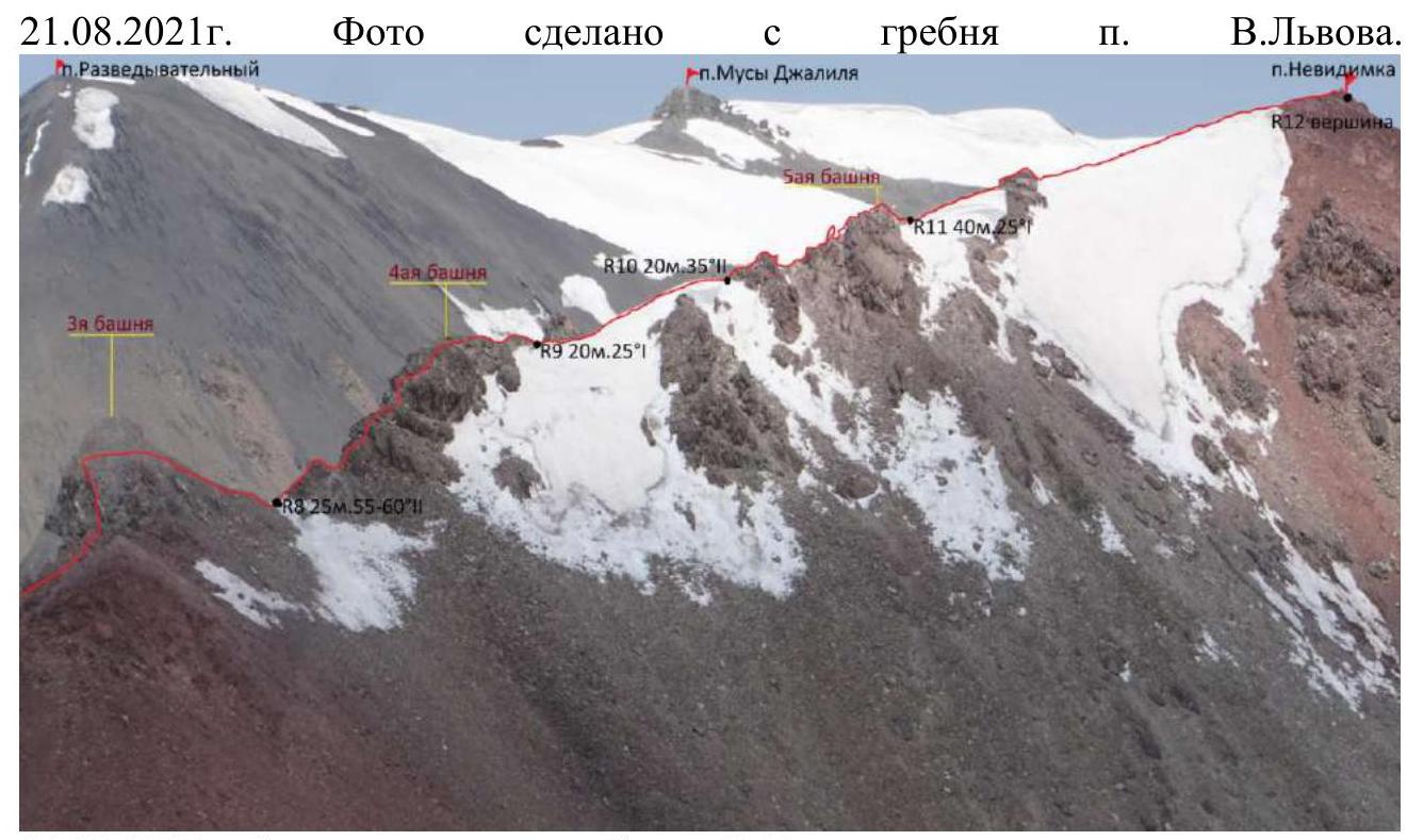
The 4th tower starts immediately:
- we climb;
- don't descend, but move onto snow practically on the level;
- a "gendarme" remains on the left;
- a snowy cornice is on the right, so we don't veer too far right.
Up to a rocky barrier, we climb over it — and it's the 5th tower:
- again we climb, holding on with our hands;
- again on the ridge — a snow patch, firn with a cornice;
- then — a rocky outcrop;
- a snow patch almost to the very summit, a small cornice.
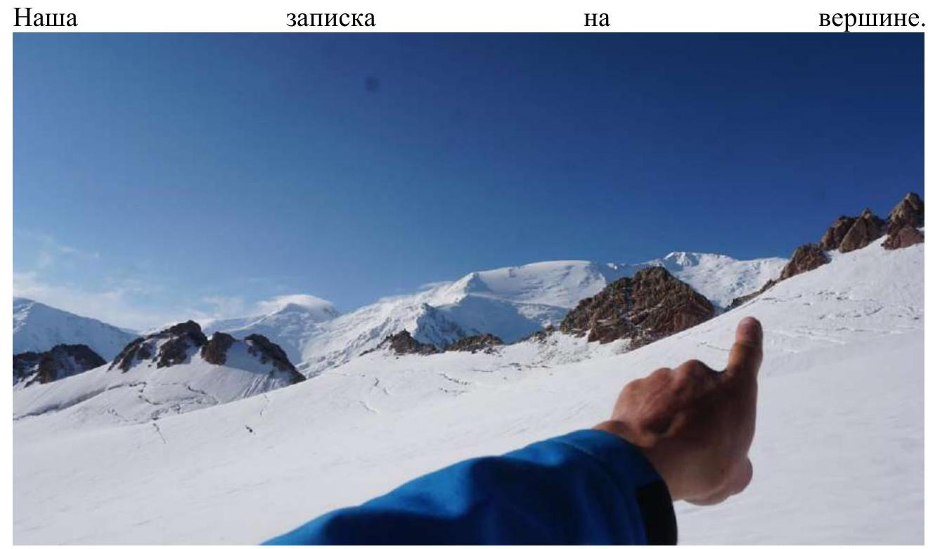
We reached Peak Nevidimka at 7:20. The summit is loose scree with a rocky ridge visible underneath. We stayed on the summit for 20 minutes, took photos, and wrote a note. I didn't find the previous note from 2021; the cairn was also destroyed.
We decided to descend to the south:
- descended 50 m along the ridge and down;
- descent on medium loose scree to the glacier, sometimes accelerating down small scree;
- below, we tied in with a rope, put on crampons;
- crossed the open glacier, encountered a couple of crevasses;
- traversed through a rocky ridge where Peak V. Lvov is located, to the left of it.
Through this pass, I descended in 2021, so the route was known:
- the first 50 m were snow (last time it was snow with ice), we descended with ice axes and tools in a team;
- when loose scree began — we removed all unnecessary equipment;
- mainly medium-sized stones, at the bottom — "suitcases";
- nothing was falling from the surrounding walls, but there are two adjacent couloirs on the right, and rockfalls are possible there.
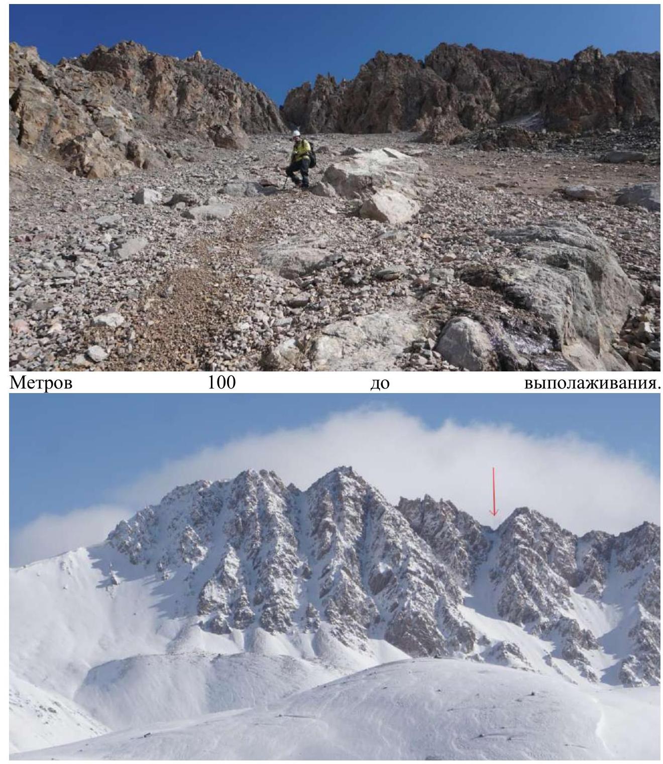
We descended under the couloir, had a snack. We were at the 1st camp (4400 m) at 13:00.
 July 29, 2023. Photo from under the pass, taken after descent.
 August 11, 2021. Photo taken from the beginning of the ridge.
 August 11, 2021. Photo taken from the ridge of Peak V. Lvov.
 August 21, 2021. Photo taken from the ridge of Peak V. Lvov.

 August 21, 2021. Photo taken from the ridge of Peak V. Lvov.
2.3. Technical Characteristics of Route Sections
| Section № | Relief characteristics | Category of difficulty | Length, m | Type and number of hooks |
|---|---|---|---|---|
| R0–R1 | snow | 1 | 350 m | |
| R1–R2 | scree (sc.) | 1 | 200 m | |
| R2–R3 | sc., snow | 1 | 150 m | |
| R3–R4 | snow, ice | 1 | 250 m | |
| R4–R5 | snow | 1 | 100 m | |
| R5–R6 | snow, rock | 1 | 70 m | |
| R6–R7 | rock | 2 | 100 m | |
| R7–R8 | snow, rock | 1 | 50 m | |
| R8–R9 | rock | 2 | 25 m | |
| R9–R10 | snow | 1 | 20 m | |
| R10–R11 | rock | 2 | 20 m | |
| R11–R12 | snow, rock | 1 | 40 m |
 Approach to the pass.
 Approach under the ridge.
 Main part of the route.
3.1.
Main part of the route.
3.1.
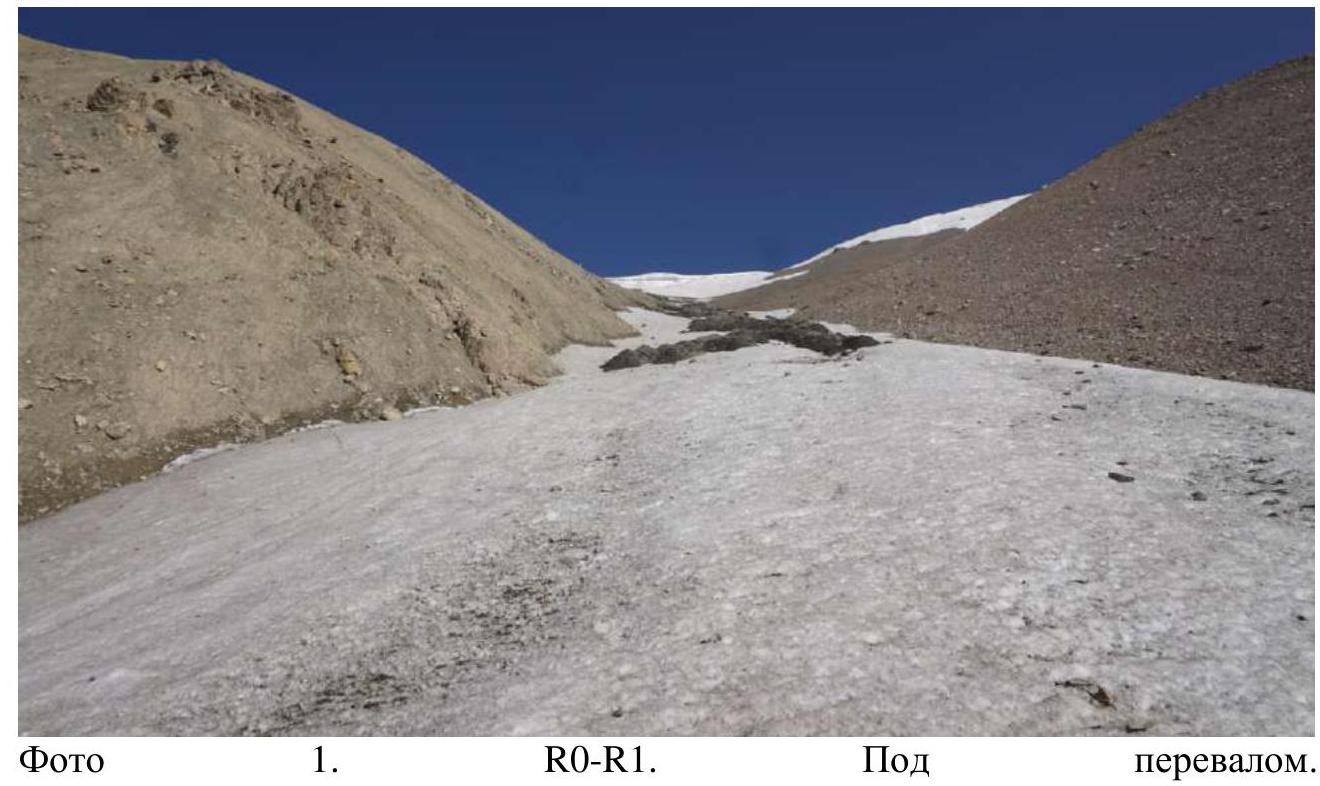 Photo 1. R0–R1. Under the pass.
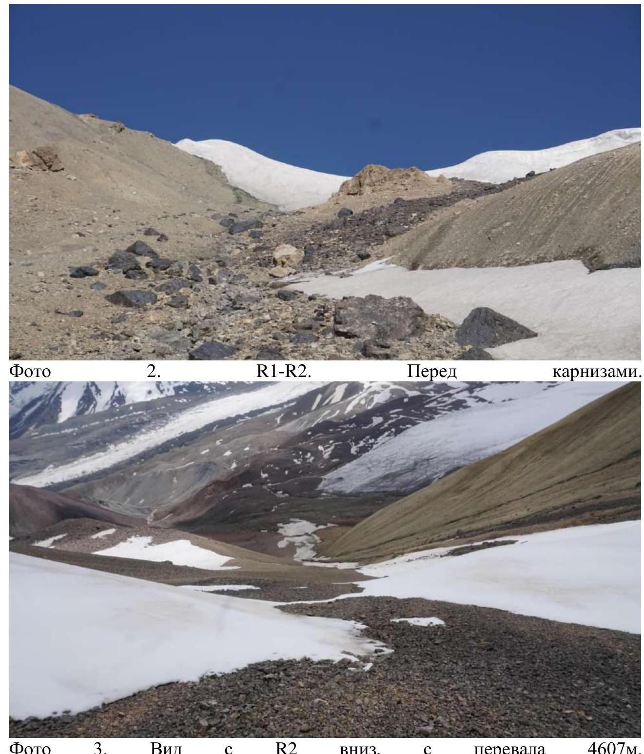 Photo 3. View from R2 down, from the 4607 m pass.
 Photo 4. R2–R3, view towards Peak V. Lvov and Peak Nevidimka.
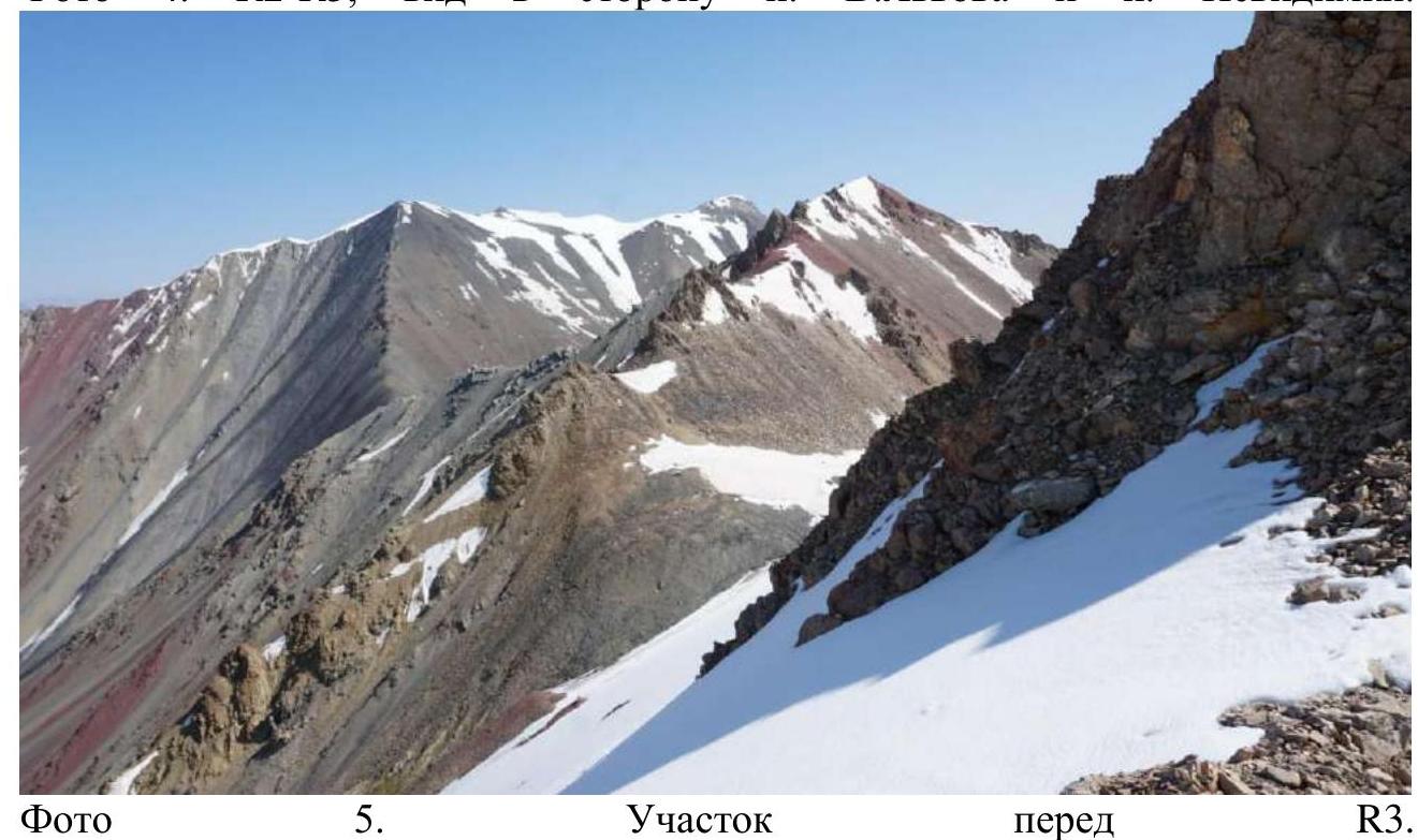 Photo 5. Section before R3.
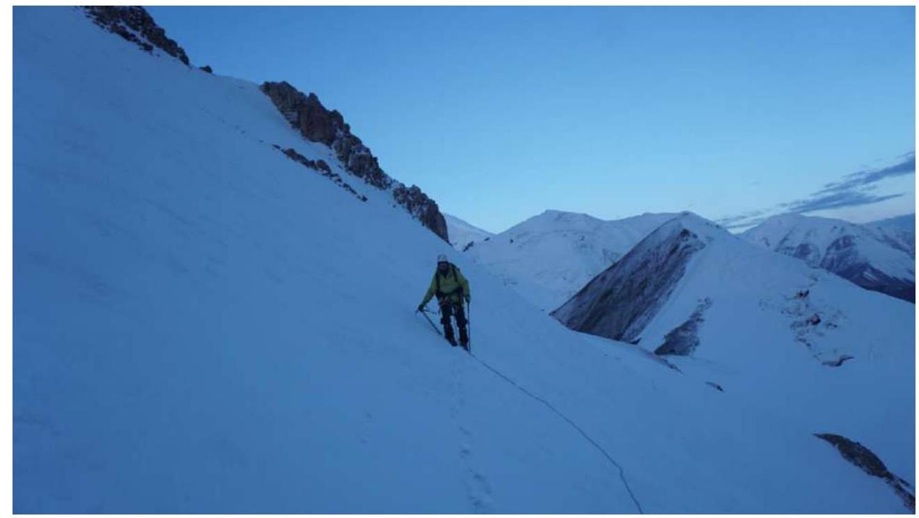 Photo 6. R3–R4, Vadim traverses a dangerous section; if he falls, he can fly 500 m to the south.
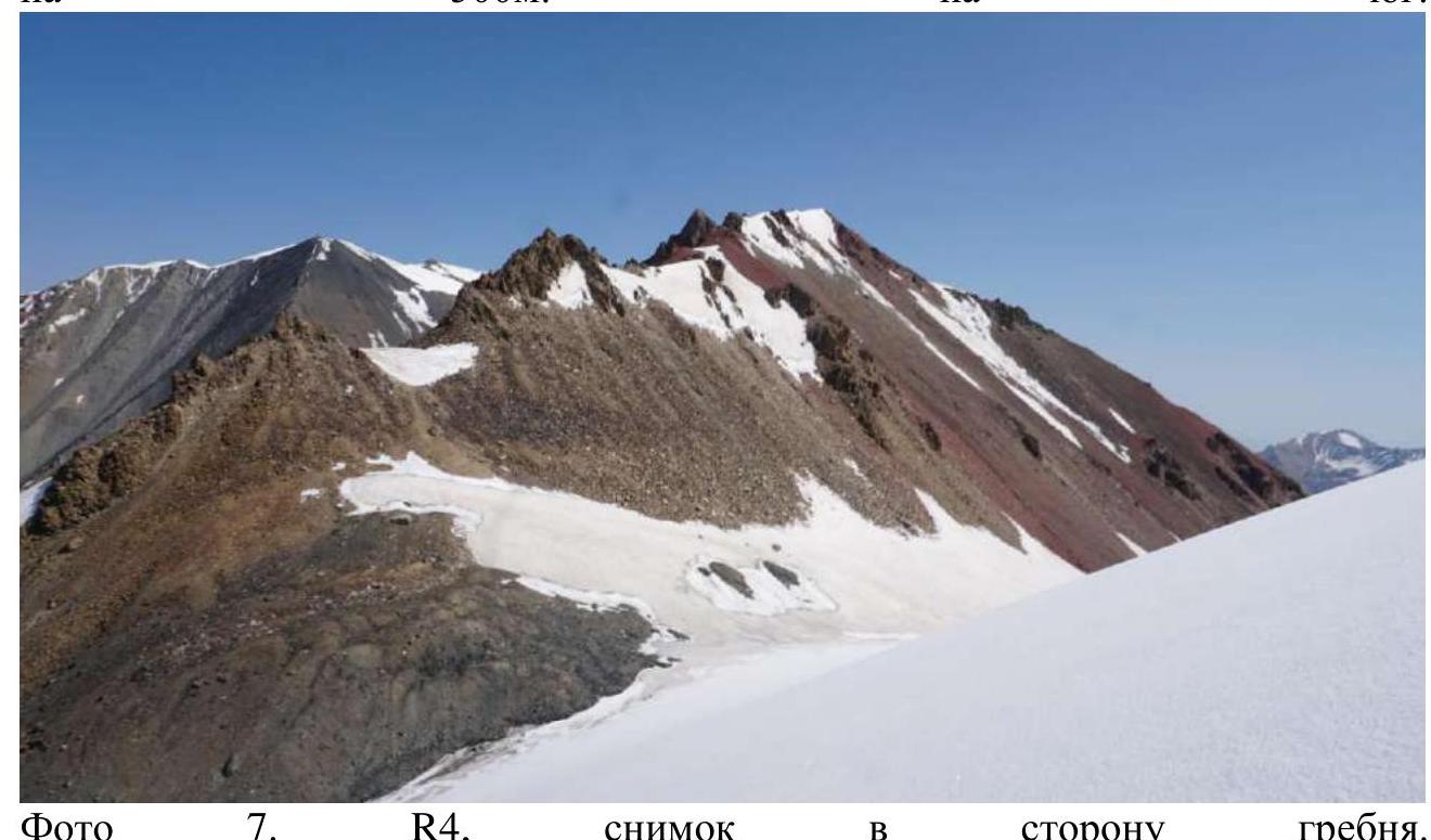 Photo 7. R4, view towards the ridge.
 Photo 8. R5–R6, removing crampons, putting away the rope. Before the 1st tower.
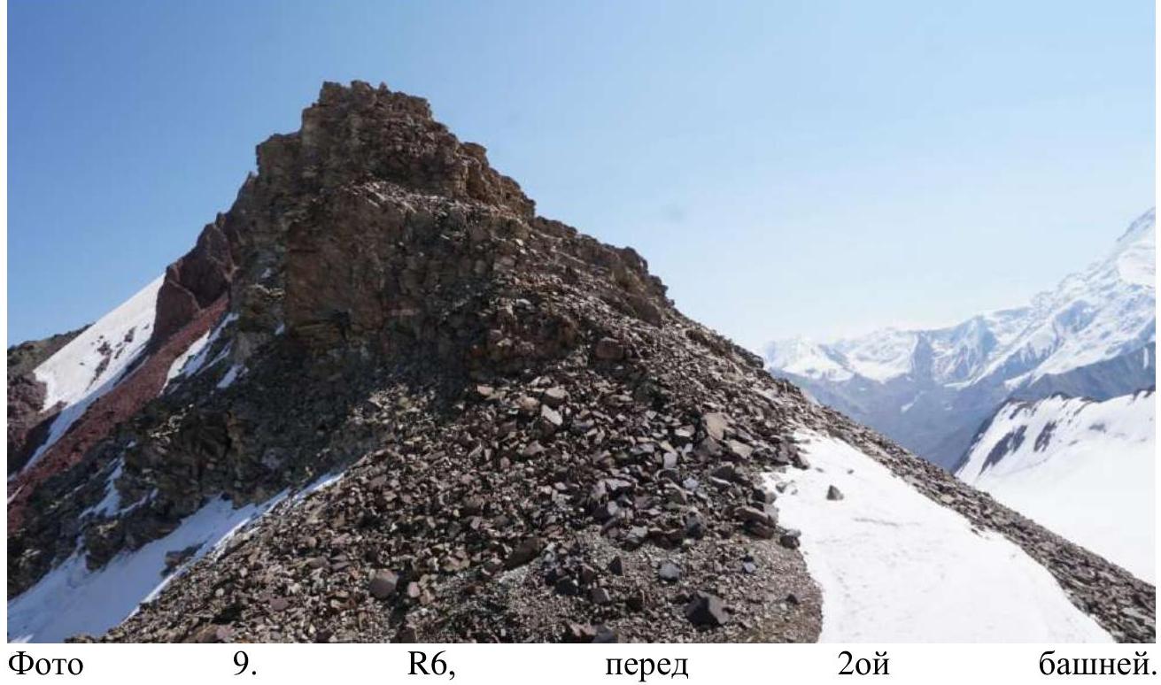 Photo 9. R6, before the 2nd tower.
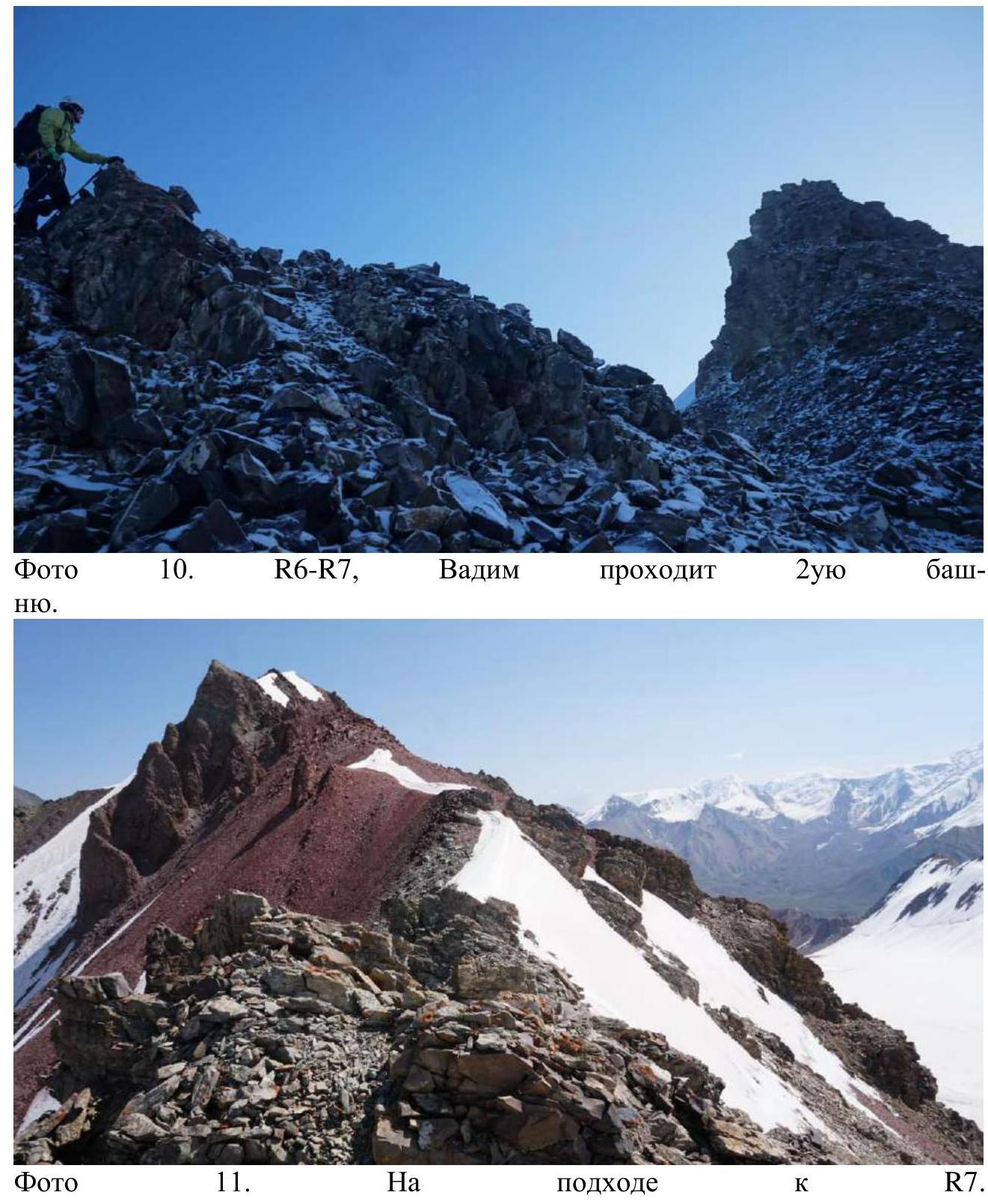 Photo 10. R6–R7, Vadim climbing the 2nd tower.
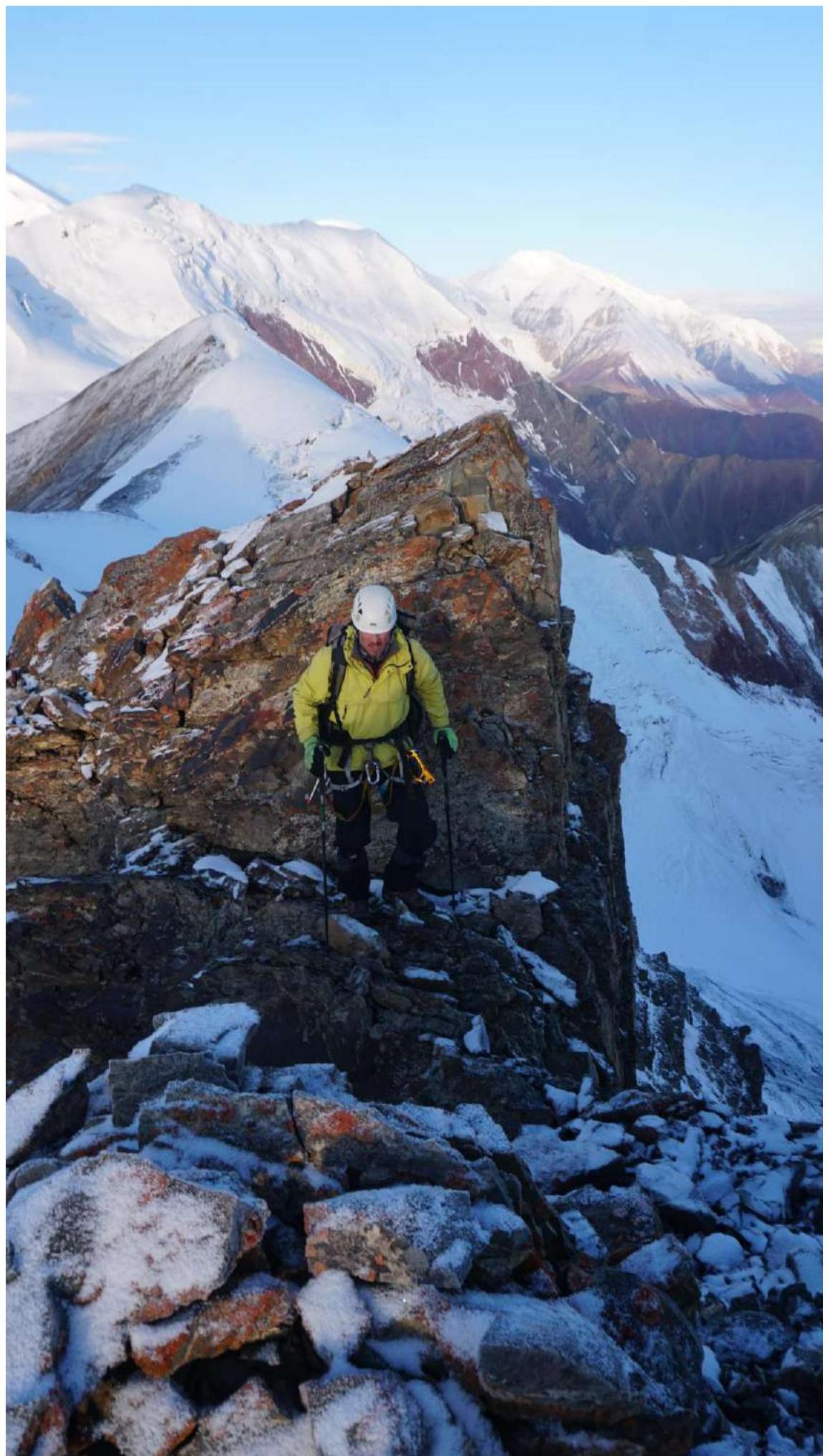 Photo 12. R7.
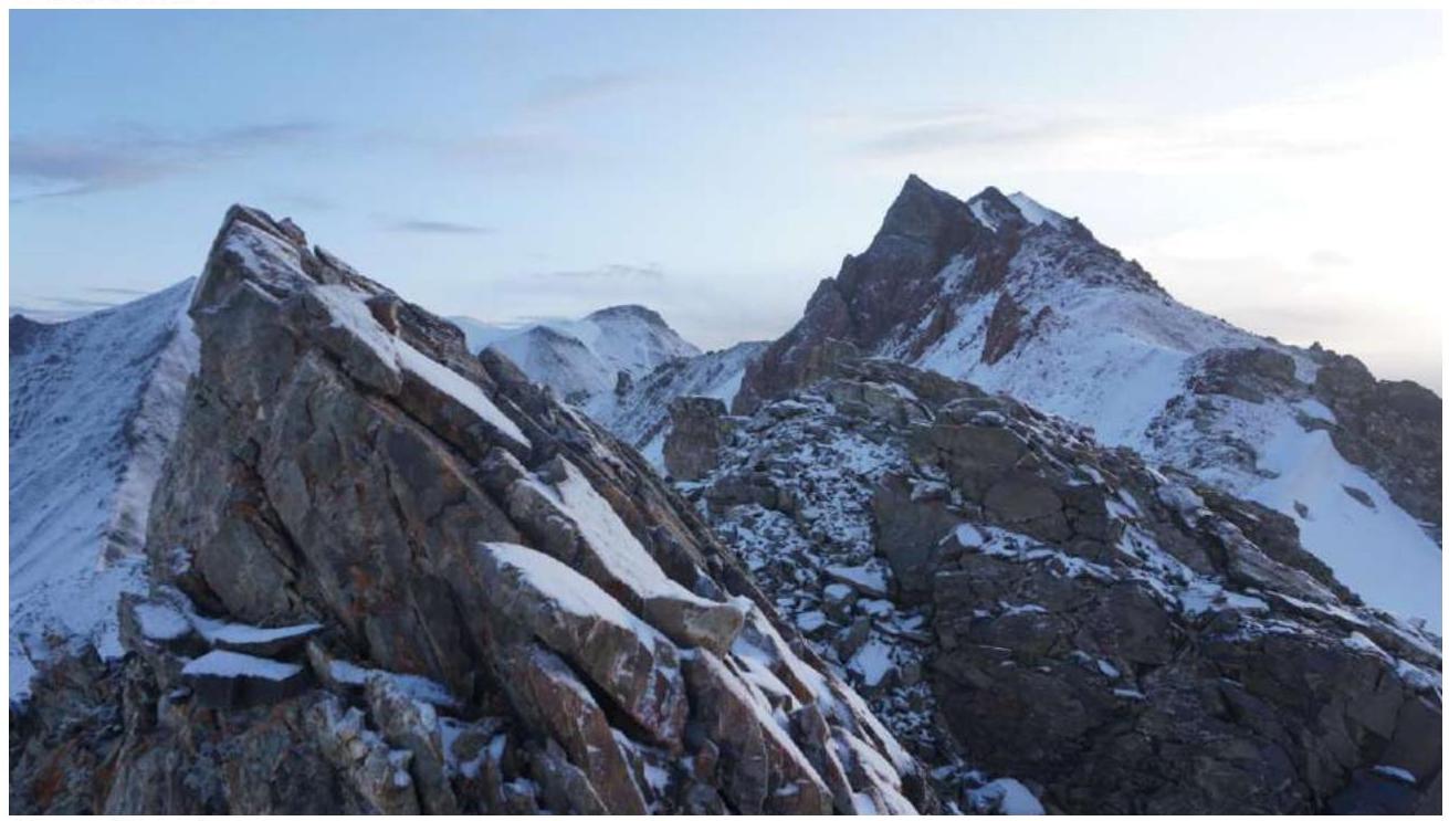 Photo 13. R7.
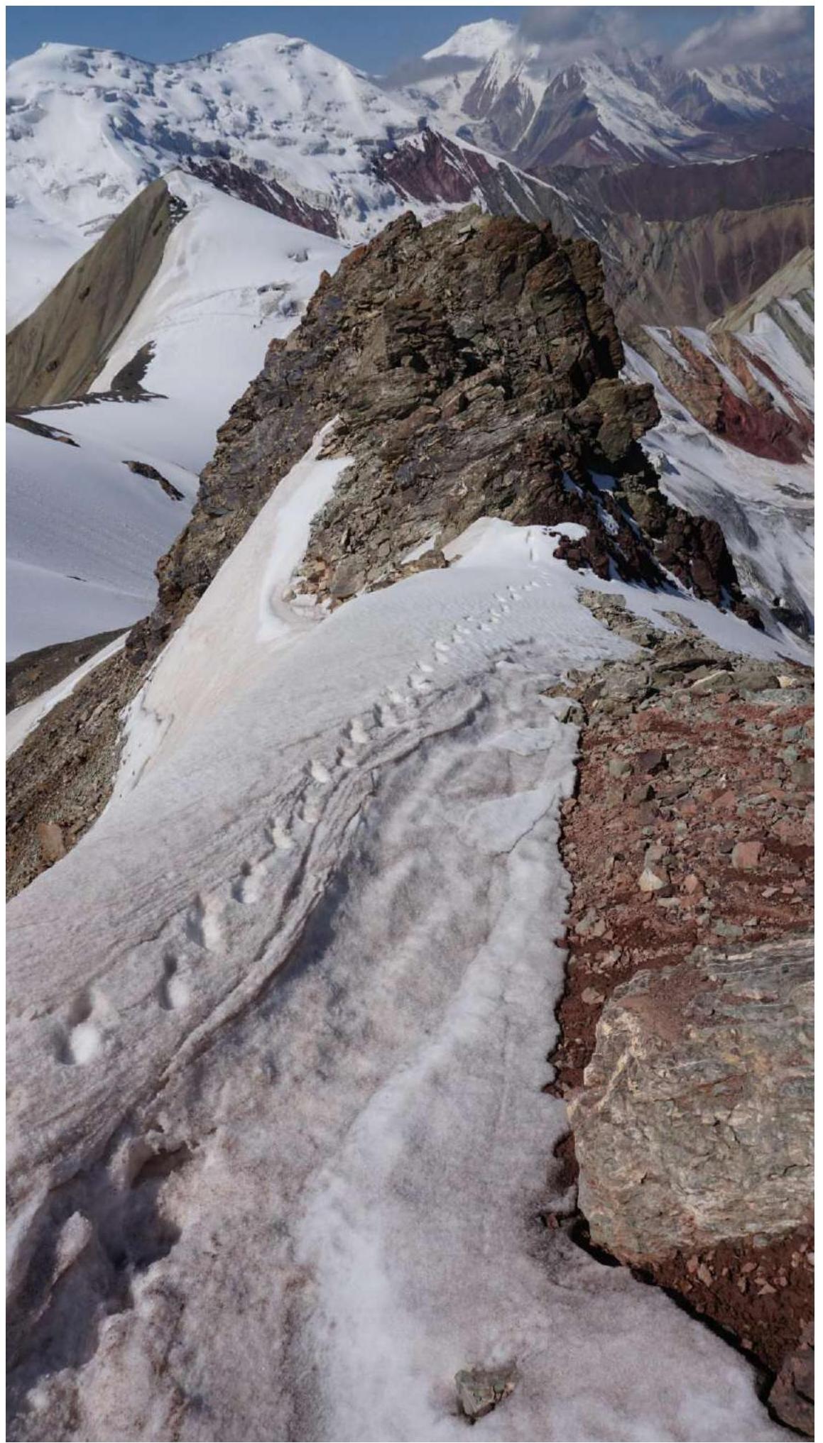 Photo 14. R7, view down.
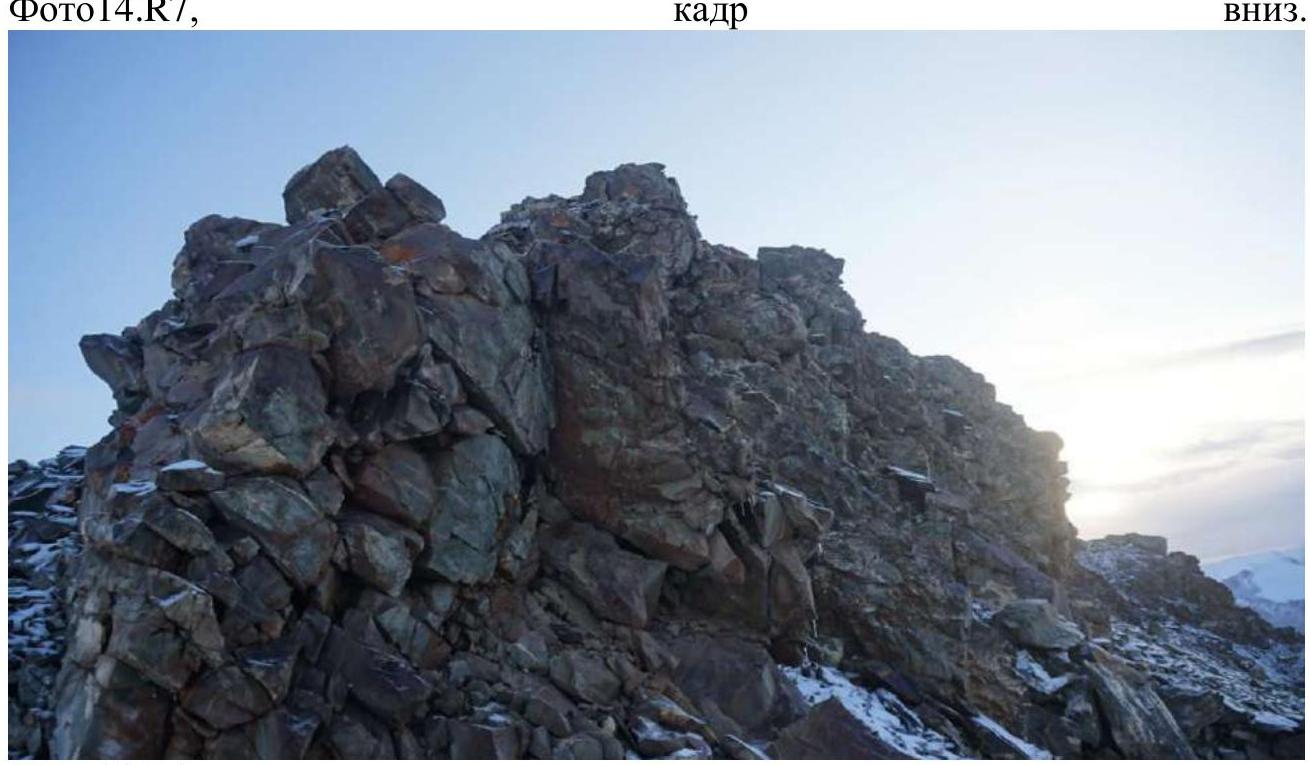 Photo 15. R7, 2nd tower.
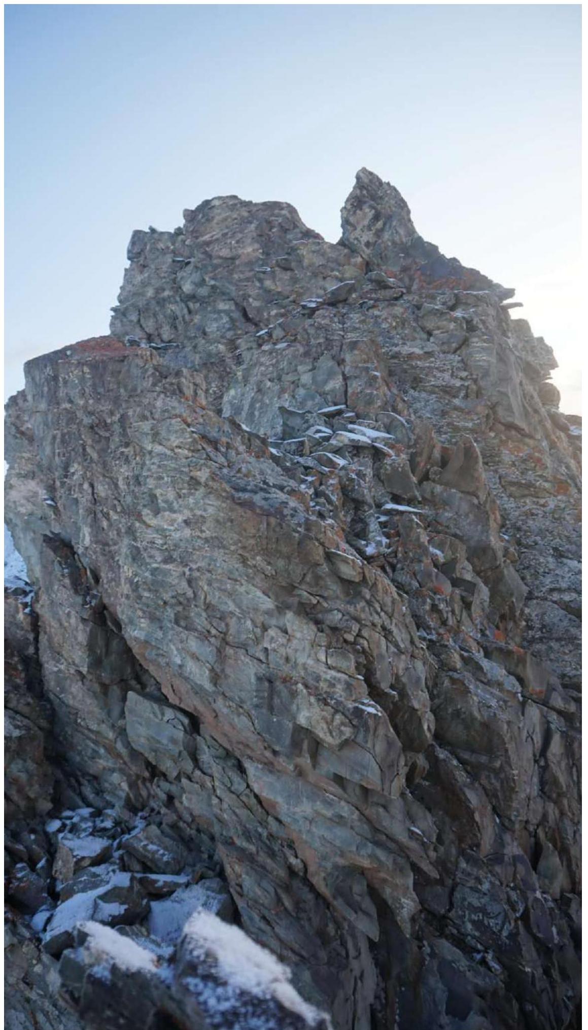 Photo 16. R7, 2nd tower.
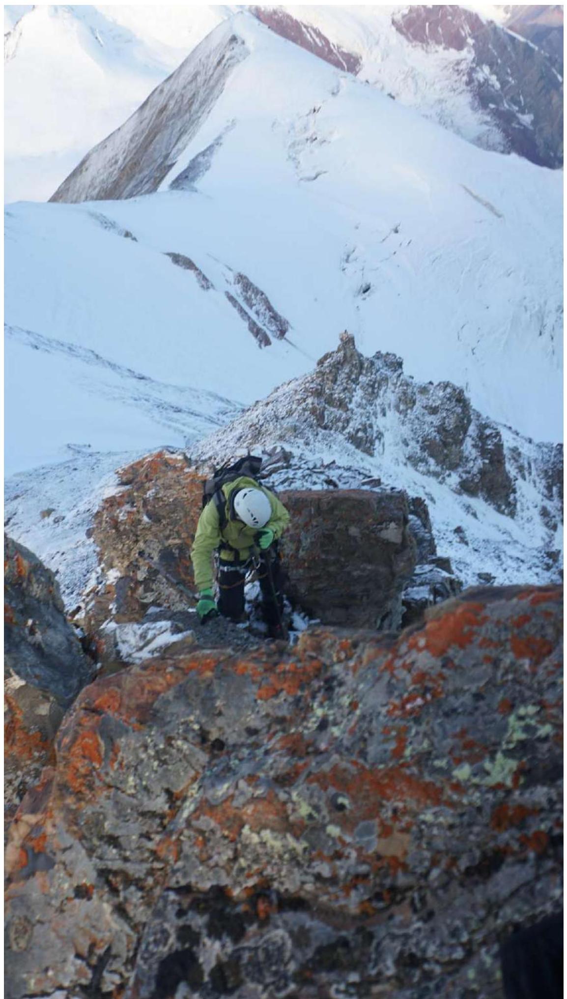 Photo 17. R7, 2nd tower.
 Photo 18. View down from the 3rd tower.
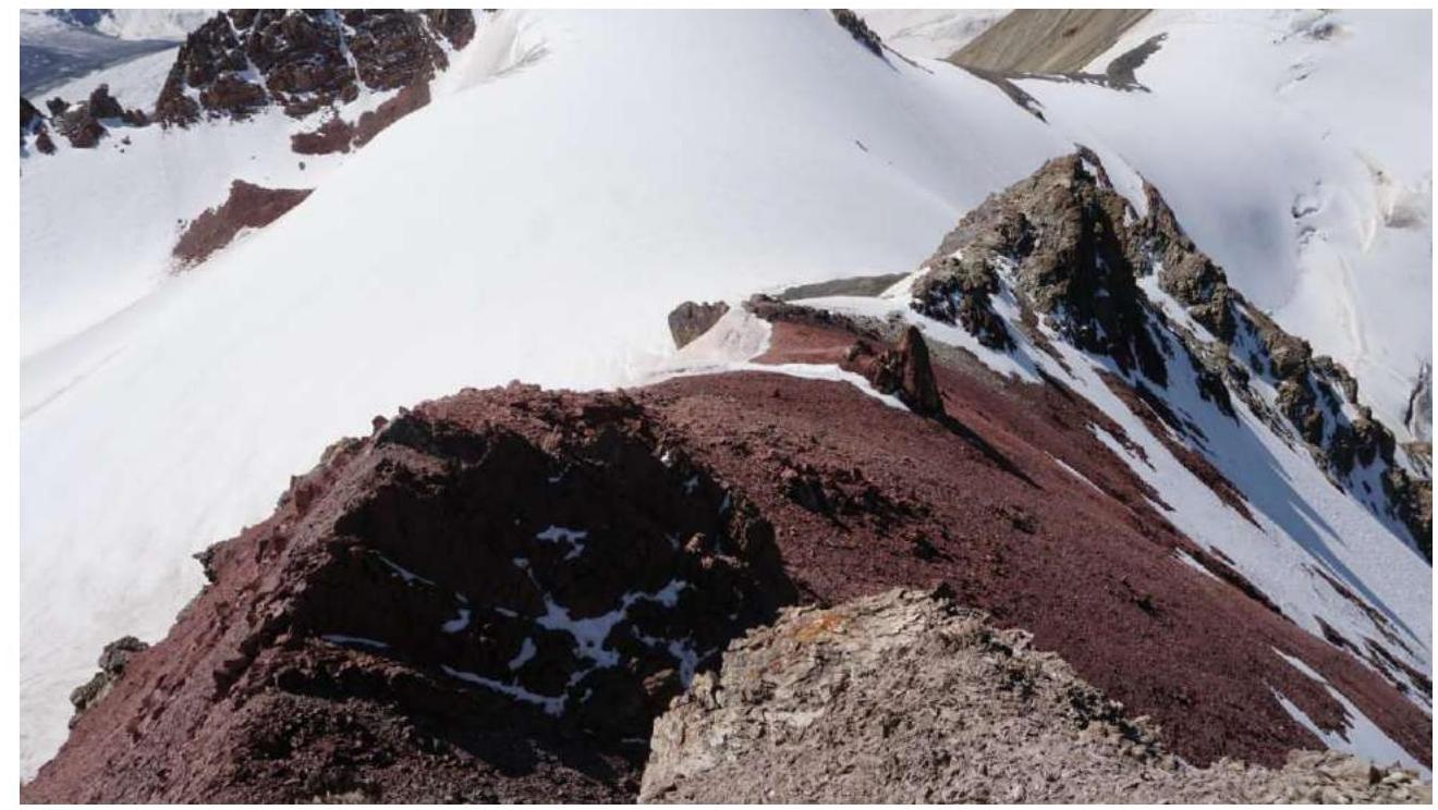 Photo 20. R7–R8, view from the 3rd tower down. Red scree.
 Photo 21. R8–R9, view from the 4th tower down.
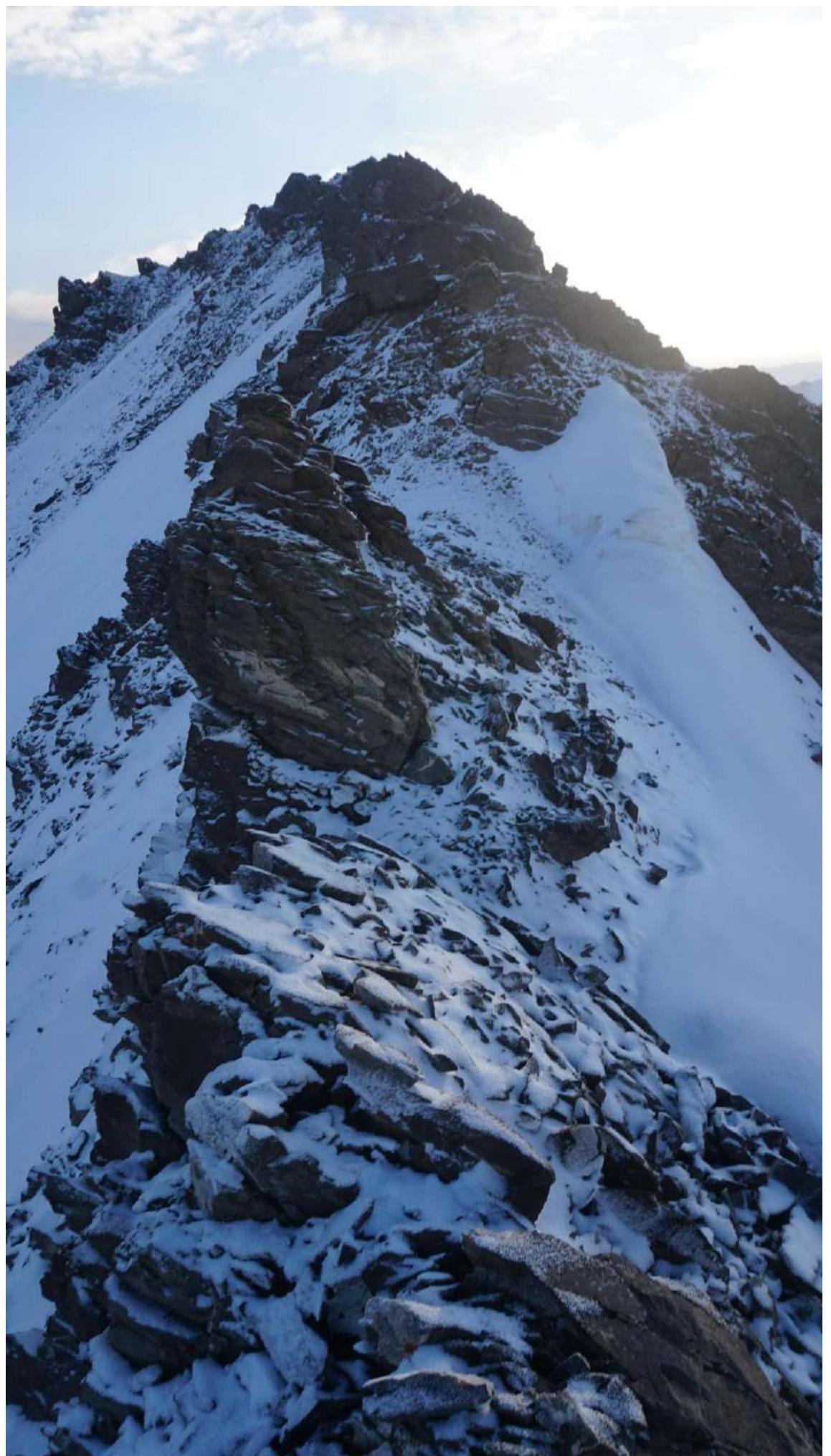 Photo 22. R10–R11, view towards the 5th tower.
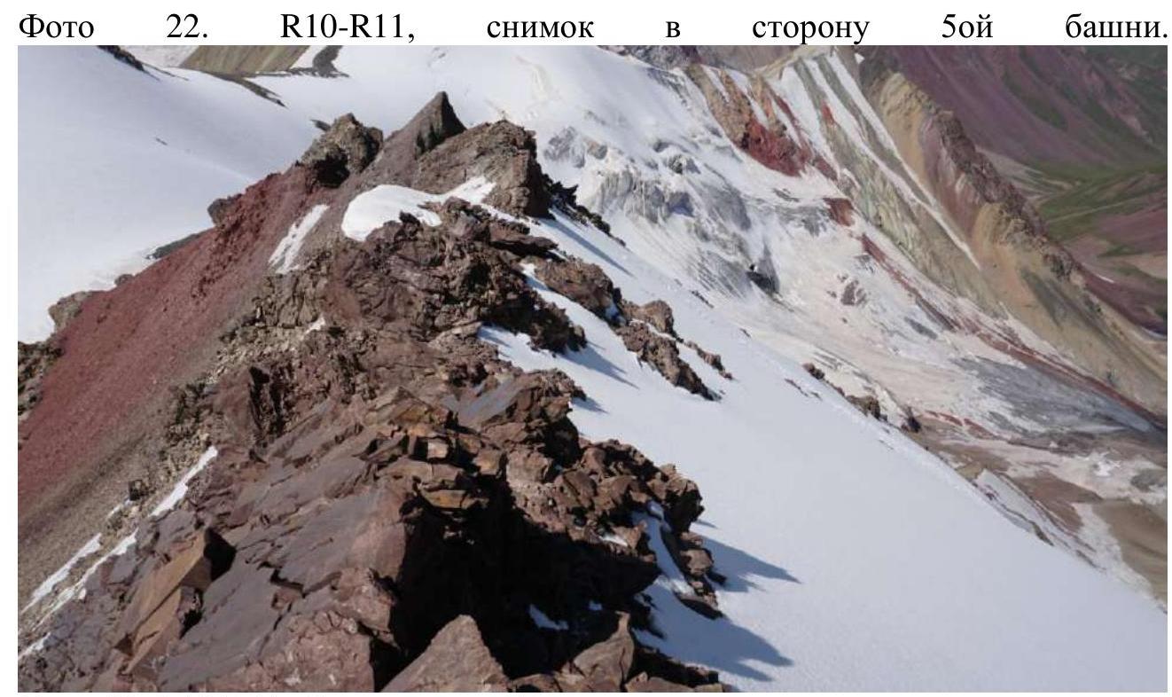 Photo 23. R10–R11. View down. Inclined rock wall.
 Photo 24. R11–R12, snow cornices on the ridge; the summit is near.
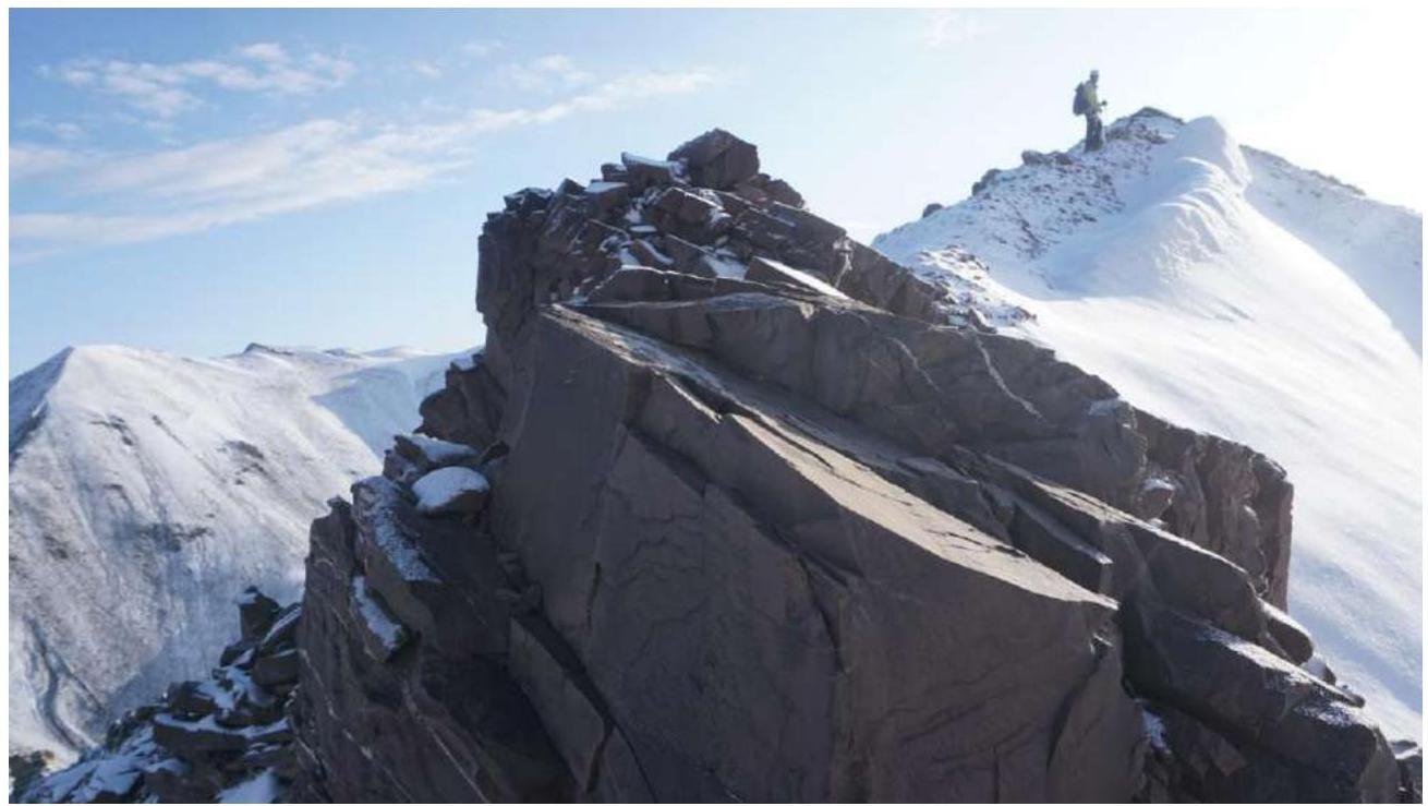 Photo 25. R11–R12, ridge towards the summit; Vadim is practically on it.
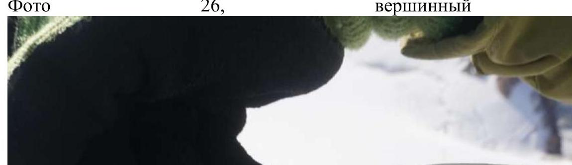
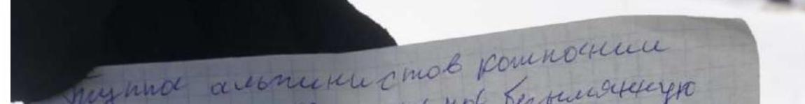
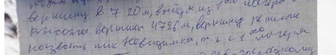
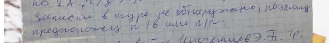
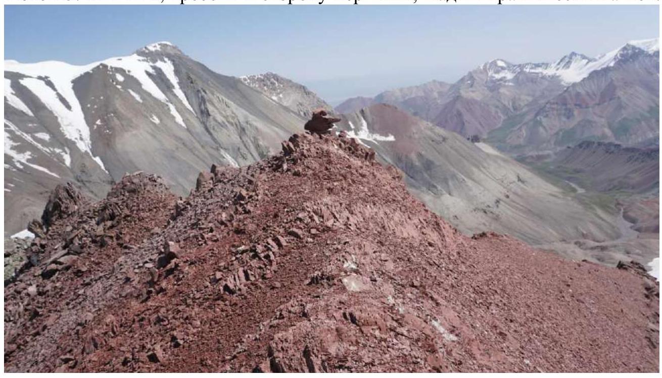 Photo 26. Summit cairn.
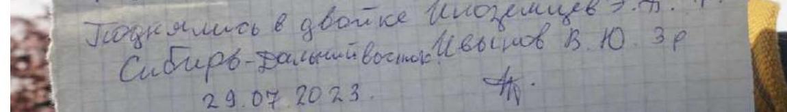
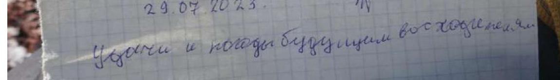
The Group of climbers from the company "Asia Out" ascended an unnamed peak at 7:20, having left the 1st camp at 4:00. The height of the peak is 4726 m. The peak was named "Nevidimka" because it's not visible from the camp. They ascended via the NW-W ridge, presumably category 1B, through a pass. The weather was excellent. No note was found in the cairn, so the assumption is category 1B or 1A. Climbed in a team of two: Eduard B. Inozemtsev (1st sports rank) Siberia–Far East; Vadim Yu. Ivanov (3rd sports rank) on July 29, 2023. Good luck and good weather to future climbers!
Photo 26. Summit cairn.
The Group of climbers from the company "Asia Out" ascended an unnamed peak at 7:20, having left the 1st camp at 4:00. The height of the peak is 4726 m. The peak was named "Nevidimka" because it's not visible from the camp. They ascended via the NW-W ridge, presumably category 1B, through a pass. The weather was excellent. No note was found in the cairn, so the assumption is category 1B or 1A. Climbed in a team of two: Eduard B. Inozemtsev (1st sports rank) Siberia–Far East; Vadim Yu. Ivanov (3rd sports rank) on July 29, 2023. Good luck and good weather to future climbers!

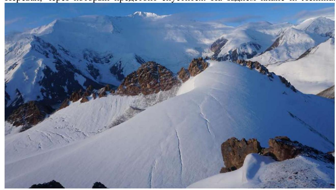
 The pass we'll need to descend from. Peak Lenin is in the background.
 Peak Vyacheslav Lvov and Peak Lenin, from Peak Nevidimka.
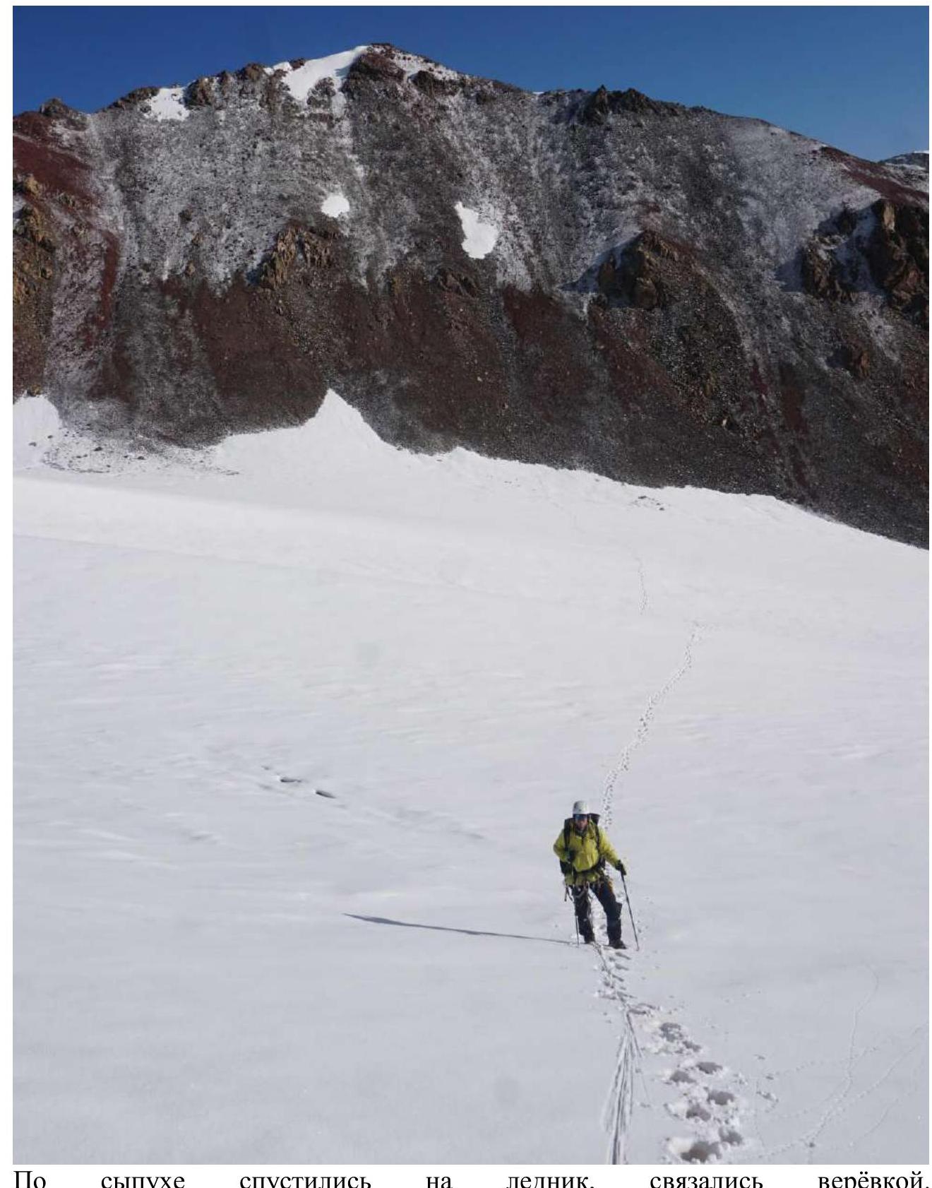 We descended on scree to the glacier and tied in with a rope.
 Start of the couloir; we put on crampons, tied in; there was ice under the snow. Snow in the couloir is only in the upper 30-50 m; below it's dry.
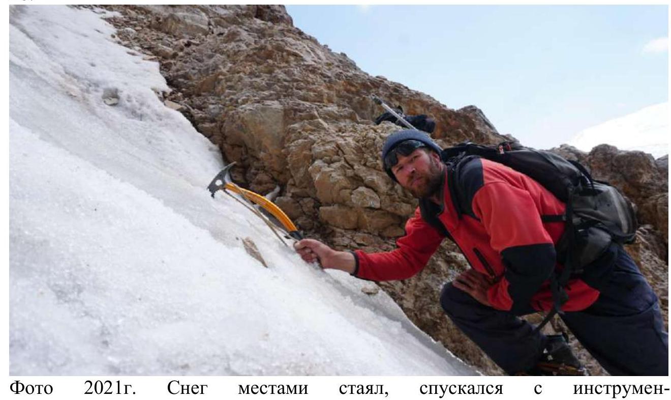 2021 photo. Snow had melted in places; I descended with an ice axe.
 Our descent couloir; snowy variant of the photo.
| Section № | Description | Photo № |
|---|---|---|
| R0–R1 | At 5:00, we approached the pass, height 4387 m, 350 m, 30°, snow is firn, ascent with trekking poles; ice axe not required. At the beginning of the season, there's more snow; at the end, it may melt entirely except for cornices. | 1 |
| R1–R2 | Snow ends; we transition to dried, somewhat steep scree, 200 m, 35°. From above, snow-ice cornices overhang, but there are no signs of avalanches or their runouts (I've been on this pass 5 times) and, probably, they don't occur. The cornices don't hang continuously; there's a bypass to the right, in the center. We exit onto scree to the 4607 m pass. | 2 |
| R2–R3 | At 5:40, we're on the pass. We put on crampons, take out ice axes, and tie in with a rope. The incline is 20°, 150 m, on scree, then we transition to snow. Although the ascent is small, you can fly down to the left for 500 m, with an incline of 40-45°. | 3, 4, 5 |
| R3–R4 | A small gain in height, carefully, the same steep incline to the left. 250 m, 20°. 6:05. | 6, 7 |
| R4–R5 | 100 m on a practically horizontal section, at the end, the gradient reaches 20°. We stop on scree, remove the rope, ice axes, and take off crampons. | |
| R5–R6 | 70 m, 30°. 6:23. From here on, we move simultaneously without a rope. We climb on scree and large stones to the 1st tower, descend to snow, a cornice to the right, up on scree to the rocky section of the 2nd tower. | 8 |
| R6–R7 | 100 m, 35°. We climb the 2nd tower; the climbing is simple; we go on foot, holding onto the rock. After the tower, we descend and climb over a small rocky barrier. | 9–17 |
| R7–R8 | 50 m, 20°. We pass along the edge of snow and scree on the ridge; a snow-ice cornice is on the right slope. Large stones, red scree; a small red "gendarme" is on the left; we don't climb it. The 3rd tower; you can climb over the top or traverse in the middle part. We descend to a snow patch. 6:54. | 18, 19, 20 |
| R8–R9 | 25 m, 55-60°. We ascend the 4th tower; this is the steepest section on the route but short. The rocks are stepped; we pass a |