Ascent Passport
- Region: Trans-Alay Range. Valley of the Kichkesu River (Left Kichkesu Glacier). Section number according to the classification table — 4.4
- Name of the summit: 5395.5 m. Proposed — Peak Semen Dvornichenko. Route: Via the SE ridge from the Left Kichkesu Glacier.
- Proposed 3B category of difficulty, first ascent.
- Character of the route: ice and snow.
- Elevation gain of the route: 880 m (according to GPS readings).
Route length: 4200 m. Length of sections with III category of difficulty — 850 m. Steepness: main part of the route up to 40°.
- Pitons used on the route: rock — 0, ice — 57, including ATO — 0.
- Team's moving hours: 20 hours.
- Descent from the summit via the ascent route.
- Leader: Nikolay Anatolyevich Totmyanin.
Participants:
- Pavel Mikhailovich Bozhko
- Maria Mikhailovna Bozhko
- Anna Viktorovna Kirillova
- Natalya Dmitrievna Palarush
- Alexander Mikhailovich Portnoy
- Ekaterina Nikolaevna Semenova
- Vadim Nikolaevich Solomin
- Coach: Nikolay Anatolyevich Totmyanin, Honored Master of Sports in alpinism.
- Departure from base camp: 8:00, August 19, 2018.
Summit arrival: 15:15, August 21, 2018. Return to base camp: 19:00, August 22, 2018.
- Team of climbers from St. Petersburg.
- Responsible for the report — N.A. Totmyanin, e-mail: tot-alp@mail.ru
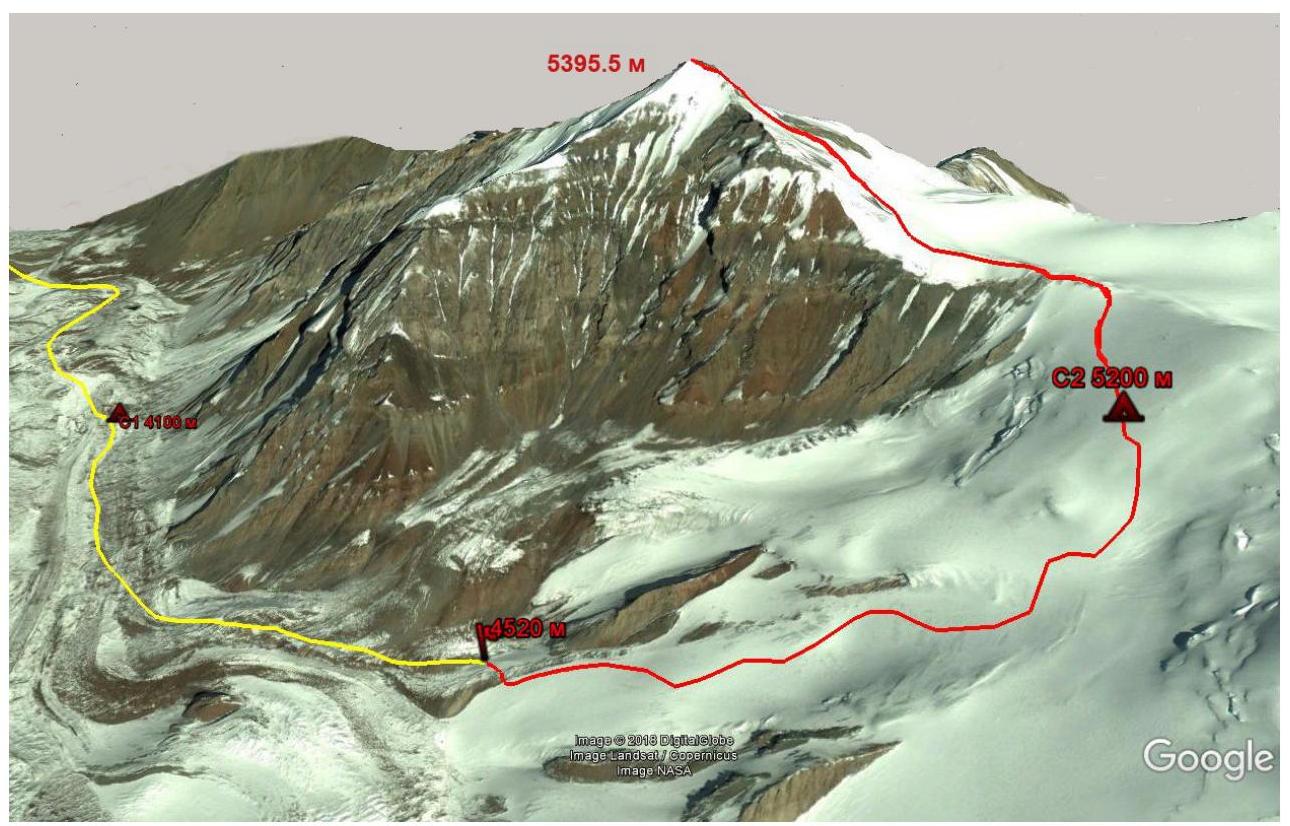
Photo 1. General photo of the summit. Approach to the route — yellow line. Route — red line. 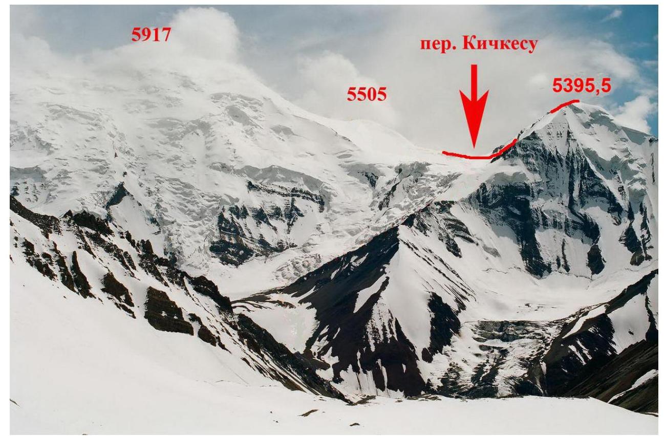
Photo 2. Photo of the summit from the east, from the Pravyy Kichkesu Glacier. 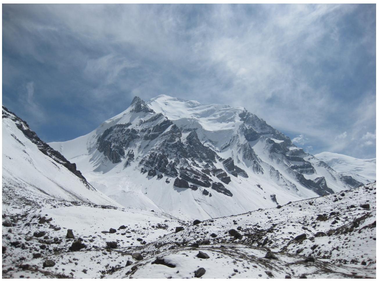
Photo 3. Photo of the summit from the northwest, from the terminal moraine of the Levyy Kichkesu Glacier. 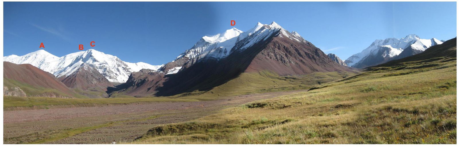
Photo 4. Panorama of the area. A — Peak TurkVO (6243.5 m); B — Peak 5917.5 m; C — Peak 5395.5 m; D — Peak Pogranichnikov (5437.9 m). View from the base camp at an altitude of 3550 m.
Brief description of the ascent area. The summit 5395.5 m is located in the eastern part of the Trans-Alay Range (area of Peaks TurkVO and Pogranichnikov) in a spur of the Trans-Alay Range, branching off from the summit 5505 m to the north. The ridge between the summits has a col with an elevation of 5186 m, known as the Kichkesu Pass, which connects the Pravyy and Levyy Kichkesu Glaciers.
History of visits:
- In 2001, a group from a German expedition ascended to the Kichkesu Pass from the Levyy Kichkesu Glacier while making an ascent of Peak 5917.5 m.
- In 2014, two climbers, Russian Nikolay Totmyanin and Frenchman Henri Bizot, attempted a one-day ascent of Peak 5395.5 m via the NW ridge and reached the rock buttresses at an altitude of about 5000 m, but did not have enough time to overcome them.
The climate of the area is dry and stable, typical for the Pamir region. At an altitude of around 3000 m, the average July temperature is 14–15 degrees. At altitudes above 5000 m, frosts can reach up to 20 degrees. In mid-August, a short period of bad weather usually occurs.
The valleys of the Eastern Trans-Alay are easily passable, except for certain sections where difficulties may arise due to:
- constrictions,
- canyons,
- steep conglomerate slopes,
- river flooding in the second half of the day.
First ascents of the past:
- Peak Markansu via the S ridge (V. Zemerov, year unknown),
- Peak TurkVO via the SW ridge (4B, Nagel E.I., 1956),
- Peak Pogranichnikov via the N ridge (5A, Nikonov E., 1957),
- Peak Arkhar via the S slope (3B, Nagel E., 1956).
The main reason for the rare visits in the past was that the area was closed. More or less active visits to the area began around the year 2000. To date, about a dozen new ascents (first ascents) have been made to several summits in the area.
Access to the base camp on the bank of the river flowing from the Pogranichnikov Glacier, via the route Osh — Sary-Tash — Pamir Highway, dirt road along the Trans-Alay Range, is possible with a 4WD vehicle and takes 7–8 hours.
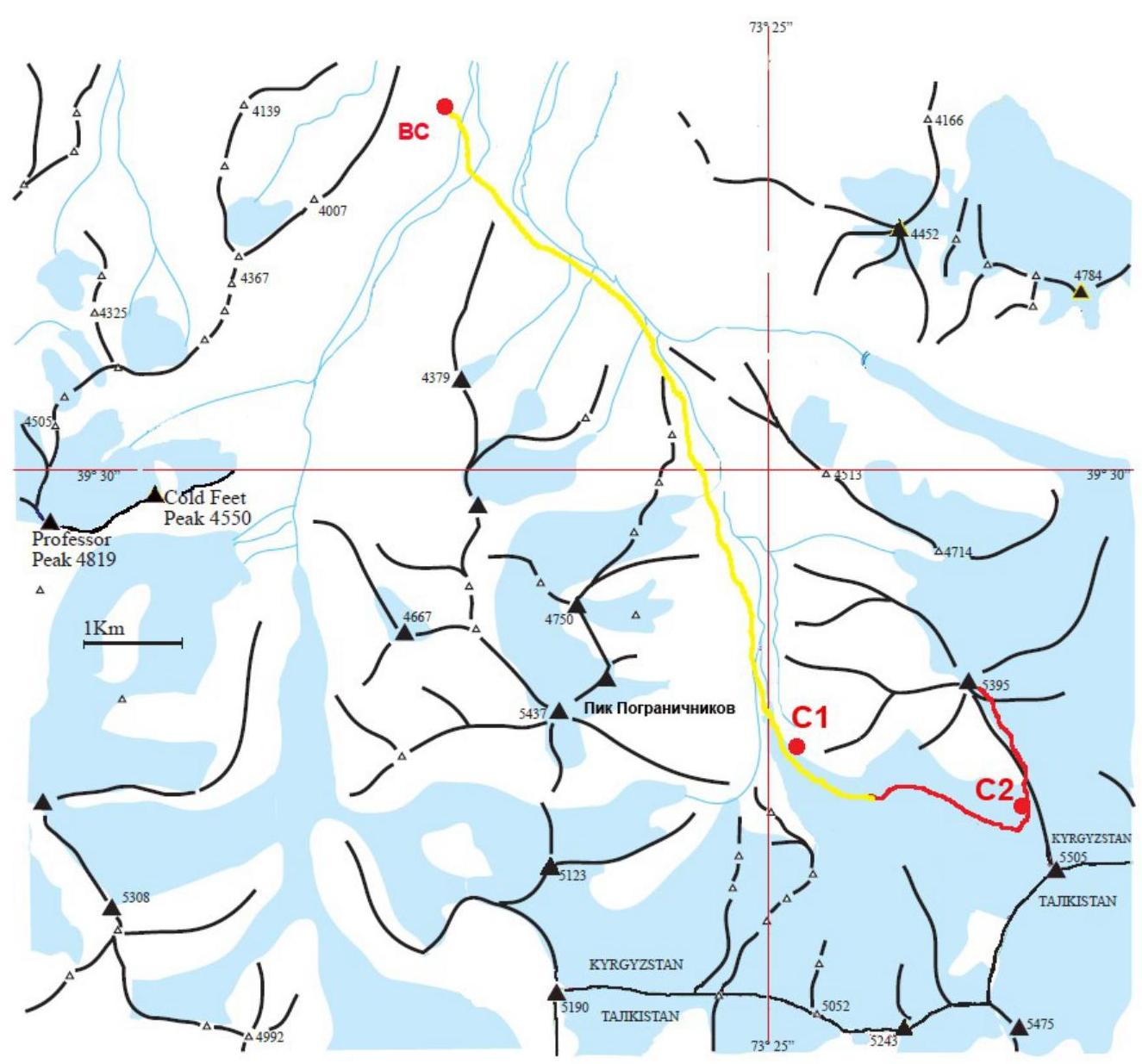
Photo 5. Scheme of the ascent area. Approach to the route — yellow line. Route — red line.
Brief description of the route passage.
**19.08.**From the base camp, located at an altitude of 3550 m, approach to the cirque of the Levyy Kichkesu Glacier along the riverbed or the left bank of the Kichkesu River, then via moraines with medium and large scree. Establishment of the advance camp C1 (4100 m) at the foot of the western slope of Peak 5395.5 m. Travel time — 9:00.
**20.08.**Ascent initially via moraines and an open, gently sloping glacier, then via snow and ice slopes of the SE ridge with a steepness of up to 40° with closed crevasses in the direction of the Kichkesu Pass. Establishment of the assault camp C2 (5244 m) on a subtle shelf on the slope. Travel time — 12 hours.
**21.08.**The team departed from the assault camp C2 at 8:00 and:
- traversed a steep ice slope with alternating belays on ice screws,
- approached the rock buttresses on the ridge at 13:30.
From here, the duo Totmyanin N. — Bozhko P. went up, who:
- bypassed the rock buttresses on the right,
- descended to the pass,
- traversed the scree part of the eastern side of the ridge,
- ascended simultaneously and alternately with belays via ice screws on the snow and ice slope straight up,
- reached the summit at 15:15,
- descended to the waiting group by 17:00.
No signs of previous human presence were found on the summit. On the western, non-snow-covered part of the summit, a control cairn with a note about the first ascent was left.
Descent to the assault camp was made via the ascent route and took 3 hours.
**22.08.**By 19:00, the team descended to the base camp.
Photo illustrations of the ascent. 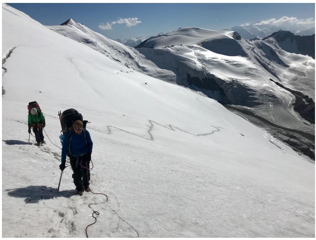
Photo 6. On the lower part of the SE ridge slope. 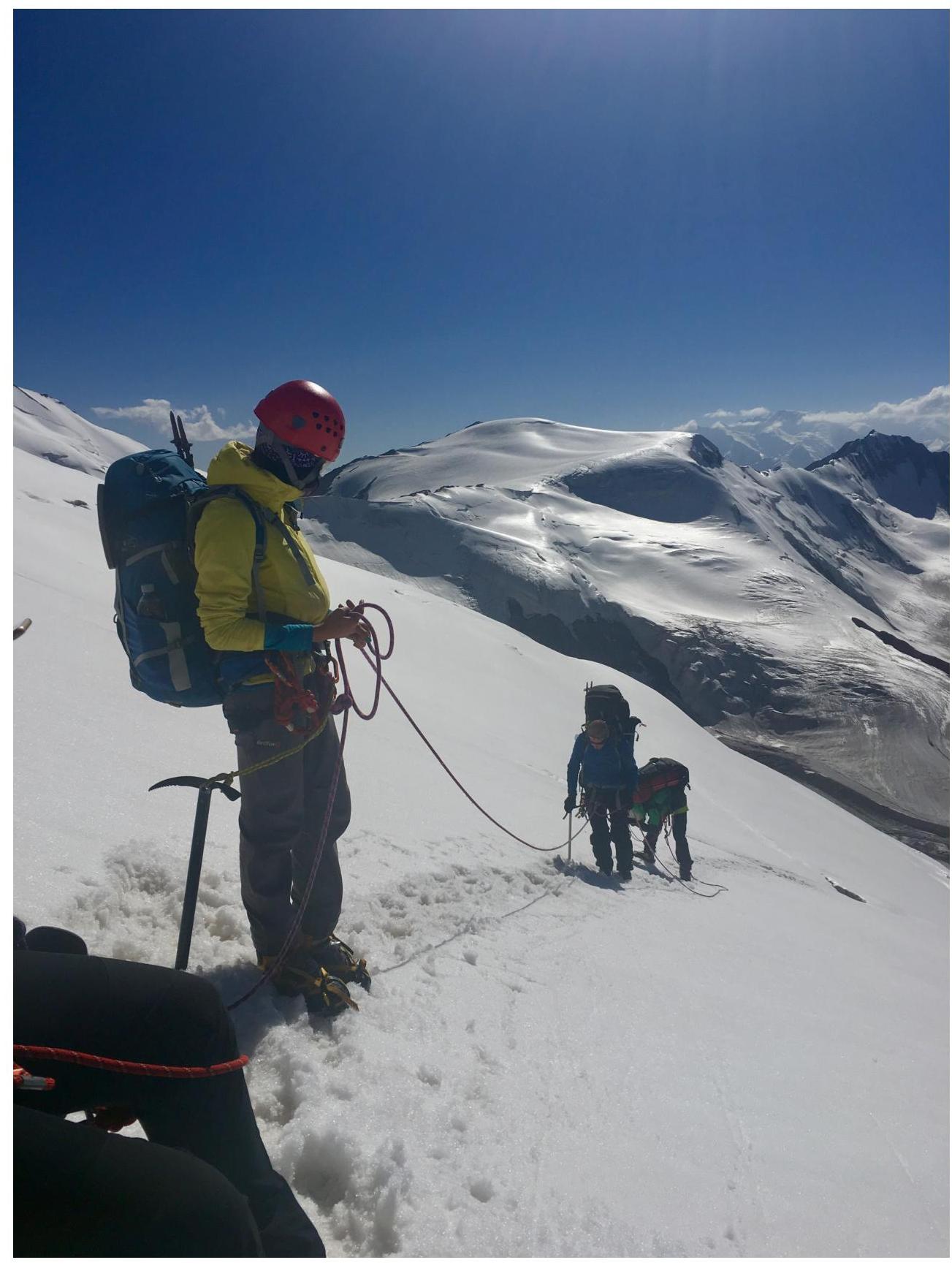
Photo 7. On the middle part of the SE ridge slope. 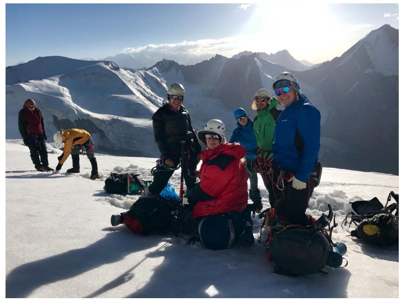
Photo 8. Group at the location of camp C2 (5244 m). 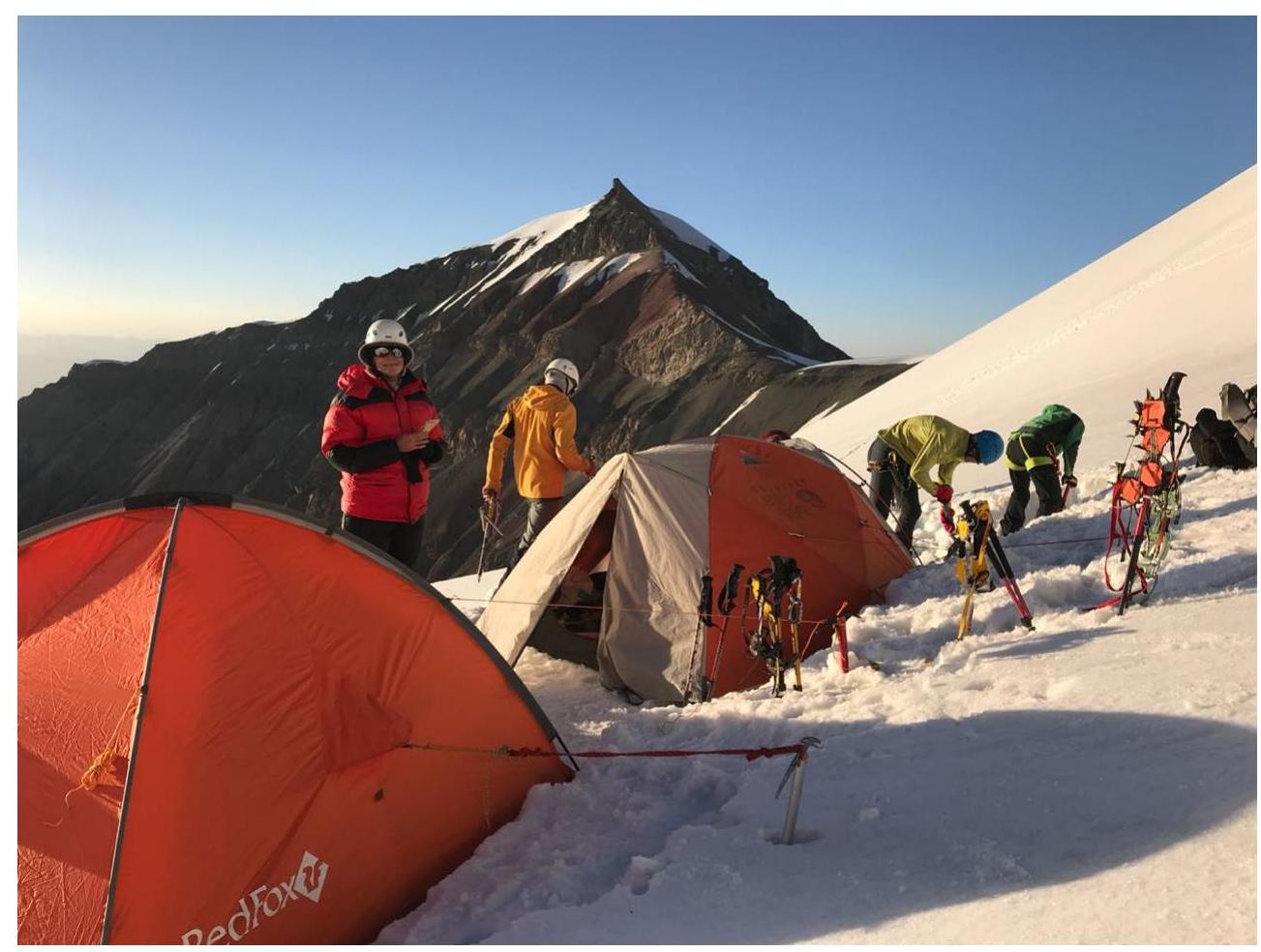
Photo 9. Camp C2 against the backdrop of the summit. 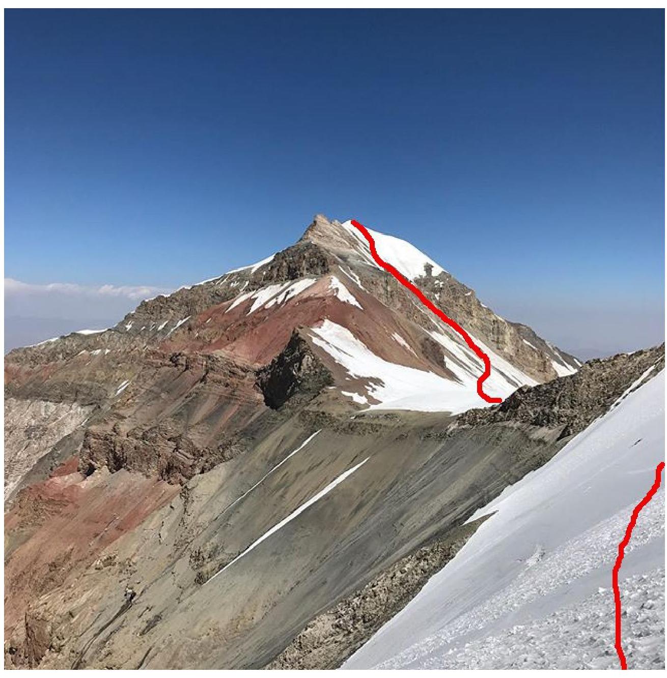
Photo 10. Kichkesu Pass and Peak 5395.5 m from the western slope of the SE ridge. 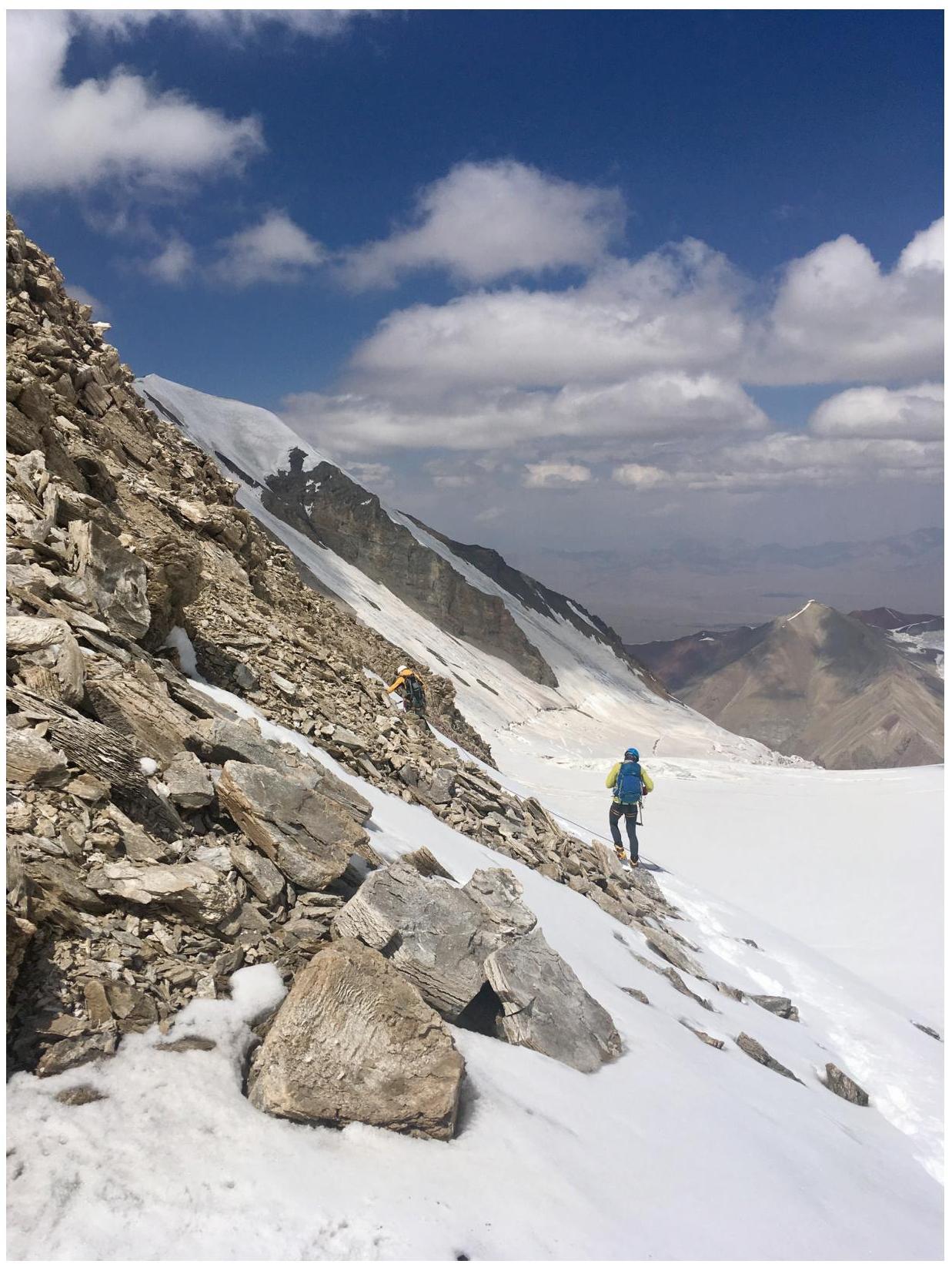
Photo 11. Bypassing the buttress on the ridge. 
Photo 12. Duo Totmyanin N. — Bozhko P. ascending to the summit. 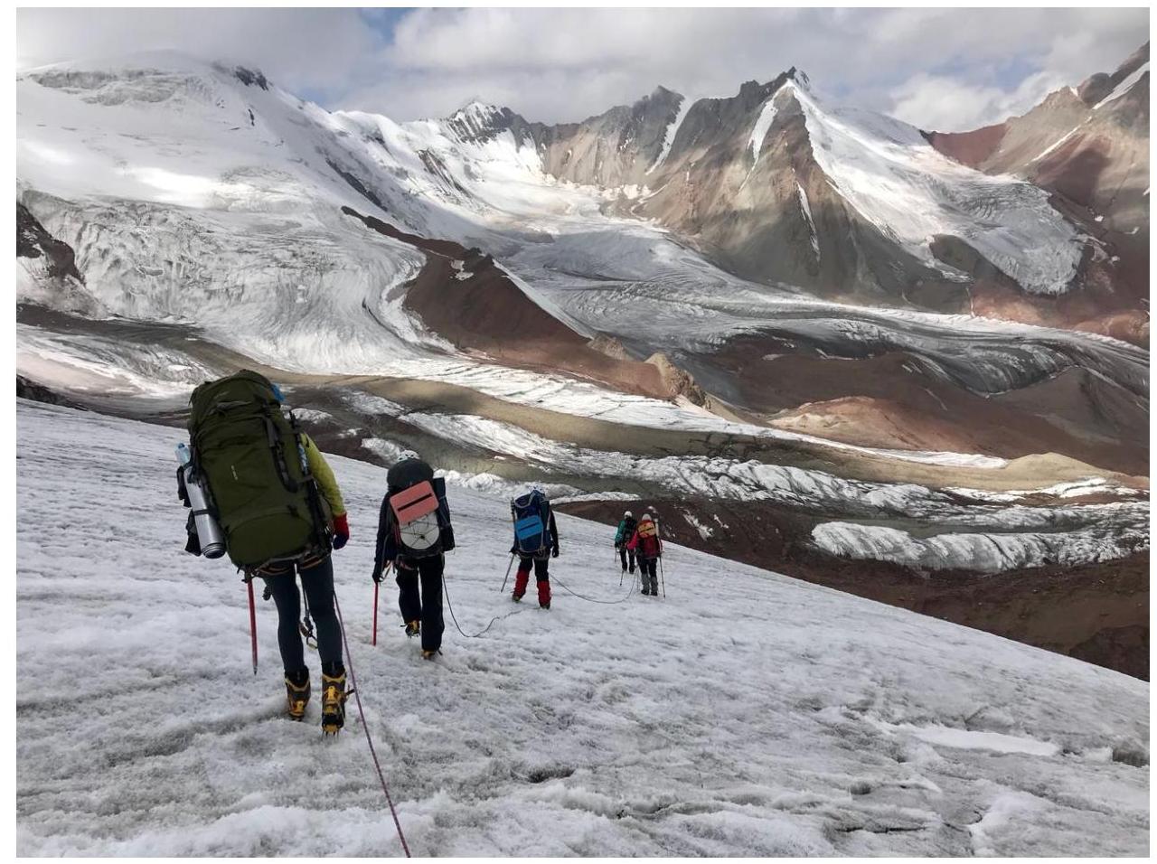
Photo 13. Descent via the ascent route on the lower part of the SE ridge slope. 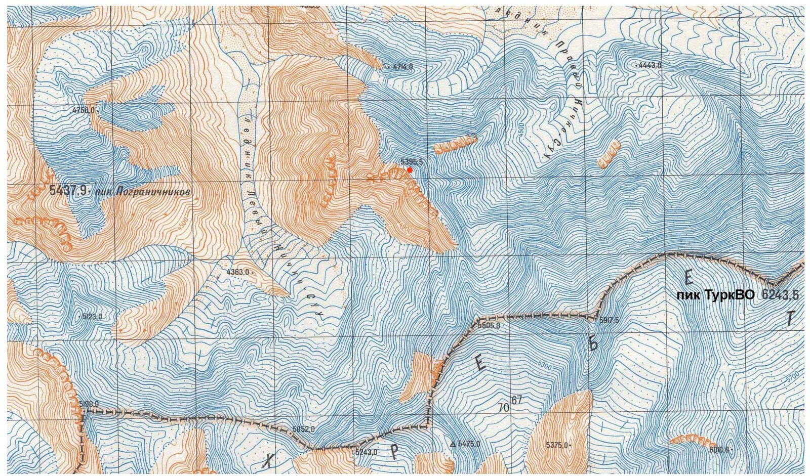
Photo 14. Ascent area. Fragment of a map at a scale of 1:50,000.