
Ascent Log
- Zaalai Ridge, Kichkesu gorge, Pograniqnikov settlement area, 4.4 (2008)
- Peak 4800 m (proposed name: Mereckii Peak), via "Srednii Galstuk" (Middle Tie) on the NE wall.
- Proposed category: 4A, first ascent.
- The route is combined.
- Height difference: 500 m.
Distance: 950 m. Average steepness: 40°.
- 2 pitons left on the descent from the summit tower.
- Climbing time: 4.5 hours.
- Team leader: Koshelenko Yu. — Honored Master of Sports.
Partner: Bukinich A. — Candidate Master of Sports.
- Coach: Koshelenko Yu.
- Approach to the route: August 18, 2010.
Route started: 8:00. Summit reached: 12:30. Return: 16:30. Descent from the summit to the north; the route is essentially a traverse.
- Combined team: Rostov-on-Don — Sochi.
- Responsible for the report: Koshelenko Yu.V., ykoshelenko@gmail.com

The team's route from the Base Camp (BC).
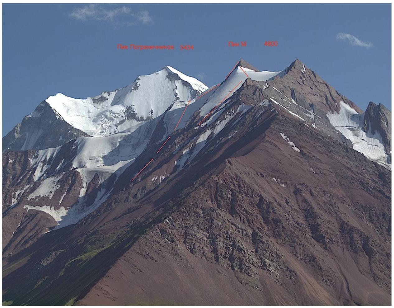
The team's route, view from the Kichkesu river valley.

Photo panorama of the area.

Map of the ascent area. BC and two ascent objects: In'Yan and Pik M are marked.
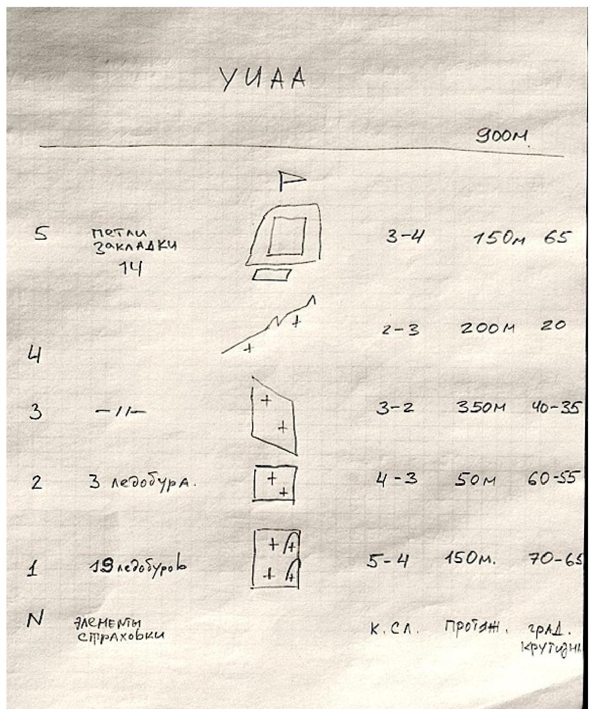
Route diagram in UIAA symbols.

Legend for the route diagram:
- R5: difficulty category 3–4, length 150 m, steepness 65°. Protection: slings, nuts (14).
- R4: difficulty category 2–3, length 200 m, steepness 20°.
- R3: difficulty category 3–2, length 350 m, steepness 40–35°.
- R2: difficulty category 4–3, length 50 m, steepness 60–55°. Protection: 3 ice screws.
- R1: difficulty category 5–4, length 150 m, steepness 70–65°. Protection: 19 ice screws.
- Total route length: 900 m.
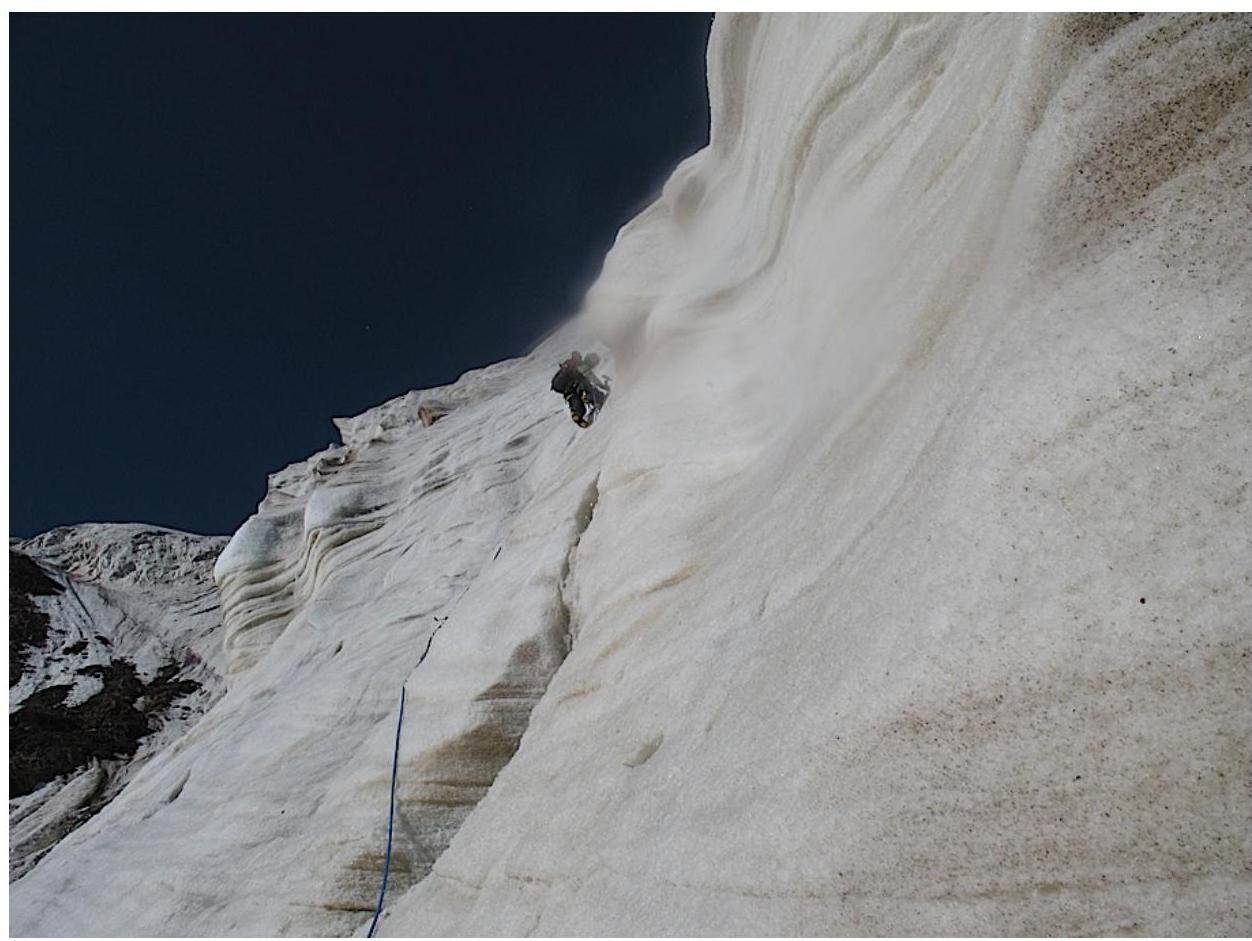
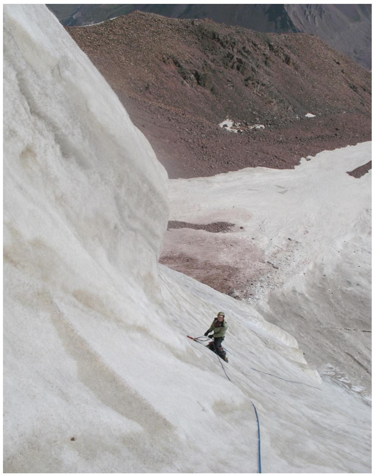
Technical photo of the route.
The route is combined.
- Lower part: 200 m of the icefall wall — climbed with two tools on front points.
- Then the steepness decreases, and the slope becomes a firn slope — "Srednii Galstuk" (Middle Tie).
- After 350 m — exit via a bergschrund to the ridge, along the ridge to the summit tower.
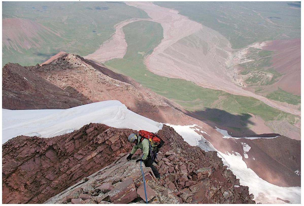
- Via the tower's rock face — to the pointed summit.
- Descent towards the col to the north: 1 rappel down a mixed couloir.
- Then to the sub-summit and from it down the Left Slope ("Pravyi Galstuk" / Right Tie) — to the base of the route.
The difficulty is similar to the classic 4A on the NW buttress of Chegetkara in Adylsu.
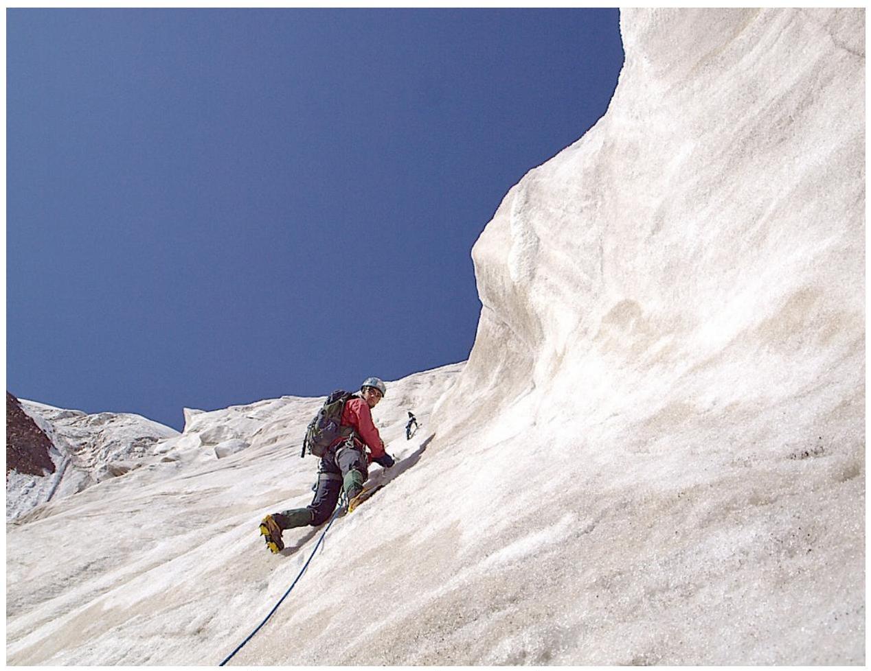
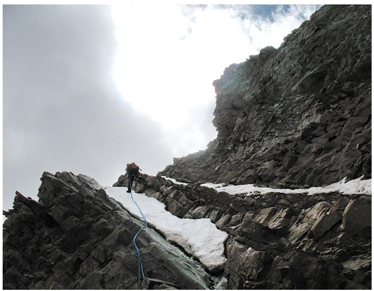
Start of the route, 70-degree ice.
3rd rope, change of leader.
4th rope, followed by the wall's inflection.
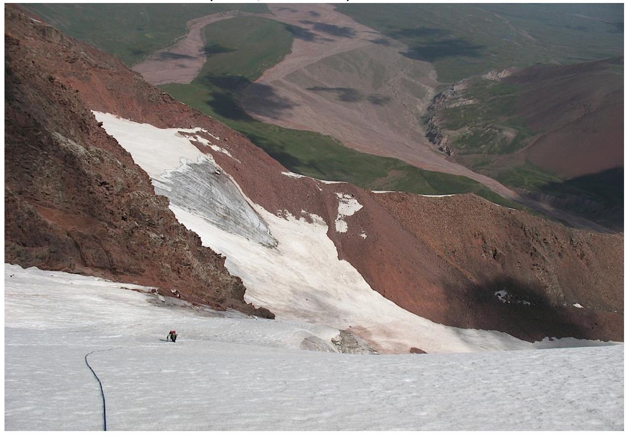
Section 3, firn slope, "Srednii Galstuk".
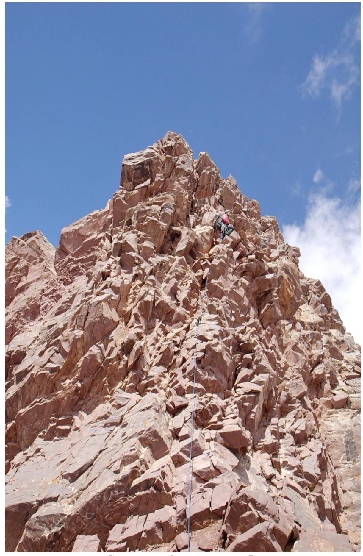
Summit tower, section 5.
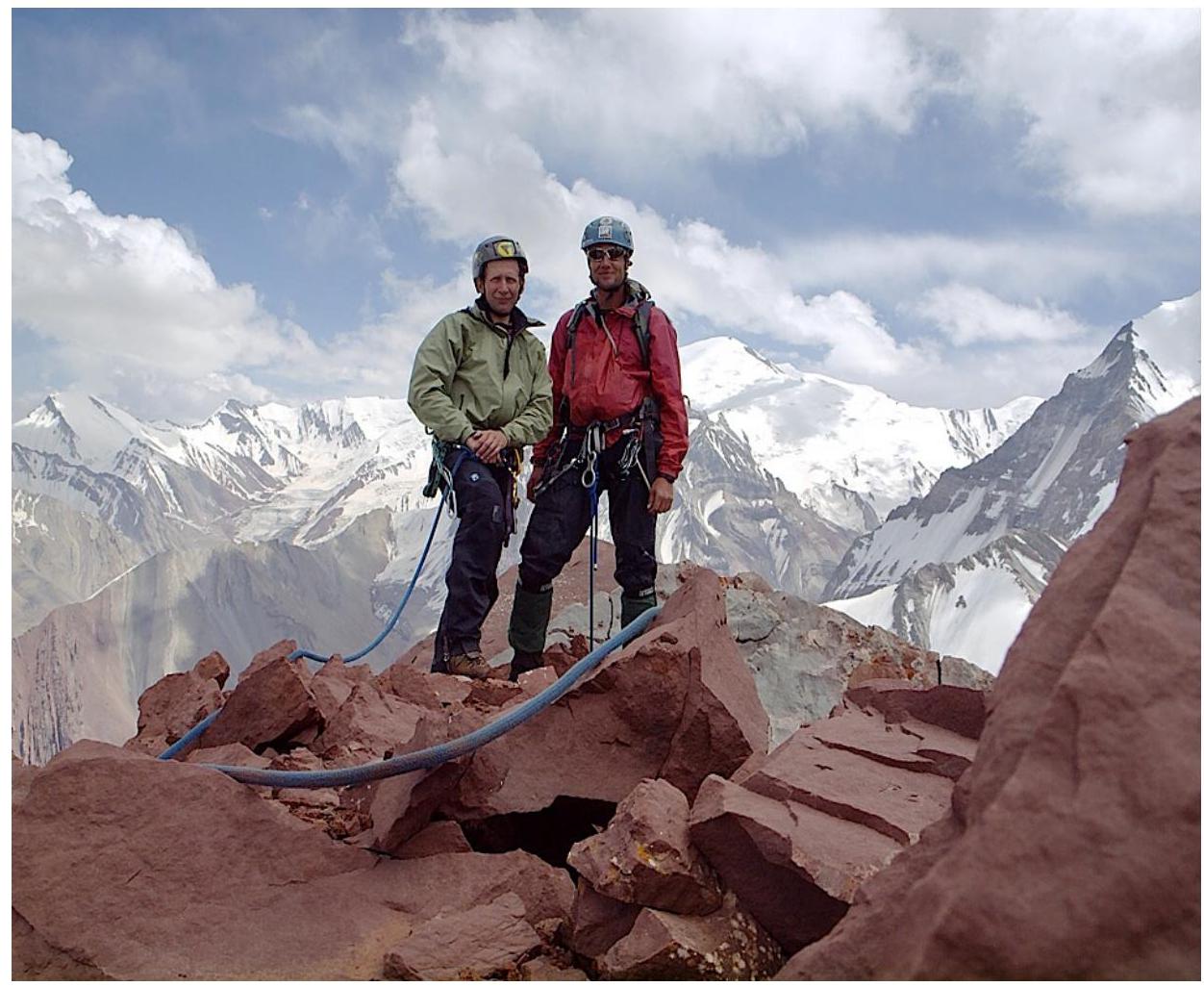
Summit, 4800 m, August 18, 2010, 12:40.
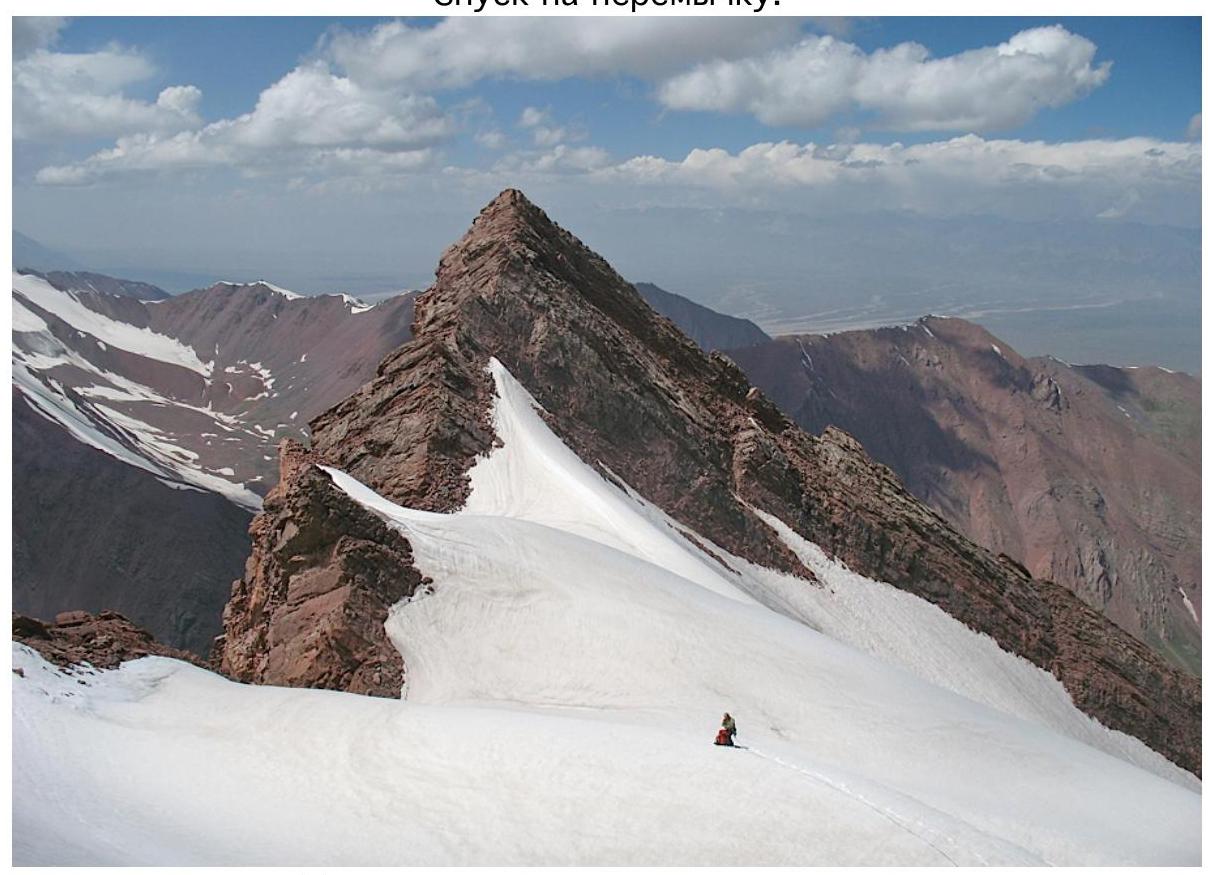
Start of descent to the N.
Descent to the col.
Start of descent via the Right Tie.