Report on the First Ascent of the Route to Peak Petrovsky (4700 m) via the North Face.
Climbing Details
- Pamir. Trans-Alay Range.
Peak Petrovsky 4700 m. Presumed 5A category, first ascent.
Route type — ice.
Route elevation gain — 750 m.
Route length — 950 m.
- Section lengths: II — 50 m, III — 200 m, IV — 445 m, V — 245 m, V+ — 10 m.
- Average slope: main part of the route — 55°.
- Pitons left on the route: total — 0;
- Total ice screws used on the route: 70
- Total artificial protection points (APs) used — 0 pcs.
- Team's total climbing hours: 10 hours, 1 day (without overnight stays)
- Team:
Sergey Seliverstov (leader), Viktor Filinov.
- Senior coach: Fedor Popov
- Departure to the route: 5:00, August 14, 2015
Reached the summit: 13:00, August 14, 2015
Returned to Base Camp: 15:00, August 14, 2015
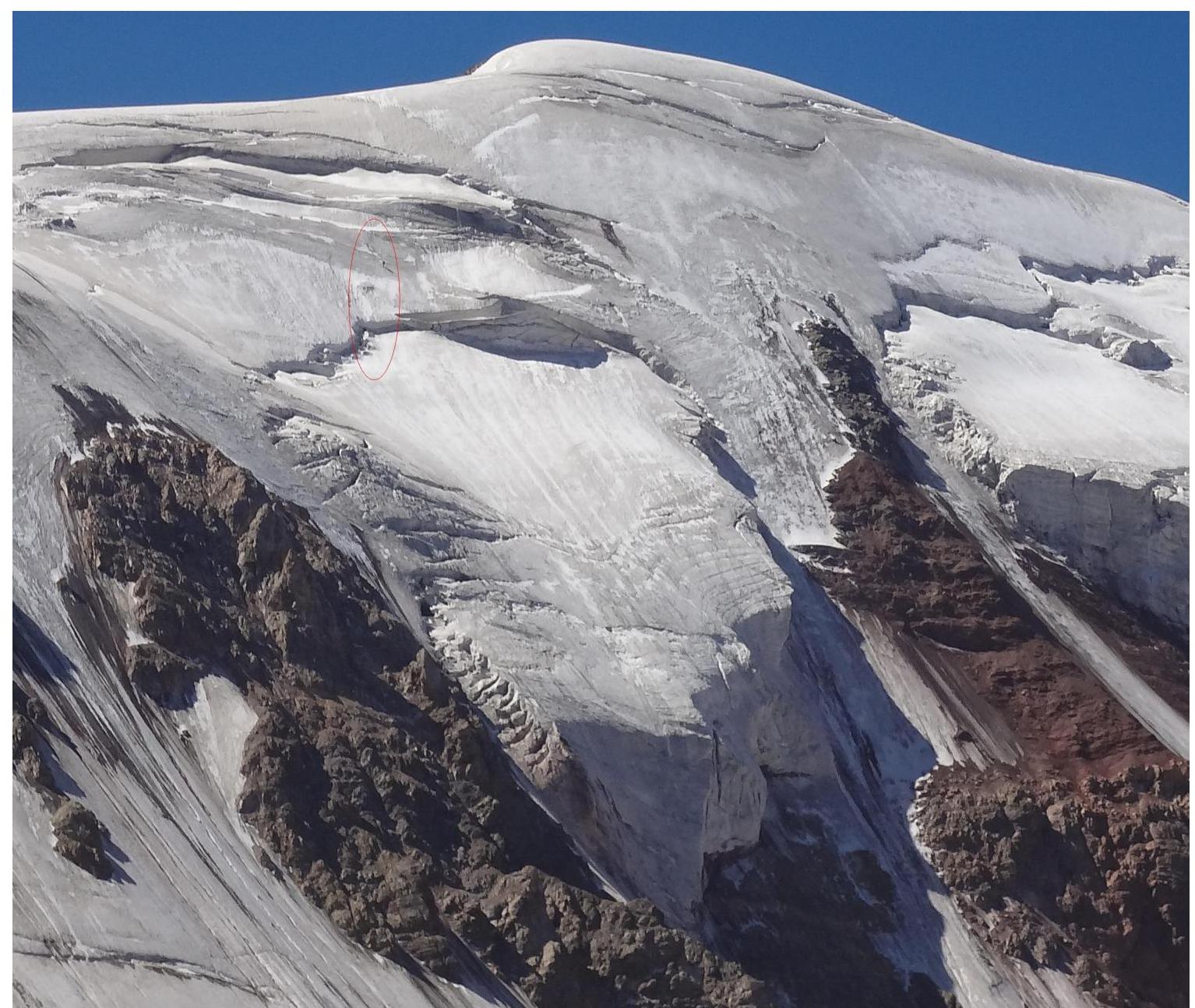
General view of the summit
Route diagram R3, 50 m, 30′, 11
& + \
& + \
- 1/1 1/1
R6, 95 м, 60′, 11 / R5, 5 м, 90′, 11+
& + \
& + \
R4, 100 м, 45′, 111 / R3, 100 м, 55′, 11
& + \
R5, 100 м, 55′, 111 / R4, 1510 м, 60′, 11
& + \
© (R1, 150 м, 50′, 111) / (R6, 100 м, 40′, 11) Profile of the route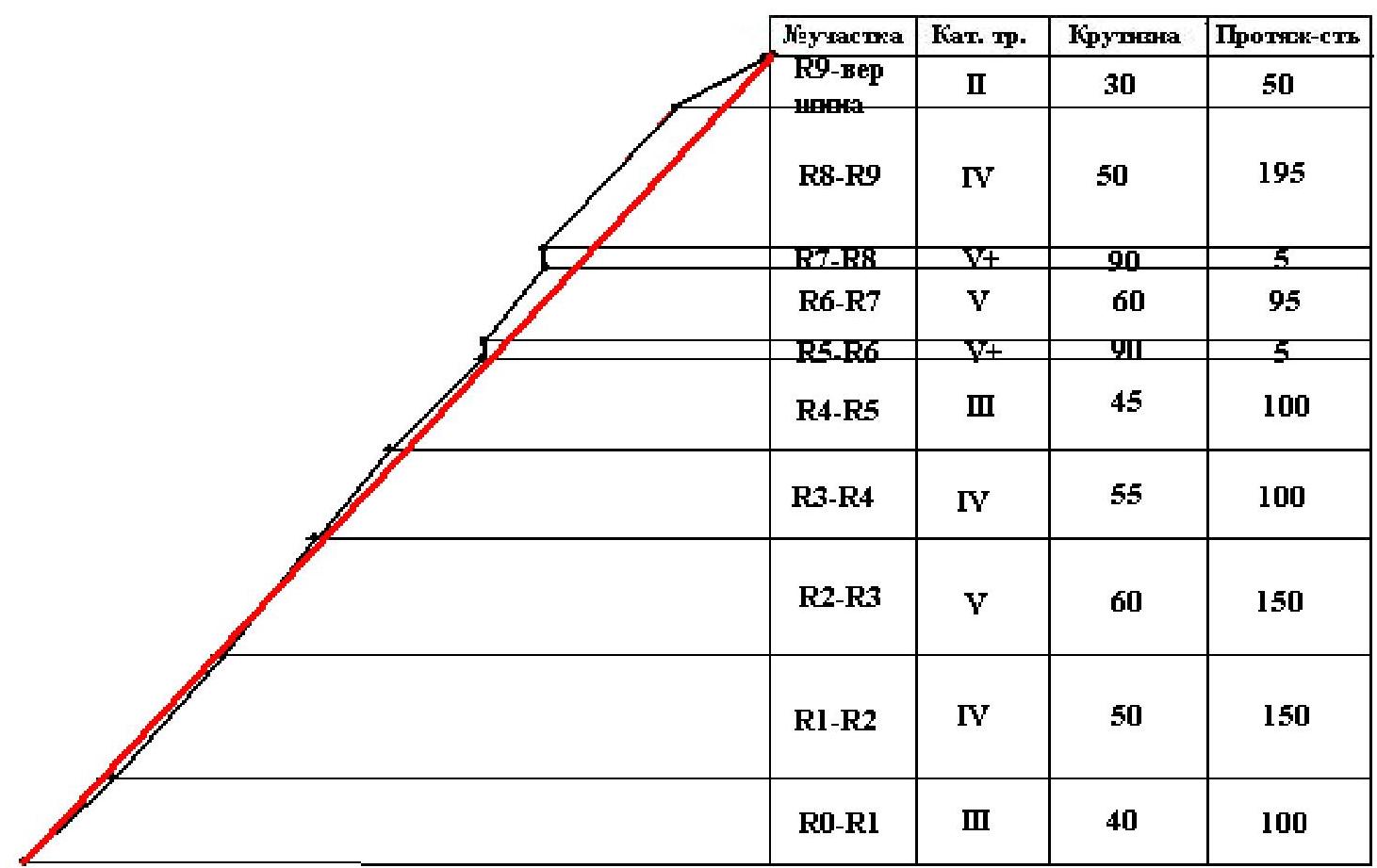
Route Description
| Departure from Aчик-Tаш Base Camp | 5-00 | 14.08.2015 |
|---|---|---|
| Arrived under the route | 7-00 | 14.08.2015 |
| Reached the summit | 13-00 | 14.08.2015 |
| Descent to Base Camp | 15-00 | 14.08.2015 |
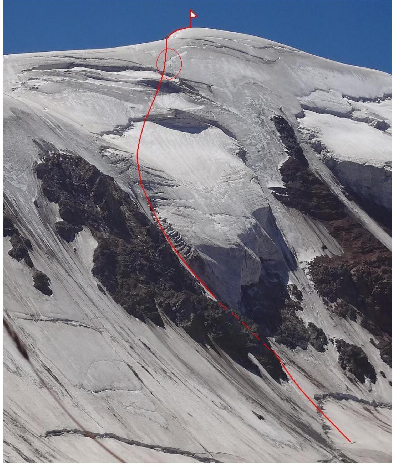
From Aчик-Tаш Base Camp, we ascend to the ridge leading to Peak Petrovsky. Along the ridge up to a logical descent to the glacier in the cirque, to the north face.
Initially, we planned to ascend via the center of the face but were deterred by rocks — it was evident that the rock ridge was melting and shedding debris, with many fresh tracks. We opted for a less logical but safer variant. We decided to approach the rock wall from the left and then navigate between the rocks and glacier crevices to reach the ice wall.
- R0–R1. We cross the bergschrund and proceed directly under the rock wall. We set up a station. A safe location in case of rockfall. Then, we move up and to the right, bypassing the rocks. The second station is also behind the rock wall. 100 m, 40°, III.
- R1–R2. We emerge to the right and upwards, towards the ice cornice. There are rock outcrops in places. The ice is twisted. 150 m, 50°, IV.
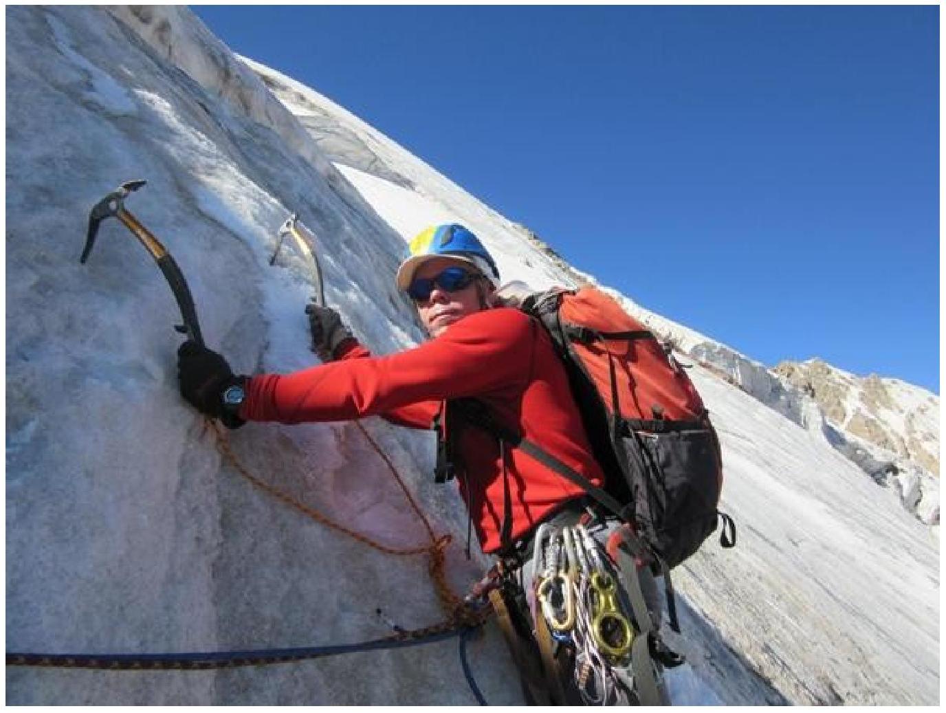
- R2–R3. We navigate between the rocks and the ice "cushion". Many crevices and cracks. Steep sections up to 70–80°. Interesting technical climbing. We reach the upper part of the "cushion". 150 m, 60°, V.
- R3–R4. We ascend, heading towards the snowfield. The ice becomes more pronounced. 100 m, 55°, IV.
- R4R5. We reach the firn, which turns into a deep snowfield under the berg. The first station is on ice screws, the second on the berg wall. 100 m, 45°, III.
- R5R6. We cross the berg. A good, steep wall. 5 m, 90°, V+.
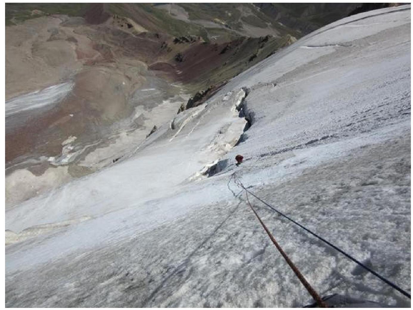
- R6R7. We ascend towards the second berg, to the most logical crossing point. Steep, clean ice. 95 m, 60°, V.
- R7R8. The berg is similar to the previous one. 5 m, 90°, V+.
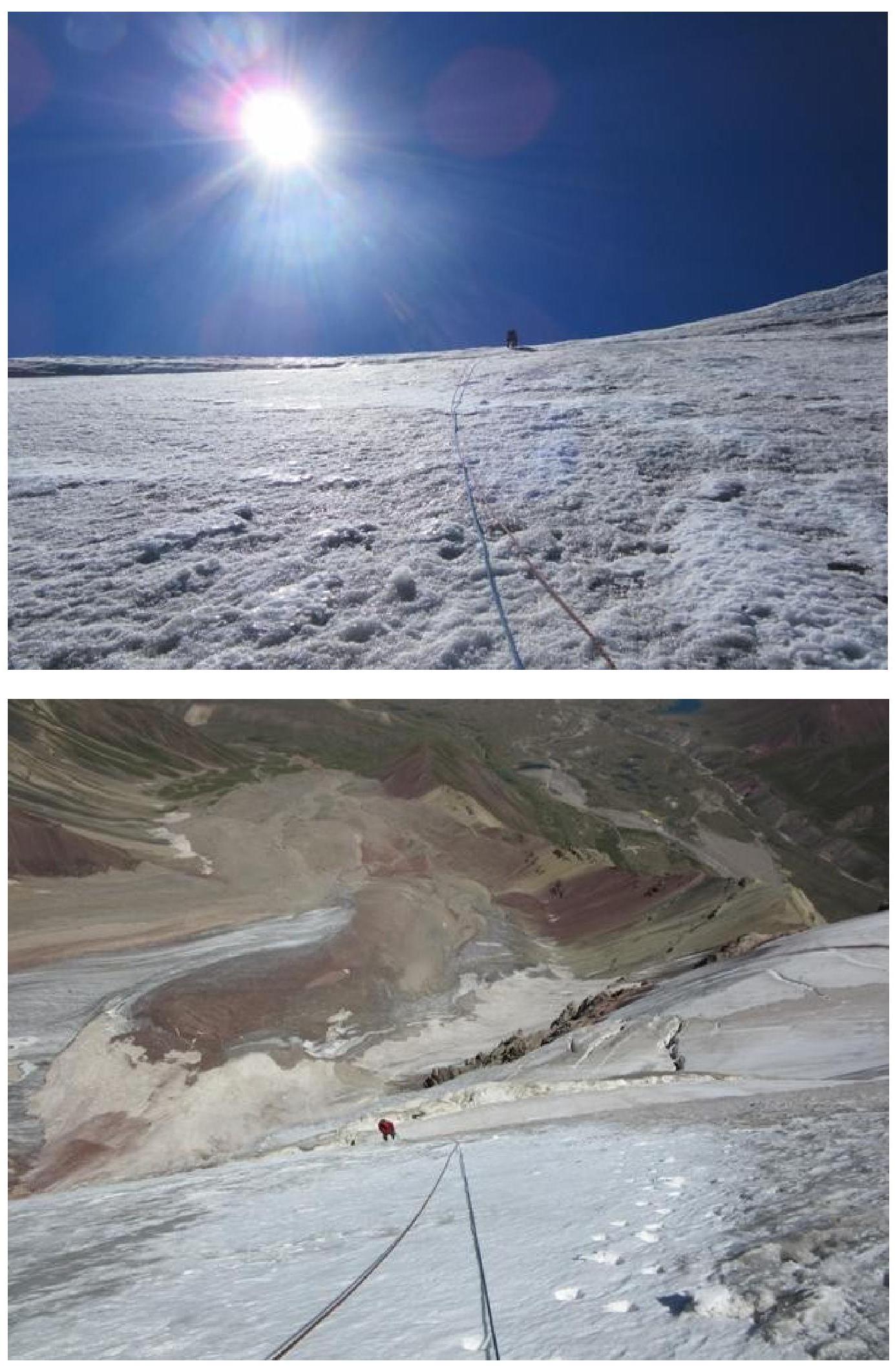
- R8R9. We move towards the upper part of the "shoulder". We reach the ridge! 195 m, 50°, IV.
- R9 — summit. We drop unnecessary gear and ascend to the summit in a rope team. 50 m, 30°, II.
We write a note, have a snack, and descend! Descent is via the eastern ridge. Until the end of the snowfield, we remain roped and wear crampons; thereafter, we remove all gear and descend to camp via scree.
Section R1–R2
Section R2–R3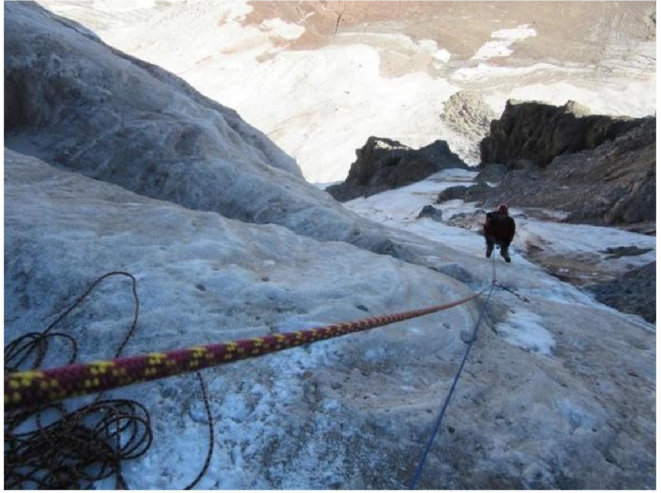
Section R3–R4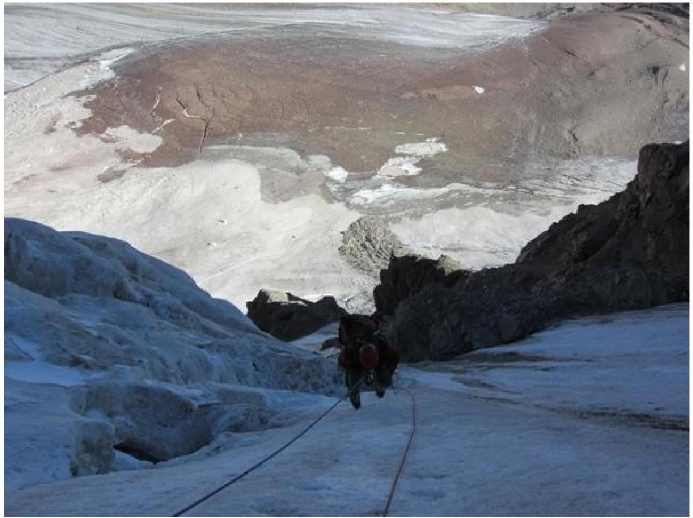
Section R5–R6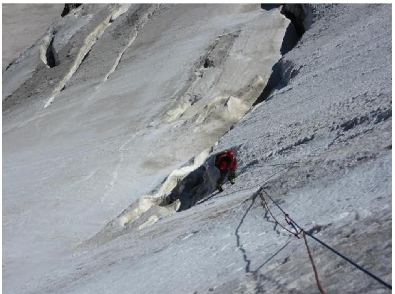
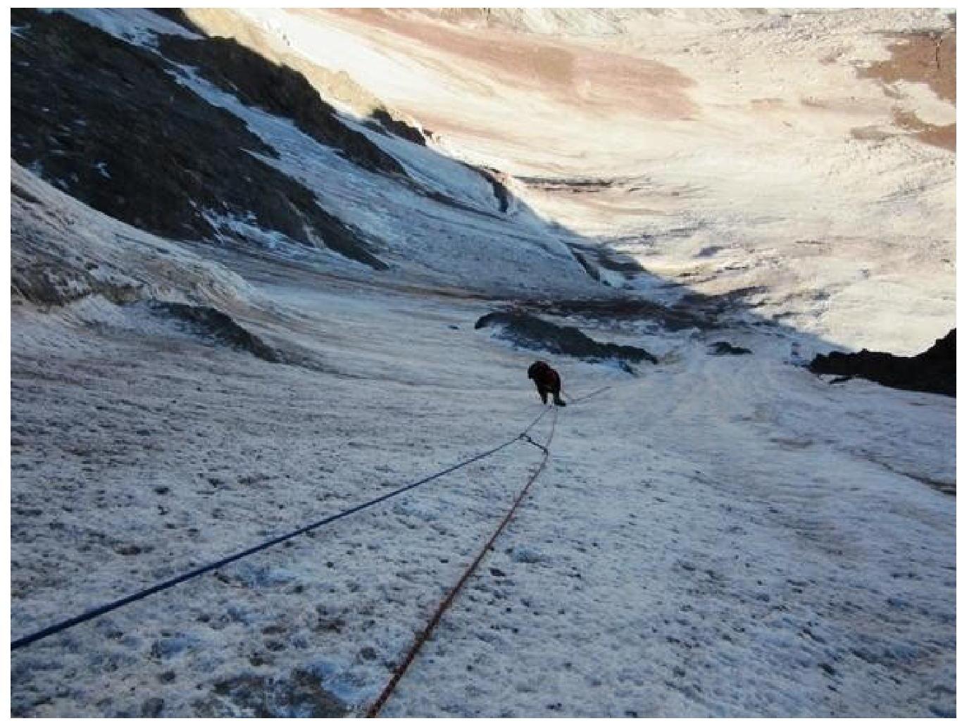
Section R8–R9, reaching the "shoulder"
1 Photo from our observer, Pasha Vyazovetsky. Photo taken from the ridge.