Recreational Climbing in Achik-Tash. Peak Musa Dzhalil via the North Face.
Alpinism, Report, Pamir By khomenyuk, Today at 15:07
On August 31, 2017, we successfully completed a first ascent via the north face of Peak Musa Dzhalil (4800 m, according to the classifier). From the Ak-Sai Travel base camp in Achik-Tash, we reached the summit and returned in ten and a half hours. We thoroughly enjoyed the route. In anticipation of the new season, I'm sharing a detailed description of the route.

Ascent Details
- Pamir, Trans-Alay Range, Achik-Tash valley, category 4.4 according to the 2017 classification table.
- Peak Musa Dzhalil, 4800 m, via the North face.
- Proposed category — 3B, first ascent.
- Route type: ice and snow.
- Elevation gain: 600 m according to GPS.
Route length: 950 m.
Section lengths:
- Category V — 0 m.
- Category VI — 0 m. Average steepness:
- Main part of the route — 50°;
- Entire route — 40°.
- Pitons left on the route: 0; including screw pitons — 0.
- Team's climbing time: 4 hours, 1 day.
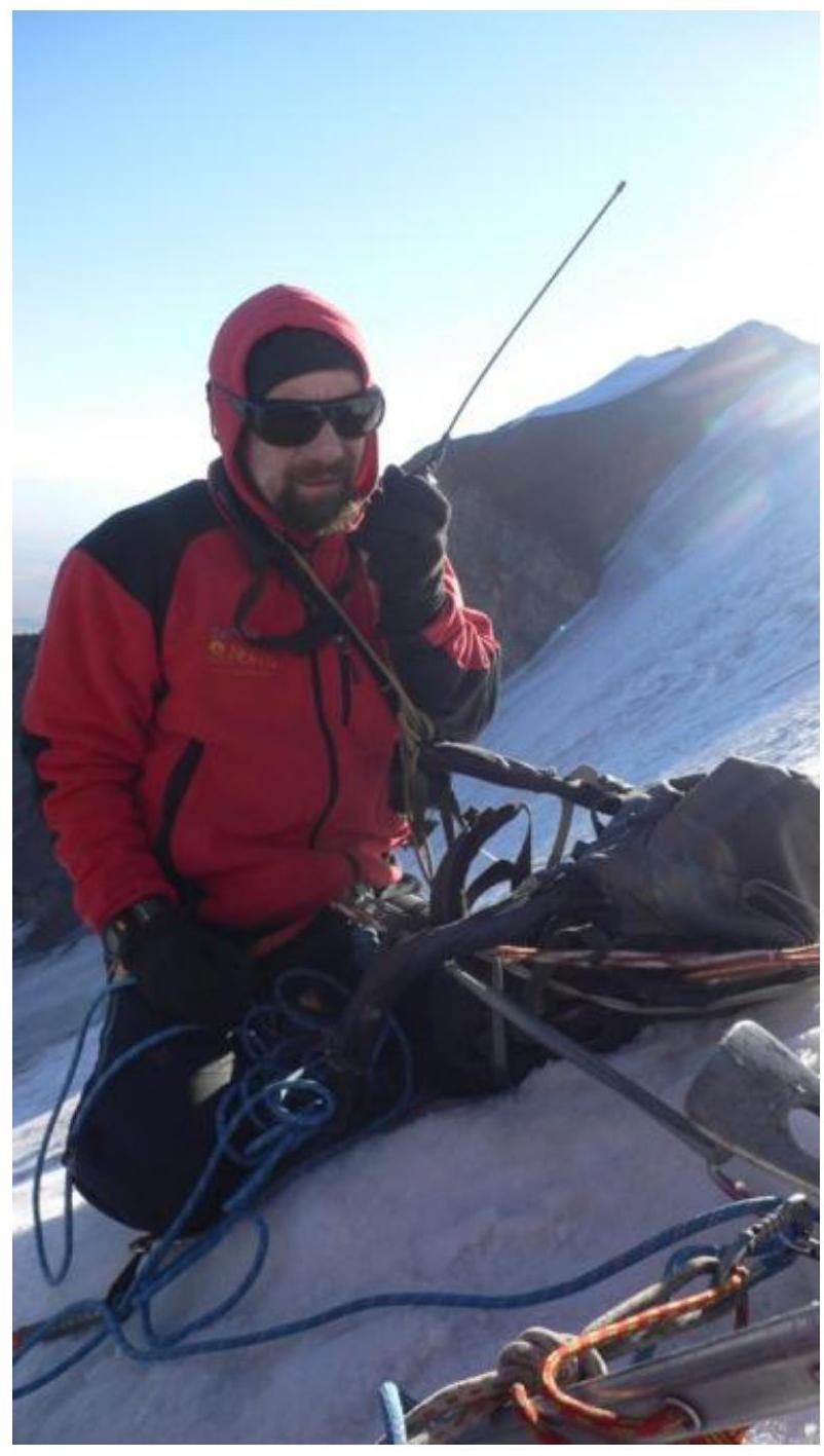
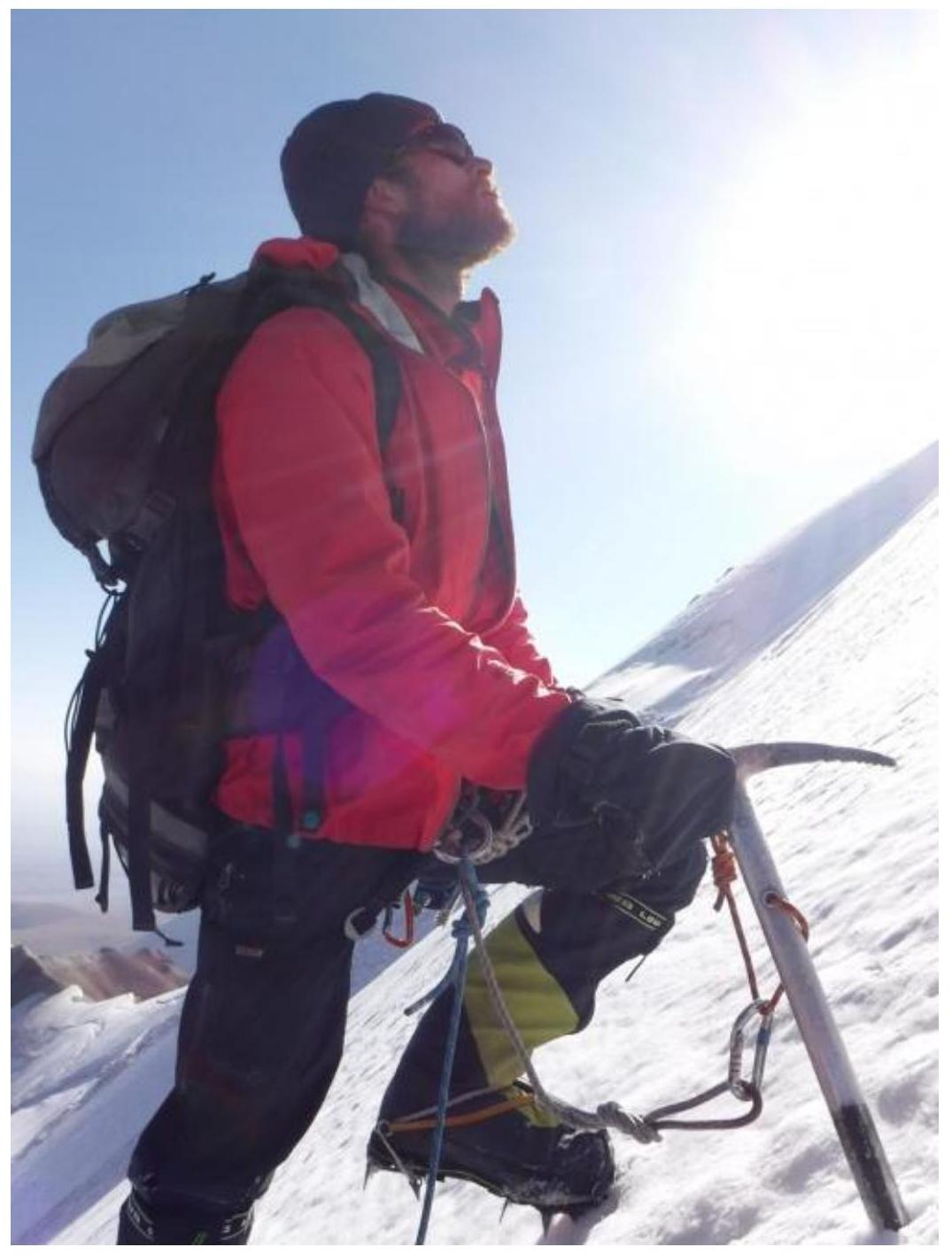
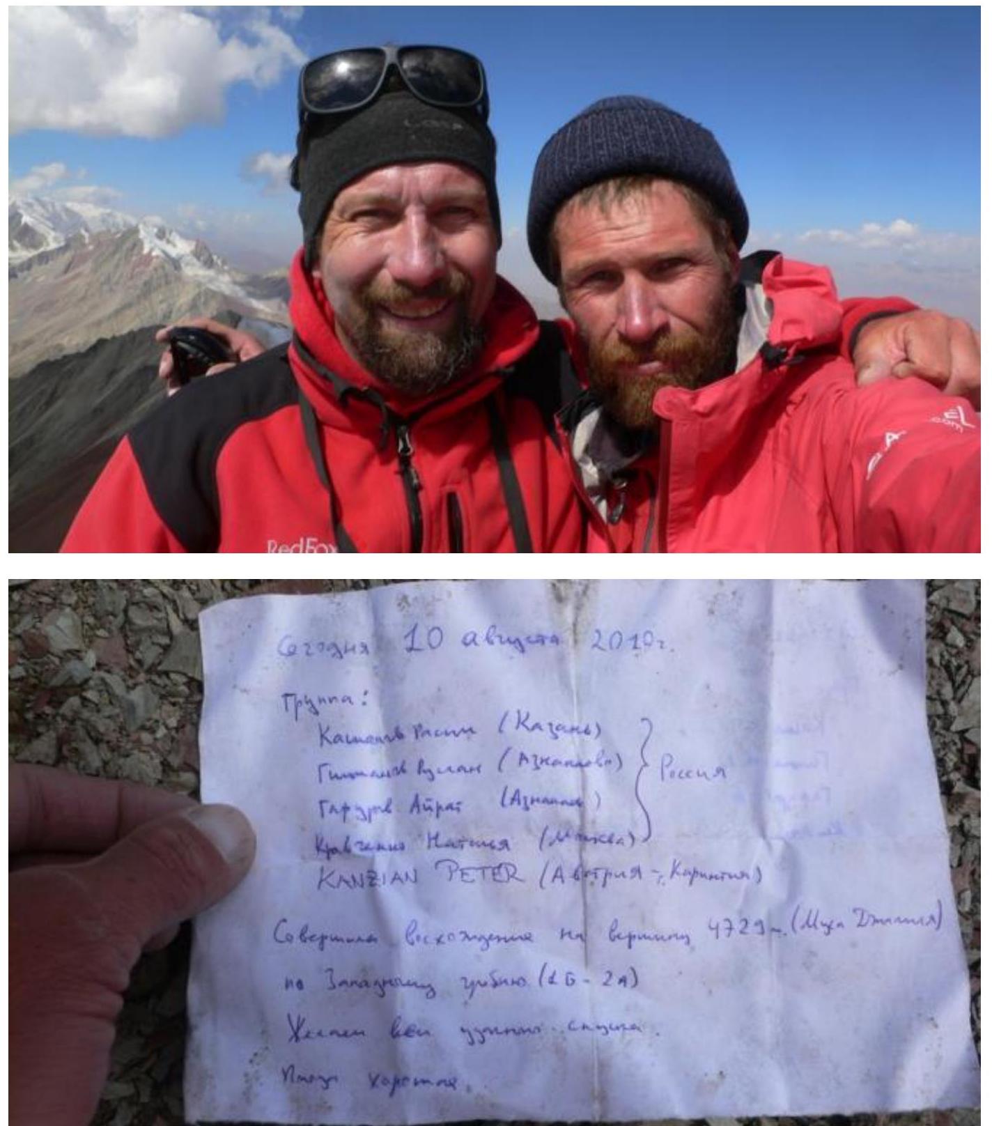
- Leader: Mikhail Khomenyuk, 1st sports category. Participants: Eduard Inozemtsev, 1st sports category.
- Coach: Vladimir Ivanovich Suviga, Honored Coach of Russia.
- Departure from base camp: 5:00, August 31, 2017. Route started: 7:00, August 31, 2017. Summit reached: 11:15, August 31, 2017. Return to base camp: 15:20, August 31, 2017. Descent from the summit: via category 1B route to Achik-Tash valley.
- Organizing body: Ak-Sai Travel.
- Report responsible: Mikhail Khomenyuk. Email: khomenyuk@ya.ru Phone: +201069479518
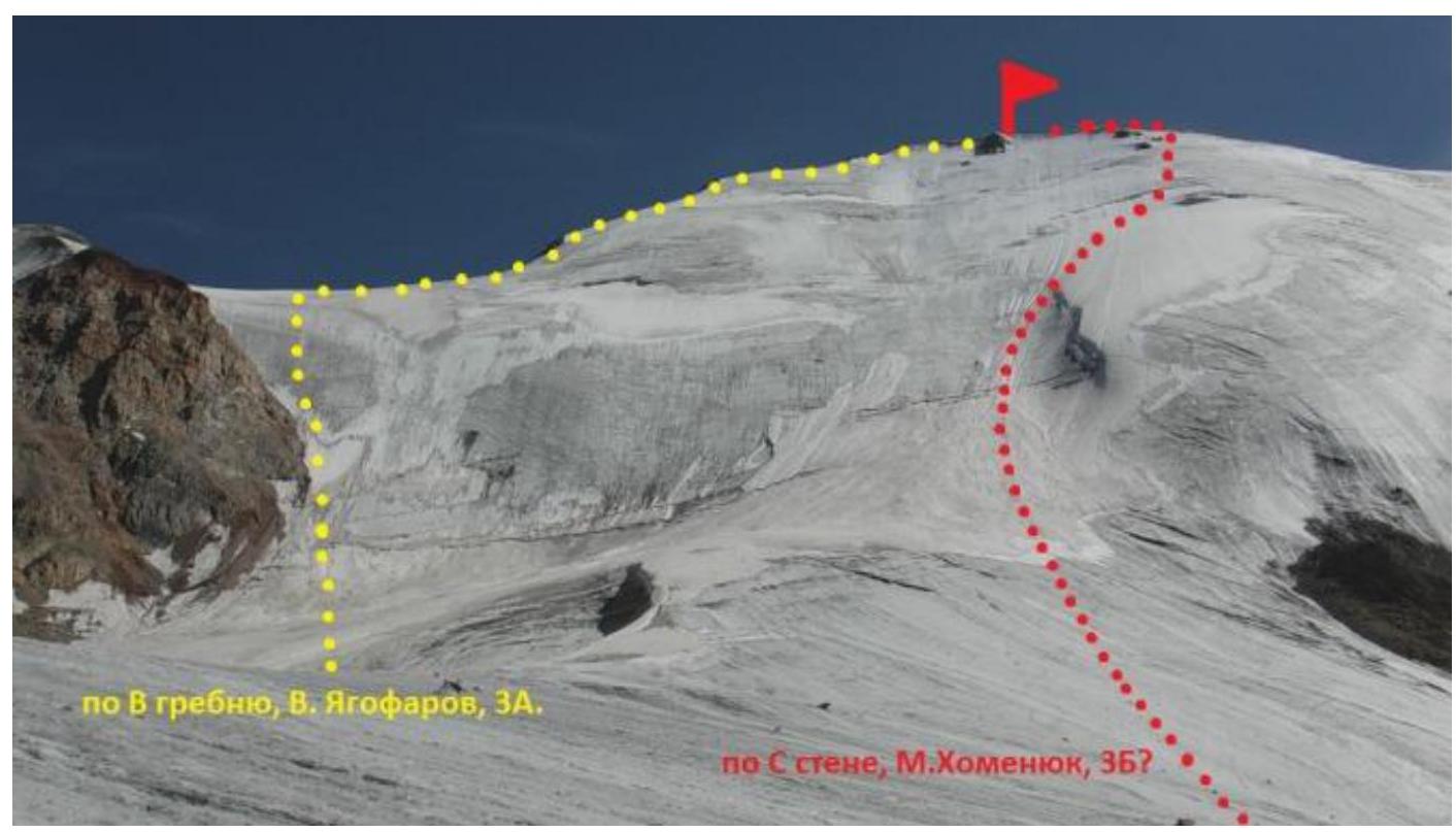
Via the ridge, V. Yagofarov, 3A.
Via the N face, M. Khomenyuk, 3B?
 General photo of the summit. Date taken: August 19, 2017. Location — glacier below the North face of Peak Musa Dzhalil. Taken during the preliminary route reconnaissance.
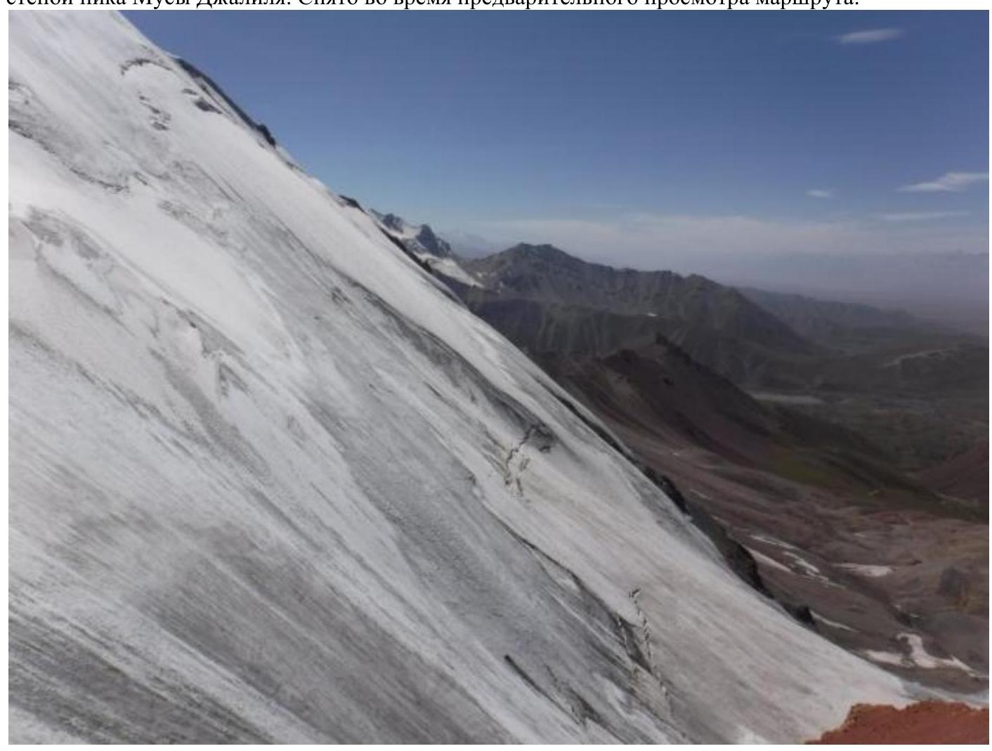 Photo of the route, lower and middle sections. Taken on August 19, 2017, from the East ridge during the preliminary route reconnaissance.
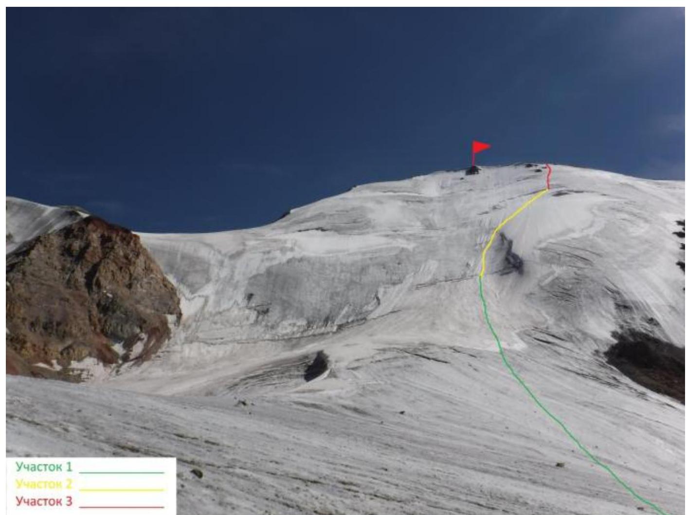
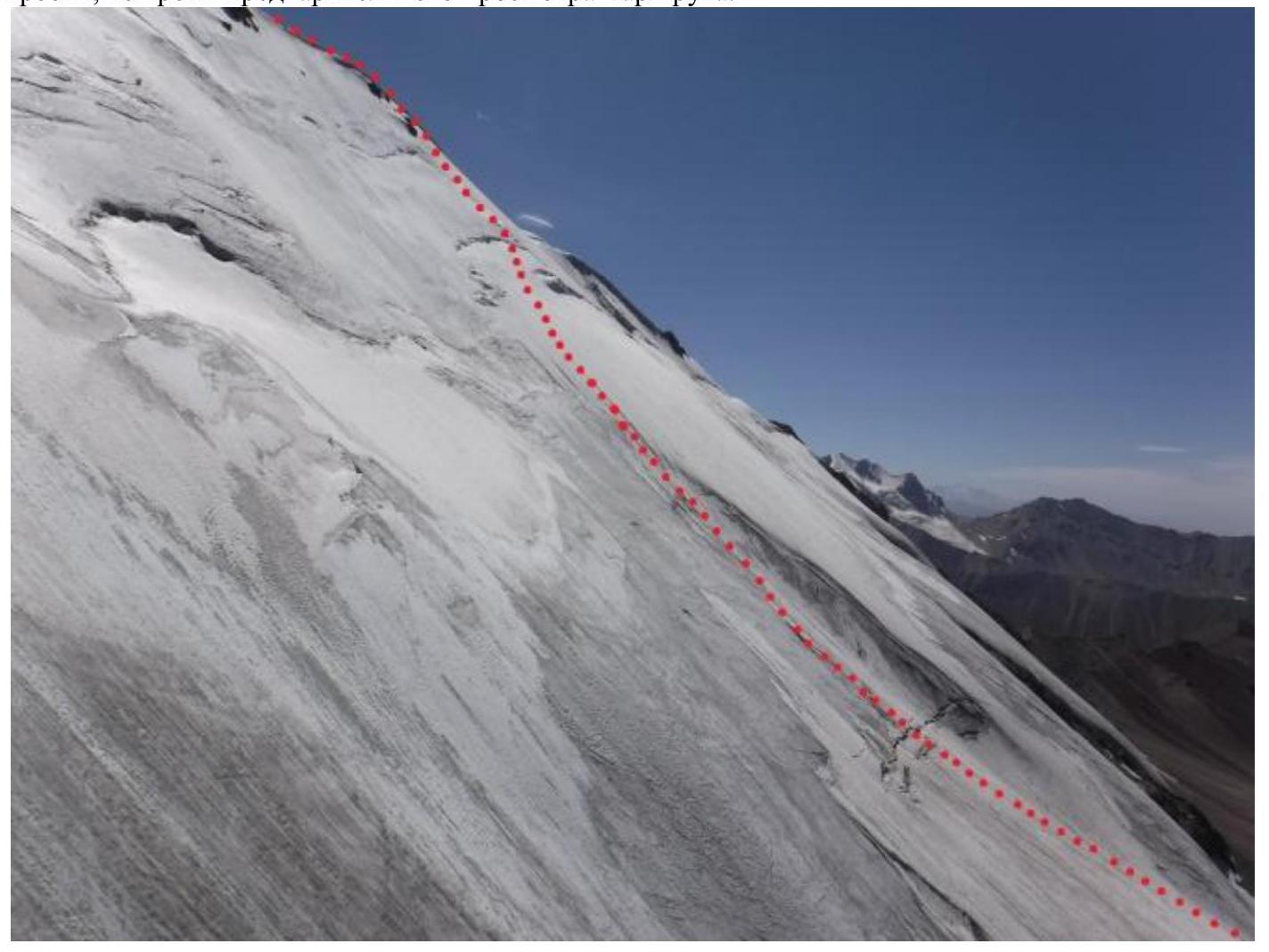 Photo of the route. Middle and upper sections. Taken on August 19, 2017, from the East ridge during the preliminary route reconnaissance.
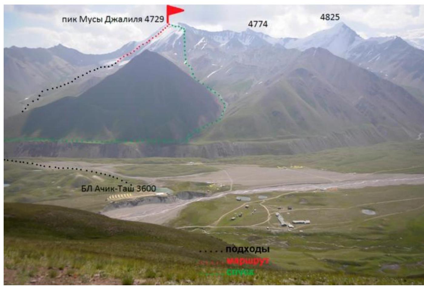
Panorama of the area. View from the Petrovsky peak ridge. Heights are according to the topographic map.
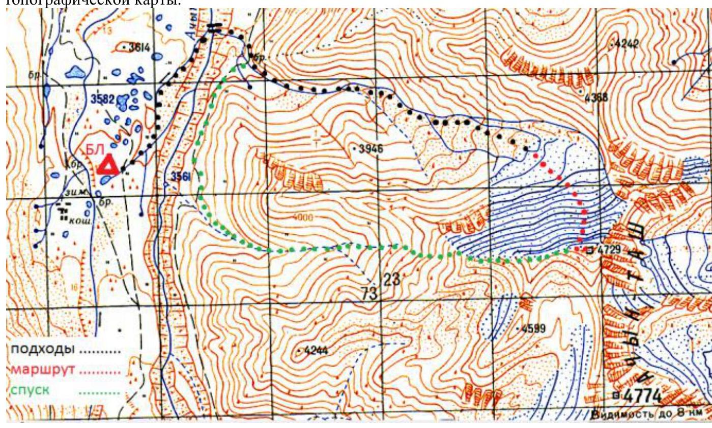
Approach route from Achik-Tash base camp, Ak-Sai Travel.
| Section # | Length | Steepness | Terrain characteristics | Category | Pitons |
|---|---|---|---|---|---|
| 1 | 350 | 20–30 | Snow and ice slope. | II | 0 |
| 2 | 300 | 30–40 | Snow and ice slope. | III | 1 |
| 3 | 200 | 50–60 | Snow and ice slope. | IV+ | 20 |
| 4 | 100 | 20 | Snow and ice ridge. | I | 0 |
Technical photo of the route.
Route Description
Approach: From Achik-Tash base camp, follow the trail to the bridge over the Achik-Tash river. After crossing the bridge, ascend the valley along the stream that flows into the Achik-Tash river right by the bridge. In the upper part of the valley, turn right onto the moraine and approach the glacier below the North face of Peak Musa Dzhalil. Approach time is 2 hours.
Section 1: Snow and ice slope, steepness 20–30°. Steepness gradually increases. Category II. Section length is approximately 350 m. Simultaneous movement on crampons in a rope team.
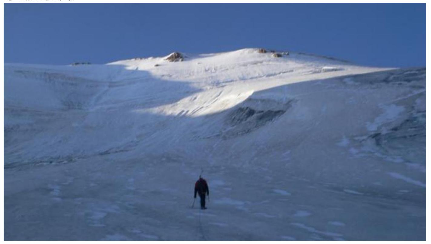
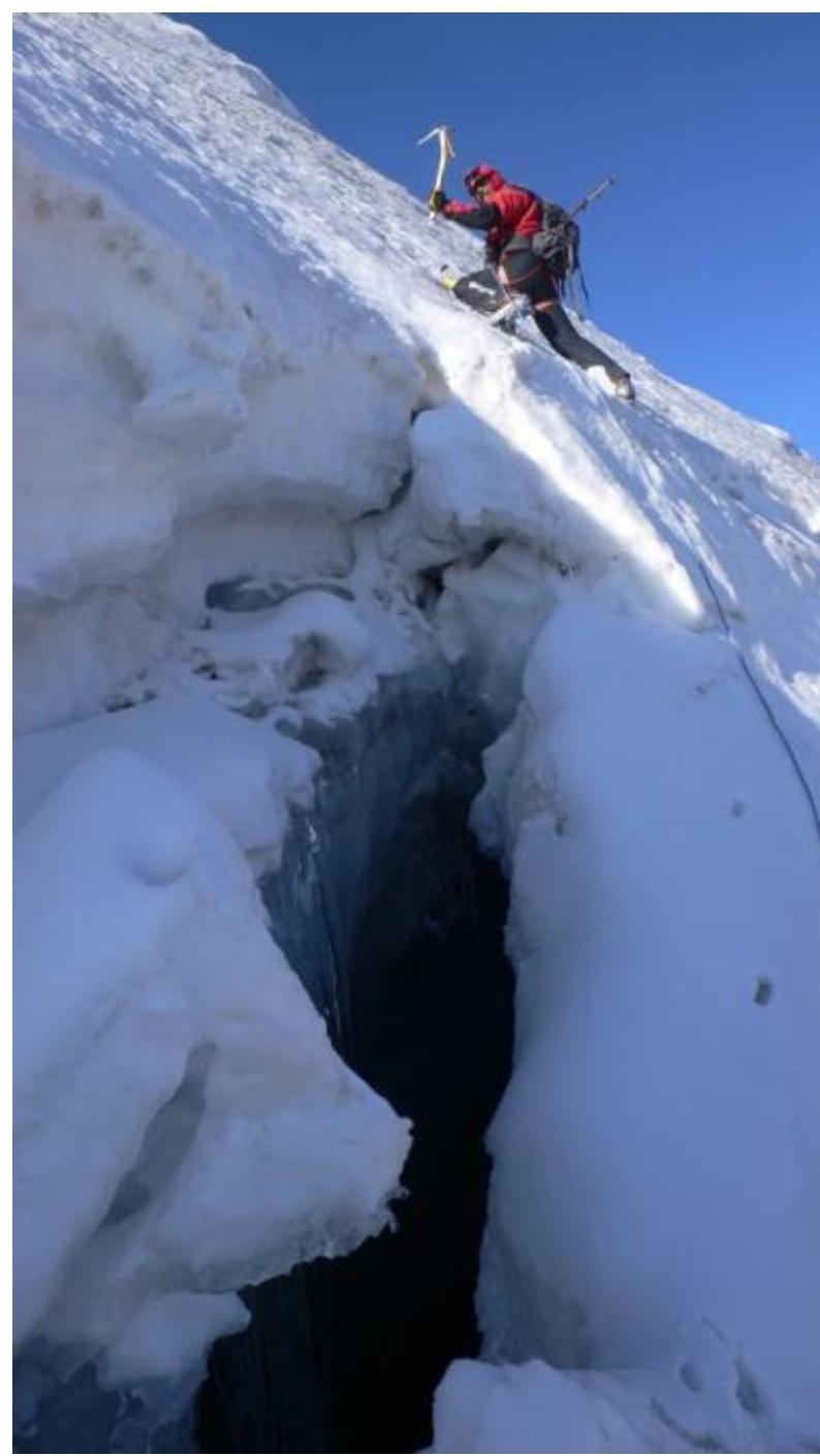
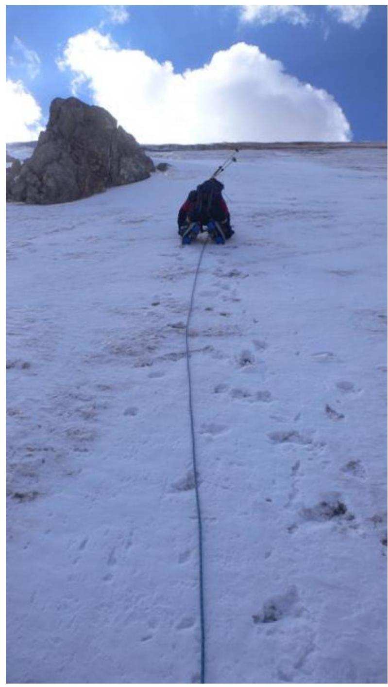
Section 2: Snow and ice slope, steepness 30–40°. Steepness gradually increases. Category III. Section length is approximately 300 m. Cross the bergschrund via a snow bridge. Continue with simultaneous movement in a rope team, using front points of crampons and ice axe support. One ice screw was placed for a belay station during a scheduled radio communication. During the ascent, we moved slightly to the right along the less steep part of the slope. At the end of the section, under the second bergschrund, a belay station was established on an ice axe.

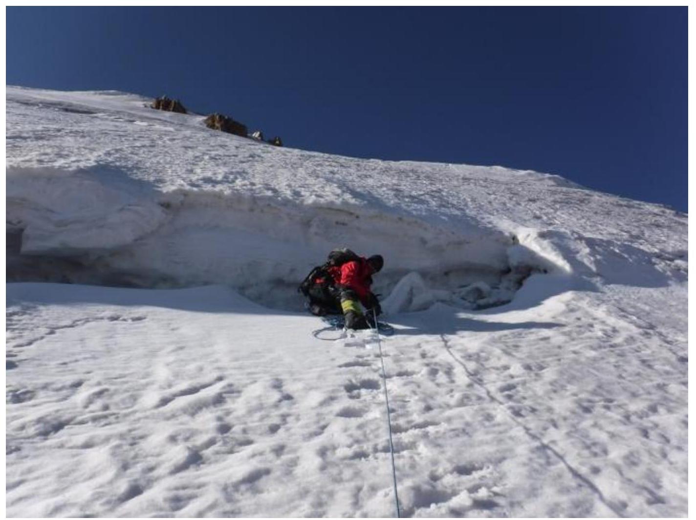
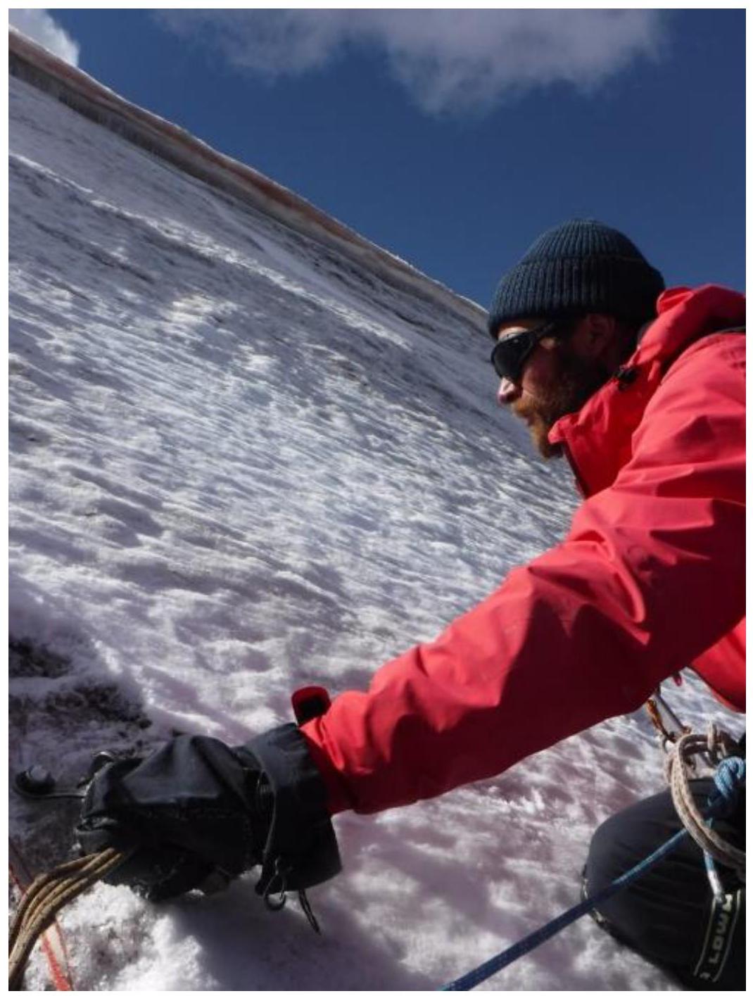
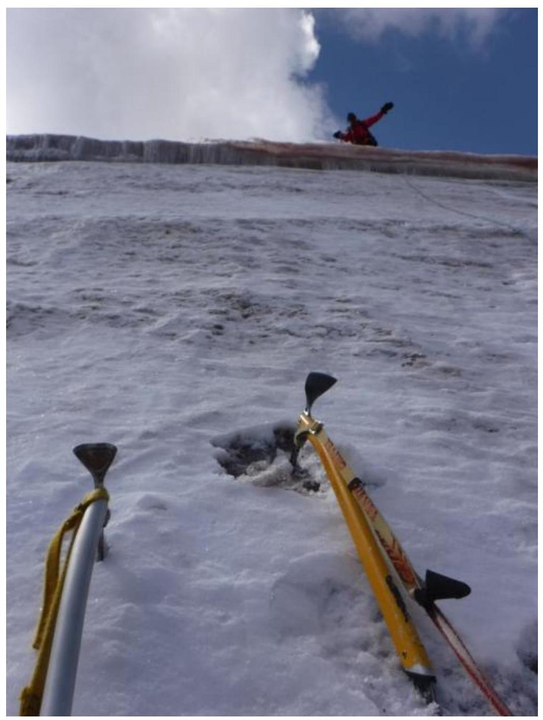
Section 3: Snow and ice slope, steepness 50–60°. Category IV+. Section length is 200 m: 7 rope lengths of 30 m, the last one slightly shorter. Cross the bergschrund via a snow bridge. Continue with alternating movement, changing leaders at belay stations, using front points of crampons and two ice axes. Protection — 1 ice screw in the middle of the 30-meter rope, belay stations on two ice screws. Bypass the rock outcrop at the end of the second-to-last rope on the right. A small corniche before reaching the ridge does not pose a problem.
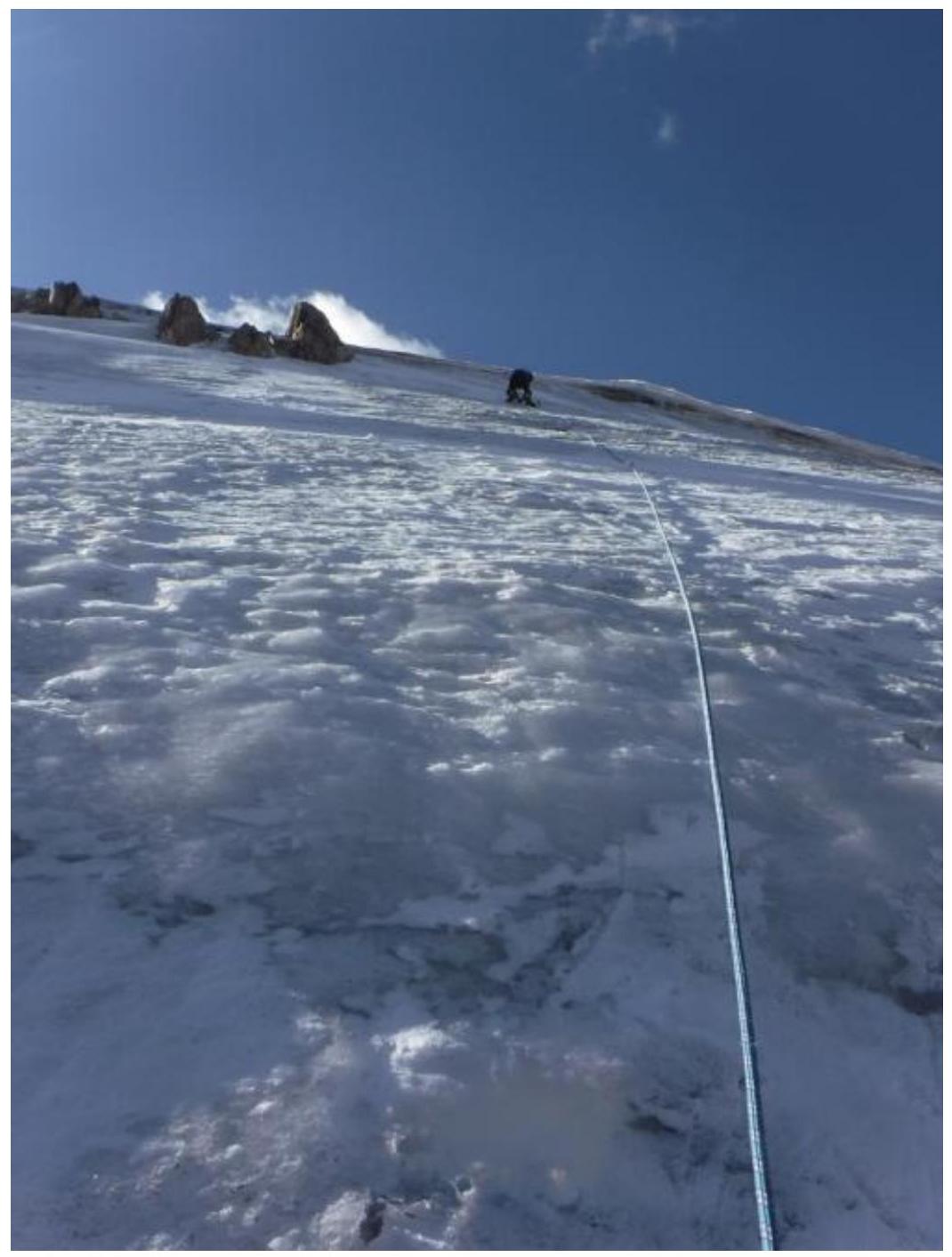
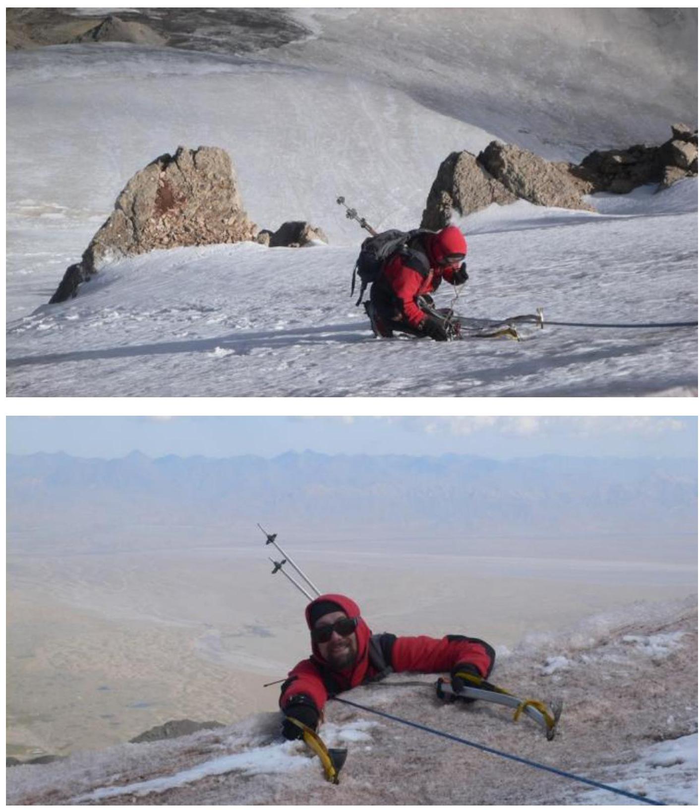
Section 4: Wide snow and ice ridge, steepness around 20°, length approximately 100 m. Walk left along the ridge to the summit. Category I.
Overall impression: A beautiful and enjoyable route. Reliable protection. Not avalanche-prone as of late August — no snow. Practically not rockfall-prone: during the ascent, nothing fell, and during the reconnaissance from the ridge, one rock flew by around 13:00.
Descent: Via the west ridge, approximate difficulty 1B–2A, then down the scree slope into the valley and along the trail to the bridge. It's possible to descend quickly into the valley via the southern fine scree slope, but this makes the return to the bridge significantly longer.
Red Fox Today, August 10, 2010 Team: Kastanov Rasti (Kazan) Gilotinov Ruslan (Aznakayeva) Russia Garziriv Airat (Aznan') Kravchenko Nateshya (Moskva) KANZIAN PETER (Austria Carinthia) Reached the summit 4729 m (Dmanner Mikhail) via the West ridge (LG-2A) Vernen ben yjunni. Engarai. Good luck.
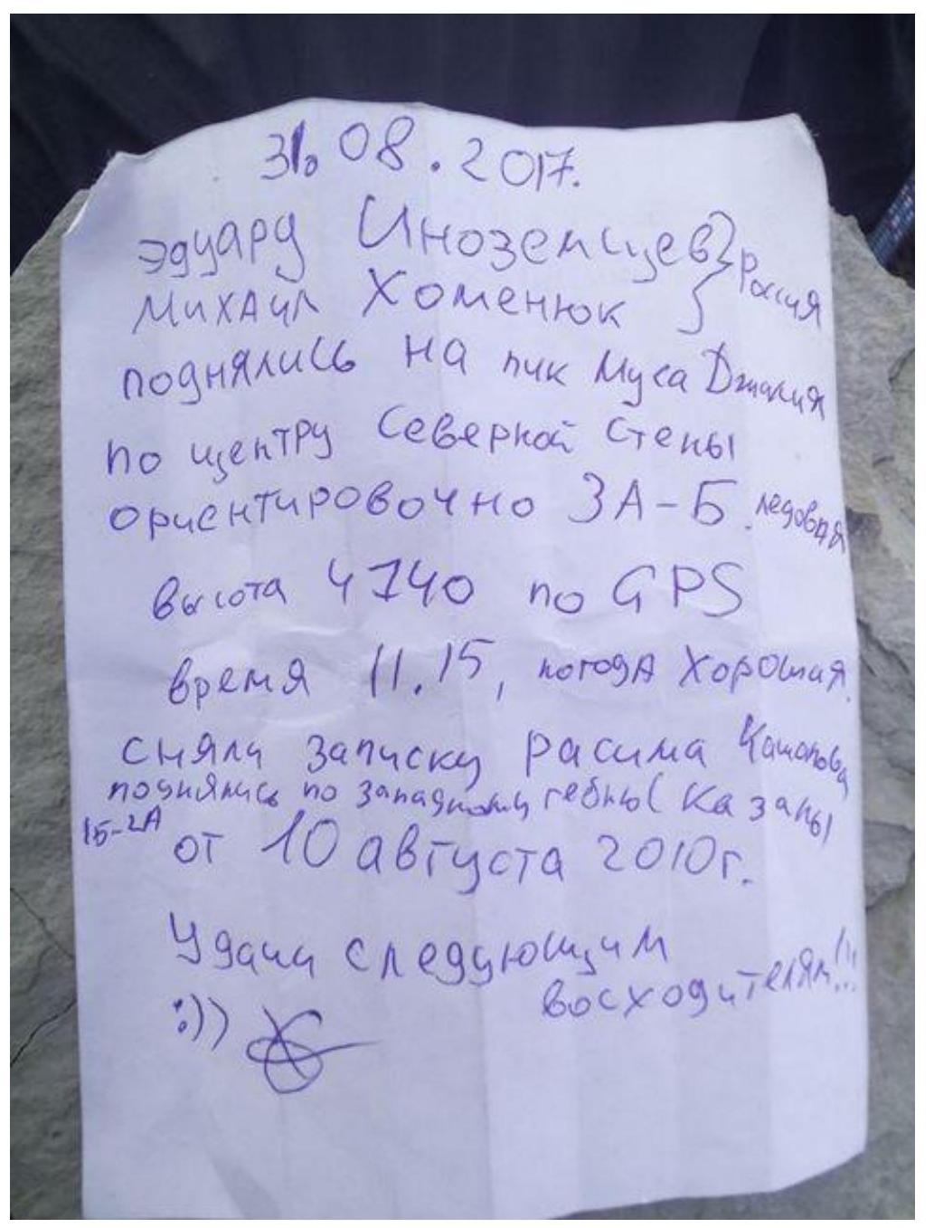
August 31, 2017 Eduard Inozemtsev Russia Mikhail Khomenyuk ascended Peak Musa Dzhalil via the center of the North face Approximately 3A–3B ice height 4740 m according to GPS time 11:15, good weather. Retrieved Rasim Kamolov's note ascended via the West ridge (Kazan) 1B–2A from August 10, 2010. Good luck to future climbers!))
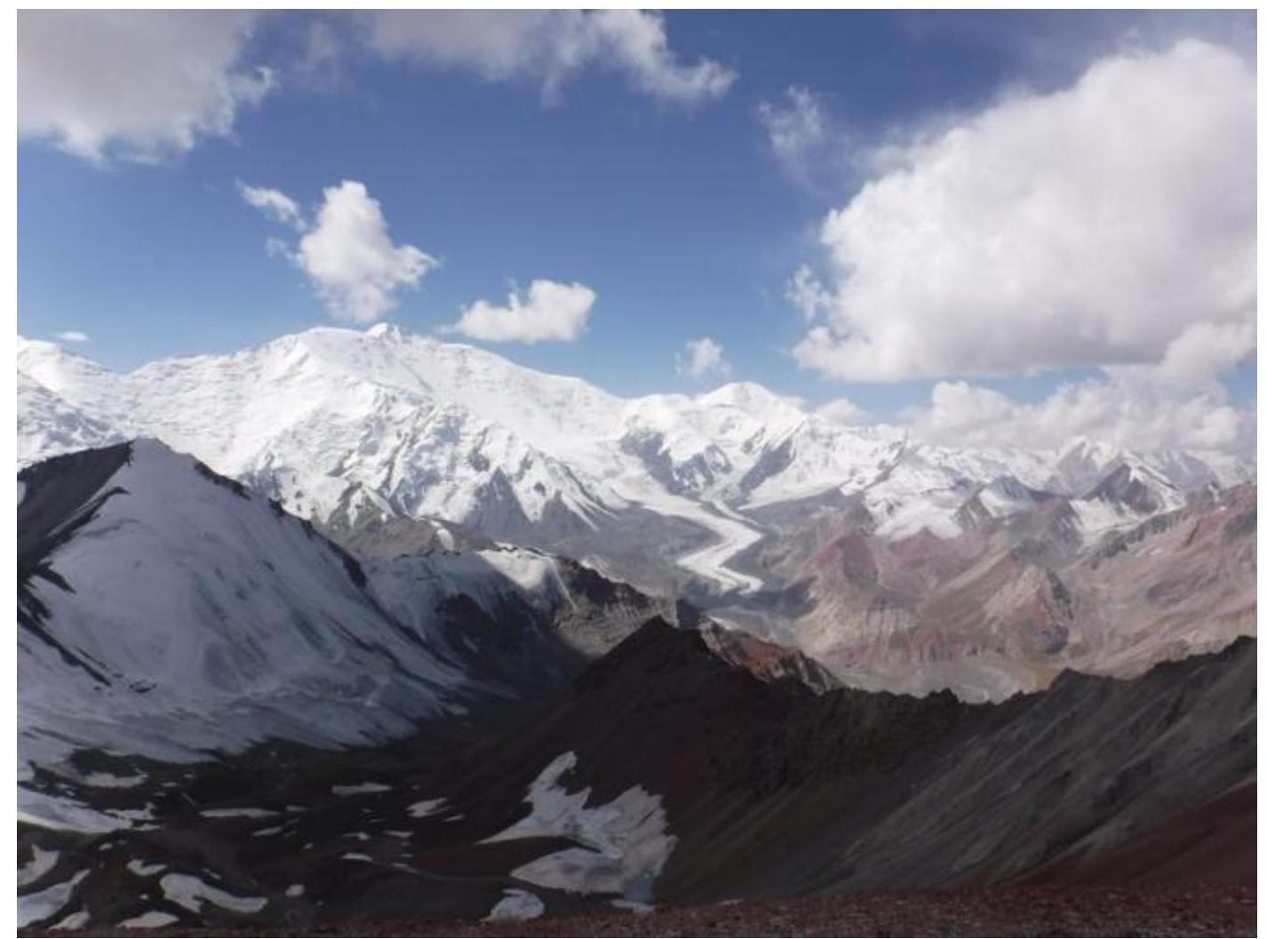
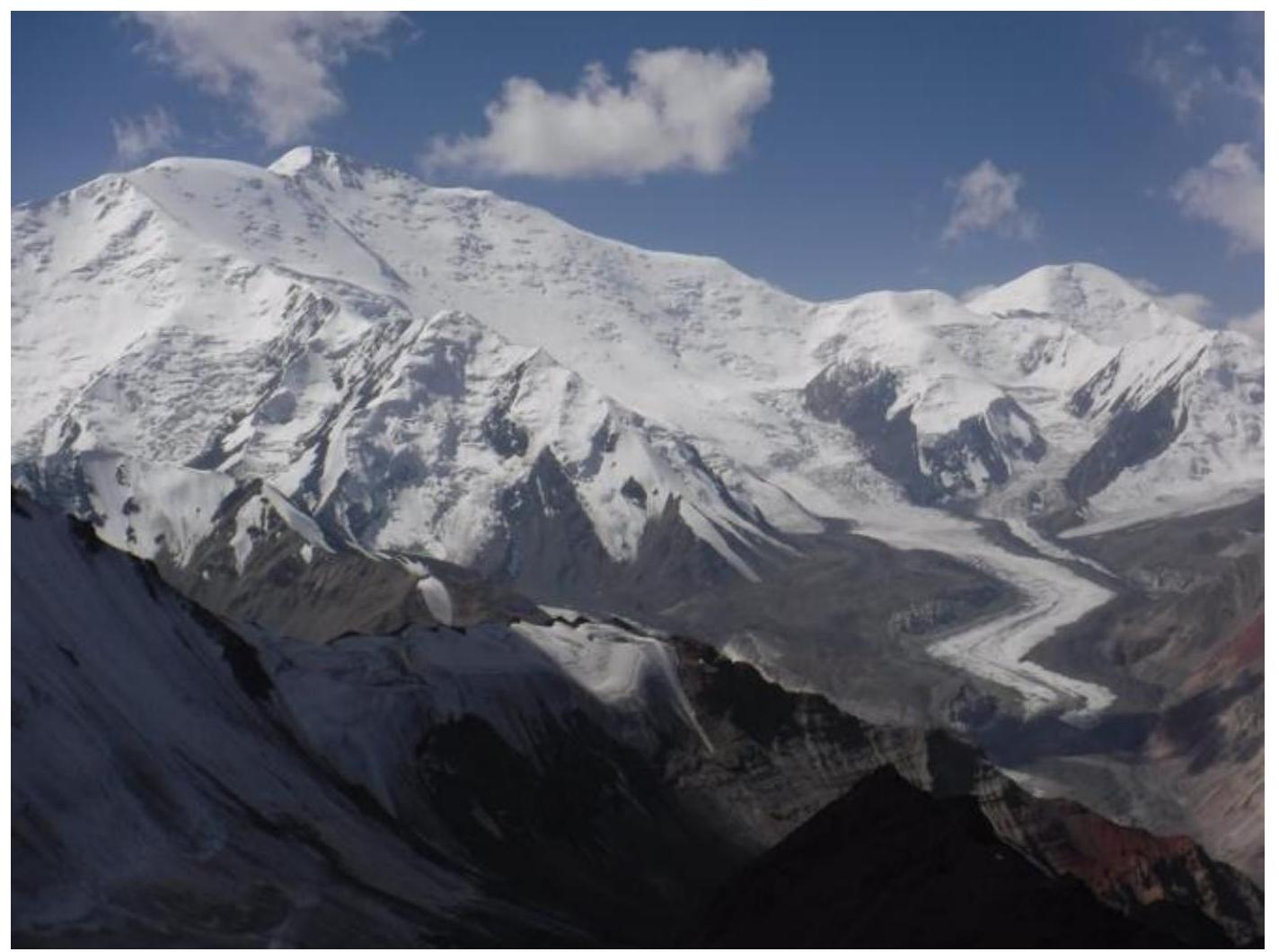
View from the summit towards Peak Lenin:
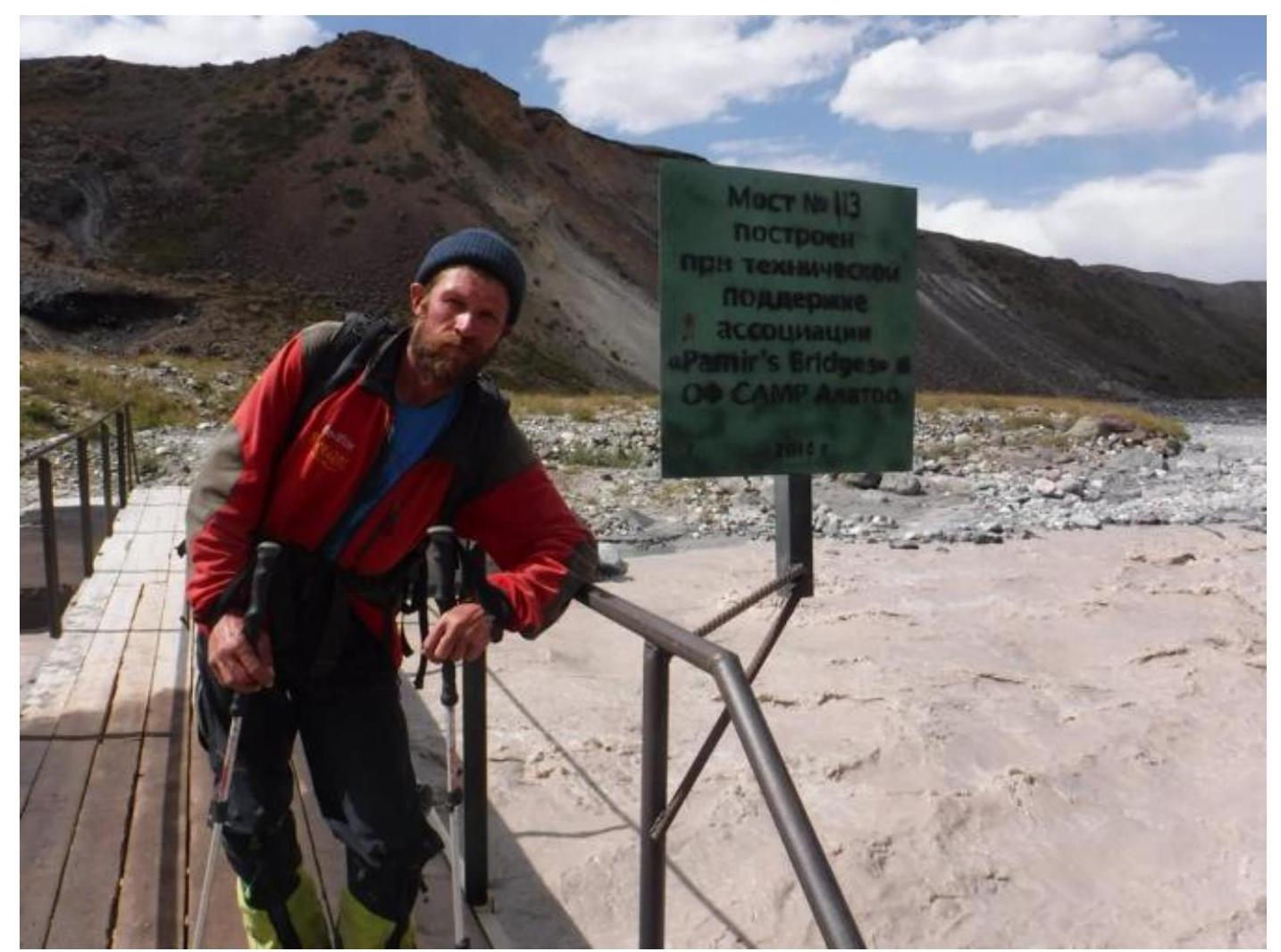
Special thanks to the bridge builders! Life has become easier and more enjoyable!))
Bridge # 113 built with technical support from the Pamir's Bridges association, OF SAMR Alatoo 2010.
Thanks to Ak-Sai Travel for our happy summer! Good luck to future climbers!))