REPORT
On Ascent to Lenin Peak 7134 m via the South-West Ridge of the Western Crest (First Ascent of the Route)
1. ASCENT DETAILS
- Region: Zaalaysky Range (Pamir). Valley: Malaya Saukdara. Section number according to the classification table – 4.4
- Name of the peak: Lenin Peak. Name of the route: via the South-West Ridge of the Western Crest.
- Proposed category: 5A, first ascent.
- Route characteristics: snow-ice.
- Height difference on the route: 1134 m (by GPS).
- Route length: 3130 m.
- Average slope: main part of the route (6090–6740) – 30°, entire route – 22°.
- Number of pitons used on the route: 0.
- Team's climbing hours: 14 hours, 2.5 days.
- Team leader: Lebedev Andrey Alexandrovich (Moscow).
- Team members: Babich Mikhail Vasilyevich (St. Petersburg), Zhdanov Ivan Nikolaevich (Moscow), Maximovich Yuri Alexandrovich (Moscow), Lavrenenko Vladimir Vyacheslavovich (Moscow).
- Coach: Lebedev Andrey Alexandrovich.
- Start of the route: 9:30 August 31, 2012.
- Reach the summit: 11:30 September 2, 2012.
- Descent to Lenin Glacier via Razdel'naya peak, arrived at camp 4400 at 18:30 September 3, 2012.
2. SUMMIT PHOTO
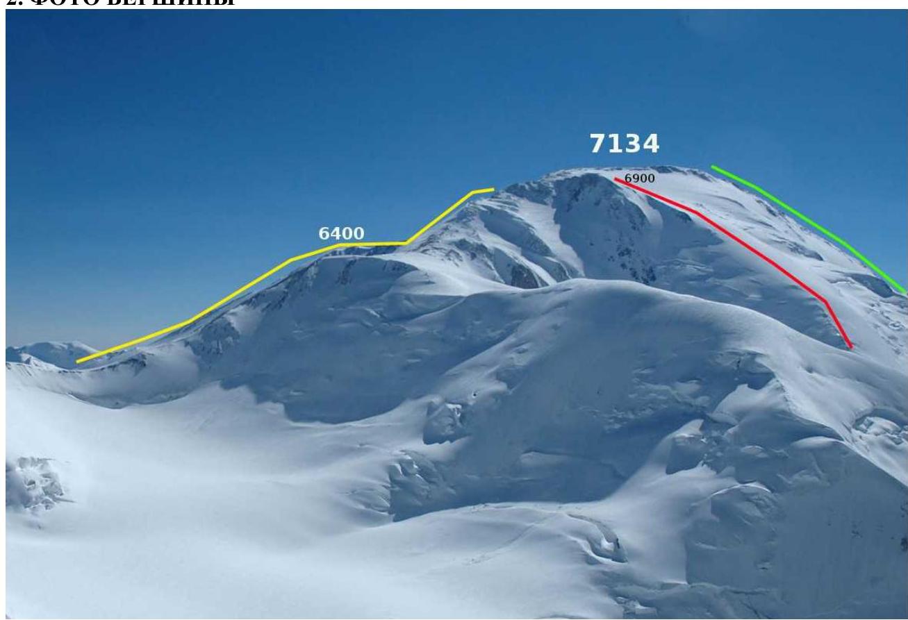 Fig. 2.1. View of Lenin Peak from Dzerzhinsky Peak (photo by D. Zelentsov, 2007). The route via the South-West Ridge of the Western Crest is marked with a red line. The route via the Western Crest (V. Kovalev, 1954) is marked with a yellow line. The route via the South-West Crest (N. Yushin, 1967) is marked with a green line.
3. PANORAMIC PHOTOS OF THE AREA
 Fig. 3.1. View of the southern slopes of Lenin Peak from Beleuli Peak (photo by A. Lebedev, 2001). The route via the South-West Ridge of the Western Crest is marked with a red line. The route via the Western Crest (V. Kovalev, 1954) is marked with a yellow line. The route via the South-West Crest (N. Yushin, 1967) is marked with a green line.
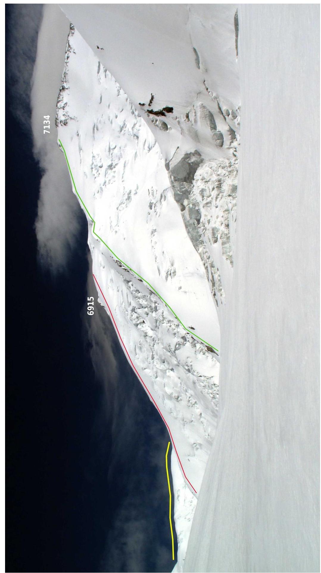 Fig. 3.2. View of Lenin Peak from the south from Malaya Saukdara Glacier (photo by Ivan Zhdanov, 2009). The route via the South-West Ridge of the Western Crest is marked with a red line. The route via the Western Crest (V. Kovalev, 1954) is marked with a yellow line. The route via the South-West Crest (N. Yushin, 1967) is marked with a green line.
4. ROUTE PROFILE PHOTO
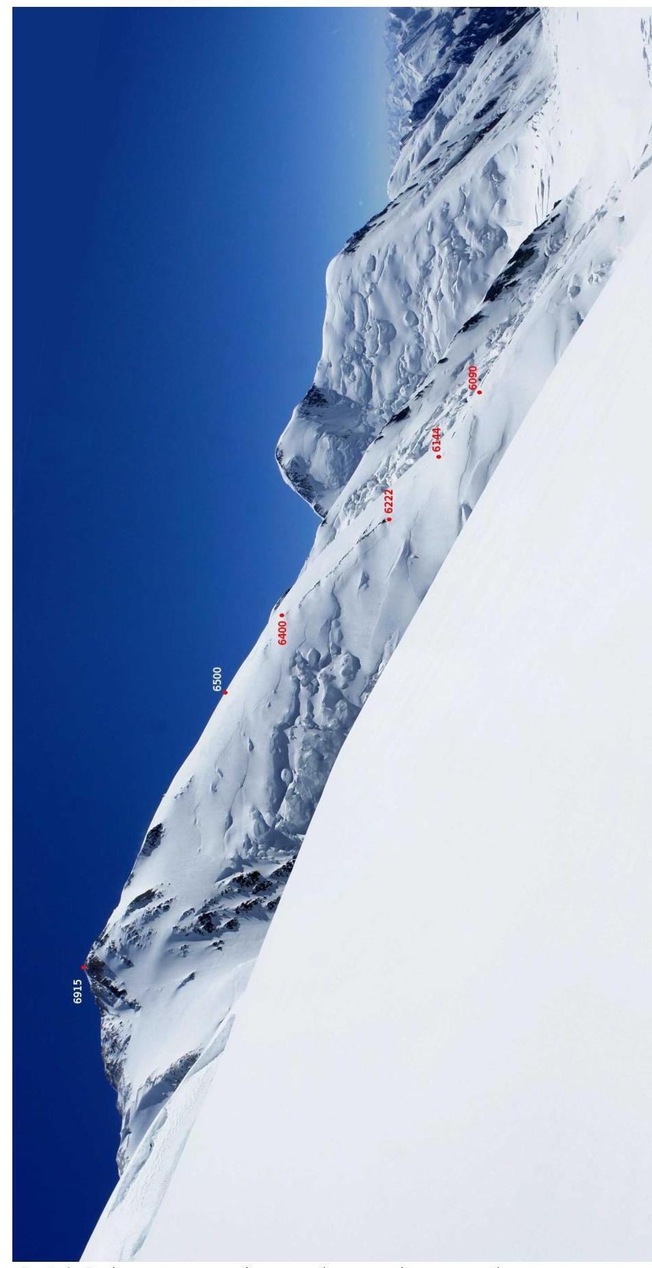 Fig. 4.1. View of the South-West Ridge of the Western Crest on descent from the Western shoulder of Lenin Peak to Malaya Saukdara Glacier (photo by Ivan Zhdanov, 2012).
5. ASCENT AREA MAP
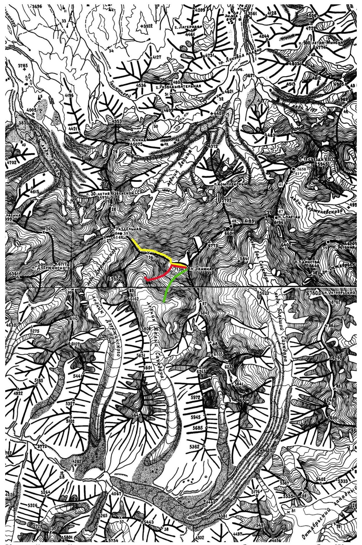
The route via the South-West Ridge of the Western Crest is marked with a red line. The route via the Western Crest (V. Kovalev, 1954) is marked with a yellow line. The route via the South-West Crest (N. Yushin, 1967) is marked with a green line.
6. TECHNICAL PHOTOGRAPHY OF THE ROUTE
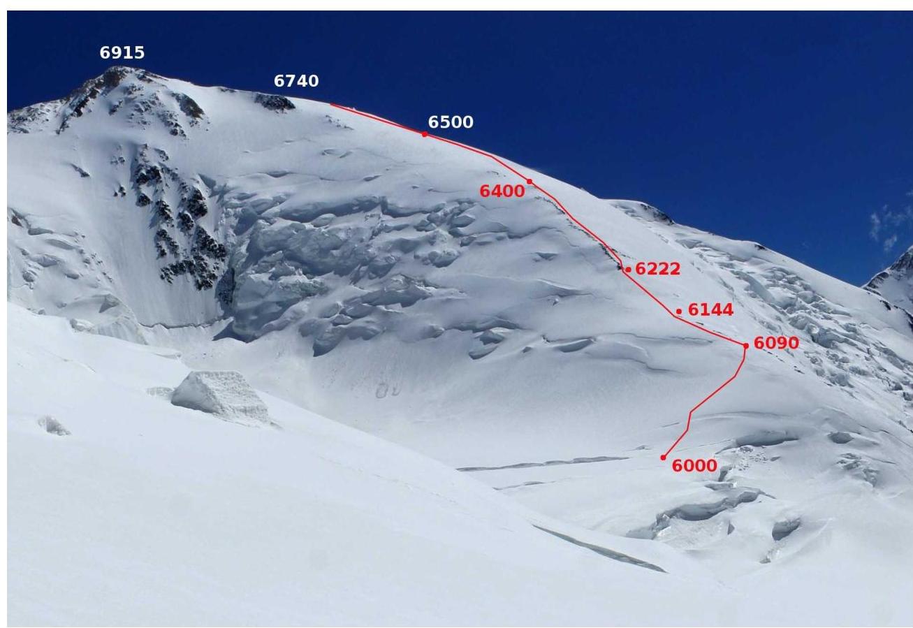 Fig. 6.1. Elevations 6000, 6090, 6144, 6222, 6400, 6740 divide the route into sections. Elevation 6500 — bivouac site for the night of August 31 to September 1.
7. ROUTE SECTIONS
- 6000–6090 — exit from the plateau to the ridge. Snow-ice slope with rare crevasses.
- 6090–6144 — ridge with scree.
- 6144–6222 — snowy slope.
- 6222–6400 — rocky ridge with scree and rock outcrops (hereinafter — "rock-scree ridge"). Short walls are found on the rocks.
- 6400–6740 — slope with deep snow, average steepness around 30°.
- 6740–6909 — snowy slope, gradually flattening and transitioning into a plateau.
8. ASCENT SCHEDULE
August 31. 5908–6500, 7 hours. Approach to the route and ascent to 6500. Clear.
September 1. 6500–6909, 5 hours. Ascent to Parachutists' Plateau 6909. Clear.
September 2. 6909–7134–6584, 2 hours ascent + 4 hours descent via the Western Crest. Strong wind in the morning, snow, visibility 20 m. From 10:00 to 12:00, visibility appeared with strong wind. Visibility almost disappeared after lunch.
September 3. 6584–4400, 6 hours. Descent to "Gory Azii" camp 4400 on Lenin Glacier.
9. PHOTO ILLUSTRATIONS
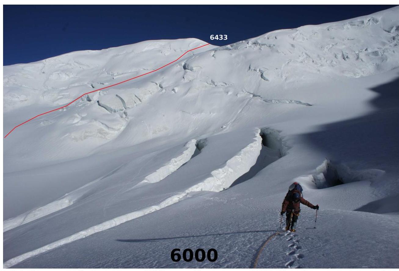 Fig. 9.1. At the beginning of the ascent from plateau 6000 to the ridge to point 6090. The descent route from the Western shoulder of Lenin Peak to Malaya Saukdara Glacier is marked with a red line in the background.
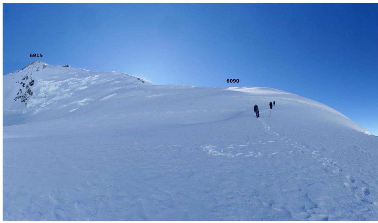 Fig. 9.2. Ascent from the plateau to the ridge to point 6090.
 Fig. 9.3. Ascent to the rock-scree ridge.
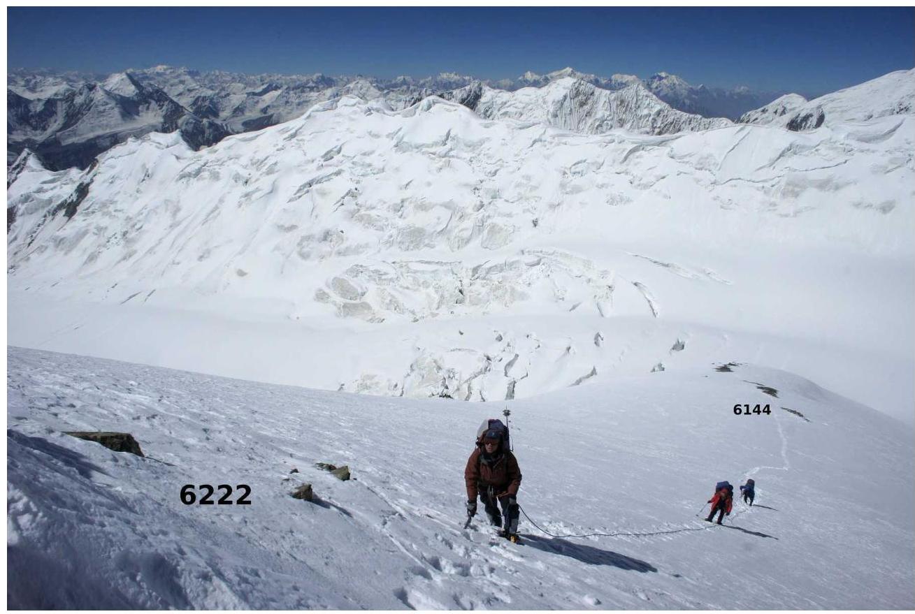 Fig. 9.4. On the ascent to the rock-scree ridge.
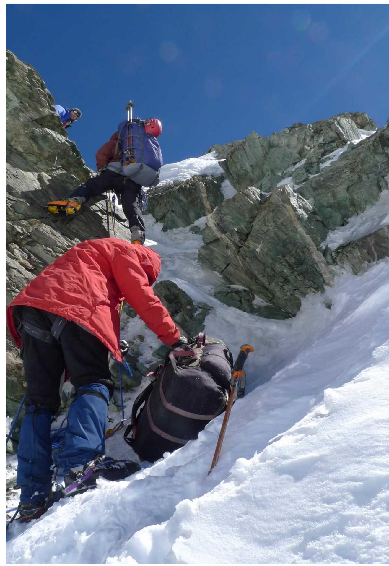 Fig. 9.5. Overcoming a gendarme.
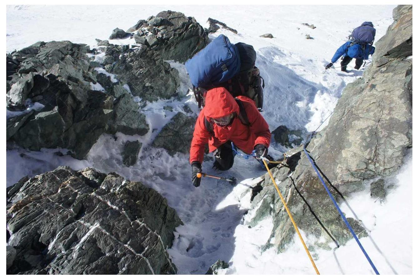 Fig. 9.6. Rappel on a rock wall.
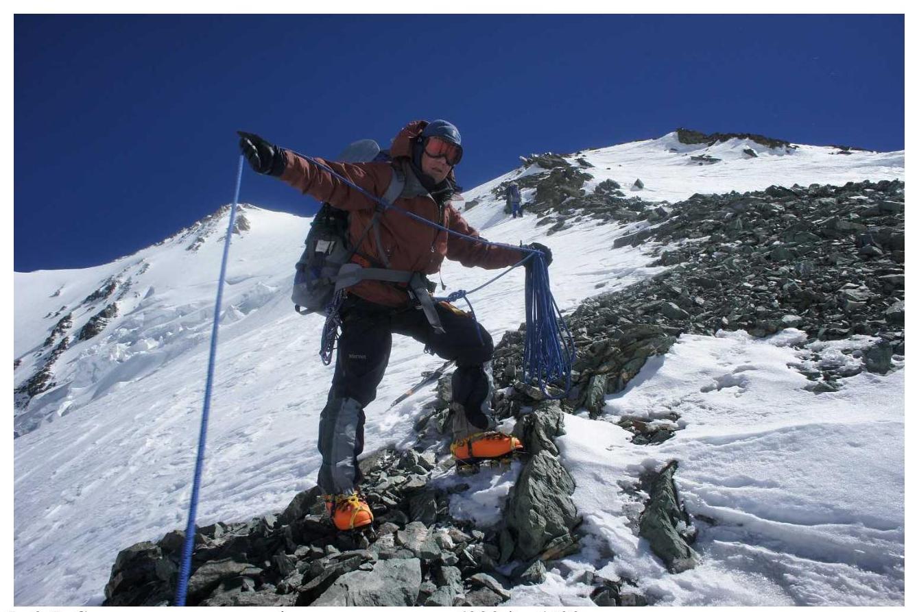 Fig. 9.7. Rock-scree ridge on the section from 6222 to 6400.
 Fig. 9.8. Movement along the rock-scree ridge.
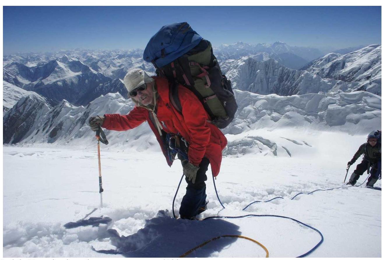 Fig. 9.9. Approaching the bivouac at 6500 m.
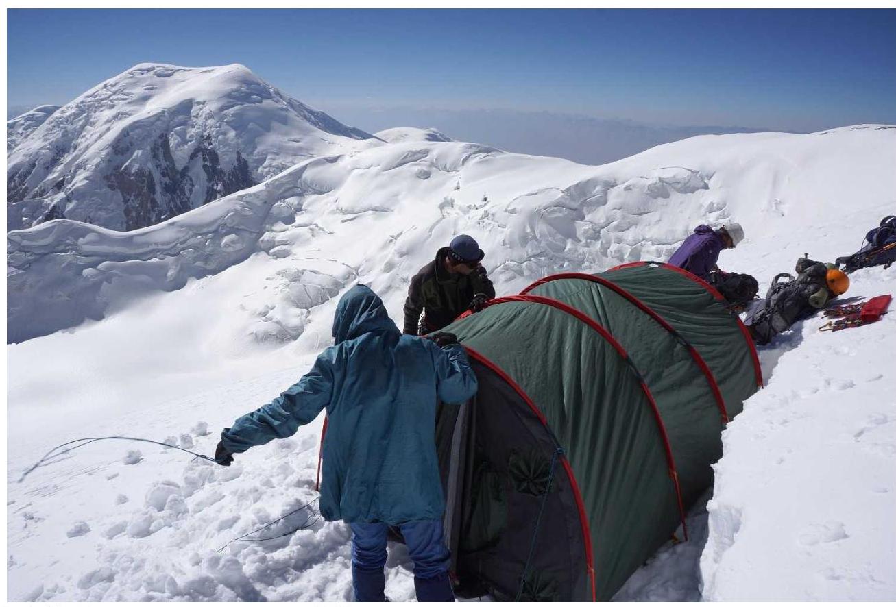 Fig. 9.10. Setting up a tent at 6500.
 Fig. 9.11. Snowshoe trail on the way to plateau 6900.
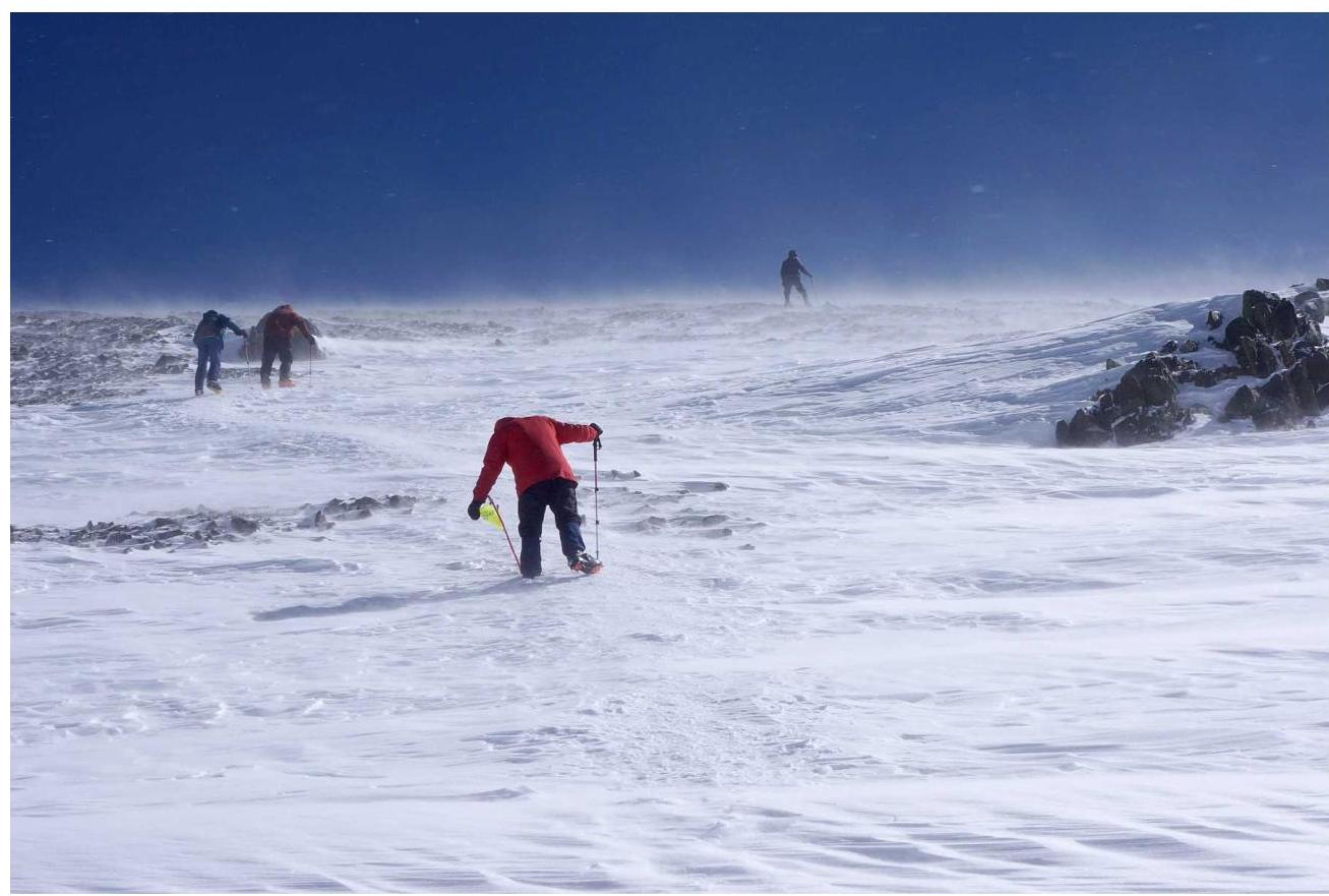 Fig. 9.12. On the morning of September 2, we attempted to exit camp 6909 to the summit of Lenin Peak. However, bad weather (wind, snowfall, visibility 20 m) forced us to return to the tent. Two hours later, the wind intensified, but visibility appeared, and we exited to the summit for the second time.
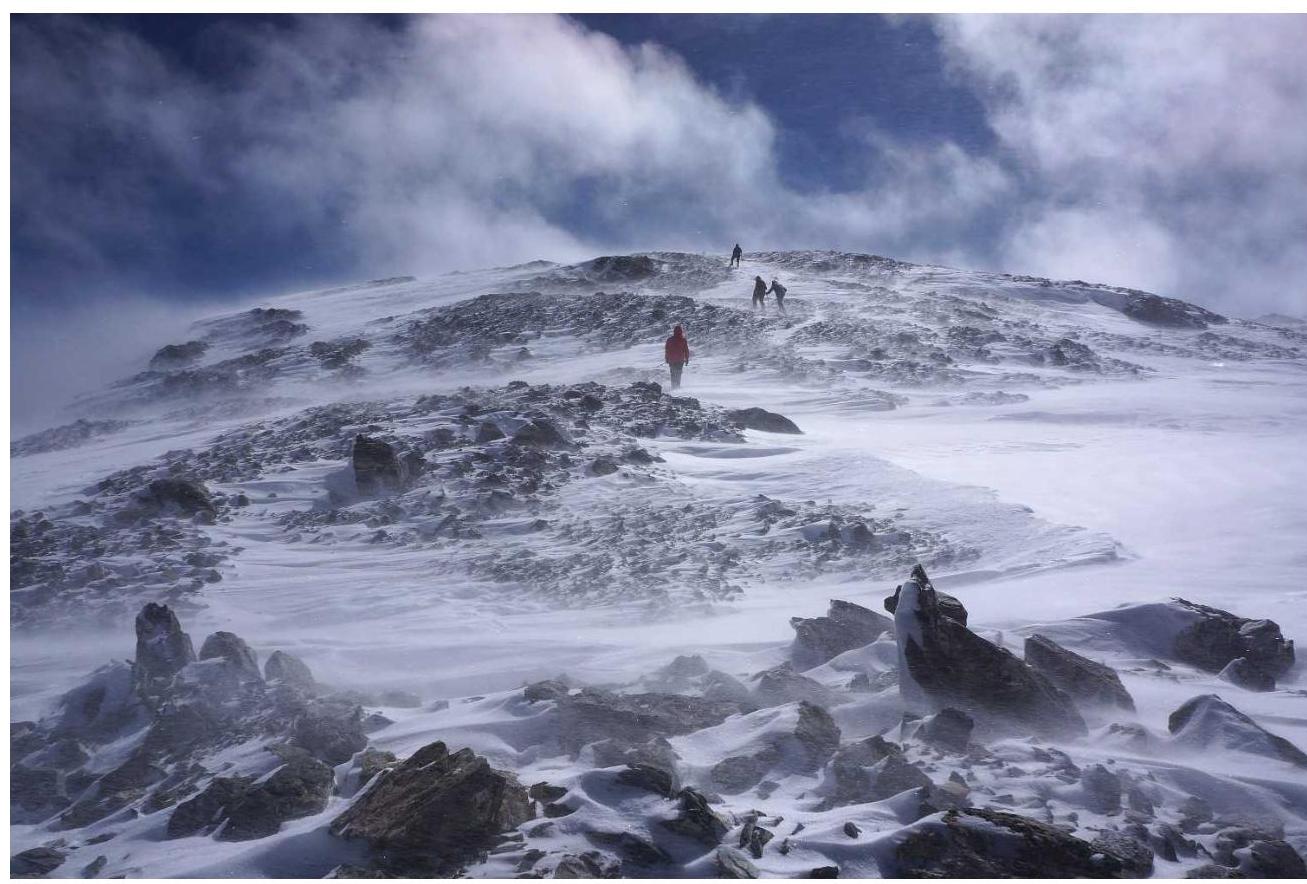 Fig. 9.13. On the scree above 7000 m.
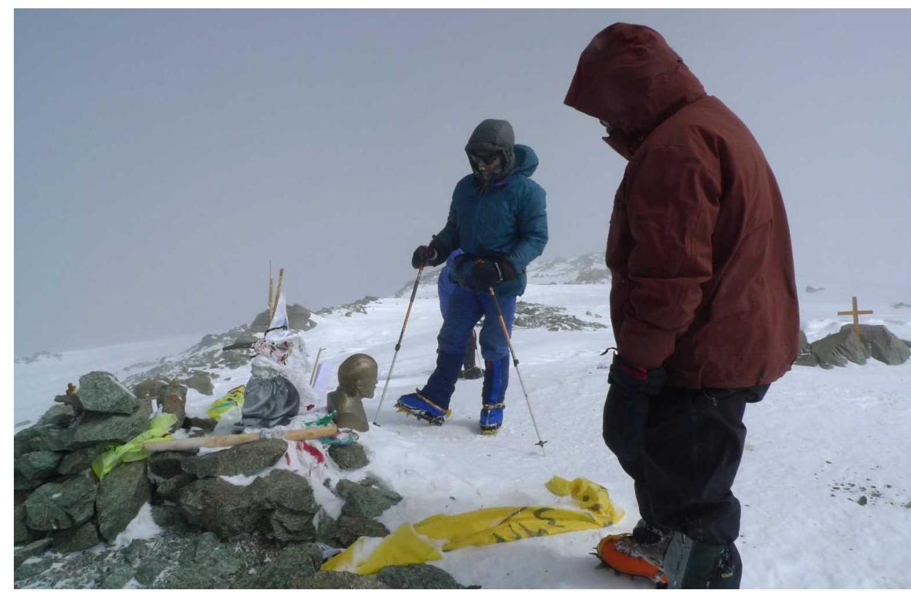 Fig. 9.14. Between 2010–2012, someone dragged a bust of Lenin to the summit.
 Fig. 9.15. At the summit of Lenin Peak (7134 m).
10. APPROACHES TO THE ROUTE
10.1. Approach from Razdelny Pass. From Razdelny Pass, one should ascend to the Western shoulder of Lenin Peak and almost immediately after the ascent, at a point with coordinates 39° 21.22′ N 72° 50.65′ E, begin descending along a wide and gentle snow-ice gully to Malaya Saukdara Glacier, see fig. 9.1 and 10.1.
 Fig. 10.1. Descent route from the Western shoulder of Lenin Peak to Malaya Saukdara Glacier.
On the descent, sometimes one has to navigate around crevasses. From Razdelny Pass to camp 5908 on Malaya Saukdara Glacier, it takes 4 hours of walking for an acclimatized group.
10.2. Approach from the south from Bolshaya Saukdara valley via Malaya Saukdara Glacier involves overcoming Malaya Saukdara's icefall and is described in [1].
11. ASCENT DESCRIPTION
August 31. Clear morning. We left camp 5908 m on Malaya Saukdara Glacier at 9:30. After crossing the icefall, we ascended to plateau 6000 m, see fig. 6.1, from which the route to Lenin Peak begins.
We ascended a non-steep snow-ice slope to the ridge. Elevation 6090. We followed the ridge to elevation 6144 on scree. Between elevations 6144 and 6222, scree is absent, snow is loose, so we had to wear snowshoes, see fig. 9.3 and 9.4.
Between elevations 6222 and 6400, a rock-scree ridge emerges from the snow, starting with a rocky gendarme, see fig. 9.5. Bypassing the gendarme via loose and steep snow is significantly more difficult than climbing it via the rocks. We placed around 8 meters of rappel on the gendarme. There are a couple more short walls on the rock-scree ridge. Except for these sections, the rest of the path along the rock-scree ridge is traversed in belayed teams simultaneously, see fig. 9.8.
Above 6400 and up to Parachutists' Plateau (6900), the ascent follows a snowy slope. Up to elevation 6740, this slope maintains a steepness of around 30° and becomes even steeper in the upper part. At elevation 6740, there is a bend. Beyond the bend, the slope becomes gentler, and as you ascend, it becomes even gentler, gradually transitioning into plateau 6900. The snow on the slope is deep and loose, so we wore snowshoes, periodically changing the lead.
At elevation 6500 m, we found the gentlest spot on the slope and dug out a bivouac site, see fig. 9.10.
September 1. Clear morning. By lunch, we "finished off" the slope and ascended to Parachutists' Plateau 6900. After a difficult trek, see fig. 9.11, everyone felt tired, so we postponed the ascent to Lenin Peak's summit until morning. The elevation of the camp is 6900 m.
September 2. Wind and snow at night. We left the camp without breakfast around 8:00, with no visibility. We relied on GPS, but then realized we were taking a risk — if the GPS fails or gets lost, the team is done. Not having traveled a hundred meters, we returned to the tent.
Two hours later, we woke up to the sun. We looked outside — visibility had returned! We gathered again and headed to the summit, battling strong winds, see fig. 9.12.
On the descent from the summit, visibility began to deteriorate again, so upon returning to the camp, still booted and dressed, we decided to descend immediately. While packing up the camp, visibility dropped to 50 m. With difficulty finding the wands, we approached the edge of the plateau. Everything below was in dense fog. I remembered there was supposed to be a traverse of the slope to the Western Crest, but I had no idea of the slope's scale or avalanche danger. Right on the edge of the plateau, on the ridge, we started digging out a spot for a tent. The spot was ready, and we even pulled out the tent when it suddenly cleared up, and we saw another wand directly 30 meters below us, and the next one almost on the Western Crest. It turned out we just had to cross a small snowy gully or ravine.
We crossed the ravine and began descending along the Western Crest in breaks in the fog. On a short ascent of the crest above the "knife," we cleaned the slope and consciously triggered 20-centimeter snow slabs. Then we found the "knife." We couldn't find the fixed rope at first; it was deeply buried in the snow. We descended to the left along the rocks using our own rope. Only at the bottom did we notice that the camp rope was actually there. Below the "knife," we found a gentle spot and set up camp at an elevation of 6584 m.
September 3. We barely slept at night. A hurricane-force wind hit the tent. Thankfully, Misha Babich didn't slack off and set up additional storm guy lines in the evening. The tent wasn't just flapping and hitting; it was periodically slapping loudly above our ears like a powder pistol. Moreover, the tent started getting buried. High ridges of dense snow formed outside, at our feet and head.
Then it got stuffy, but as soon as I tried to open the entrance, about 10 liters of snow fell into the tent. I scooped it out with a tablet, wiped everything with toilet paper, opened the window, and fell asleep satisfied. Waking up from another slap, I saw that another 10 liters of snow had accumulated through the window! And so it went all night…
In the morning, the wind died down, and we immediately started packing up. As we were packing, a large group of climbers led by guide Yuri Yermachek from the camp on Razdel'naya Peak caught up with us.
The descent to camp 4400 m on the moraine of Lenin Glacier passed without incident. The whole day was sunny, with numerous cumulus clouds periodically covering the summit.
12. ASCENT ORGANIZATION
- The ascent was conducted as part of a 6th category sports mountaineering trip, submitted for the Russian Tourism Championship [2]. Route book No. 1/3-602, approved on June 20, 2012, by MKK FT Moscow.
- The expedition was organized by the Sports Club of MAI.
- Hosting side — "Gory Azii" (Asia Mountains) company.
- We thank Marmot, Outdoor Research, Black Diamond, and the "Day of the Groundhog" store chain for the provided equipment.
13. REFERENCES
- A.A. Lebedev. Report on a 6th category mountaineering trip to Central and North Pamir, 2009. Library of MGCTK, report No. 6553. http://static.turclubmai.ru/papers/1847/0_ch.htm↗
- A.A. Lebedev. Report on a 6th category mountaineering trip to North Pamir, 2012. Library of MGCTK, report No. 7323. http://static.turclubmai.ru/papers/2052/↗