Moscow Alpine and Rock Climbing Federation
Report
On the First Ascent to the Summit 5368 (Peak Alexandr Gubaev)
Via the northwestern slope, category 3B difficulty
Moscow, MAI Tourism Club, 2008
1. Ascent Passport
-
Region: Zaalai Ridge. Valley: Kyzylsu (East Kyzylsu Glacier). Classification table section number for 2001 — 4.4
-
Summit name: 5368, proposed — Peak Alexandr Gubaev. Route name: Via the northwestern slope
-
Difficulty category — proposed 3B.
-
Route type: ice and snow.
-
Route elevation gain: 268 m (according to GPS readings)
Route length: main part of the route — 245 m, total route — 428 m. Length of sections: 4th category difficulty — 245 m. Average steepness: main part of the route — 51°, total route — 40.5°.
-
Pitons used on the route: rock — 0, ice — 22, including ITO — 0.
-
Team's total climbing hours: 4 hours.
-
Leader: Lebedev Andrey Alexandrovich (Moscow), Master of Sports of International Class (tourism), 1st sports category (alpinism)
Team members:
Zharov Andrey Viktorovich (Moscow, Zelenograd), 1st sports category (tourism),
Zhdanov Ivan Nikolayevich (Moscow), 1st sports category (tourism), 2nd sports category (alpinism),
Komarov Dmitry Alexandrovich (Moscow), 1st sports category (tourism),
Maximovich Yuri Alexandrovich (Moscow), Candidate Master of Sports (tourism),
Timoshenkov Alexey Sergeyevich (Moscow, Zelenograd), 1st sports category (tourism), 2nd sports category (alpinism),
Shapovalov Dmitry Sergeyevich (Kiev), 1st sports category (tourism),
Yanchevsky Oleg Zigmontovich (Kiev), Candidate Master of Sports (tourism).
-
Coach: Khokhlov Yuri Vladimirovich (Moscow), Master of Sports (alpinism).
-
Departure for the route: 11:30 on August 24, 2008.
Summit arrival: 15:40 on August 24, 2008. Descent to the glacier: 17:50 on August 24, 2008.
2. Summit Photographs
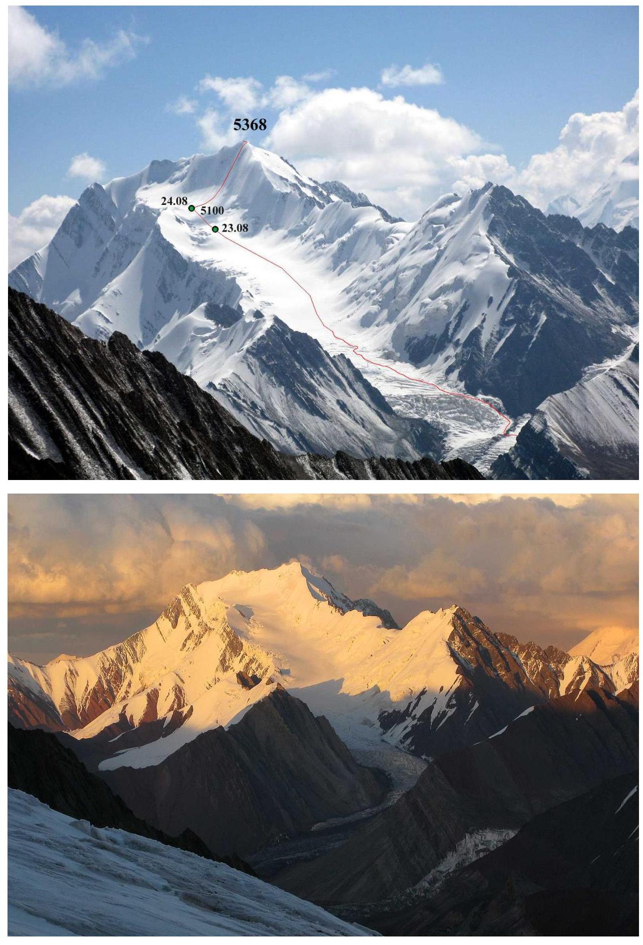 Fig. 2.1–2.2. View from the west from the eastern chamber of the East Kyzylsu Glacier. Taken on August 28, 2008.
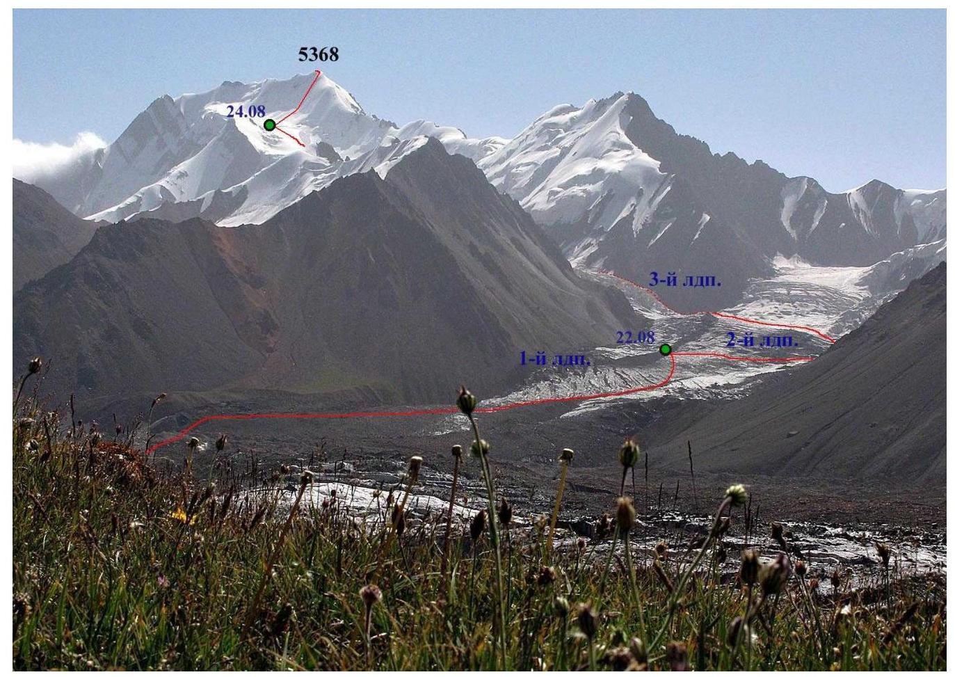 Fig. 2.3. View from the west from the left bank of the East Kyzylsu Glacier.
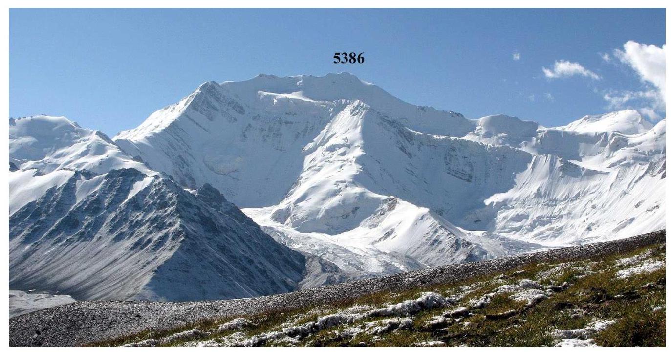 Fig. 2.4. View from the northwest from the left bank of the East Kyzylsu Glacier.
3. Route Profile Photographs
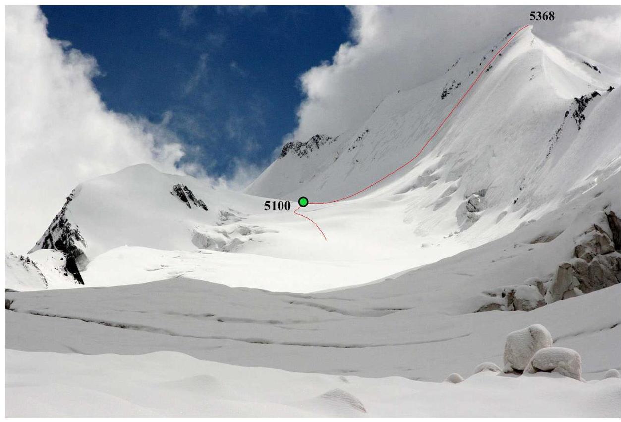 Fig. 3.1. View from the southwest towards the assault camp and the route.
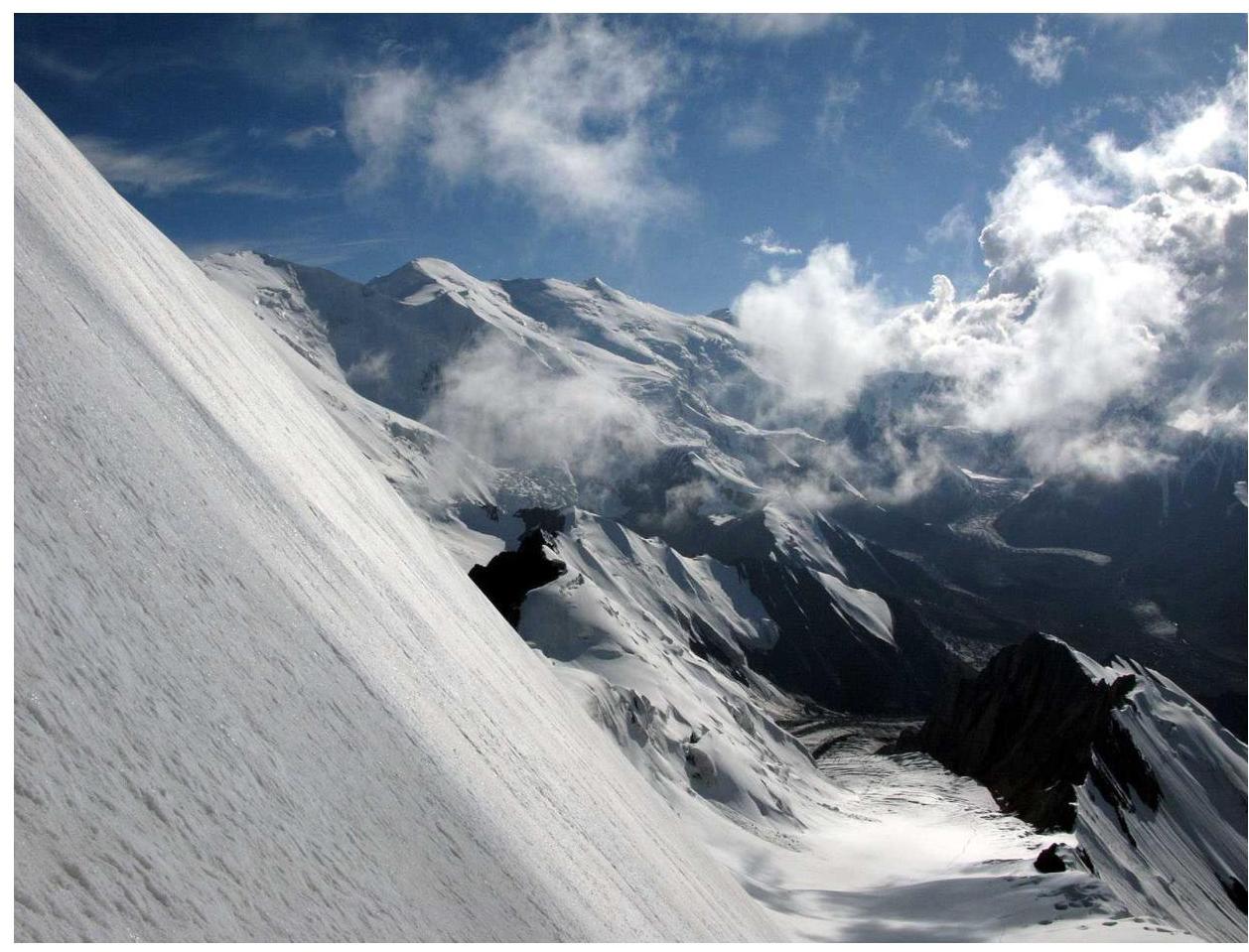 Fig. 3.2. View from the route (from the summit slope) to the southwest towards Kurumdy.
4. Panoramic Photographs of the Area
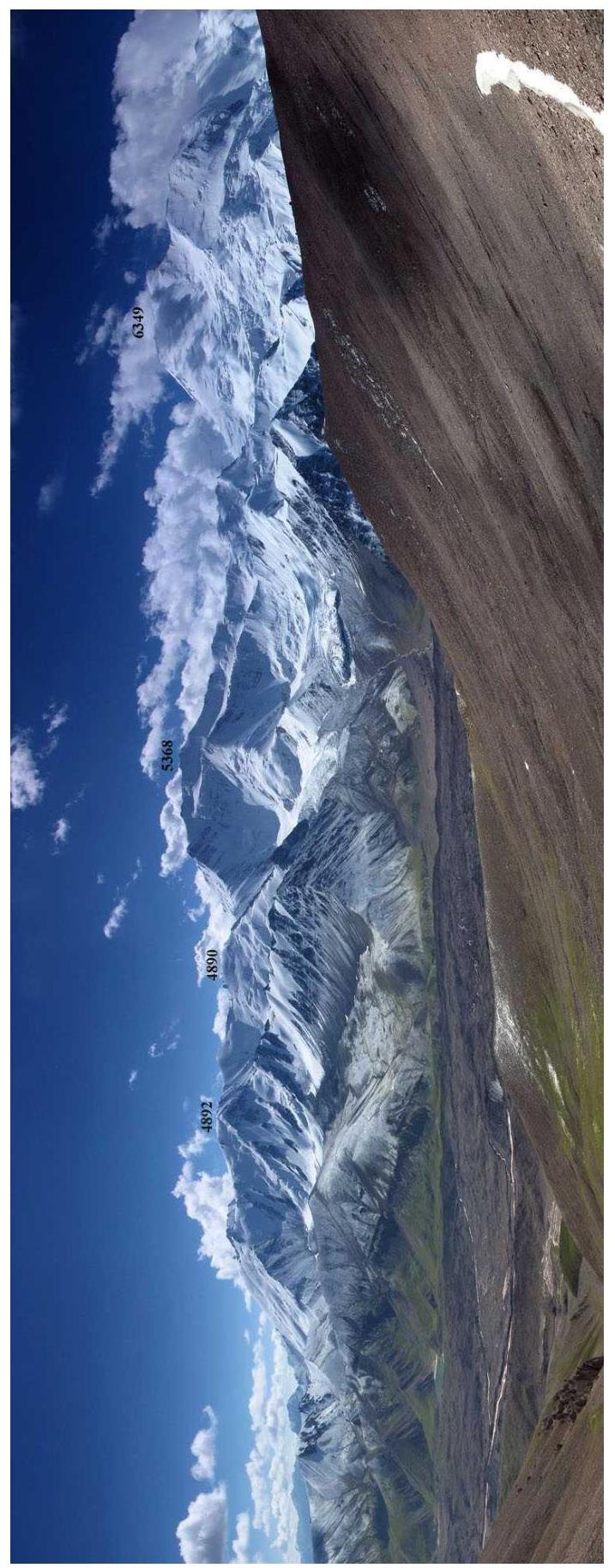 Fig. 4.1. View from the Transportny Pass (No. 4 on diagram 1) into the East Kyzylsu Glacier valley. To the right of summit 5368 rises Zarya Vostoka (6349).
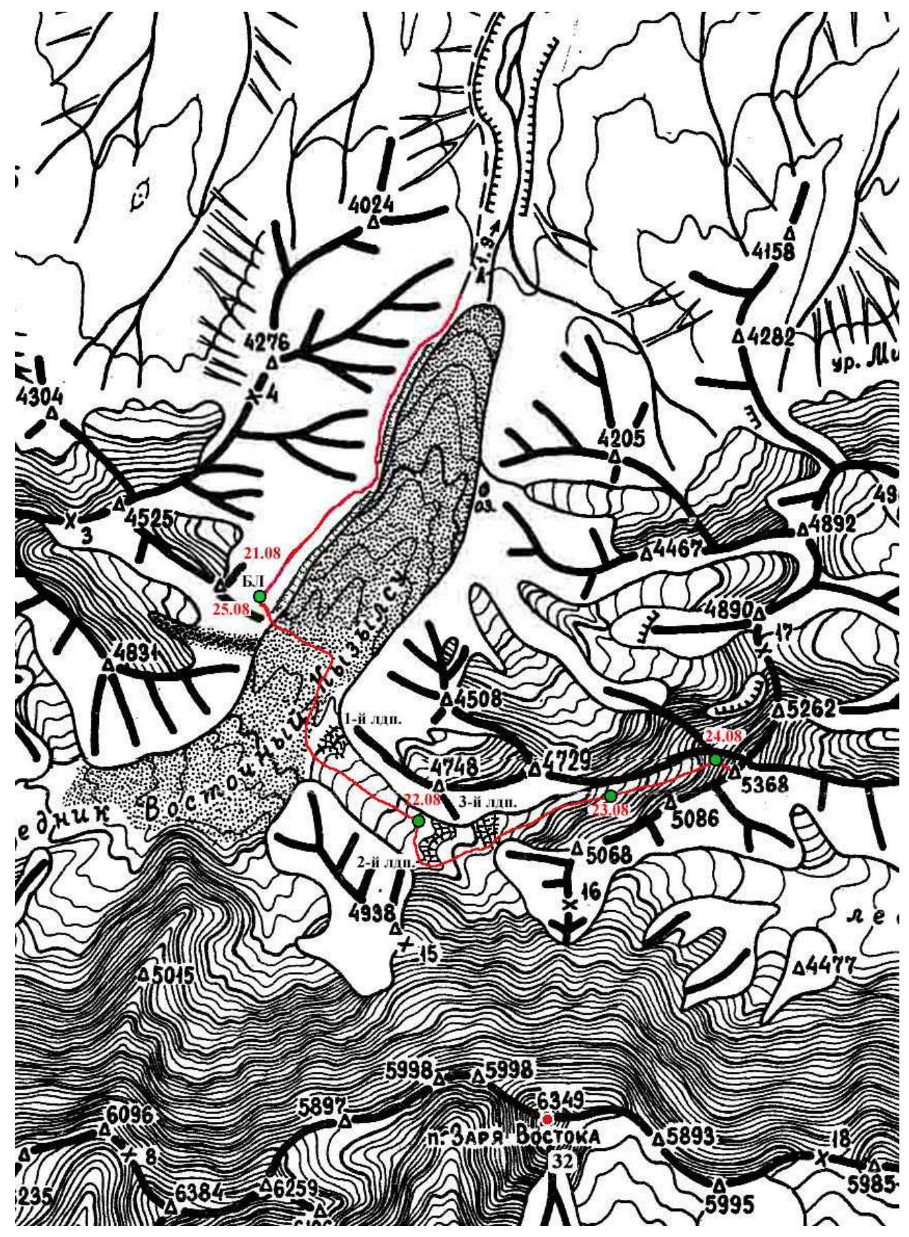
Diagram 1. Area of the East Kyzylsu Glacier and summit 5368
6. Brief Description of Summit 5368
Summit 5368 rises above the right bank of the East Kyzylsu Glacier, located north of the Zarya Vostoka massif (6349), and is the highest point of the northern ridges, separated from the Zaalai Ridge watershed between the East Kyzylsu and Nura glaciers.
Summit 5368 is an ideal observation point and is visible from everywhere.
Along the northeastern slope of the summit stretches an inclined shelf, from which a glacier flows to the west-southwest. This glacier forms the northern branch of the first right tributary of the East Kyzylsu Glacier.
The most straightforward approach to the summit is via this glacier.
7. Hand-Drawn Route Profile
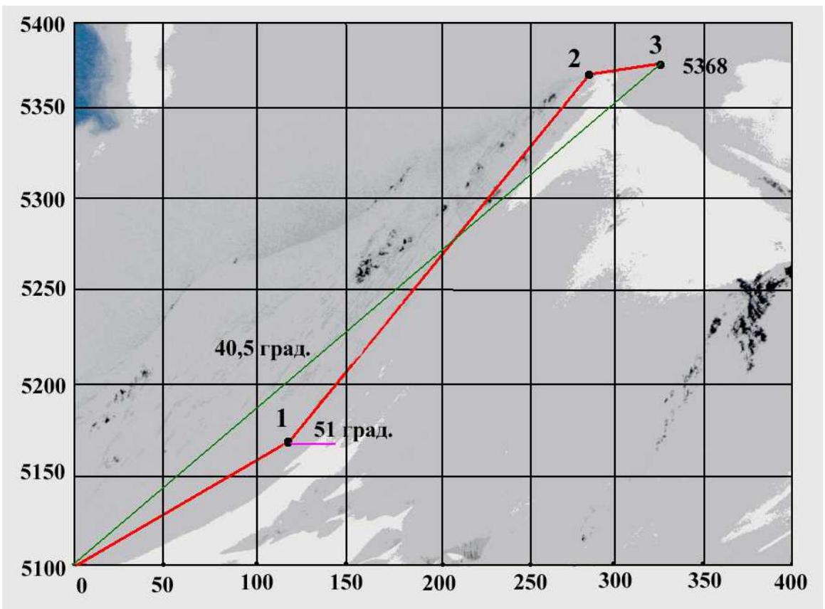
Fig. 1. Black numbers along the graph — section numbers of the route (marked at the ends of the corresponding sections).
8. Route Breakdown into Sections
| № | Section Type | Start Height [m] | End Height [m] | Technical Difficulty | Difficulty with Altitude Considered | Length [m] | Average Steepness [degrees] |
|---|---|---|---|---|---|---|---|
| 1 | Snow slope | 5100 | 5170 | 2 | 3 | 133 | 29 |
| 2 | Ice slope | 5170 | 5360 | 3 | 4 | 245 | 51 |
| 3 | Ridge with cornices | 5360 | 5368 | 2 | 3 | 50 | 9 |
Average steepness of the route — 40.5°. Average steepness of the main part of the route (section 2) is 51°. Route length — 428 m.
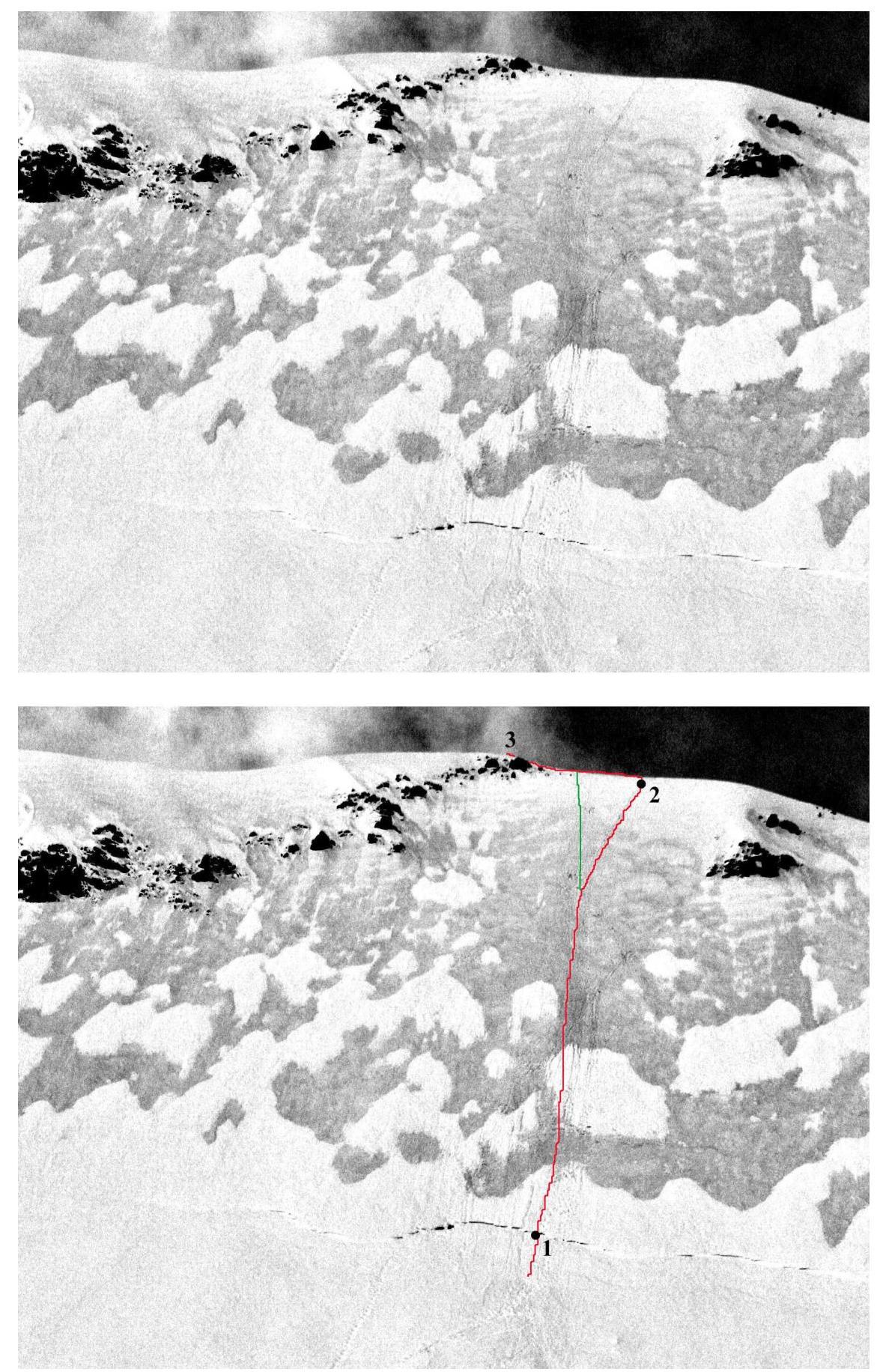 Fig. 9.1. Technical photograph of the route. Numbers indicate the ends of the corresponding route sections, see Table 1.
10. Description of the Path from the Base Camp to the Assault Camp
The base camp (BC) can be conveniently set up in a pocket of the left-bank moraine of the East Kyzylsu Glacier in front of the enormous moraine ridge of the glacier on the northern slope of summit 4834. Water can be obtained from the river that flows out from under this moraine ridge. There is also a clean stream that emerges from the ground above the clearing on the slope in its eastern corner.
The path to BC along the Kyzylsu River and the glacier moraine is well-known, quite obvious, and does not require a description, see diagram 1.
The group departed from BC on the morning of August 21. From the base camp, one should cross the hummocky and moraine-covered East Kyzylsu Glacier towards its right bank; the glacier is relatively flat near the right bank. Follow the East Kyzylsu Glacier up to its large right tributary, bypass it on the right, pass the 1st icefall, and enter the alignment of this right tributary, see diagram 1.
Climb the open ice up to the second icefall, located just below the confluence of the two glacier branches. Here, near the right bank of the glacier, on the rocks of the medial moraine, a camp can be set up.
The group arrived at this location at noon on August 22. After lunch, they conducted a reconnaissance and found a bypass for the 2nd icefall. They decided to spend the night here to ensure more substantial acclimatization (this was the 4th day in the mountains).
The second icefall is bypassed on the right under the slopes of the Zarya Vostoka summit. On a short section of this bypass, one has to "run" about 50–70 meters through ice debris in the zone of ice fall. Above this section is an exit to the plateau where the two glacier branches merge.
Follow the plateau to the right-hand edge of the 3rd icefall — the icefall of the northern branch of the glacier, which descends from summit 5368, see Fig. 11.1. The icefall is passed on the right (along the orographically left bank). Here it is not complicated — there are possibly two or three 50-degree, 5–10-meter walls, and at the exit from the icefall, there is a wide crevasse (up to 2 m), see Fig. 11.2. Most likely, the crevasse can be overcome using some ice plug.
Above the icefall, there are many crevasses on the glacier; navigating around the crevasses ends above 4600 m when the thick snow cover begins, see Fig. 11.3. On the snow plateau at an altitude of 5100 m, opposite the icy northeastern slope of summit 5368, it is advisable to set up an assault camp, see Fig. 11.4.
The group ascended to the 5100 m plateau on the morning of August 24. They set up tents and departed for the ascent around 11:30, see section 12.
11. Photo Illustrations of the Path to the Assault Camp
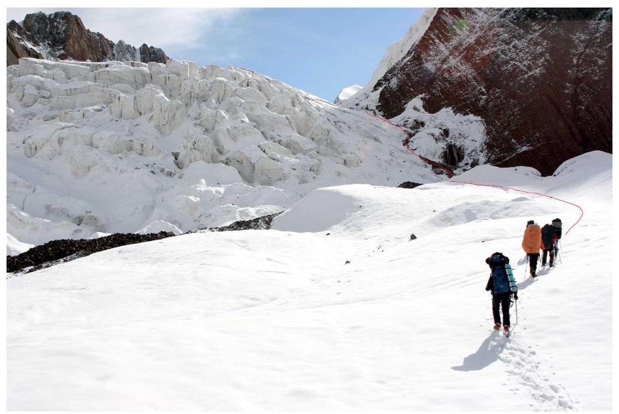 Fig. 11.1. Icefall at the mouth of the northern branch of the right tributary of the East Kyzylsu Glacier (3rd icefall, see diagram 1).
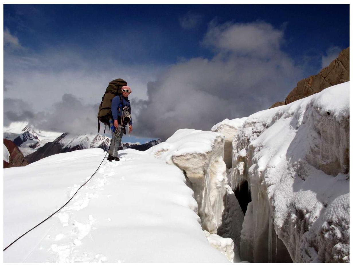 Fig. 11.2. The final crevasse of the 3rd icefall.
 Fig. 11.3. Path to the assault camp above the 3rd icefall.
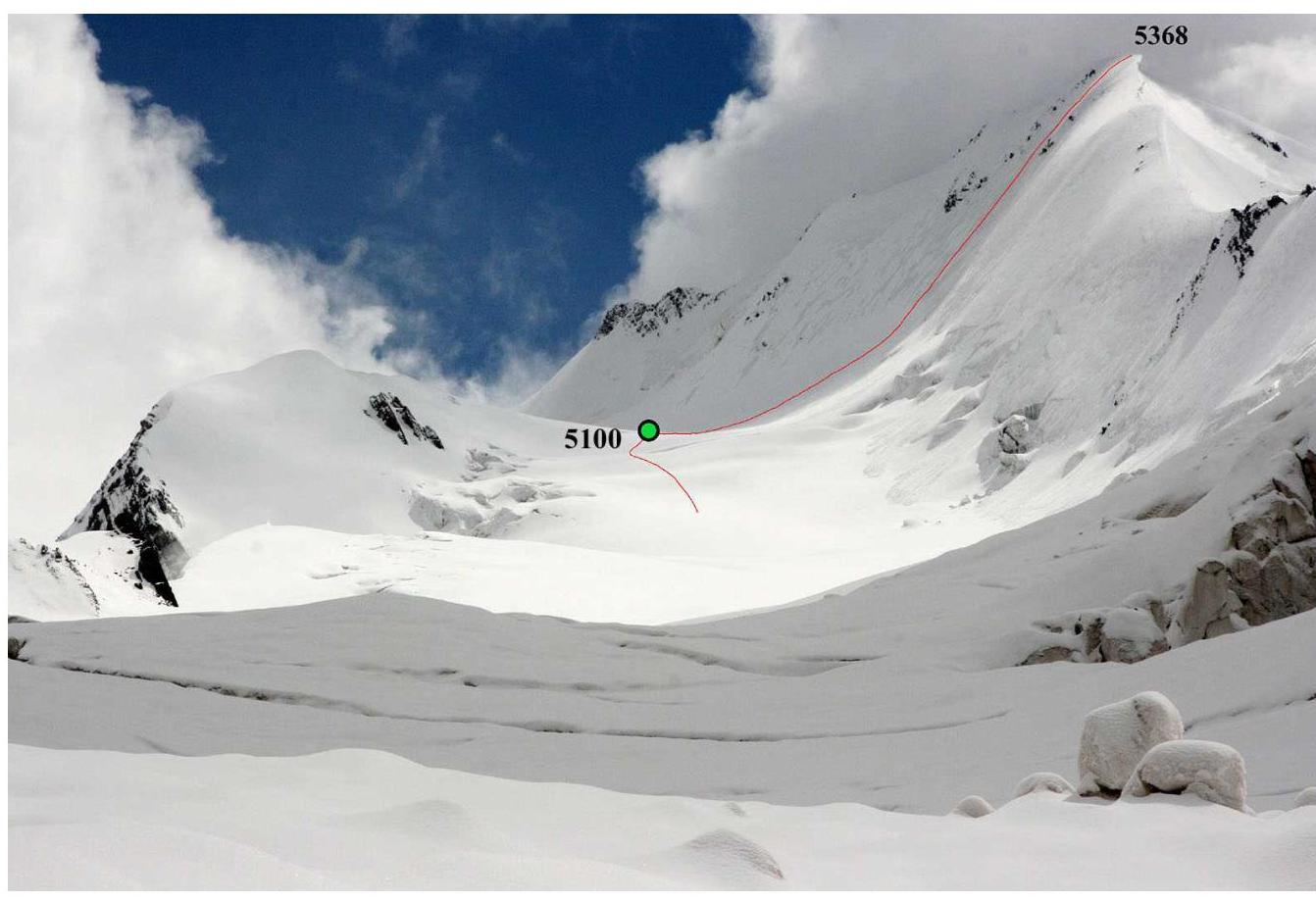 Fig. 11.4. Assault camp (5100 m) and the route to summit 5368.
12. Description of the Ascent to the Summit
Opposite the 5100 m assault camp rises an icy slope of summit 5368, undercut by a bergschrund, see Fig. 9.1 (technical photo). The slope's length above the bergschrund is 240–250 meters, with a steepness of about 50 degrees. The bergschrund is not wide and can be easily crossed via a snow bridge.
To avoid falling rocks, it is advisable to ascend via the icy strip between the rock outcrops, which leads slightly to the right of the summit, see Fig. 9.1, 11.4, and 13.1. Then, 5 ropes of fixed lines lead to the ridge.
On the ridge, there are large and dangerous cornices to the east. Here, one should turn left and ascend along the line of cornice break-off towards the summit, see Fig. 13.2. The highest point is on a cornice, and ascending to it is hazardous due to the risk of cornice collapse. It is better to stop near the line of cornice break-off.
Descent to the assault camp follows the ascent route.
The group departed from the assault camp (5100 m) on August 24 at around 11:30 and reached the summit in 4 hours at 15:40. They descended to the assault camp (5100 m) by 17:50 and did not continue further, as the ascent was also conducted for acclimatization, and a night at 5100 m was required to fulfill future plans.
The next day (August 25), the team descended to BC by evening.
13. Photo Illustrations of the Ascent to the Summit
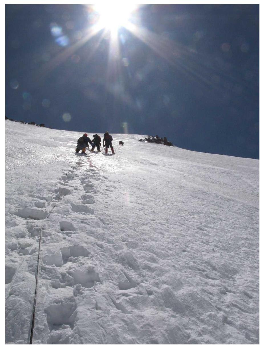 Fig. 13.1. At the beginning of section 2.
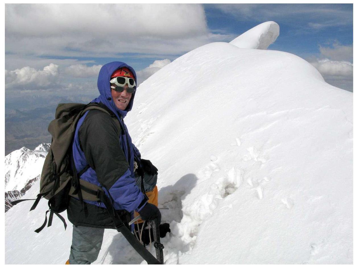 Fig. 13.2. The final meters of the summit ridge (Andrey Lebedev).
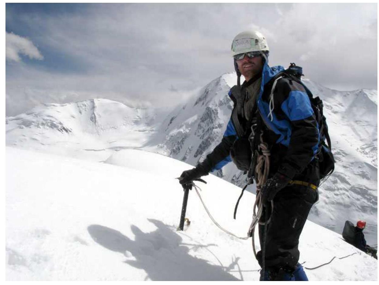 Fig. 13.3. On the summit at the edge of the cornice break-off (Andrey Zharov).
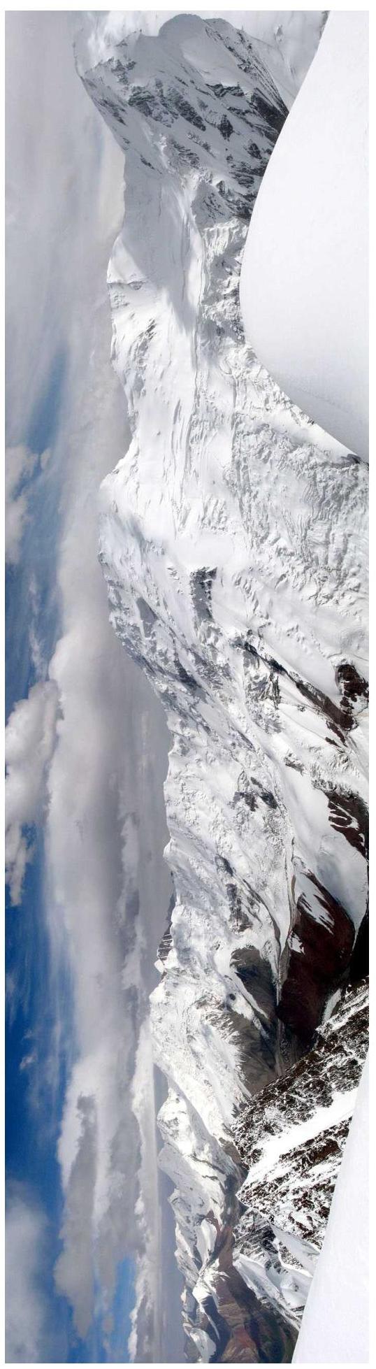 Fig. 13.4. Panorama from the summit to the east towards the mountains surrounding the Nura Glacier.
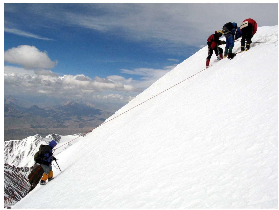 Fig. 13.5. Beginning of the descent from the summit. In the lower left corner, behind the descending participant, a rock outcrop is visible where a plaque can be secured.
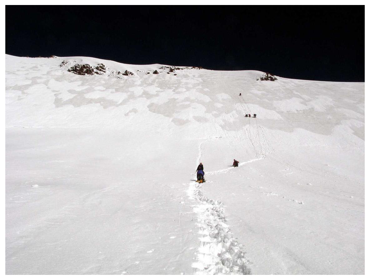 Fig. 13.6. Completion of the descent from the summit.
 Fig. 13.7. View from the assault camp towards the descending group.
Report author — Lebedev Andrey Alexandrovich, September 6, 2008