PASSPORT
-
High-altitude technical climb.
-
North-West Pamir, Bivachny Glacier.
-
Pik Rossia, 6878 m, center of the SE wall.
-
Proposed - 6B, first ascent.
-
Elevation gain - 2052 m, length - 2332 m. Length of sections 5-6B - 1615 m. Average steepness of main sections: 47° snow-ice slope (4800-5600 m), 70° wall (5600-6750 m), 30° pre-summit ridge (6750-6852 m).
-
Pitons driven:
rock 219
bolts - chocks 29
ice 82
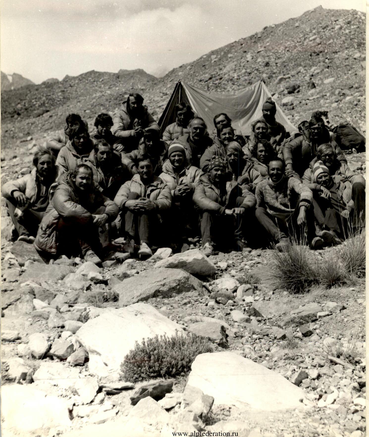
- Team's climbing hours: 71.0 h, days - 6.
- Overnight stays: 1,3 - lying on ice
2,4 - semi-reclining on rocks, 5 - sitting on rocks and snow.
- Leader: Nevrotin Vadim Kirillovich, Master of Sports
Deputy leader: Ivanov Alexander Vasilyevich, Candidate for Master of Sports
Team members:
- Artamonov Alexey Vladimirovich, Candidate for Master of Sports
- Bastrikov Vyacheslav Petrovich, Candidate for Master of Sports
- Dubroskikh Vladimir Viktorovich, Candidate for Master of Sports
- Melnik Vladimir Grigoryevich, Candidate for Master of Sports
- Shumikhin Gennadiy Ivanovich, Master of Sports
- Yagupov Sergey Nikolayevich, Candidate for Master of Sports.
- Coach: Nevrotin Vadim Kirillovich, Master of Sports of the USSR.
- Departure on the route: July 31, 1982.
Summit - August 5, 1982. Return August 7, 1982.
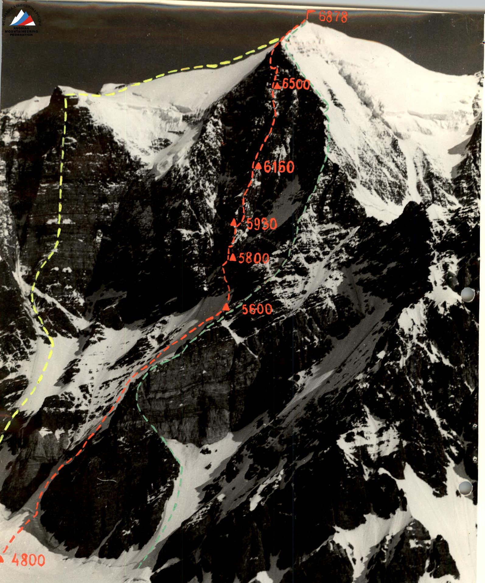
Pik Rossia 6878 m. Photo taken on August 1, 1982 at 11:00 from the slopes of Pik Oktyabrskaya Magistral. Lens T-22, F=80 mm. Distance 3 km, height ~5500 m. Point # 1.
- ——— route by V. Bozhukov 1974
- ——— route by E. Ilyinsky 1979
- ——— route by the CSFIS team 1982

Profile of the wall on the right
Photo taken at 14:30 from a Mi-8 helicopter over the slopes of Pik Glukhovtseva.
- Lens: Industar-58, F=80 mm
- Shooting point: # 2, H ~5000 m
- Date: September 1, 1982
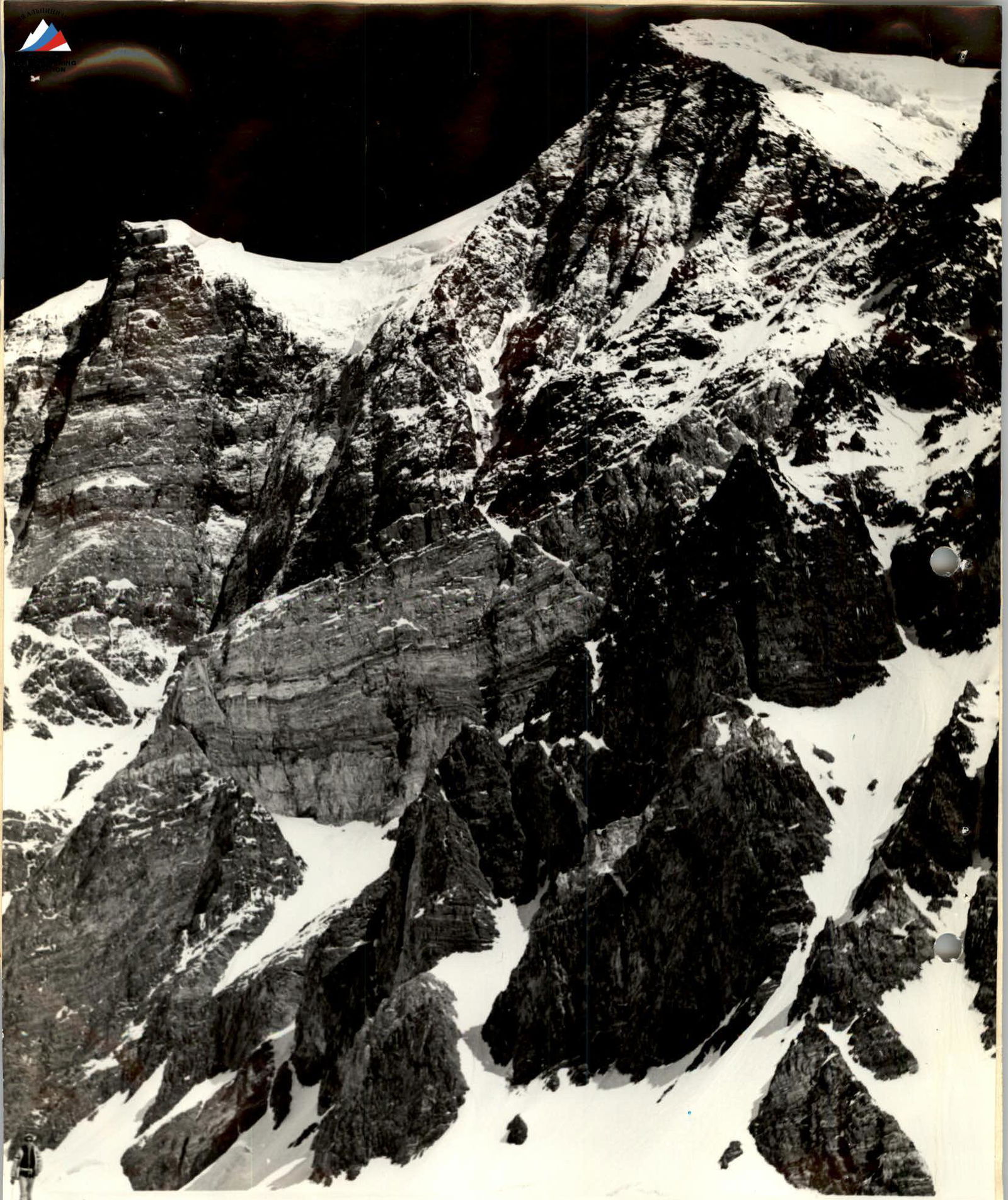
Profile of the wall on the right
Photo taken on July 26, 1982 at 12:00 from l. Krutoy.
- Lens: Industar-58, F=80 mm
- Distance: 2 km
- Height: 4700 m
- Point: 3
Preparation for the ascent
The first acquaintance with the south-eastern wall of Pik Rossia took place in 1974. After the wall was climbed by the army team via the bastion in 1979, it became clear that the next route to be taken should be the one through the center of the wall, logically leading to the summit.
This year, a helicopter overflight of the ascent area was carried out. Photographing the wall was done from the Bivachny Glacier and Pik Oktyabrskaya Magistral, located opposite the wall. Before the ascent, the wall was studied, including the nature of illumination, timing and direction of rockfall, possible bivouac sites, and the most optimal ascent route was planned.
The team was composed mainly of participants who had experience of prolonged high-altitude work on Pik Moskva in 1981. The final stage of preparation was carried out in June of the same year at the "Dzhailyk" alpine camp, where team members climbed p. Ullu-Tau and p. Shkhelda via the Cherernoslivin and Subartovich routes.
The control standard for climbing a slope with an elevation gain of 800 m was completed by team members in Dzhirgital in 45-50 minutes.
The challenges of the ascent were:
- climbing the snow-ice slope in one day without prior processing;
- climbing the bastion in the center of the wall - a section without visible bivouac sites;
- increased rockfall hazard on the wall in hot weather.
To quickly climb the snow-ice slope, 12-tooth crampons of Ural design were used. The team members were named as having excellent physical fitness, good rock and ice technique (1st category in rock climbing).
As a main safety measure, early departures on the route and preliminary processing of complex sections early in the morning or late in the evening when there were no rockfalls were employed.
For effective use of medication in case of illness and inability to quickly descend, a three-liter cylinder with medical oxygen was taken on the route.
Ascent schedule
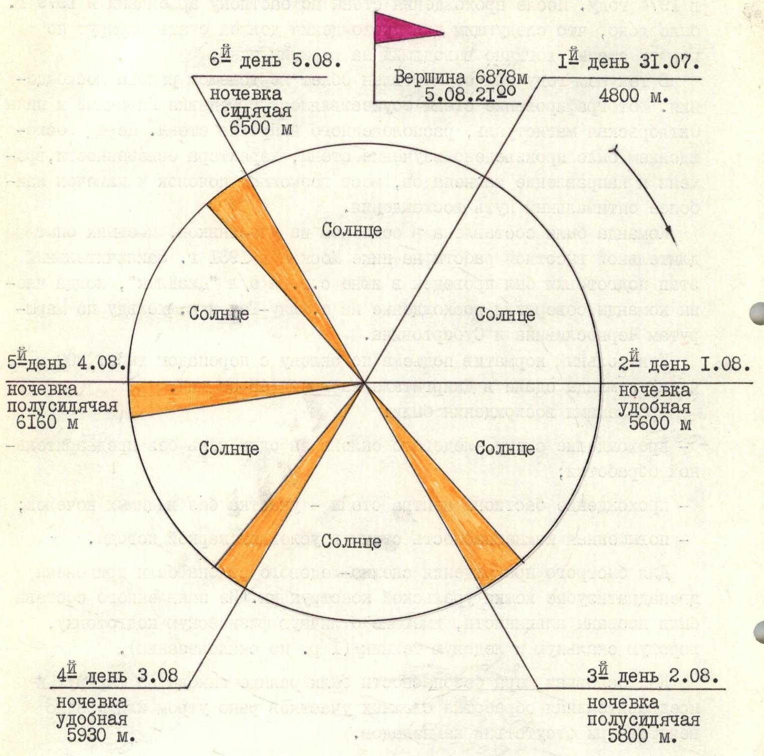
6th day August 5. Sitting bivouac 6500 m. Summit 6878 m August 5 21:20. 1st day July 31. 4800 m. 5th day August 4. Semi-sitting bivouac 6160 m. 2nd day August 1. Comfortable bivouac 5600 m. 4th day August 3. Comfortable bivouac 5930 m. 3rd day August 2. Semi-sitting bivouac 5800 m. — route processing.
Tactical actions of the team
The team's actions on the route were mainly determined by the tactical plan developed in accordance with the specific characteristics such as the wall's steepness and the number of climbers - eight people.
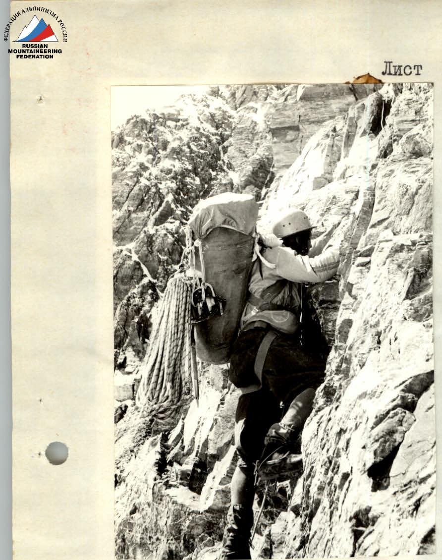
The first rope climbed technically complex sections, leaving fixed ropes for the rest of the team to follow and bring up ropes from below. The first climber typically went without a backpack, wearing galoshes, which ensured reliability on complex sections.
The following team members worked on the first rope:
- A. Artamonov
- V. Dubrovskikh
- V. Melnik
- S. Yagupov
The team departed on the route between 8:00 and 10:00 am. Daily climbing time was 10-12 hours. Hot meals were provided in the morning and evening. During the day, each participant ate dry rations distributed in the morning, including dried fruits, chocolate, and crackers.
Bivouacs were organized in places protected from rockfall by overhanging or sheer walls. There were no falls on the route. The challenging tasks of quickly climbing rockfall-prone and technically complex sections were successfully completed. Compared to the tactical plan, the team had one fewer bivouac due to the optimal climbing of the snow-ice slope. Otherwise, there were no deviations from the tactical plan.
The following equipment was used during the ascent:
- main rope manufactured in the GDR by the first rope,
- 12-tooth crampons,
- autoclaves for food preparation.
Communication with observers and the base camp via radio was regular from the moment the team started on the route. Observers had visual contact with the team after the first bivouac using a 30-60x telescope.
Sheet 8 UIAA ROUTE SCHEME
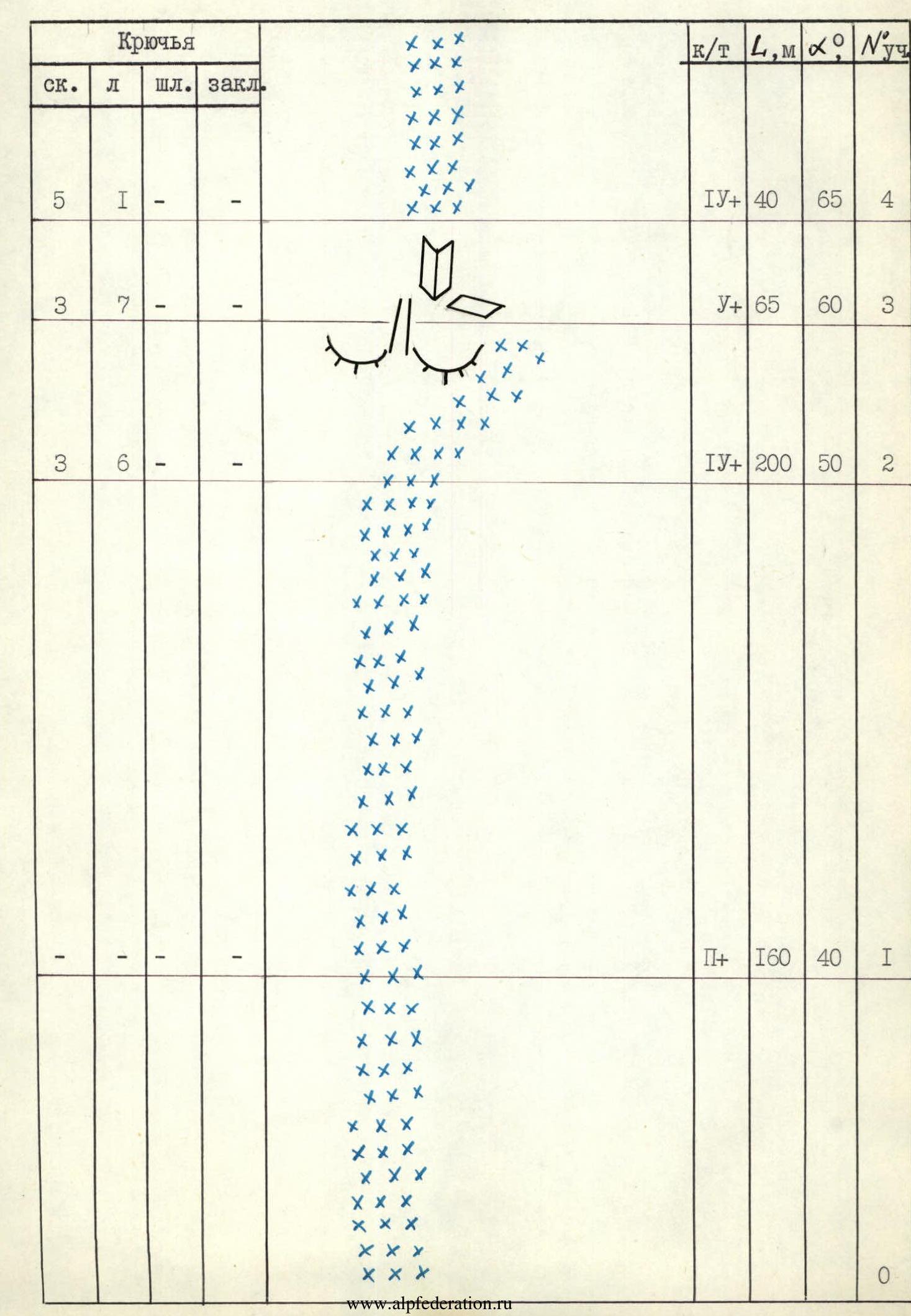
| Pitons | ||||||||
|---|---|---|---|---|---|---|---|---|
| rock | ice | bolt | chocks | Grade | L,m | α,° | Section # | |
| 5 | 1 | - | - | IV+ | 40 | 65 | 4 | |
| 3 | 7 | - | - | V+ | 65 | 60 | 3 | |
| 3 | 6 | - | - | IV+ | 200 | 50 | 2 | |
| - | - | - | - | II+ | 160 | 40 | 1 | |
| 0 |
Sheet 8a
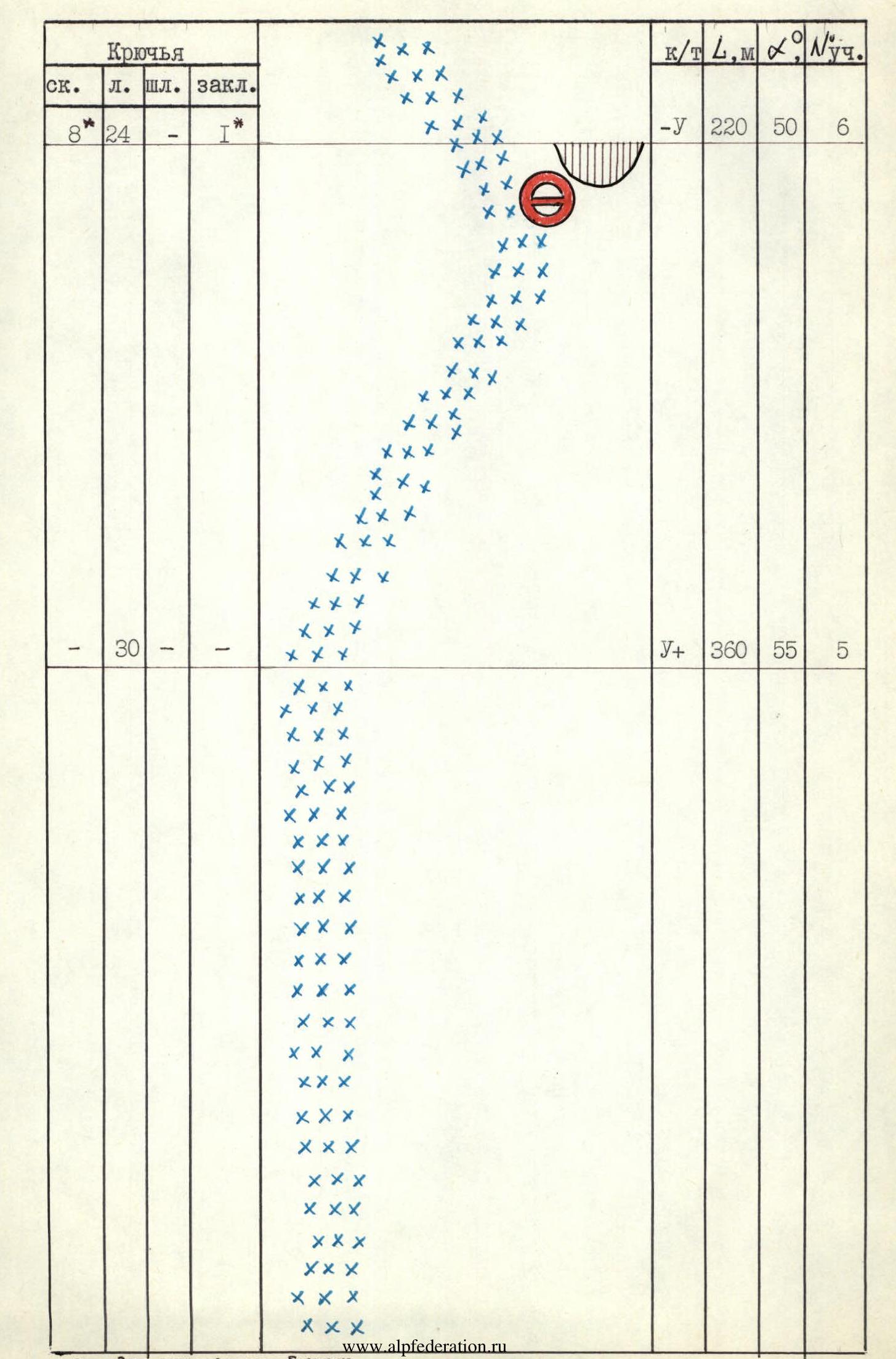
| Pitons | ||||||||
|---|---|---|---|---|---|---|---|---|
| rock | ice | bolt | chocks | Grade | L,m | α,° | Section # | |
| 8* | 24 | - | 1* | -V | 220 | 50 | 6 | |
| - | 30 | - | - | V+ | 360 | 55 | 5 |
Sheet 8b
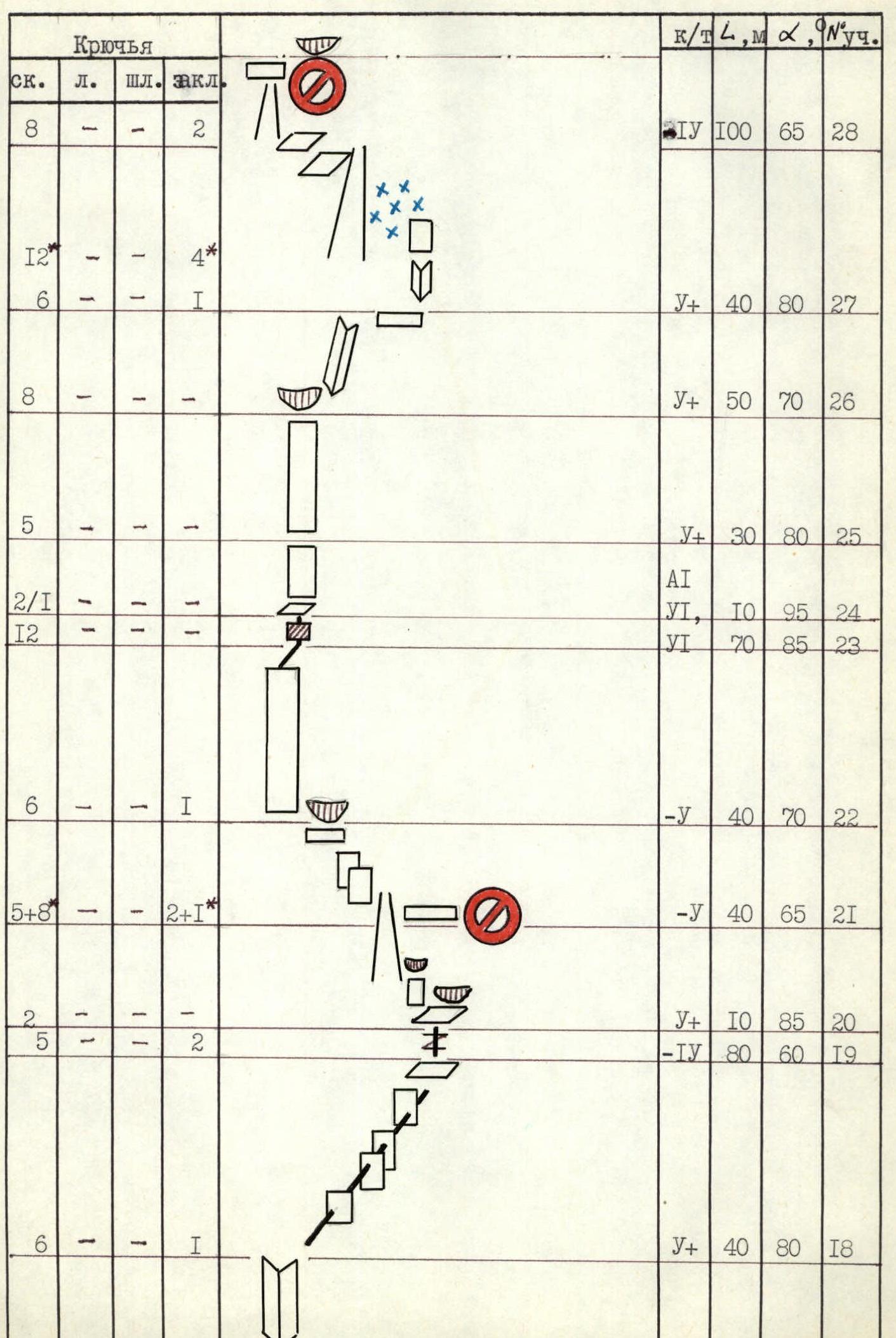
| Pitons | ||||||||
|---|---|---|---|---|---|---|---|---|
| rock | ice | bolt | chocks | Grade | L,m | α,° | Section # | |
| 11 | - | - | 3 | -V | 100 | 65 | 17 | |
| 8+6* | 1 | - | 2* | -IV | 100 | 50 | 16 | |
| 5 | - | - | 1 | V+ | 20 | 90 | 15 | |
| 10/3 | - | - | 2 | VI, A2 | 50 | 90 | 14 | |
| 2+8* | - | - | 1* | -III | 20 | 45 | 13 | |
| 3 | - | - | - | VI | 15 | 90 | 12 | |
| 3 | - | - | - | -V | 20 | 70 | 11 | |
| 4 | - | - | - | V+ | 30 | 85 | 10 | |
| 10 | - | - | - | V+ | 60 | 75 | 9 | |
| 5 | 1 | - | 1 | V+ | 40 | 65 | 8 | |
| - | 12 | - | - | 2V | 120 | 50 | 7 |
Sheet 8g
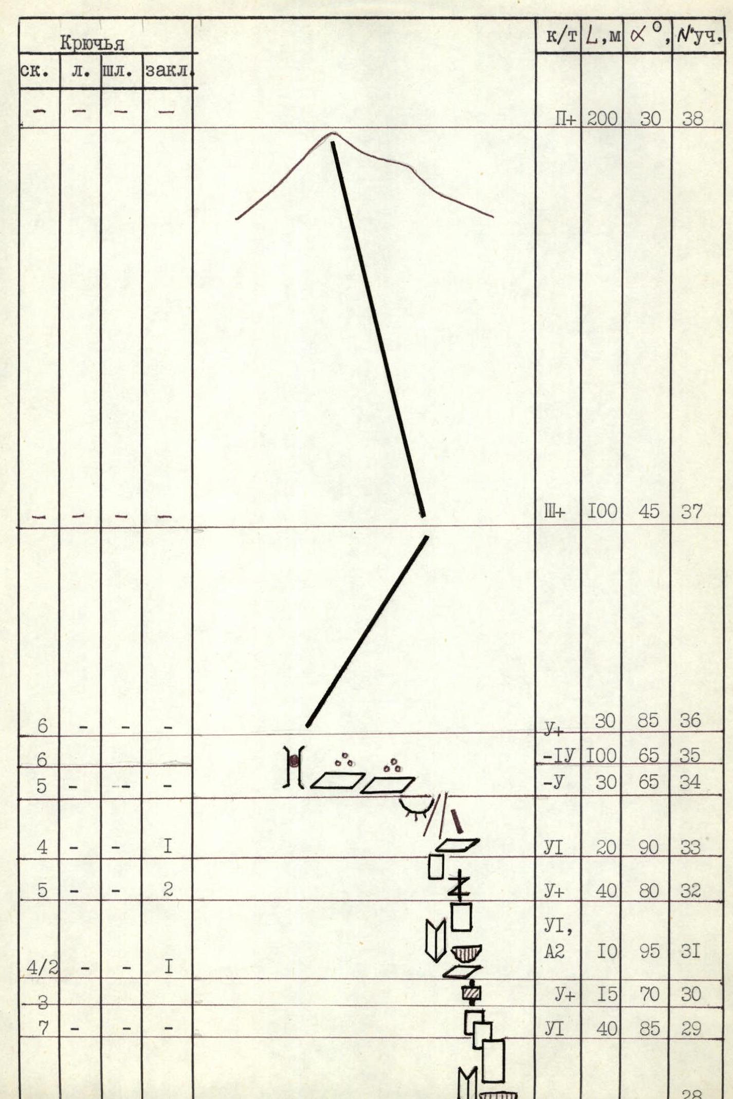
| Pitons | ||||||||
|---|---|---|---|---|---|---|---|---|
| rock | ice | bolt | chocks | Grade | L,m | α,° | Section # | |
| - | - | - | - | II+ | 200 | 30 | 38 | |
| - | - | - | - | III+ | 100 | 45 | 37 | |
| 6 | - | - | - | V+ | 30 | 85 | 36 | |
| 6 | - | - | - | -IV | 100 | 65 | 35 | |
| 5 | - | - | - | -V | 30 | 65 | 34 | |
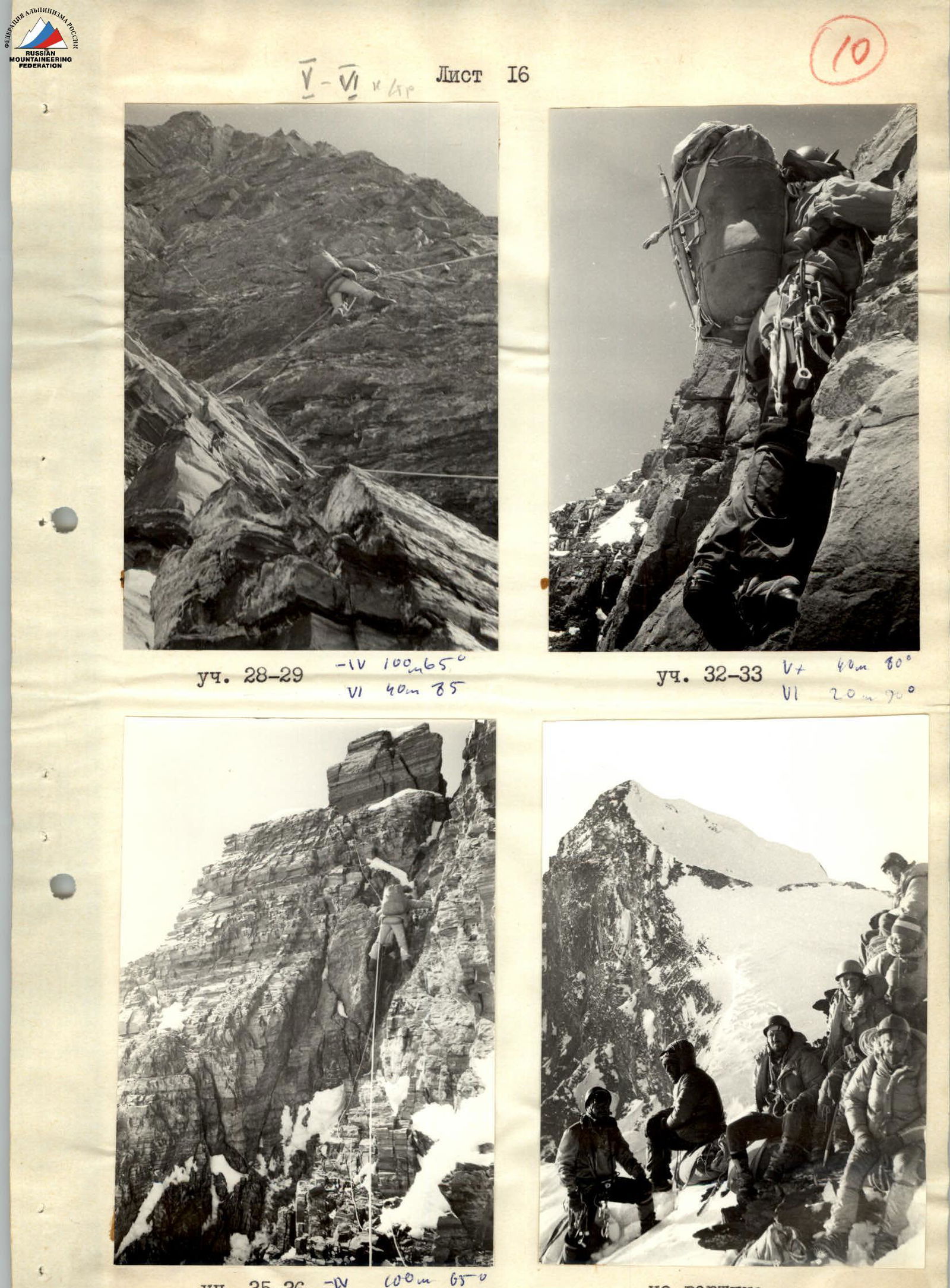
| 4 | - | - | - | VI | 20 | 90 | 33 | |
| 5 | 1 | - | 2 | V+ | 40 | 80 | 32 | |
| 4/2 | - | - | 1 | VI, A2 | 10 | 95 | 31 | |
| 3 | - | - | - | V+ | 15 | 70 | 30 | |
| 7 | - | - | - | VI | 40 | 85 | 29 | |
| 28 |
Route description by sections
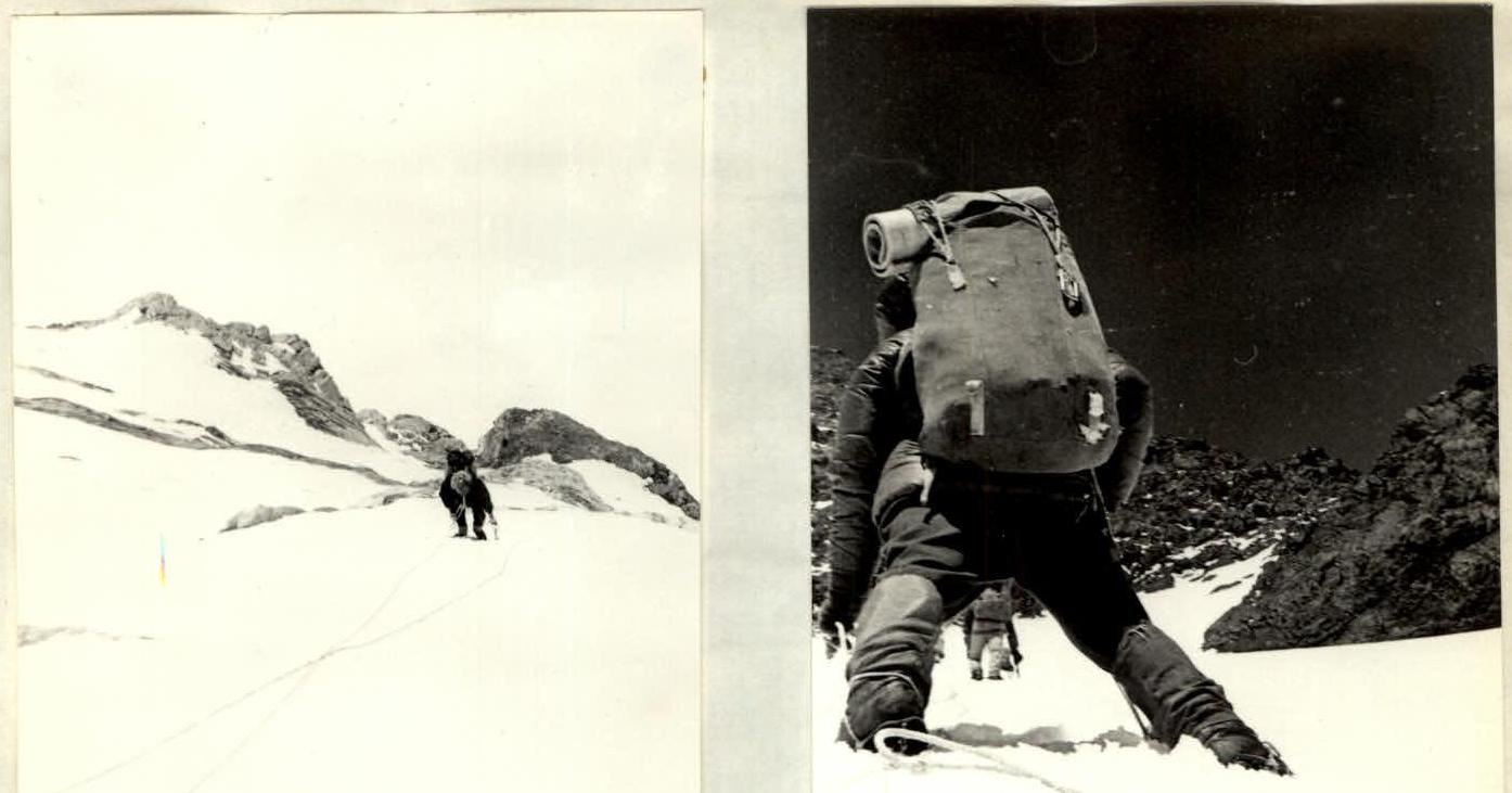
July 31. Start of movement - 7:00. End - 20:00. Section R0-R1. Climb up a snowy slope to a bergschrund. The bergschrund is crossed via a snow bridge on the right (in the direction of travel) side.
Sections R1-R3. Climb up a snow-ice slope on the right (in the direction of travel) side of the couloir to a "plug" represented by rock outcrops resembling "ram's foreheads" separated by steep couloirs with névé ice.
Section R3-R4. The "plug" is climbed on the right via steep névé ice, exiting left onto rocks and climbing them to the top of the rock island (1st control point).
Sections R4-R6. Climb up a poorly defined snow-ice ridge to a large rock island. From it, exit right upwards to beneath an overhanging rock wall. Under the wall is a convenient bivouac site.
August 1. Start of movement - 8:00. End - 21:00. Processing of sections R13-R14.
Sections R6-R8:
- From the bivouac, climb up an ice slope leftwards towards a small rock island at the base of the SE wall.
- Then, via a ledge and an internal angle, exit to the top of the island.
- Climb up ice leftwards to an inclined rock ledge.
Section R8-R9. From the ledge, climb 30 m up an internal angle on the right (in the direction of travel) side of the couloir. (Beware of falling rocks!). Then, traverse to the left side of the couloir and exit onto a diagonal snow-covered ledge beneath an overhanging grey wall. (Caution! Sections R6-R9 are extremely prone to rockfall after the wall is exposed to sunlight at 2 am).
Sections R9-R11. From the ledge, climb up a black chimney, exiting onto severely damaged rocks. Climb up steep slabs to the base of a vertical internal angle.
Sections R11-R13. Climb up the vertical internal angle (15 m, 90°) with few small holds - exit onto snow-covered damaged rocks beneath the "red" wall. On the ledge beneath the wall is a bivouac site. (Sections R9-R12: the first climber goes without a backpack. The rest follow the fixed ropes, pulling up their backpacks on section R11-R12).
Sheet 10
Section R13-R14. From the bivouac site, exit along a diagonal ledge to the base of an overhanging internal angle in the middle of the "red" wall. The internal angle is interrupted by a cornice with a small (for 1 person) inclined platform (the walls of the internal angle are severely damaged) and a poorly defined ledge leading to the right edge of the central bastion.
August 2. Start of movement - 10:00. End - 20:00.
Section R14–R15. From under the cornice, climb up a small wall (VI) to a poorly defined diagonal ledge. Traverse along the ledge to the right edge of the wall to an ice-filled ledge (suitable for 3-4 people).
(Sections R13-R15: the first climber goes on a double rope without a backpack, wearing galoshes. The rest follow the fixed ropes with top-rope protection. Backpacks are pulled up.)
Section R15-R16. From the ledge, climb leftwards up a poorly defined ridge with rocks resembling "ram's foreheads" and small walls made of damaged slabs - 100 m to a snow-covered ledge beneath an overhanging wall forming the start of the central bastion of the SE wall. Here is a convenient bivouac site.
August 3. Start of movement - 8:00. End - 18:00. Processing of sections R16-R17 and R21-R22.
Section R16-R17:
- From the bivouac, climb rightwards up, crossing a couloir (beware of falling rocks!).
- Climb up steep icy rocks on the right wall of the couloir - 20 m to a poorly defined counterfort.
- Climb up the counterfort, overcoming a series of sheer rock walls - to an inclined ledge beneath a wall.
Section R17-R18. Continue along the ledge rightwards, overcoming an overhanging block - to an icy internal angle, climbing 40 m straight up to a poorly defined rock ridge.
Section R18-R19. Climb along the ridge - 120 m (60°) to a ledge beneath overhanging rock walls.
Sections R19-R21. Climb up a narrow crevice straight up beneath a 4-meter overhanging wall. Traverse left along an inclined ledge and climb up wet slabs straight up beneath a large rock. Traverse left around the rock via a narrow snow-covered couloir - to a snow-covered ledge beneath an overhanging "red" rock. Here, a semi-reclining bivouac can be organized.
Section R21-R22. From the bivouac, traverse left across a couloir, climb up a wall, and up slabs on the left side of the bastion - to a small platform beneath an overhanging wall. August 4, 1982. Start of movement - 8:00. End - 19:00. Processing of section R22-R23.
Section R22-R23. From the platform, traverse 5 m left from under the overhang and then climb straight up a very difficult sheer monolithic wall with few uncomfortable holds. (The first climber goes without a backpack, wearing galoshes, on a double rope). After the wall, a 5-meter ridge leads to a 10-meter wall.
Sheet 11
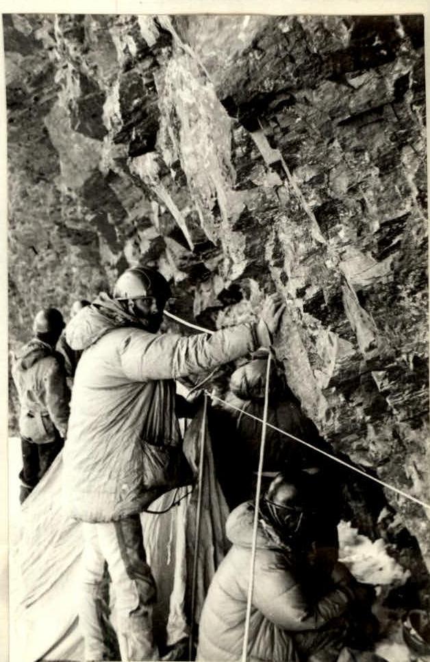
Sections R23-R26. Climb the wall via a crack left of the ridge (grade not given) - to a diagonal, rock-strewn ledge beneath a sheer 15-meter black wall. Overcome the wall and exit onto steep rocks resembling "ram's foreheads". Climb 70 m straight up these rocks to beneath a sheer wall.
Section R27-R28. Climb 5 m up an internal angle - to damaged rocks. Traverse this slope and a rock couloir leftwards and upwards (80 m) - to beneath a wall. Traverse leftwards and upwards (80 m) along damaged rocks - to the base of a monolithic internal angle. To the right of it, beneath the protection of a wall, organize a sitting bivouac.
August 5. Start of movement - 8:00. End - 22:00. Processing of sections R28-R31.
Sections R28-R31. Climb up the internal angle left of the bivouac (10 m, 80°). Then, climb rightwards and upwards via a monolithic wall (50 m, 85°) with small, smooth holds. Continue up steep (70°) slabs leftwards and upwards (20 m) - to a carnage crossing the entire wall. Traverse the carnage via a diagonal crevice (10 m, 95°) using artificial aids (beware of falling rocks!).
Section R31-R32. Above the carnage, climb leftwards and upwards along a snow-covered ledge (15 m, 55°) - to beneath a wall. Climb the wall on the left via an internal angle (10 m, 90°). Then, climb rightwards and upwards along steep and damaged slabs (15 m, 70°) - to beneath a sheer wall.
Section R32-R33. Climb the wall using difficult climbing techniques - first rightwards along a slightly overhanging diagonal crack (beware of falling rocks!), then straight up sheer walls cut by vertical cracks (30 m, 90°).
Section R33-R34. Exit from the wall onto an inclined ledge, then rightwards and upwards onto a ridge. Traverse leftwards and upwards along a couloir - to damaged rocks resembling "ram's foreheads" beneath walls leading to the summit of the rock "triangle" of the SE wall.
Sections R34-R37. Traverse leftwards along rubble-strewn, icy ledges (100 m, 65°) - to an internal angle with a "plug" (30 m, 90°) leading to the ridge of the left edge of the summit "triangle" of the SE wall. Climb up slabs on the left edge (80 m, 55°) - to the summit of the "triangle".
Photo illustrations for the report
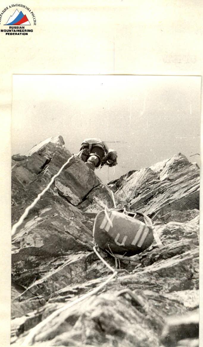
Sect. R4–R5. V+ L 360 m, α 55°.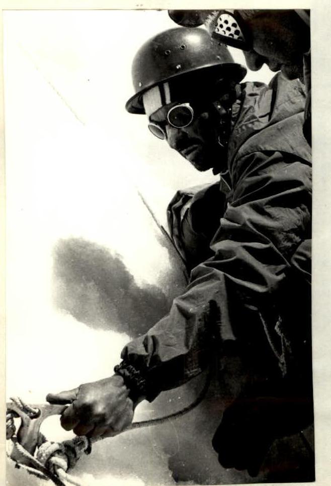
 Sect. R12. VI L 15 m, α 90°.
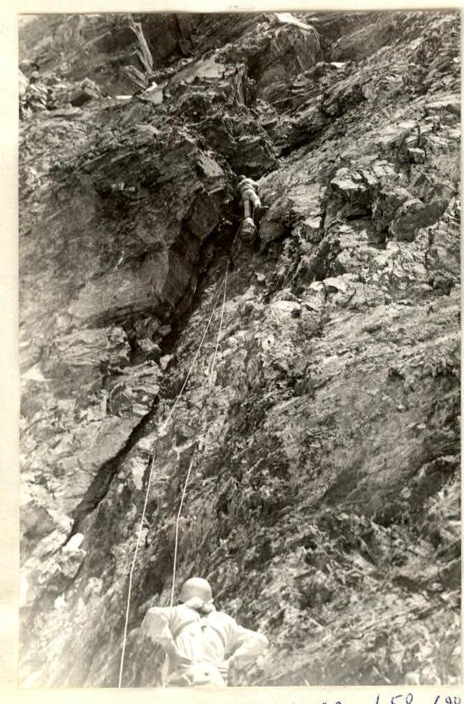 Sect. R14. VI A2 L 50 m, α 90°.
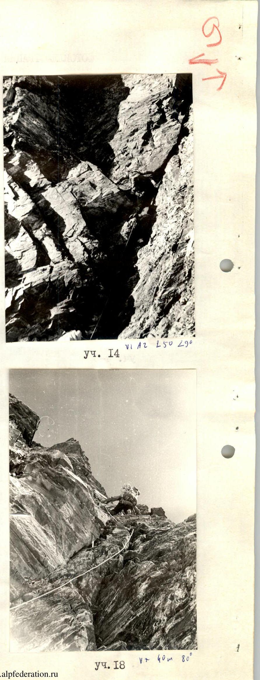
Sect. R19–R20. -IV L 30 m, α 60°.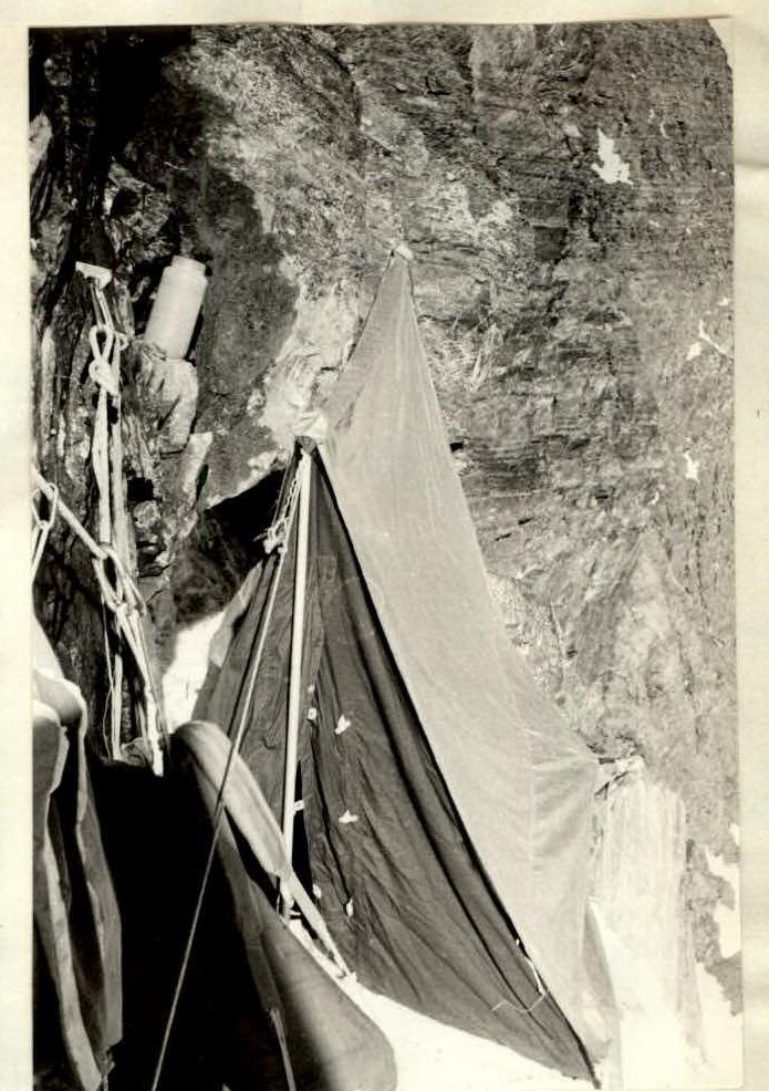
Bivouac 4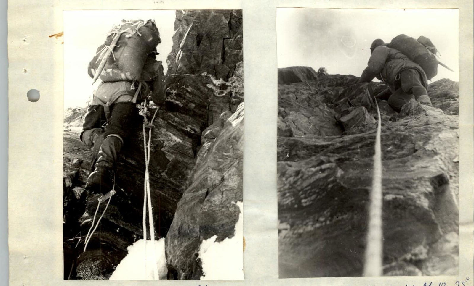
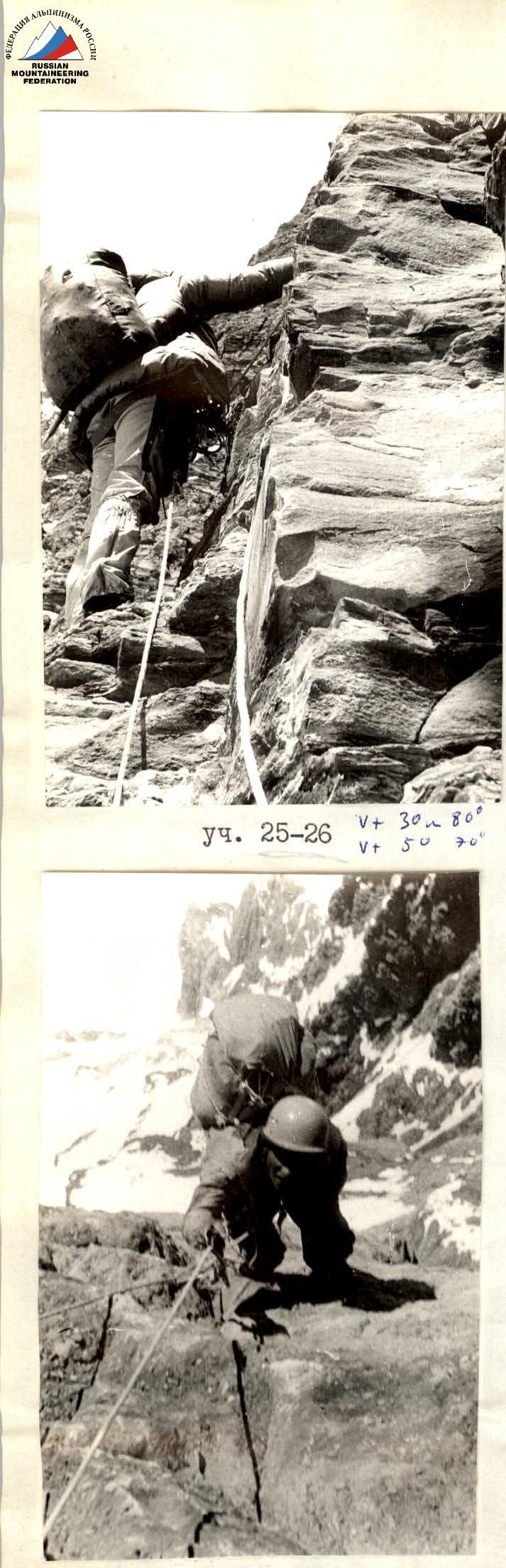
General view of sect. R23–R26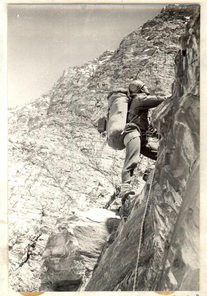
On the summit