Peak Korzhenevskaya 7105 m
Left edge of the western wall of the southern ridge
led by Chochia P.A. 1988
Ascent Passport
- Pamir, Academy of Sciences Range, section №4.1 of the route classifier on mountain peaks.
- Peak Evgenia Korzhenevskaya (7105 m), left edge of the western wall of the southern ridge.
- Proposed: 5B — 6A difficulty category (first ascent).
- Route character: combined.
- Height difference of the route: 1800 m.
Route length: 2900 m. Length of sections:
- V difficulty category — 200 m.
- VI difficulty category — 310 m. Average steepness:
- main section of the route — 70°
- entire route — 40°
- Number of pitons driven (denominator for artificial anchors):
rock: 50 (approximate) chock stones: 30 (approximate) ice screws: 10 (approximate) bolt pitons: 0 Total artificial anchors used (IT): 0
- Team's working hours: 41 hours, 4 days.
- Team composition:
Leader: Chochia P.A., Master of Sports of the USSR Members:
- Koren A.V., Master of Sports of the USSR
- Okhonin S.A., Candidate for Master of Sports
- Golikov N.A., Candidate for Master of Sports
- Coach: —
- Departure to the route: July 27, 1988.
Ascent to the summit: July 29, 1988. Return to Base Camp: July 30, 1988. Descent from the summit via Tsetlin's route, 5A difficulty category.
- Organization: MAL-Pamir 1988
- Person responsible for the route description: Chochia P.A. ph. +7 903 167-0668, e-mail:
pa4@mail.ru
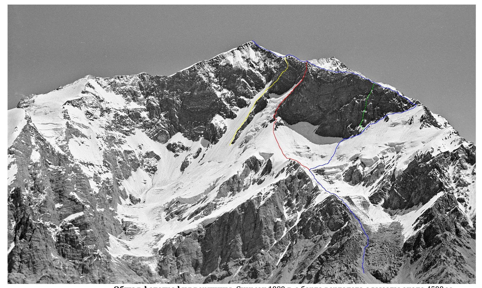
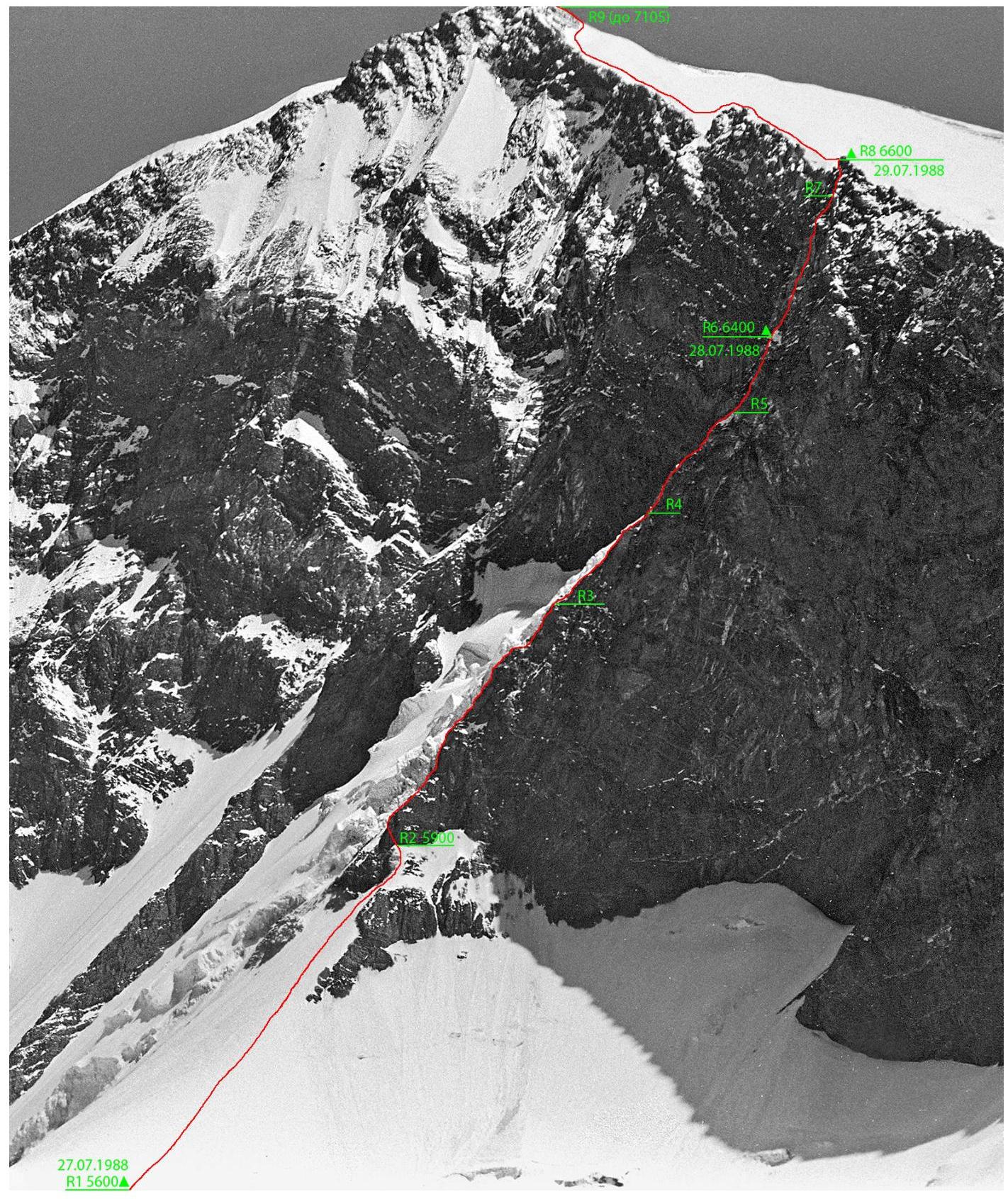
General photograph of the summit. Taken in 1989 from a helicopter at an altitude of about 4500 m.
- Red line — team's route
- Blue — Tsetlin's route, 5A, 1966
- Yellow — Dobrovolsky's route, 5B, 1966
- Green — Petrov's route, 5B, 1988 (line is approximate)
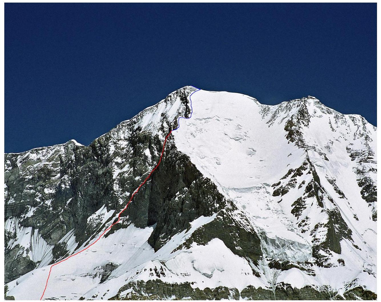
Profile of the wall section of the route on the right. Taken in 2007 from Borodkin's route on Peak
Kommunizma, at an altitude of about 6300 m.
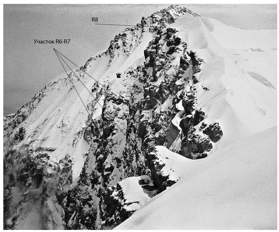
Profile of the upper part of the wall (sections R6–R8). Taken in 1989 from Tsetlin's route.
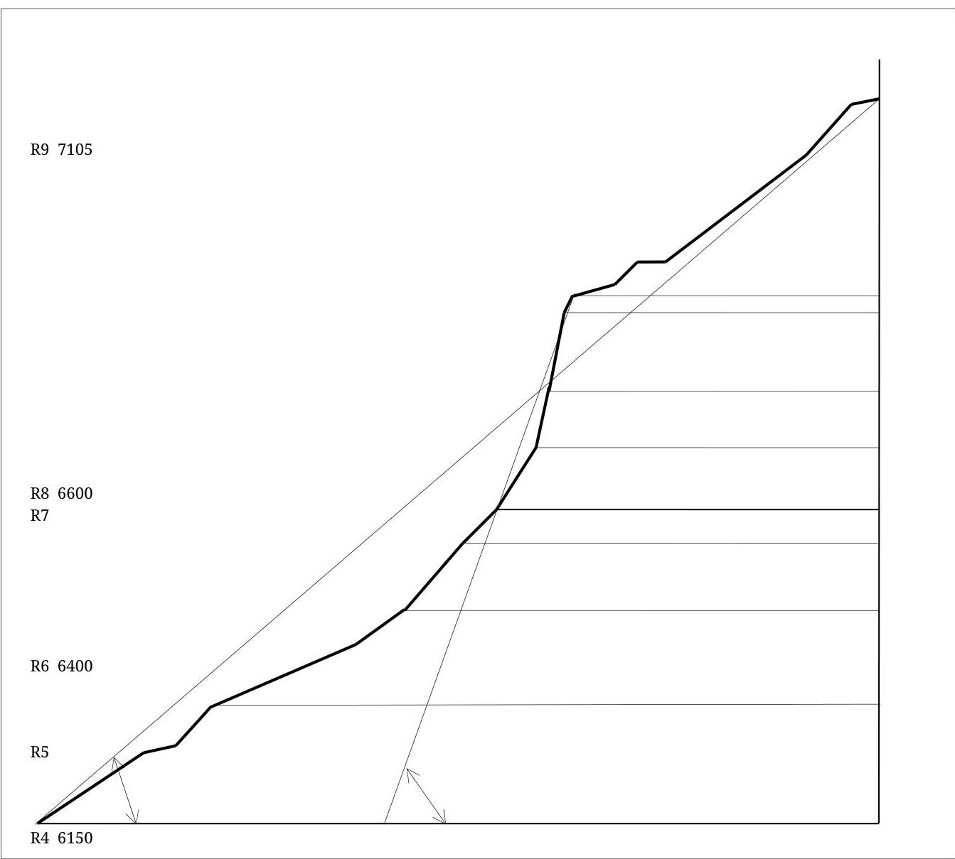
Hand-drawn profile of the route

Photopanorama of the area (from the upper part of Borodkin's route on Peak Kommunizma; altitude about 6200 m.).
| 11 900 м. 35″ | 86600 |
|---|---|
| V 50 м. 70″ | 7 |
| VI 180 м. 80″ | 66400 |
| VI 130 м. 75″ | 5 |
| V 150 м. 60″ | 46150 |
| IV 130 м. 50″ | 3 |
| IV 180 м. 55″ | 2 |
| II 550 м. 30″ | 15600 |
Route scheme in UIAA symbols
Technical photograph of the route. Taken in 1999 from a helicopter, at an altitude of about 5800 m.
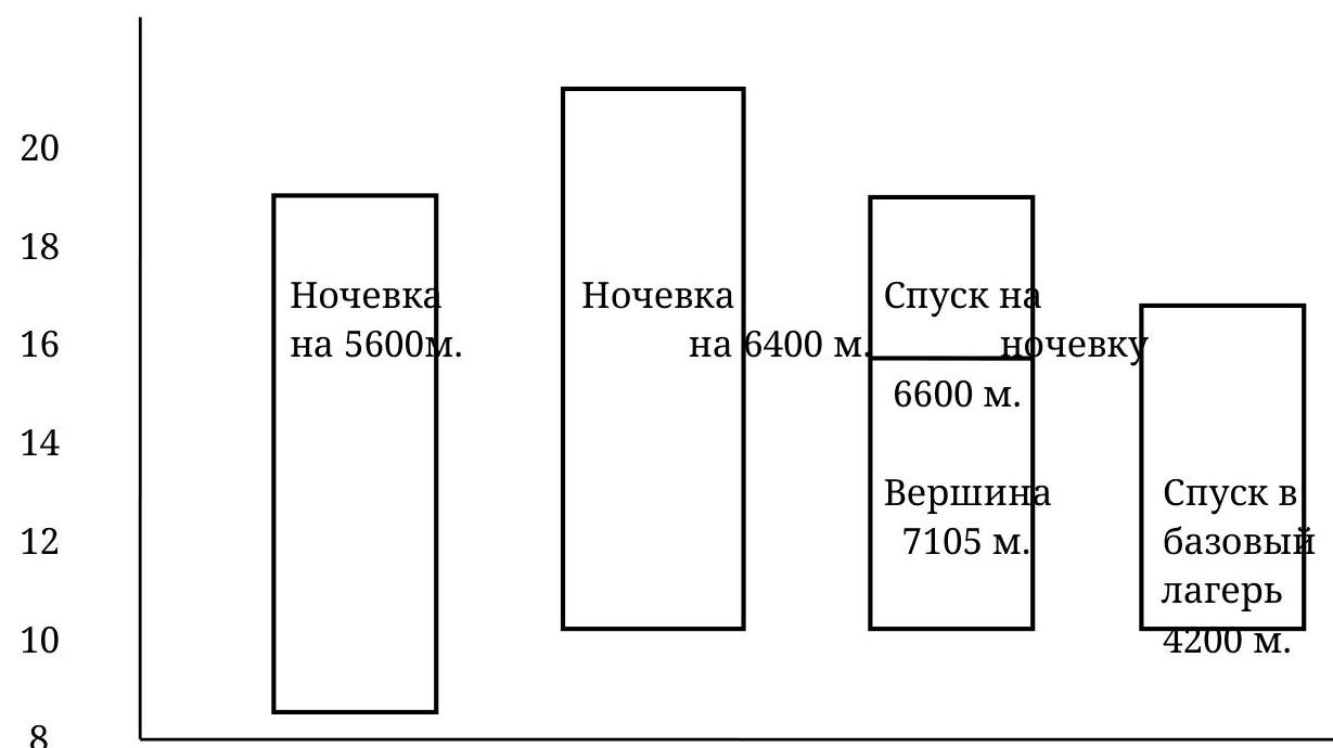
Ascent Graph
6
27.07, 28.07, 29.07, 30.07, 27.07.1988 (12 hours)
Departure from Base Camp on Moskvina Glacier (4200 m.). Ascent to the first camp on Tsetlin's route (5300 m., "dusty" overnight stay) is essentially just an approach to the route, so this point can be considered the starting point of the route.
From 5300 m.
- Ascent along the glacier flowing from the western slope of the S. ridge
- Exit to a plateau at an altitude of about 5500 m (up to this point, the team's route coincides with Tsetlin's route, 5A difficulty category)
- From the plateau, ascent to the left upwards along a snowy slope to a counterfort (not steep and snowy in its lower part), separating the S. ridge cirque and the western cirque of the summit (section R0–R1)
- Overnight stay on snow at an altitude of about 5600 m
Weather is excellent. August 28, 1988 (12:00)
Along the snowy part of the counterfort of increasing steepness, approach to the rocks of the left edge of the wall (section R1–R2), exit to a rocky ridge with a steepness of 45–60°, to the left of which is a serac. In the lower part of the ridge — a control cairn. Along the rocks of the ridge (section R2–R3, Photo 1 and 2), in the upper part of which a passage is possible along ice with a steepness of about 50° (section R3–R4, Photo 3), ascent to the lower part of the wall, at the beginning of which are located very characteristic 3 rocky "fingers" (Photo 4). Bypassing the "fingers" is possible both from the left and from the right. The lower part of the wall (section R4–R5) is a heavily destroyed rocks with a steepness of about 60°. Then begins the middle (steep) part of the wall (section R5–R6, Photo 5). Along rocks with a steepness of 75–80° to an ice ridge (about 5 m), in which a place for a sitting overnight stay was carved out. Second control cairn (in a tin can, tied to a rock piton). Weather is good. July 29, 1988 (10:00)
Continuation of the passage of the middle part of the wall. Steepness of rocks is 80–90° (section 6–7, see also photograph of the upper part profile). In the upper part (section 7–8), rocks become less steep (60–75°), exit to the S. ridge at an altitude of about 6600 m (upper part of Tsetlin's route). Preparation of a site on a snowy ridge, setting up a tent. Ascent to the summit (7105 m) with light packs and descent to the tent. Overnight stay. Weather is good. 30.07.1988 (7 hours)
Descent to Base Camp on Moskvina Glacier (4200 m) via Tsetlin's route. Weather is excellent. Comparison with similar routes in the area climbed earlier:
- According to the team leader, the climbed route is not inferior in complexity to Bezubkin's route on Peak Kommunizma
- заметно сложнее маршрута Добровольского на п. Корженевской (significantly more challenging than Dobrovolsky's route on Peak Korzhenevskaya)
- существенно сложнее маршрутов Романова и Маркелова на п. Корженевской (significantly more challenging than Romanov's and Markelov's routes on Peak Korzhenevskaya)
The opinion of participant A. Koren is reflected below in the debriefing protocol.
There are no notes from the summit, as there is no control cairn at the summit. To confirm, the text of the debriefing protocol is provided.
The ascent was carried out as part of the preparation for the 1998 USSR Championship in the high-altitude class.
Debriefing
of the ascent to Peak Korzhenevskaya via the left edge of the western wall of the S. ridge from July 27 to 30, 1988.
Attendees:
ascent participants: Chochia P.A. (leader), Koren A.V., Okhonin S.A., Golikov N.A., releasing Eifmov B.V., head of rescue R. Smirnov, Prokopenko V.I., Markelov V.V.
Chochia: The route was planned in 1987, combined. The lower part — a not clearly defined rocky ridge, about 16 ropes, passed on the first day. Overnight stay was on a small snowy ridge, sitting. Stopped for the night at 22:00.
Second day:
- 5 ropes of complex, almost vertical rocks
- exit to the ridge
- ascent to the summit
Rocks are very destroyed, steepness and complexity increase with altitude. The route is logical, it's hard to get off the route.
Regarding participants: no complaints against anyone. On the rocky part, Koren worked mainly at the front, Golikov — at the back. I evaluate the route as more complex than 5B difficulty category.
Markelov: Compare with 6th category routes passed by participants.
Koren: Compared to the route on Peak Klara Zetkin — there is a longer route, but there is no such complex climbing.
Markelov: There's a feeling that the team wants to classify the route as 6th category, isn't it too quick to classify the route as 6th category for 1 day?
Chochia: It should be taken into account that all participants had excellent acclimatization, all had seven-thousanders in this season, and Koren and Chochia had their third seven-thousander in the summer season.
Eifmov: I propose the following approach to route classification. We give an assessment of the complexity of sections as in low mountains, without taking into account the altitude. The assessment of "six" rocks corresponds to the complexity, for example, of Yaghnob routes.
Markelov: How do you assess the objective danger of the route?
Chochia: The route passes along the edge, separated from the serac by a gully, so being hit by ice is unlikely. Rocks are very steep, there were problems with insurance.
Prokopenko: How many control points?
Chochia: Two, at the beginning and in the middle of the route.
Eifmov: I propose to approve the route for the participants, the leadership — for the leader, and to submit the route for classification as 6th category.
Okhonin: The route was liked. Very good work by Koren as the lead climber, both in route choice and as a rock climber. Regarding safety: when approaching the ridge, stones can fall from it.
Golikov: It's a bit early to start preparing the overnight stay site.
Koren: The route is very good. The big difficulty is that the rocks are very destroyed, every insurance point must be carefully checked. A small miscalculation in the number of pitons. The wall is lit by the Sun very late, it's cold to climb.
Debriefing was led by releasing Eifmov B.V. Secretary Golikov N.A. August 2, 1988.
(The original debriefing text is available. — P. Chochia)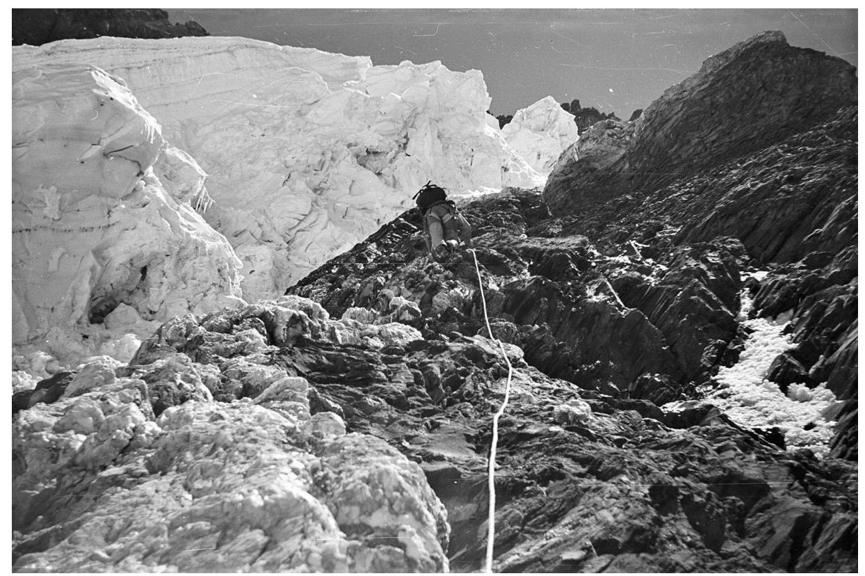
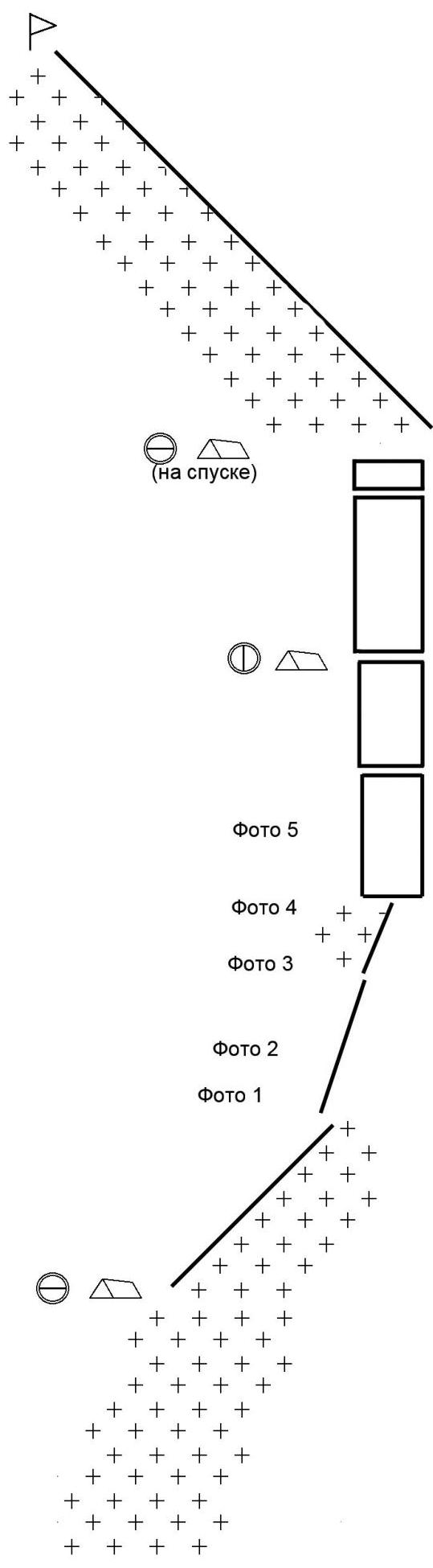
Photo 1. Section R2–R3. In the lower part of the counterfort. Altitude about 5950
m.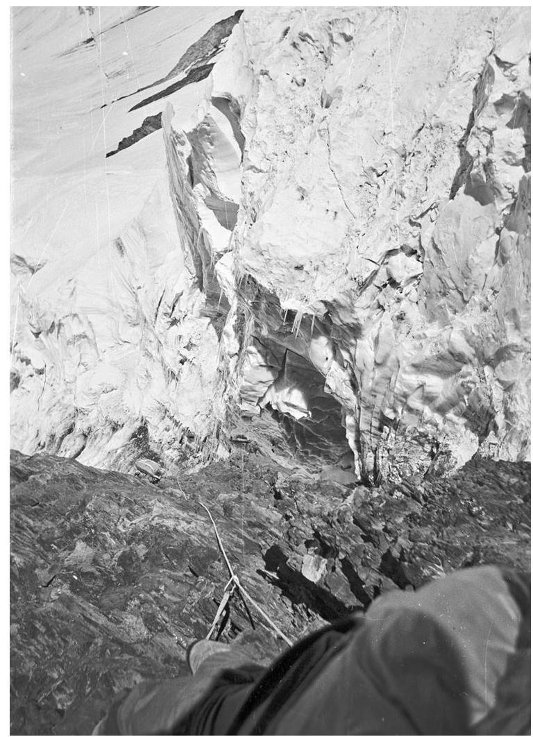
Photo 2. Section R2–R3. In the middle part of the counterfort. View downwards. Altitude about
6000 m.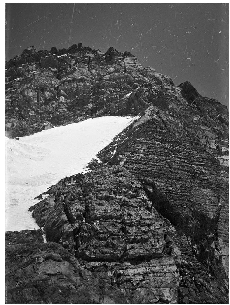
Photo 3. Section R3–R4. Upper part of the counterfort and lower part of the wall. Altitude about
6100 m.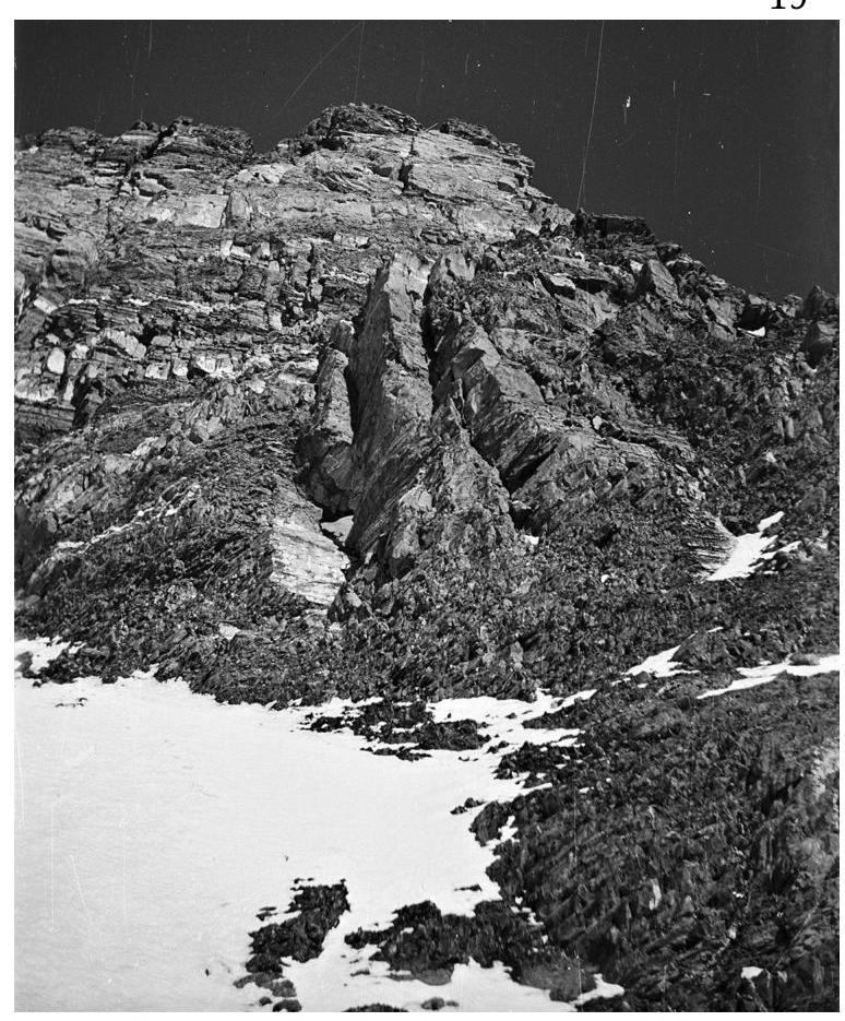
Photo 4. Sections R4–R5, R5–R6. Beginning of the wall. Altitude about 6150
m.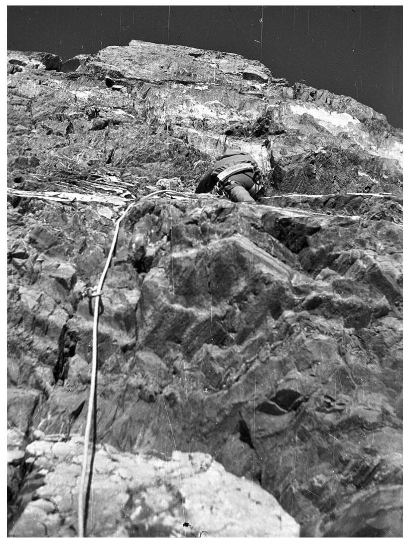
Photo 5. Section R4–R5. In the lower part of the wall. First to work is A. Koren. Altitude about 6250 m.
The film with subsequent frames from the ascent was lost.