St. Petersburg Climbing Championship 2018 High-Altitude Class
Report on the Ascent to the Summit of Peak Korzhenevskaya via the South Ridge (Tsetlin, 1966) 5A Category of Difficulty
Team Coach: S.A. Semiletkin
Team Leader: F.M. Zaliev
Team Members:
- A.S. Dusheiko
- S.V. Livandev, St. Petersburg 2018
Ascent Passport
- Region: PAMIR
Area: Academy of Sciences Range (western side of Fedchenko Glacier from Yazglemsky Pass in the south to Muksu River in the north with all lateral spurs) Peak Name: Peak Korzhenevskaya, 7105 m
- Route Name: via South Ridge (classic route)
- Category of Difficulty: 5A
- Route Type: snow-ice
- Route Characteristics:
Height Difference: 2739 m. Route Length: 13360 m. Section Lengths:
-
V category of difficulty: 50 m
-
VI category of difficulty: 450 m. Average Steepness:
-
main part of the route: 65 degrees
-
entire route: 40 degrees
-
Number of Belay Points Used: Total: 7.
The team did not leave any of their own points on the route. The route was completed without any falls.
- Team's Time on the Route: 38 hours, 4 days.
- Team Leader: F.M. Zaliev — Candidate Master of Sports
Team Members:
-
A.S. Dusheiko — 3rd sports category
-
S.V. Livandev — Candidate Master of Sports
-
Coaches: S.A. Semiletkin — Master of Sports
-
Departure from Base Camp: 10:00, August 16, 2018
Summit Ascent: 16:15, August 19, 2018. Return to Base Camp: 17:30, August 20, 2018.
- Organization: Alpine Club of St. Petersburg State University "BARS"
- Report Author: A.S. Dusheiko
info@alpclubbars.com
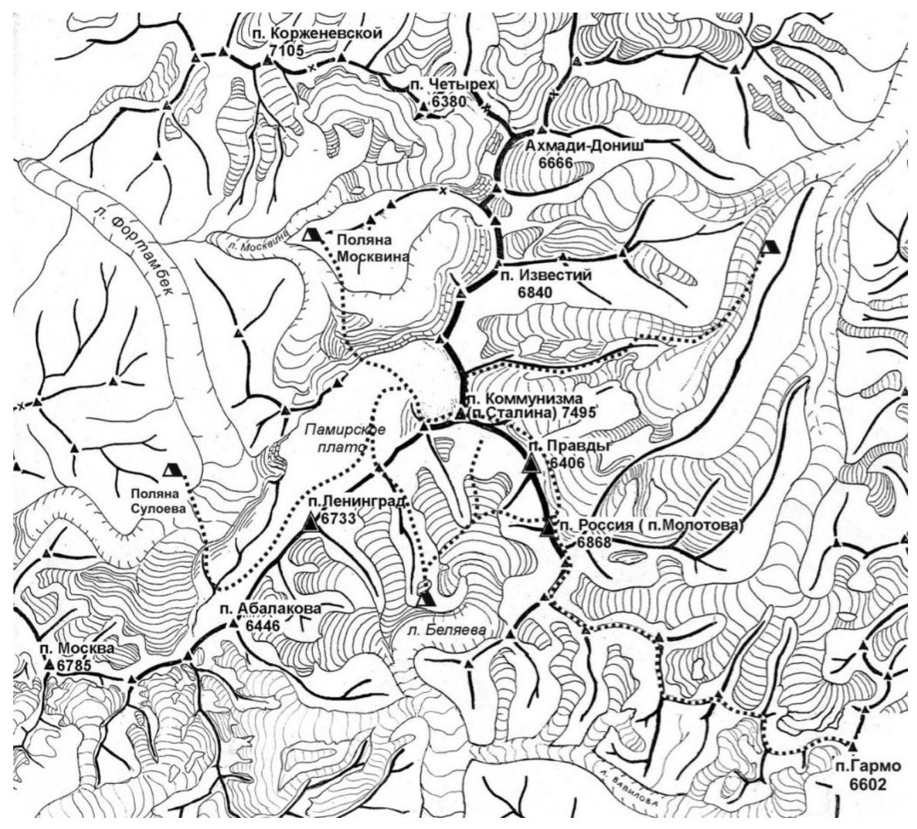
Fig. 1. Area Map-Scheme
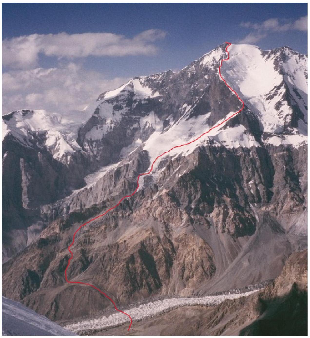
Fig. 2. Route on Peak Korzhenevskaya (Tsetlin's Route, 1966)
Route Description
Approach: From the base camp (BC 4366 m) cross the Moskvina Glacier and ascend to the foot of the south ridge of Peak Korzhenevskaya. Traverse it from the left side and reach the Korzhenevskaya Glacier. Cross it and ascend along the rocky moraine to the left of the glacier in the direction of travel.
At an altitude of 5100 m, a camp can be set up for several tents.
Then, also along the glacier, approach closely to the bastion (sometimes with rockfall), put on crampons, and traverse along the glacier 50–60 m upwards. Then, with simple climbing, ascend the bastion in a small couloir (old ropes are hung).
At an altitude of 5300 m, a camp can be set up for several tents; there is good water.
From 5300 m, move to the middle of the glacier and ascend to 5600 m to the start of the route, where there is a good firn field and a camp can be set up.
5600 m. From the firn field (5600 m) along the western wall of Peak Korzhenevskaya towards the south ridge with a height gain of 200 m and a slope angle of 60 degrees in some places, approach the "SAIL" rock and traverse along the wall to the south ridge with a slight height gain but with a strong slope in some places. Especially at the beginning of the traverse from the rock — it is advisable to use belay. At the end of the traverse, reach the south ridge — 6100 m — slightly lower towards the Moskvina Glacier. There are two places for a tent.
6100 m. Ascend the rocky ridge at about 70° — 50 meters — and reach the snow-ice crest at about 50°. Move about 200 m to a height of 6300 and reach a small shoulder where several tents can be set up.
6300 m. Ascend the snow crest to a height of 6700. Then, ascend about 50 m along the rocks near the line of contact with the snow drift. Stick to moving along the rocks. Ascend to the summit tower and traverse to the left with a slight height gain, moving about 500 m to the eastern ridge.
Path to the Summit:
- Turn left
- Walk 70 m
- Reach the summit 7105 m.
Descent from the summit is via the ascent route.
Team's Tactical Actions
On August 16, departed from the base camp at 10:00 with the goal of ascending to 5100 m and replenishing supplies with Polish sublimates. At 15:00, set up a tent at a convenient and safe location near some frostbitten Poles who had been camped at 6300 for six days and only decided to descend when one of them developed snow blindness.
On August 17, at 8:00 AM, departed for the next camp at 5600 m. Reached the location in 4 hours.
On the section from 5300 to 5600, moved in a rope team on a closed glacier. On August 18, 1953, at 8:00 AM, moved from 5600 to 6300 m, ascended in 8 hours, set up a camp, and prepared for the ascent the next day.
On August 19, 1953, at 7:50 AM, departed for the summit assault, reached the summit at 16:15, and returned to the camp at 6300 m at 20:25.
On August 20, 1953, at 10:00 AM, began the descent, which followed the ascent route. The time taken was 7 hours 30 minutes. Returned to the base camp at 17:30.
During the entire ascent, radio communication with the base camp was maintained at 9:14 and 19:00.
Fig. 3. Route on Peak Korzhenevskaya (with altitude indications)
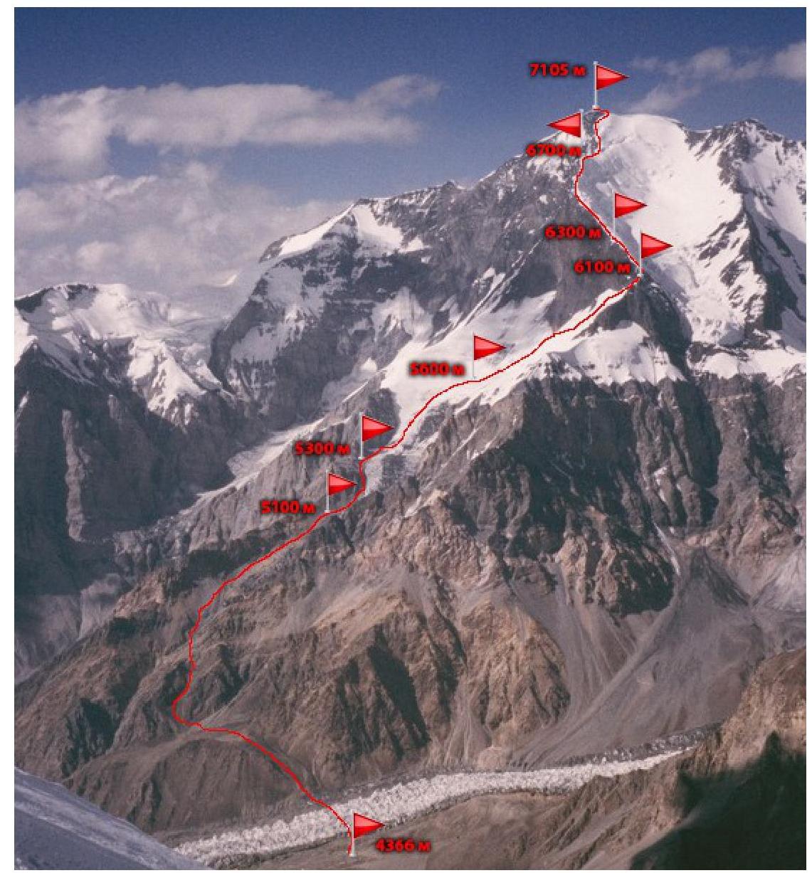
PHOTO REPORT
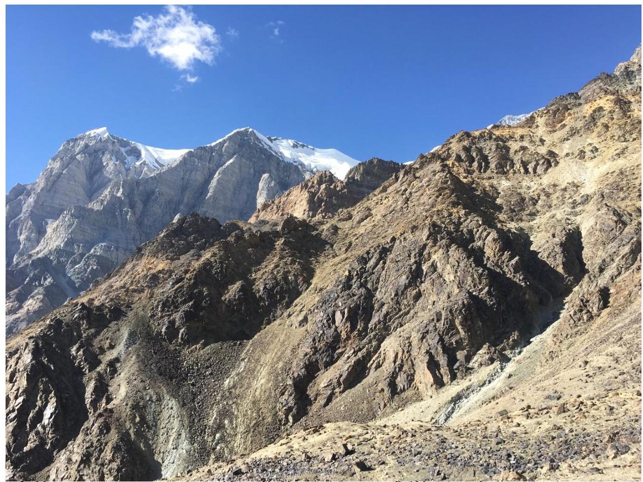
Fig. 4. Approach to the Route on Peak Korzhenevskaya (Tsetlin)
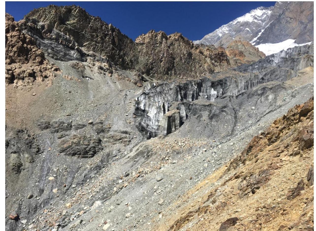
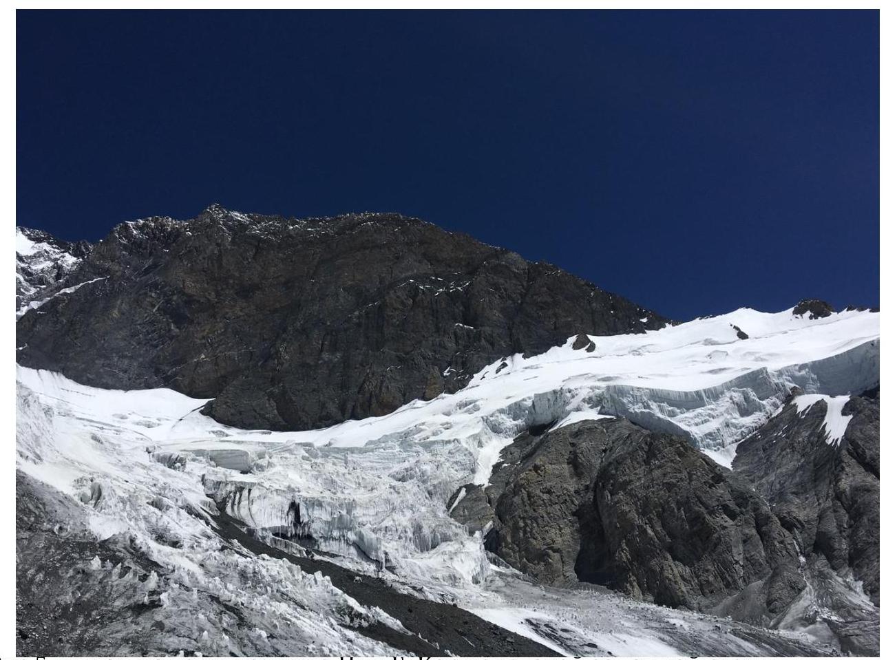
Fig. 5. Exit to the tongue of the Korzhenevskaya Glacier on the western wall
Fig. 6. View of the icefall on the western wall and south ridge of Peak Korzhenevskaya
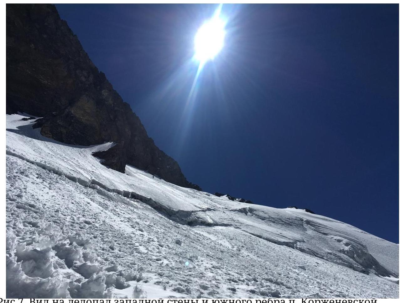
Fig. 7. View of the icefall on the western wall and south ridge of Peak Korzhenevskaya
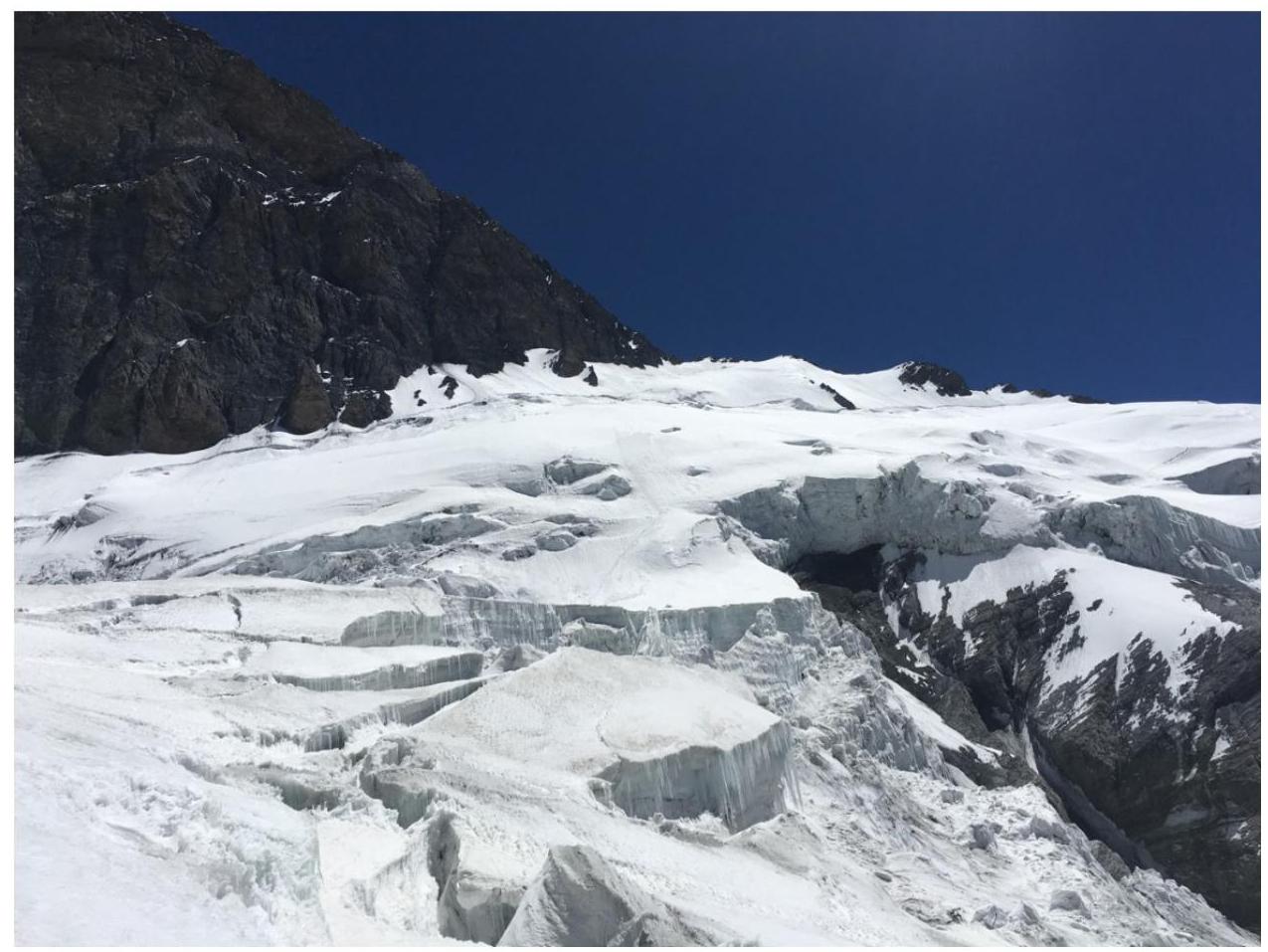
Fig. 6. Approach to the "Sail" rock under the western wall of Peak Korzhenevskaya
Fig. 7 and 8. South ridge of Peak Korzhenevskaya 6100 m. Photos taken from below and above the rocky ridge.
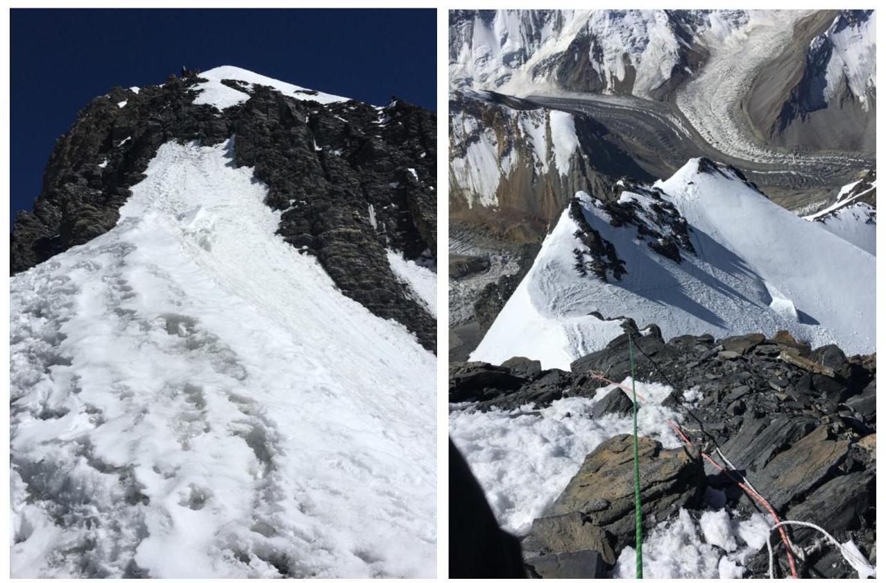
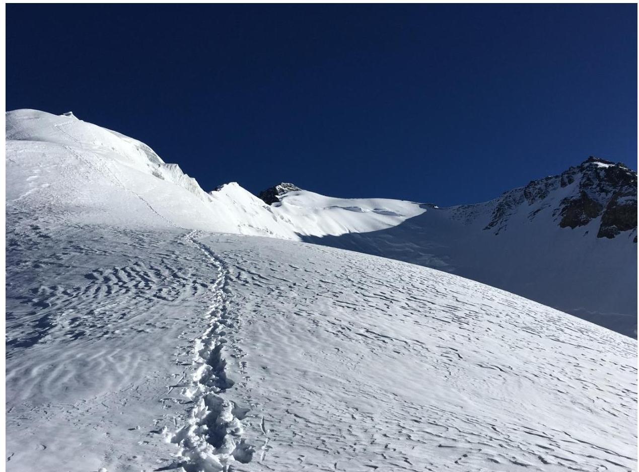
Fig. 9. View of the summit of Peak Korzhenevskaya the day after the assault from 6300 m.
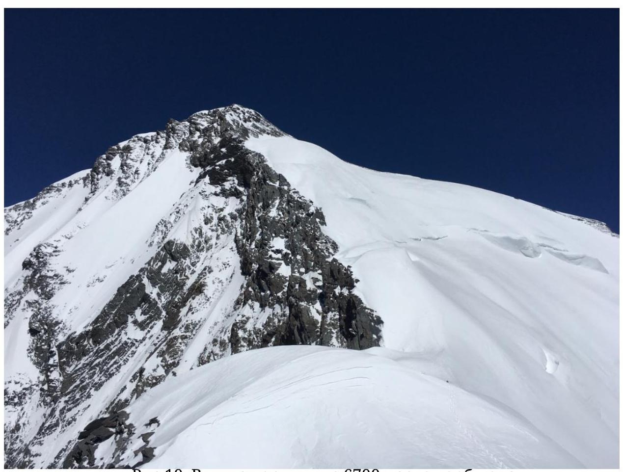
Fig. 10. View of the summit from 6700 m after the "camels".
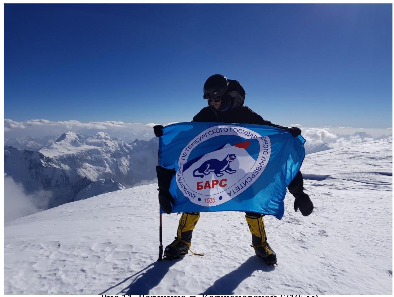
Fig. 11. Summit of Peak Korzhenevskaya (7105 m) — photo by Alpine Club of St. Petersburg State University "BARS" of the St. Petersburg Climbing Federation.


