PASSPORT
- High-altitude class
- Central Pamir, Academy of Sciences Range
- Peak Kommunizma, 7495 m, from Walter Glacier through the ice barrier and along the left part of the northwest wall.
- Proposed - 6B category of difficulty, first ascent. p. 4.1.
- Height difference - 2770 m (4400–7170 m), length - 3985 m. Average steepness of the main part of the route - 54°. Length of sections with 5–6 category of difficulty - 1530 m. Average steepness of sections with 5–6 category of difficulty - 66°.
- Pitons driven:
| rock | placements | ice |
|---|---|---|
| 149 | 64 | 198 |
| 0 | 0 | 0 |
- Team's working hours: 56 and days - 5.
- Overnights: 1st - a platform cut into the snow-ice ridge; 2nd - on the plateau; 3rd-4th - on rock ledges; 5th - on Peak Dushanbe. All in tents.
- Team leader: Chochia Pavel Antonovich, Master of Sports
Team members:
- Koren Alexey Vladimirovich, Candidate Master of Sports
- Sokolov Gleb Anatolyevich, Master of Sports
- Filatov Sergey Alekseyevich, Candidate Master of Sports
- Golikov Nikita Alexandrovich, Candidate Master of Sports
- Okhonin Sergey Alexandrovich, Candidate Master of Sports
- Tuitsyn Alexander Vladimirovich, Candidate Master of Sports
- Coach: Markelov Victor Viktorovich, Master of Sports
- Departure to the route: August 6, 1988.
Reached the summit: August 10, 1988. Return: August 11, 1988.
- Organization: International Mountaineering Camp "Pamir" of the Soviet Sports Committee.
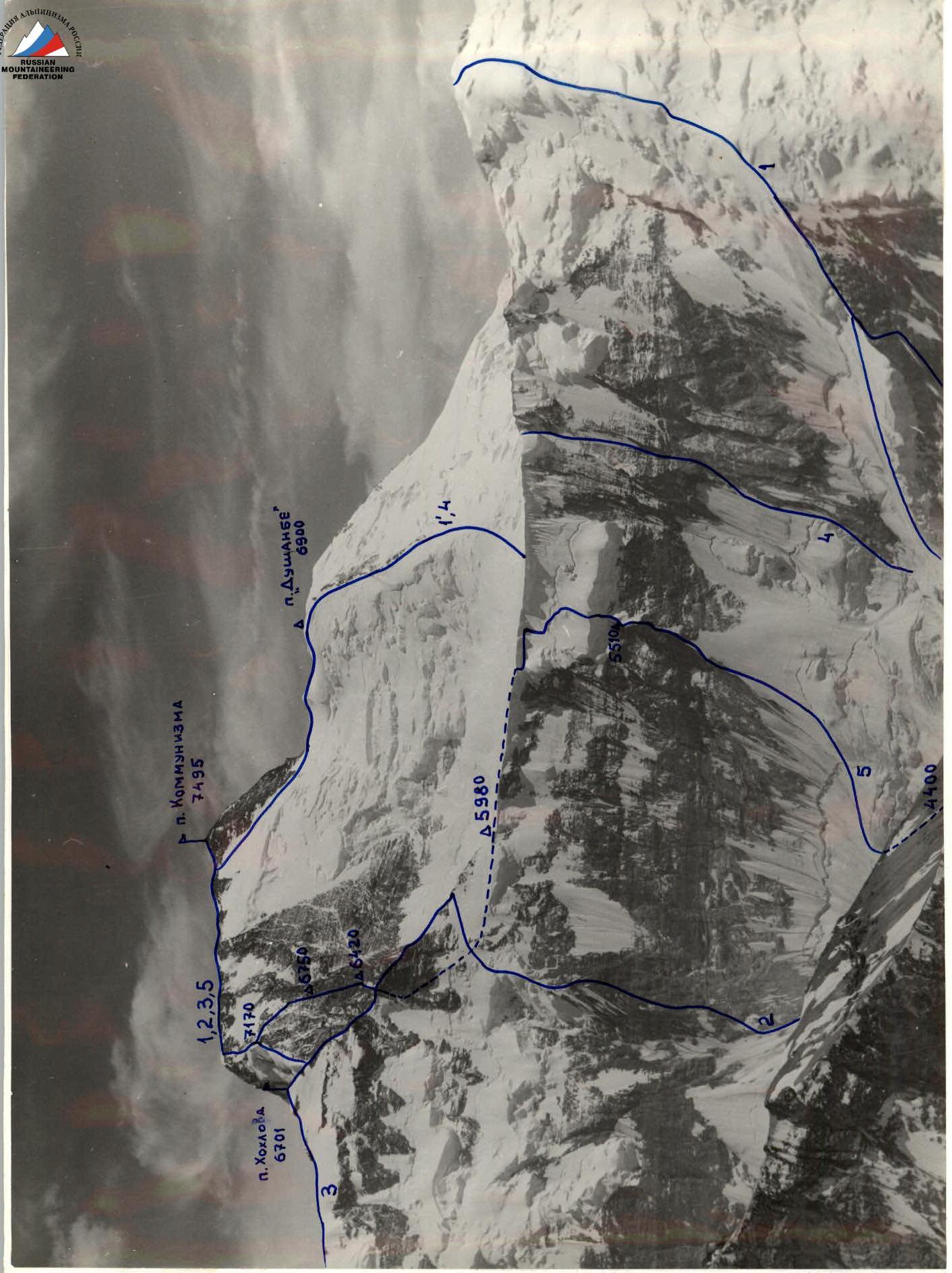
Legend for the route diagram:
- Borodkin's route, 5B (1' – 5A)
- Bezzubkin's route (through Peak Khokhlova), 5B
- Chyorny's route (through Peak Khokhlova), 5B
- Bělitsa/Mařek duo's route (Czechoslovakia), uncategorized (19812)
- Route taken by the team
Point of survey № I. Camera "Lyubitel", F=75 mm. H=5900 m, distance ≈10 km. Surveyed on July 15, 1984.
Tactical actions of the team
The tactical plan was almost entirely adhered to by the group. Movement was accelerated in the upper part of the route due to deteriorating weather and a received storm warning, which was justified from a safety perspective.
The group's movement was organized so that all members worked as lead climbers on the route:
- Chochia - sections 7–10, 14–16
- Koren - 13, 18–25
- Sokolov - 2, 6, 11–13, 26–28
- Filatov - 4, 11–13
- Golikov - 11–12, 28
- Okhonin - 3, 28
- Tuitsyn - 11–12, 27–28
The technical and tactical means of increasing safety consisted of rapidly completing the route, which was achieved by significantly increasing the speed of traversing long ice sections. To achieve this, partners in a rope team moved simultaneously on a full rope, with the lead climber screwing in ice screws at a distance of 5–7 m, ensuring the presence of at least 5–6 screws per rope, thereby achieving sufficient safety. The lead climber of the next rope team moved, lagging behind by one screw from the previous team; screws were left for subsequent teams and removed by the last team member. Organized belay stations (anchors) on rocks and ice when handing over screws to the lead climber - at least two screws. To ensure the safety of the lead climber on steep ice and rock sections, a double rope tested by UIAA (manufactured by BEAL, France) was used, allowing the lead climber to move without shock absorbers (photos 9, 10). All sections of the route were climbed using free climbing, except for sections 10 and 14, where "Ice-Fifi" hooks were used for climbing (photos 4, 6).
Special attention was given to the selection of locations and organization of overnight stays. Since the group worked daily for an extended period (10–15 hours), to compensate for the significant physical exertion and ensure proper rest, all overnight stays were lying down, in tents, in safe locations regarding possible rock or ice falls (photos 13, 14). Thanks to good prior acclimatization and technical preparation, as well as proper rest during the ascent, the team members constantly maintained a reserve of physical strength and technical capabilities. There were no falls or injuries during the ascent.
New elements of equipment:
- "Drop"-type placements
- Handle for screwing in ice screws (ensures screwing a screw into ice within 10–12 seconds)
- Attachment of "Ice-Fifi" hooks when passing steep and overhanging ice sections to crampons (photos 4, 6)
Team actions in bad weather conditions (upper part of the route): a) reduced by one day the planned ascent time; b) increased the time for evening route preparation; c) changed the variant for passing the north wall - the upper rock bastion was bypassed on the left; d) the upper section of the wall, covered in snow, was climbed in crampons.
 Semi-profile of the upper part of the route on the right. Photo taken from point № 3 on August 10, 1988, at 20:30. H = 6900 m, distance 2 km. Camera "Smena", F=40 mm.
 Profile of the lower part of the route on the right. Photo taken from point № 2 on August 8, 1988, at 16:00. H = 5800 m, distance 2.5 km. Lens "Helios-44", F = 58 mm. (see also photo 15).
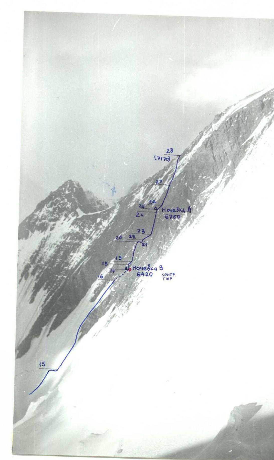
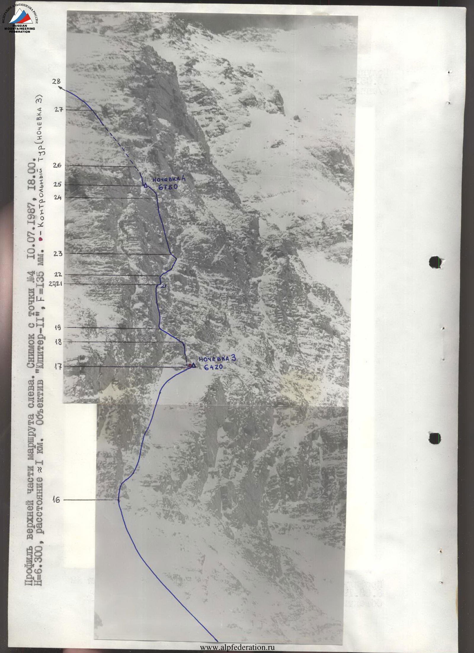
Profile of the upper part of the route on the left. Photo taken from point № 4 on July 10, 1987, at 18:00. H = 6300 m, distance ≈ 1 km. Lens "Yupiter-11", F=135 mm. - Control climb (overnight stay 3).
During the ascent, the rescue team was located at the base camp on Moskvina Glacier, from where the entire route was visible, except for the section of the north wall (6000–6500 m). For observation on this section, a duo of observers with class B judge V. N. Rusanov was sent to the plateau. Radio communication with the base (on the section 6000–6400 m via a repeater) was carried out regularly 3 times a day.
Problematic sections of the route:
- Ice barrier and cornice belt when exiting to the plateau
- Rocky part of the north wall above the plateau
The final variant for their passage was chosen by the team as they approached the respective sections, simultaneously analyzing their condition from the base camp using a telescope. Variants for passing the right part of the ice barrier were dismissed due to a snow cornice at the top of the ice and the presence of a crevasse, as well as a variant for overcoming the cornice belt directly.
Table of food and fuel products
| № | Name | Weight in kg | Fuel: | Weight in kg |
|---|---|---|---|---|
| 1 | Sausage | 1.0 | 1 Petrol (2 l) | 1.7 |
| 2 | Boiled meat | 2.0 | 2 Gas (9 cylinders) | 3.4 |
| 3 | Cheese | 1.0 | ||
| 4 | Pork fat | 0.4 | Weight of products and fuel | 25.6 |
| 5 | Butter | 0.2 | ||
| 6 | Rusks | 1.5 | Average weight of backpacks when departing to the route | 16.4 kg |
| 7 | Chocolate candies | 1.0 | ||
| 8 | Concentrated soups | 0.5 | ||
| 9 | Bouillon cubes | 0.6 | ||
| 10 | Oatmeal concentrate | 3.0 | ||
| 11 | Dry milk | 1.0 | ||
| 12 | Dry drinks | 1.0 | ||
| 13 | Honey | 1.0 | ||
| 14 | Crackers | 0.5 | ||
| 15 | Sugar | 2.0 | ||
| 16 | Tea, coffee | 0.3 | ||
| 17 | Mashed potatoes | 1.5 | ||
| 18 | Dried fruits | 2.0 |
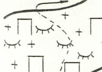
Route diagram in symbols
Technical data by route sections
| Section | Length, m | Steepness, ° | Category of difficulty | Ice pitons | Rock pitons | Placement pitons | Photo |
|---|---|---|---|---|---|---|---|
| 6 | 100 | 80 | 5–6 | – | 21 | 9 | 2 |
| 5 | 120 | 60 | 4 | 3 | 9 | 5 | 1 |
| 4 | 40 | 55 | 4 | – | 4 | 2 | |
| 3 | 100 | 60 | 5 | 12 | – | – | |
| 2 | 700 | 50 | 4+ | 60 | 2 | – | |
| 1 | 300 | 40 | 2 | – | – | – | 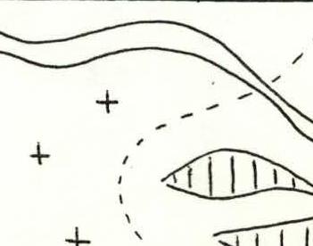 |
| 14 | 30 | 85 | A2 | 7 | – | – | 6 |
| 12–13 | 120/120 | 55 | 4–5 | 14 | – | – | |
| 11 | 280 | 40 | 3 | 10 | – | – | |
| 10 | 40 | 100 | A2 | 4 | – | – | 4, 5 |
| 9 | 100 | 65 | 5 | 10 | – | – | 3 |
| 8 | 40 | 40 | 2 | 13 | – | – | |
| 7 | 80 | 50 | 5 | – | – | – | 13 |
| 22 | 25 | 80 | 6 | – | 5 | 3 | |
| 21 | 30 | 60 | 5 | – | 6 | 2 | |
| 20 | 70 | 80 | 5–6 | – | 13 | 6 | 8 |
| 19 | 15 | 60 | 3 | – | 2 | – | |
| 18 | 40 | 80 | 5 | – | 10 | 3 | |
| 17 | 200 | 45 | 4 | 8 | 18 | 5 | 7 |
| 16 | 300 | 50 | 5 | 40 | – | – | |
| 15 | 100 | 40 | 3 | 4 | – | – | |
| 28 | 350 | 45 | 3–4 | 2 | 5 | 3 | 18 |
| 27 | 140 | 65 | 5 | – | 19 | 8 | 12 |
| 26 | 50 | 75 | 5 | – | 5 | 4 | 11 |
| 25 | 30 | 65 | 4 | – | 4 | – | 14 |
| 24 | 120 | 85 | 5–6 | – | 18 | 11 | 10 |
| 23 | 45 | 70 | 5 | – | 8 | 3 | 9 |
Summary data for the route
Total for the entire route:
- Pitons: ice 198, rock 149, placements 64
- Working hours: 49.5 (+ processing 6.5 hours)
- Height difference: 2770 m
- Length: 3985 m
Total for the fifth day:
- Pitons: ice 2, rock 29, placements 15
- Working hours (until the summit): 8 hours
- Height: 7170 m
- Height difference: 320 m
- Length: 540 m
Total for the fourth day:
- Pitons: rock 66, placements 28
- Working hours: 6 hours (+ processing 4 hours)
- Height: 6750 m
- Height difference: 330 m
- Length: 375 m
Total for the third day:
- Pitons: ice 52, rock 18, placements 5
- Working hours: 8.5 hours (+ processing 2 hours)
- Height: 6420 m
- Height difference: 440 m
- Length: 680 m
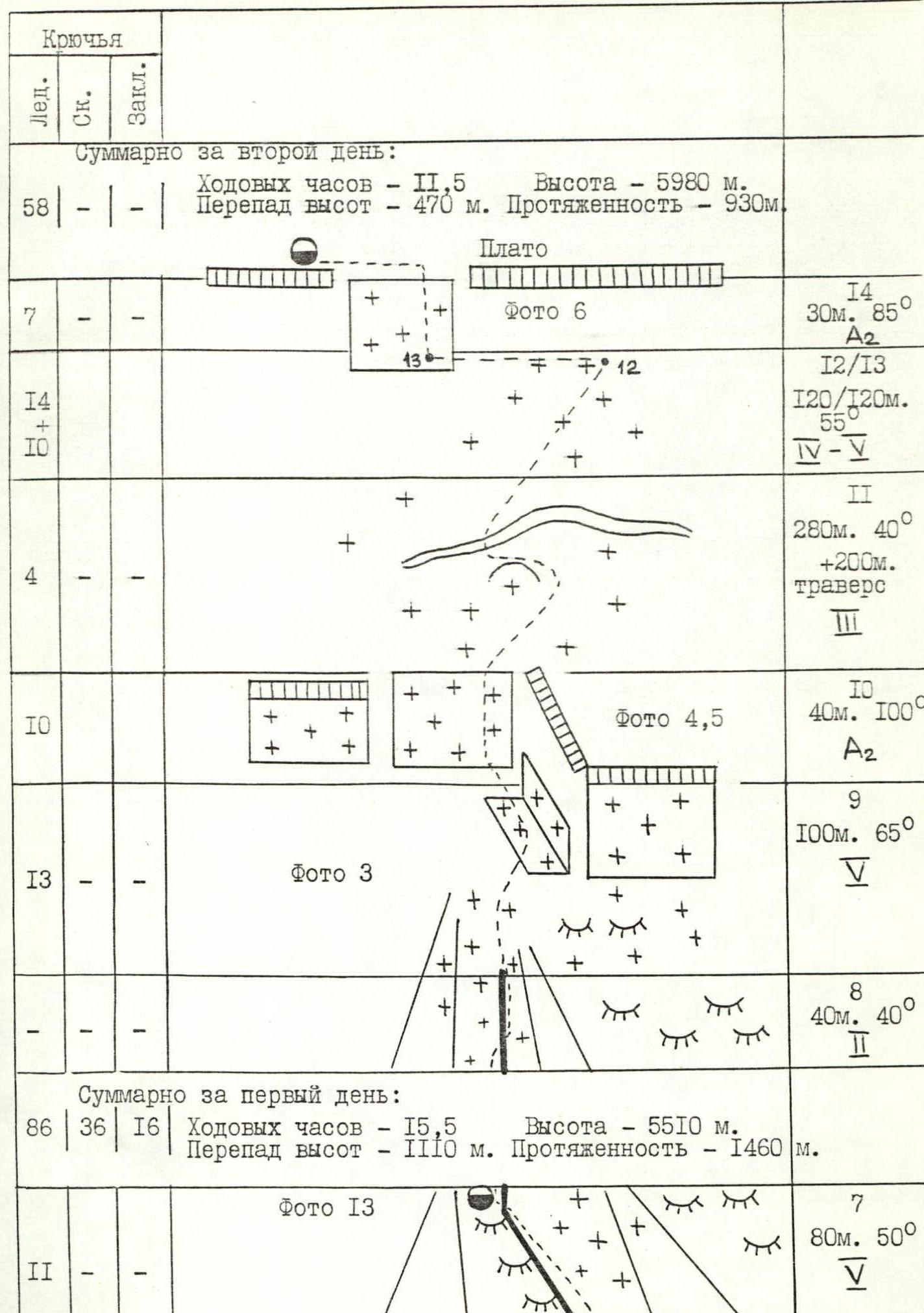
Total for the second day:
- Pitons: ice 58
- Working hours: 11.5 hours
- Height: 5980 m
- Height difference: 470 m
- Length: 930 m
Total for the first day:
- Pitons: ice 86, rock 36, placements 16
- Working hours: 15.5 hours
- Height: 5510 m
- Height difference: 1110 m
- Length: 1460 m
Description of the route by sections
- Beginning of the route. Snow slope with gradually increasing steepness and decreasing snow thickness. Movement is simultaneous, in teams. Cyclic change of the lead climber who cuts steps.
- Ice slope. Movement is simultaneous, in teams; belay through ice screws. The upper part of the slope (60–70 m) is hard ice with a steepness of up to 55–60°. Movement with alternate belay. Exit to a small rock ridge.
- Upper part of the ice. Movement near the ridge with cornices along a steep ice slope. Alternate belay.
- Destroyed rocks covered in ice and snow. Climb along an icy ridge to a rocky wall. Bypass on the left along a destroyed rocky ledge under overhanging rocks; it juts out.
- Beginning of the rock tier. A barely expressed ridge, steep destroyed rocks like "ram's foreheads" with individual snow sections (photo 1). Movement along fixed ropes. Approach under a vertical rock wall.
- The most complex part of the rock tier. Steep snowy rocks, partially vertical and icy (photo 2). Traverse right under a cornice, then an internal corner with an overhang, a chimney. The first climber goes in crampons, without a backpack.
- Steep ice slope covered with powdery snow. In the upper part, exit to a sharp snow-ice ridge ("knife-edge"). First overnight stay; tents are set up on a platform cut into the ice ridge (photo 13).
- Sharp snow ridge ("knife-edge"). Alternate movement.
- Beginning of the ice barrier. Ice is hard, close to winter conditions, with crevasses and sections with steepness up to 70°. Passage of the first climber using "Ice-Fifi" hooks in such sections (photo 3). Fixed ropes.
- Overhanging ice wall with a steepness of 95–105°. Passage on artificial support points ("Ice-Fifi") (photos 4, 5) without backpacks. In the upper part, the ice is soft; the bend is overcome with additional use of two ice axes. Pulling up backpacks.
- Snow slope. Simultaneous movement, belay mainly through ice axes. Traverse of the slope between a bergschrund and a serac. The bergschrund is overcome in the narrowest part (ice wall 2 m).
- Steep ice slope leading under the cornice belt. Simultaneous movement, belay through ice screws.
- Traverse under cornices along a steep snow-ice slope. Belay through ice screws screwed into the ice base of the cornices.
- Passage of the cornice belt. Ice wall, overhanging in the lower part, with a steepness of up to 100°. Passage on "Ice-Fifi" (photo 6). Exit to the plateau. Second overnight stay.
- Lower part of the north wall. Beginning along an ice slope with passage of a bergschrund and traverse right under a rock "paw".
- Bypass of the rock "paw" on the left along a steep ice slope. Possible rockfall from the upper part of the wall. Simultaneous movement, belay through ice screws.
- Large inclined ledge leading to the top of the lower rock "iron" (photo 7). Movement along destroyed rocks of an internal corner between the ledge and the wall, in the upper part - along ice. Rocks are partially covered with rime ice and snow. Control climb on top of the ledge under an overhanging rocky outcrop. Third overnight stay: one tent on top of the ledge, the second - a rope higher on a rocky outcrop. Snowfall at night, 5–7 cm of snow fell.
- Chimney leading to a small rocky platform. Space for the second tent. Vertical rock wall passed along a crack on the right.
- Destroyed inclined rocky ledge covered with snow. Leads to the base of a rocky wall.
- First rock wall. Beginning along destroyed rocks of an internal corner (photo 8), along its left side, in the upper part - along a crack. Rocks are heavily destroyed.
- Traverse right along steep destroyed rocks covered with ice and snow.
- Vertical chimney filled with ice and snow.
- Inclined internal corner. Rocks are covered with snow fallen overnight, many loose rocks; lower team members are protected from possible rockfall by the inclined nature of the movement. Climbing mainly along the left (vertical) side of the corner (photo 9).
- Second rock wall. In the lower part - a vertical section with a small number of holds; in the upper part - a system of chimneys transitioning into an internal corner (photo 10).
- Steep rocky couloir. Rocks are snowy, like "ram's foreheads". Traverse left onto a small ledge. Fourth overnight stay (photo 14). Space for one tent is cut into the snow, for the second - laid out with stones on a rocky ledge. About 4 cm of snow fell overnight.
- Rock wall above the overnight stay. Traverse right into a rocky couloir (photo 11).
- Steep couloir like a wide internal corner. Rocks are destroyed (photo 12). In the upper part, the couloir is filled with ice and snow. Exit to the "roof" of the wall.
- "Roof" of the wall, exit to the summit ridge of Peak Kommunizma. Uncomplicated rocky terrain, including small rock walls and snow fields.
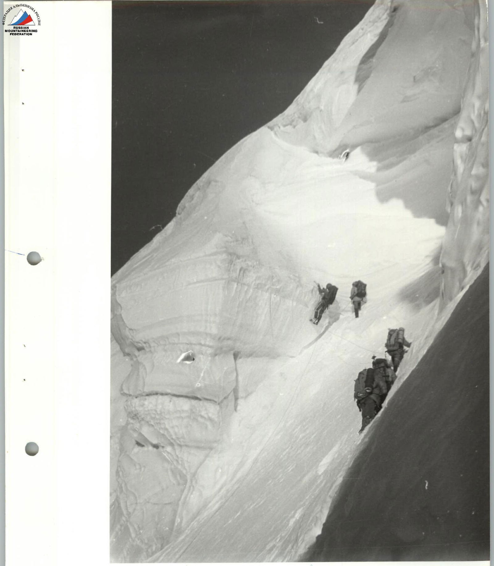 Photo 6 (section 14). Passage of the cornice belt along an ice wall. The first climber is on "Ice-Fifi".
 Photo 9 (section 23). End of the inclined internal corner. The beginning of the second rock wall is visible.
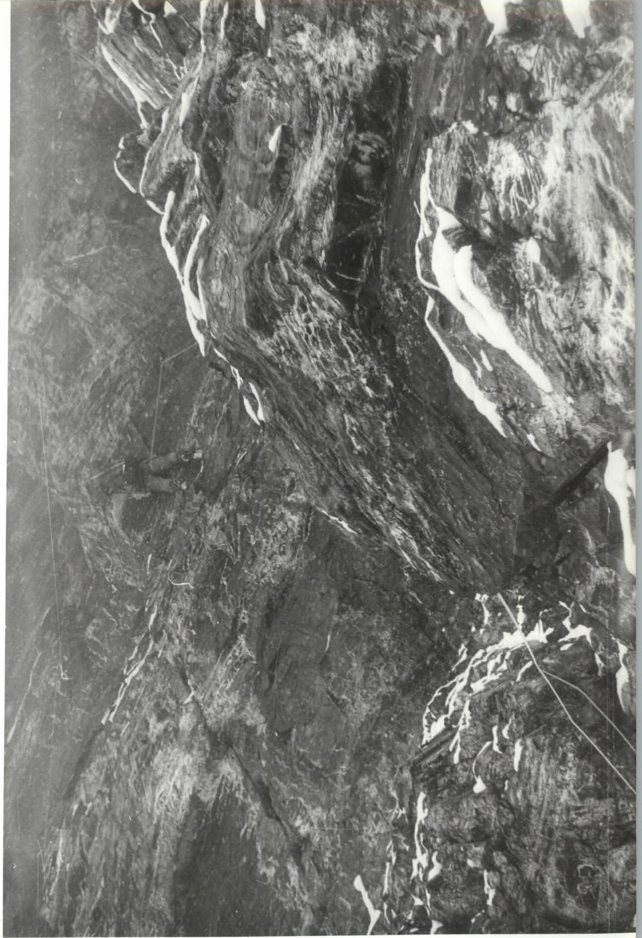 Photo 10 (section 24). Upper part of the second wall. End of the chimney system, traverse into an internal corner.
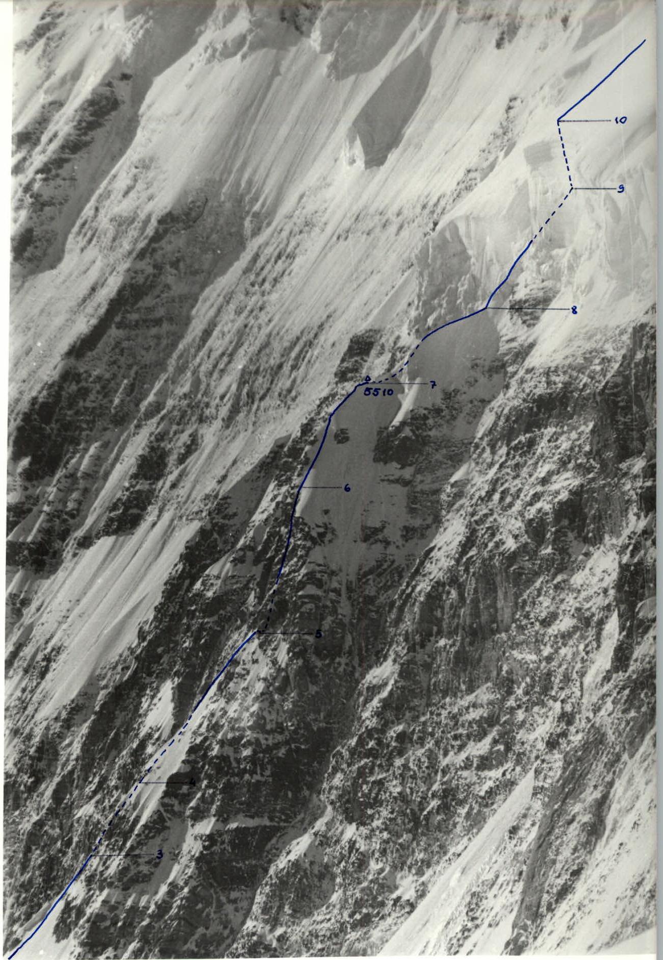 Photo 15 (sections 3–11). Technical profile photograph of the rock section and ice barrier in the lower part of the route.