Ascent Passport
-
Region, valley, section number according to the classification table (2001) - 4.1 Mountain region: Pamir (Tajikistan) Range: at the junction of Akademiya Nauk and Petra Pervogo.
-
Name of the peak: Kommunizm (7495 m), route name: via S slope from Walter's Glacier through BSP and "Big Barrier" (Borodkin's variant via Dushanbe Pass)
-
Category of difficulty – 5Ba
-
Route type: snow-ice
-
Height difference of the route: 3000 m
Route length: 7250 m. Length of sections: V category of difficulty – 200 m, VI category of difficulty – 0 m. Average steepness of the main part of the route – 28°, including:
- section 4500–6200 – 37°
- section 6200–6900 – 28°
- section 7100–7400 – 35° entire route – 22°.
- "Hooks" left on the route: total 0, including pitons 0. Hooks used on the route:
- rock – 0
- ice – 2, including ITO – 0
- snow – 0. Pitons (stationary, removable) were not used.
- Team's travel hours: 64 h, 7 days.
- Leader: Vyacheslav V. Odokhovsky, Candidate Master of Sports
Team members:
- Ivan E. Volodin, 1st sports category
- Andrey E. Petrov, Candidate Master of Sports
-
Coach: Yuri V. Khokhlov, Master of Sports Senior coach: Yuri P. Tinin, Candidate Master of Sports
-
Route start: Exit from Base Camp: 14:00 (Moscow time), August 11, 2006 Ascent to the summit: 11:15 (Moscow time), August 15, 2006 A. Petrov up to 7100 m. Return to Base Camp: 18:00 (Moscow time), August 16, 2006
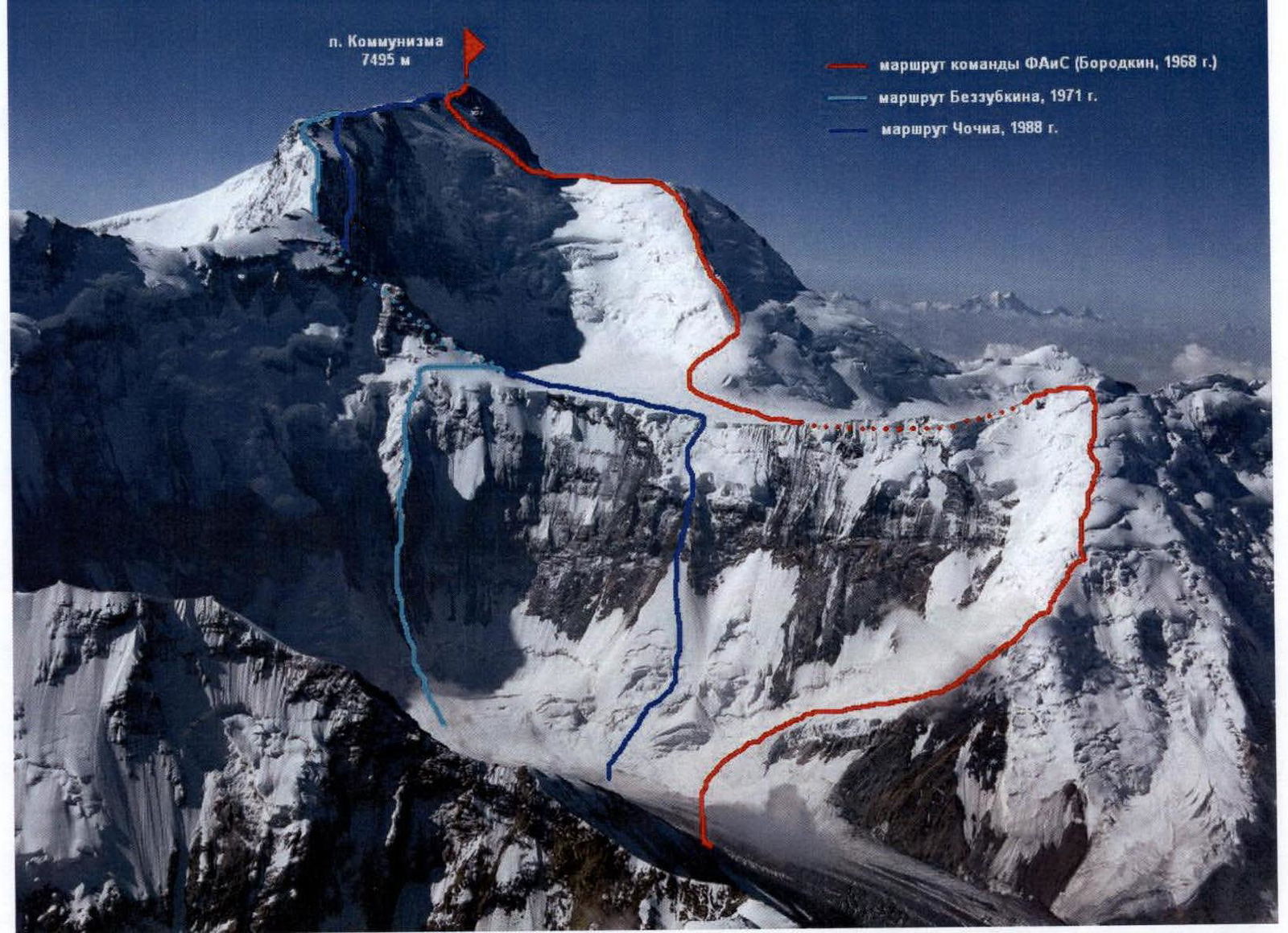
Photo #1 (V. Odokhovsky), August 2006, from the slopes of Peak Korzhenevskaya 6600 m.
UIAA Symbol Route Diagram
| Rock Hooks | Ice Hooks | Snow Hooks | Description of the section | Length, m | Steepness, ° | Category of difficulty | Section # |
|---|---|---|---|---|---|---|---|
| 0 | 2 | 0 | Peak Kommunizm 7495 m | 7250 | 22 | 5B | |
| - | - | - | ridge to the summit | 120 | 25 | 4 | R18 |
| - | 1 | - | snow-firn slope along the rock wall "trapeze" | 450 | 35 | 4 | R17 (Photo #11) |
| - | - | - | snow-ice ridge | 400 | 20 | 3 | R16 |
| Camp 4, 6900, snow areas (overnight stay August 14–15, 2006) | |||||||
| - | - | - | snow-ice slope of Dushanbe Pass | 500 | 35 | 4 | R15 |
| Camp 3, 6600, talus areas (overnight stay August 13, 2006) | |||||||
| - | - | - | snow slope along the rock ridge | 150 | 30 | 3 | R14 |
| - | - | - | snow-ice slope | 150 | 45 | 5 | R13 |
| - | - | - | snow-ice ridge of Dushanbe Pass | 500 | 30 | 3 | R12 (Photo #10) |
| - | - | - | crossing BSP under the slopes of Dushanbe Pass | 1600 | 5 | 2 | R11 |
| - | - | - | descent down the snow slope | 400 | 35 | 4 | R10 |
| Camp 2, 6200, snow areas (overnight stay August 12, 2006) | |||||||
| - | - | - | descent down the snow slope | 150 | 30 | 3 | R9 |
| - | - | - | ridge, "Grudi" peak | 550 | 33 | 3 | R8 |
| - | - | - | large serac, standard overnight stays 5800 m | 400 | 35 | 3 | R7 |
| - | - | - | snow slope | 250 | 36 | 3 | R6 (Photo #9) |
| - | - | - | snow slope | 200 | 40 | 4 | R5 |
| - | 1 | - | ice wall (5 m, 70° V+) | 50 | 50 | 5 | R4 |
| - | - | - | snow slope | 350 | 35 | 3 | R3 (Photo #8) |
| Camp 1, 5100, talus areas (overnight stay August 11, 2006) | |||||||
| - | - | - | rock ridge | 380 | 38 | 2 | R2 |
| - | - | - | talus gully | 50 | 36 | 2 | R1 |
| - | - | - | "cushion" | 600 | 33 | 2 | R0 |
| 0 | 2 | 0 | Total route | 7250 | 22 | 5B |
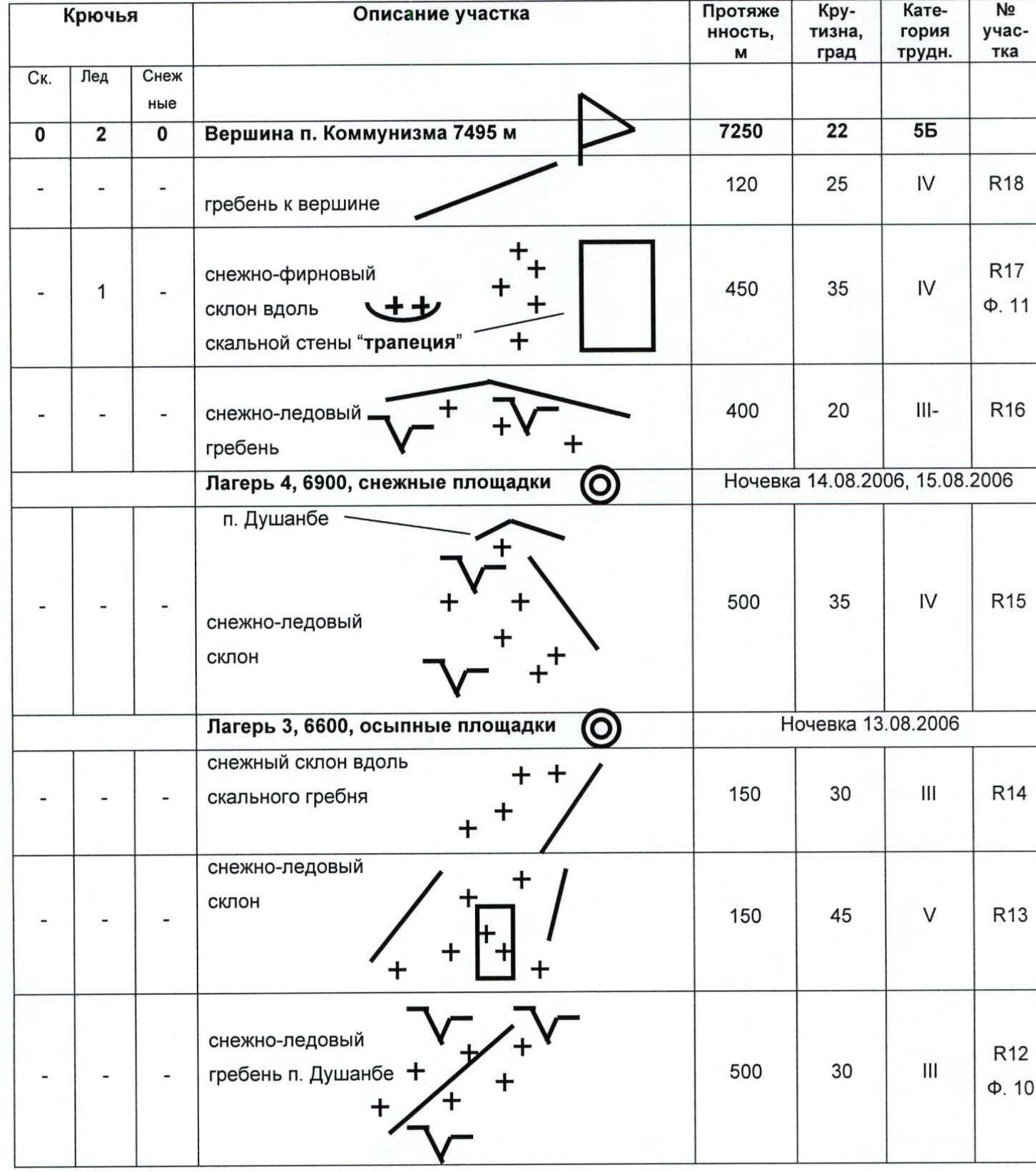


Photo #6 (A. Petrov), August 2006, from the helicopter landing site, 4500 m.
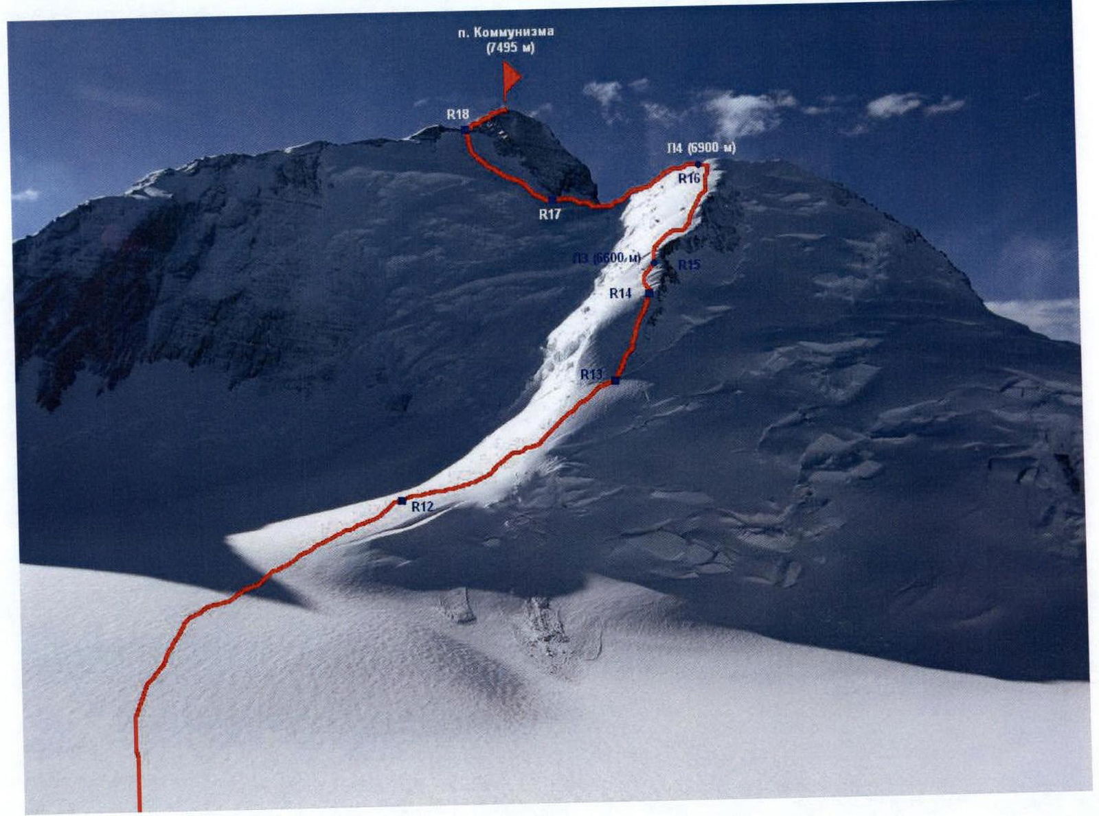
Photo #7 (V. Odokhovsky), August 2006, from "Grudi", 6200 m.
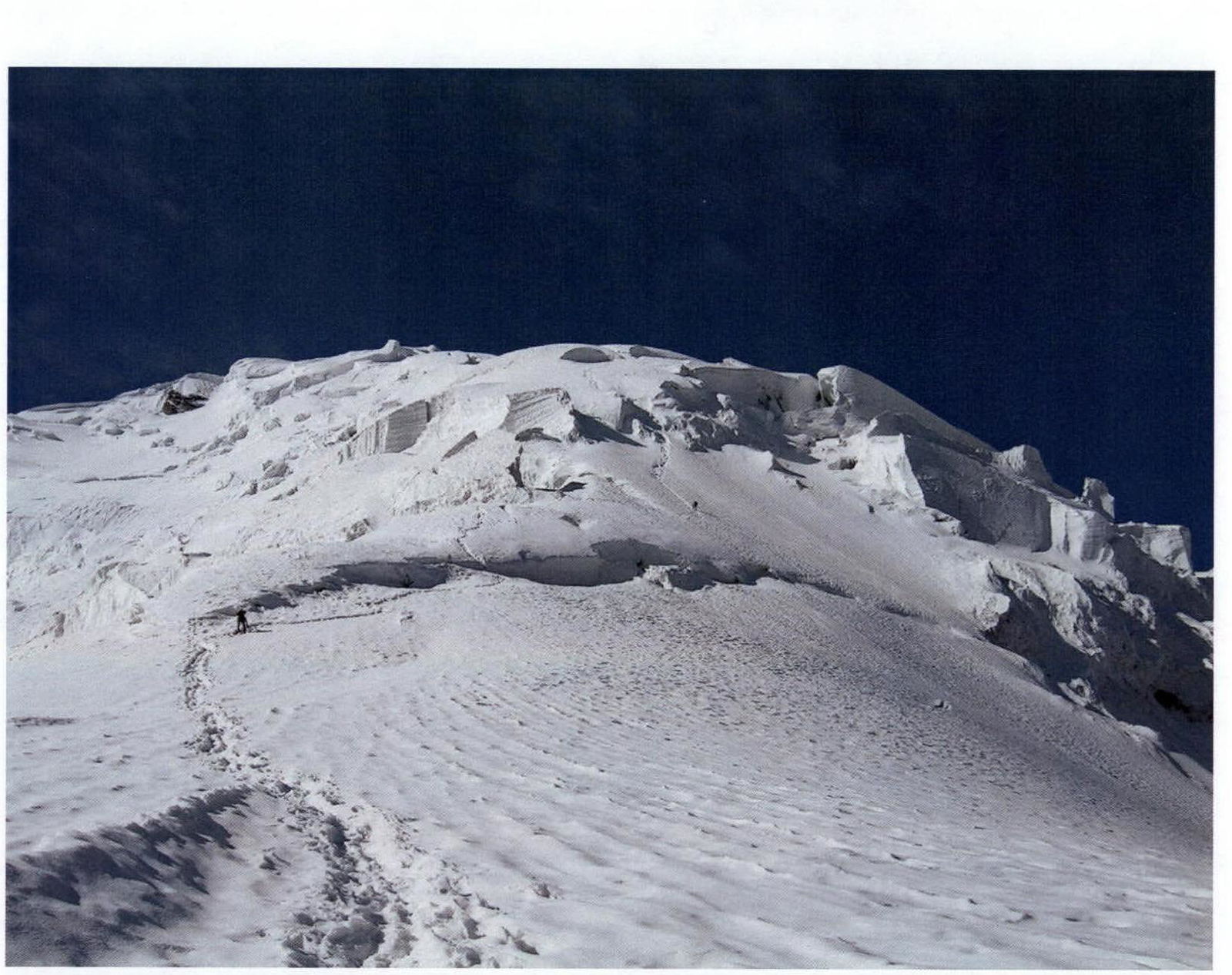
Photo #8 (A. Petrov), August 2006, section R3, 5400 m.
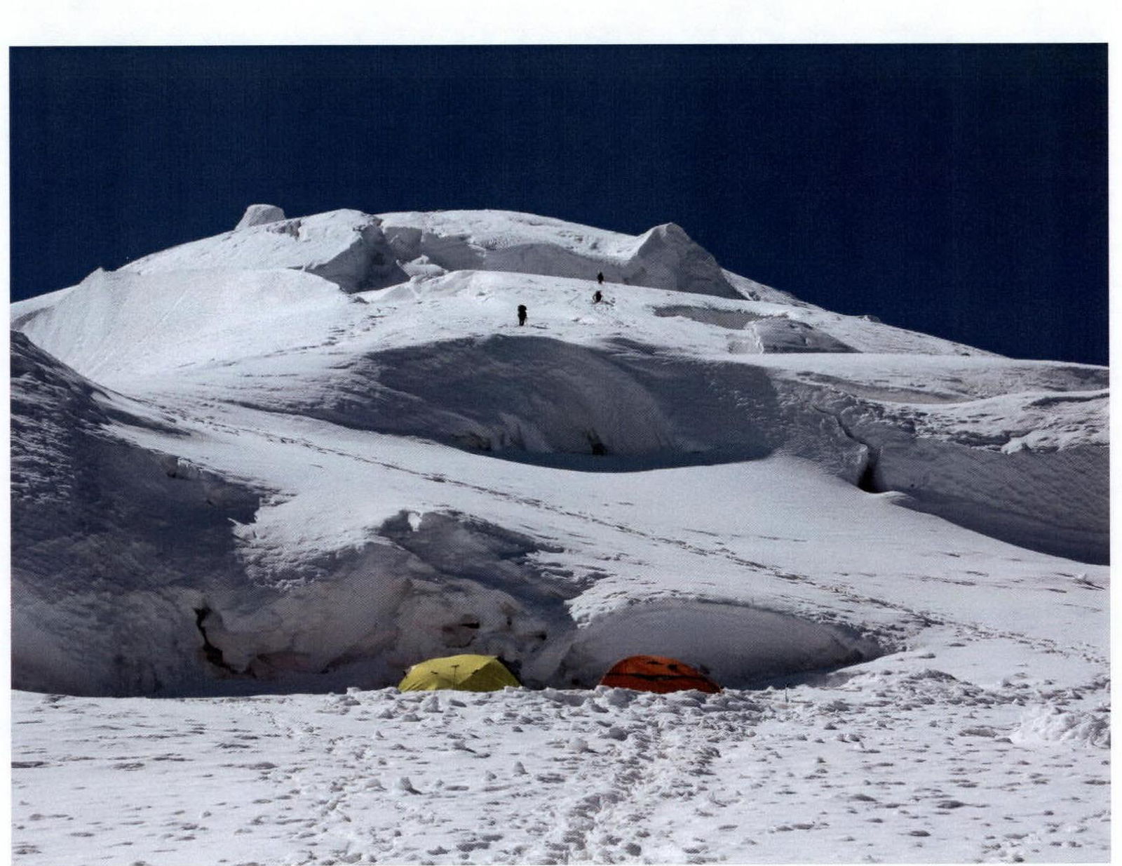
Photo #9 (V. Odokhovsky), August 2006, section R6, 5600 m.
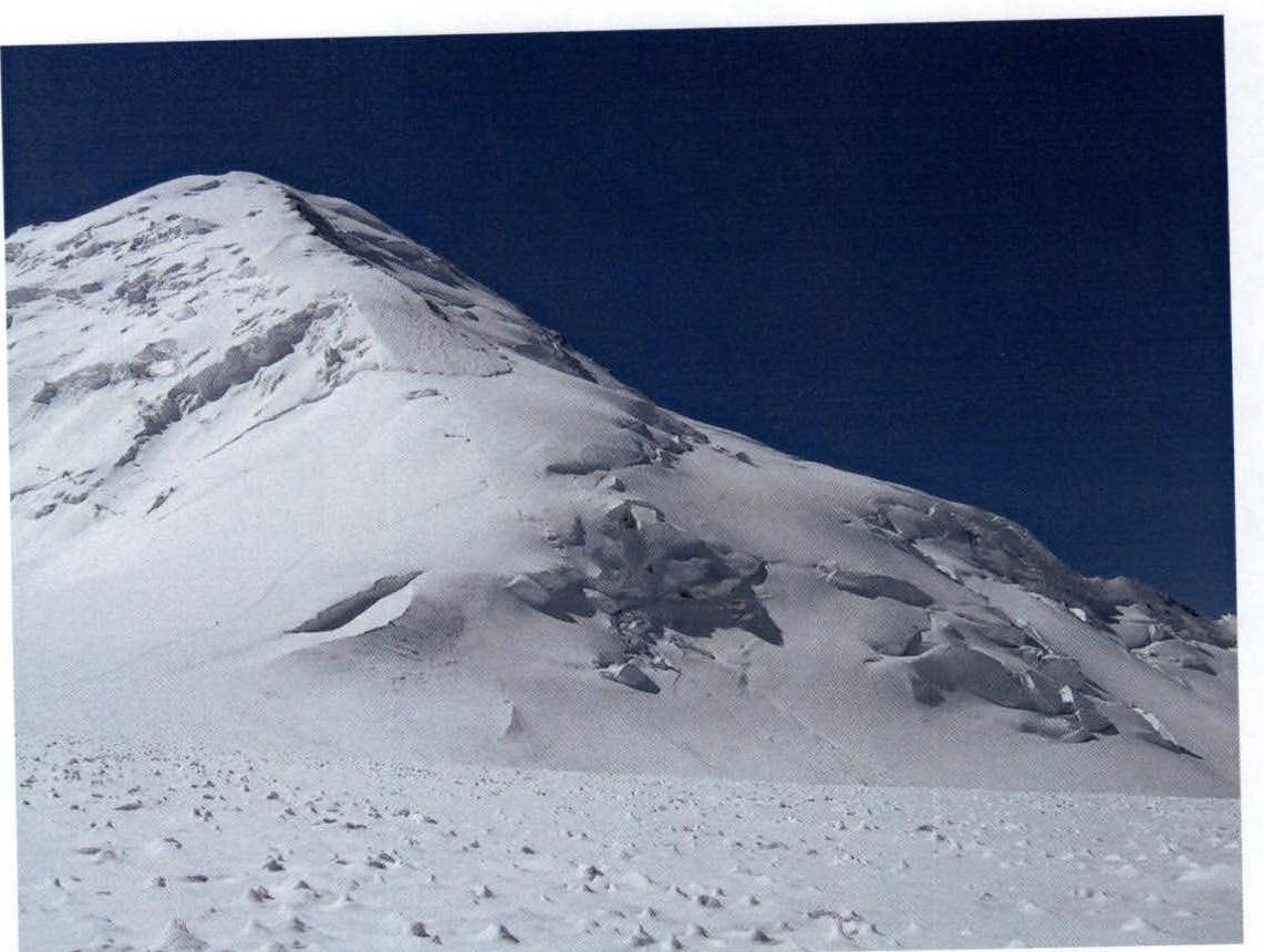
Photo #10 (A. Petrov), August 2006, section R12, 6200 m.
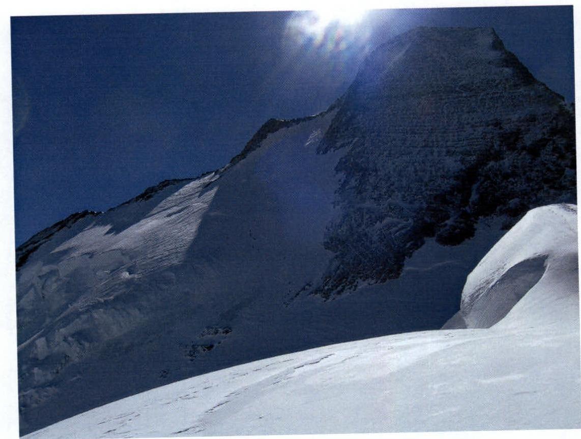
Photo #11 (A. Petrov), August 2006, section R17, 7200 m.


