

Ascent Passport
- Ascent area: Kamchatka. Klyuchevskaya group of volcanoes.
- Summit name: Klyuchevskoy volcano 4750 m. North slope.
- Proposed category: 2B.
- Route type: combined.
- Elevation gain: 3000 m.
- Route length: 4.5 km.
- Average slope: 40°.
- Total climbing time: 16 hours.
- Leader: D. Gauz.
- Ascent date: 1788.
- Description compiled by A. Bichenko.
Area map. Scale 1:2000 m.
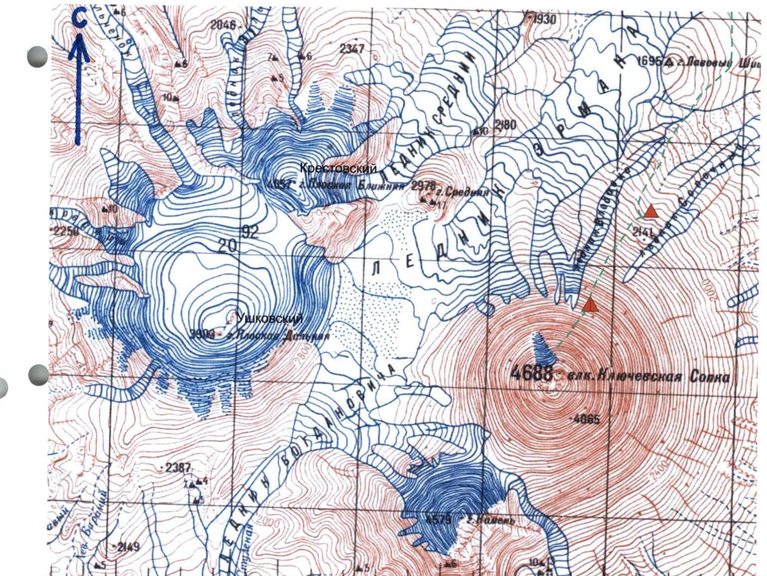
Base camp — 2000 m. Assault camp — 2500 m.
Approach Route
Brief Overview of the Klyuchevskaya Group of Volcanoes
The Klyuchevskaya group of volcanoes is located in the center of Kamchatka, 500 km north of the city of Petropavlovsk-Kamchatsky. Klyuchevskoy volcano is the highest volcano in its group. The nearest settlement to Klyuchevskoy volcano is the town of Klyuchi, located 40 km from the foot of the volcano. The town of Klyuchi provides a convenient and closest approach to the north slope of Klyuchevskoy volcano. The first ascent to the summit via the north slope was made in 1788 by Daniil Gauz. This ascent is documented and is considered the starting point of Russian mountaineering. To this day, ascents are made via the north slope every year by climbers from different cities and countries. However, the route is not officially registered and is not included in the classifier of mountaineering routes in Russia. The proposed route via the north slope of Klyuchevskoy volcano corresponds to category 2B. The Kamchatka federation proposes to include the route in the classifier under the name D. Gauz, as it is a historical fact.
Klyuchevskaya Sopka volcano, 4750 m, N-slope
The route can be accessed from the town of Klyuchi. In summer, high-clearance vehicles can be used to reach the volcanologists' base "Podkova" at an altitude of 1100 m, 37 km from the town. From the base, the approach to the route takes a day's journey along the lava cones to the hut located at an altitude of 2500 m on the shoulder of the cone (in winter, this entire distance is covered on skis). The start of the route is an ascent up a wide snow-and-ice couloir to an altitude of 3000 m, followed by a traverse to a poorly defined ridge. The ridge is a lava flow consisting of densely packed medium and large volcanic rock scree, covered with firn and ice. The slope steepness is 40–45°. Along the ridge, there is an exit to the edge of the Krestovskaya shara and from there to the crater rim. The volcano does not have a clearly defined summit. Klyuchevskaya Sopka has a crater 400 m in diameter. The ascent must be made wearing helmets due to rockfall hazards on the slopes.
Ascent time is 8–9 hours. Descent is made via the ascent route.

Comments
Sign in to leave a comment