Kamchatka Federation of Alpinism and Rock Climbing
REPORT
ON THE FIRST ASCENT TO THE SUMMIT YUZhnaya (SOUTHERN), GANALSKIE VOSTRYAKI RANGE, KAMCHATKA PENINSULA VIA THE ROUTE:
"FROM THE SOUTH, ALONG THE WESTERN COUNTERFORT, THROUGH 'SLONIK'" CAT. 2B
The ascent was made by the team of the Kamchatka Federation of Alpinism and Rock Climbing on June 24, 2016.
ASCENT DOCUMENTATION
| № | 1. General Information | |
|---|---|---|
| 1.1 | Full name, sports rank of the leader | Benedyk Ivan Nikolaevich, 1st sports rank |
| 1.2 | Full name, sports rank of the participants | Kostyrya Mikhail Vladimirovich, 2nd sports rank |
| 1.3 | Full name of the coach | Farberov F.A., CMS |
| 1.4 | Organization | RRO "Kamchatka Federation of Alpinism and Rock Climbing" |
| 2. Characteristics of the Ascent Object | ||
| 2.1 | Area | Ganalskie Vostryaki Range, Kamchatka Peninsula |
| 2.2 | Valley | - |
| 2.3 | Section number according to the 2013 classification table | 3.2 |
| 2.4 | Name and height of the summit | v. Yuzhnaya (Southern), 2050 m |
| 2.5 | Geographical coordinates of the summit (latitude/longitude), GPS coordinates | N 53.47641° E 157.78540° |
| 3. Characteristics of the Route | ||
| 3.1 | Name of the route | "From the south, along the western counterfort, through 'Slonik'" |
| 3.2 | Proposed category of difficulty | 2B |
| 3.3 | Degree of route development | First ascent |
| 3.4 | Nature of the route terrain | Combined |
| 3.5 | Height difference of the route | 680 m |
| 3.6 | Length of the route | 1123 m |
| 3.7 | Technical elements of the route | I cat. sl. snow/firn – 650 m |
| II cat. sl. firn/rock/scree – 315 m | ||
| III cat. sl. rock – 147 m | ||
| IV cat. sl. rock – 6 m | ||
| 3.8 | Descent from the summit | Via route 2B "Along the southern ridge" |
| 3.9 | Additional characteristics of the route | |
| 4. Characteristics of the Team's Actions | ||
| :-- | :-- | :-- |
| 4.1 | Time of movement (team's walking hours, indicated in hours and days) | 11 h 30 min |
| 4.2 | Overnights | - |
| 4.3 | Start of the route | 05:00 |
| 4.4 | Reach the summit | 12:35 |
| 4.5 | Return to the base camp | 16:30 |
| 5. Responsible for the report | ||
| 5.1 | Full name, e-mail | Benedyk I.N., ivanbenedyk@yandex.ru, Fedorov A.V., sanfed90@mail.ru |
GENERAL PHOTO OF THE SUMMIT. Shooting point: N 53.47717° E 157.76639°. Height: 1050 m. June 23, 2016.
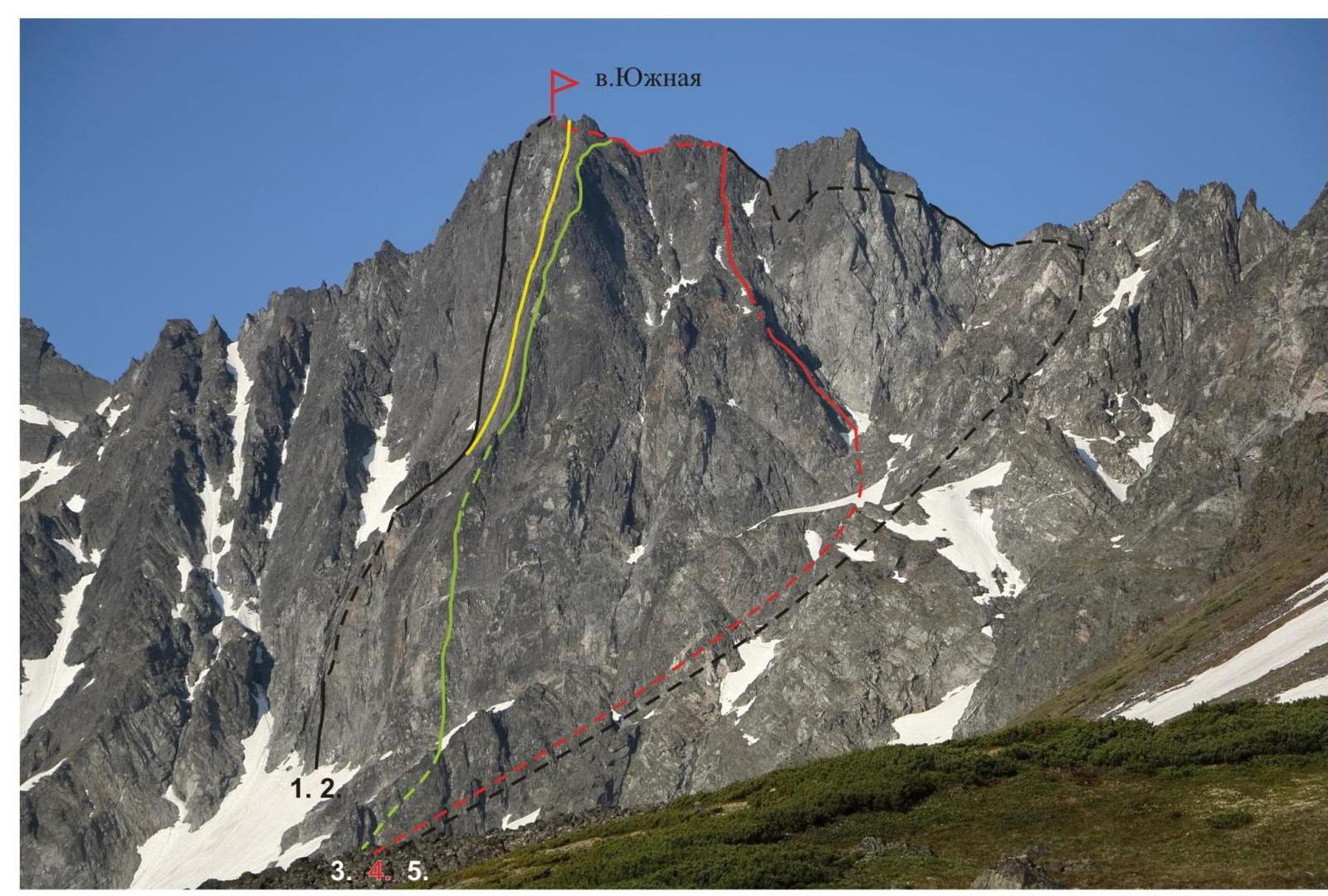
- "Along the center of the northwest wall", cat. 5B. F. Farberov 1991
- "M-33, along the center of the NW wall", cat. 5B. I. Benedyk 2001
- "Along the edge of the northwest wall", cat. 5A. A. Bichenko 1995
- New route: "From the south, along the western counterfort, through 'Slonik'", cat. 2B. I. Benedyk, M. Kostyrya 2016
- "Along the southern ridge", cat. 2B. A. Bichenko. 1998
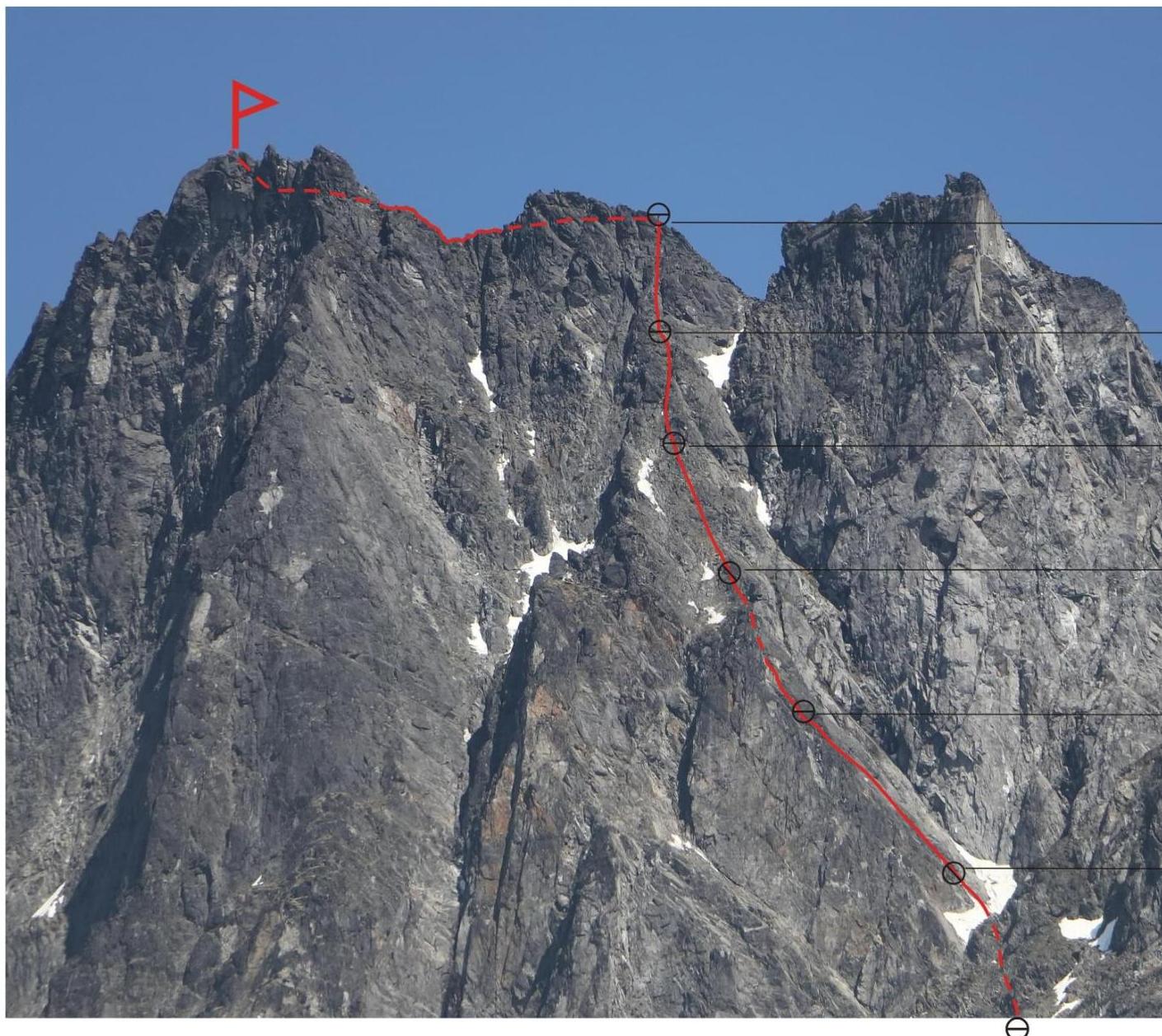
PHOTO OF THE ROUTE PROFILE FROM THE LEFT
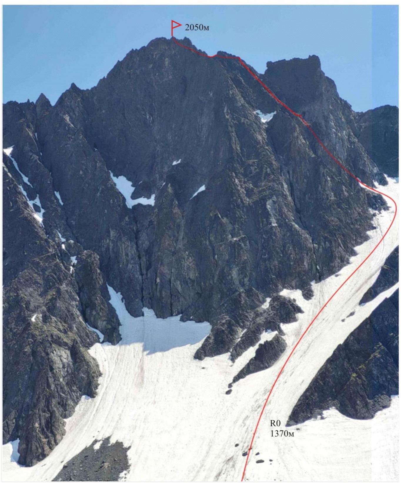
The photo was taken from the southeastern cirque of v. Yurchik. Height of the shooting point: 1450 m. June 21, 2022.
Photopanorama of the Main Valley
Ganalskie Ostriaki Range, Kamchatka
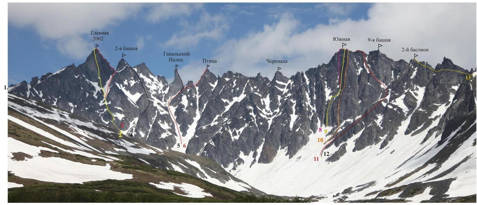
- "From the northwest", cat. 3B. I. Korbukh. 1981
- "Along the center of the SW wall", cat. 5B. F. Farberov. 1991
- "Along the southern edge", cat. 4A. I. Benedyk. 2006
- "Along the SW edge ('Nevidimka')", cat. 3B. A. Zobenko. 2018
- "Along the southern edge", cat. 5A. F. Farberov. 1991
- "Along the northern edge", cat. 3B. I. Benedyk. 2005
- "Along the northwest edge", cat. 2B. E. Lysenkov. 2017
- "Along the center of the northwest wall", cat. 5B. F. Farberov. 1991
- "M-33, along the center of the NW wall", cat. 5B. I. Benedyk. 2001
- "Along the edge of the northwest wall", cat. 5A. A. Bichenko. 1995
- "From the south, along the western counterfort, through 'Slonik'", cat. 2B. I. Benedyk. 2016
- "Along the southern ridge", cat. 2B. A. Bichenko. 1998
- "Along the western ridge", cat. 2A. A. Fedorov. 2022
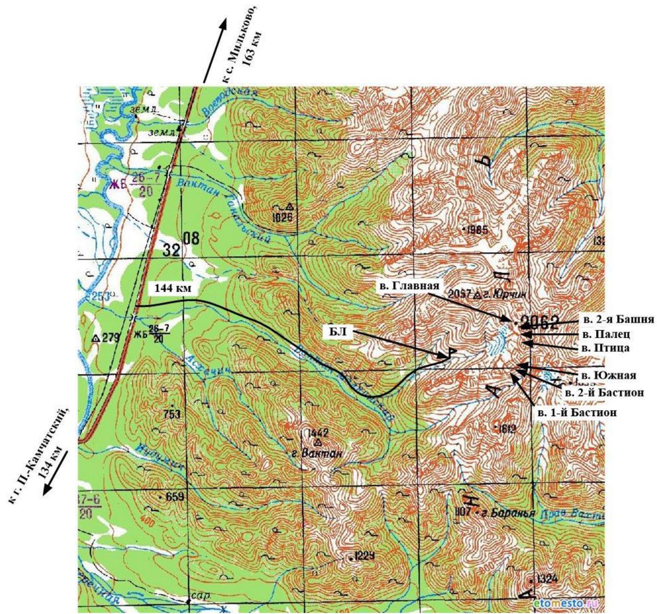
MAP OF THE ASCENT AREA
BRIEF OVERVIEW OF THE ASCENT AREA
In the southern part of the Kamchatka Peninsula, within the system of the Great Eastern Ridge, lies a unique, compact area - the Ganalskie Vostryaki Range. Its length from northwest to southeast is 20 km, and from northeast to southwest is about 10 km.
The maximum height is the summit Glavnaya (Main) at 2062 m. The area is characterized by alpine mountain structure. The height of the walls reaches 450 m. Despite the relatively low absolute height of the objects, winter lasts nine months here. The first frosts begin in early September, and snow falls around September 15-20. In December-February, the temperature drops to -45°C. Snow at the base camp level melts only by mid-June.
Most ascents in the area are made during the summer. The most suitable period for climbing is from mid-June to the end of August.
However, if in June-July all routes are accessible, by August, due to significant melting of snowfields in the couloirs and increased rockfall hazard, the ascent path to some of them may become impassable. This applies to routes on the summits Ganal'skiy Palets (Ganal Finger), Ptitsa (Bird), Cherepakha (Tortoise).
From the city of Petropavlovsk-Kamchatsky, it is convenient to drive to the bridge over the Vaktan Malkinskiy River, 144th km of the Milkovo highway (see the map of the area). Beyond the bridge - to the right, along the forest road, you can drive a total of 5-6 km. Further, on foot or by high-clearance vehicle - another 5 km to the ascent into the valley on the left. This is the first tributary of the Vaktan Malkinskiy River along the way. The road ends here. Then, to the left, in the alder bushes, a footpath begins. You need to walk along the left side of the valley, up to the exit to the terrace. Further, at the border of the forest and bushes, cross the bed of a small stream. The ascent to the upper valley will take 50-60 minutes.
From this point, a panorama of all the main summits opens up: Yurchik, Glavnaya (Main), Palets (Finger), Ptitsa (Bird), Yuzhnaya (Southern). From here to the base camp is three kilometers. Further, the path goes along the left (in the direction of travel) slope of the tributary flowing from the mountain Yurchik, and after four hundred meters, it descends to the right to the tributary along a snowfield in a steep ravine. Cross the tributary and head towards the main cirque, to the cedar thickets on the morainic cushions. Here, near the left (orographic) slopes of the valley, under a clearly visible pass, is a good location for the base camp.
The travel time from the city to the Vaktan Malkinskiy River is 2.5 hours. The walking part of the journey is 10 km, 3.5-4 hours.
Approach to the route: from the base camp, further along the valley, along an old, overgrown with grass and moss, stony moraine, 1.5 km to a large snowfield completely covering the bottom of the cirque. Then, along the snowfield to the right and up, go to the entrance to the couloir separating the summits Yuzhnaya (Southern) and Devyataya Bashnya (Ninth Tower) - on the left of the couloir, and the summit 2-y Bastion (2nd Bastion) - on the right. Here, at the beginning of the rocks on the right side of the couloir, is the start of the route (R0).
Shooting point: N 53.47717° E 157.76639°. Height: 1050 m. June 30, 2016.
Conventional symbols: Insurance stations: — convenient; — inconvenient.
R7 Photo № 8
R6 Photo № 7
R5 Photo № 6
R4 Photo № 4, 5
R3
R2 Photo № 2, 3
R1 Photo № 1
TECHNICAL CHARACTERISTICS OF THE ROUTE SECTIONS
| Section № | Nature of the terrain | Category of difficulty | Length, m | Type and number of pitons |
|---|---|---|---|---|
| R0 | Snow/firn | I | 650 | - |
| R1 | Firn | II | 100 | - |
| R2 | Rock | III/III+ | 47 | Friends, pitons 7 pcs. |
| R3 | Rock | III | 30 | Nuts, friends, pitons 6 pcs. |
| II | 10 | |||
| R4 | Rock/scree, partially grassy slope | II/II+ | 45 | Friends, pitons 5 pcs. |
| R5 | Rock chimney | III- | 35 | Nuts, friends, pitons 4 pcs. |
| II | 10 | |||
| R6 | Rock | III | 30 | Nuts, friends, pitons 10 pcs. |
| II+ | 10 | |||
| IV- | 6 | |||
| R7 | Rock/scree/rubble | I/II | 150 | - |
DESCRIPTION OF THE TEAM'S ACTIONS BY SECTIONS
The approach to the start of the route is described on page 8 "Brief overview of the ascent area".
Section R0
Move up the snow-firn couloir for about 650 m, with a slope of up to 35°. Movement in crampons with an ice axe. Go to the adjacent short and steep ice-firn couloir on the left, leading to the foot of the western wall of v. Devyataya Bashnya (Ninth Tower). Here, turn into the couloir, beginning section R1.
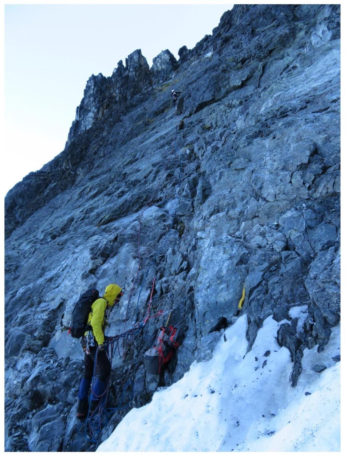
Section R1 (photo №1, 2)
Firn couloir with a slope of up to 45°, length 80-100 m, cat. II. Insurance: stations on snow, movement in rope teams. Climb almost to the foot of the western wall of Devyataya Bashnya and exit to the left, onto the rocks of the western counterfort. Station on personal points (friend and pitons).
Further, the rock part of the route - movement in rope teams with alternate insurance.
Section R2 (photo №1, 2, 3)
Movement upward with alternate insurance, slightly traversing to the left towards the exit to the ridge of the counterfort. Smoothed, partially wet, inclined slabs (resembling "ram's foreheads"), with small scree on ledges. Relief is poor, few cracks, difficulties with setting intermediate points. Pitons are used more often.
47 m, slope 40-50°, cat. III/III+. Station - a convenient ledge for 3-4 people (on the station friend №2, nut №3, piton).
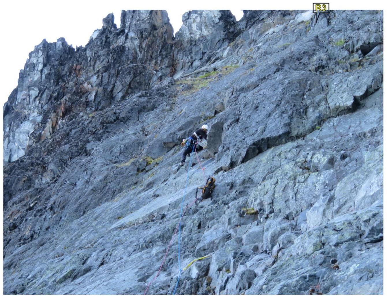
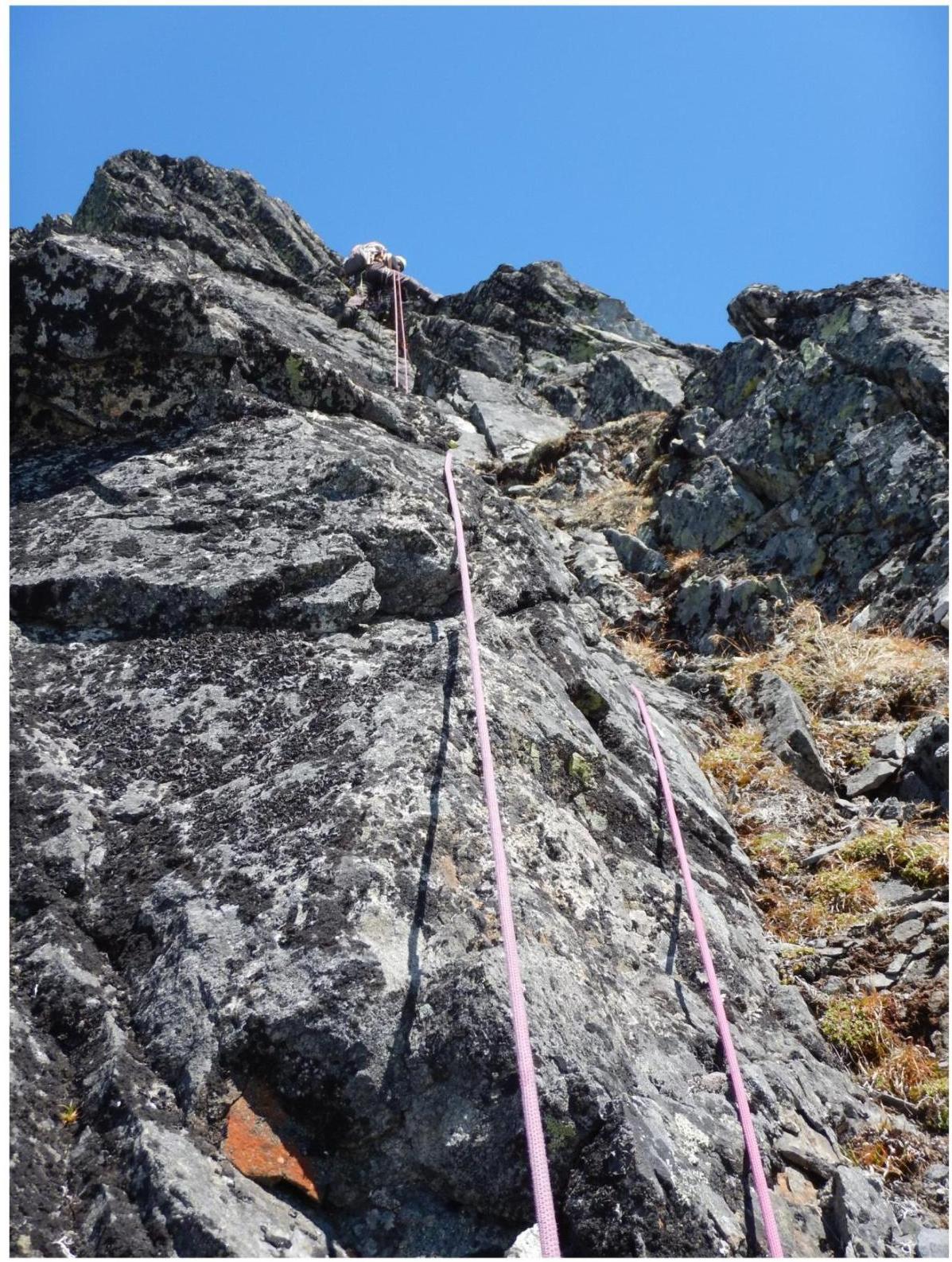
Section R3
From the station, to the left and straight up 30 m, along inclined slabs, small walls, and ledges, exit to the edge of the counterfort. Then, pass another 10 m along simple grassy rocks on the ridge of the counterfort. Station on inclined slabs.
30 m - cat. III, slope up to 50°, 10 m - cat. II. Station - pitons and friends.
Section R4 (photo №4, 5)
Along the counterfort - up along simple grassy, destroyed inclined slabs, approach a small rock ascent/wall. To the left of it, the entrance to the chimney is visible. At this wall, there is a convenient and safe place for a station.
45 m, cat. II/II+, slope 40-45°. Insurance - rock outcrops, pitons, friends.
Station: nuts №3, 4, friends №2, 3.
Section R5 (photo №6)
Further up, enter the inclined rock chimney, 30-35 m long. Slope 40-60°, cat. III-. Insurance - pitons, nuts, and friends (all of medium and small sizes). Exit from the chimney onto simple rocks densely overgrown with moss. Pass along them about 10 m under the ascent of the counterfort - station.
It is also possible to bypass the chimney on the right, along rock walls, but here the path is more difficult, cat. III+/IV-, with a slope of up to 60°. The relief for insurance is diverse. The exit is to the same place under the station as when moving through the chimney.
Station: friend № 4, "shveller" piton, anchor. Position the station considering the possible fall of stones when the leader moves up section R6.
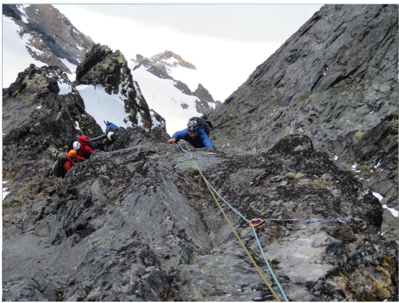
Section R6 (photo №7, 8)
From the station, further straight up, along the edge of the counterfort. Rocks, mostly solid, partially destroyed. 35 m, slope up to 65°, cat. III. The choice for intermediate points is diverse: pitons and friends.
Further, exit to a small, destroyed, inclined terrace. Through the terrace, approach the final vertical rock ascent - a wall about 6 m. Cat. IV-.
Along the wall, exit to the pre-summit ridge. Station on a rock outcrop.
Section R7 (photo from the summit)
Simultaneous movement along the southeastern slope of v. Yuzhnaya (Southern) to the summit point. Gentle rocks, rubble, to the summit, 100 m, cat. II-, slope up to 40°.
The summit is a large inclined area. Control cairn.
Descent from the summit via route 2B cat. sl. "Along the southern ridge".
CONCLUSION
The participants of the ascent have experience of climbing in various mountain areas, on routes up to cat. 6A, inclusive. Based on their experience and comparing the considered route with others, including those located in the Ganal'skie Vostryaki Range: v. Yurchik 2A, "along the NE ridge"; v. Cherepakha (Tortoise) 2B, "along the NW edge"; volcano Kozel'skiy 2Bz, "traverse from the NW summit, including Zub"; v. Ptitsa (Bird) 3B, "along the N edge"; v. Glavnaya (Main) 3B, "from the northwest"; volcano Kozel'skiy 3A, "from the east, without the 1st summit", and others, the team concluded that the specified route, in terms of the volume of technical work and technical techniques, corresponds to the category of difficulty 2B.
The route stands out for its beauty and logic, the relief is quite safe. Since our first ascent in 2016, the route has already been repeated by five ascents of different sports teams. In general, it can be recommended both for sports ascents and as a high-quality training route. This is also an important aspect in organizing UTS within the framework of NP-2 and SP and for the development of alpinism in the Kamchatka Krai as a whole.
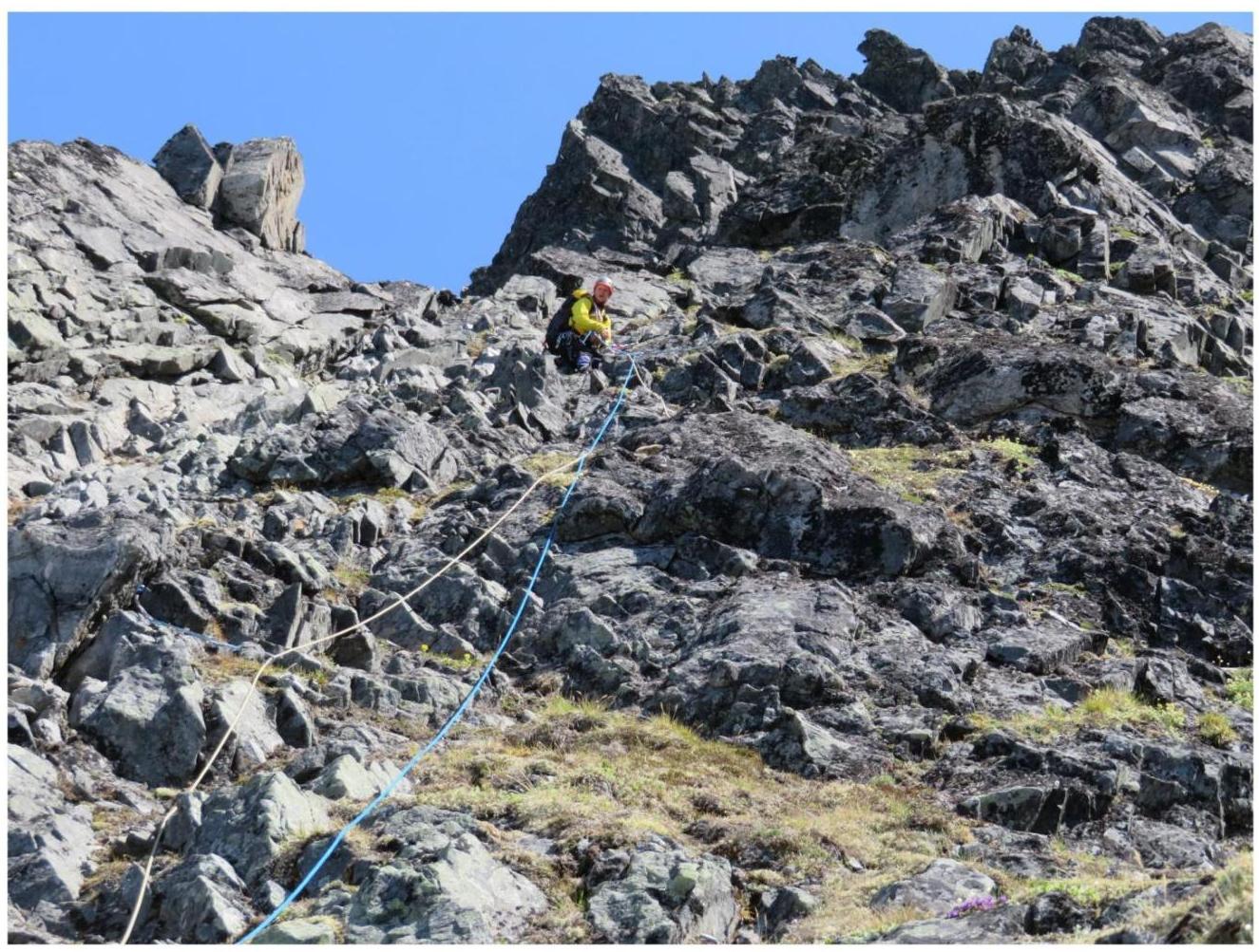
PHOTO №1
Sections R1–R4

The photo was taken from section R0–R1 on June 24, 2016.
PHOTO №2
Section R2
Passage by a rope team of section R2. The photo was taken from section R1 on June 28, 2022.
PHOTO №3
Section R2
The photo was taken from section R1–R2. Passage by the leader of section R2 on June 28, 2022.
PHOTO №4
Section R4
Starting station of section R4. The photo was taken from section R4. View from top to bottom on June 28, 2022.
PHOTO №5
Section R4
The photo was taken from section R4. Station at the entrance to the chimney. June 28, 2022.
PHOTO №6
Section R5
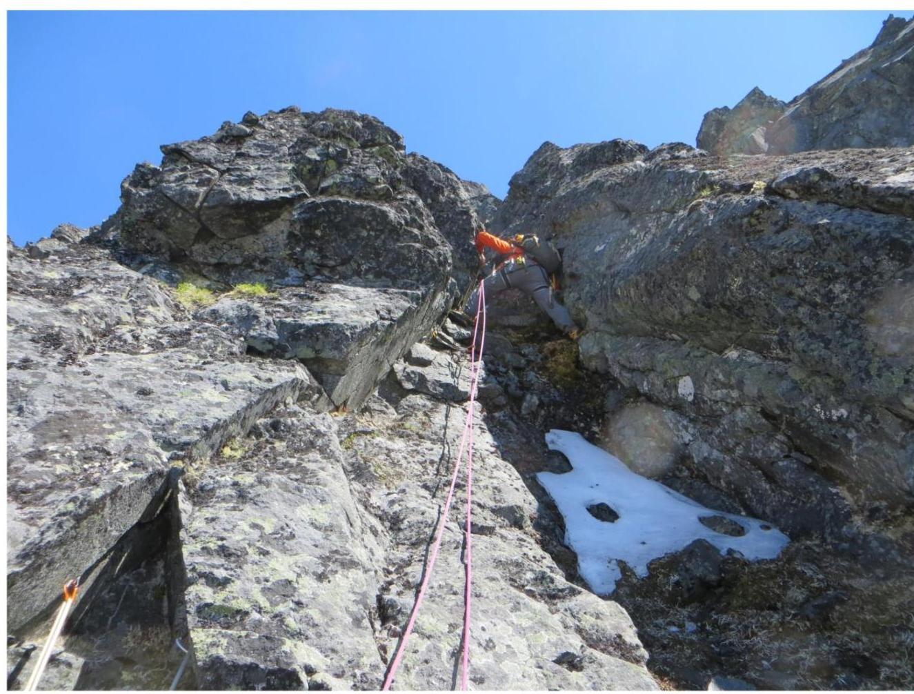
Leader's entry into the chimney, 35 m long. The photo was taken from the station of section R5. June 24, 2016.
PHOTO №7
Section R6
The photo was taken from the station of section R6. June 24, 2016.
PHOTO №8
Section R6
The photo was taken from section R6. June 25, 2018.
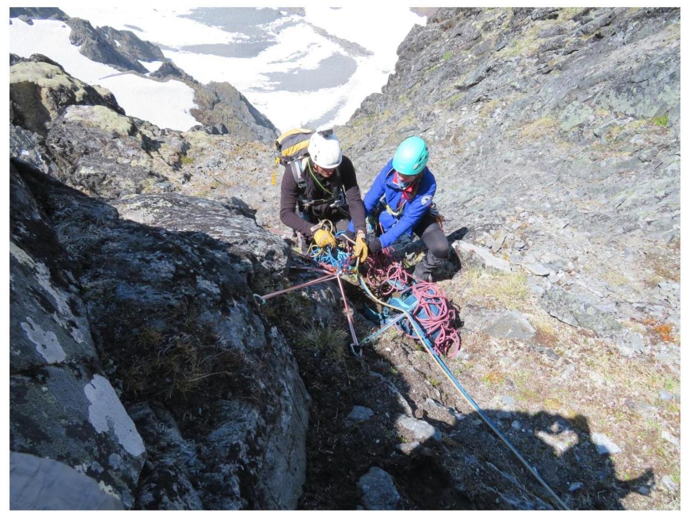
PHOTO FROM THE SUMMIT OF V. YUZhnaya (SOUTHERN), 2050 M.
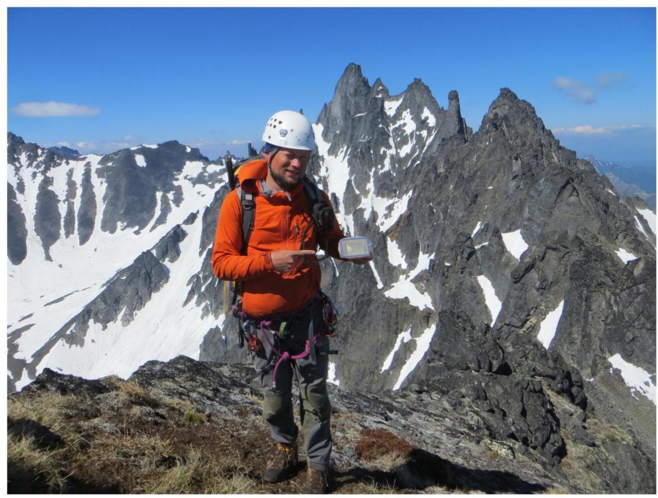
In the photo is Kostyrya M.V. The photo was taken on June 24, 2016.