Report
On the first ascent to the summit
VACHKAZHTSY "DVUZUBKA" RIGHT, 1501 m above sea level (Kamchatka Krai, Elizovsky District, Ganal Range) VIA THE LEFT PART OF THE EASTERN RIDGE, CATEGORY 2B DIFFICULTY (rocky, combined in winter) KHABAROVSK KRAI ALPINISM FEDERATION
September 1, 2022
I. Climbing Report
| № | 1. General Information | |
|---|---|---|
| 1.1 | Full name, sports rank of the team leader | Krasnolutsky Alexander Vyacheslavovich, Candidate for Master of Sports, instructor №606 |
| 1.2 | Full name, sports rank of the participants | Kirilin Ilya Fedorovich, no rank Potapenko Yuri Alexandrovich, no rank Rudchenko Alena Igorevna, no rank Rychkova Elena Vladimirovna, no rank Simshag Tatyana Vladimirovna, no rank |
| 1.3 | Full name of the coach | Krasnolutsky Alexander Vyacheslavovich, Candidate for Master of Sports |
| 1.4 | Organization | Khabarovsk Krai Alpinism Federation |
| 2. Characteristics of the Climbing Object | ||
| 2.1 | Region | Kamchatka Krai, Elizovsky District |
| 2.2 | Range | South-Bystrinsky, Vachkazhez massif |
| 2.3 | Section number according to the classification table | 3. Kamchatka 3.1. Southern part of the Kamchatka Peninsula |
| 2.4 | Name and height of the summit | Vachkazhtsy "Dvuzubka" right, 1501 m above sea level |
| 2.5 | Geographical coordinates of the summit (latitude/longitude) | 53°03′35″ N 157°55′20″ E |
| 3. Characteristics of the Route | ||
| 3.1 | Name of the route | Via the left part of the eastern ridge |
| 3.2 | Proposed category of difficulty | 2B, rocky, combined in winter |
| 3.3 | Degree of route development | First ascent, date of the first ascent unknown |
| 3.4 | Nature of the route terrain | Rocky, combined in winter |
| 3.5 | Height difference of the route | 700 m |
| 3.6 | Length of the route (in meters) | 1315 m technical part, excluding the approach to the route |
| 3.7 | Technical elements of the route (total length of sections of various difficulty categories with indication of terrain type) | 1–1+ category — 600 m, including rocky-scree sections with a slope up to 40°. In winter, potentially avalanche-prone. 2–2+ category — 620 m, including rocky sections with a slope up to 55°. 3–3+ category — 95 m, including rocky sections with a slope up to 75–80°. |
| 3.8 | Descent from the summit | Via the descent trail along the N ridge |
| 3.9 | Additional characteristics of the route | Average slope 45°, maximum slope 75–80°; in winter, potentially avalanche-prone sections on the approaches and the first third of the ascent; cellular signal available at the summit. |
| 3.10 | Equipment used | Local loops with carabiners — 3 pcs., friends 1 set, nuts 1 set, anchor hooks 5 pcs. |
| 4. Characteristics of the Team's Actions | ||
| 4.1 | Time of movement (hours) | 10 |
| 4.2 | Overnight stays | - |
| 4.3 | Start of the route | 7:00 |
| 4.4 | Reaching the summit | 14:00 |
| 4.5 | Return to the base camp | 17:00 |
| 5. Person Responsible for the Report | ||
| 5.1 | Full name, e-mail | Krasnolutsky A.V., krasnyi@mail.ru, 8902-525-8840 |
II. Description of the Ascent
1. Characteristics of the Climbing Object
1.1. General Photo of the Summit. Routes to the Summit.
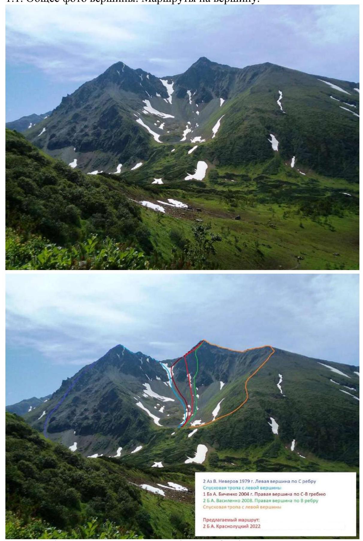
Photo 1, 2. Vachkazhtsy "Dvuzubka" summit, shot from the circus of g. Letnyaia Poperechnaia.
1.2. Photo of the Route Profile
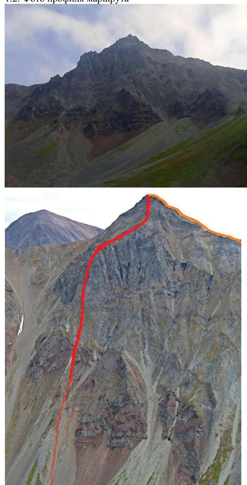
Photo 3–4. Photo from a drone. Profile of the route (marked with a red line, orange — descent trail).
1.3. Profile of the Route

Figure 1. Profile of the route in Google Earth Pro.
1.5. Map of the Area
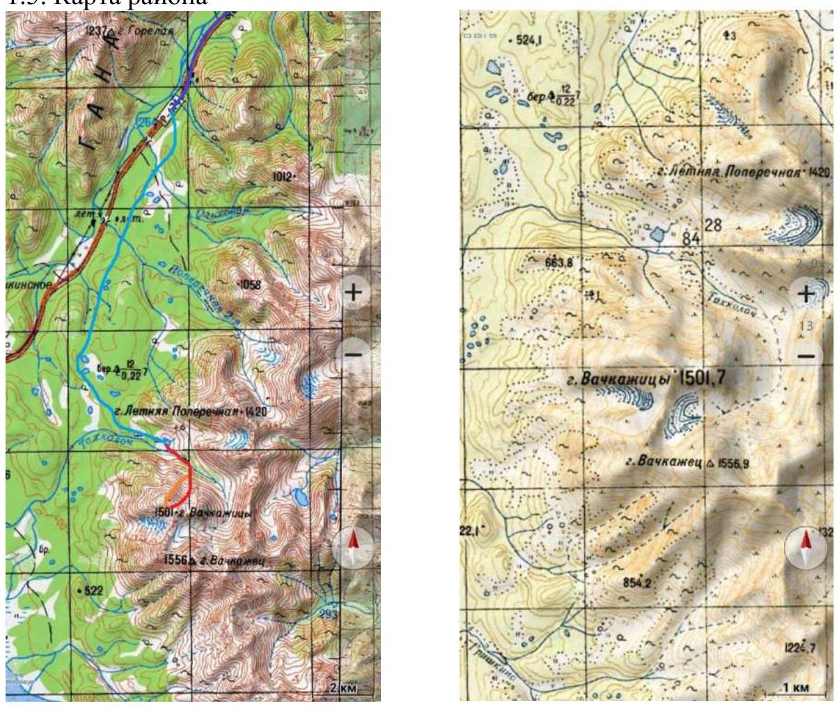
Figure 2–3. Map of the climbing area indicating the route. The blue line schematically indicates the path along the highway to the 72nd km of the Petropavlovsk-Kamchatsky — Milkovo highway, the light blue — the path along the technological passage and then along the forest road to Lake Takholoch (base camp).
1.4. Description of the Area. Approach to the Route.
The Vachkazhtsy "Dvuzubka" summit is located northwest of Petropavlovsk-Kamchatsky. Together with neighboring peaks:
- Vachkazhez 1556 m
- Letnyaia Poperechnaia 1420 m
forms the Vachkazhez massif of the South-Bystrinsky Range.
The distance from Petropavlovsk-Kamchatsky along the Petropavlovsk-Kamchatsky — Milkovo highway is 72 km, then there is a right turn onto a technological passage, along which 10 km on a prepared vehicle (in snowy conditions — on a snowmobile). Then there is a left turn from this passage, along which 3 km along a forest road (in summer — on foot, in winter — on a snowmobile) to Lake Takholoch, located in a glacial valley between the Vachkazhtsy and Letnyaia Poperechnaia peaks.
The approach to the start of the route is clearly visible from the lake. Currently, there are several categorized routes to the summit (photo 2). The proposed route does not duplicate the previously climbed 2B route by A. Vasilenko in 2008. The defining sections do not completely coincide. Moreover, it is crucial (!):
- the approach to Vasilenko's route in June goes along a snowfield;
- in August–September, it is extremely prone to rockfall and cannot be recommended for ascent in snow-free conditions.
2. Characteristics of the Route
2.1. Diagram of the Route in UIAA Symbols
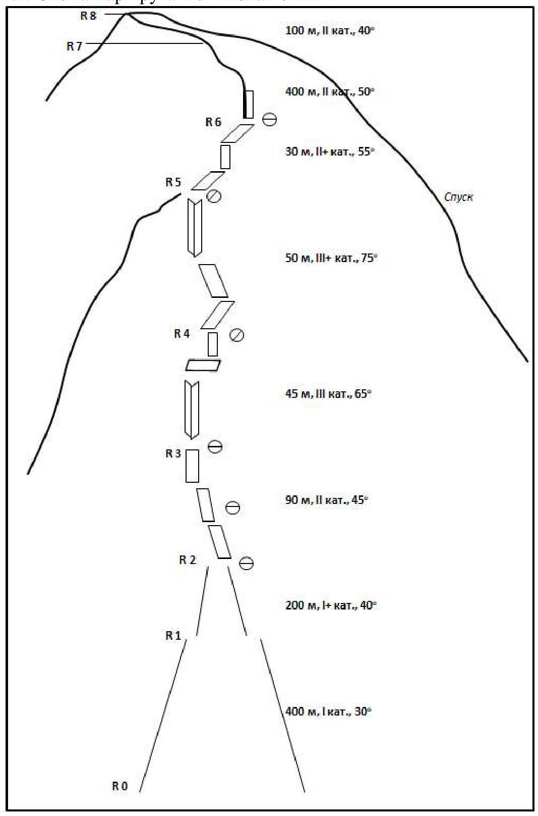
Figure 4. Diagram of the route in UIAA symbols.
2.3. Technical Characteristics of Route Sections
| № section | Terrain characteristics | Category of difficulty | Length, m | Type and number of hooks |
|---|---|---|---|---|
| R0–R1 | Rocky scree moraine slope, angle 25–30° | 1 | 400 | - |
| R1–R2 | Rocky scree moraine slope, angle up to 40° | 1+ | 200 | - |
| R2–R3 | Simple, heavily destroyed rocks, system of inclined shelves and несложных wall, angle up to 45° | 2 | 90 | 4 friends; station on terrain with hook insurance |
| R3–R4 | Key section I. Wide internal angle, turning into an inclined shelf, then a vertical wall. Rock is destroyed, angle up to 65° | 3 | 45 | 2 hooks, 1 friend, 2 nuts; station on friends and hooks |
| R4–R5 | Key section II. Inclined shelves, turning into an internal angle, exiting onto a small counterfort, angle up to 75° | 3+ | 50 | 4 hooks, 1 friend, 1 nut; station on terrain |
| R5–R6 | Simple climbing along the counterfort ridge, angle up to 55° | 2+ | 30 | 1 nut, station on terrain |
| R6–R7 | Movement along the ridge and periodically encountered simple rocky walls, angle up to 50° | 2 | 400 | Insurance for terrain |
| R7–R8 | Movement along the ridge and periodically encountered simple rocky walls, angle up to 40° | 2 | 100 | - |
3. Characteristics of the Team's Actions
3.1. Brief Description of the Route Passage with Photo Illustrations.
| № section | Description | Photo number |
|---|---|---|
| R0–R1 | Rocky scree moraine slope, angle 25–30°. Simultaneous movement. In snowy conditions — with consideration of potential avalanche danger. | Photo 5 |
| R1–R2 | Rocky scree moraine slope, angle up to 40°. Simultaneous movement. In snowy conditions — with consideration of potential avalanche danger. At the same time, in snowy conditions, the section is easier to pass, in summer the scree is partially mobile. | Photo 6, 7 |
| R2–R3 | Simple, heavily destroyed rocks, system of inclined shelves and несложных wall, angle up to 45°. Passed alternately, or by perims, depending on the level of group preparation and slope condition. | |
| R3–R4 | Key section I. Wide internal angle, turning into an inclined shelf, then a vertical wall. Rock is destroyed, angle up to 65°. Start of climbing on the left part of the angle. Perims. Station is inconvenient, requires attention in organization due to rock destruction. | |
| R4–R5 | Key section II. Inclined shelves, turning into an internal angle, exiting onto a small counterfort, angle up to 75°. Perims. Climbing is tense. Station is inconvenient. | Photo 8 |
| R5–R6 | Simple climbing along the counterfort ridge, angle up to 55°. Passed alternately, or by perims, depending on the level of group preparation. | |
| R6–R7 | Movement along the ridge and periodically encountered simple rocky walls, angle up to 50°. Simultaneous movement, with insurance for terrain. | Photo 9 |
| R7–R8 | Movement along the ridge and periodically encountered simple rocky walls, angle up to 40°. Simultaneous movement. | |
| Descent along a trodden trail along the W ridge and N slope into the circus of the massif. |
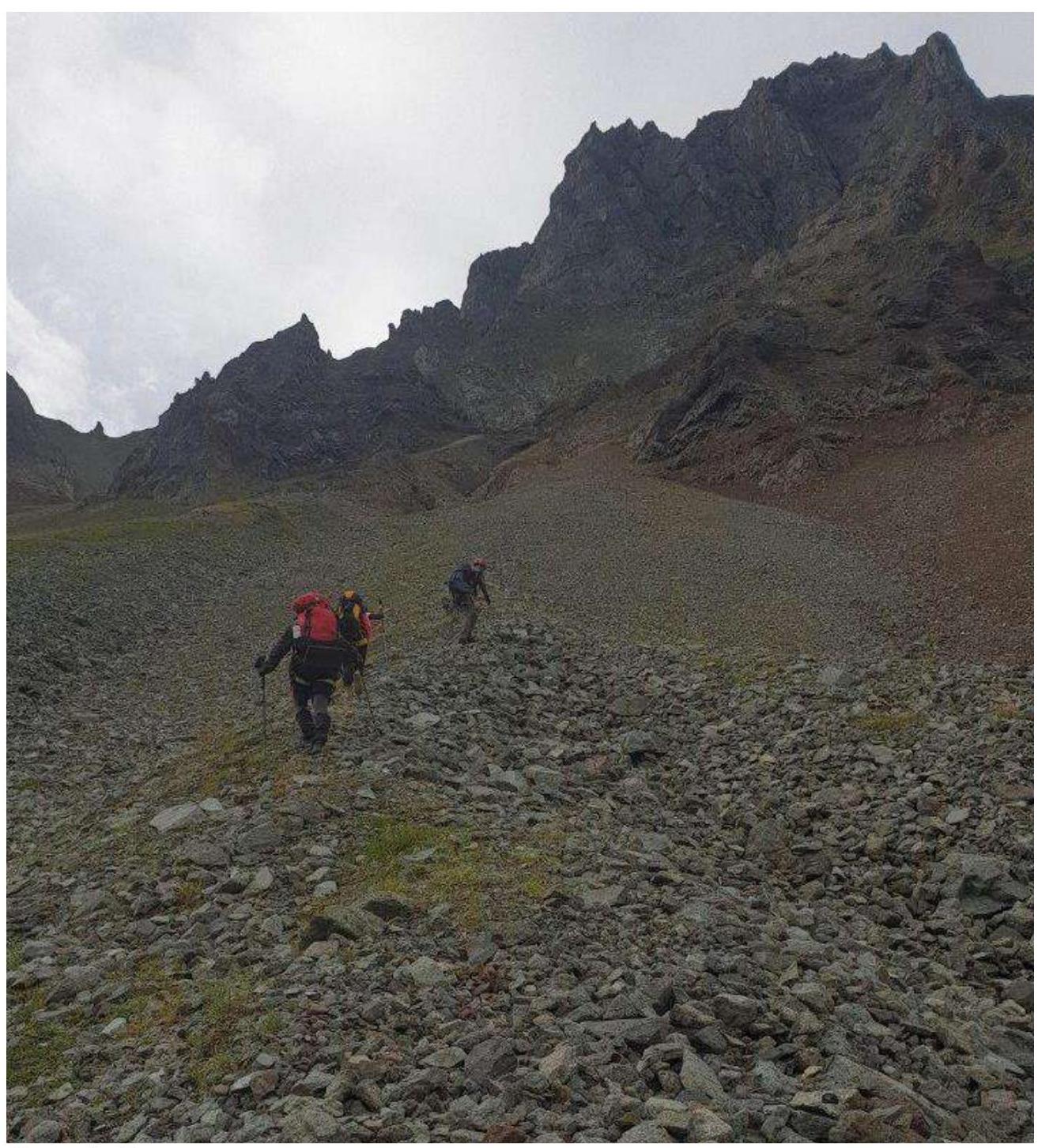
Photo 5. Movement on section R0–R1.
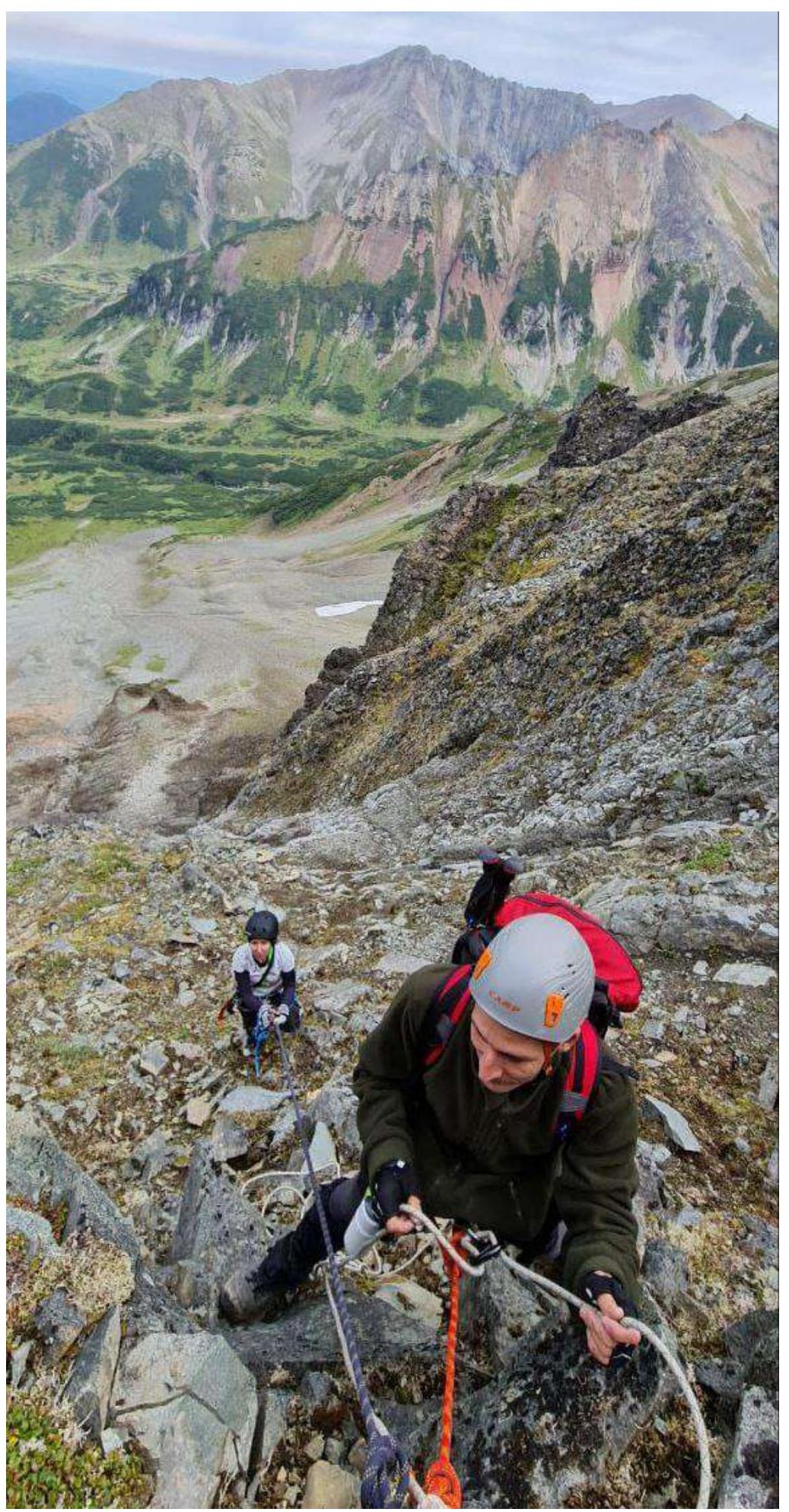
Photo 6. Movement on section R1–R3.
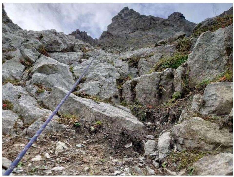
Photo 7. Movement on section R1–R3.

Photo 8. Movement on section R4–R5.
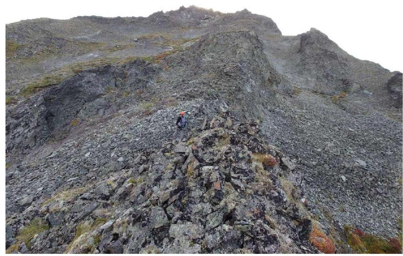
Photo 9. Movement on sections 6–8.
3.2. Photo of the Team on the Summit near the Control Tour at the End of the Ascent and the Beginning of the Descent Trail.

3.3. The route is logical, logistically accessible, and with visibility, is well visible from Lake Takholoch in the center of the massif.
In snow-free conditions, it requires attention on scree sections, which are partially mobile during ascent. In winter and during the off-season, it requires close attention to avalanche danger control, especially after heavy snowfalls.
With fresh snow on the approaches, the use of snowshoes is recommended.
There is a stable cellular signal at the summit.