Report
On the first ascent to the summit of Vachkazhtsy (1509 m) via the East Ridge, category 2B, by the team of the Kamchatka Alpine and Climbing Federation for the period from June 13, 2008 to June 13, 2008 2021
I. Ascent Passport
| №№ | 1. General Information | |
|---|---|---|
| 1.1 | Full name, sports rank of the leader | Vasilenko Anatoly Borisovich, 1st sports rank |
| 1.2 | Full names, sports ranks of the participants | Ivanov Georgy, 3rd sports rank, Mayakovskaya Natalia, 3rd sports rank, Zenkova Yulia, 3rd sports rank, Pasyukova Raisa, 3rd sports rank, Sharova Lyubov, 3rd sports rank |
| 1.3 | Full name of the coach | Vasilenko Anatoly Borisovich |
| 1.4 | Organization | Kamchatka Alpine and Climbing Federation |
| 2. Characteristics of the Ascent Object | ||
| 2.1 | Region | Kamchatka Krai, Elizovsky district |
| 2.2 | Valley | South-Bystrinsky ridge |
| 2.3 | Section number according to the 2013 classification table | 3. Kamchatka |
| 2.4 | Name and height of the summit | Mt. Vachkazhtsy, 1509 m |
| 2.5 | Geographical coordinates of the summit (latitude/longitude), GPS coordinates (1) | 53°04′ N 157°93′ E |
| 3. Characteristics of the Route | ||
| 3.1 | Name of the route | Via the East Ridge |
| 3.2 | Proposed category of difficulty | 2B |
| 3.3 | Degree of route exploration | First ascent |
| 3.4 | Nature of the route terrain | Combined |
| 3.5 | Height difference of the route (altimeter or GPS data) | 1059 m |
| 3.6 | Length of the route (in meters) | 3800 m |
| 3.7 | Technical elements of the route (total length of sections with different categories of difficulty, indicating the terrain type) | Category I (snow) — 600 m. Category II (rock) — 650 m. Category III (rock) — 80 m. Category IV (rock) — 10 m. |
| 3.8 | Descent from the summit | Along the northwest slope towards Lake Takholoch |
| 3.9 | Additional characteristics of the route | No water on the route. Approach to the start of the route takes 3 hours from the base camp located near Lake Takholoch. Average slope — 50°, maximum — 70°. The upper part of the route, the pre-summit ridge, consists of heavily fragmented rocks. Special caution is required when moving in ropes with simultaneous belay on this section. 5 rock pitons used on the route, 3 left on the route. No friends or nuts used. No ITO used. |
| 4. Characteristics of the Team's Actions | ||
| 4.1 | Time of movement (team's walking hours, in hours and days) | 12 hours |
| 4.2 | Overnights | - |
| 4.3 | Start of the route | 9:00, June 13, 2008 |
| 4.4 | Reaching the summit | 17:30, June 13, 2008 |
| 4.5 | Return to the base camp | 21:00, June 13, 2008 |
| 5. Responsible for the Report | ||
| 5.1 | Full name, e-mail | Vasilenko A.B. anatoly.snejnybars@yandex.ru |
II. Description of the Ascent
1. Characteristics of the Ascent Object
Photo 1. General photo of the summit. Photo 2. Profile photo of the route. Photo 3. Profile photo of the route (pre-summit ridge). Photo 4. Panoramic photo of the area.
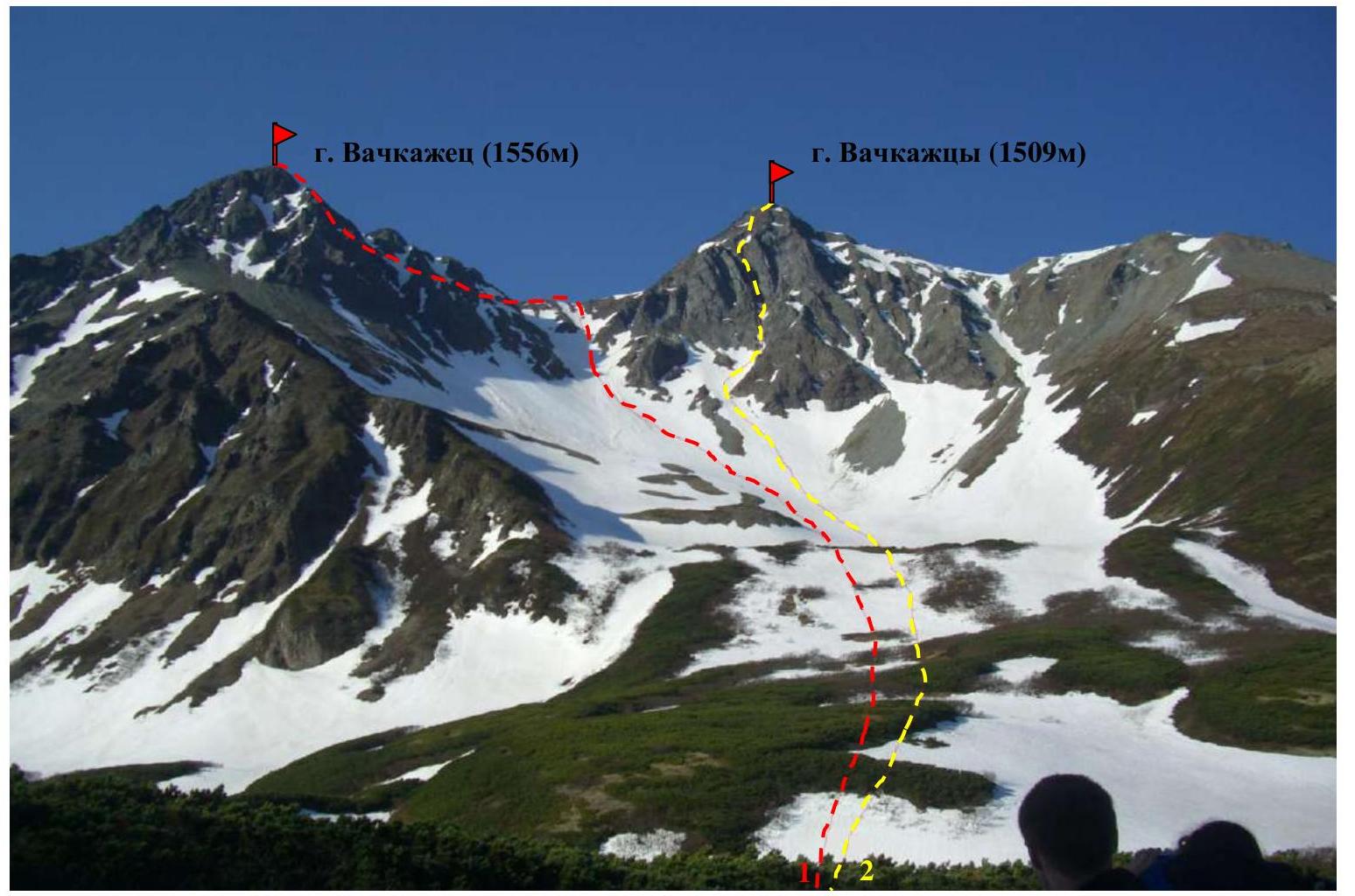
Photo 1. General photo of the summit. Date taken: June 13, 2008. Location: from the approach to the route. Approximate distance to the object — 1 km. 1 — "Via NE ridge", category 1B, 2004. Leader: A.N. Bichenko. 2 — "Via the East Ridge", category 2B, 2008. Leader: A.B. Vasilenko
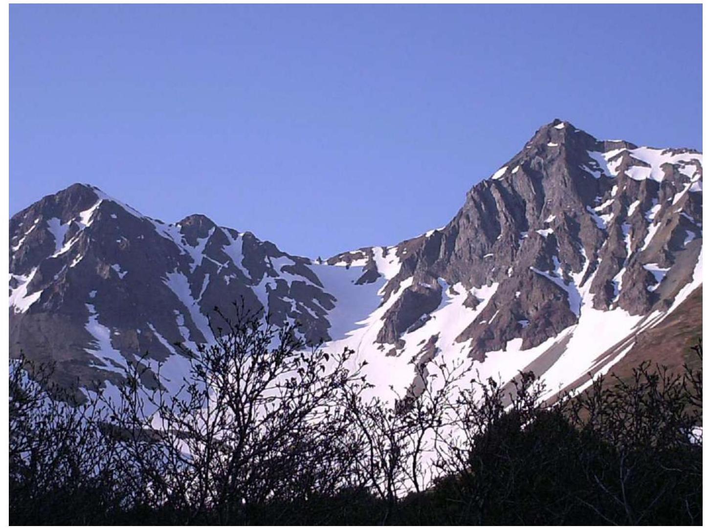
Photo 2. Profile of the route.

Photo 3. Profile of the route (pre-summit ridge).
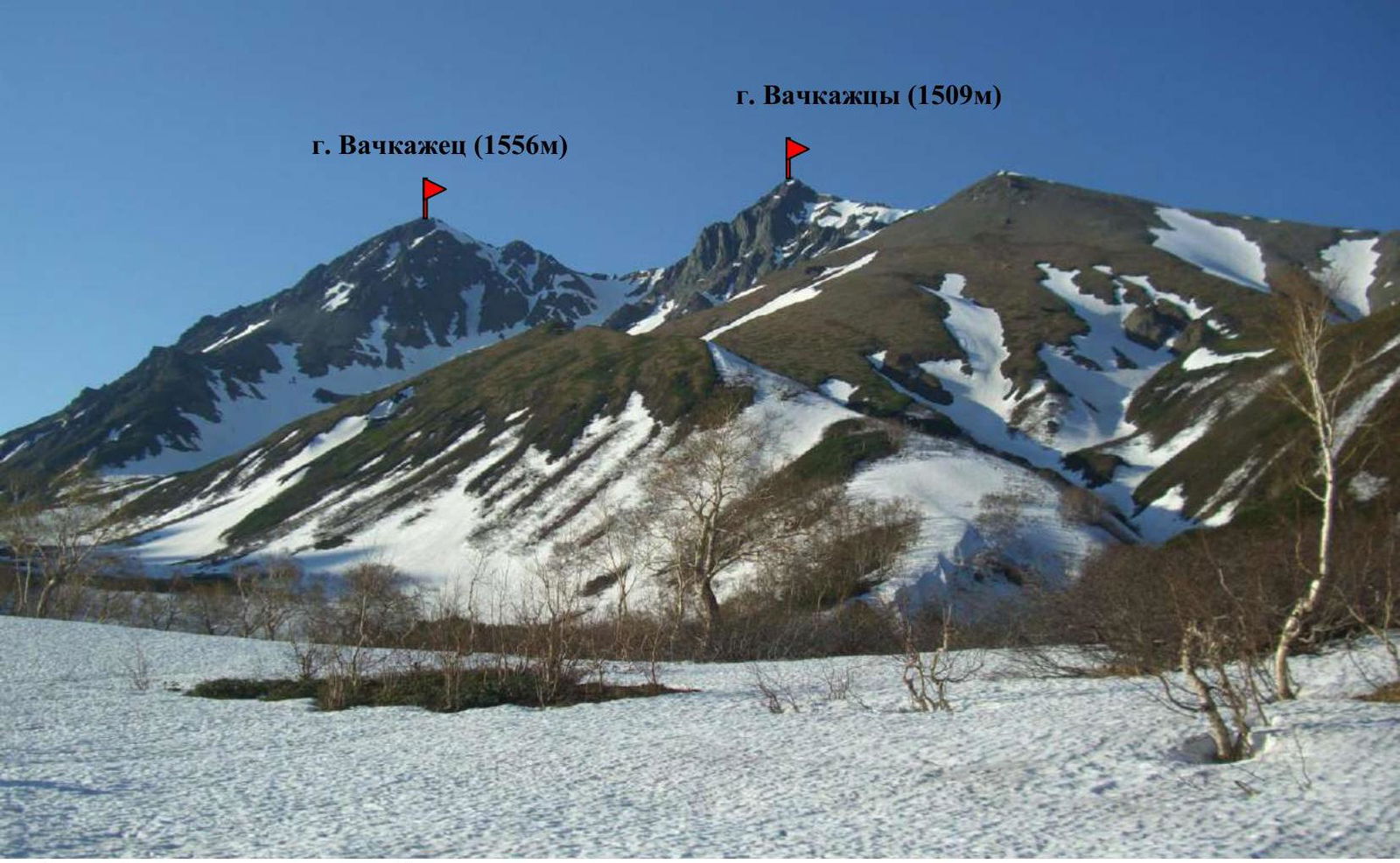
Photo 4. Panoramic photo of the area.
Map-scheme of the ascent area

1 — Mt. Vachkazhtsy (1509 m) — approach route. B.L. — base camp.
The Vachkazhetz mountain range is located in the Elizovsky municipal district of Kamchatka Krai, 80 km west of Petropavlovsk-Kamchatsky and 34 km west of Elizovo, on the western slopes of the South-Bystrinsky ridge. It combines picturesque mountain landscapes and a geological complex of deposits of the Viluchinskaya, Paratunskaya, and Berezovskaya suites of the Anavgayskaya series (lavas, tuffs, tuffogenously sedimentary rocks) with rare minerals and remains of exceptionally rare ancient fauna in the deposits.
As a result of a strong eruption, the ancient volcano Vachkazhetz was divided into three main clearly defined parts: Mt. Letnyaya Poperechnaya (1417 m), Mt. Vachkazhtsy (1509 m), and the highest point of the area — Mt. Vachkazhets (1556 m). In the area of Letnyaya Poperechnaya, two large volcanic glacial circuses still remain, which are likely remnants of the crater of a single large volcano.
The area is suitable for mountaineering, trekking, birdwatching, enjoying flowers in summer, and skiing in winter.
The base camp is located at an altitude of 450 m on the shore of Lake Takholoch, in the valley at the foot of Mt. Letnyaya Poperechnaya and Mt. Vachkazhtsy.
The approach by car from Petropavlovsk-Kamchatsky to the 72nd km of the Milkovo highway takes 2 hours. Turn left. Then by car on a dirt road to the stopping point — 10 km. On foot from the stopping point to the base camp on the shore of Lake Takholoch — 1–1.5 hours. The approach from the base camp to the start of the route takes 3 hours (in mid-June, there is still a snow cover in this place, in the lowlands and gullies, and sometimes in the mountains).
2. Characteristics of the Route
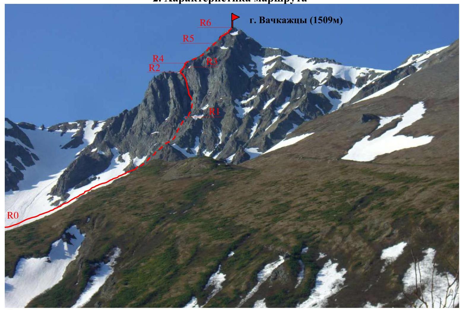
Photo 5. Technical photo of the route.
Technical characteristics of the route sections
| Section № | Terrain characteristics | Category of difficulty | Length, m | Type and number of pitons |
|---|---|---|---|---|
| R0–R1 | Wide snow slope, slope angle 35° | 1 | 600 | 0 |
| R1–R2 | Steep rocky inner corner, slope angle 70° | 3 | 40 | 0 |
| R2–R3 | Rocky ridge, slope angle 70° | 3 | 40 | 2 vertical rock pitons |
| R3–R4 | Rock wall, slope angle 70° | 4 | 10 | 3 vertical rock pitons |
| R4–R5 | Rocky ridge, slope angle 50° | 2 | 350 | 0 |
| R5–R6 | Pre-summit rocky ridge turning into a small rocky "bastion", slope angle 50° | 2 | 300 | 0 |
3. Characteristics of the Team's Actions
Brief description of the route passage
| Section № | Description | Photo № |
|---|---|---|
| R0–R1 | Ascent along a wide snow plateau 600 m long with a slope angle of 35°. Without ropes. Simultaneous movement. Into the middle large rock crevice (there are three visible, orient towards the middle one). Approach to the inner rocky corner. | Photo 6, Photo 7 |
| R1–R2 | On the left side, a steep inner corner in the rocks. Slope angle 70°, length 40 m. The first participant passes it with lower belay and hangs a rope. The rest go this section on a jumar with upper belay. | Photo 8 |
| R2–R3 | Further exit to the ridge with a slope angle of 70°, length 40 m. The first participant passes it with lower belay, hangs a rope using two rock pitons and a hammer. The rest move along the rope on a jumar with upper belay. The ridge turns into a 10-meter vertical rock wall. | Photo 9 |
| R3–R4 | The 10-meter vertical rock wall with a slope angle of 70° is passed by the first participant with lower belay, using three rock pitons and a hammer, and hangs a rope. The rest pass along the rope using a jumar with upper belay. | Photo 10 |
| R4–R5 | Exit to the rocky ridge with a slope angle of 50° and a length of 350 m. Movement in ropes, simultaneously. | Photo 11, Photo 12 |
| R5–R6 | Then exit to the pre-summit rocky ridge turning into a small rocky "bastion", slope angle 50°. Length 300 m. Movement in ropes simultaneously. Sometimes — rope team follows rope team. Exit to the summit. | Photo 13, Photo 14 |
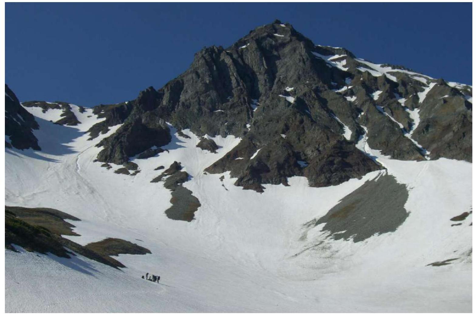
Photo 6. R0–R1. Ascent along a wide snow plateau 600 m long with a slope angle of 35°.
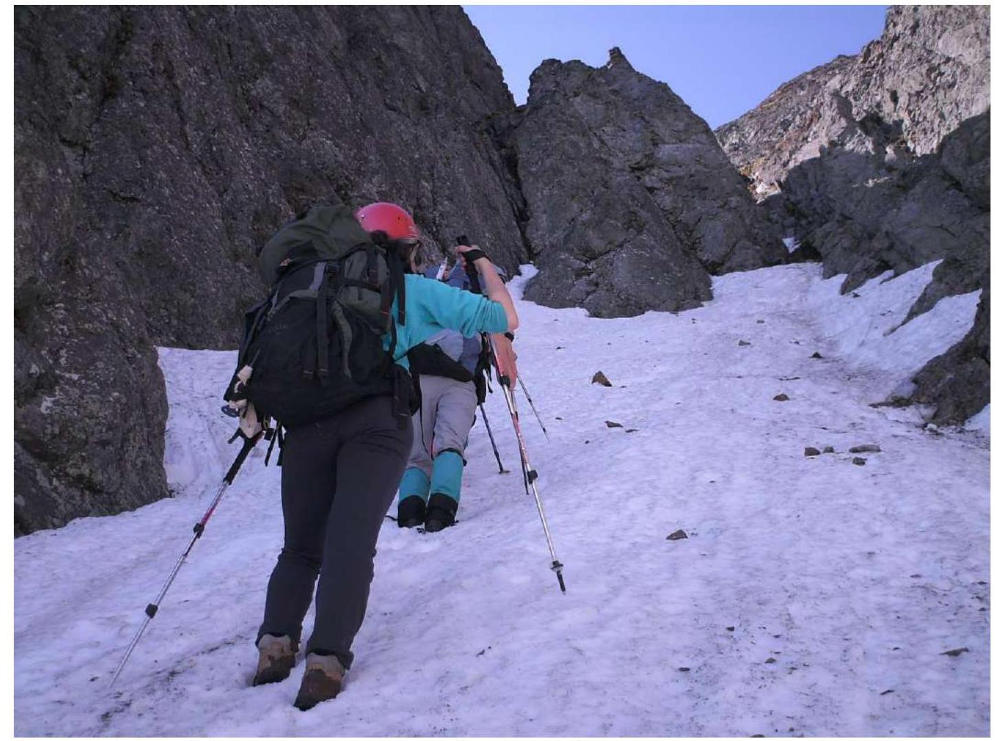
Photo 7. R0–R1. Approach to the inner rocky corner.
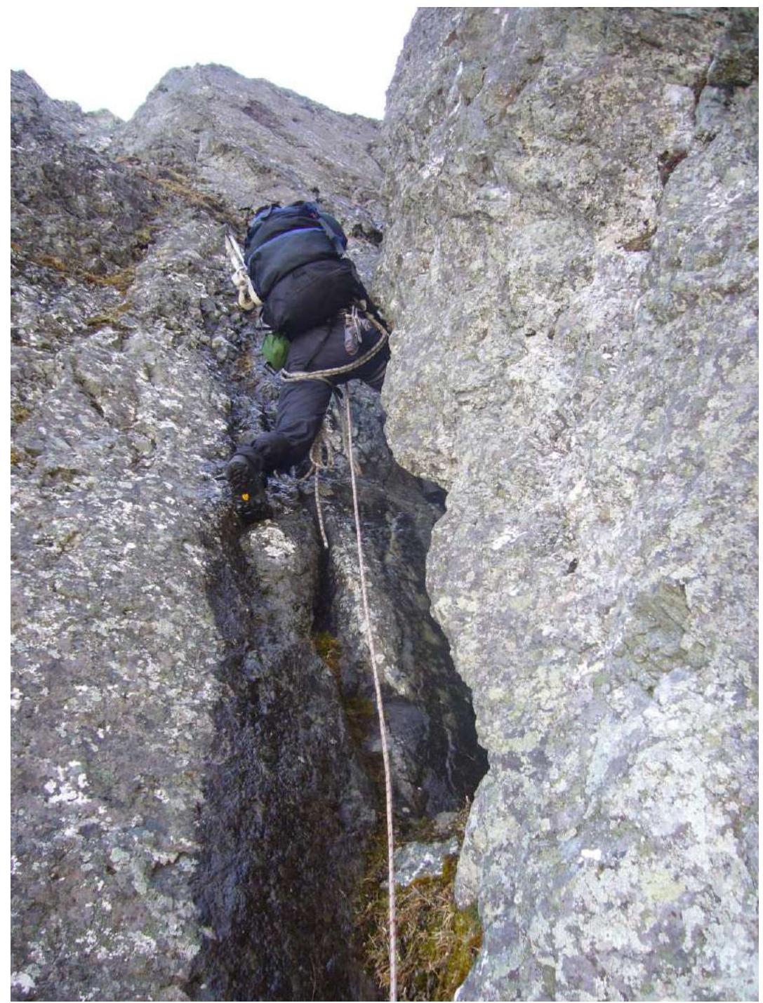
Photo 8. R1–R2. Passage of the inner corner.
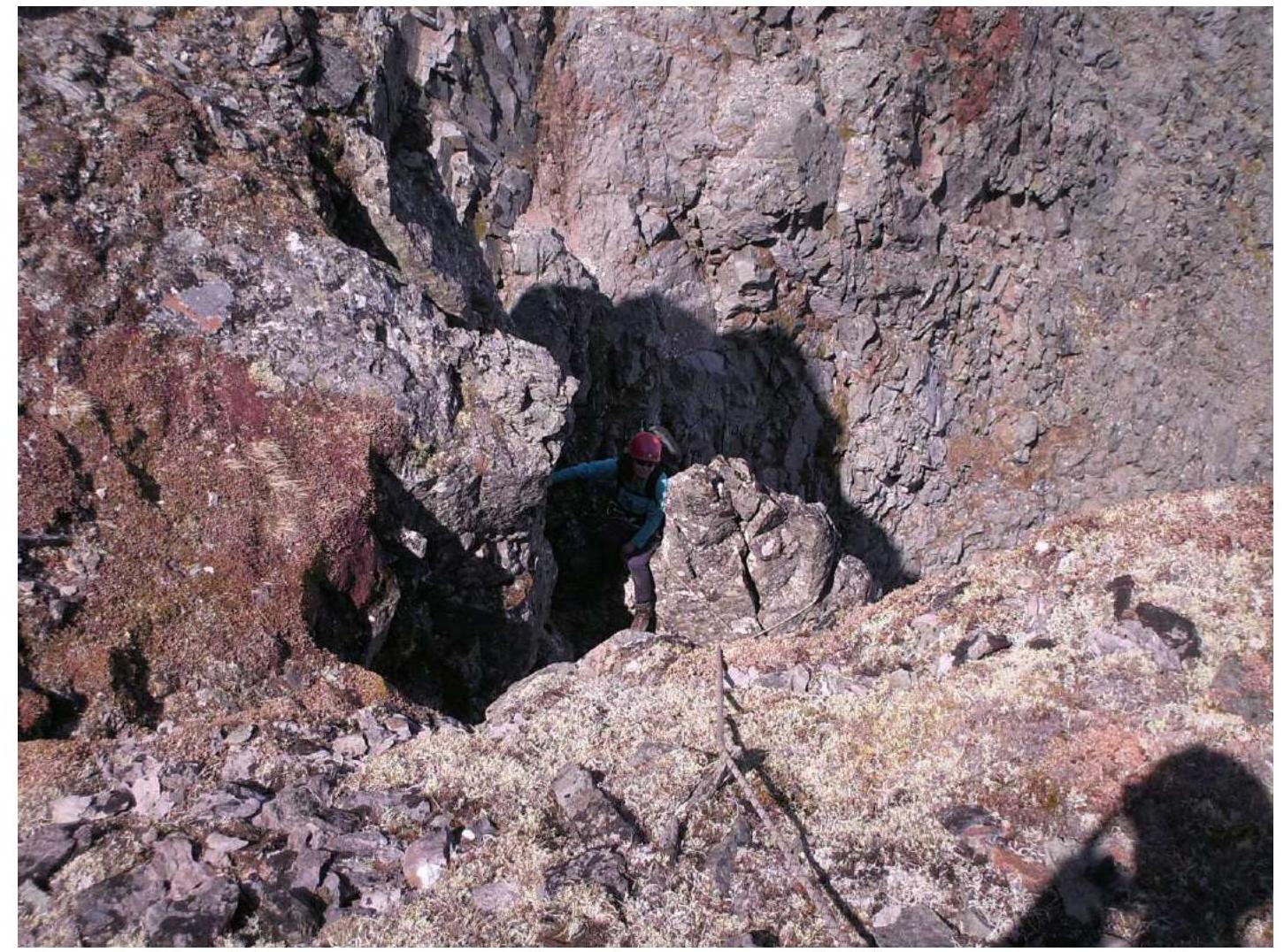
Photo 9. R2–R3. Exit to the rocky ridge with a slope angle of 70°, length 40 m.
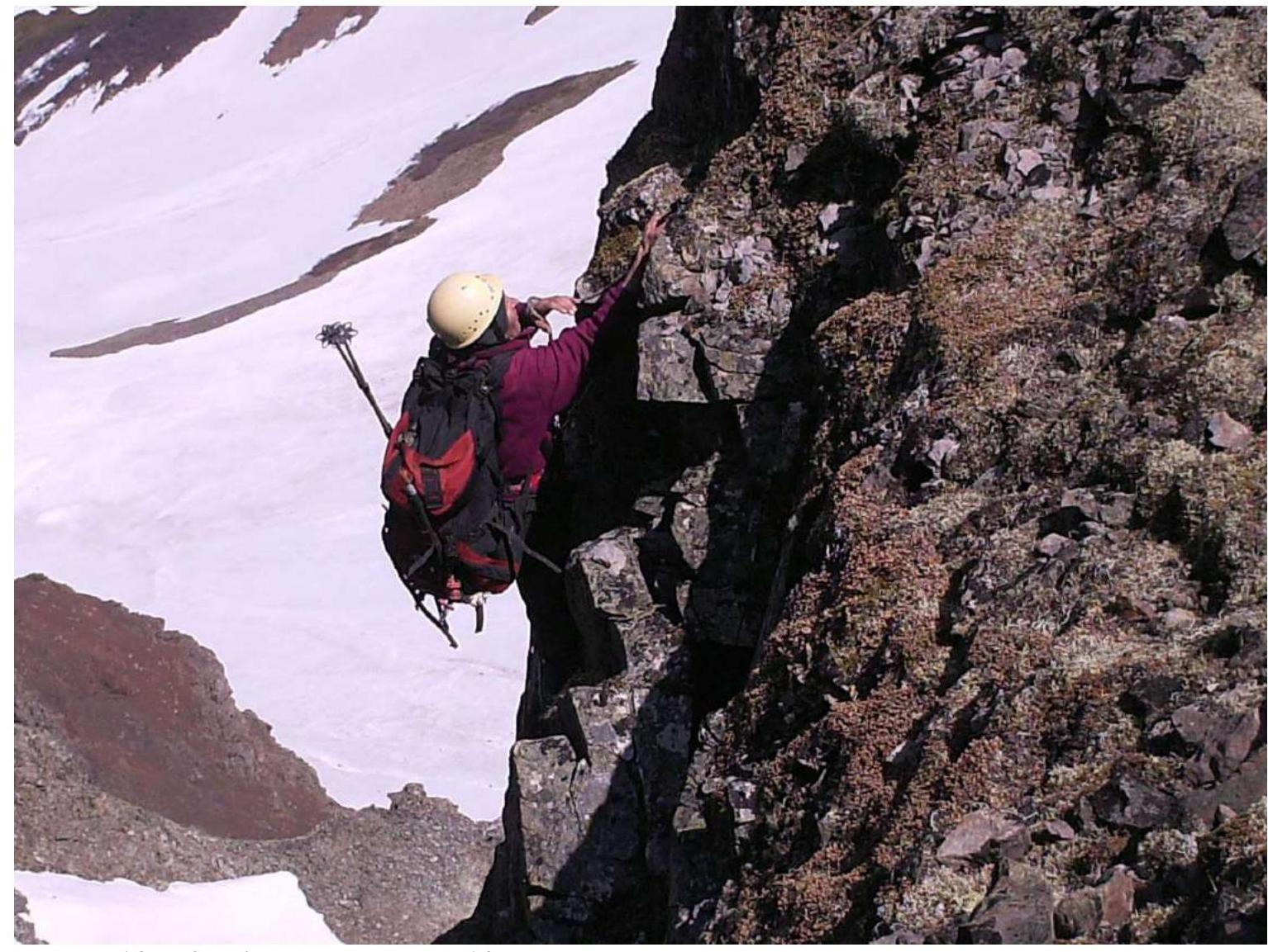
Photo 10. R3–R4. Passage of the 10-meter vertical rock wall.
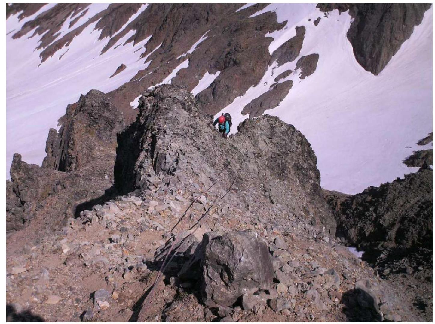
Photo 11. R4–R5. Exit to the rocky ridge with a slope angle of 50°, length 350 m.
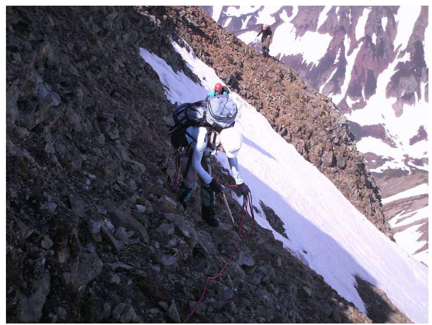
Photo 12. R4–R5. Movement along the ridge in ropes.

Photo 13. R5–R6. Exit to the pre-summit rocky ridge. Slope angle 50°. Length 300 m.
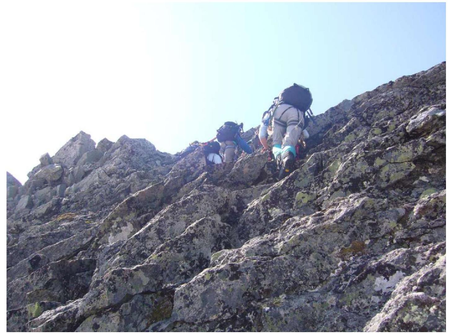
Photo 14. R5–R6. Simultaneous movement in ropes. Exit to the summit.
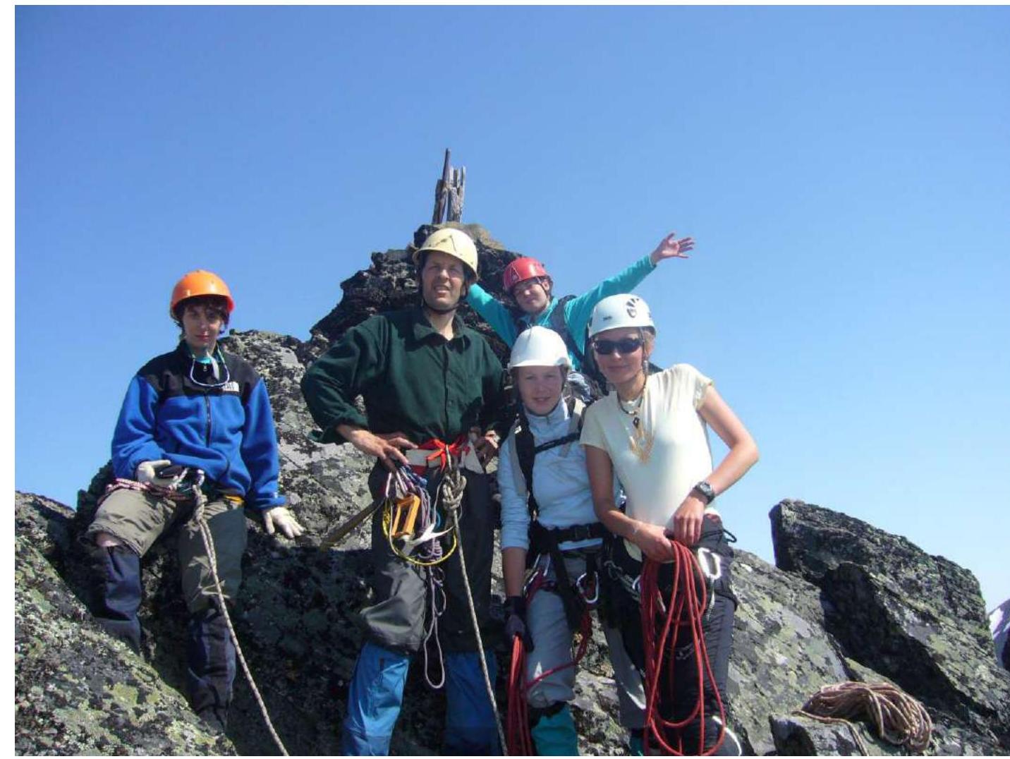
Photo 15. Photo of the team at the summit by the control tour.
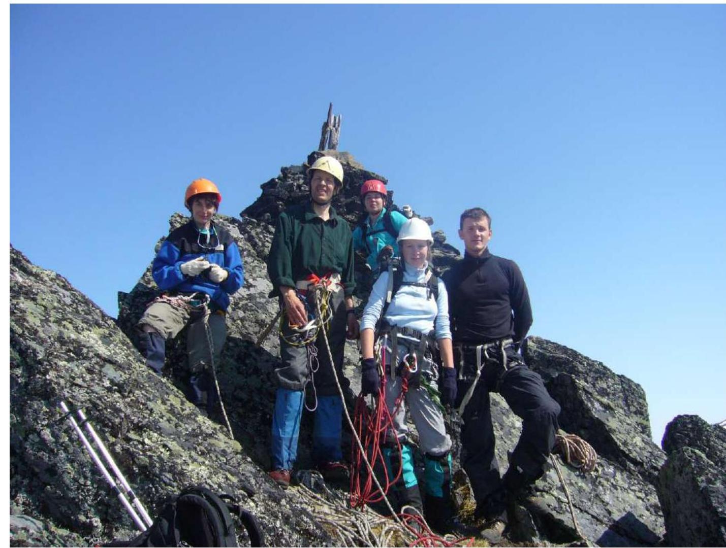
Photo 16. Photo of the team at the summit by the control tour.
Route safety assessment The route is predominantly rocky. Objectively hazardous. Steep sharp rocky ridges. There is room to fall. Therefore, helmets, ropes, hammers, pitons, harnesses, jumars are mandatory. Communication on the route is available. Many "live" stones. It is necessary to work with the rope carefully to avoid dislodging stones onto those below. Descent from the summit occurs along the northwest ridge, into the valley, towards Lake Takholoch. The descent ridge is clearly defined. However, in case of worsening weather and visibility on the descent, a GPS navigator or compass is necessary. The route, compared to other similar routes in Kamchatka, fully corresponds to the declared category 2B.
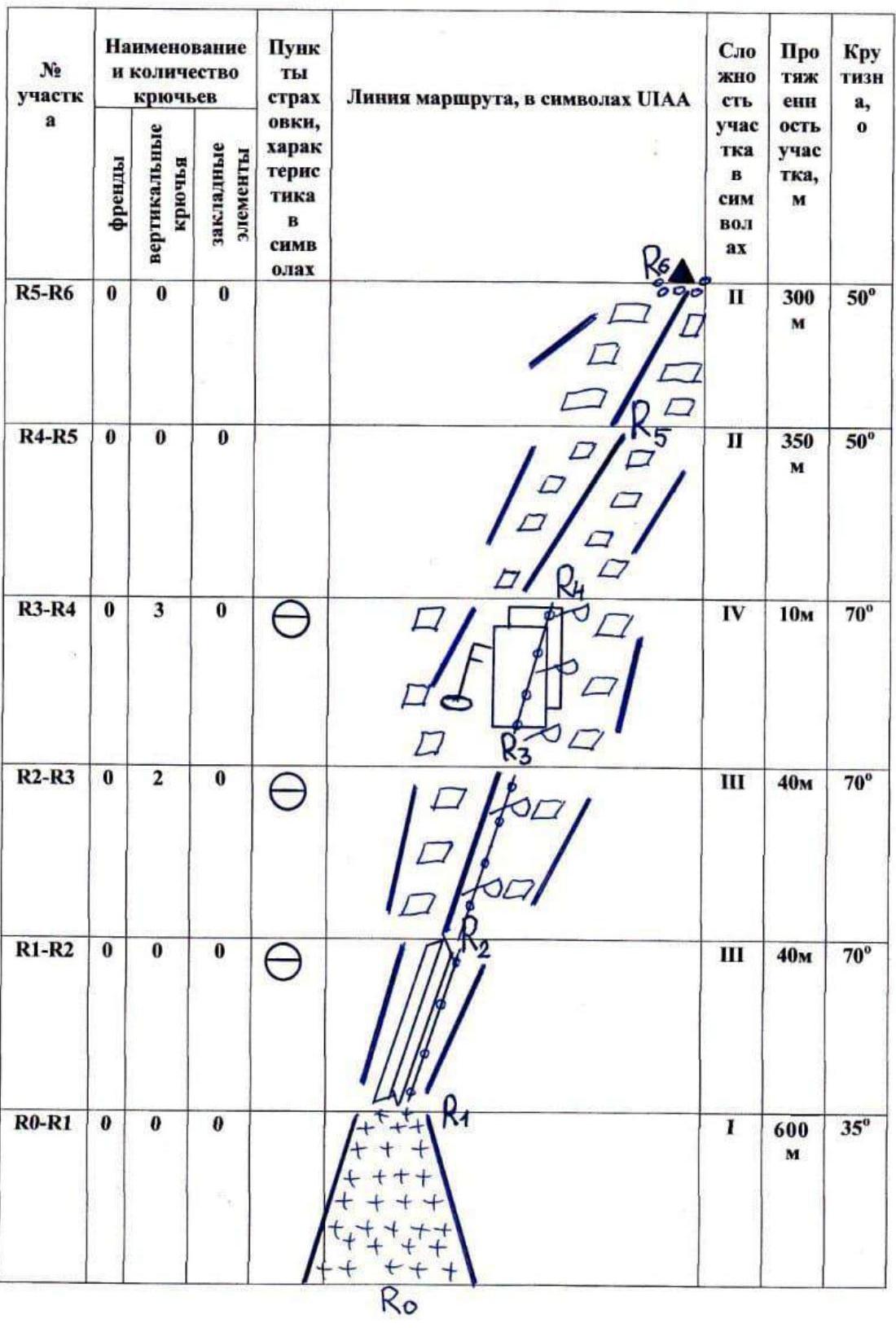
Appendix № 3. Route scheme in UIAA symbols