Ascent Passport
- Ascent area — Kamchatka, Bystrinsky ridge.
- Peak — Vlk. Vackhazhec 1547 m, via North-Eastern ridge.
- Ascent class — Combined.
- Estimated category of difficulty 1B (Winter)
- Height difference — 850 m.
- Route length — 1320 m.
- Number of days — 1 day.
- Number of travel hours — 6 hours.
- Leader, participants, surname and initials, sports rank.
- Bichenko Alexander Nikolaevich — Candidate Master of Sports.
- Shakhova E. — 2nd sports rank.
- Shinkevich A. — 3rd sports rank.
- Vorobets A. — 3rd sports rank.
- Kovkova O. — 3rd sports rank.
- Kovkov A. — 3rd sports rank.
- Pasyukov A. — 3rd sports rank.
- Departure to the route April 16, 2004.
- Return to base camp April 16, 2004.
The ascent was organized by year-round training camps, tourist club "KUTH".
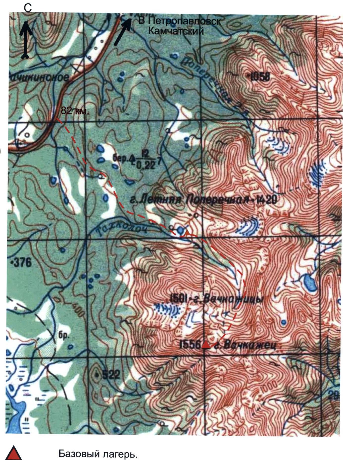
Map of the ascent area
Scale 1 × 1000 m.
 Photopanorama of the ascent area Vackhazhec volcano. Southern Kamchatka.

- Northern edge. 2A (winter) led by V. Neverov 1979.
- Descent path.
- North-Eastern ridge. 1B led by A. Bichenko 2004.
Brief overview of the ascent area
The Vackhazhec volcanic massif is located in the Bystrinsky ridge, fifty kilometers west of Petropavlovsk-Kamchatsky. The volcano can be reached by car: driving along the Milkovskaya road to the 82nd km and then along the forest road for eleven km to Lake Tokhkoloch. In winter, this section is traversed on skis from the highway.
The base camp is conveniently located near the lake. The approach to the route from the lake takes 1 hour (see map).
The Vackhazhec volcanic massif was explored by Kamchatka climbers in the seventies; there are routes of 2B and 3B category of difficulty in this area.
The proposed route, North-Eastern ridge, was climbed by Kamchatka climbers long ago and is often used for training ascents to the summit of Vackhazhec volcano. However, it is not included in the classifier.
The proposed route corresponds to 1B category of difficulty.
Table of main route sections:
| Date | Designation of sections | Slope steepness | Length | Difficulty | Route condition |
|---|---|---|---|---|---|
| 16.04.04 | 1 | 25–35 | 1 km | Snow — firn | |
| 2 | 40–45 | 100 m | Firn — rocks | ||
| 3 | 15–20 | 100 m | Snow ridge | ||
| 4 | 45–50 | 120 m | 2 | Rocky ridge |
Technical description of the route
The route begins with an ascent along a wide snow couloir, 1000 m long, with a slope steepness of 25–35°. Further along the couloir, there is an approach to the rocks along the rocky massif, leading to a snow ridge. At the exit to the ridge, the steepness of the couloir increases to 45°. Movement along the ridge is simultaneous in rope teams.
The ascent to the summit is:
- along a rocky ridge 120 m long,
- steepness 45–50°,
- climbing is simple, with protection through ledges.
The summit is a rocky massif.
Descent is via the ascent route.
The ascent takes 6 hours.
Vackhazhec mountain 1556 m, NE ridge.
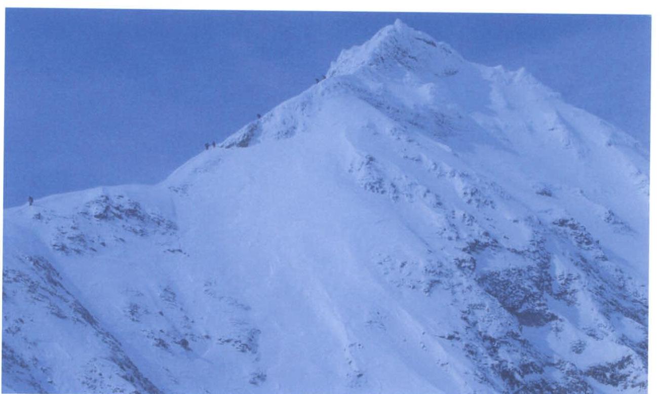
General view of section #4
Vackhazhec mountain 1556 m, NE ridge.
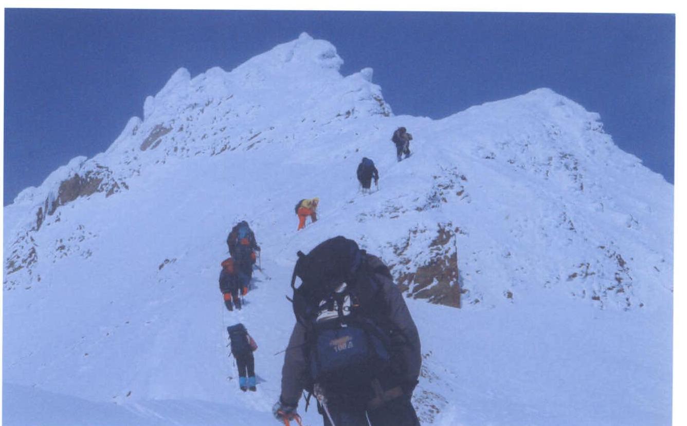
General view, upper part of section #4.


