ASCENT REPORT
-
Ascent category — rock climbing.
-
Ascent region, ridge — Lesser Caucasus, Zangezur Ridge.
-
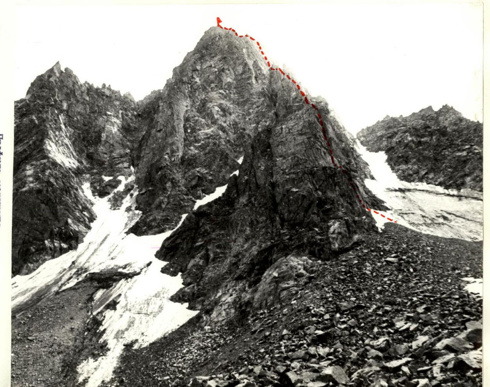
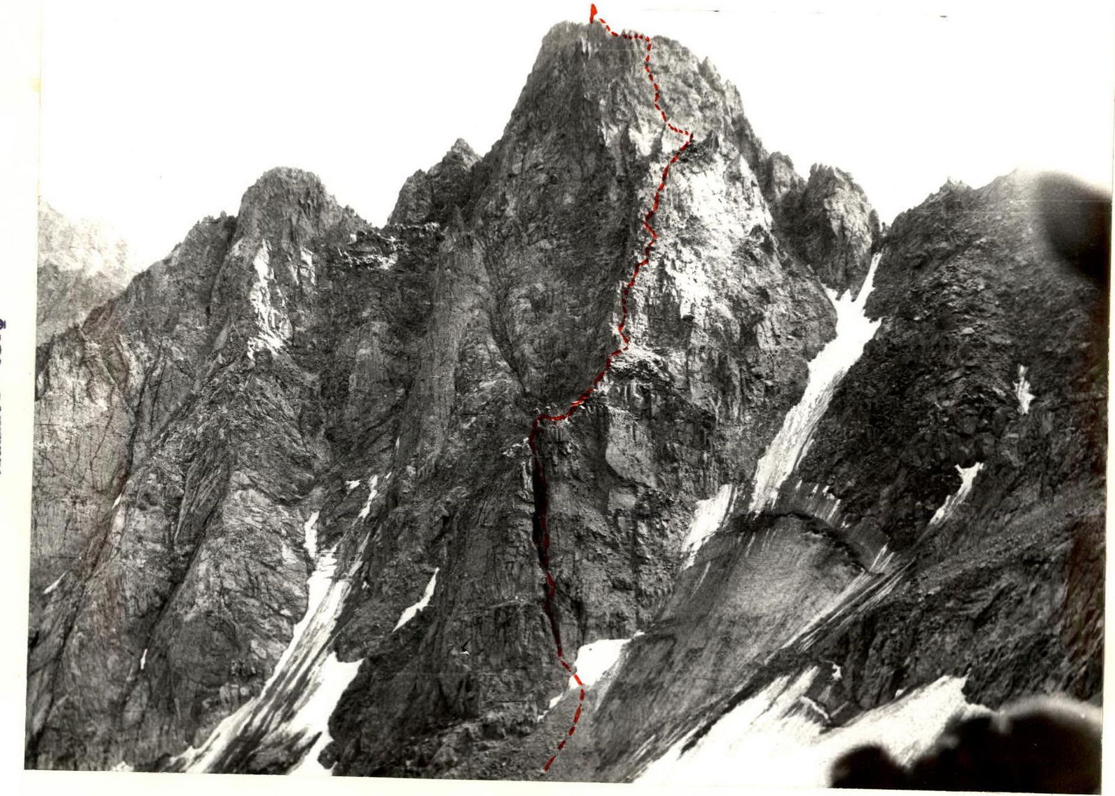
Peak, its height, ascent route — Pik Brat'ev Alikhanyan, 3710 m, via the right edge of the north face.
-
Proposed category — 5A.
-
Route characteristics: height difference — 400 m, length of sections with 5–6 difficulty category — 110 m, average steepness — 65°.
-
Pitons hammered: for belay — 43/4; rock pitons — 20/4; ice screws — 2/0; placed protection — 23/0.
-
Total climbing time — 14 hours.
-
No bivouacs on the route.
-
Team leader — Tamamyan Nelson Gevorkovich, 1st sports category.
Team members:
- Azizbekyan Grigoriy Vartanovich, 2nd sports category
- Arutyunyan Suren Gurgenovich, 2nd sports category
- Khachatryan Gagik Norikovich, 1st sports category
-
Team coach — Tamamyan N.G.
-
Date of starting the ascent — October 15, 1984.
-
Organization — Republican Alpine Club "Aragats". Armenian SSR, Yerevan, Paronyan St., 13.
 PIK BRAT'EV ALIKHANYAN VIA THE RIGHT EDGE OF THE NORTH FACE. N. TAMAMYAN'S ROCK CLIMB, October 15, 1984.
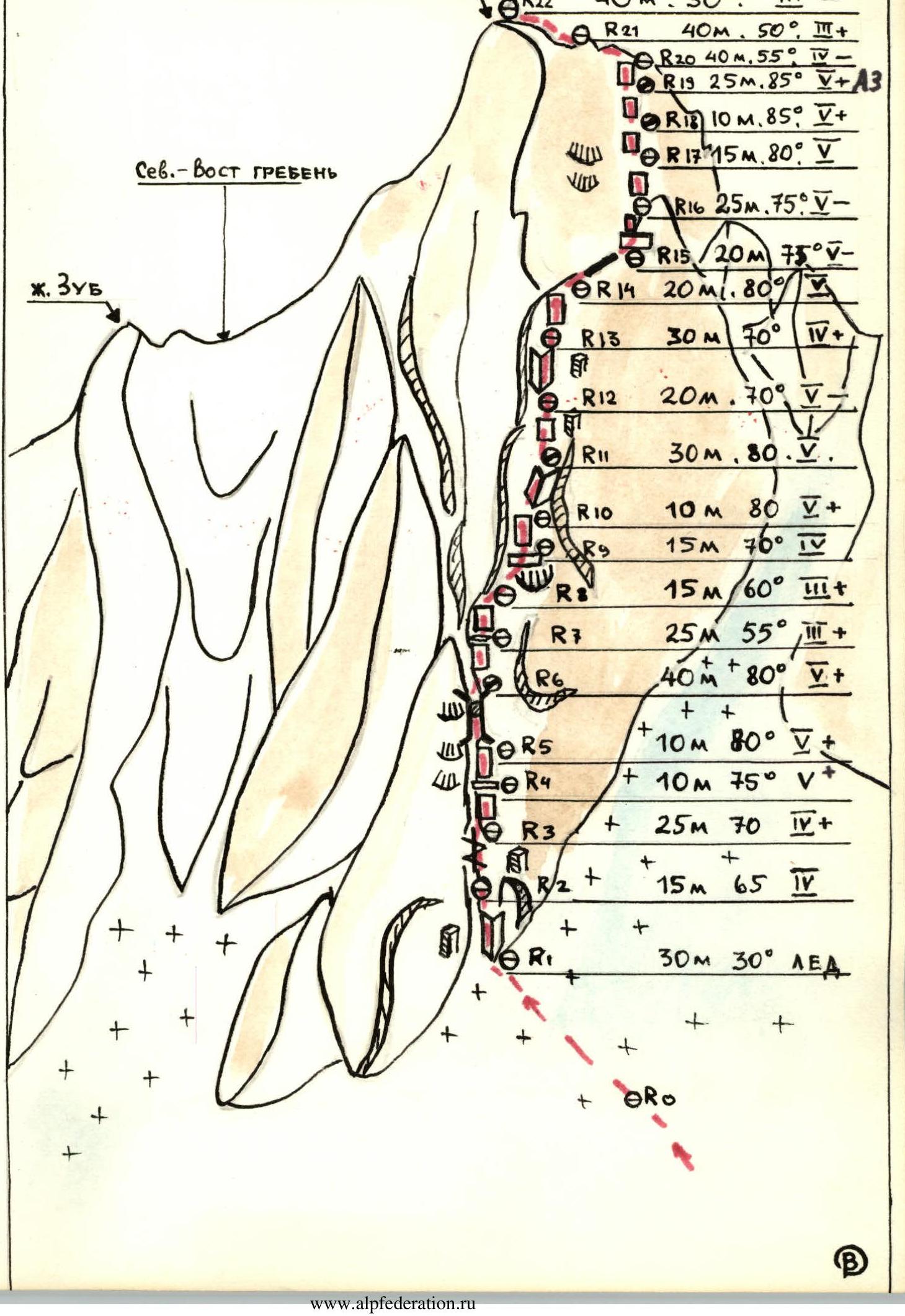
UIAA Diagram Explanation
- The upper part of the chimney (section 6) is climbed via a crack on the right wall. In the upper part, it is recommended to use protection with sizes:
- 3 cm
- 4 cm
- 5 cm.
- The wall after the ridge section 9 (sections 10, 11) is climbed directly, as the detour to the right goes through a heavily damaged and rockfall-prone wall.
- The crux wall (section 18) is climbed via a steep, poorly defined ledge with a minimal number of holds in the middle of the wall (using artificial aids).
- The I control point is located on a ledge after the chimney in the lower part of the route, the II control point is hung in the middle of the 60-meter wall (crux section 18), before reaching the ridge.
 Route profile.
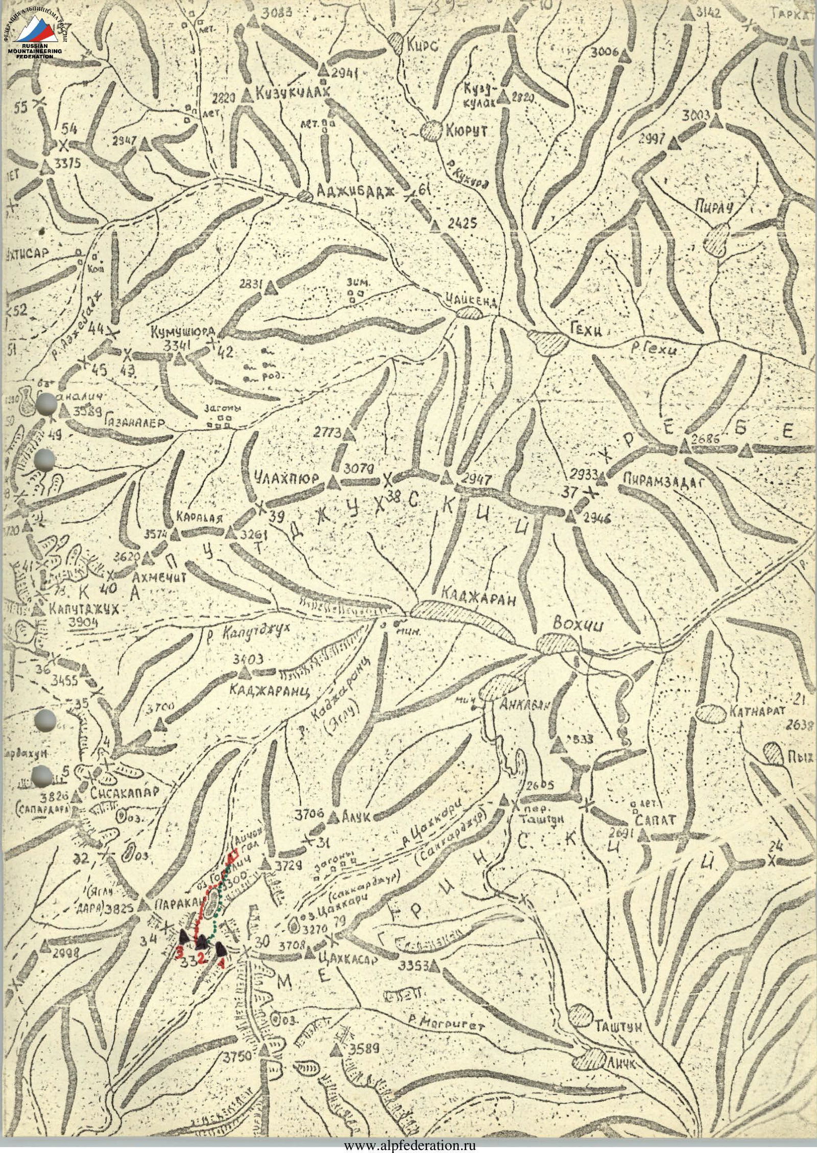
Approach to the Route Description
From Kajaran, Armenian SSR, follow up the Kajaranadzur River valley to the picturesque Goglitch (Gogigel) lake, elevation — 3120 m. From here, the steep walls of Pik Brat'ev Alikhanyan are visible directly to the south, with the lower Pik U. Avetisyana to its left.
Bypass the lake on the right along a steep grassy slope and reach a large talus field. Climb up through the talus field towards a glacial couloir. A steep glacial couloir descends from a col between Pik Brat'ev Alikhanyan and Pik 3670 to its right (northwest). Cross a small glacial tongue at the bottom of the couloir and reach the chimney at the base of the route.
The chimney narrows at the top, forming a large opening against the sky, making it easy to identify the start of the route.