Kyzylkaya Western, via the North Ridge
Mamedov Z. S.
East Caucasus 2.11.16
PASSPORT
- Route type — rock
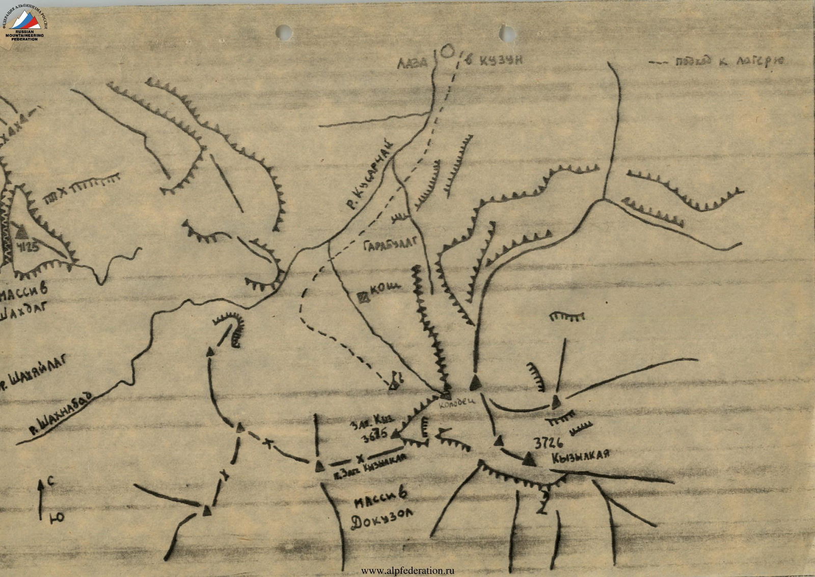
- East Caucasus, Shahnabad and Kusarчай river gorge
- Kyzylkaya Western via the North Ridge
- Assumed 4A category of difficulty — first ascent
- Height difference — 825 m, length — 1195 m
Length of grade 4 sections — 240 m. Average steepness of the main part of the route — 65°
- Climbing time — 7–9 hours
- Leader — Mamedov Elchin Soltan oglu
Participants — Asadov Yakub Aliaga oglu
- Coach — Jafarov Rasim Pashaevich
- Ascent to the summit — descent — September 1, 1993
- Organizing body — Azerbaijan Republican Mountaineering Club

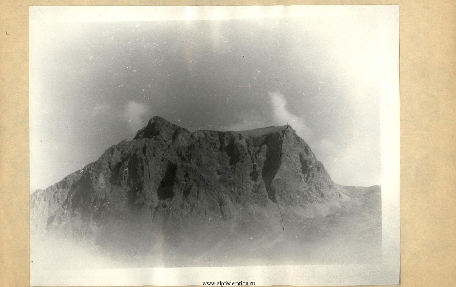
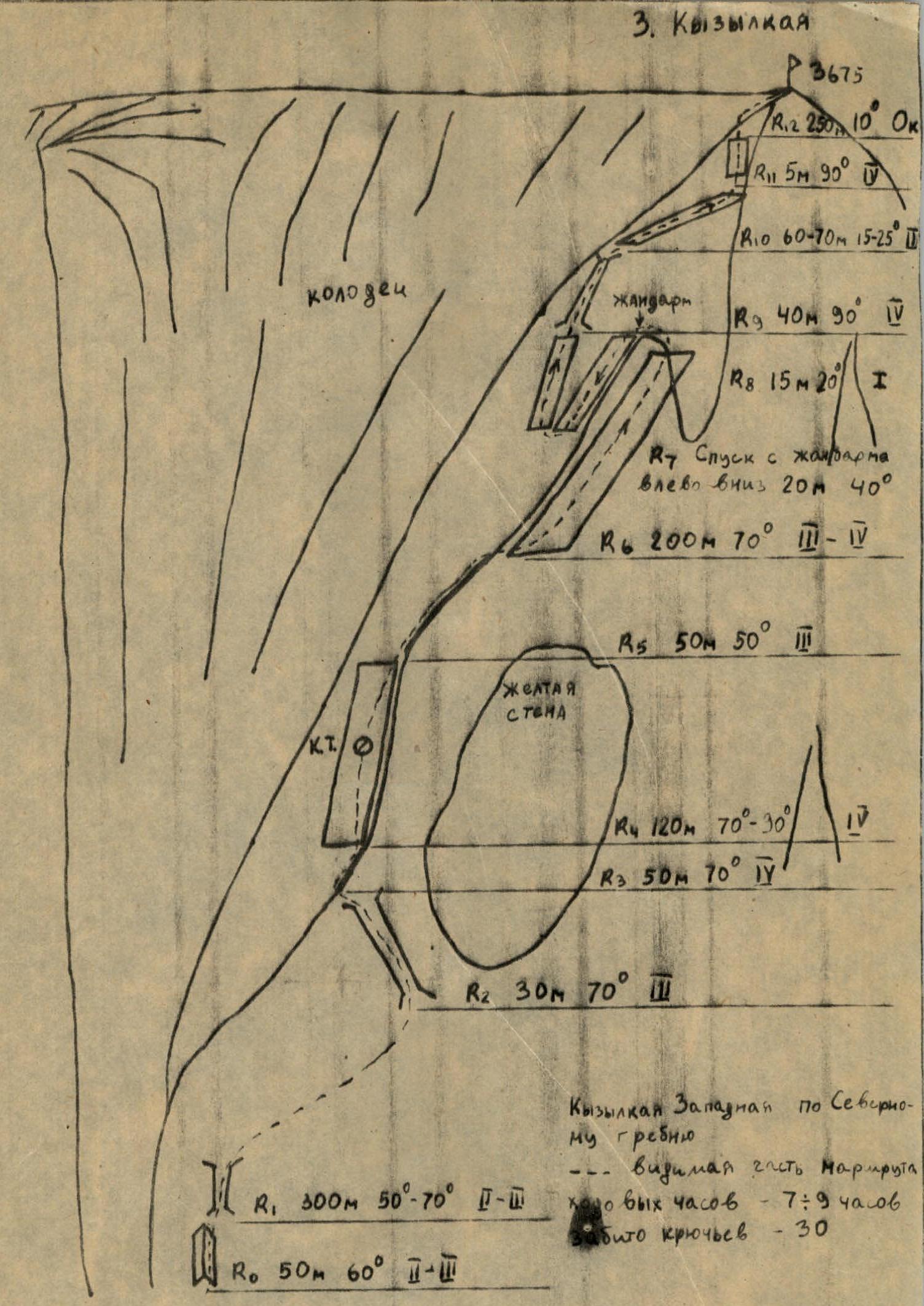
C. Kyzylkaya Western (3675 m), via the North Ridge. 4A category of difficulty. Brief description.
From the village of Kuzun, along a dirt road to the village of Laza (about 5 km). From Laza village along a good trail on the left side of the Kusarчай River, then along the Shahnabad River to a large corral to the left of the trail near a small stream that flows into the Shahnabadчай. From here, towards the clearly visible large gully in the wall of Kyzylkaya. 300 m before reaching the base of the gully to the right of the direction of travel, from the stream with steep white banks, flowing from the gully in the wall of Kyzylkaya, on a grassy clearing near the spring — a convenient overnight stay.
Approach to the route — along the stream bed with steep white banks. Start of the route — wall 1–2. Then enter the couloir (rockfall hazard). Exit to the right along a ledge to a small shoulder. Then up along small walls — exit below a wide reddish wall, from it via a chimney — exit to the ridge. Rock grade 2–3.
Keeping to the left side of the ridge, climb 3 rope lengths up the wall. Rock grade 4. In the middle of this section, a control cairn hangs on a hook. Few protection points. Further path — along the ridge, sometimes moving to the right side. In places, difficult climbing. Rockfall hazard. Rock grade 3–4, steepness 50–85°.
Then — exit to the summit of a gendarme. From it — to the left down, about 20 m, into a small dip, in the direction of the large gully in the wall of Kyzylkaya. Then along a convenient ledge up — approach to a chimney (steepness 90°, grade 4).
After passing the chimney — along ledges that bypass the scree-filled couloir above, descending into the large gully. Approach to a small wall (5 m, grade 4). Along the wall — exit to a rocky outcrop. From the rocky outcrop — along a stone bridge — transition to the plateau of Kyzylkaya.
Then, keeping to the right edge in the direction of travel, — exit to the summit.
The route takes 7–9 hours.
Descent via the South Couloir (route 1B category of difficulty).