Bazardyuzi via South Ridge. Ragimov E. M. East Caucasus
2.11
Passport
- Character of the route — combined
- East Caucasus, Yatuхdere, Shakhnabad, Kusarçay gorges
- Bazardyuzi via South Ridge
- Category 1B — first ascent
- Height difference — 1160 m, length — 2850 m
Average steepness of the main part — 25° - Duration — 5 hours
- Leader — Ragimov Elman Mubariz oglu
Participants — Baranov Sergey Nikolaevich - Coach — Jafarov Rasim Pashaevich
- Departure — summit — return — 29 August 1993
- Organization — Azerbaijan Republican Mountaineering Club
Shahdagh massif (4243)
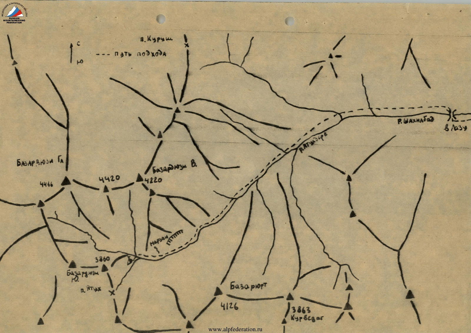
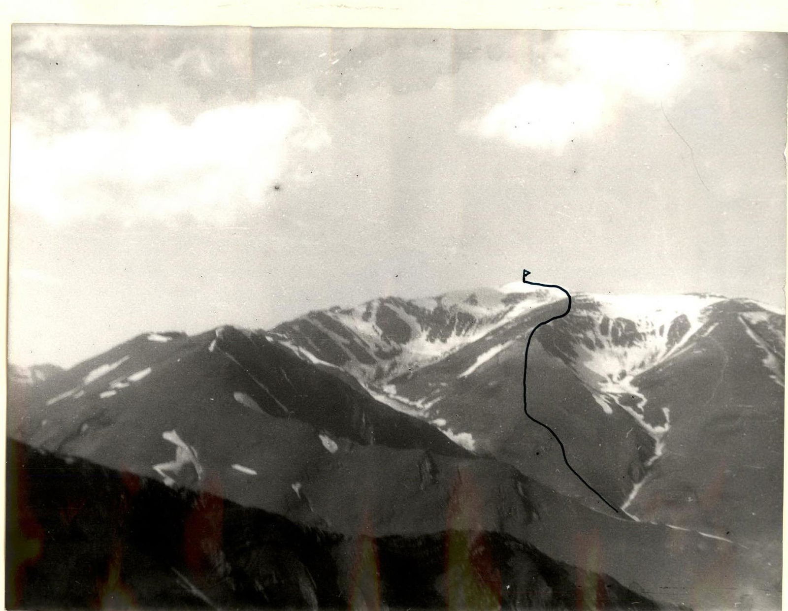
Mt. Bazardyuzi (4466 m) via South Ridge, category 1B. Brief description
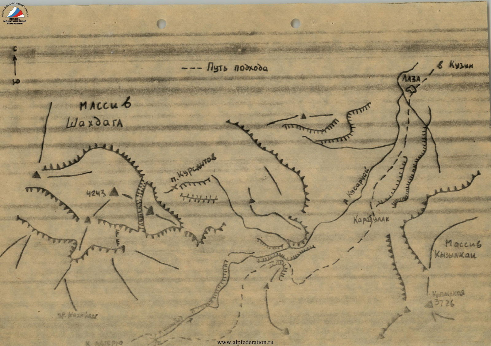
From Kuzun village, take a dirt road to Laza village (about 5 km). From Laza village, walk on a good trail on the left side of the Kusarçay river, then along the Shakhnabad river to Shahyaylag. Cross the Shakhnabad river via a bridge. 9–12 hours from Kuzun village to the bridge.
Continue upstream on the right side of the Shakhnabad river. Cross the river flowing from the Kurush pass. Continue upstream along the right side of the Yatuхdere river. 200–300 meters short of the Yatuх pass, there are good campsites on a grassy glade at the foot of a rocky hill. 6–8 hours from the bridge to the campsite.
In the upper part of the Yatuхdere river, it is possible to walk on its left side (crossing the river on a snowfield). There is a good trail from the bridge to the Yatuх pass.
From the camp, ascend on the right orographic side of the river up to the beginning of a couloir that leads to the South cirque. Cross the river on a snowfield. It takes 30–40 minutes from the campsite to the beginning of the route.
Ascend via small scree slopes to the South Ridge. Continue up, keeping to the left side of the ridge (slope steepness is about 15°, distance is about 400 m). Further, there are severely damaged rocks (steepness 30–35°, about 150 m). Then ascend via small scree slopes of the South Ridge from one rocky outcrop to another, about 2000 m (steepness is about 25°). From the rocks of the upper part of the ridge, ascend slightly above to a flatter area in the South-West cirque. From here, ascend to the dome of Mt. Bazardyuzi Main (300 m, steepness is about 25°) — to the summit.
Descent is via the ascent route.